East Gorge triple pak 4/25/14
Posted: April 27th, 2014, 8:37 am
With rain forecast for Portland on Friday, I decided to head east toward sunnier prospects and fill in a few blank spots in my mental map by taking three short hikes I hadn't done before: Mitchell Point, Hood River Mountain, and Mosier Plateau. Wildflowers were, of course, a primary inducement.
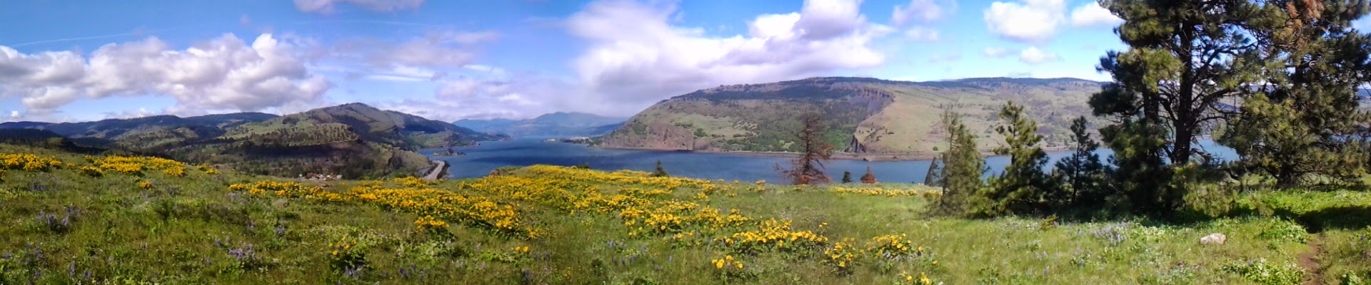
It made sense to do Mitchell Point first, since it's only accessible from the eastbound side of 84. I've driven past the exit for it a hundred times, and now was my chance to check it out. The parking area has a decent viewpoint, so this place would be a good stop for a little break even if you're not up for a hike:

The hike is only 2 miles RT, but it climbs about 1200 feet, mostly in the trees until you break out into the open for top few hundred feet. Here's the approach to the top:
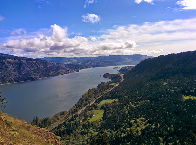
And here's the view west, down the Columbia. Across the river is Cook Hill on the right, Dog Mtn on the left, and Drano Lake and the mouth of the Little White Salmon at the base of Cook Hill:

Here's the view to the east:
And here's my track:
http://gpsfly.org/gps_map.php?gps_id=3263&w=645&h=440" scrolling="no" frameborder="no"></iframe>
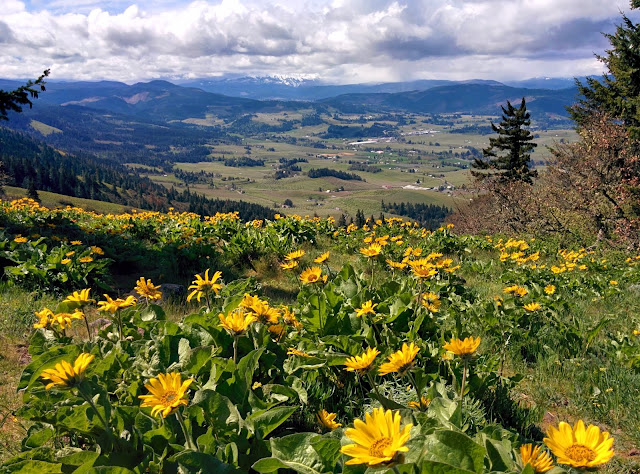
Next was Hood River Mountain, a wonderful vantage point for viewing both wildflowers and the Hood River Valley. Thanks to SDS Lumber Co. for letting hikers use it. Blooming then was mostly balsamroot and paintbrush.


I did the hike as a loop, as described in Lorain's book, walking back along the gravel road. It totaled about 3 miles, with about 700 ft elevation gain:
http://gpsfly.org/gps_map.php?gps_id=3264&w=645&h=440" scrolling="no" frameborder="no"></iframe>
Next, I moseyed along back roads to Mosier, for the Mosier Plateau hike. This hike is mostly on land purchased for conservation by the late Nancy Russell, founder of Friends of the Columbia Gorge, and the land is now owned by the Friends land trust. If you've ever enjoyed the wonders of the Gorge, you should thank Nancy Russell for the huge role she played in preserving it.
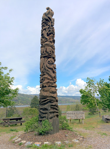
I started at the Mosier Totem pole, in the middle of town:
From there I walked 1000 feet east along the Old Columbia Highway, crossing this fine old bridge over Mosier Creek:

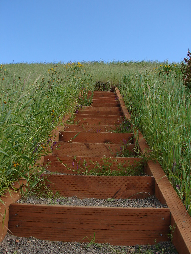
The trailhead's at the east end of the bridge. There's no sign for "Mosier Plateau Trail." Instead, there's this bench:

In a few yards, the trail climbs to a small scattering of old headstones:

It then continues along the deep little Mosier Creek gorge:

Taking you to Mosier Falls, a 70 foot drop:

Amazingly, some folks have actually rafted these falls:
https://www.youtube.com/watch?v=9QDJSXCCeGY
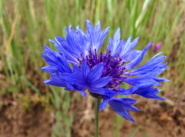
Not for me, thanks. Anyway, from there the trail starts to climb more. A number of batchelor's buttons were in bloom. My flower guide tells me these are considered a noxious weed, an alien import from Europe that thrives in disturbed soils. They are nonetheless very pretty:
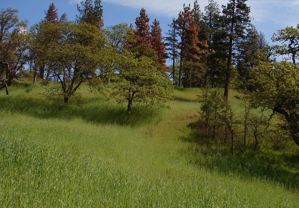
The slopes were lush with fresh grass:

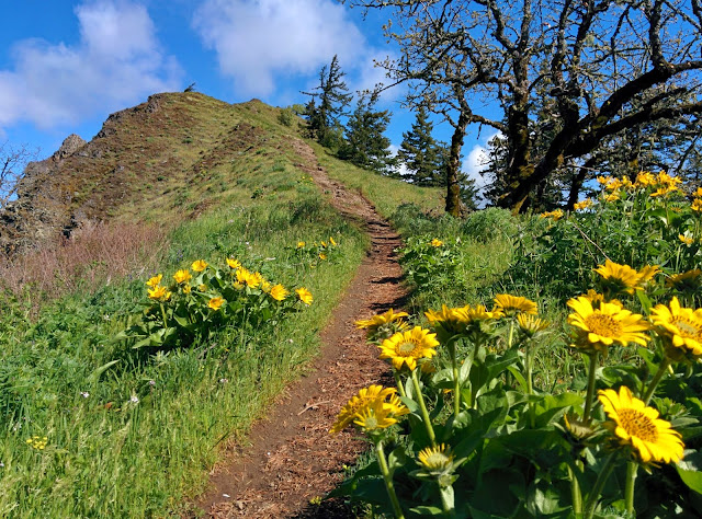
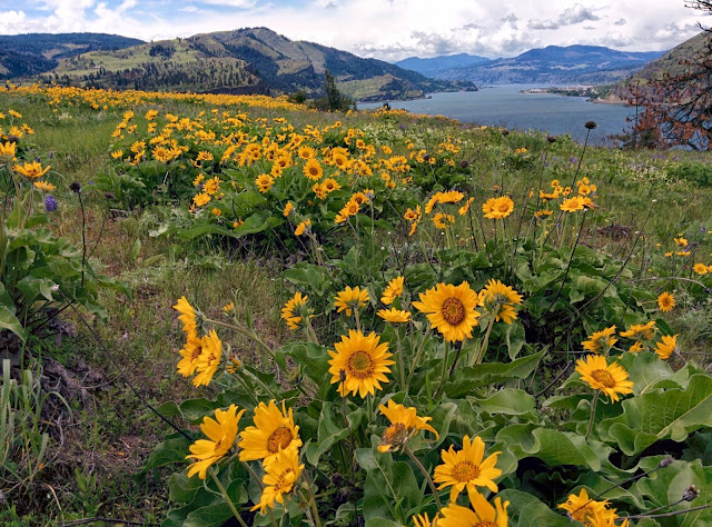
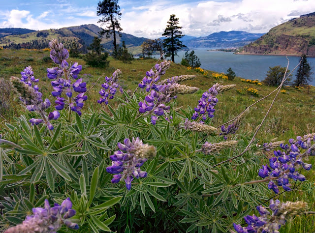
Before long, Scout and I were in the thick of blooming balsamroot and lupine:

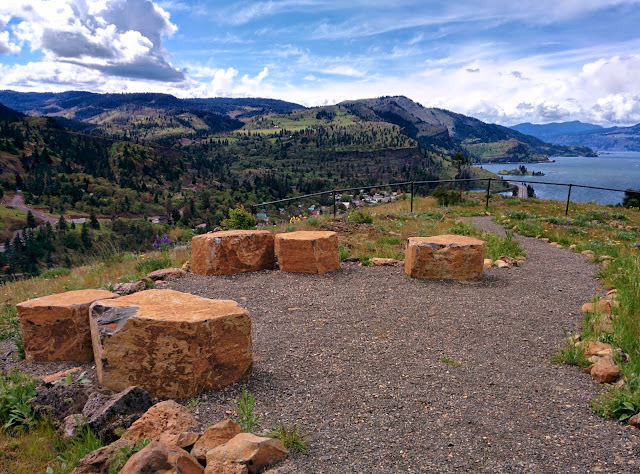
At the trail's high point, Friends have made a nice little sitting spot with basalt columns:
From there, the trail wends its way north, down the slope towards the river:

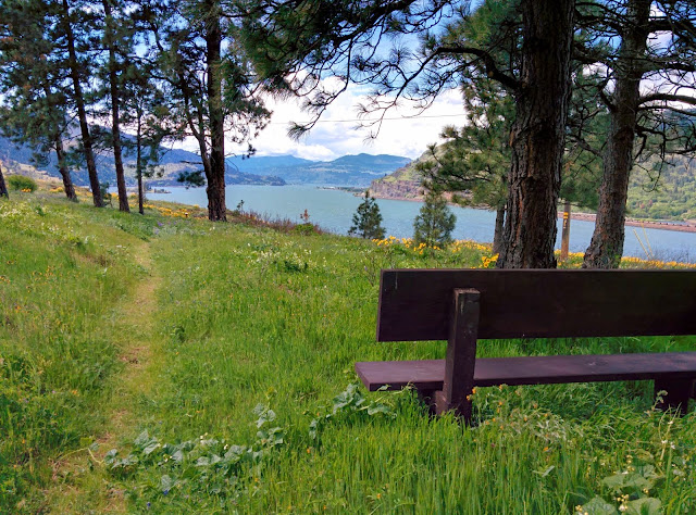
There's a nice bench down the slope a ways:
Amid the flowers, there are maybe a half-dozen concrete foundations scattered about. I assume these were from houses that were removed after Nancy Russel acquired the property.
The trail ends at a gravel driveway that takes you down to the highway. There wasn't much traffic on the highway, so it was a pleasant enough walk back along it to town, making a 2.6 mile loop with 600 ft elevation gain:
http://gpsfly.org/gps_map.php?gps_id=3265&w=645&h=440" scrolling="no" frameborder="no"></iframe>
It made sense to do Mitchell Point first, since it's only accessible from the eastbound side of 84. I've driven past the exit for it a hundred times, and now was my chance to check it out. The parking area has a decent viewpoint, so this place would be a good stop for a little break even if you're not up for a hike:
The hike is only 2 miles RT, but it climbs about 1200 feet, mostly in the trees until you break out into the open for top few hundred feet. Here's the approach to the top:
And here's the view west, down the Columbia. Across the river is Cook Hill on the right, Dog Mtn on the left, and Drano Lake and the mouth of the Little White Salmon at the base of Cook Hill:
Here's the view to the east:
And here's my track:
http://gpsfly.org/gps_map.php?gps_id=3263&w=645&h=440" scrolling="no" frameborder="no"></iframe>
Next was Hood River Mountain, a wonderful vantage point for viewing both wildflowers and the Hood River Valley. Thanks to SDS Lumber Co. for letting hikers use it. Blooming then was mostly balsamroot and paintbrush.
I did the hike as a loop, as described in Lorain's book, walking back along the gravel road. It totaled about 3 miles, with about 700 ft elevation gain:
http://gpsfly.org/gps_map.php?gps_id=3264&w=645&h=440" scrolling="no" frameborder="no"></iframe>
Next, I moseyed along back roads to Mosier, for the Mosier Plateau hike. This hike is mostly on land purchased for conservation by the late Nancy Russell, founder of Friends of the Columbia Gorge, and the land is now owned by the Friends land trust. If you've ever enjoyed the wonders of the Gorge, you should thank Nancy Russell for the huge role she played in preserving it.
I started at the Mosier Totem pole, in the middle of town:
From there I walked 1000 feet east along the Old Columbia Highway, crossing this fine old bridge over Mosier Creek:
The trailhead's at the east end of the bridge. There's no sign for "Mosier Plateau Trail." Instead, there's this bench:
In a few yards, the trail climbs to a small scattering of old headstones:
It then continues along the deep little Mosier Creek gorge:
Taking you to Mosier Falls, a 70 foot drop:
Amazingly, some folks have actually rafted these falls:
https://www.youtube.com/watch?v=9QDJSXCCeGY
Not for me, thanks. Anyway, from there the trail starts to climb more. A number of batchelor's buttons were in bloom. My flower guide tells me these are considered a noxious weed, an alien import from Europe that thrives in disturbed soils. They are nonetheless very pretty:
The slopes were lush with fresh grass:
Before long, Scout and I were in the thick of blooming balsamroot and lupine:
At the trail's high point, Friends have made a nice little sitting spot with basalt columns:
From there, the trail wends its way north, down the slope towards the river:
There's a nice bench down the slope a ways:
Amid the flowers, there are maybe a half-dozen concrete foundations scattered about. I assume these were from houses that were removed after Nancy Russel acquired the property.
The trail ends at a gravel driveway that takes you down to the highway. There wasn't much traffic on the highway, so it was a pleasant enough walk back along it to town, making a 2.6 mile loop with 600 ft elevation gain:
http://gpsfly.org/gps_map.php?gps_id=3265&w=645&h=440" scrolling="no" frameborder="no"></iframe>