
Who: Brad (Born2BBrad) and Dawn (Forest Panther)
When: 4/17/14-4/19/14
Why: Because it's what we love doing
Opening picture:

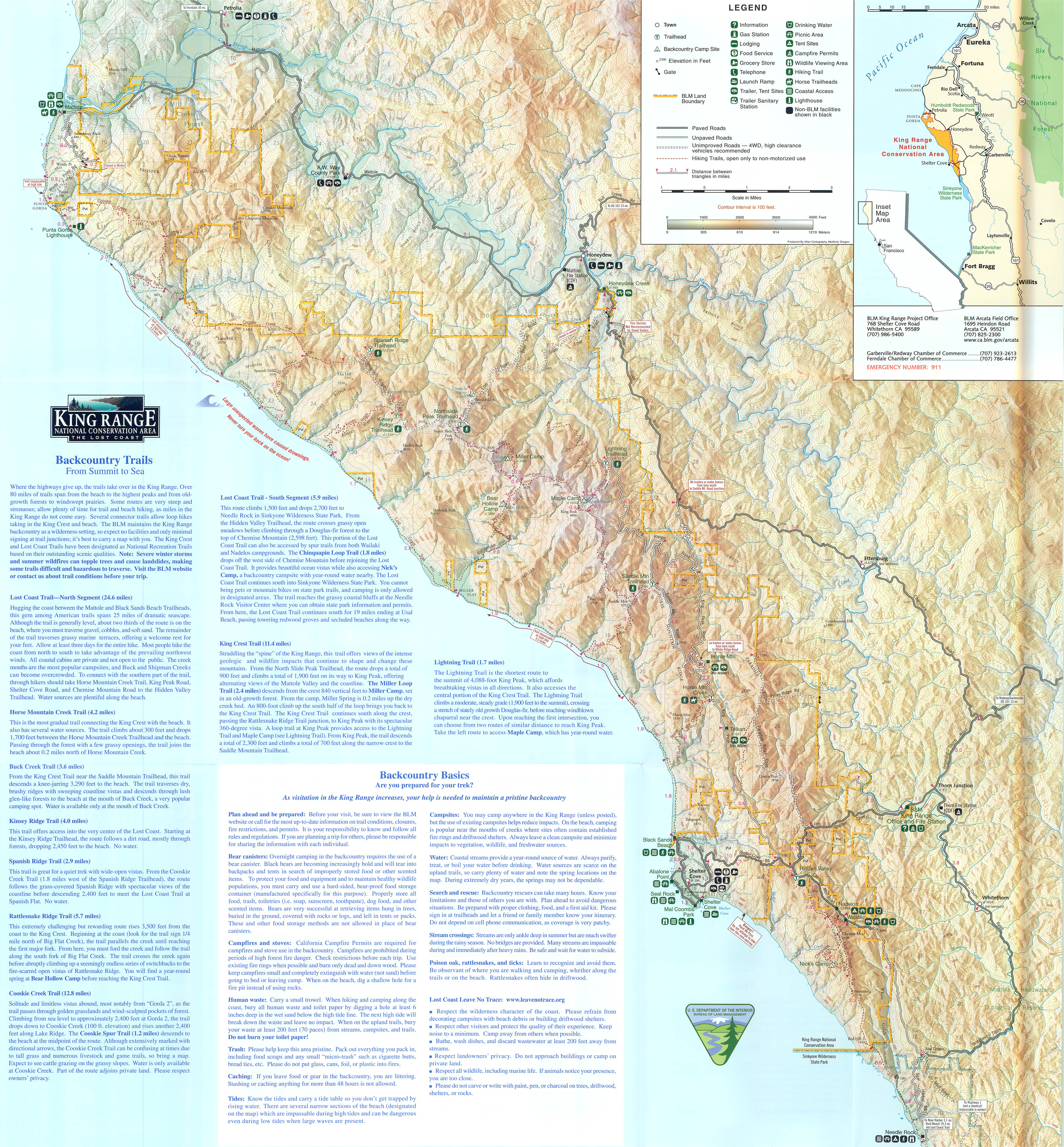
The Lost Coast is an area of the Northern California coast 35 miles long that was, and still is, too rugged for highway building. Because of this, Highway 1 was forced to be built inland. Thus, the area became known as The Lost Coast.
The Lost Coast is actually part of the King Range National Conservation Area (KRNCA) and Sinkyone Wilderness State Park. The KRNCA encompasses over 60,000 acres and has over 80 miles of trails that can only be accessed by foot, hoof or plane. These trails range from the beach to peaks as high as 4000' and from old-growth forest to windswept prairies.
Hiker Chris and I took a trip there in May of 2013 and thoroughly enjoyed it. When my wife, Dawn, saw the pictures of that trip and heard me raving about it, she put it on her bucket list.
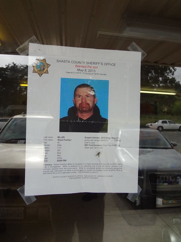
Last year we made an attempt at a trip there, but were turned away just before the trailhead by throngs of law enforcement. They were there looking for a fugitive who murdered his family and whose vehicle was found at the very trailhead we were destined for. That was the end of our Lost Coast adventure and the beginning of another.
This guy has still not been found:
This year we decided to try again. I didn't have to do all the research again, but I did update the tide tables. Using GPS File Depot, I found a free California topo mapset to download to my GPS. That turned out to be helpful. On a side note, keep a link to the GPS File Depot website if you ever need free GPS mapsets. I'm 3 for 3 so far.
As the date of the trip approached, we watched the weather forecast closely. It was favorable so we committed to the trip, and the 10 hour drive.
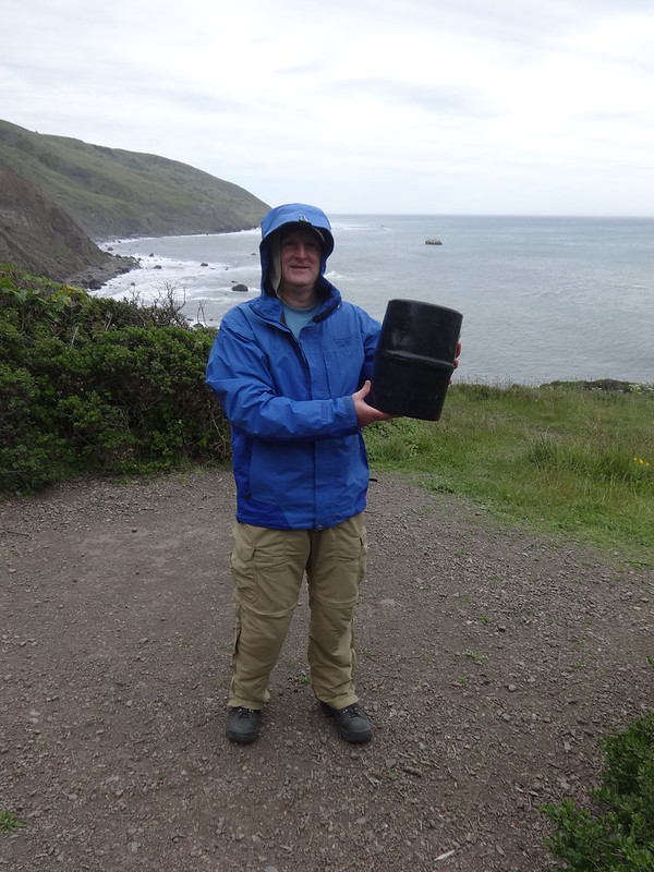
So on Wednesday, April 17th, we left Portland at 4 PM and made it to Fortuna by midnight. The next day after a rough and curvy 45 mile drive, we made it to Petrolia, where we rented the required bear canister at the general store. Fifteen minutes later we were at the Mattole trailhead.
Video showing an example of the rough road:
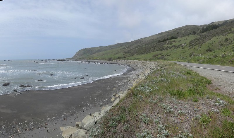
A short portion of the road before Petrolia is right next to the ocean:
Fun fact about Petrolia: It is named so because in 1865, one of CA's first oil wells was drilled in nearby Mattole Valley.
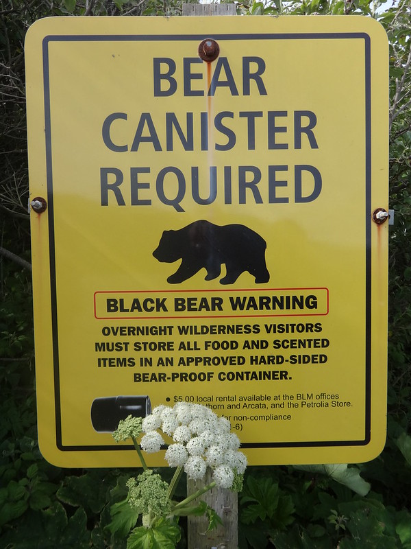
Bear canister sign at trailhead:
Here is what a bear canister looks like:
We were off!!
The weather at that point was sunny with some high, hazy clouds. The wind was blowing a constant 10 MPH from the north, at our backs.
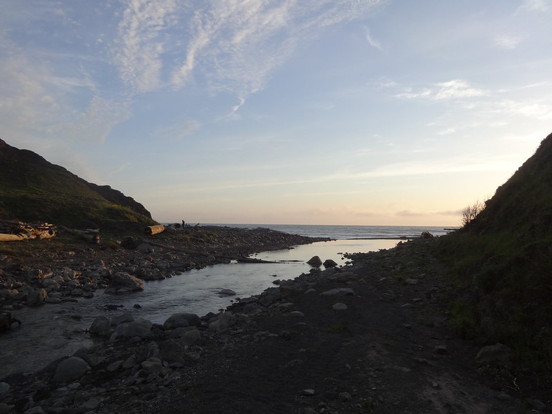
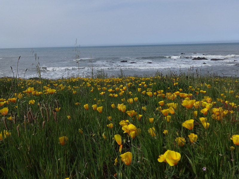
First view of the beach:
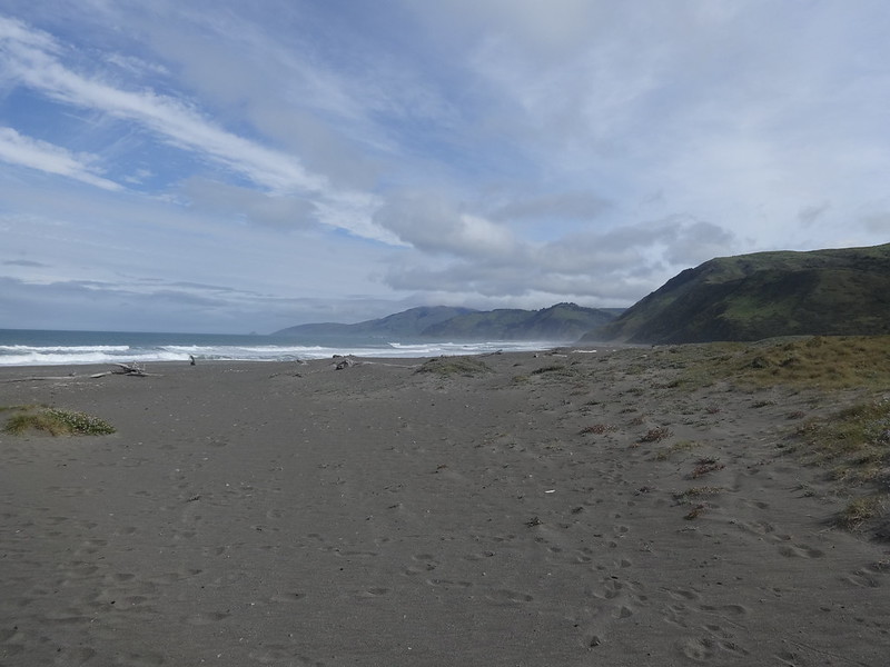
Right away I was reminded how difficult it is to hike in loose beach sand. Fortunately, many parts of the trail are above the beach on solid ground.
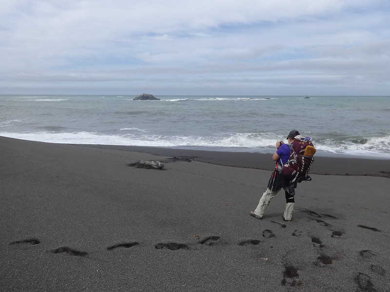
As we were walking along, just before Punta Gorda (fat point in Spanish) we saw a creature come out of the ocean and pull itself onto the beach. As we got closer we could see it was an elephant seal. A picture-taking frenzy ensued. We made sure to maintain a respectful distance.
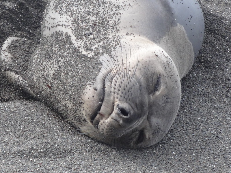
Elephant seal on the beach:
Isn't it adorable? I want one!
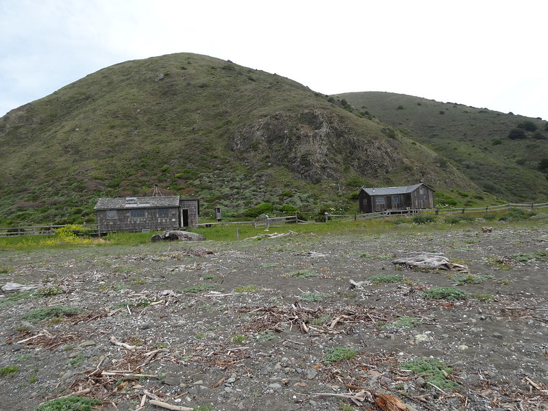
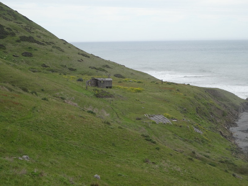
Continuing on, we passed a cabin on a piece of private property, just before Fourmile Creek. The cabin is one of several along the Lost Coast and is the residence of a driftwood artist. The story of the artist and how he came to live there is an interesting one.
Cabin near Fourmile Creek:
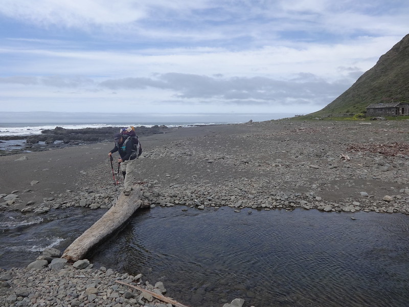
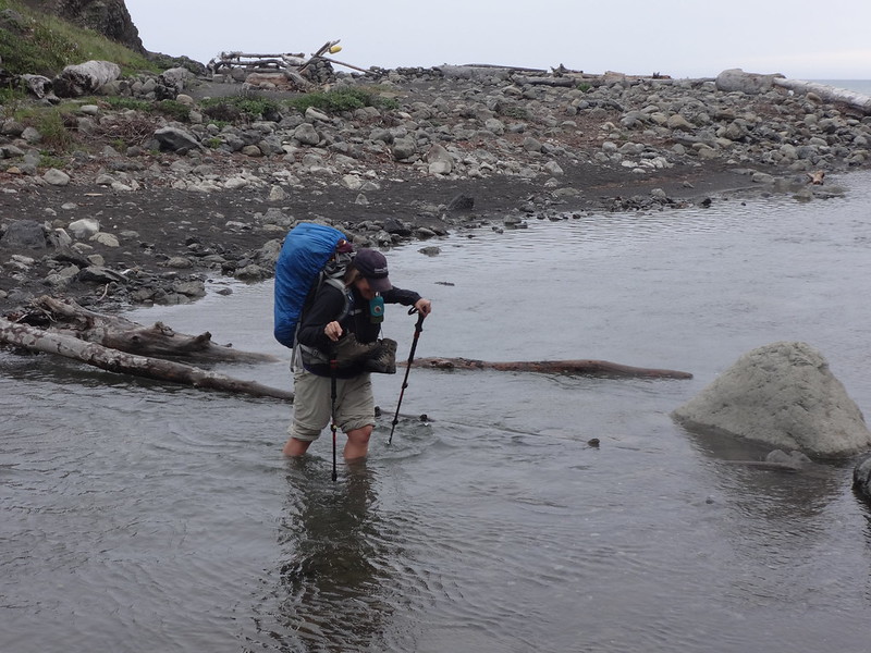
Fourmile Creek is the first creek crossing that is more than a simple step-over or rock-hop. This year someone placed a large, stable log across it. Thank you whoever you are.
Dawn crossing Fourmile Creek:
Right after crossing Fourmile Creek the trail veers above the beach onto compacted soil. You can still walk on the beach, but that is much more difficult and not as good of a view.
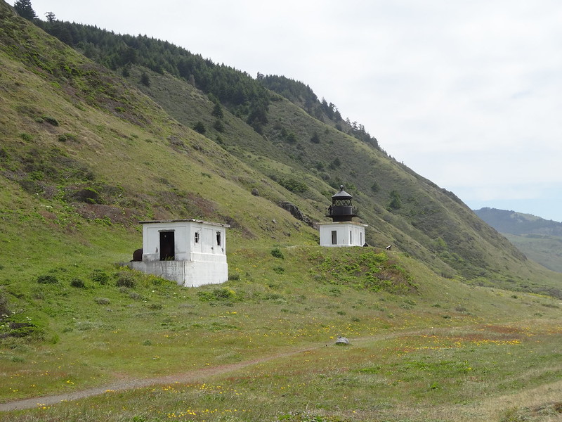
Shortly after the trail goes above the beach is the remains of the Punta Gorda Lighthouse. It was nicknamed the Loneliest Lighthouse and the Alcatraz of Lighthouses. Constructed in 1912, it was extremely isolated and cut off from civilization for much of each winter due to fierce winds and flooded streams. It was decommissioned in 1950, but the structure still remains for hikers to visit
Punta Gorda lighthouse:
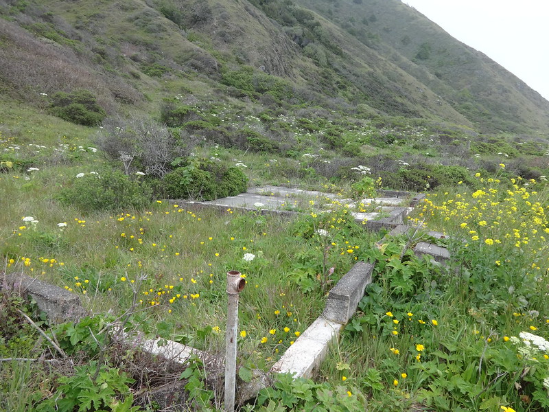
Remnants of the foundation of the light keeper house:
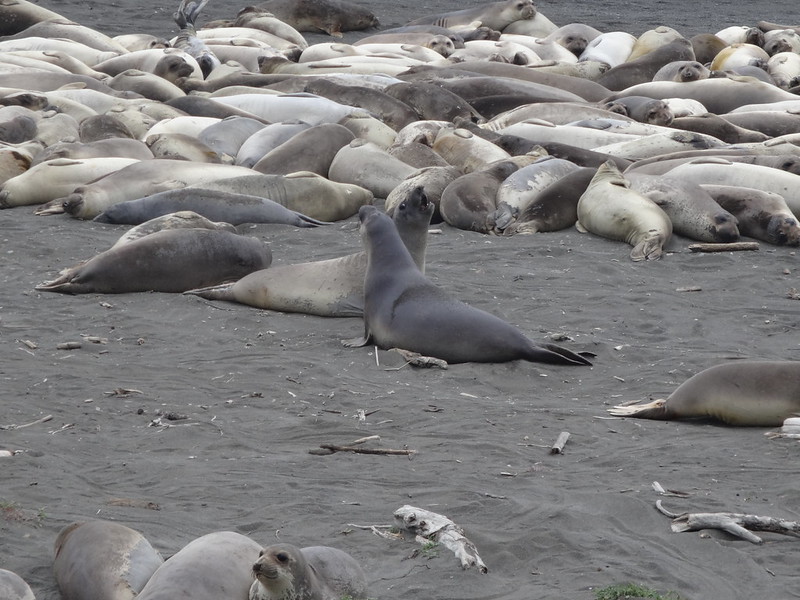
Directly below the lighthouse is a lip of land overlooking the beach. We had been told by a person going north that a large group of sea lions were hanging out there. He was sort of right. They were actually elephant seals.
Elephant seals on the beach:
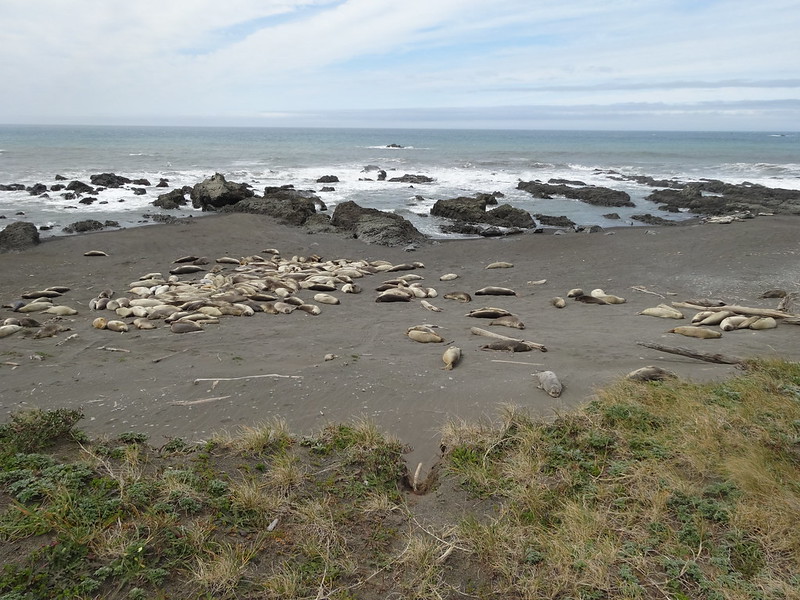
For the most part they were being lazy and basking in the sun, except for two of the larger males.
These guys were jousting to see who was the beachmaster:
This would make a good puzzle:
Who needs to go to Sea Lion Caves?!
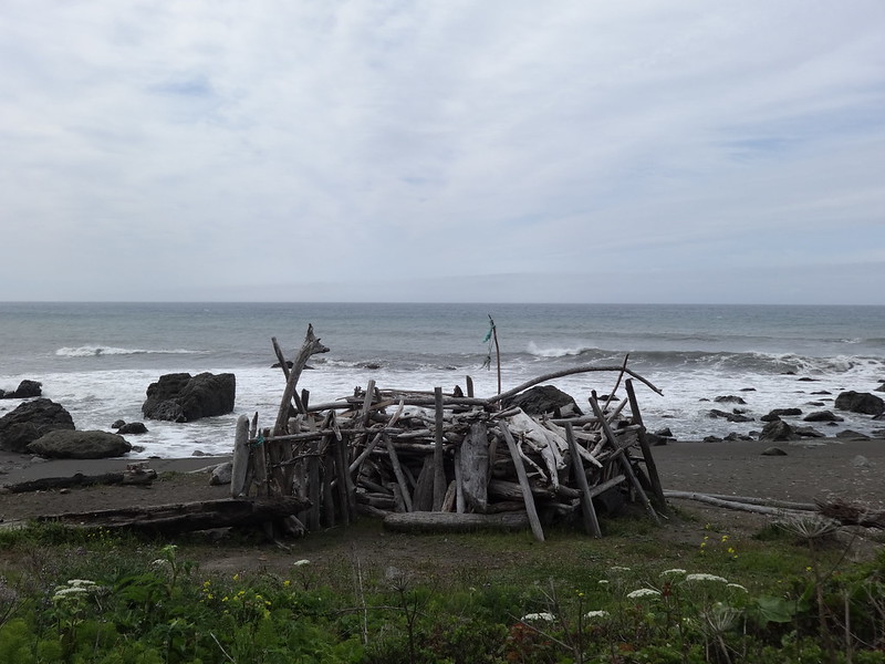
We found many shelters built on the beach, this one being the most elaborate:
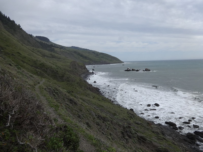
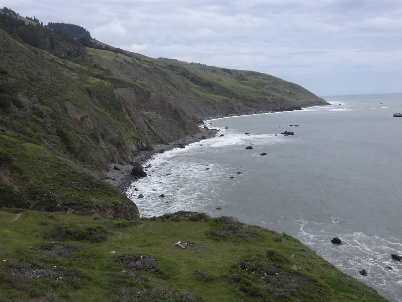
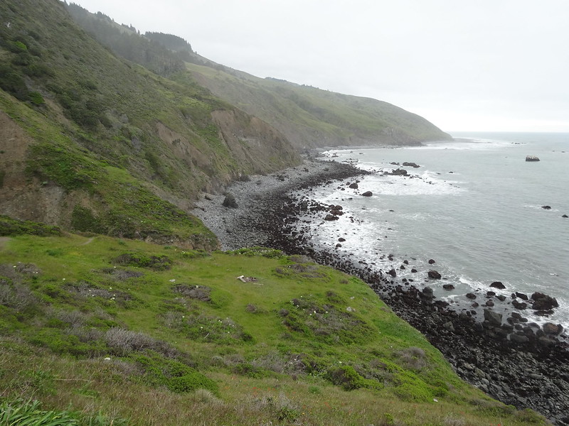
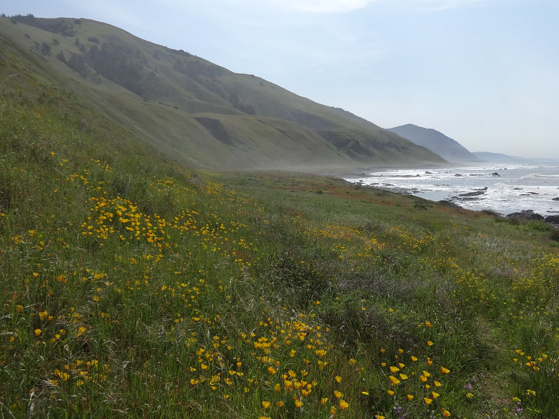
Not long after the lighthouse, the trail gains elevation and follows along a hillside until reaching Sea Lion Gulch. Quickly it became one beautiful view after another. With the rolling ocean, flower-filled grassy hillsides and peaks climbing straight out of the sea, I had a hard time keeping my eyes on the trail.
Trail high above the beach:
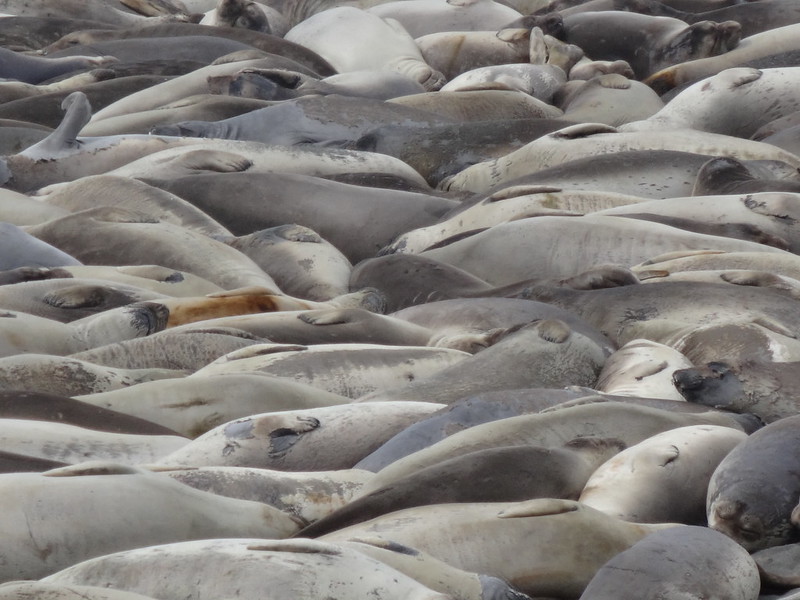
At Sea Lion Gulch, just offshore are a group of rocks called Sea Lion Rocks. I'll give you one guess what was on those rocks. I think they were elephant seals, but why the name Sea Lion Gulch and Sea Lion Rocks?
Elephant seals (or are they sea lions?) on Sea Lion Rocks:
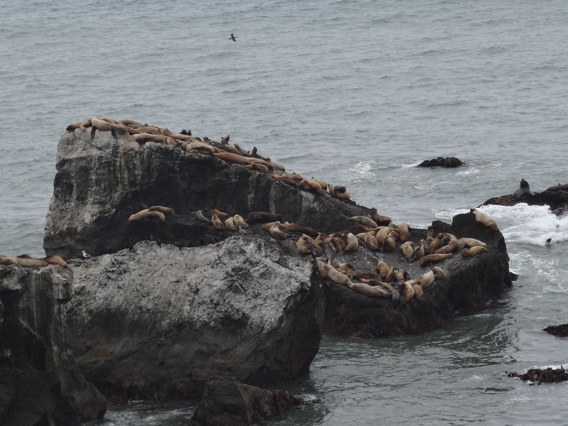
This group were much more vociferous than the other group. They sounded like me after eating a pizza and drinking a large bottle of pop.
Long abandoned shack:
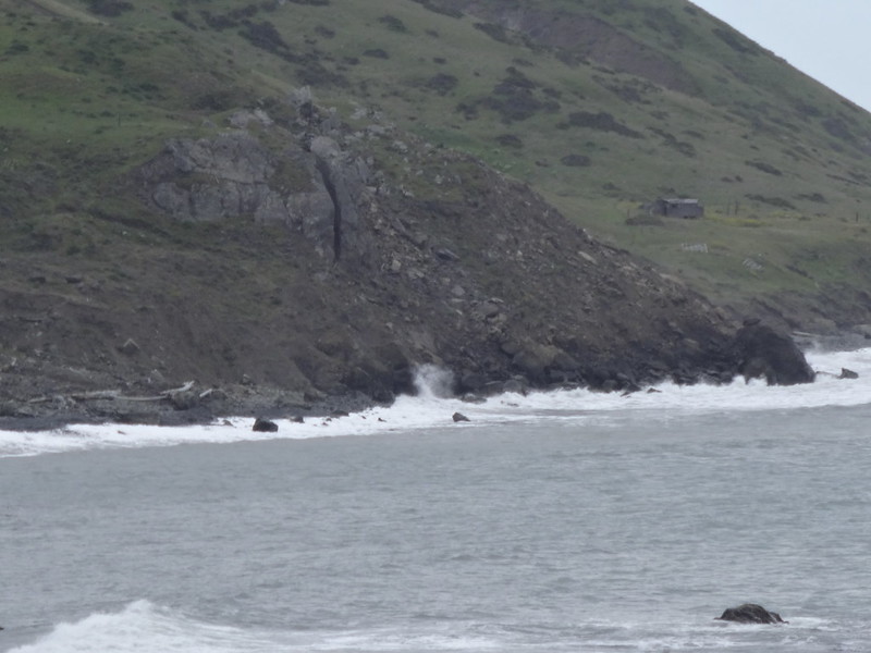
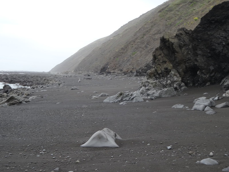
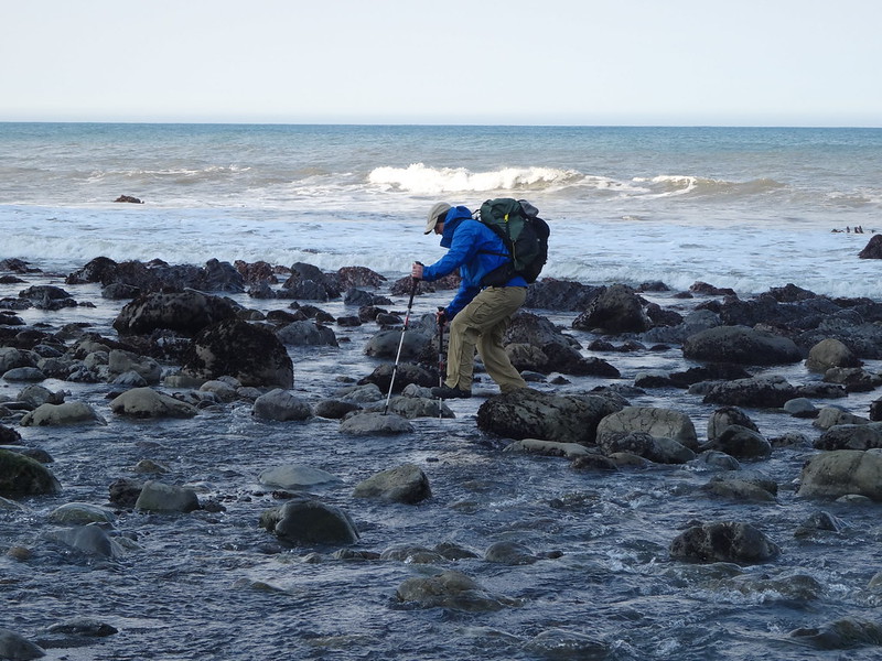
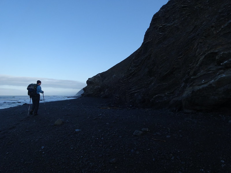
At Sea Lion Gulch is where the trail descends back down on to the beach. It's also where a section impassable at high tide begins. It's also where one of the rocky section begins.
Since we arrived at that location just after high tide, we had to wait for it to recede. We could clearly see the waves crashing against the cliff walls at many points. Only the foolish would attempt passing at high tide, and we met one of those. He described getting soaking wet, along with all of his gear.
View of the area impassable during high tide:
Here is that same spot at low tide on day three:
Zoomed pic of waves crashing. Would you try to pass that?
An hour and fifteen minutes after high tide, we could see that the first points where waves had been crashing we safe to pass. We calculated that the remaining points would be safe by the time we got there, so we began the descent to the beach. Was it safe? Read on.
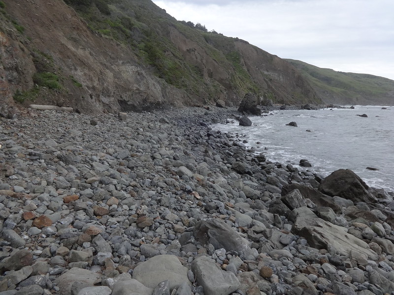
The beginning of the rocky section:
There were a couple of points where the waves were still lapping at the base of the rocks:
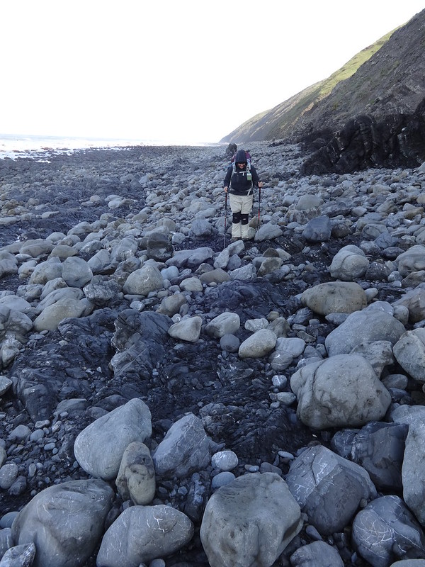
After much hiking through pebbles, rocks and boulders we were nearing our destination for the day: Cooskie Creek.
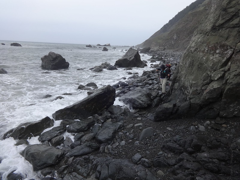
However, there was still one more point to get around. This one we had to time it just right between the waves to get around the rocks jutting into the ocean.
Video of passing the final point:
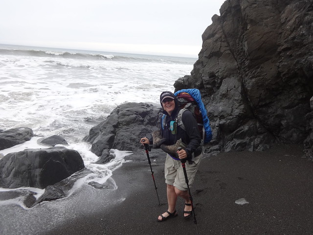
Dawn pleased she made it passed the final point:
Here is that same spot at low tide on day three:
Cooskie Creek is in the middle of the section impassable during high tide, but it is a refuge and has many campsite options. We were the only ones there so we had our pick.
Dawn crossing back over Cooskie Creek after scoping out camp sites:
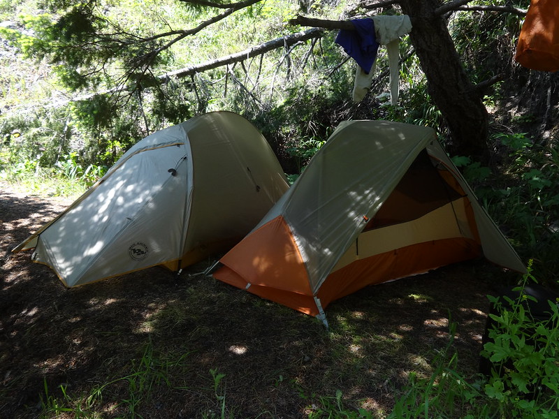
We opted for a spot a hundred yards up the creek on the north side. It was sheltered from the wind, which by then was a constant 15 MPH. We got our tents up just as it began to rain lightly.
Our campsite at Cooskie Creek. Yes, we have separate tents. I snore and don't smell too good when back backpacking. I wouldn't want to share a tent with me either.
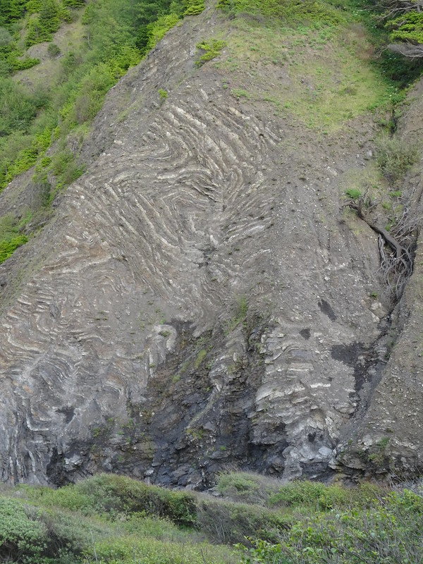
Funky rock formation accross from our campsite. I'm sure a geologist would have something smart to say about it.
Cooskie Creek and the ocean right before sunset:
The next day our destination was Spanish Creek, but we still had two miles of rocky hiking through a section impassable during high tide. Since high tide was at 2:53 PM, there were no worries about that. We were pleased that the sky was mostly sunny and there was little wind.
Rock hopping across Cooskie Creek:
More rock walking after crossing Cooskie Creek and going south:
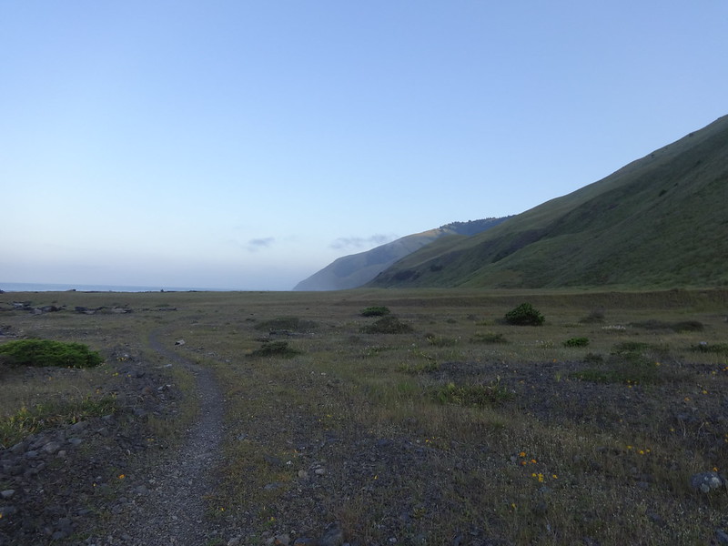
The rocky section ends at Randall Creek, where the trail once again climbs above the beach. Shortly thereafter is the beginning of Spanish Flat. Just as in 2012, Spanish Flat was my favorite part of the trip. Spanish Flat is a broad, flat, grassy area above the beach about two miles long with a trail, thankfully allowing for solid footing. The views there were spectacular. There were California poppies and green grass everywhere.
Dawn resting above Randall Creek:
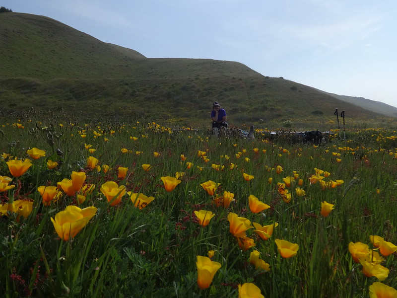
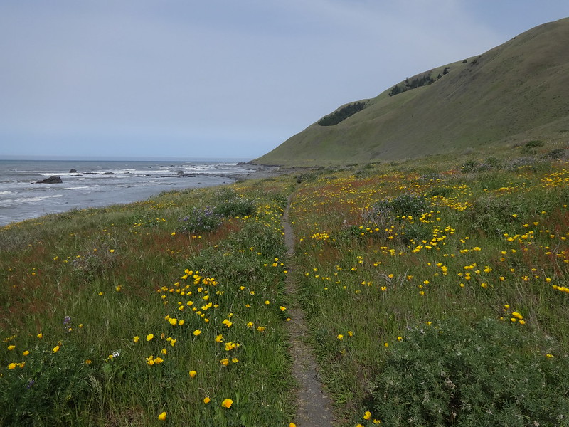
Poppies over the ocean at Randall Creek:
Poppies and Randall Creek drainage:
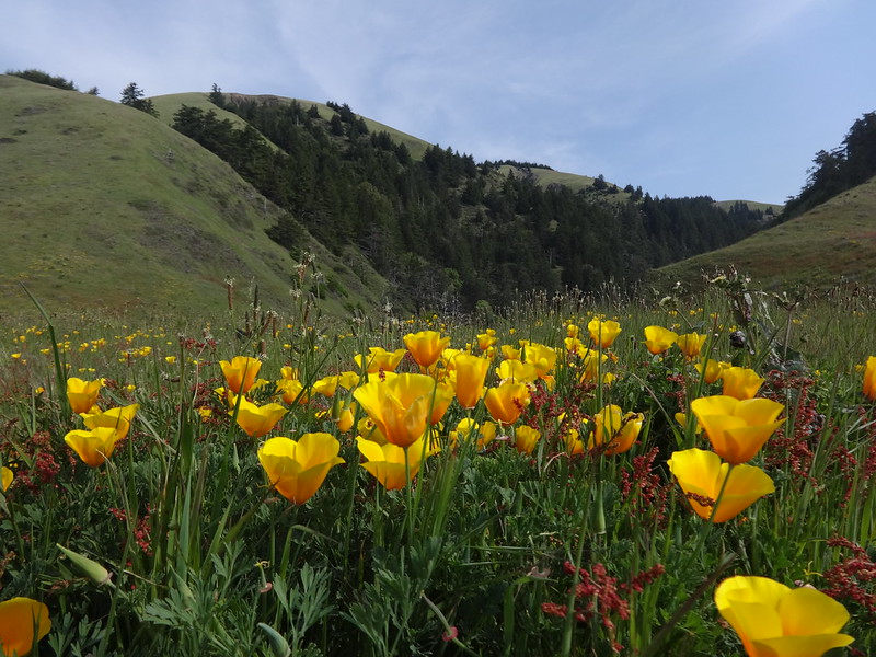
The beginning of Spanish Flat:
In the middle of Spanish Flat:
Spanish Flat 360 video:
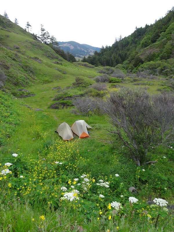
When we got to Spanish Creek, we went upstream for a couple hundred yards to the campsite I stayed at in 2012. While not on the beach, it afforded shelter if it became windy and shade from the sun.
Our campsite up Spanish Creek:
With plenty of time left in the day, we commenced wandering and beachcombing, finding all sorts of interesting things.
Wandering around the beach at Spanish Creek:
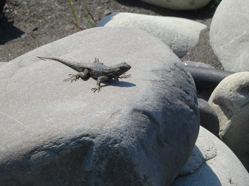
Lizard near Spanish Creek:
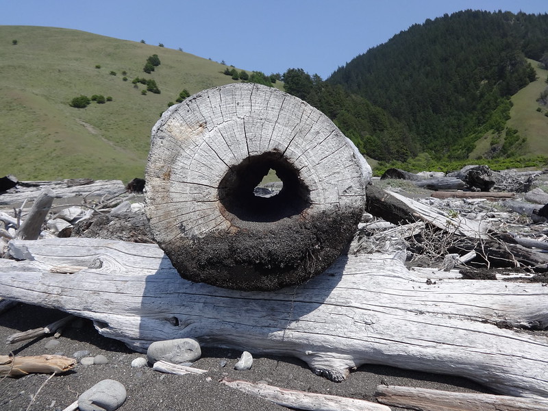
A hollow log all the way through for my buddy Chase:
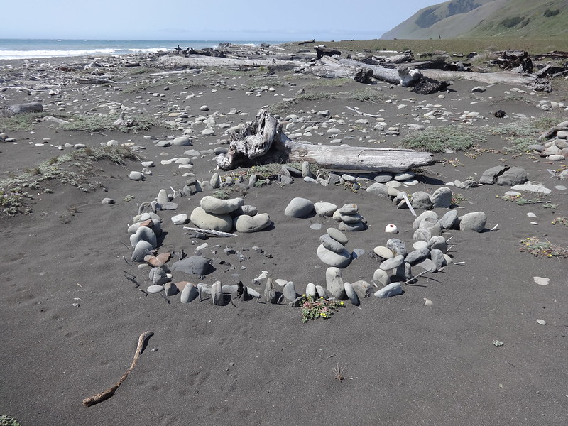
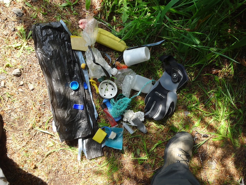
Dawn's contribution to cleaning up the beach:
The next day we decided to hike north all the way back to the trailhead, rather than stay the planned third night. This is because north of Cooskie Creek, there really wasn't any good campsites. Also, the timing of high tide had something to do with it.
Brad beginning the hike back:
Looking north at Spanish Flat at sunrise:
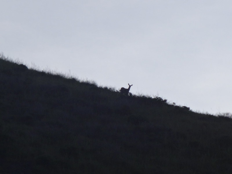
Deer on the hillside watching us:
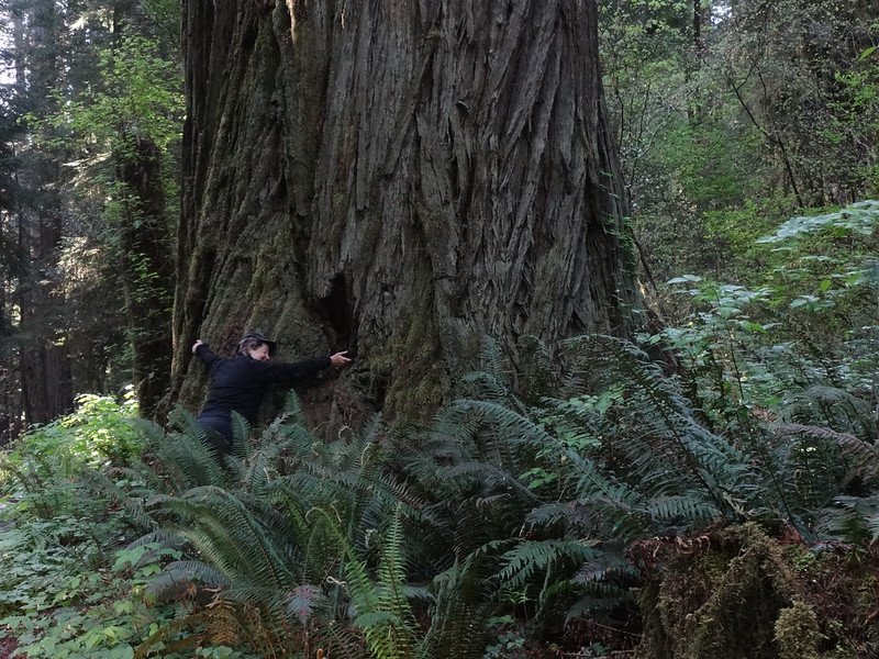
The views on the way back were pretty much the same, although with more gray clouds and misty ocean spray. After returning the bear canister at the store in Petrolia, we drove to Crescent City for the night and a much enjoyed shower. The next day we drove back to Portland, stopping to check out some giant redwood trees.
Dawn is a hippie liberal tree-hugger:
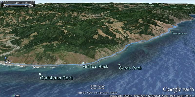
Tracks in Google Earth:
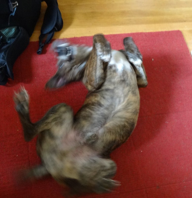
Buddy was happy to see us:
FInal notes:
- In places poison oak is everywhere.
- Dawn found a tick on her pants. I read reports that ticks can be bad there.
- No rattlesnakes this time.
- Mileage: 26.8 hard miles with 2170' EG.
Links:
- Link to all my pics
- Link to all Dawn's pics
- Link to the best map on the Internet
- Link to tide tables for the Lost Coast
- Link to BLM website
- Link to misc. info, such as route description


