Table Rock Wilderness 20-Apr-2014
Posted: April 20th, 2014, 2:54 pm
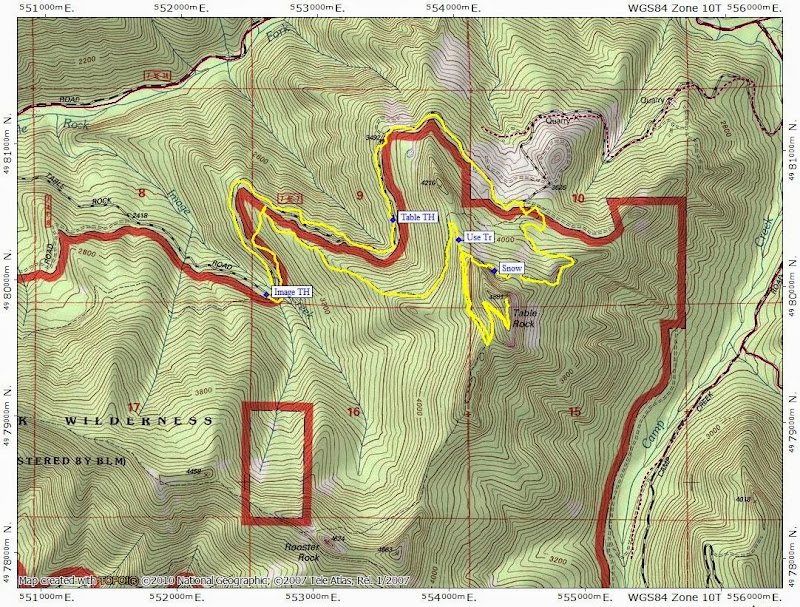
Going through some old 35mm slides the other day, I realized that I hadn't visited the Table Rock Wilderness is something like 18 years! That glaring omission, some time today for a short hike before heading to DC on business, and curiosity about snow levels, found me at the Table Rock TH early this morning.

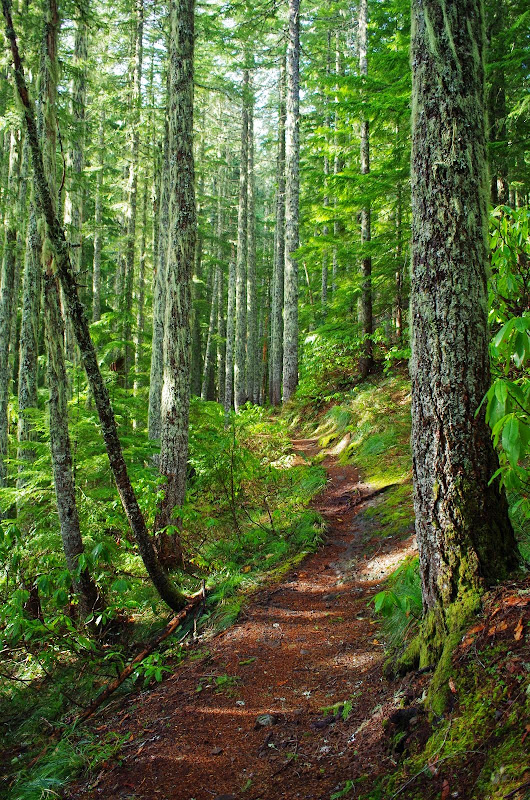
The road and the Table Rock trail up to 4200' were mostly snow-free, with only short stretches of snow in a few places. No need for snow shoes or spikes, but the crusty, breakable, soft, uneven surface was a little hard to hike on.
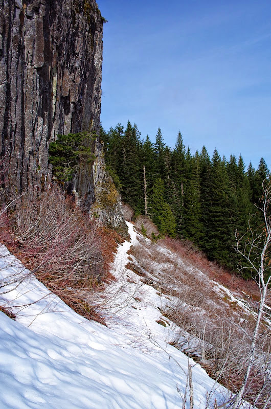
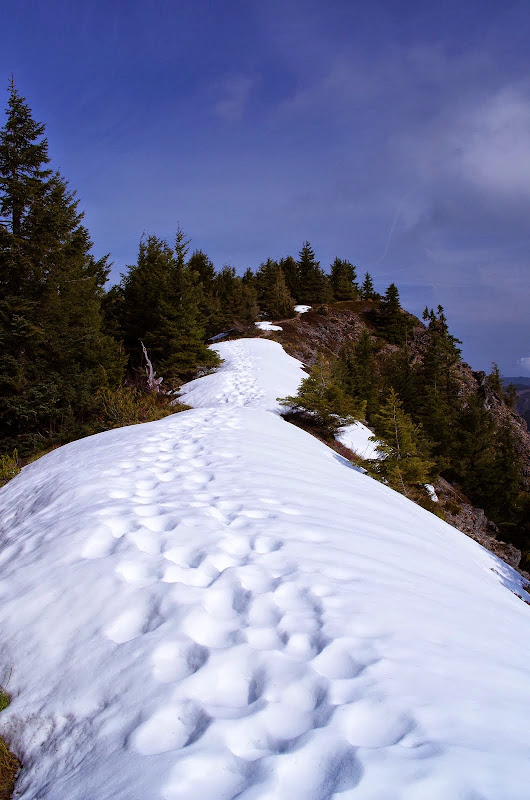
At 4400', the trail cuts below the north face to Table Rock,
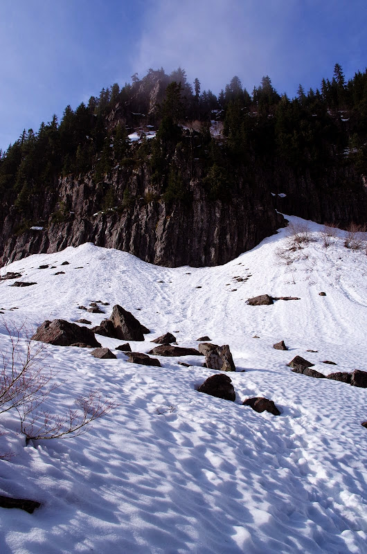
and here the trail was completely buried in snow.
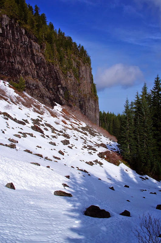
I worked my way across carefully, as this is soft snow on a boulder field - punching through the snow and getting your ankle/leg trashed by an underlying rock is a real possibility. Once the I reached the W side to Table, the snow largely disappeared again and it was an easy hike up to the top of the rock.
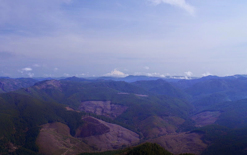
There was still a lot of water vapor in the air from Saturday's storms but Hood was visible (and so are the clear cuts - which come almost to the wilderness boundary in some spots),
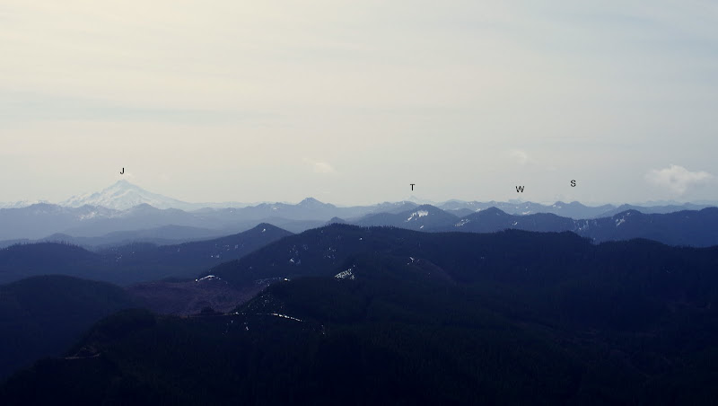
as were Jefferson (J), Three Finger Jack (T), Washington (W), and the Sisters (S).
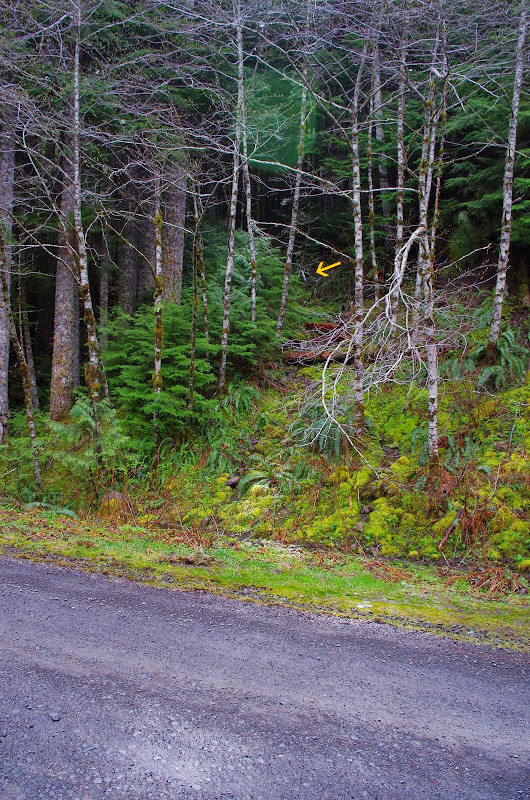
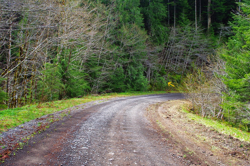
I had lunch on the summit then, with a high overcast moving in, decided to head back. Rather than go back across the snow field, I used a use trail to leave the Table Rock trail and descend to intersect the Image Creek trail at about 4200'. There's no official Image Creek TH on the Table Rock road but the trail comes very close to the road and I was curious what that looked like. So I went W on the Image Creek trail, accomplished a soggy, slippery crossing of Image Creek, and dropped on to the road immediately thereafter. The only sign that this connection exists is a wilderness marker (arrow) back in the trees,
and something of a wide spot in the road.
Back up the road to my car and home to pack. 8.3 mi, 2300' EG. Will have to come back again this year - and not wait another 18 (at which point I won't be able to get my walker up the trail).
The road and the Table Rock trail up to 4200' were mostly snow-free, with only short stretches of snow in a few places. No need for snow shoes or spikes, but the crusty, breakable, soft, uneven surface was a little hard to hike on.
At 4400', the trail cuts below the north face to Table Rock,
and here the trail was completely buried in snow.
I worked my way across carefully, as this is soft snow on a boulder field - punching through the snow and getting your ankle/leg trashed by an underlying rock is a real possibility. Once the I reached the W side to Table, the snow largely disappeared again and it was an easy hike up to the top of the rock.
There was still a lot of water vapor in the air from Saturday's storms but Hood was visible (and so are the clear cuts - which come almost to the wilderness boundary in some spots),
as were Jefferson (J), Three Finger Jack (T), Washington (W), and the Sisters (S).
I had lunch on the summit then, with a high overcast moving in, decided to head back. Rather than go back across the snow field, I used a use trail to leave the Table Rock trail and descend to intersect the Image Creek trail at about 4200'. There's no official Image Creek TH on the Table Rock road but the trail comes very close to the road and I was curious what that looked like. So I went W on the Image Creek trail, accomplished a soggy, slippery crossing of Image Creek, and dropped on to the road immediately thereafter. The only sign that this connection exists is a wilderness marker (arrow) back in the trees,
and something of a wide spot in the road.
Back up the road to my car and home to pack. 8.3 mi, 2300' EG. Will have to come back again this year - and not wait another 18 (at which point I won't be able to get my walker up the trail).