Exploring Upper Catherine Ck 28-Feb-2014
Posted: February 28th, 2014, 4:57 pm
Early last year, I found a way across Catherine Ck so that it was possible (without too much steep hill climbing) to make a loop from Atwood Road to Tracy Hill (Crossing the Creek 2013). The old road continues past the fork down to the creek and I always wondered how much further it went. With bad weather predicted for the weekend, it seemed like today was a good day to explore this road. This was one of those odd days when it was foggier in the Gorge than in Portland and so I spent the day (uncharacteristically) under a gray blanket of gloom.
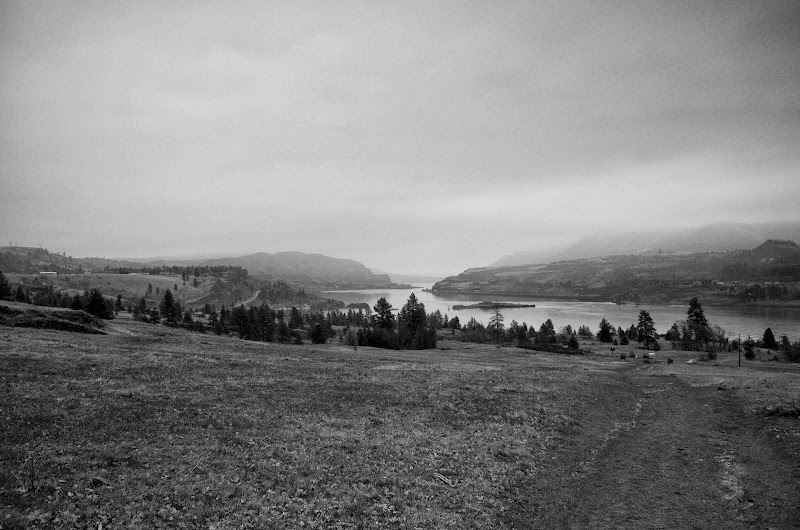
It was an exploration day, which was good because taking photos without sunlight isn't ideal.
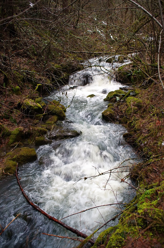
I took CA2, then C07 to 850', where an unmarked trail (more than a use trail) snakes eastward up to Atwood Rd. I took Atwood to the old road (past the stove) that goes up Catherine Ck, and followed that road past where I usually turn-off to cross the creek. The old road is more overgrown further N, with more uncleared blow downs, but not hard to follow. Initially it climbs away from the creek but after about 0.5 mi, levels off and contours back to only 50' above the creek. This high up, the creek was pretty easy to cross.
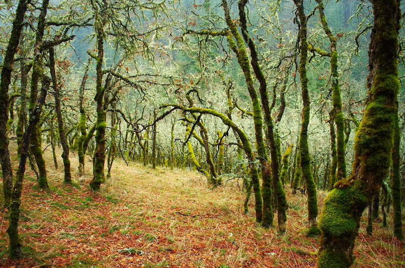
After crossing, I headed straight-up so as to cross an old road on the ridge above within the national forest boundary. There's private land to the N and I didn't want to pop out of the trees into someone's backyard. The slope here is much less steep than the one at the lower creek crossing. On the lower slopes, I ascended through a charming forest of old, mossy oaks.
But I got to the ridge to find that the old road was now a logging road for a partial logging operation - basically take the commercial timber and leave the rest.
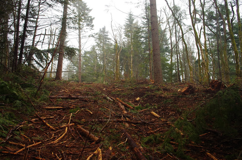
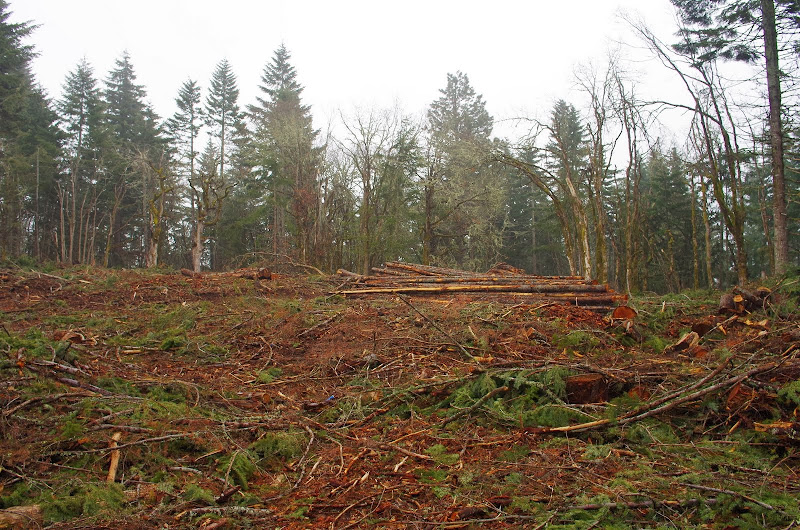
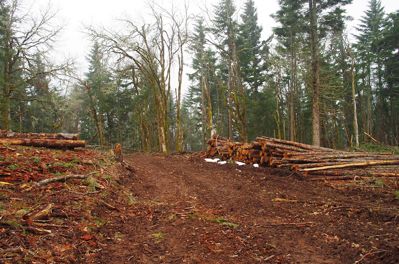
Hmmm. Land of many uses... I headed down the road and at about 1800' the logging stopped and the "old" old road came back.
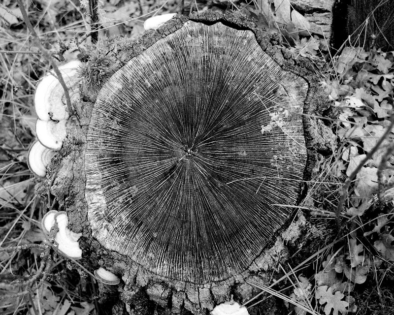
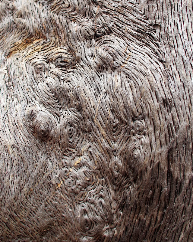
Nice burl.
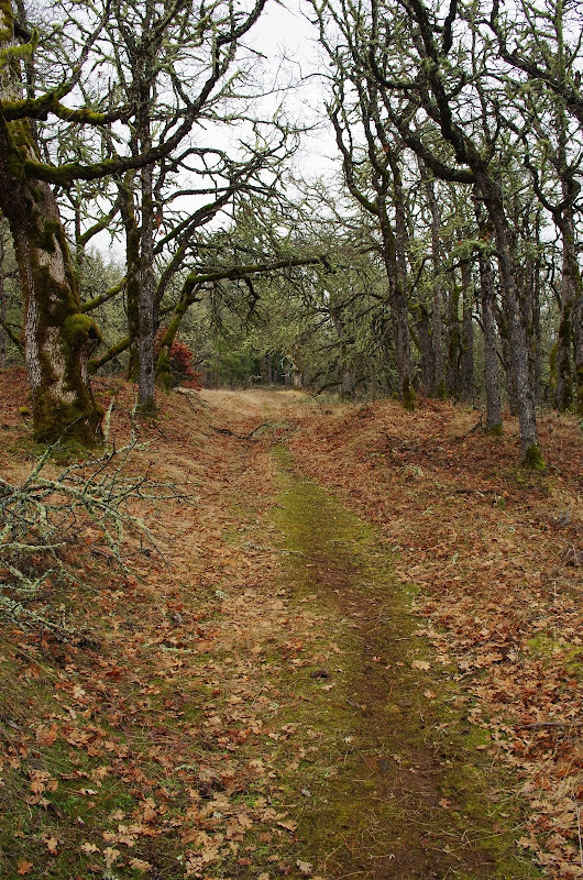
The old road soon becomes a trail heading out on to the meadows,
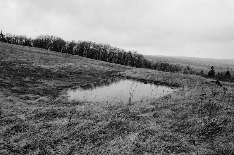
past the old stock (now frog) pond,
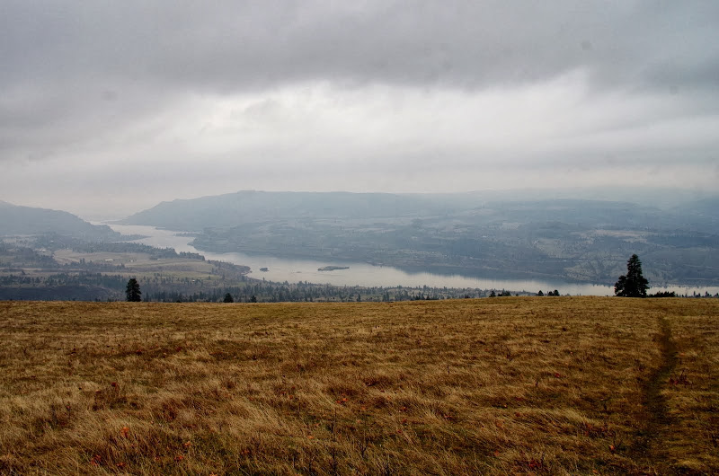
and on down the sloping meadow to the TH. Flocks of robins and stellar jays but no flowers other than some grass widows. But things are starting to sprout...
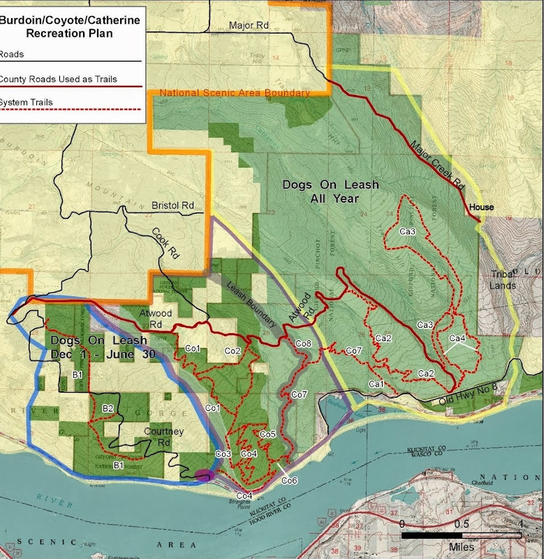
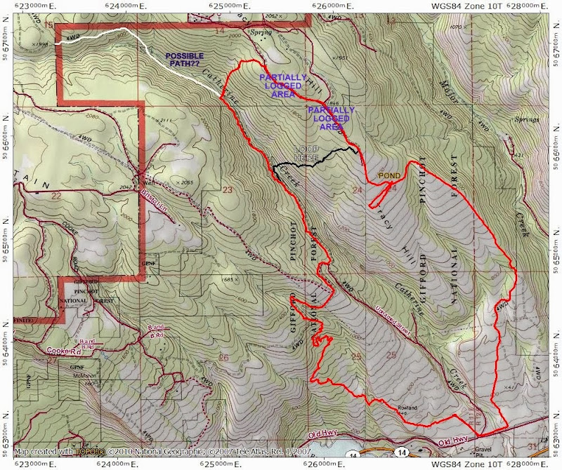
The red line is today's route, the black line ("Loop Here") is the path I've used before and which misses the logging, and the white line ("Possible Path??") is my guess that the old road continues - in a tawdry and broken down manner - on up to the plateau at 2000'. It was fun to see where the old road went but with all the logging on the ridge, this particular route - despite the walkable road and easy creek crossing - isn't worth a repeat. Better to cross the creek lower down and pretend there are still trees up the hill somewhere. 8.8 mi RT, 1800' EG.
It was an exploration day, which was good because taking photos without sunlight isn't ideal.
I took CA2, then C07 to 850', where an unmarked trail (more than a use trail) snakes eastward up to Atwood Rd. I took Atwood to the old road (past the stove) that goes up Catherine Ck, and followed that road past where I usually turn-off to cross the creek. The old road is more overgrown further N, with more uncleared blow downs, but not hard to follow. Initially it climbs away from the creek but after about 0.5 mi, levels off and contours back to only 50' above the creek. This high up, the creek was pretty easy to cross.
After crossing, I headed straight-up so as to cross an old road on the ridge above within the national forest boundary. There's private land to the N and I didn't want to pop out of the trees into someone's backyard. The slope here is much less steep than the one at the lower creek crossing. On the lower slopes, I ascended through a charming forest of old, mossy oaks.
But I got to the ridge to find that the old road was now a logging road for a partial logging operation - basically take the commercial timber and leave the rest.
Hmmm. Land of many uses... I headed down the road and at about 1800' the logging stopped and the "old" old road came back.
Nice burl.
The old road soon becomes a trail heading out on to the meadows,
past the old stock (now frog) pond,
and on down the sloping meadow to the TH. Flocks of robins and stellar jays but no flowers other than some grass widows. But things are starting to sprout...
The red line is today's route, the black line ("Loop Here") is the path I've used before and which misses the logging, and the white line ("Possible Path??") is my guess that the old road continues - in a tawdry and broken down manner - on up to the plateau at 2000'. It was fun to see where the old road went but with all the logging on the ridge, this particular route - despite the walkable road and easy creek crossing - isn't worth a repeat. Better to cross the creek lower down and pretend there are still trees up the hill somewhere. 8.8 mi RT, 1800' EG.