On the Lookout for Badger Creek Loop 24-Oct-2013
Posted: October 25th, 2013, 5:50 pm
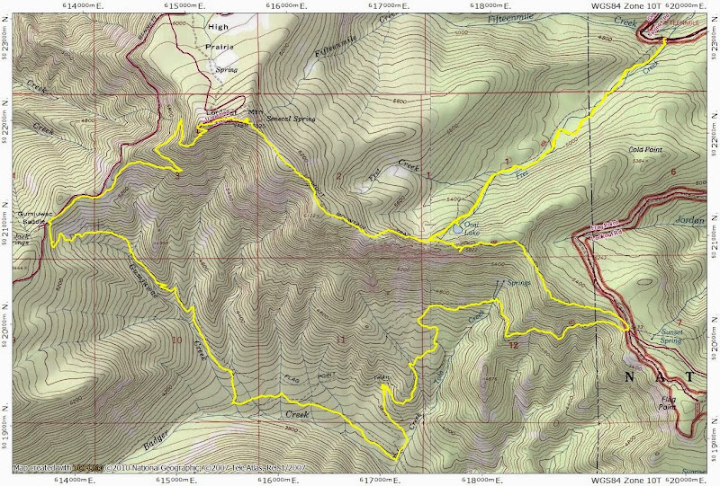
I had sketched out some loop trips in the Badger Creek Wilderness, figuring I wouldn't be able to get to them until next summer. Then no snow, some excellent Flag Point-related TRs from awildman and kepPNW for encouragement, a day off, and I was out-bound for the Fret Creek TH (#456A) near Fifteenmile Camp. That's on the E side of Mt. Hood, which was still cast in morning light as I drove in.
Then it was up Trail 456A, past Oval Lake,
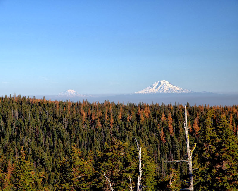
to a junction with the Divide Trail (# 458), which I took E to the top of the divide, for views of Jefferson and Olallie,
and Adams and Rainier (these would be obscured by smoke later in the day).
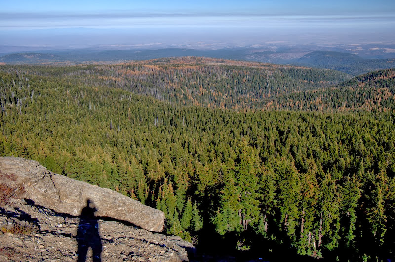
Then it was further E on the Divide Trail toward Flag Point,
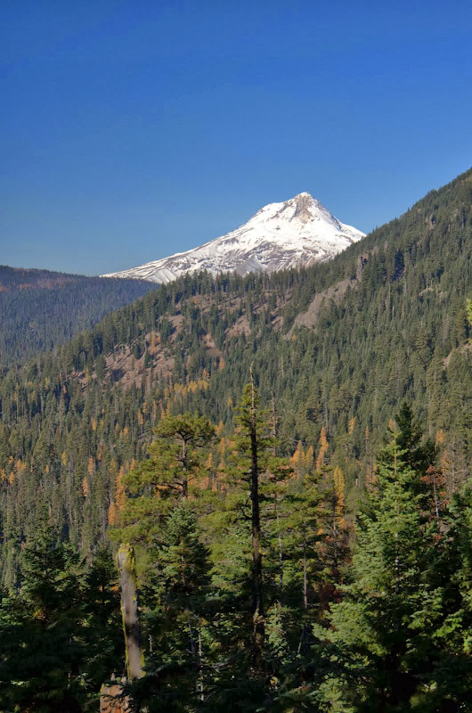
and a junction with the Badger Creek Cutoff Trail (# 477). I followed that down toward Badger Creek, catching a few more glimpses of Hood along the way.
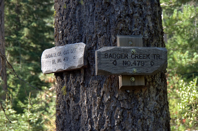
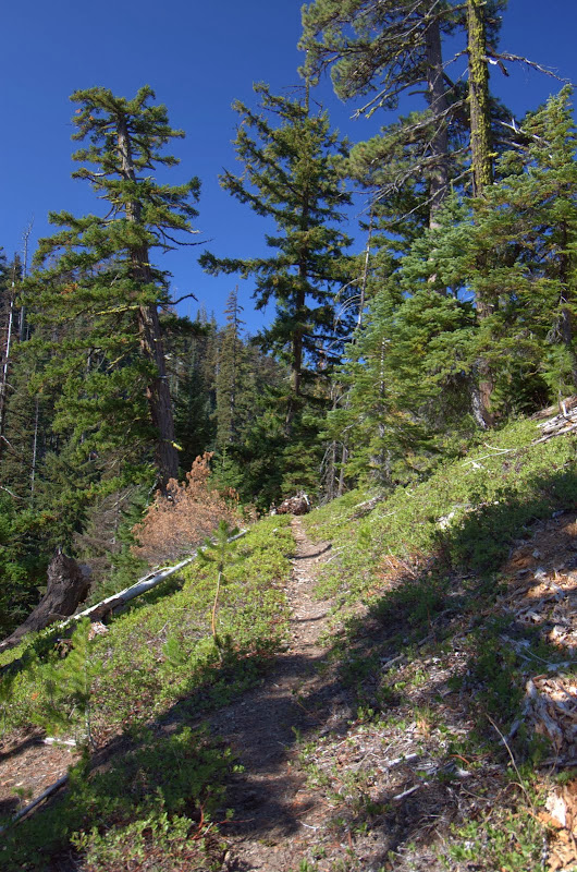
My old topos and the Green Trails map #463 show a few trails connecting with the 477 but I could find no trace of these. If they ever existed, they may now be lost under the considerable deadfall in the area. The 477 cuts through this as it descends gently but steadily toward Badger Creek and a junction with the creek trail (# 479).
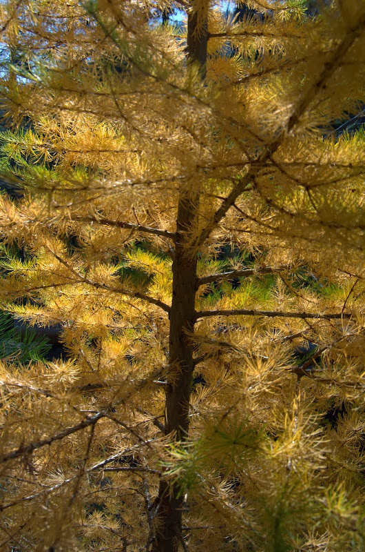
I got up close and personal with a tamarack,
then took the 479 W to its junction with the Gumjuwac Trail (#480) and followed that as it ascended gently but steadily toward Gumjuwac Saddle.
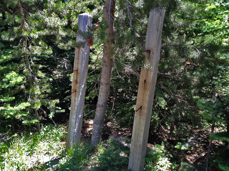
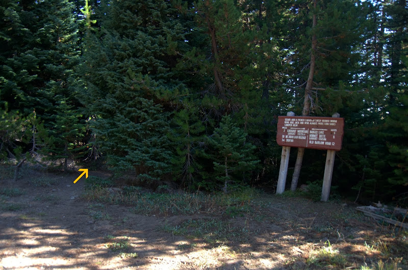
At the saddle, the 480 just popped out of the bushes (arrow) on to the road, with no signage that I could see.
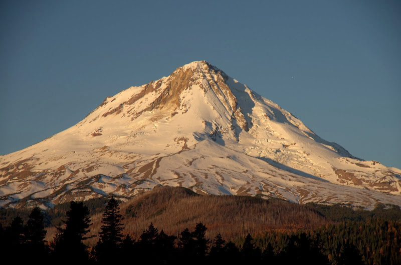
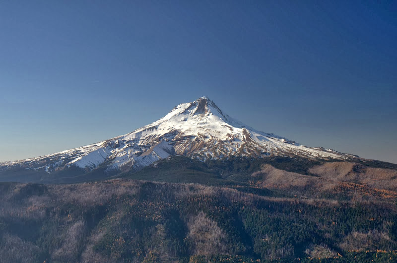
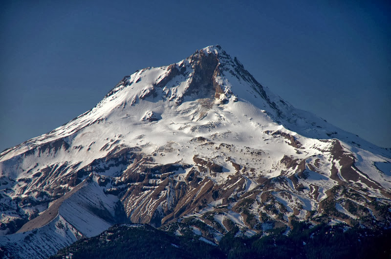
At this point I was re-connected with trail 458, which I used to reach the summit of Lookout Mtn, with its stellar views of Hood,
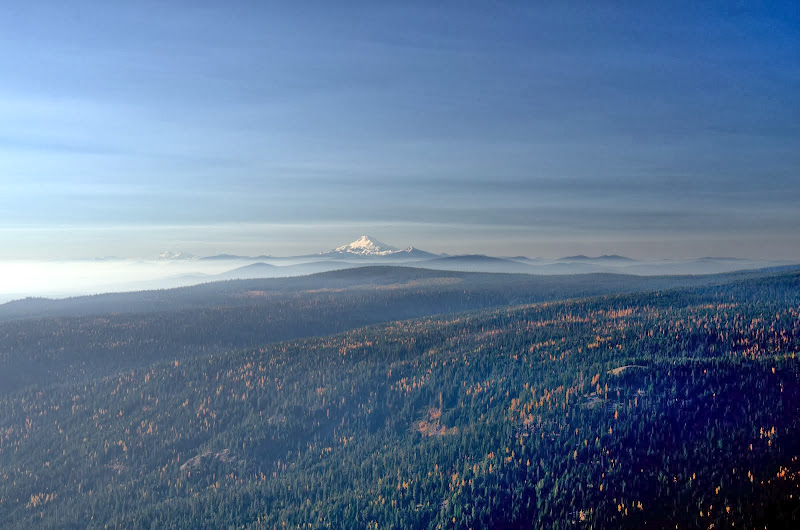
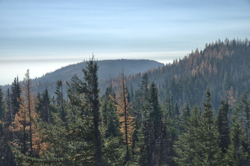
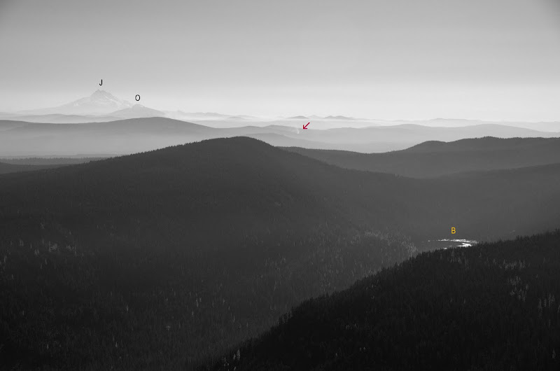
and of smoke-shrouded Jefferson (J), Olallie (O), and Badger Lake (B) due to fires (arrow) in the area.
By this time, I’d put more miles and gain into this project than expected and I still had a 2 h drive back to Portland. So, with a fond farewell to the tamaracks,
I took the 458 and 456A trails back to the TH. A long (16.5 mi RT, 4,400’ EG) but satisfying bluebird day wandering through an excellent wilderness. Saw just one other person the whole day.
Then it was up Trail 456A, past Oval Lake,
to a junction with the Divide Trail (# 458), which I took E to the top of the divide, for views of Jefferson and Olallie,
and Adams and Rainier (these would be obscured by smoke later in the day).
Then it was further E on the Divide Trail toward Flag Point,
and a junction with the Badger Creek Cutoff Trail (# 477). I followed that down toward Badger Creek, catching a few more glimpses of Hood along the way.
My old topos and the Green Trails map #463 show a few trails connecting with the 477 but I could find no trace of these. If they ever existed, they may now be lost under the considerable deadfall in the area. The 477 cuts through this as it descends gently but steadily toward Badger Creek and a junction with the creek trail (# 479).
I got up close and personal with a tamarack,
then took the 479 W to its junction with the Gumjuwac Trail (#480) and followed that as it ascended gently but steadily toward Gumjuwac Saddle.
At the saddle, the 480 just popped out of the bushes (arrow) on to the road, with no signage that I could see.
At this point I was re-connected with trail 458, which I used to reach the summit of Lookout Mtn, with its stellar views of Hood,
and of smoke-shrouded Jefferson (J), Olallie (O), and Badger Lake (B) due to fires (arrow) in the area.
By this time, I’d put more miles and gain into this project than expected and I still had a 2 h drive back to Portland. So, with a fond farewell to the tamaracks,
I took the 458 and 456A trails back to the TH. A long (16.5 mi RT, 4,400’ EG) but satisfying bluebird day wandering through an excellent wilderness.