Yocum Ridge (Almost Like Summer!) 18-Oct-2013
Posted: October 19th, 2013, 6:31 am
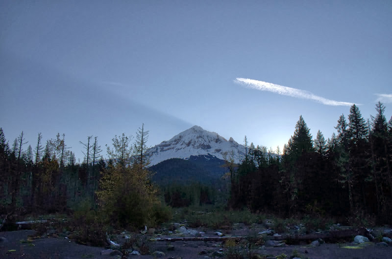
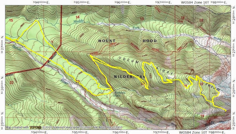
Restarting the train of government is a slow process (even with its clown car temporarily decoupled), which gave me the opportunity to squeeze in just one more mid-week, bluebird day of hiking. I wanted the biggest views possible, which brought to mind Yocum Ridge. Thanks to pdxgene’s recent TR (Ramona Falls), I knew crossing the Sandy wouldn’t be an issue. So Friday found me leaving the Ramona Falls TH early enough (except for a few mushroom pickers, I was alone in the parking lot) to cross the Sandy just as the sun was breaking over Hood.
Then it was up the PCT, past Ramona Falls (obligatory shot of same),

to connect with the Timberline Trail (#600) and then the Yocum Ridge trail (# 771) for the gentle, but steady, climb to the small pond at 5,200’, where the first patches of snow appeared.

I continued on the 771, encountering a few more patches of snow, until the point (at about 5,500’) where it makes a hard right turn and contours S to the Sandy River Canyon viewpoint. I’d get there eventually, but first I turned left and headed due E straight up the ridge toward the high campsites at 6,285’. There was really no significant snow – except in a few shaded areas and defiles – until about 6,000’. Up to just below the high campsites, this hike is mostly in the trees, with limited views,
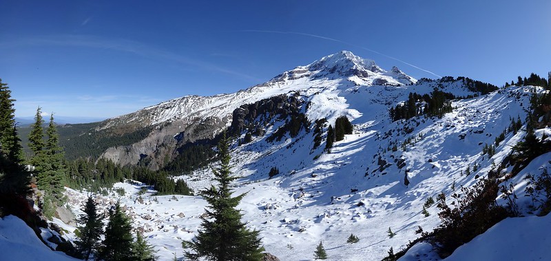
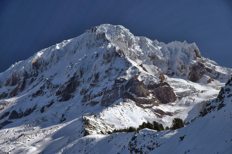
which is why the HUGE view of Hood you get when you finally crest the ridge is so stunning.
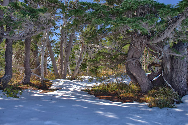
Once on the ridge, it was an easy snow walk around to one of the high campsites (in the trees in the foreground),

which, despite the heavy snow all around, were pretty snow-free.
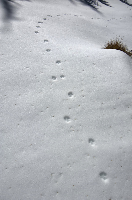
I was alone up here and, judging from the absence of tracks, there hadn’t been any other human visitors recently either. I settled in for a warm, sunny, wind-free lunch, with one of the most expansive views around. 1: Buck Peak, 2: Table Mountain, 3: Lost Lake, 4: Greenleaf Mountain, 5: St. Helens, 6: Indian Mountain, 7: Chinidere Mountain, 8: Tomlike Mountain(?), 9: Greenpoint Mountain, 10: Mt. Rainier, 11: Defiance. Wow!

All too soon, it was time to head down to the Sandy overlook and the 771, following a route
I’d taken last summer past a small pond below the campsites –then

and now.
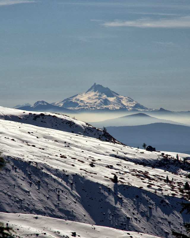
During the descent, I got a good view of Jefferson,
before intersecting the 771 about ¼ mi W of the viewpoint. From there, a good use trail (arrow) works its way back up to the high campsites but when there’s snow above 5,500’-6,000’, it’s just as easy to go straight up from further W on the 771 (or go directly up the ridge like I did). I also think a lot of folks who just follow the 771 miss an opportunity to go higher and see more.

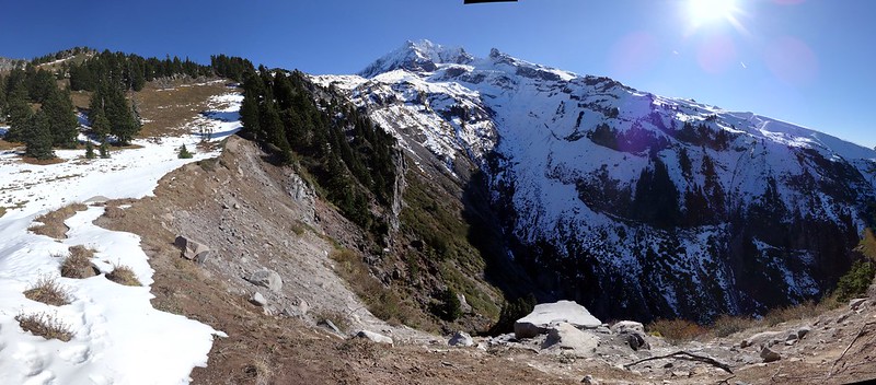
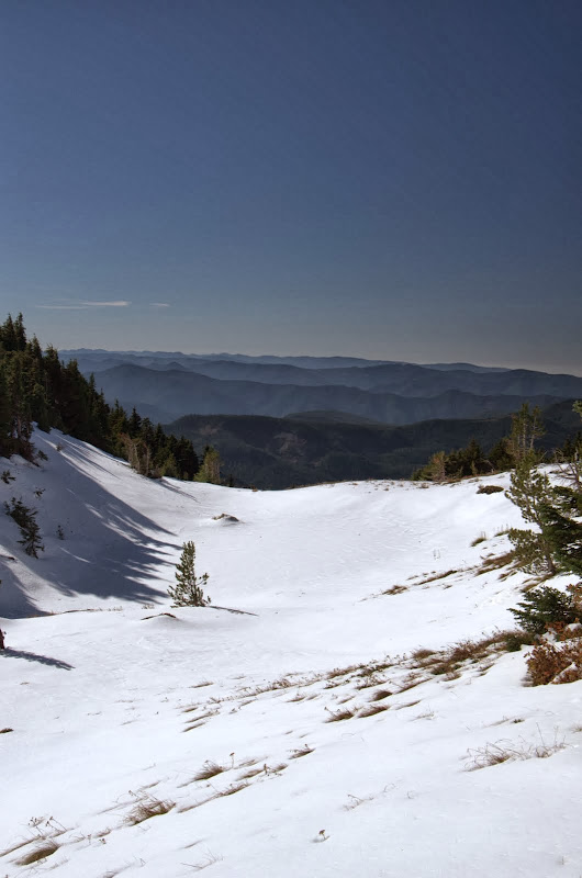
That said, the views from here of the Sandy River Canyon

and of the Reid Glacier

are jaw-dropping. Put this together with a visit to the high campsites and have your quota of views filled for a long time. Reluctantly, I turned away from all this and headed back to the TH. Passed two people coming up the 771, two on the Ramona Falls trail (#797), and one (!) on the 770 to the TH - that was the “crowd” for the day. Classic hike, brilliant day, magnificent scenery. (17 mi RT, 3,800’ EG).
Then it was up the PCT, past Ramona Falls (obligatory shot of same),
to connect with the Timberline Trail (#600) and then the Yocum Ridge trail (# 771) for the gentle, but steady, climb to the small pond at 5,200’, where the first patches of snow appeared.
I continued on the 771, encountering a few more patches of snow, until the point (at about 5,500’) where it makes a hard right turn and contours S to the Sandy River Canyon viewpoint. I’d get there eventually, but first I turned left and headed due E straight up the ridge toward the high campsites at 6,285’. There was really no significant snow – except in a few shaded areas and defiles – until about 6,000’. Up to just below the high campsites, this hike is mostly in the trees, with limited views,
which is why the HUGE view of Hood you get when you finally crest the ridge is so stunning.
Once on the ridge, it was an easy snow walk around to one of the high campsites (in the trees in the foreground),
which, despite the heavy snow all around, were pretty snow-free.
I was alone up here and, judging from the absence of tracks, there hadn’t been any other human visitors recently either. I settled in for a warm, sunny, wind-free lunch, with one of the most expansive views around. 1: Buck Peak, 2: Table Mountain, 3: Lost Lake, 4: Greenleaf Mountain, 5: St. Helens, 6: Indian Mountain, 7: Chinidere Mountain, 8: Tomlike Mountain(?), 9: Greenpoint Mountain, 10: Mt. Rainier, 11: Defiance. Wow!
All too soon, it was time to head down to the Sandy overlook and the 771, following a route
I’d taken last summer past a small pond below the campsites –then
and now.
During the descent, I got a good view of Jefferson,
before intersecting the 771 about ¼ mi W of the viewpoint. From there, a good use trail (arrow) works its way back up to the high campsites but when there’s snow above 5,500’-6,000’, it’s just as easy to go straight up from further W on the 771 (or go directly up the ridge like I did). I also think a lot of folks who just follow the 771 miss an opportunity to go higher and see more.
That said, the views from here of the Sandy River Canyon
and of the Reid Glacier
are jaw-dropping. Put this together with a visit to the high campsites and have your quota of views filled for a long time. Reluctantly, I turned away from all this and headed back to the TH. Passed two people coming up the 771, two on the Ramona Falls trail (#797), and one (!) on the 770 to the TH - that was the “crowd” for the day. Classic hike, brilliant day, magnificent scenery.