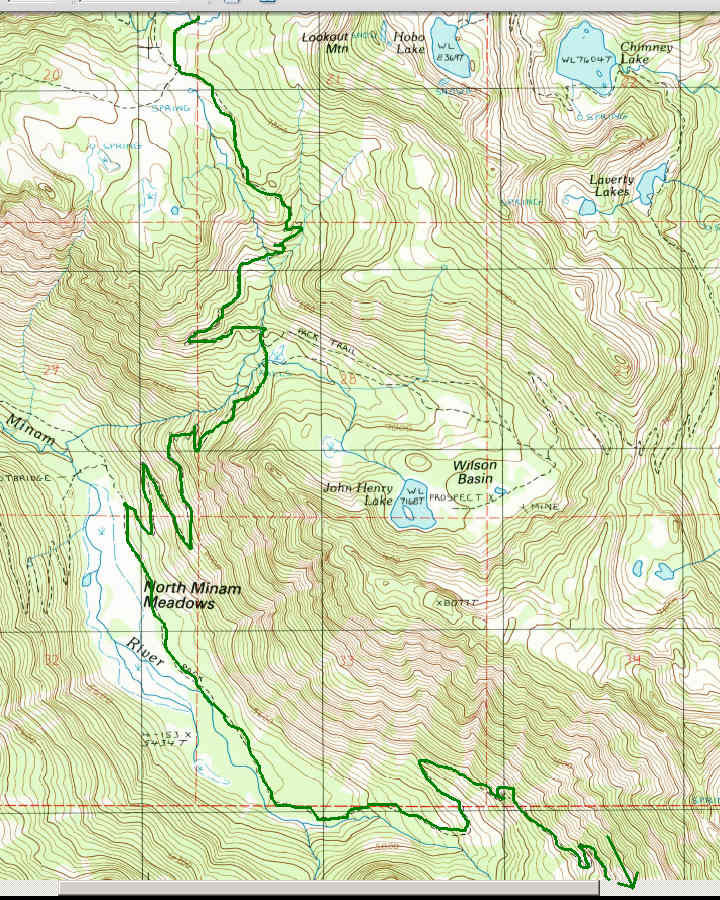
This was 5-1/2 days, 1-1/2 of it off-trail in the best Class 1 exploring country I know anywhere. Many grassy meadows, often containing clear slow sandy trout streams. Many lakes. 4 out of 5 nights I had my lake or meadow totally to myself. I went one 3-day stretch not seeing a single person. No bugs! (almost). But that was luck; I've been here in August before with bad mosquitoes. But this seemed like a dryer summer, so maybe that's why. Great weather; it threatened storms several afternoons, but actually only rained in the wee hours a couple of nights.
Day 1 (8/7W): To Wood Lake
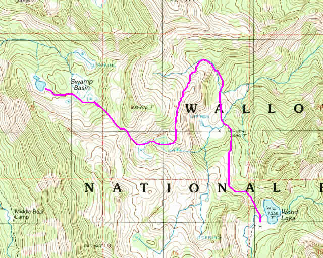
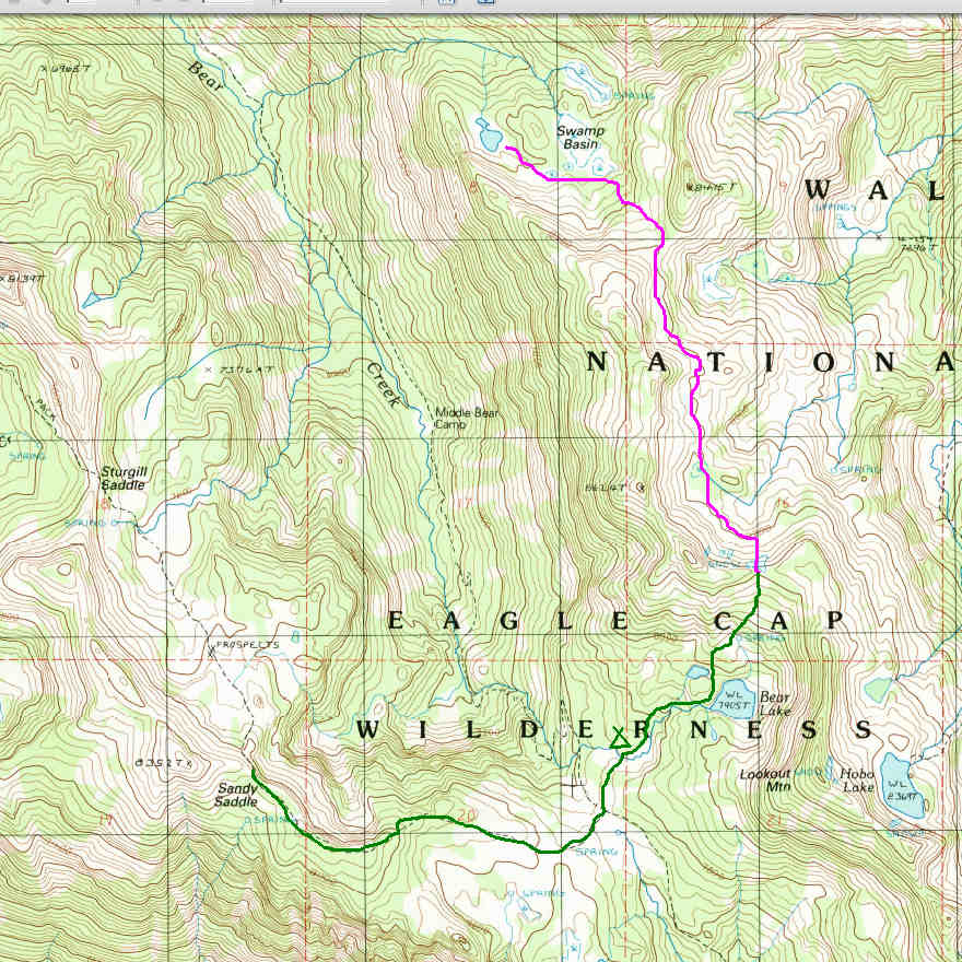
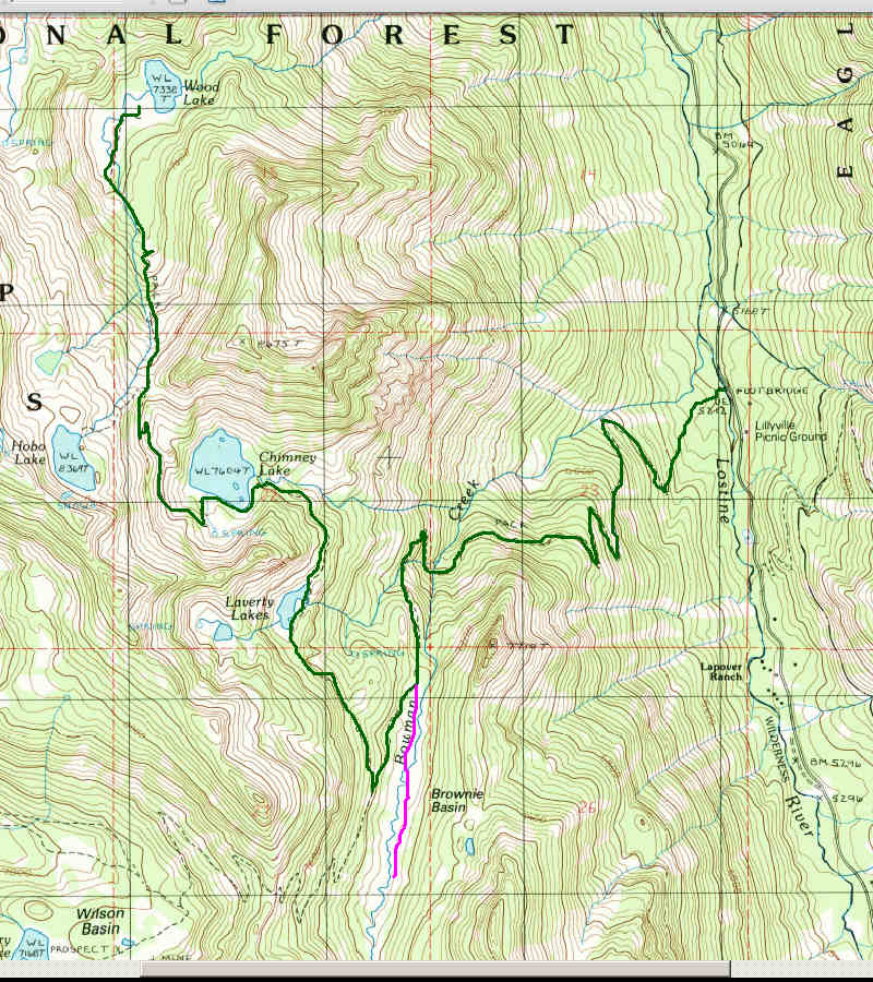 =(magenta = off-trail)
Woke up & got up around 2 AM, drove to Lostine & up the Lostine River, started up the Bowman Creek Trail around 7 AM. I took a side trip to visit Brownie Basin, which has unlimited meadow camping and the usual clear slow trout stream. Then past Laverty & Chimney Lakes & up to "Chimney Pass", then down to Wood Lake, which I had all to myself for the night. I saw noone on the trail all day, just passed a couple camped at Chimney Lake. At Wood Lake I was surprised by an apparent flu or something; I was suddenly exhausted and chilled, and barely got my tent up and contacts out before crashing for about 11 hours.
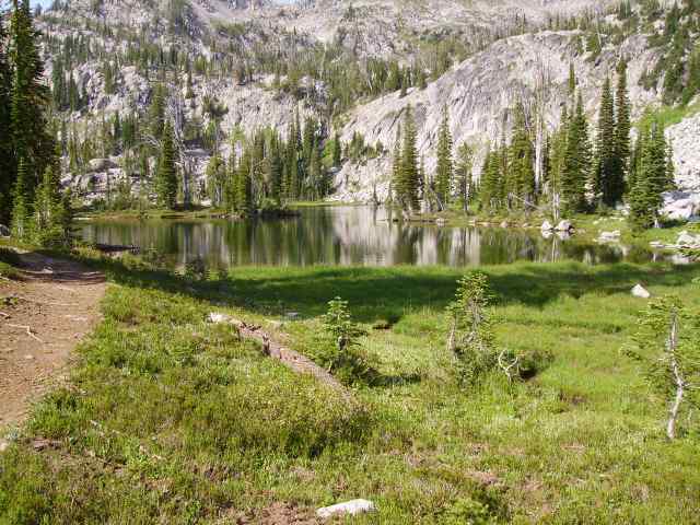 =Laverty Lake
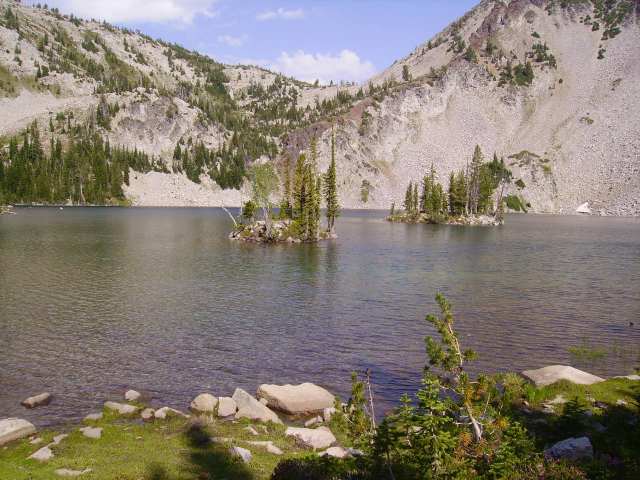 =Chimney Lake
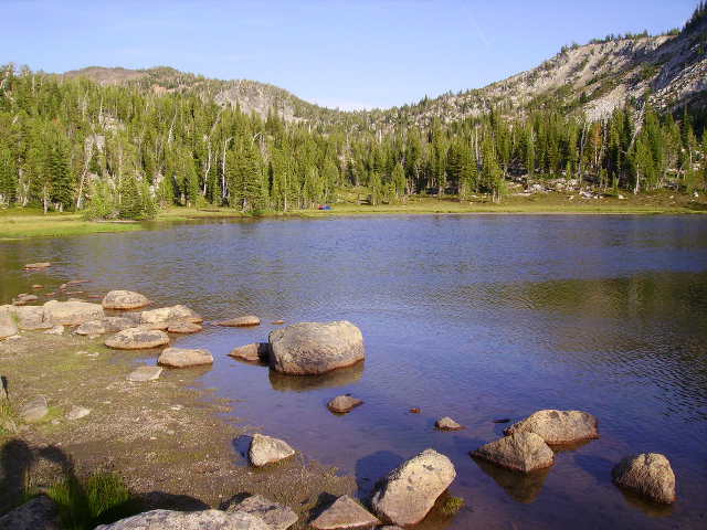
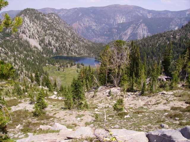 =Wood Lake
 Day 2 (8/8Th): To Swamp Basin
This day was all off-trail & I saw noone all day. The route I planned on the map all worked, with nothing very scary or really above Class 1. No nasty brush bashing, either; the woods here are fairly uncluttered.
I packed up and headed NW over a little pass, partly on scraps of possible old trail. Then I contoured and descended N down a spur to "Lower Meadow" a mile NW of Wood Lake, containing foot-long trout. Then I climbed a spur and gully N until it turned W into a little flat meadow, then SSW up a dry draw until it faded into the slope above the cliffs W of Lower Meadow. Fortunately this slope was an easy walk, contouring S and then dropping into "Side Meadow" (midway crow-wise between Wood Lake and Swamp Basin), then W up a step to "Upper Side Meadow". Here I examined my options for getting up the steeper 300' to "Swamp Basin Pass". I decided to try the gully straight up NW and a bit to the right side of the pass, and it worked fine. Longer and more exposed than what I usually do, but it was really just a staircase of rocks and grass, so as long as I didn't actually lose my balance and fall backwards I was fine. I also used my new ice axe for the first time, for a nice bit of added security.
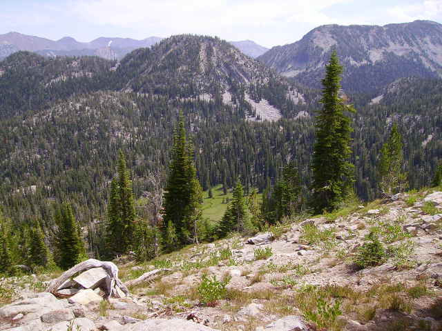 =Lower Meadow from above the cliffs to the W
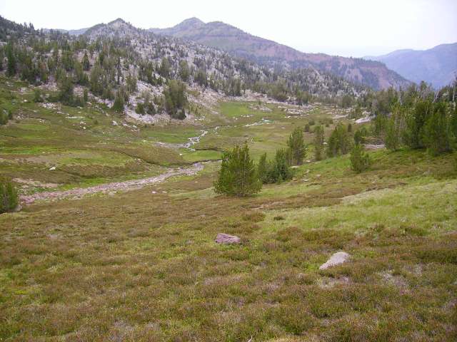
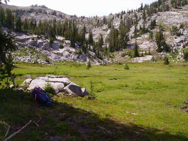 =Side Meadow & Swamp Basin Pass
From Swamp Basin Pass I walked down to "Swamp Basin Lake", which I had all to myself for the night.
 =Swamp Basin Lake
Day 3 (8/9F): To Bear Lake
Again I saw noone all day, even though after noon I was back on trail.
I packed up and headed back over Swamp Basin Pass, then contoured S on the bench to "Bear Pass" N of Bear Lake, crossing a huge meadow on the way. From Bear Pass I was back on trail for the rest of the trip. I hiked down past Bear Lake to the Washboard Trail fork at the pass 1/2 mile SW of Bear Lake, then continued W on the Washboard Trail. I was planning to camp in the meadows N of Sandy Saddle, but just past Sandy Saddle I hit a piece of trail I didn't care for. It was actual trail, but it had the typical slippery sandy surface for this area, and below the trail the ground sloped down to a cliff. So, I said "no thanks" and returned to a nice little meadow on Bear Creek near the Washboard fork, which I had all to myself for the night.
 =Meadow N of Bear Pass
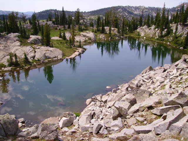 =Little Bear Lake
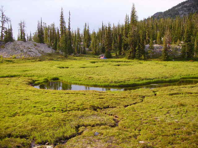 =Bear Creek meadow
Day 4 (8/10Sa): To Steamboat Lake
This was the least exciting day. First, a long switchbacky drop through forest (or, in places, hot brush) to North Minam Meadows. North Minam Meadows did not excite me; the meadows are tall-grass marshy, not good for roaming, although it turned out there were some dry paths here and there to get to the river. The camps are horsey. OTOH, the river itself, which looked muddy from 1000' up, turned out to be clear and gravelly. After lunch I headed on for Steamboat Lake. This turned into the slog from hell. Maybe I was still sick, but it took me 5 hours to gain the 2000'. I got to the lake after 7 PM, too late & tired for dinner. OTOH, I had the lake all to myself again.
I actually met two people (solo hikers like me) this day; one on the way down to N Minam Meadows, and the other on the slog up to Steamboat Lake.
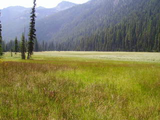 =North Minam Meadows
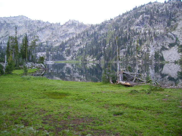 =Steamboat Lake
Day 5 (8/11Su): To Lostine Meadows
Lots of nice scenery this day. First I ascended to Swamp Lake, perhaps the
prettiest spot of the trip. Then I continued over "Sky Lake Plateau", down past Sky Lake (which has a nice little camping meadow just outside the lake bowl), down through Elkhorn Basin (possibly my favorite spot anywhere), down through Copper Basin, and finally down Copper Creek to the Lostine. I almost didn't have to wade the Lostine in this low-water season, but someone hadn't tossed quite enough stepping stones in. I had a comfortable camp in Lostine Meadows; there was actually another party nearby, but they were out of sight and quiet.
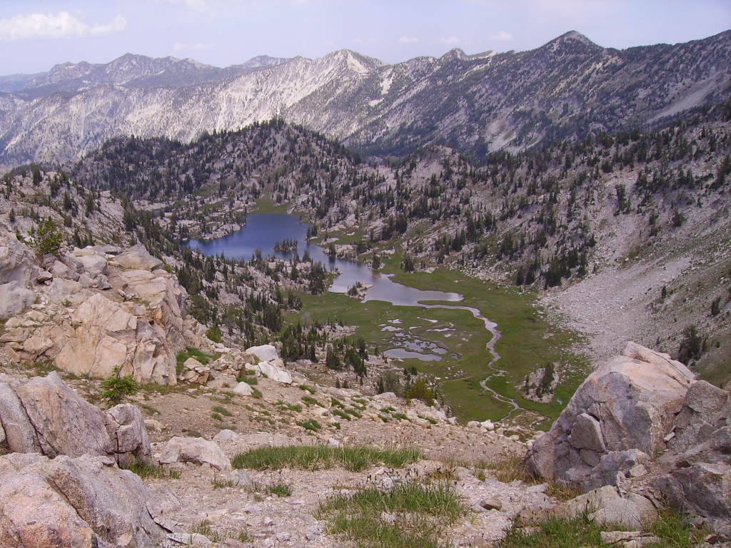 =Swamp Lake
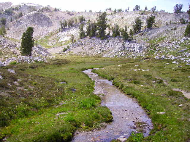 =Meadow by Sky Lake
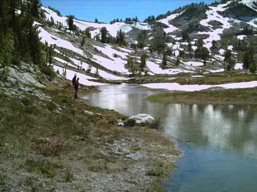 =Elkhorn Basin
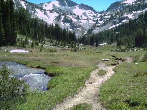 =Copper Basin
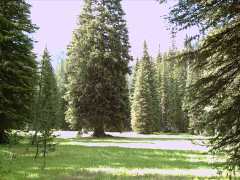 =Lostine Meadow
Day 6 (8/12M): Home
I got on the trail by about 7 AM, down the Lostine to Two Pan TH about 9, and down the road to my car by about 10 AM.