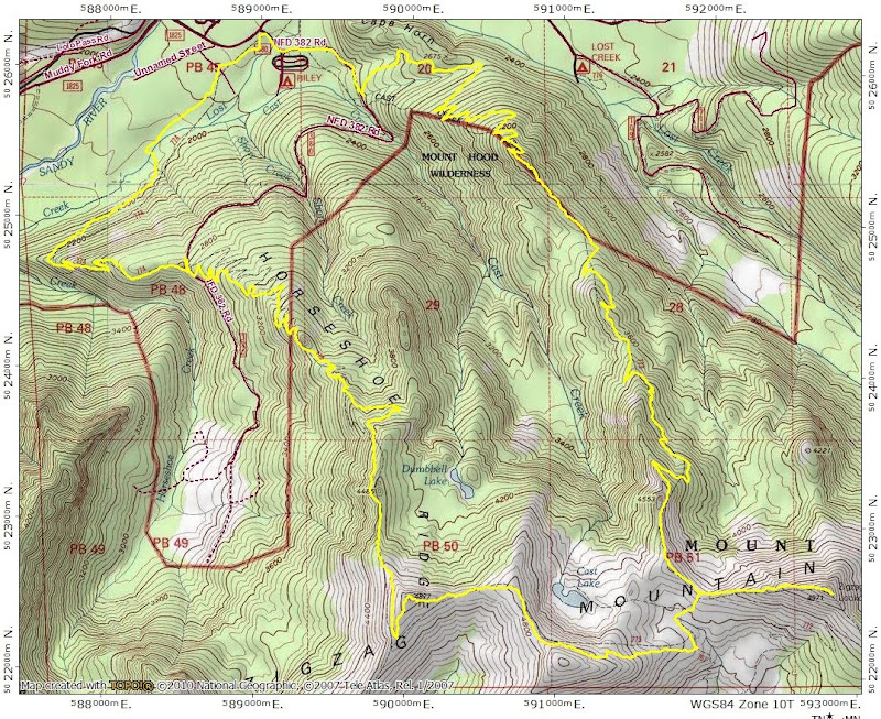
Cast Creek / Horseshoe Ridge Loop 07-Jul-2013
Posted: July 7th, 2013, 5:33 pm
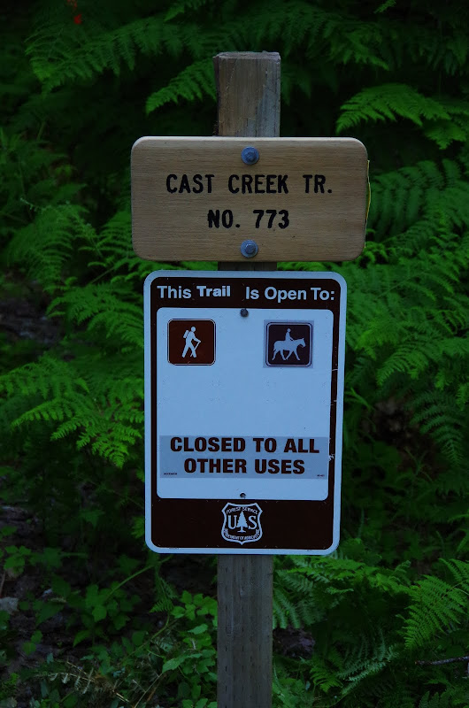
I did this loop three years ago (Cast Ck 2010) before FR 380 was officially closed and really enjoyed it - gentle grades and big views. So doing it again seemed like a good way to wrap-up the 4th of July weekend. With the demise of FR 380, the "official" start of the Cast Ck trail has been moved to the E end of Riley Horse Camp,
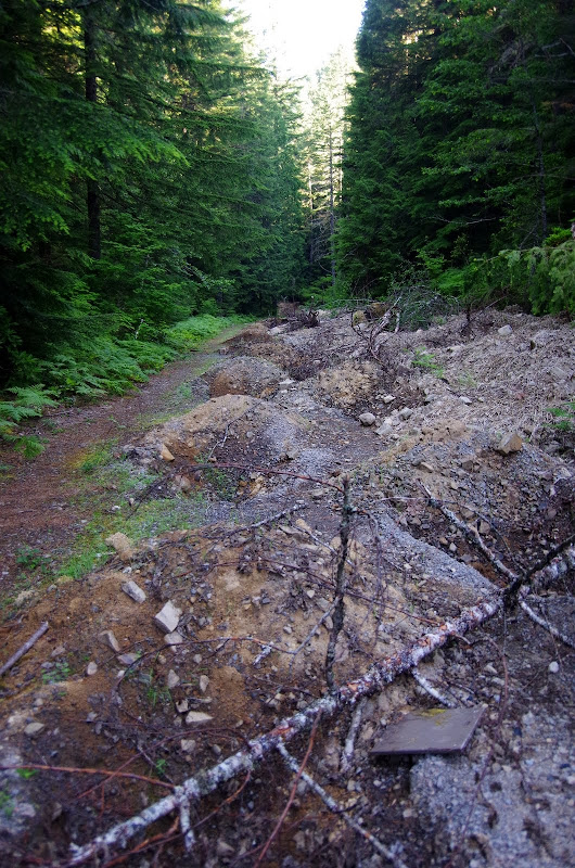
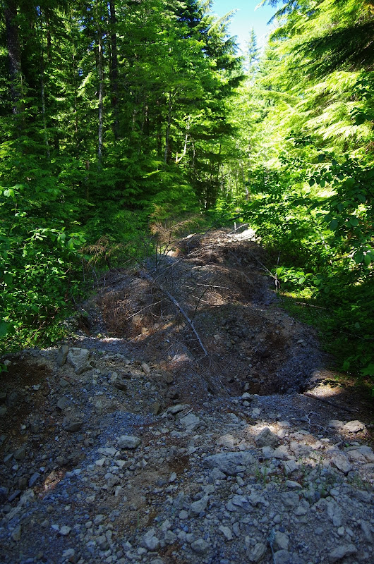
but you can still reach it by going up 380 past a seriously deep ditch and lots of big backhoe divots - 380 is now totally DEAD, gone, and buried - not even accessible to hikers. I wonder if the death of 380 will allow the wilderness boundary to expand N?
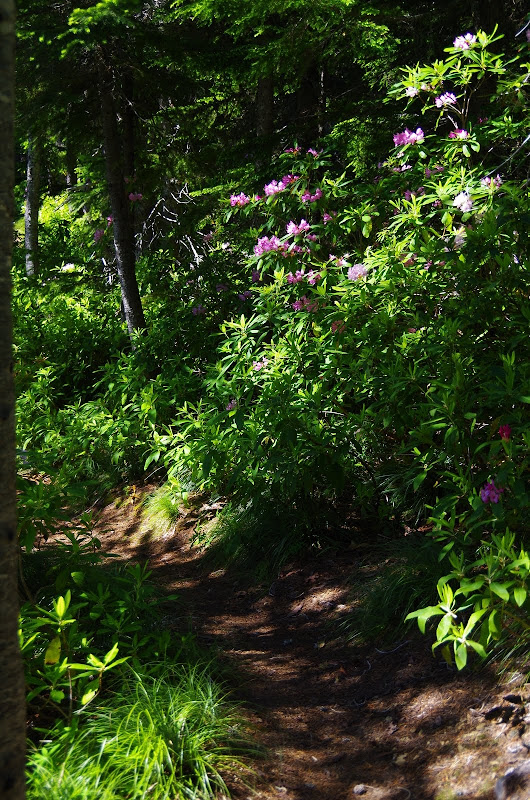
But the 773 is still in great condition, with a gentle (horse friendly) grade, all through a cool forest and, higher up, rhodie gardens.
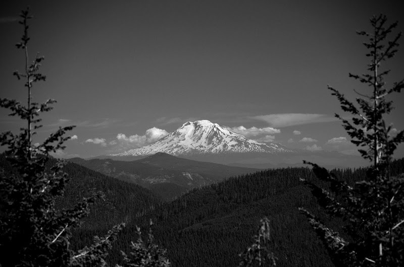
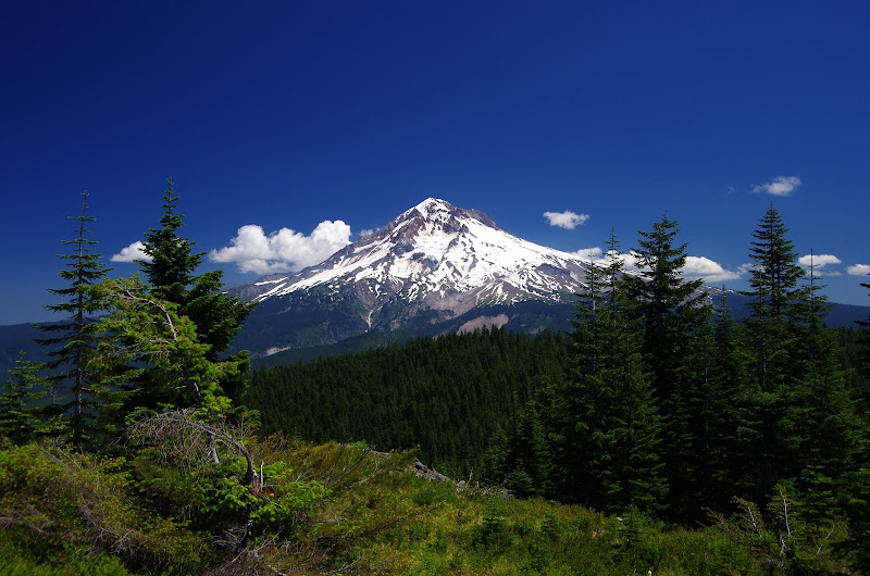
There are no views until just before you reach the ZigZag Mtn trail (775) and then - sudddenly - there's Hood
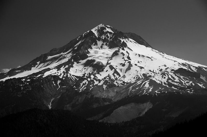
and Adams (Rainier and Jefferson were visible too).
I hiked up ZigZag East, through some nice wildflower displays,
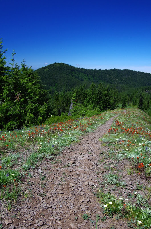
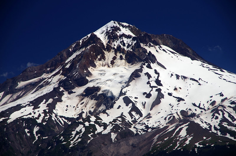
for lunch and more views of Hood.
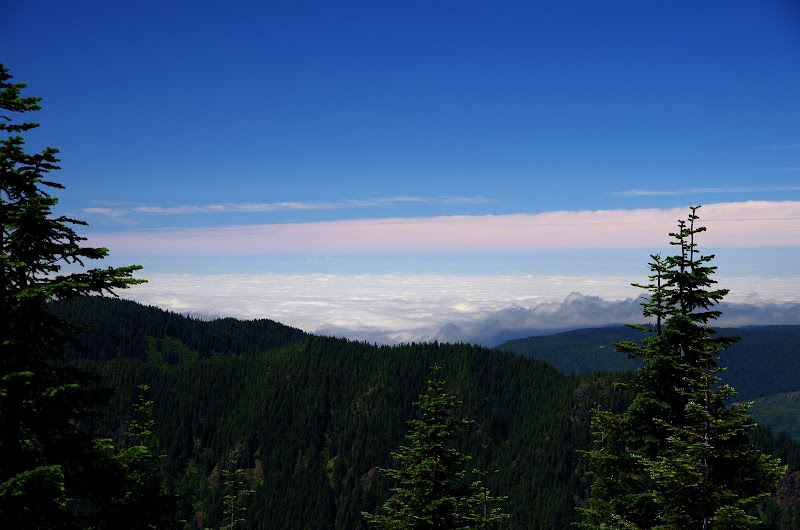
Then it was W on Trail 775 toward Pt 4877 - passing up a chance to visit Cast Lake due to fears of massive swarms of mosquitos - they were pesky enough just on the trail. From atop Pt 4877, I could see that Portland was still swaddled in low clouds,
and got one last view of Hood.
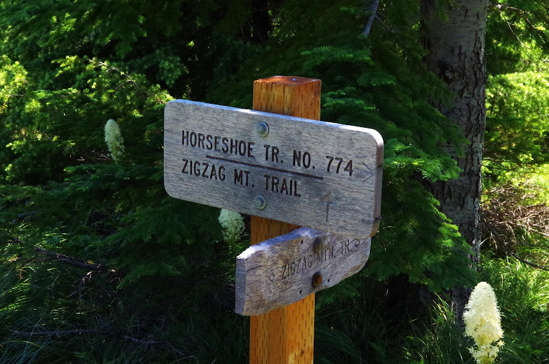
Then it was down the Horseshoe Ridge trail (774),
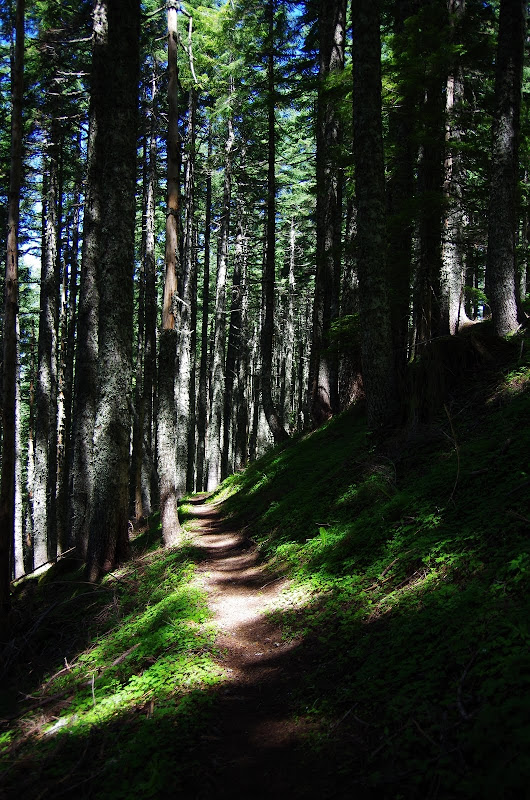
which is another gently graded trail that eases down through a pleasant forest,
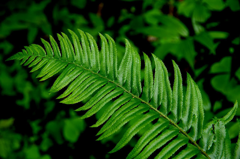
which shelters a variety of ferns,
plants,
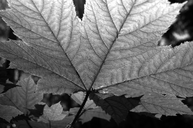
and sweaty tree fungi.

The Horseshoe Ridge trail crosses FR 388 and FR 380 as it descends. Back in the day (2010), it was possible to take FR 380 back to the TH. No more. FR 380 has been beaten and backhoed into submission - it's not even walkable anymore.
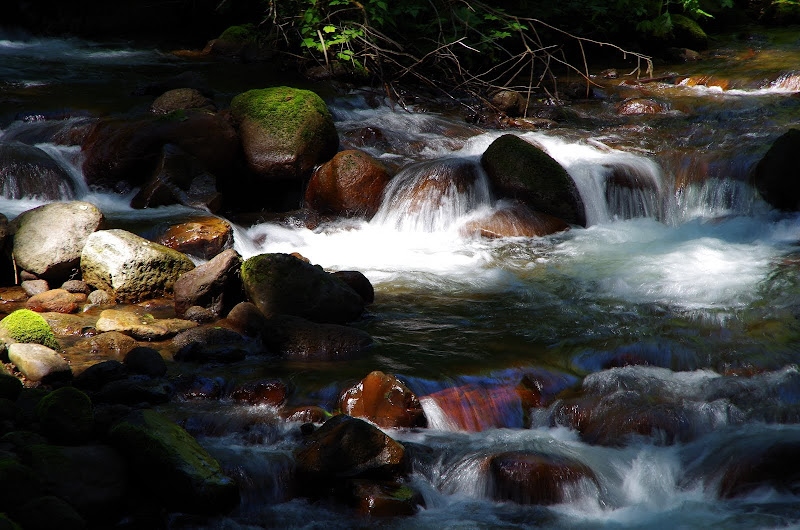
So, I continued on the 774, which eventually turned NE, crossed Lost Creek on a helpful pedestrian bridge,
and deposited me on the W side of the Riley Camp. Maybe a little longer journey than taking 380 back but the 774 is a very good, very pleasant trail to hike on. All told 14.2 mi, 3600' EG and a great end to the holiday weekend!
but you can still reach it by going up 380 past a seriously deep ditch and lots of big backhoe divots - 380 is now totally DEAD, gone, and buried - not even accessible to hikers. I wonder if the death of 380 will allow the wilderness boundary to expand N?
But the 773 is still in great condition, with a gentle (horse friendly) grade, all through a cool forest and, higher up, rhodie gardens.
There are no views until just before you reach the ZigZag Mtn trail (775) and then - sudddenly - there's Hood
and Adams (Rainier and Jefferson were visible too).
I hiked up ZigZag East, through some nice wildflower displays,
for lunch and more views of Hood.
Then it was W on Trail 775 toward Pt 4877 - passing up a chance to visit Cast Lake due to fears of massive swarms of mosquitos - they were pesky enough just on the trail. From atop Pt 4877, I could see that Portland was still swaddled in low clouds,
and got one last view of Hood.
Then it was down the Horseshoe Ridge trail (774),
which is another gently graded trail that eases down through a pleasant forest,
which shelters a variety of ferns,
plants,
and sweaty tree fungi.
The Horseshoe Ridge trail crosses FR 388 and FR 380 as it descends. Back in the day (2010), it was possible to take FR 380 back to the TH. No more. FR 380 has been beaten and backhoed into submission - it's not even walkable anymore.
So, I continued on the 774, which eventually turned NE, crossed Lost Creek on a helpful pedestrian bridge,
and deposited me on the W side of the Riley Camp. Maybe a little longer journey than taking 380 back but the 774 is a very good, very pleasant trail to hike on. All told 14.2 mi, 3600' EG and a great end to the holiday weekend!