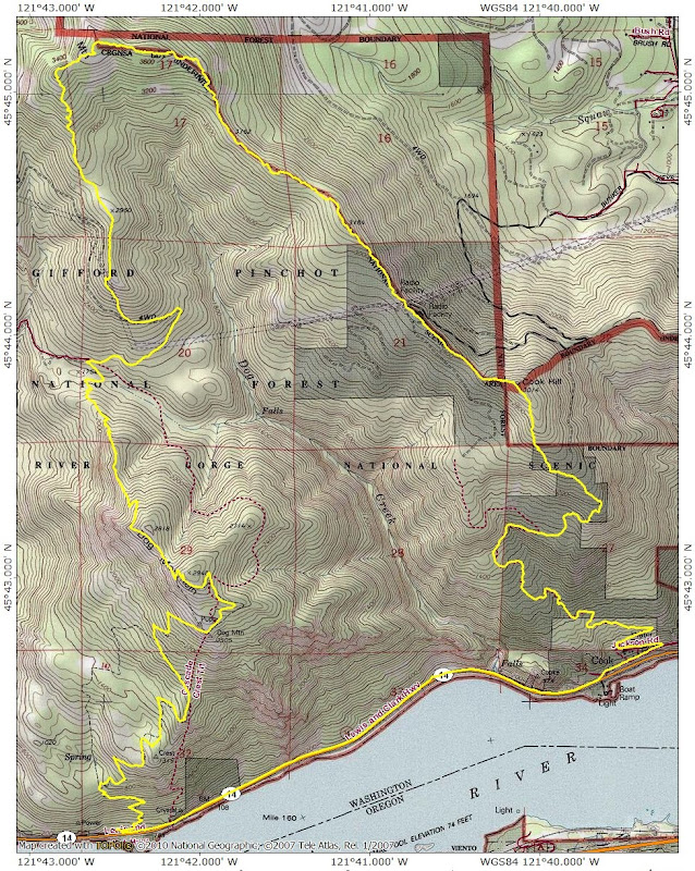
The SCAD (slog/Cook/Aug/Dog) Loop 04-Jun-2013
Posted: June 5th, 2013, 7:29 am
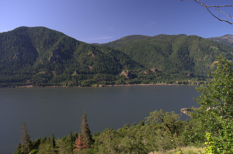
The last two times I did this loop, the weather was very uncooperative (Augspurger Jan 2012, SAD Loop Feb 2013). So it was on my list to have another go at it BUT only in bluebird weather. I’d also been chastised for not including Cook Hill in the loop, but Guy’s great TR (Guy on Cook 2013) provided a way to do that. So yesterday I threw off the bonds of work (for a day at least) and got to the Dog Mtn TH early – but there was already one car there (a dozen more would join it by the time I got back)! The slog along Hwy 14 to the Cook-Underwood Road was uneventful – just don’t look up when the 18-wheeler log trucks pass or you’ll get a face full of dirt & bark. Once on the old road that ascends Cook Hill, I passed Guy’s Chair,
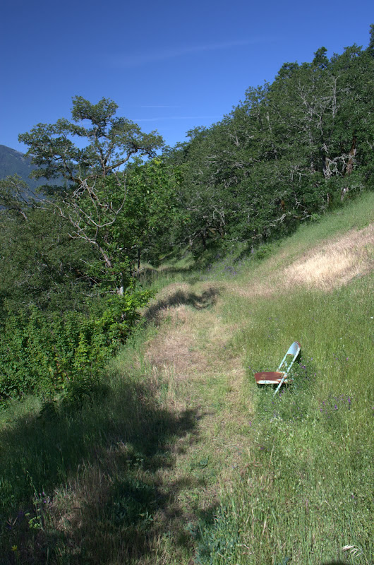
with its sublime view of the inner Gorge.
At about 1650’, I left the road and went E - following Guy’s directions - on a good use trail that opened into a meadow with a great view of Defiance and, coincidentally, of the stern wheel cruise ship.

I continued up, following the use trail - which went well except that I missed the insertion point for transiting the vine maples and had to do a little thrashing. Eventually the trail reached the large meadow that comprises the W side of Cook Hill’s summit,
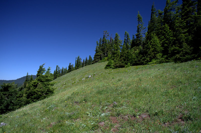
which is pretty cool in its own right but also because it allows for a big view of Hood.

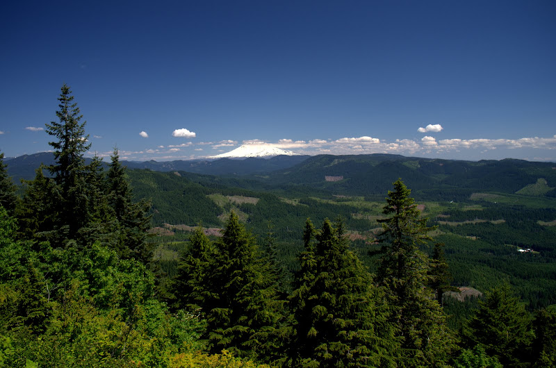
The use trail follows along the W side of Cook and then descends to connect with an old road that leads to the radio facility. Adams came into full view at this point - about the only mountain around showing any clouds.
Past the radio towers, I followed the use trail marked with lids through the forest and a few open meadows,

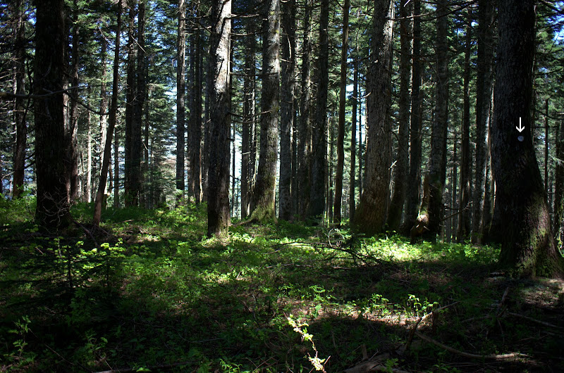
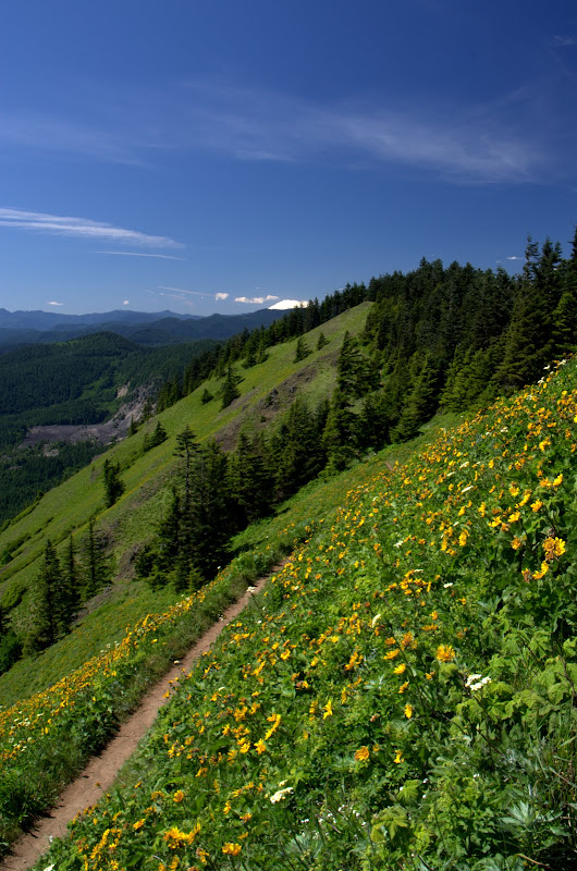
toward the summit of Augspurger. This trail is obvious in many places and overgrown in a few others. The trickiest part is at the 3200’ level where it bears W and climbs on the E side of the ridge - miss that and you’ll thrash in vine maples. Although ornamented with a lot of lids (arrow) the summit was its usual uninspiring self (but you can get views by hiking a little to the N).
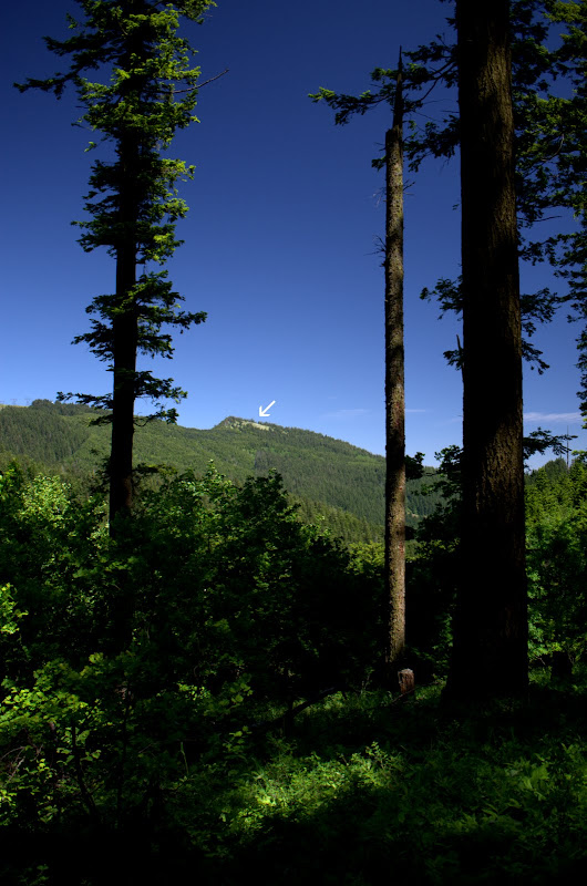
I returned via the Augspurger Mtn Trail (4407) which has blossomed into a well-used trail - complete with blue triangle markers - in what seems like just a few short years. From where it comes closest to the power lines, I descended directly down the slope and then down the VERY steep service road to reconnect with it where it reaches the service road. A different route but not really quicker owing to the loose gravel on, and steepness of, the road. Just before reaching the Dog Mtn trail, I had a view across to the meadow (arrow) on the side of Cook Hill.
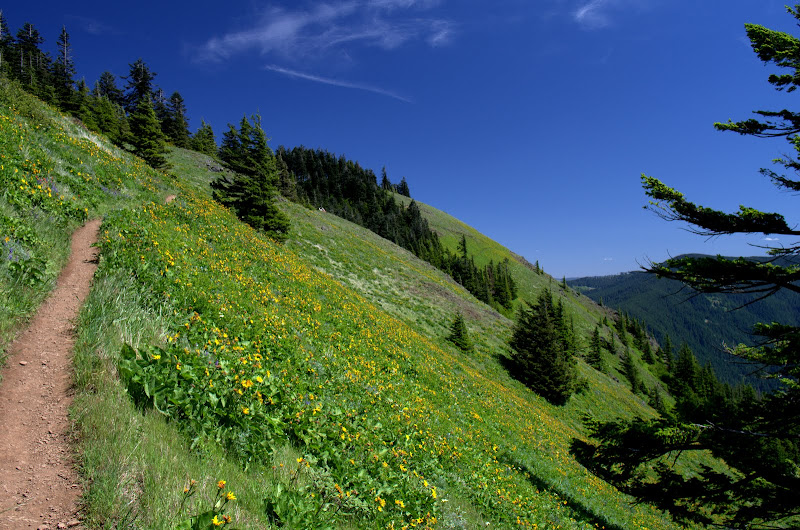
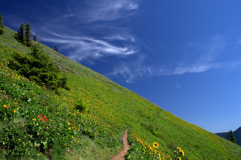
The 1200’ climb up to Dog was the last hurdle on this hike but once I broke out onto Dog’s summit meadows, all was forgiven. They looked a lot more inviting on this wonderfully warm day,
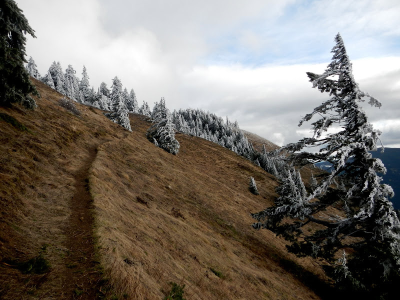
then they did last February.
There was still a little color on the slopes but the blooms were wilting fast in the heat.
A glance toward St. Helens,
a last look at Defiance (and a peek at Hood),

and then down the Dog Mtn trail to my car. This should certainly rank as one of the best loop hikes in the Gorge - somewhat strenuous (16.5 mi, 4500’ EG) but well worth it. In poor weather it’s OK for a workout but it really, really needs to be done on a bluebird day. Heck, they should all be done on bluebird days!
with its sublime view of the inner Gorge.
At about 1650’, I left the road and went E - following Guy’s directions - on a good use trail that opened into a meadow with a great view of Defiance and, coincidentally, of the stern wheel cruise ship.
I continued up, following the use trail - which went well except that I missed the insertion point for transiting the vine maples and had to do a little thrashing. Eventually the trail reached the large meadow that comprises the W side of Cook Hill’s summit,
which is pretty cool in its own right but also because it allows for a big view of Hood.
The use trail follows along the W side of Cook and then descends to connect with an old road that leads to the radio facility. Adams came into full view at this point - about the only mountain around showing any clouds.
Past the radio towers, I followed the use trail marked with lids through the forest and a few open meadows,
toward the summit of Augspurger. This trail is obvious in many places and overgrown in a few others. The trickiest part is at the 3200’ level where it bears W and climbs on the E side of the ridge - miss that and you’ll thrash in vine maples. Although ornamented with a lot of lids (arrow) the summit was its usual uninspiring self (but you can get views by hiking a little to the N).
I returned via the Augspurger Mtn Trail (4407) which has blossomed into a well-used trail - complete with blue triangle markers - in what seems like just a few short years. From where it comes closest to the power lines, I descended directly down the slope and then down the VERY steep service road to reconnect with it where it reaches the service road. A different route but not really quicker owing to the loose gravel on, and steepness of, the road. Just before reaching the Dog Mtn trail, I had a view across to the meadow (arrow) on the side of Cook Hill.
The 1200’ climb up to Dog was the last hurdle on this hike but once I broke out onto Dog’s summit meadows, all was forgiven. They looked a lot more inviting on this wonderfully warm day,
then they did last February.
There was still a little color on the slopes but the blooms were wilting fast in the heat.
A glance toward St. Helens,
a last look at Defiance (and a peek at Hood),
and then down the Dog Mtn trail to my car. This should certainly rank as one of the best loop hikes in the Gorge - somewhat strenuous (16.5 mi, 4500’ EG) but well worth it. In poor weather it’s OK for a workout but it really, really needs to be done on a bluebird day. Heck, they should all be done on bluebird days!