Day 1: Driving
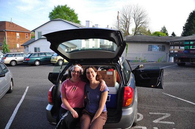
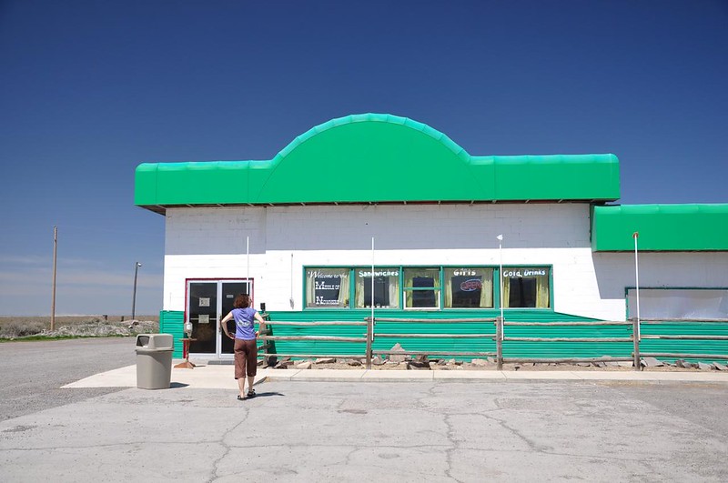
I couldn't get off work until 5:00 because so many of my coworkers were away at a conference that day, so we didn't hit the road until about 6:30. We made it as far as Hilgard Junction State Park, where we camped for the night. Here we are in Portland ready to get the heck out of dodge!
Day 2: More Driving
HJSP is at a higher elevation and it got so cold overnight that the tent had frost on it in the morning. BRRRR!
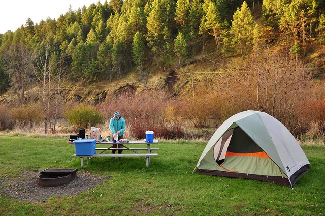
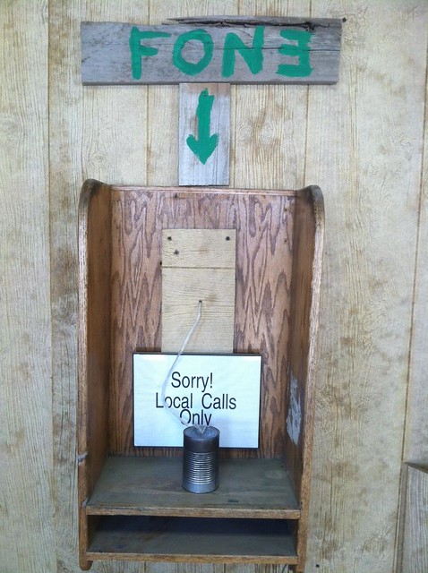
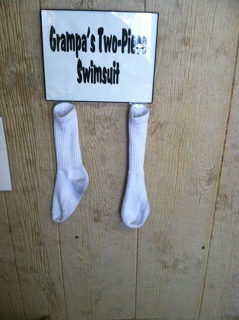
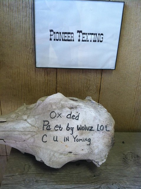
We quickly ate, packed up, and left at 7:15 to begin the LONG LONG drive (750 miles) to Moab, where we hoped to be by bedtime. Not much to note about this drive, except the amusing stop at a gas station that was in the middle of nowhere in Idaho. They even say as much in the sign in their window!
They apparently get a kick out of entertaining the few people who stop here:
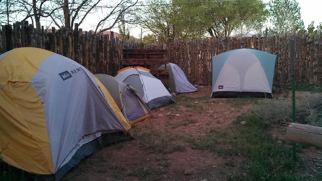
When we got to Moab at 9:30 that Friday night we were amazed to find the town absolutely hopping. The sidewalks were full, the streets were full, and all the hotels had "no vacancy" signs. Our plan had been to head to Sand Flats, the largest BLM campground in the area. But we saw a sign on the road to the campground that said it was all full. Crap.
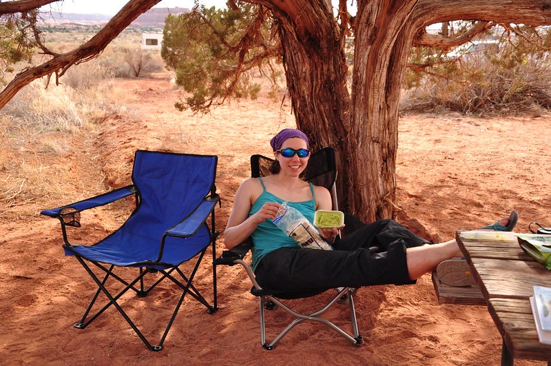
We got out the map and started looking for alternatives. We also got on our phones and discovered that there was a huge hot rod show going on in Moab that weekend, which explained all the crowds. There are quite a few BLM campgrounds around Moab, but most of them are pretty small. We could easily have spent hours visiting all the campgrounds looking for a vacancy. Considering the beautiful weekend forecast and the hot rod show, we had a hunch that our search would be in vain. Fortunately we hit a stroke of luck and the awesome guy at the hostel in town let us pitch our tent outside the hostel. We clearly weren't the only people who got skunked on camping accommodations. Here was the view the next morning (and there are more tents you can't see in this photo!):
Day 3: Arches National Park
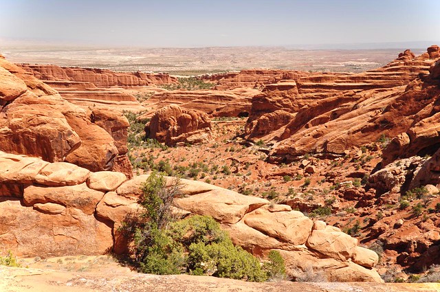
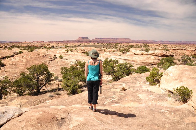
Our first day in the area was spent at Arches National Park. The park has over 2,000 known arches (and probably more that haven't yet been documented). They range in size from a three-foot opening to the largest (Landscape Arch) at 306 feet from base to base. In a nutshell, the arches form because of erosion, but there's a lot more to it than that, which you can read about here.
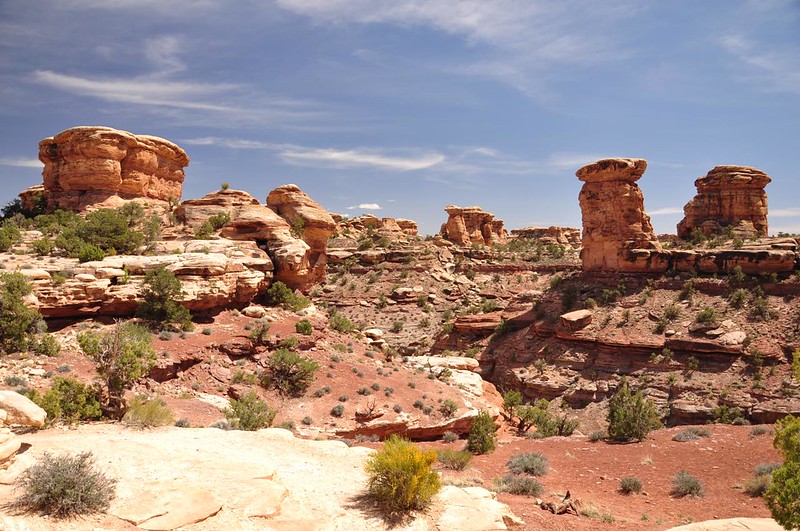
We decided to do the Devil's Garden hike, where we ended up seeing quite of the few of the features for which the park is named.
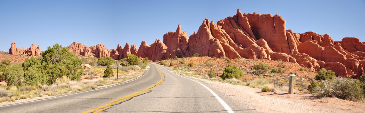
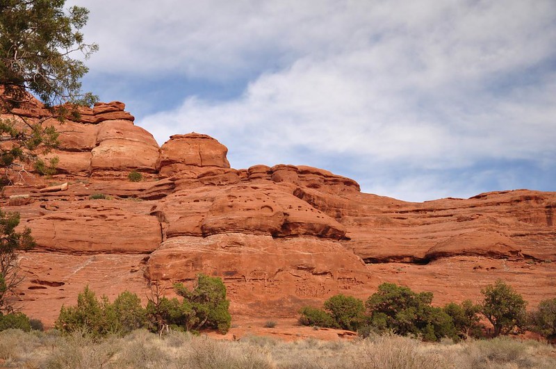
On the drive to the trailhead we were treated to some of the weird and awesome rock formations that fill the park:
We got to the trailhead, snagged a parking spot (the place was really filling up) and hit the trail.
Tunnel Arch:
Pine Tree Arch (can you see tiny Deb standing under the arch?):
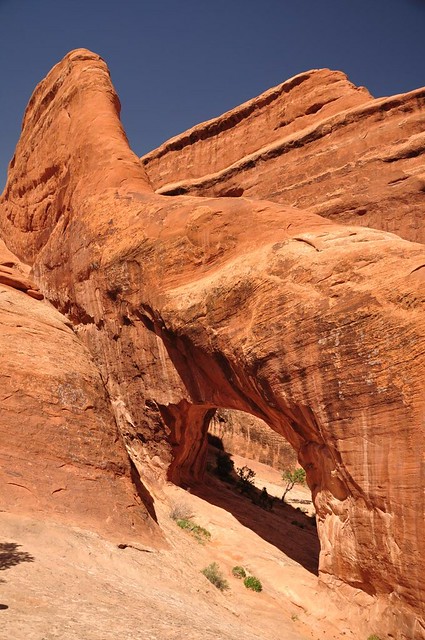
Next up was Landscape Arch:

Does that one look a little thin to you? It is. In fact, in 1991 a big slab of the arch fell off. It was caught on video, which we saw at the park visitor center. The only copy of this video I found online is not the best quality, but you get the idea: http://youtu.be/4iSWGd3w1nw?t=1m53s Scary! Since that time the trail that goes up under the arch has been closed for obvious safety reasons.
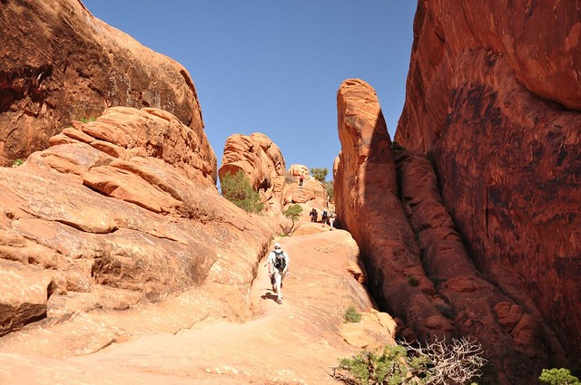
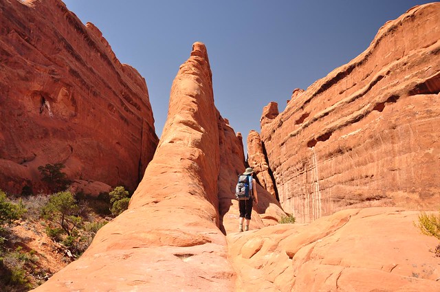
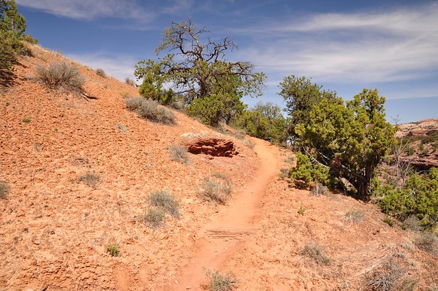
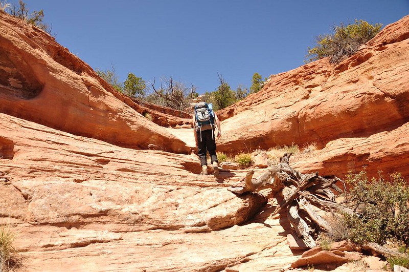
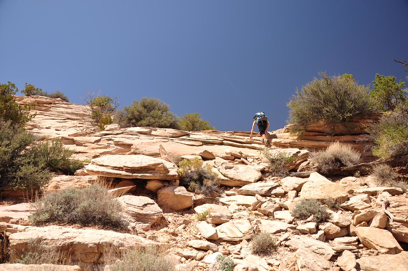
After Landscape Arch the trail got more primitive and I had my first taste of slickrock hiking. The section in the picture below doesn't look hard, but it was steeper than it looks and the afternoon was getting hot!
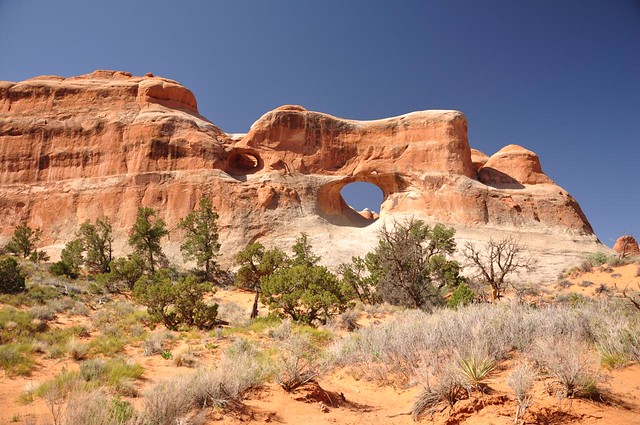
A side trail took us to Partition Arch:
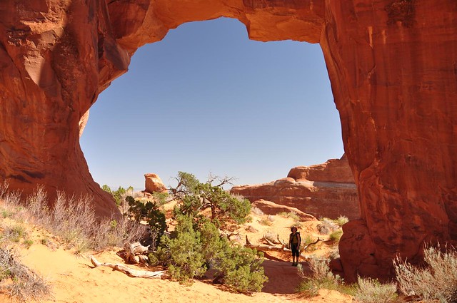
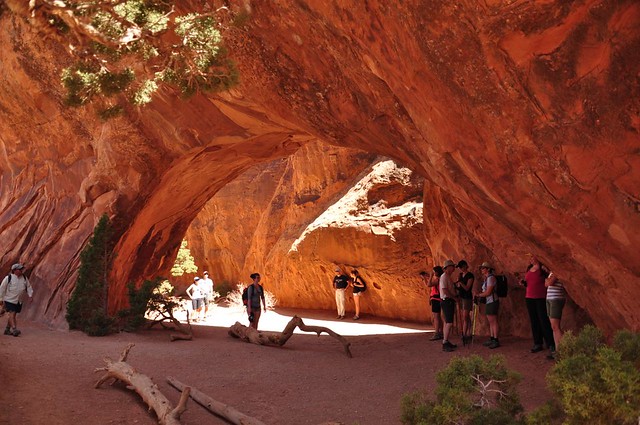
And Navajo Arch (this was one arch where I couldn't get a people-free shot; there were HUNDREDS of people doing this hike the same day as we were):
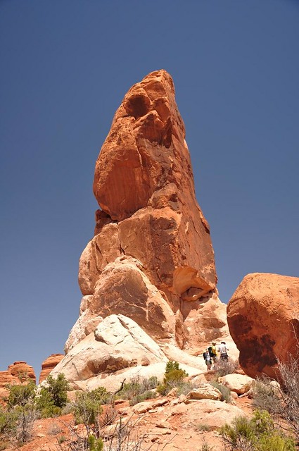
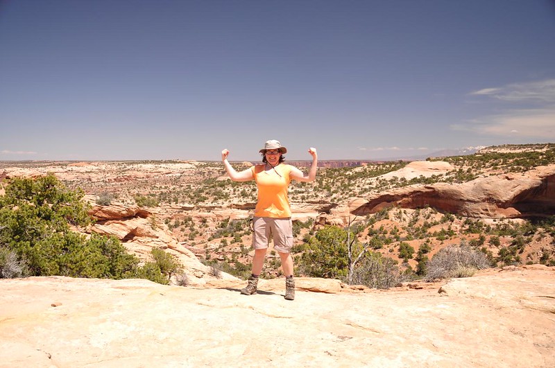
The trail took us up atop a big rock fin where we could see all around us. Cool!
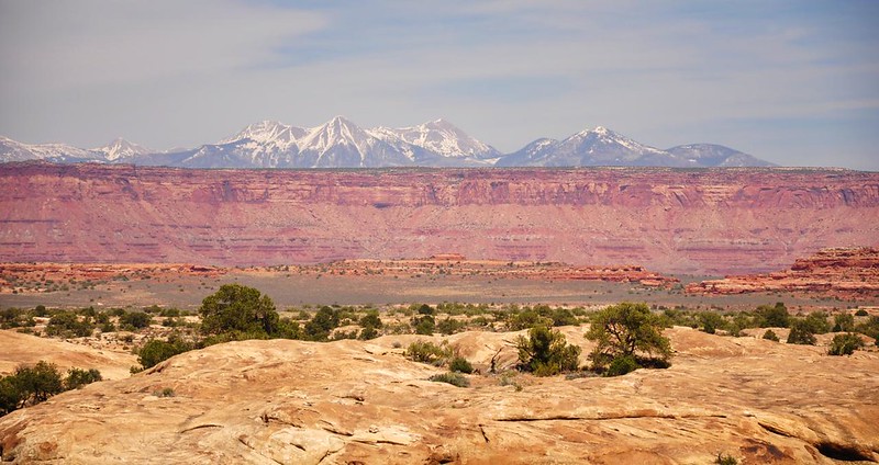
There were many spots along the trail where we could see the nearby snow capped La Sal Mountains. The tallest peak in those mountains is 12,721 feet and the range was visible from MANY places in the Moab area:

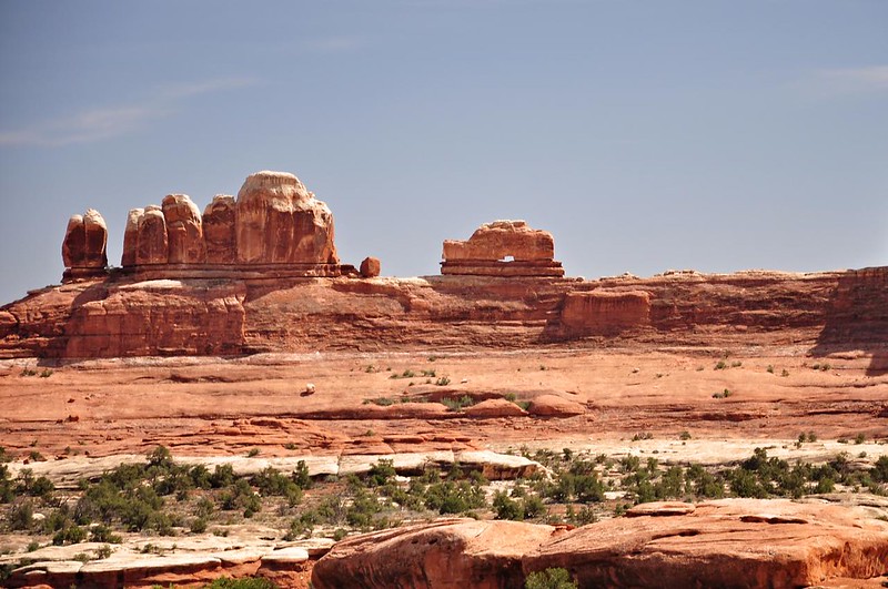
This rock formation is called Dark Angel and reminded me of Stein's Pillar in the Ochoco National Forest:
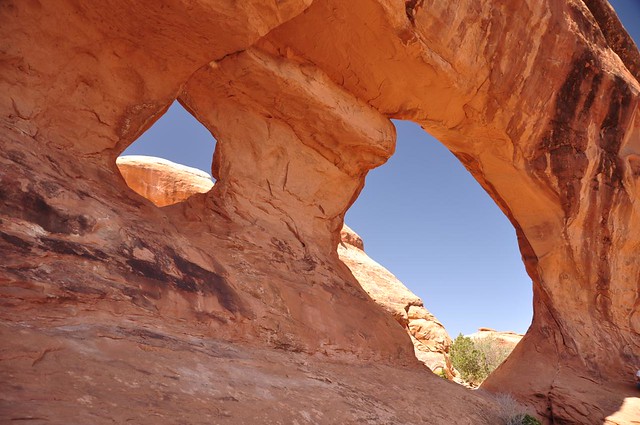
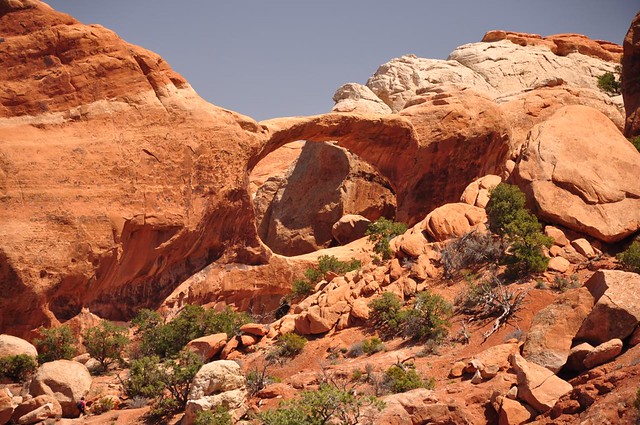
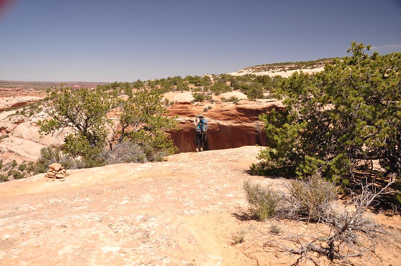
It's hard to tell from this picture, but there is a lower arch and a larger upper arch here. Appropriately this one is called Double O Arch:
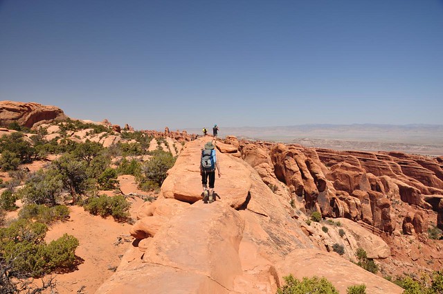
At this point in the hike you have a choice. You can return the way you came two miles to the trailhead or take a longer route back via a two-mile "primitive loop." We decided to take this loop. I'm guessing the reason that it's considered "primitive" is because there is a lot of up-and-down slickrock hiking and long stretches of sand, which - if you've ever walked very long on the beach - you know is very tiring to hike through.
Along the way a side trail led to Private Arch:
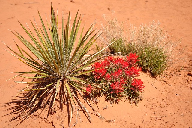
Locals and rangers told us that they had been having a cool spring and the desert wildflowers were late this year. We did see some paintbrush in bloom, though. That cool-looking plant next to it is yucca.
We were both carrying three liters of water, but Deb ran out about 30 minutes before the trailhead and I ran out about 10 minutes before. Fortunately there's a water spiggot at the trailhead. Ah, refreshing! The parking lot, by the way, was overflowing with cars. Officially the park staff tell you to "try back later" if the trailhead you need is full, but I wonder how much they enforce that.
The eight-mile hike took 5.5 hours including all the stops and side trails. It ended up being more challenging than I thought it would be. This early in the year my body isn't used to hiking at high elevations yet, nor was I used to the heat.
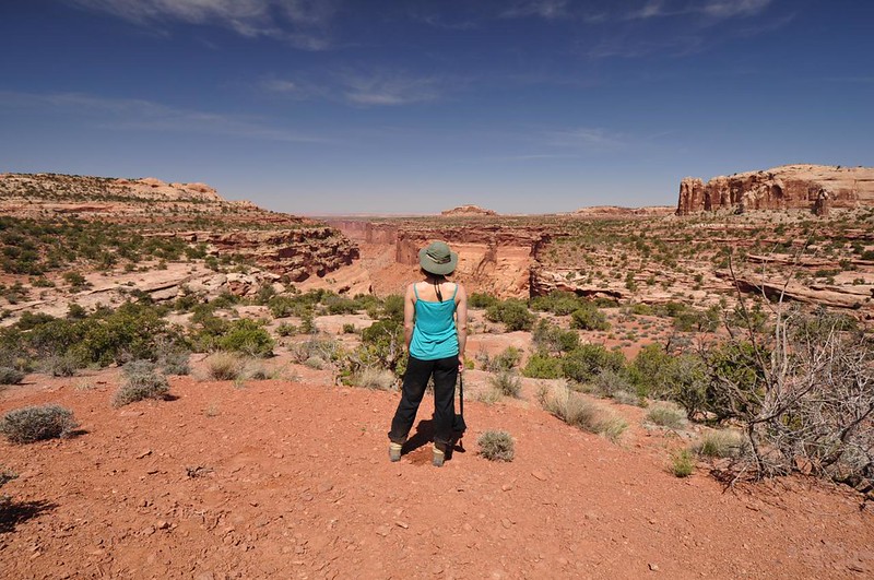
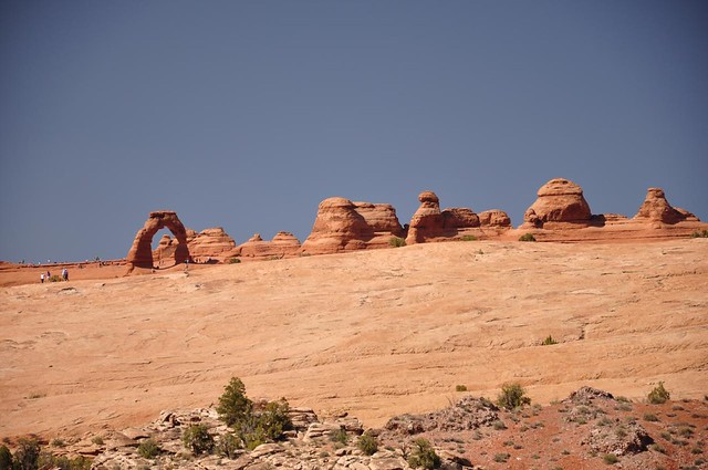
On the way back to Moab we stopped to see the most famous landmark in the park (maybe the most famous landmark in the whole state): Delicate Arch. There are three ways to see it: a three-mile round-trip hike to the base, a 1.5-mile round-trip hike to a viewpoint that gets you pretty close but not all the way, and a 30-second walk from the parking lot to a distant viewpoint, which is the one we opted for. I would have liked to get closer to this beautiful icon, but I was just too hot and tired for any more hiking this day.
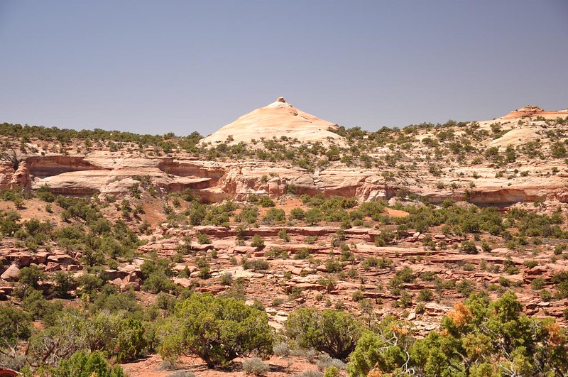
Day 4: Canyonlands National Park - Island in the Sky District
After two nights camped out at the hostel we packed up Sunday morning and moved closer to Canyonlands. We were visiting the Island in the Sky District that day, which only has one small campground. We decided to try for nearby Dead Horse Point State Park and even though it was a Sunday morning we grabbed the last available campsite that day. Whew! Campsite secured, we headed into Canyonlands to do the six-mile Neck Springs loop hike.
As with the day before, the views began immediately:
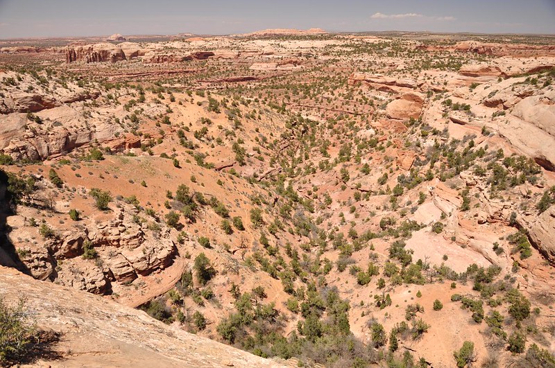
Instead of the weird rock formations and arches we saw the day before, this time we were hiking in and out of little canyons:
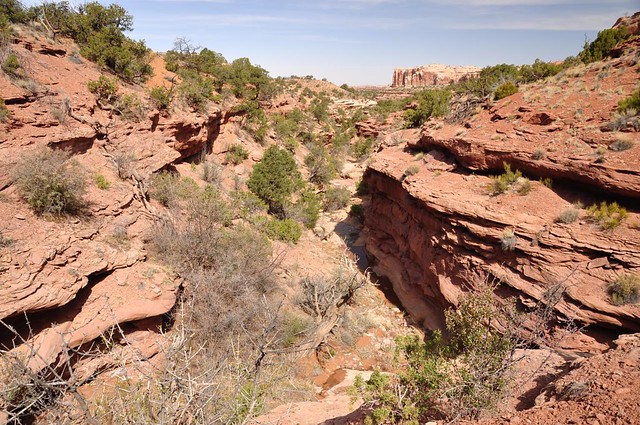
Red sandstone walls towered above us:

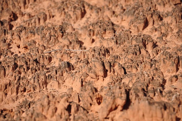
We saw lots and lots of cryptobiotic soil, which is a living crust of algae, fungi, lichens, and other biological material It stabilizes the sand and dirt so it doesn't blow away. It's a big no-no to step on it because it can take up to 100 years for it regenerate back to its former state. Here's a close-up shot:
And a wider shot:
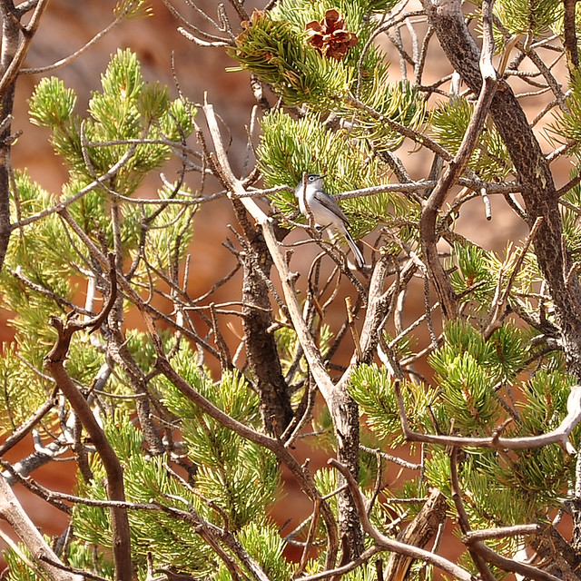
One of many birds we saw while in Utah. My sister is a bird nerd and loves identifying birds with her new iBird Pro app.
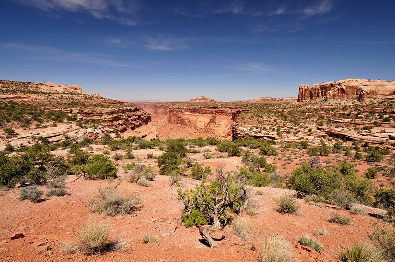
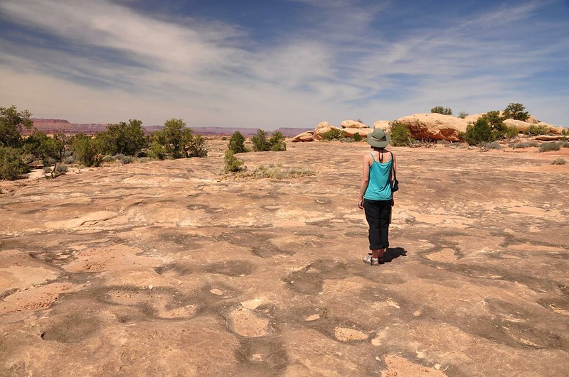
About halfway through the loop we reached a viewpoint looking west or northwest (we weren't quite sure). What an amazing landscape!
We sat at this spot for about 45 minutes eating snacks, enjoying the scenery, and relaxing. We had the place all to ourselves. In fact, we didn't see any other hikers on this entire trail, which was a welcome change from the day before.
We finally tore ourselves away and continued the hike. A short while later we had a view down into a canyon and an arch. We were startled to noticed that the tumble of rocks inside sort of resembled a sitting person with their arms wrapped around their knees. Weird!

Interesting rock formation. Reminds me of something....
The "trail" out of the canyon was a scramble up the rock. Unused to the heat and the high elevation I found this far more challenging than Deb did!
I made it!
Now we were almost directly above a part of the trail from the first half of the loop and we could see the trail far below.

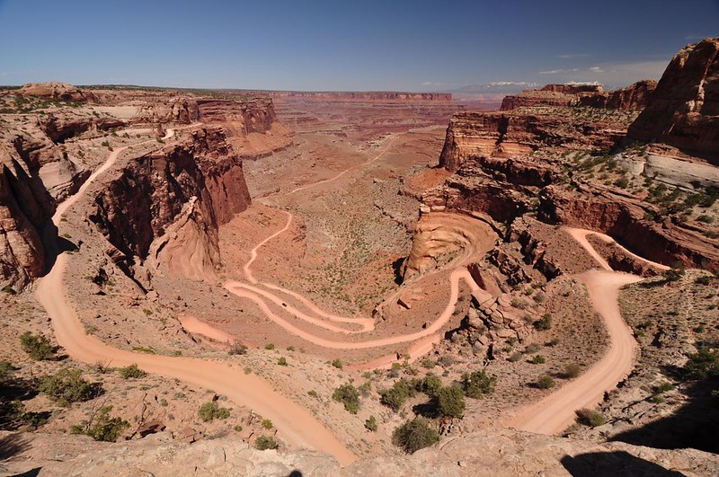
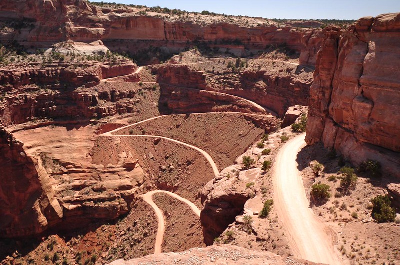
The last part of the trail back to the TH was alongside the road and we passed an astonishing viewpoint of the Shafer Trail Road dropping 1,400 feet into the canyon. I had to use my wide angle lens to get this all in. This road connects up with the White Rim Road, a 100-mile-long 4WD road through the park. These 4WD roads are SUPER popular in the greater Moab area. There are lots and lots of them from what I hear, but I was surprised to find one in a national park.
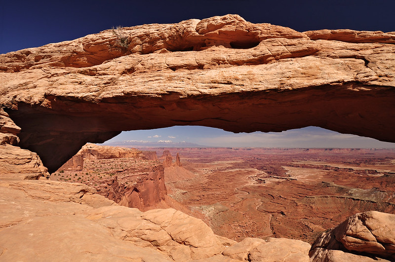
After the hike we went exploring a bit before heading back to the campground. We visited beautiful Mesa Arch, which is super popular with photographers at sunrise. I didn't bother trying to go there for that since there is room for about two and a half tripods to get the good vantage point.
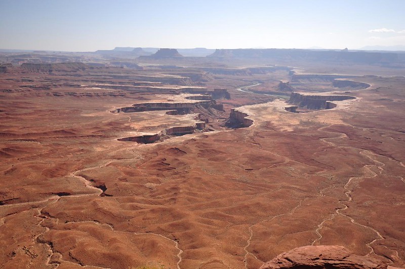
We visited the Green River Overlook, where we could see the distant snaking Green Giver and the appropriately named White Rim:
And we visited Grand View Point Overlook, which is the end of the road for the Island in the Sky District of the park. Although the southern Needles District is quite close as the crow flies, it requires an hour of driving from here, up and out of this section, down through Moab, and around down to the south.
There were other viewpoints to see but it was hot and we were tired so we headed to the campground and found our site. I've never camped anywhere where the weather gets so hot and there are no trees for shade so the picnic tables have roofs!
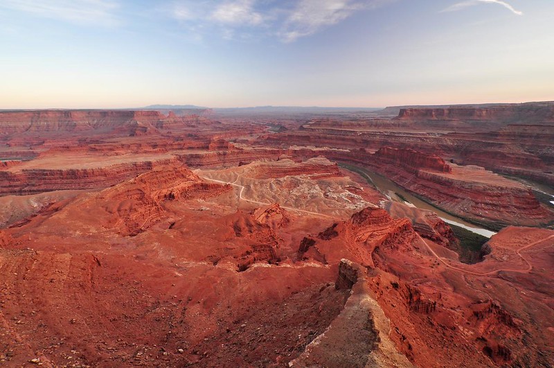
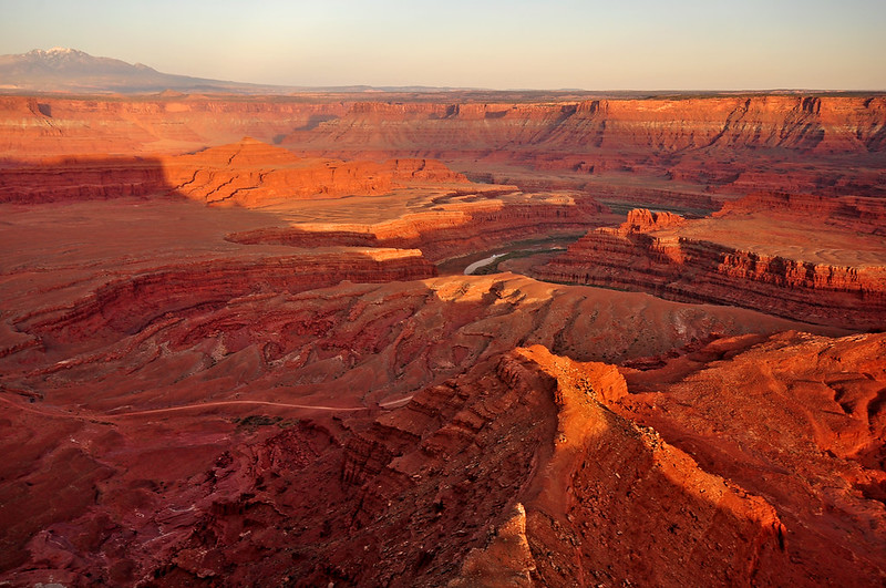
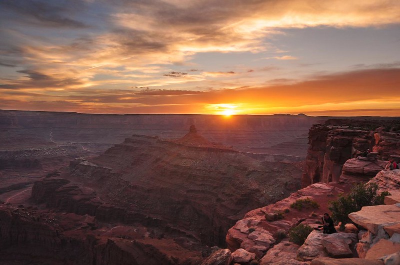
For sunset we headed to the overlook at the end of the road in Dead Horse Point State Park. (By the way, the park gets its name from a legend about how cowboys would herd wild mustangs out at the point. They fenced off the neck with branches and brush creating a natural corral. They chose the horses they wanted and left the rest out on the waterless point where they died of thirst. Sheesh, what a story!)
Anyway, the viewpoint was stunning! I was really glad we came out here and had good conditions.
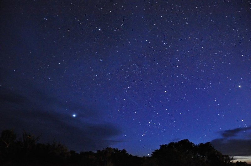
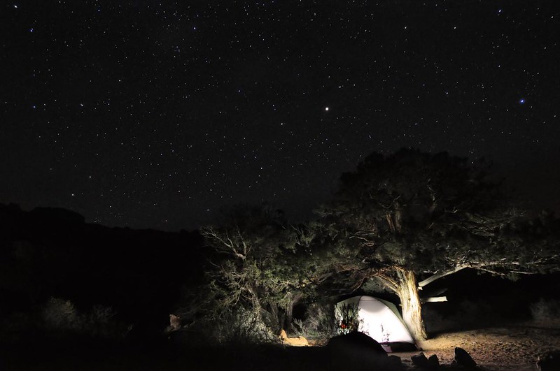
Back at our campsite we hung out at the end of our "driveway" and watched the stars for awhile. The stars out here were AWESOME. There's something supremely satisfying about stargazing with a good companion after a day spent enjoying the outdoors.
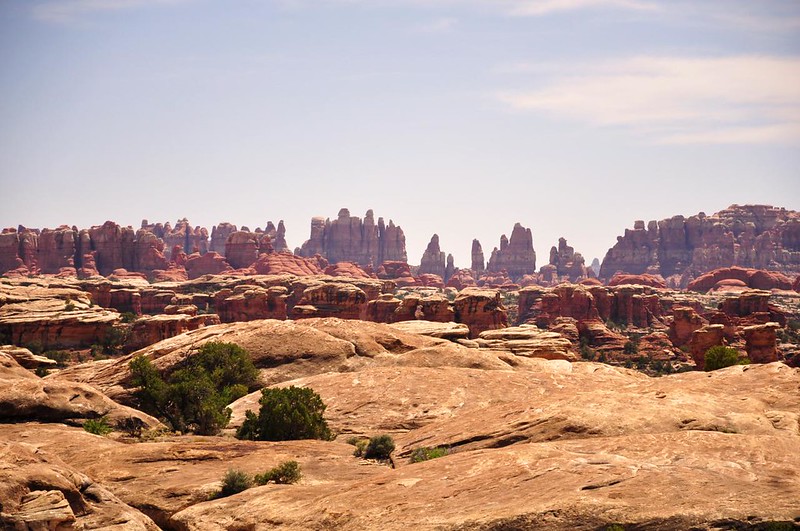
Day 5: Canyonlands National Park - Needles District
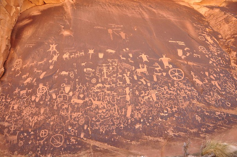
In the morning we packed up and headed south to the Needles District. On the long access road into this part of the park we passed Newspaper Rock and stopped to check it out. This cool spot is a State Historic Monument and it is a rock face covered in hundreds of different petroglyphs, some as old as 2,000 years! It is unknown why there is a high concentration of petroglyphs here or what messages the native people were trying to convey, but in any case it's pretty neat to see.
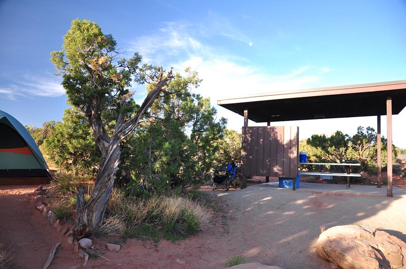
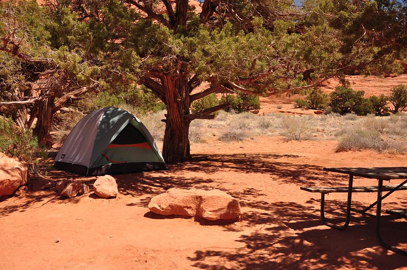
The Needles District only has one non-reservable campground which we didn't even try to get a site at. Having been burned on the campground situation once already this trip we had called ahead and made reservations at the Needles Outpost, a private campground just outside the park's boundaries. They have a little general store, water, and showers. Many of the campsites don't have shade, but since we had a tent we were given a shady spot. Hooray!
After pitching our tent and weighing it down so it wouldn't blow away we headed off into the park. Our original plan for this day was to do the long 11-mile Chesler Park trail. But since we were starting a backpacking trip the next day and since it would be a hot difficult hike we decided against it. Plus there is NO water along the hike, which meant we'd have to carry lots with us. Maybe next time!
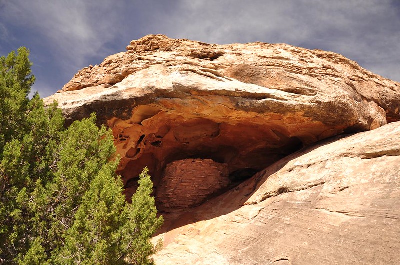
Our first stop was the Roadside Ruin trail, a 0.3-mile loop that brought us to an old Puebloan granary which the native people used for grain storage. It is thought to have been built sometime between AD 1270 and 1295.
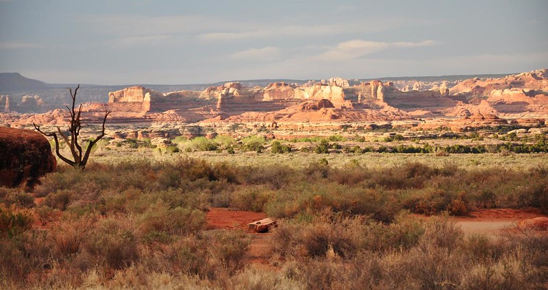
We drove to the end of the road, which is where the trailhead for the Confluence Overlook Trail is located. We didn't hike that trail but the scenery around the trailhead was very pretty.
Driving back from road's end we stopped and did the 0.6-mile Pothole Point loop. The name comes from the many depressions that have formed along the surface of the slickrock. You can kind of see them in this photo:
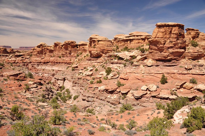
This trail also had very nice views of the surrounding landscape:
To the south are the strange rock formations for which the Needles District is named. You get an up-close view of these if you do the Chesler Park hike.
And there are those snow-capped La Sal Mountains again:
We stopped at a roadside viewpoint for Wooden Shoe Arch. Sure enough it looks like a wooden shoe!
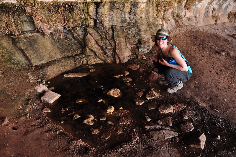
Our last stop was the 0.6-mile Cave Springs loop where we saw an old cowboy camp that was used back in the days when cattle had to be moved from range to range. Cowboys lived in isolated camps like this from the 1890s to 1975, when ranching here ended.
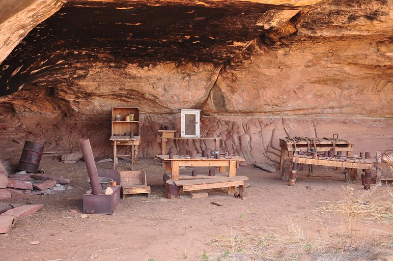
Cave Springs is tucked back in an alcove (nice and cool!) and is barely more than a trickle.
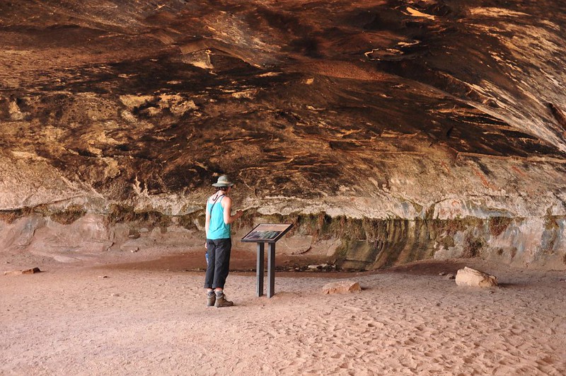
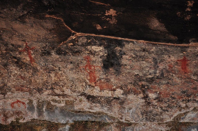
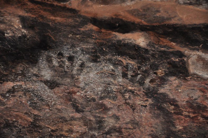
The cave wall here had some old Indian pictographs and handprints:
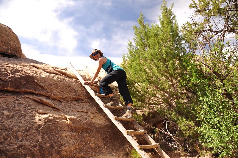
The trail hopped up onto the plateau above via two separate ladders. Fun!
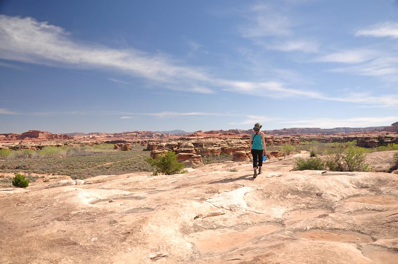
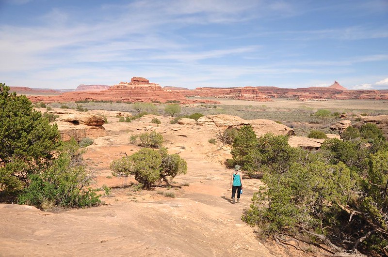
The views up there were really nice!
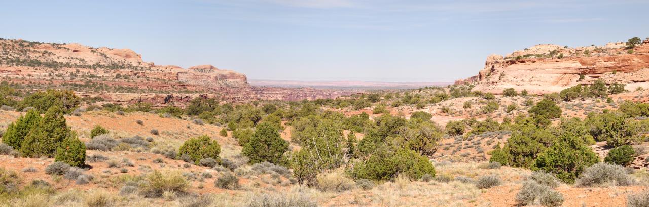
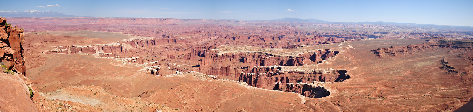
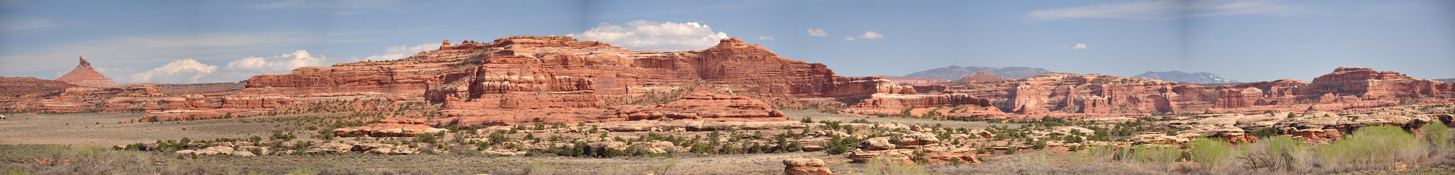
Here's a panorama (click to see a bigger version):
After that little jaunt we headed back to the campground to relax in the shade and enjoy the view from our site.
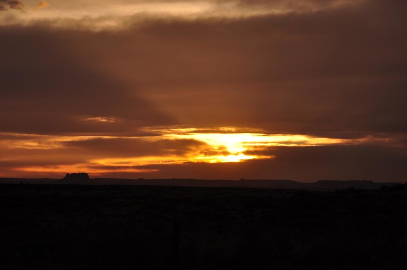
After dinner we turned and looked the other direction for sunset, which didn't materialize into much but was still nice.
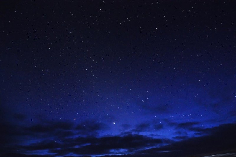
Soon after that the stars came out. SO. MANY. STARS.
Day 6: Off to go backpacking!
We awoke to another beautiful morning.
Then we packed up the car and headed south for three days and two nights of backpacking through Grand Gulch. (
I cannot recommend this area highly enough. It is crazy beautiful! Canyonlands has lots of trails that we didn't have time to explore, and there were even some spots in Arches that we didn't get to see. I look forward to going back. Also, although Moab was pretty crazy that first weekend, it's a pretty cool little town. The only downside to this area is getting there. It's a LONG drive from Portland and unless you're a really hardy road-tripper you can't do it all in one day, which means four days of your trip are eaten up with driving there and back. But it's definitely worth it!
I want to go back to those two parks, but I was also drooling over the photos and descriptions of Capitol Reef, Grand Staircase Escalante, Bryce, and Zion in my guidebook. There is SO much more to explore!