What's close? Hmmm, got it!
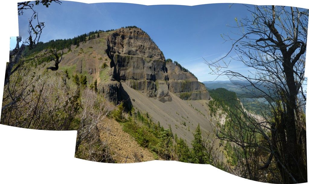
Many shot panorama: first views of the cliffs of Table Mountain.
Interactive Photosynth - zoom/scroll around in 105 megapixel image.
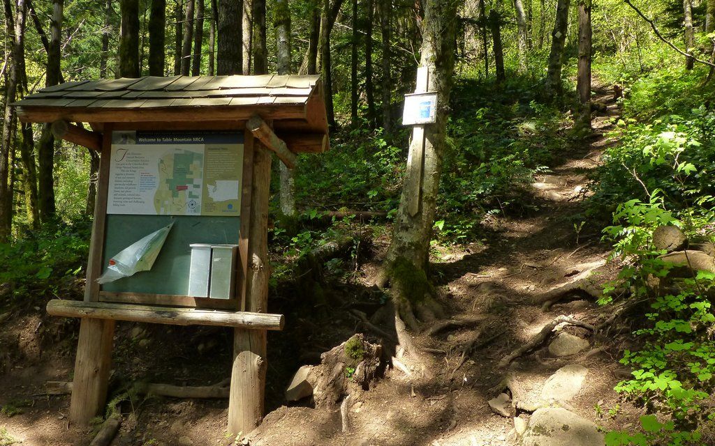
I ended up at the Bonneville Hot Springs trailhead about 12:30, or so, and was on the trail shortly. I often hear how muddy this first stretch is, but it really wasn't bad. The day was warm and amazingly still. I was wearing shorts.
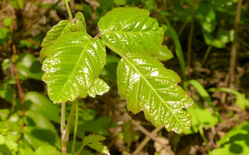
Watch it! This stuff's definitely coming out in force.
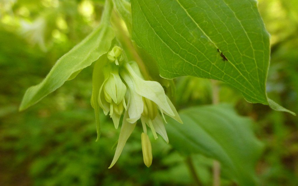
(No idea what this is?)
EDIT: Hooker's fairy bells (Prosartes hookeri)
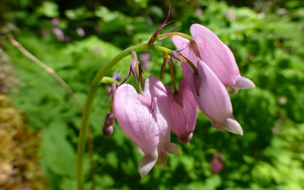
Bleeding Hearts
The shortest path is always a straight line, right? Straight up hill!
It only gets steeper, so don't be alarmed at this point.
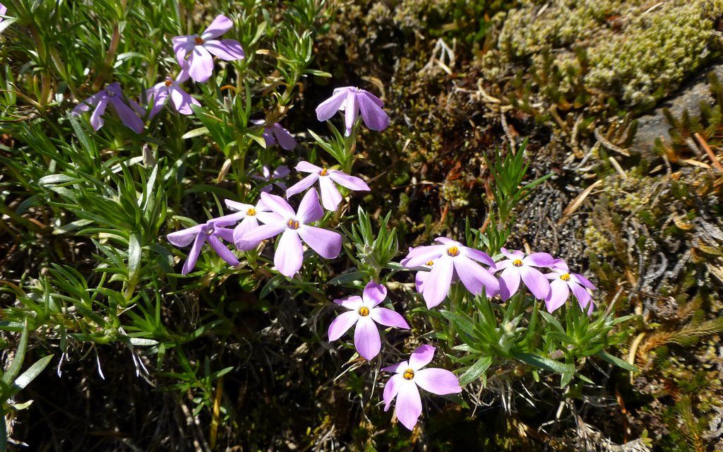
Saw my first phlox this year.
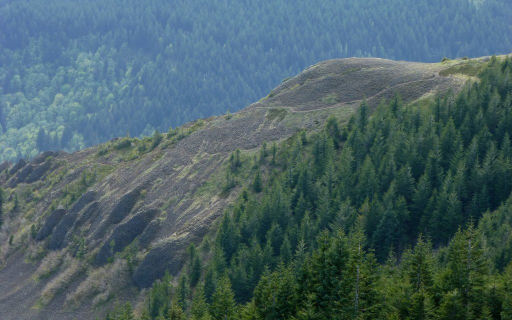
At around 2500', the trail levels off a bit, and you get some really nice views of the cliffs of Table, as well as Sacagawea Rock.
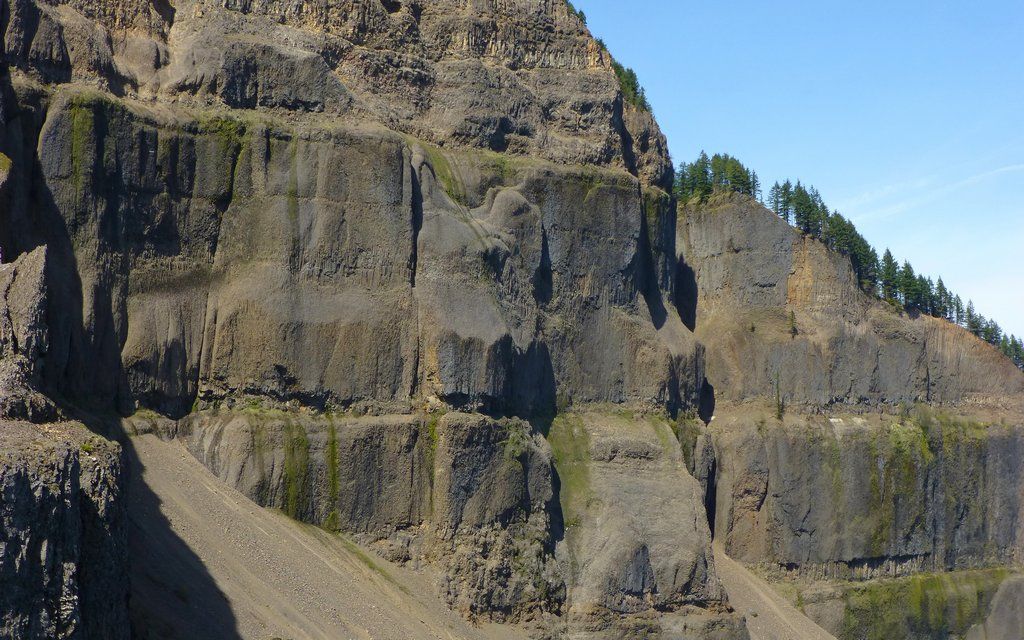
The layering within Table Mountain is amazing, really. One flow after another.
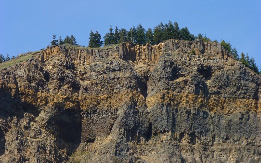
The legendary collapse accounts for the south side cliffs. But what accounts for the other sides vanishing?
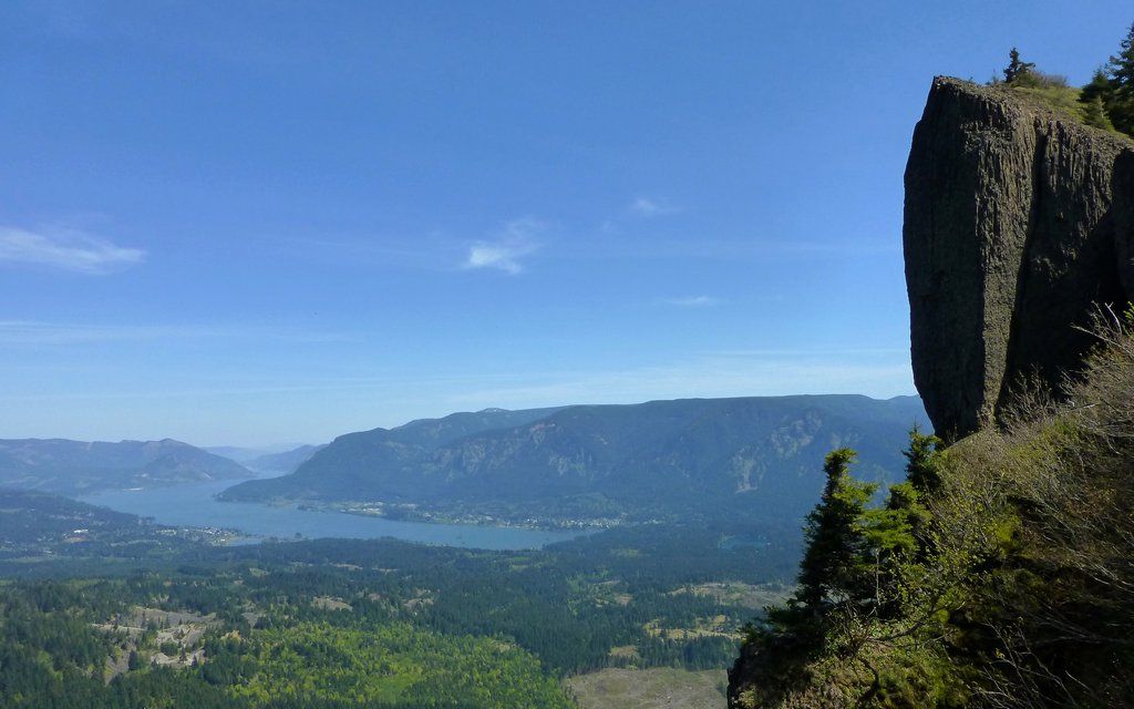
Sacagawea Rock, looking over the eastern gorge. Wind and Dog in distance. The great slide in foreground.
Then, after just a short period of fairly level trail, there's the boulder field. They're pretty stable, really. I guess I thought the Elevator Shaft might've presented more risk of severe ankle injury. Still, this is a place to be very cautious, especially when solo!
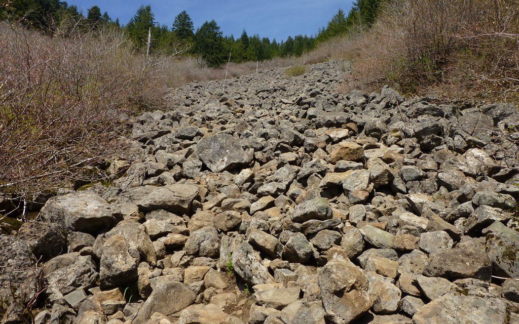
Just one step after another. It goes by pretty quick. Think five or eight steps ahead.

Looking back down the boulders, towards Hamilton Mountain.
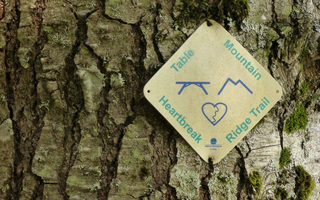
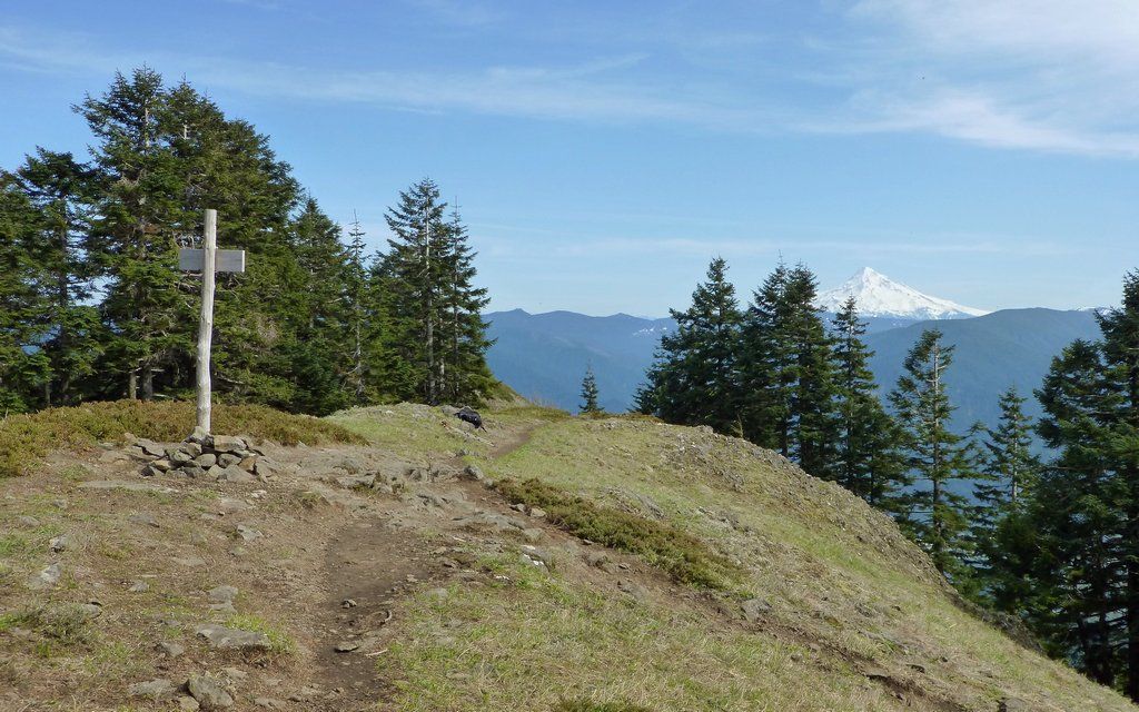
Just past the top of the boulders, hook a right on Heartbreak Ridge Trail. (One of the coolest trail signs ever.)
The summit is near!
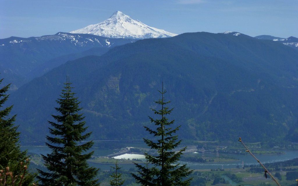
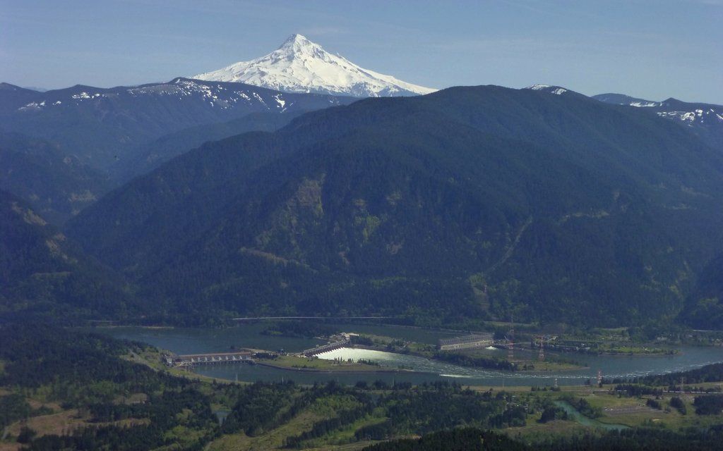
Even before hitting the summit, this tease with Bonneville Dam and Mount Hood shows up at one brief clearing.
You're there!
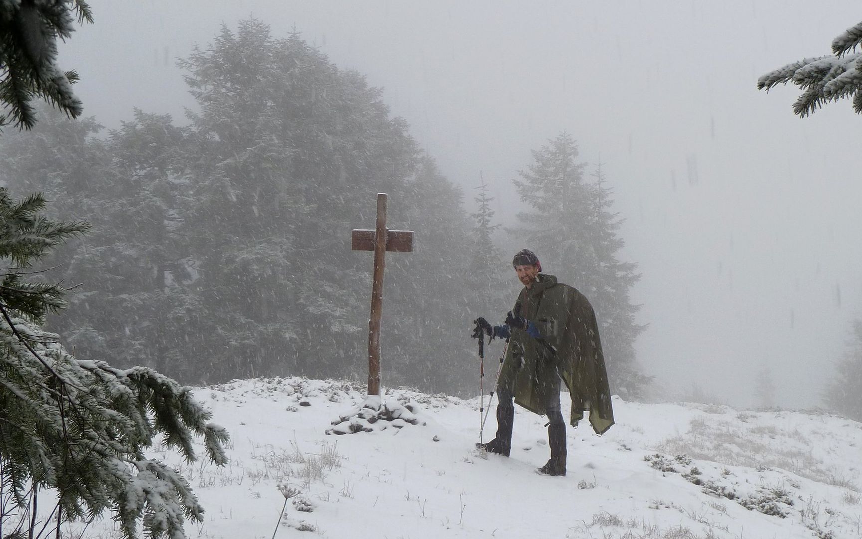
Last time I was up here, it was a whiteout. The views were far better today.
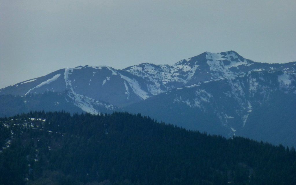
Mount Adams rising over Greenleaf Peak. Next time, I think I'll start earlier and go over there, too!
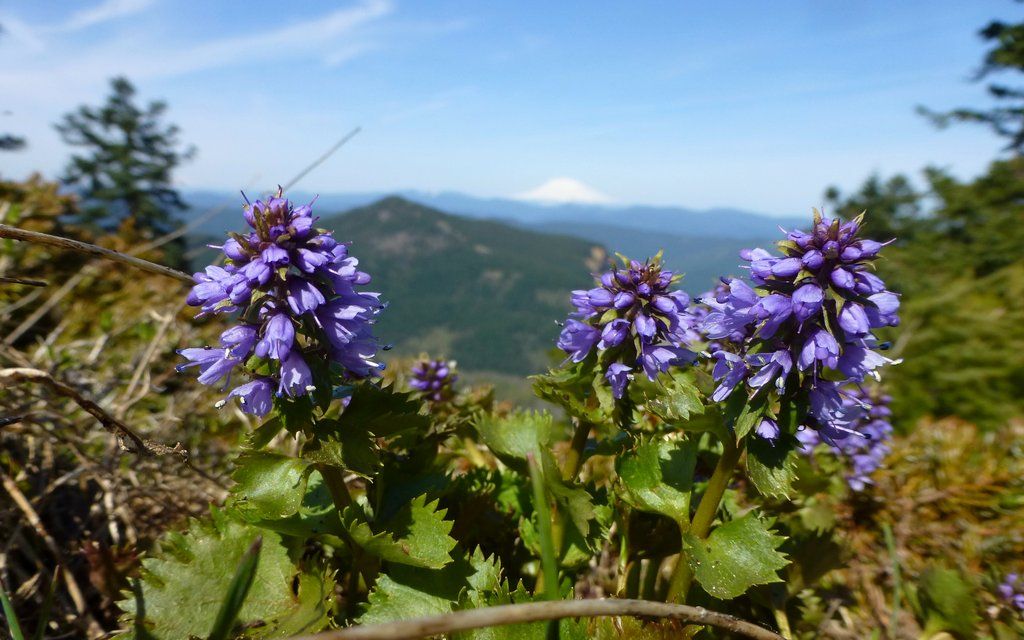
Cool little summit flowers. (No idea what they are?)
EDIT: Columbia Kittentails, (Synthyris missurica)
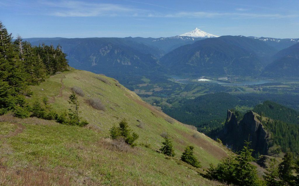
A nice little trail heads out to the edge of the cliffs, offering incredible views of the dam and iconic volcano.
How about that?
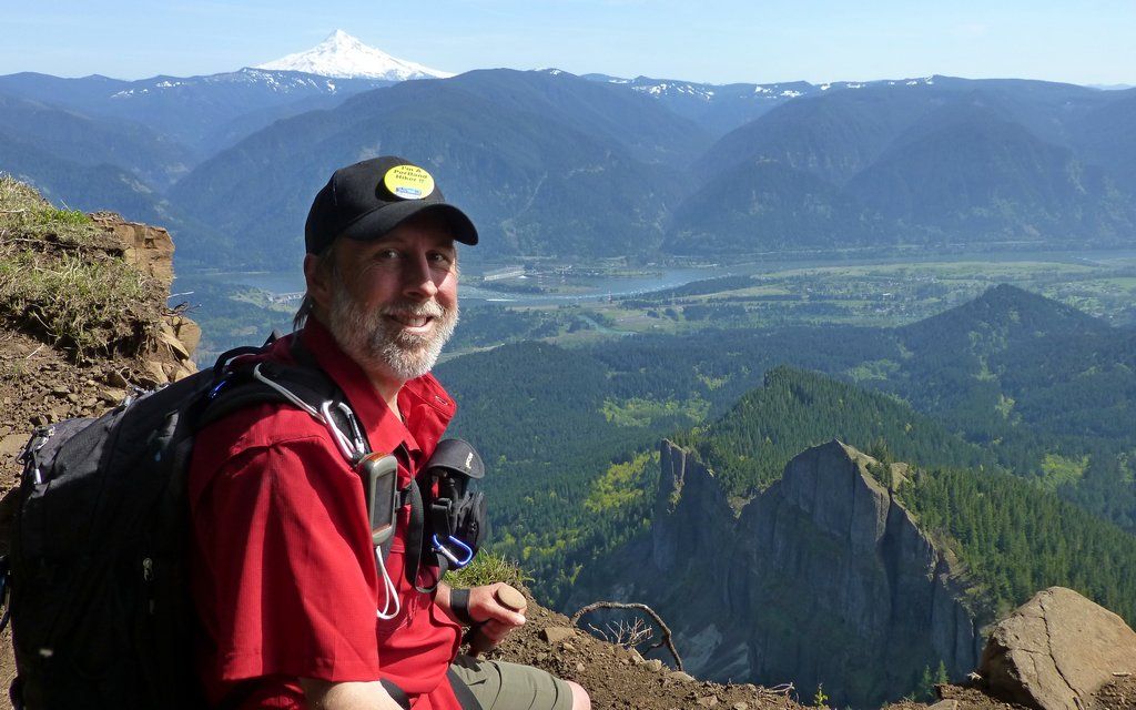
Obligatory self-shot at the precipice. Found a new place for my PortlandHikers button!
Hard to stop shooting these views!
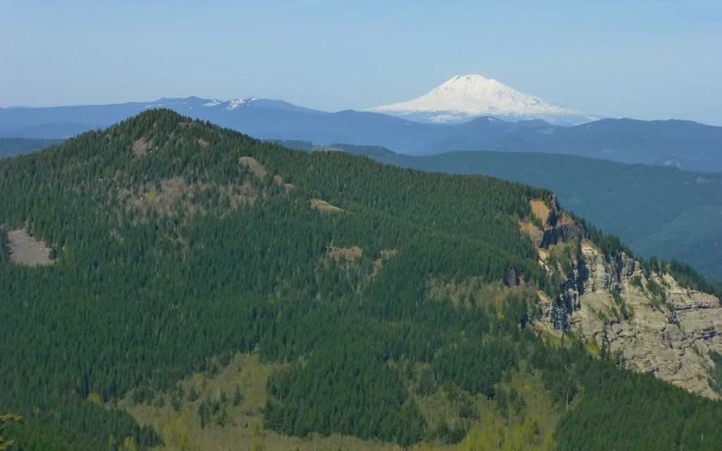
Volcanoes in every direction. Not all from one viewpoint, but here and there.
Mount Jefferson
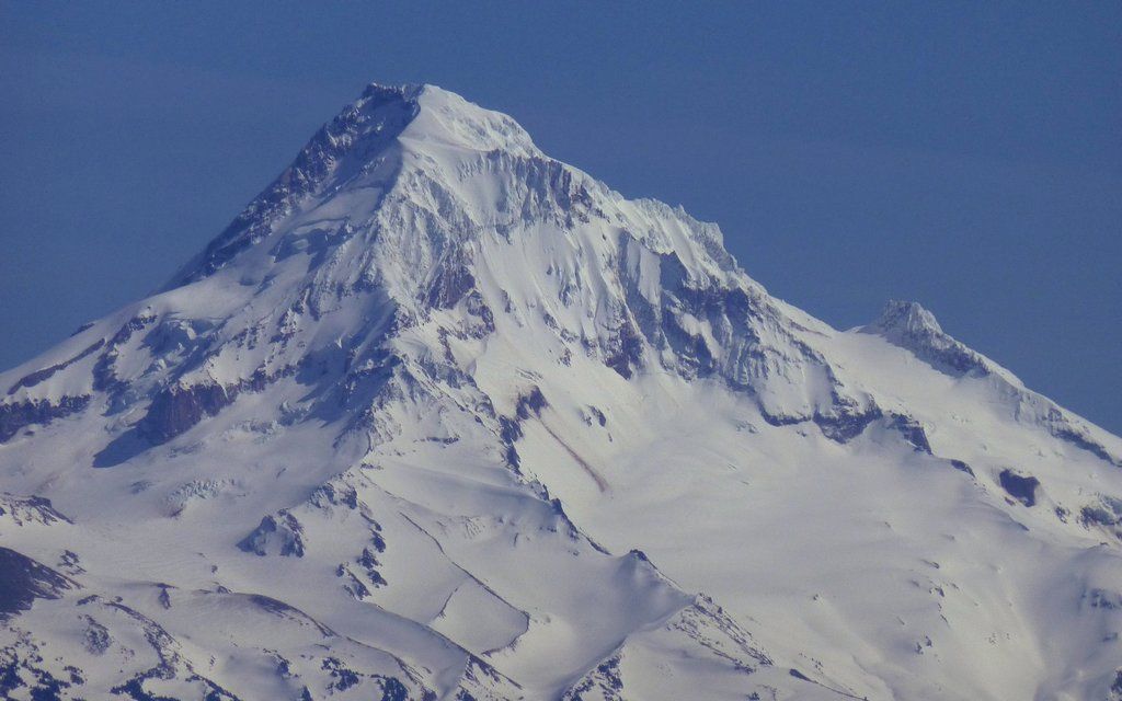
Mount Hood
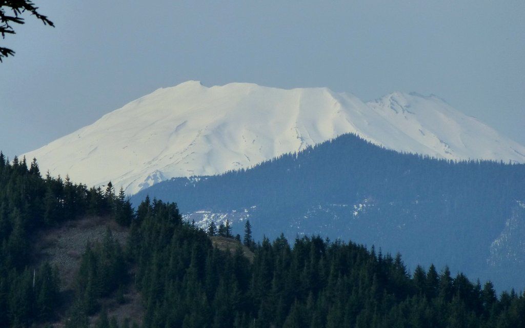
Mount Saint Helens
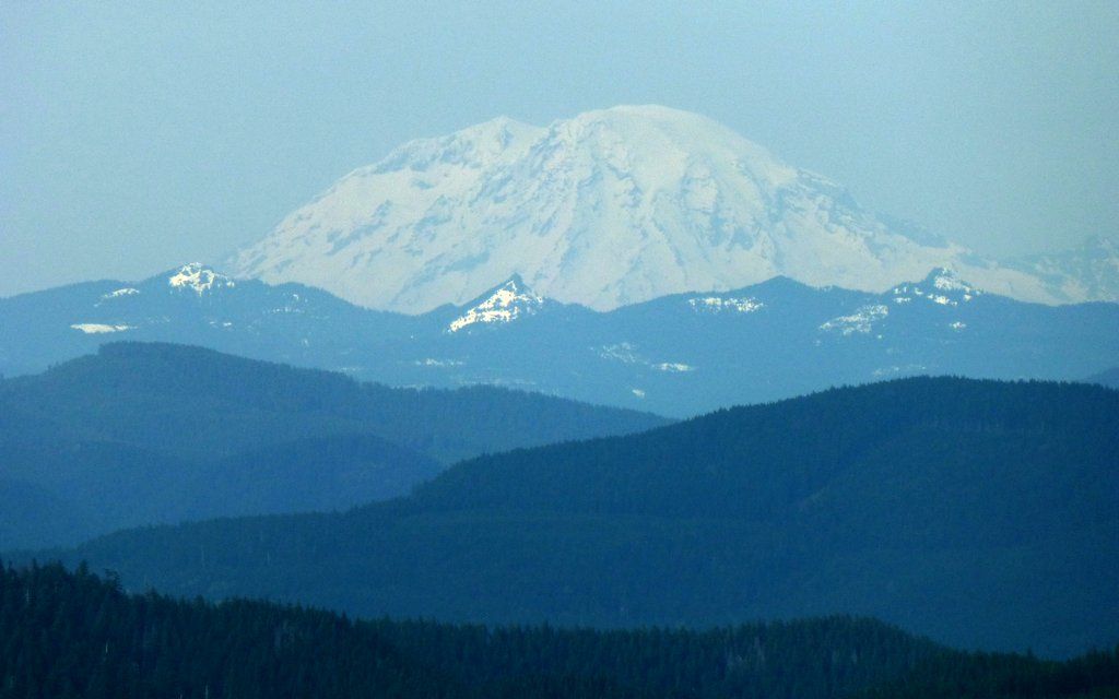
Mount Rainier
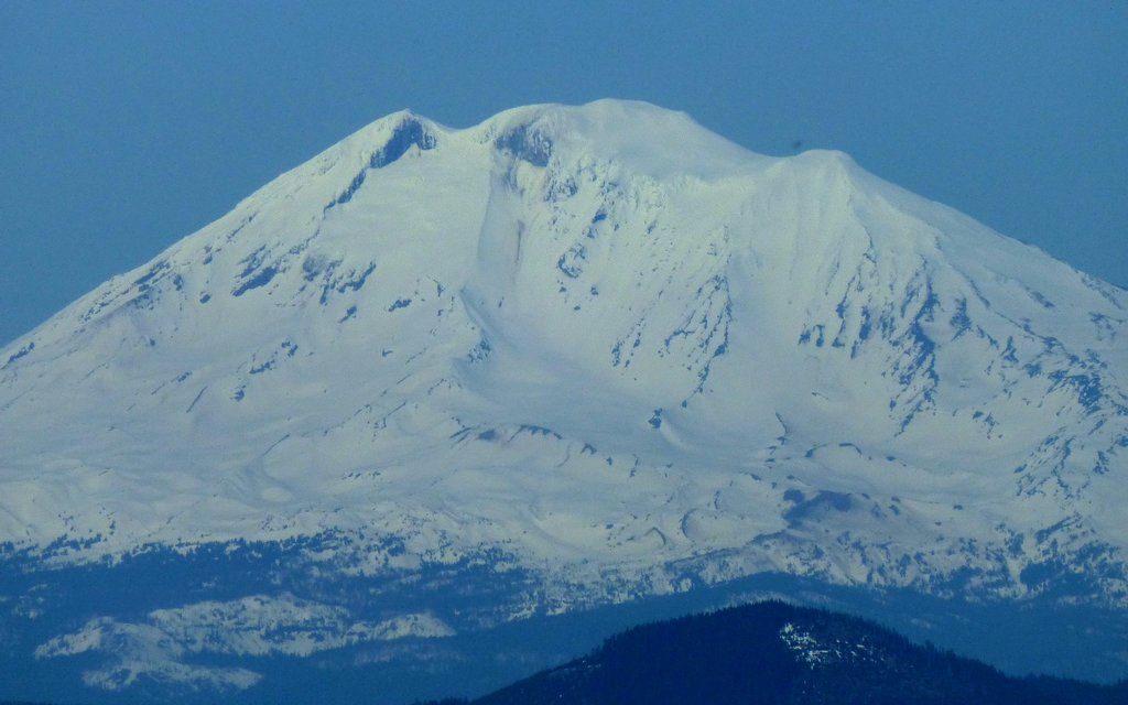
Mount Adams
As I mentioned earlier, it was an unreasonable calm day. There was actually zero breeze on top! And those pesky little black biting flies were out in swarms. I couldn't sit still to take a photo, much less to have a little snack, without turning into one myself. So I really did keep a move on up there.
Scoped out my descent route along the Westway Trail.
As I crossed back towards the north end, ...
... remembered the last time I was up here.
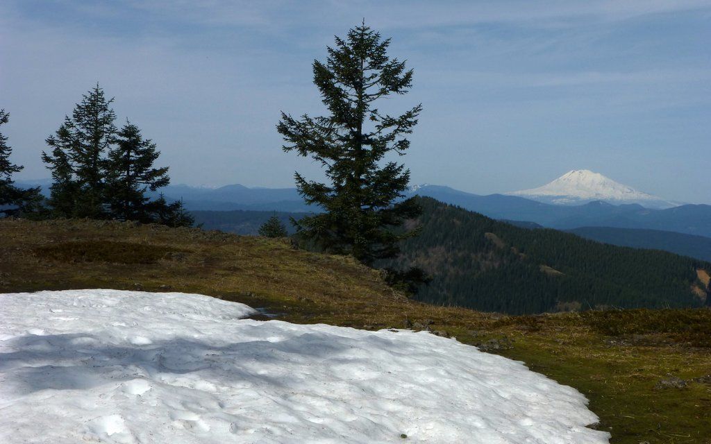
There are just a few patches of snow left now, if you'd like to camp up here!
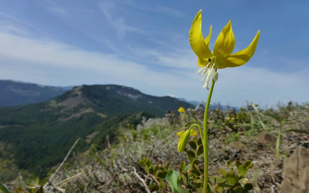
The glacier lilies are coming on strong on the northwest edge.
The south ridge of Silver Star looks ready for our assault on that in two days!
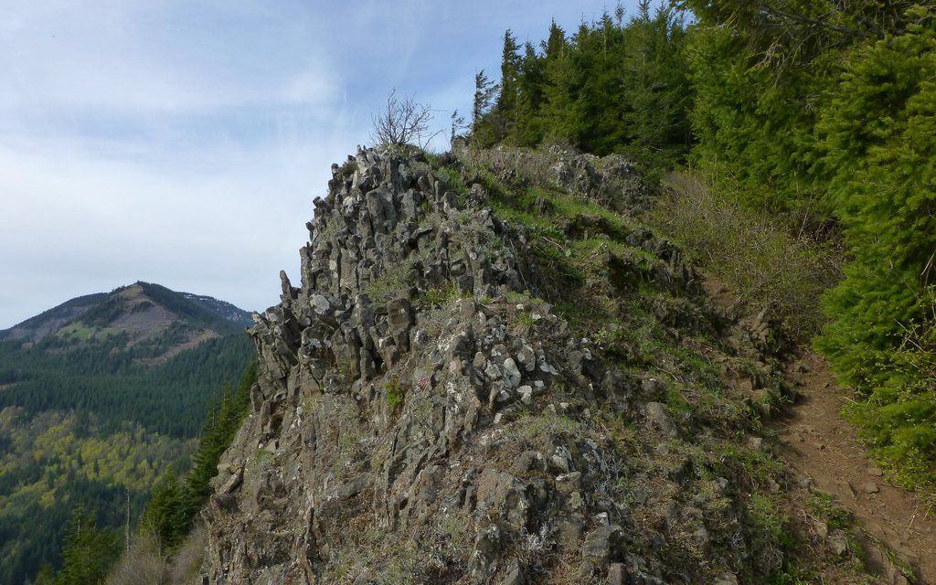
I'd heard a lot of grumbling about the Westway Trail down Table, but couldn't recall having taken it before, so I thought I oughta see what it's like. If you suffer IT-Band Syndrome, like me, don't even think of doing this without poles! You'll definitely want/need brakes. It is a very scenic route, though, and well worth it. I just went very slow, exactly as the doctor ordered.
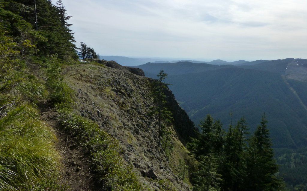
Some very cliff-y sections.
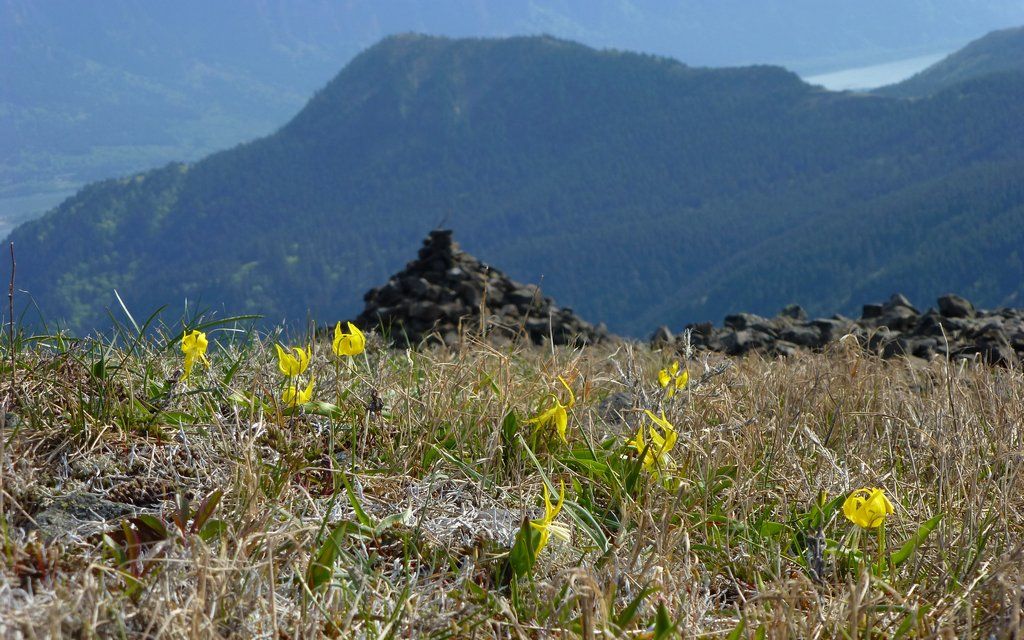
Another large patch of glacier lilies, with Hamilton in background.
Pretty cool basalt formation peeling off the mountain side.
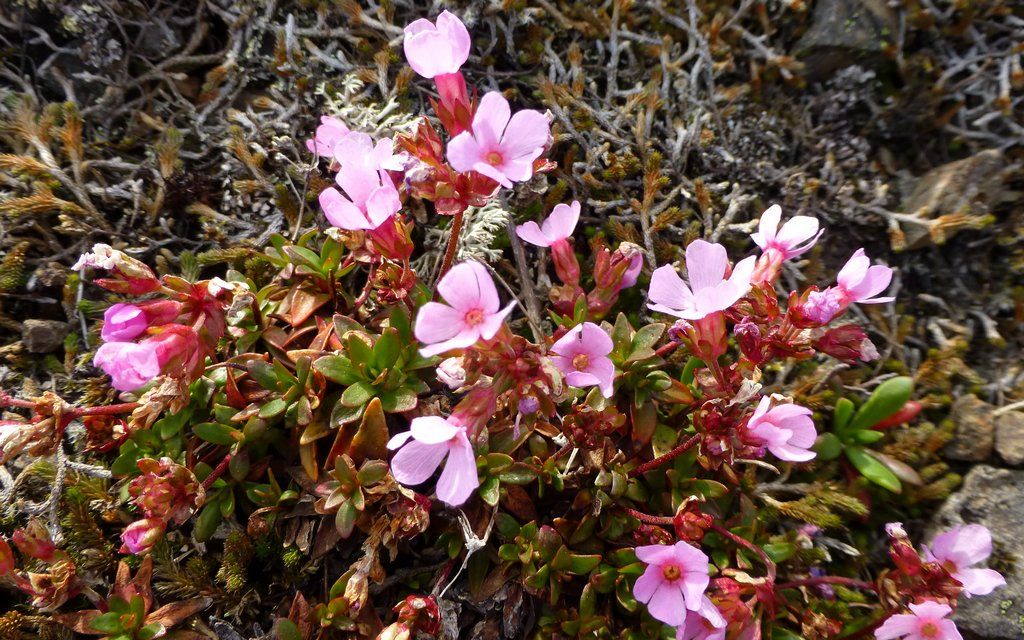
(No idea?)
EDIT: Smooth douglasia (Douglasia laevigata)
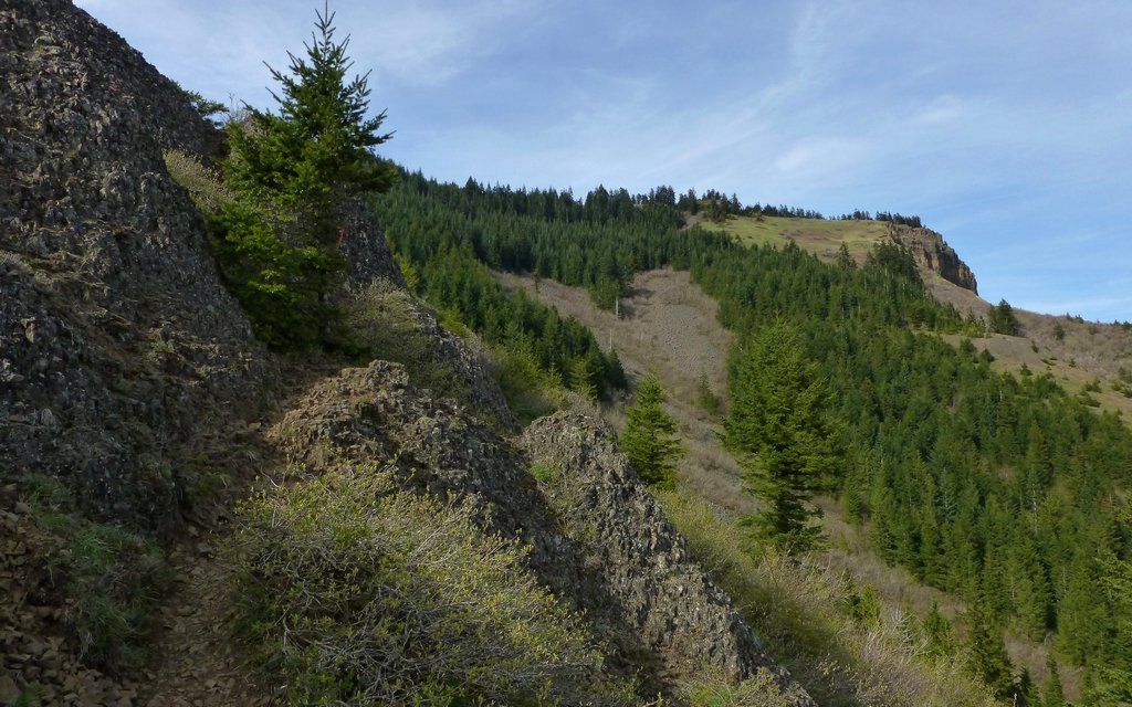
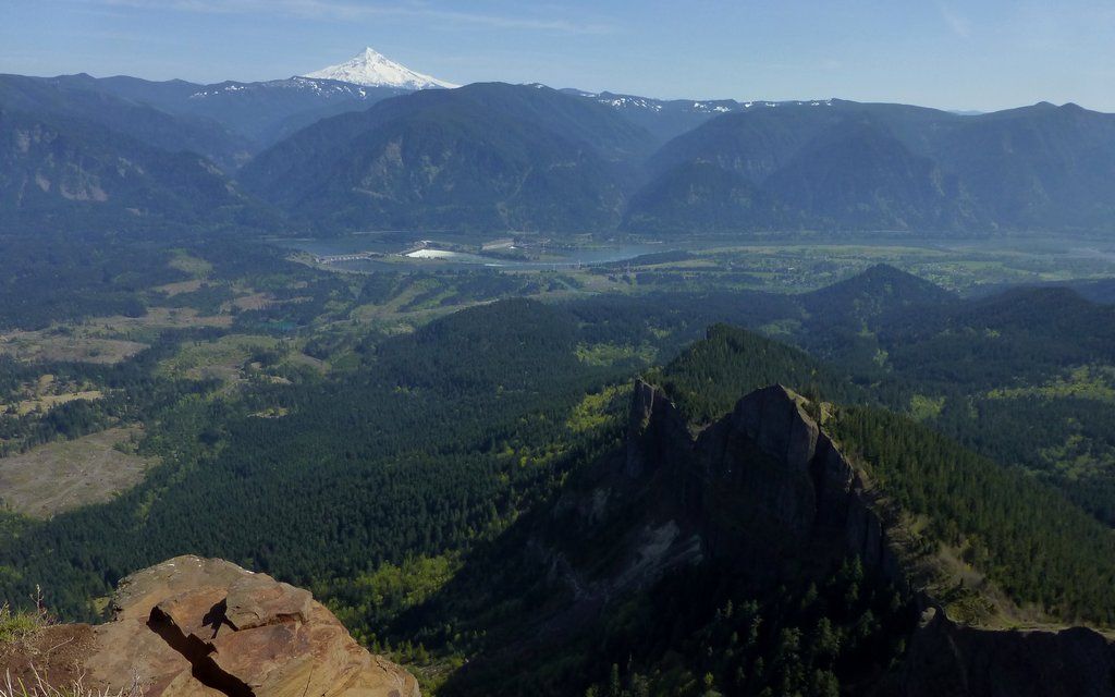
Rocky, view-drenched descent. Boulder field ascent route in background.
Alas, the forest came all too quickly.
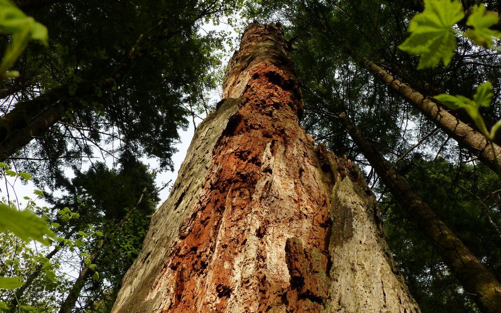
Some really huge old cedar stumps in here!
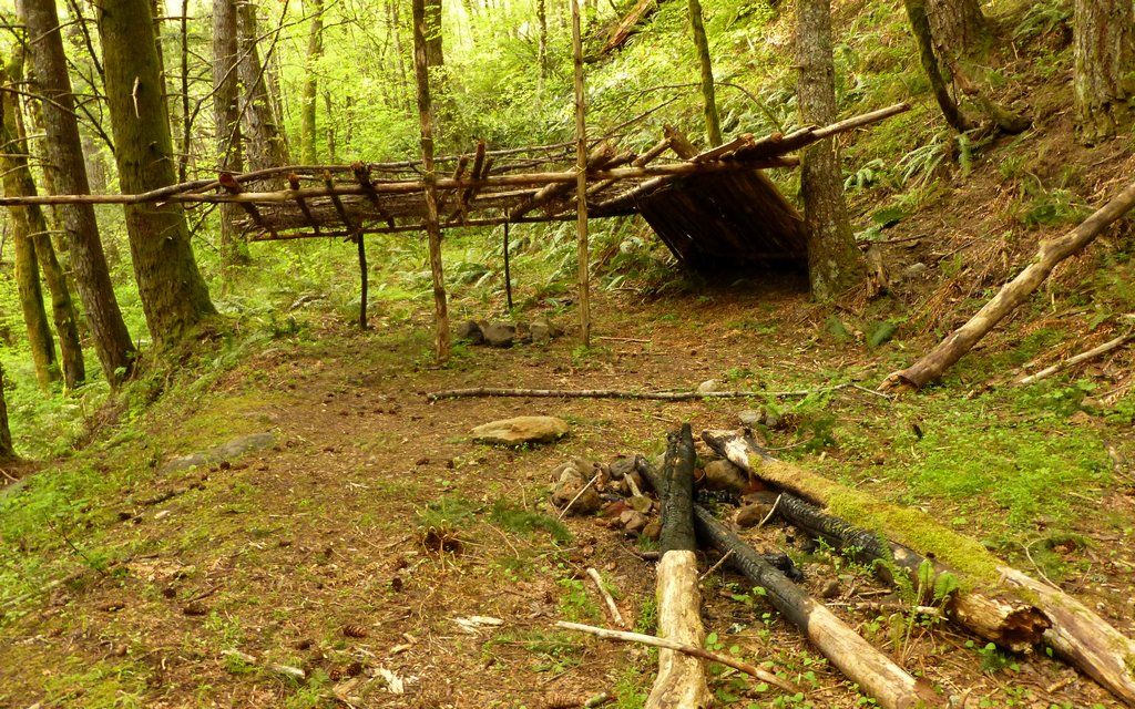
Totally funky shelter thingie. WTH kinda idjit burns logs like that?
Turned out, I wasn't out of daylight yet, so I decided to wander up Aldrich Butte as well. Hadn't ever been there, and the extra 500' EG would do me well after all that knee-banging descent.
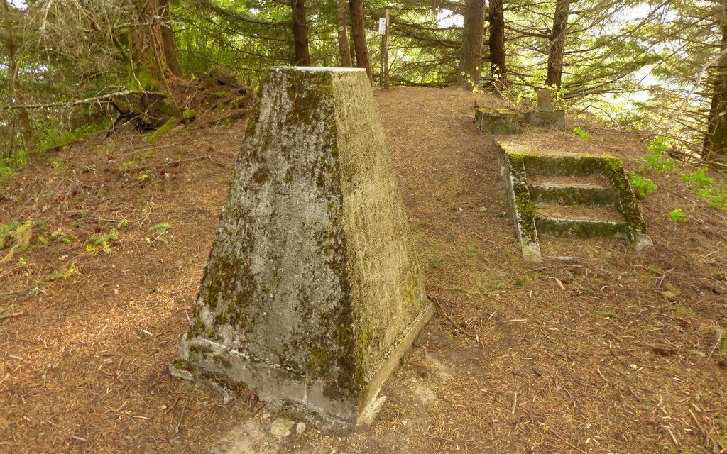
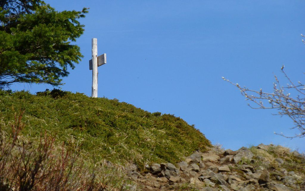
Seems to be the remains of an old fire lookout up here! Great place for one, were it not for all the trees.
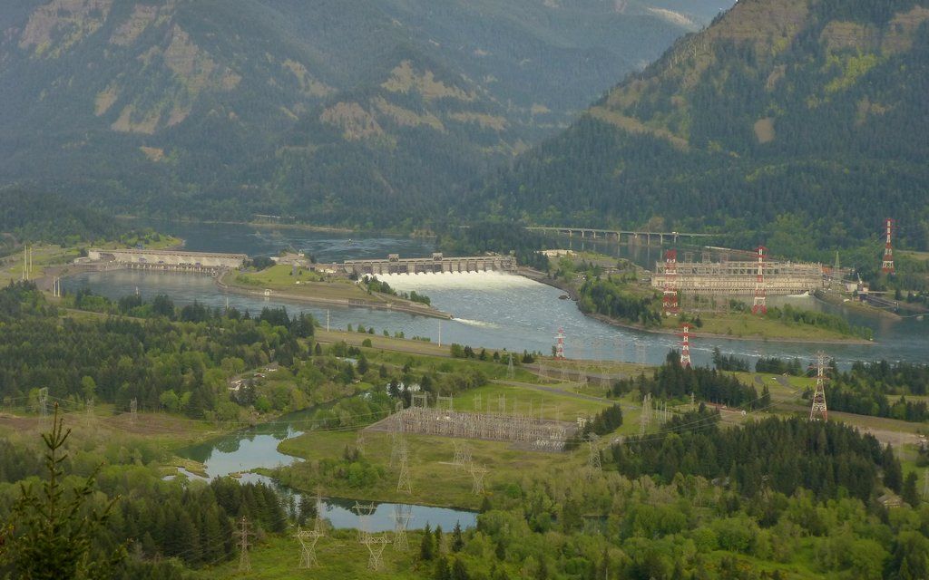
Still a very nice view of the dam, though!
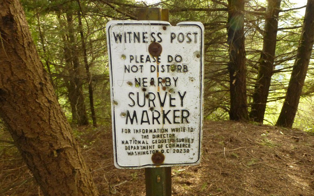
Thankfully, the local gun nuts had not disturbed the survey marker, just shot up the sign.
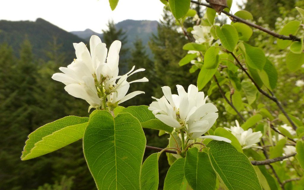
I'd really like to know what this is. It has a powerful strong odor!
EDIT: Saskatoon or serviceberry (Amelanchier alnifolia)
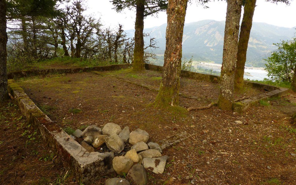
Structure clearly been gone some time, now.
Then, it was just down to the jeep, and back to the Republic of Clarkistan. Great little getaway! Altogether, about 10.6 miles and 4000' EG.
http://gpsfly.org/gps_map.php?gps_id=2359&w=645&h=440
These guys always crack me up. (I tend to stop for a cold drink at that little store in North Bonneville when I'm here.)