Re: 5.4.13 Land of the Mayhem Lost ...Without my Amigos :)
Posted: May 5th, 2013, 8:49 pm
Can't believe the wrap around fingers were omitted!!
Oregon's Forum for Hikers
https://www.oregonhikers.org/forum/
https://www.oregonhikers.org/forum/viewtopic.php?f=8&t=15212
Tough audiences! High praise!mayhem wrote:So did my wife!!Eric Peterson wrote:Mars, that was the best TR movie ever hands down man!!! Even my 16 yo daughter thought so!!
It was fun to meet you, Mayhem!mayhem wrote:Silver Star Not Today
On the return I was shuffling down the Eagle Crix sore foot style trail when someone got my attention going up the trail, stopping & giving me & Extra Eide Birth?? I slowed down & said hey it's all good ! Her reply is your Mayhem right? It's Happy Friendly Payslee. She gave a good bump fist & Bamm! I was on my way to somewhere??
Sorry I did not mean to alarm you. I was also wondering if I was on the right trail more than once. Great to meet another PHer face to face on the trailspayslee wrote:It was fun to meet you, Mayhem!mayhem wrote:Silver Star Not Today
On the return I was shuffling down the Eagle Crix sore foot style trail when someone got my attention going up the trail, stopping & giving me & Extra Eide Birth?? I slowed down & said hey it's all good ! Her reply is your Mayhem right? It's Happy Friendly Payslee
You seemed so worried that you'd scared me, but I was super-psyched to see another person. I'd been playing "which of these unmarked jeep roads is the trail?" for a while, and it was reassuring to find I was on the right track.
Stepped aside cause you were running
A beautiful day to be up there! I'll toss in a few pics for the collection soon.
-payslee
and here they are:payslee wrote:beautiful day to be up there! I'll toss in a few pics for the collection soon.
-payslee


I'll go out there, anytime (I can) - just holler! Someday, I'd like to figure out a five-spoke wrap-around up there! In just the last year, I've wandered out all five ridges:mayhem wrote:I'm going to get out there again a few more times so I can get familiar with the area & not feel out of place.
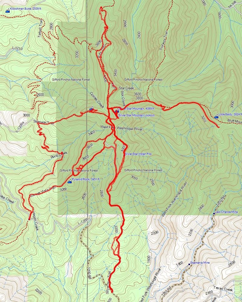
Loved your photos! And really happy to hear that track helped, at least a bit.payslee wrote:I was following (sort of) the South Ridge Route described in Doug Lorain's Afoot and Afield book. His description seemed a little vague, and none of the maps I had really satisfied me, so I (luckily, as it turned out) also made my own route topo maps by sketching in Kep's excellent track from his last snowshoe up that way onto a downloaded topo. Also brought along an aerial of the area. It had been years since I'd been up there, and I'd never taken this route before, so I was as prepared as a non-GPSer could be.
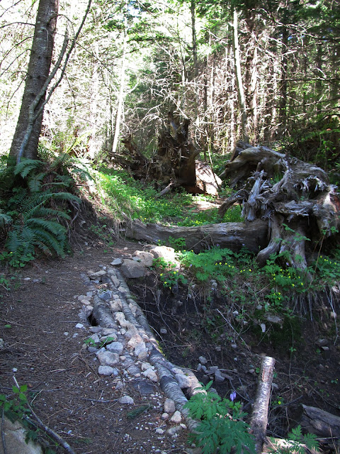
I think that's about where EP setup a camera, and we just walked on by, trying not to look at it. A bit farther down the (wrong!) road, we realized we were way off track. That was the day's first bushwrecking, as we fought our way 1/3 mile back 150' uphill through alder thickets, with a smattering of fresh devil's club mixed in.After a mile or so there's a much older, more grown-over road off to the right. It's the first side road since the TH gate. There were lots of pretty wood violets blooming, and at some point this section had some treadwork done.
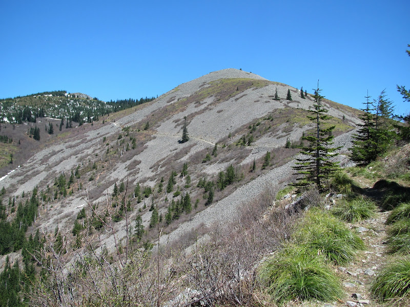
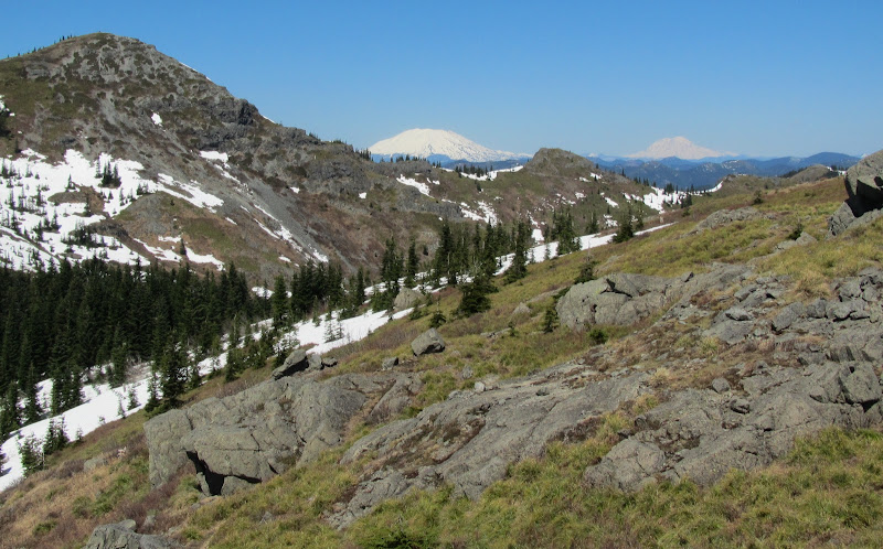
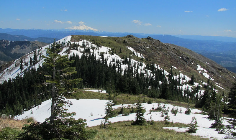
Once you start to break out into the open all the hard work and wrong turns are forgotten. Everybody takes this picture, because you can't not.
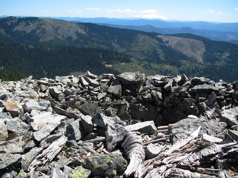
I owe that route to VanMarmot's recommend. It's a real winner! What's odd is, you can see some semblance of a trail from below, looking up. But on the way up... turns out it was just a mirage?!A lone hiker was heading down the face of the ridge as I was coming up the road, but he kept ridging it past the obvious connector spot so we didn't actually cross paths. But I was still really glad to have seen him, because I decided to head straight up the side of the ridge myself, rather than take the trail around. And I would never have kept going to that awesome little summit if I'd tried to find it by trail.
That's funny you saw folks around Pyramid Rock. (Unless it was us???) As far as we could tell, we were the only ones to wrap around that side of the ridge that day. The far side, from where you were, was a friggin' highway, though!I hung out here for a while, watching lots of people up on the Star 2 summit and along the trail to pyramid rock.
I should have done what Mayhem did and turned around. But it looks so easy and close. But the minute you drop over the backside you are in deep snow. And considering how many people I knew were ahead of me there were not nearly as many footprints near where the trail should be as I was expecting.
...
I went about another quarter mile from here. Hit the same lack of footprints and trail as previous reported, and finally decided to be smart and turn around.
But wait, what's that down below??? Footprints!
Your track was super helpful! I was intentionally staying on or as close to "trails" as I could since I was by myself and no one was likely to go looking for me til the morning if something went wrong. Since the trail wasn't always visible and the footprints didn't always go where I wanted, I just tried to trace your track against the topography in the tricky places.kepPNW wrote: And really happy to hear that track helped, at least a bit.
It happened about like this:But wait, what's that down below??? Footprints!
Heh, now I really wish you had a GPS! Would love to see where this all happened.
That's some really good route-finding!payslee wrote:Your track was super helpful! I was intentionally staying on or as close to "trails" as I could since I was by myself and no one was likely to go looking for me til the morning if something went wrong. Since the trail wasn't always visible and the footprints didn't always go where I wanted, I just tried to trace your track against the topography in the tricky places.kepPNW wrote: And really happy to hear that track helped, at least a bit.
Oh wow, that's about as nasty a place as there is up there, right now. It's bad enough without snow, but yeah, those woods are really tricky. We were definitely consulting our GPS's through there, to stay on course. And even at that, there was a lot of zigging and zagging to whack through the trees...payslee wrote:But wait, what's that down below??? Footprints!Where I dropped straight down the hill on the left is where I saw the footprints in snow. Couldn't have been more than 100 feet between the two trails at their closest.Heh, now I really wish you had a GPS! Would love to see where this all happened.