5.4.13 Land of the Mayhem Lost ...Without my Amigos :)

Re: 5.4.13 Land of the Mayhem Lost ...Without my Amigos :)
Setting your TR to music like that makes you my hero. Man, that takes balls. (Are we allowed to say balls on PH?)
-
Eric Peterson

- Posts: 4097
- Joined: May 11th, 2009, 5:39 am
- Location: Oregon
- Contact:
-
Eric Peterson
- Posts: 4097
- Joined: May 11th, 2009, 5:39 am
- Location: Oregon
- Contact:
Re: 5.4.13 Land of the Mayhem Lost ...Without my Amigos :)
Movie and pictures soon!!

Re: 5.4.13 Land of the Mayhem Lost ...Without my Amigos :)
Dude!! I think balls is fine & I'm no music buff but I think it is Loreena Mckennit the Mummers Dance.Chase wrote:Setting your TR to music like that makes you my hero. Man, that takes balls. (Are we allowed to say balls on PH?)
Shoe Shine Boy Has Left The Building!
Re: 5.4.13 Land of the Mayhem Lost ...Without my Amigos :)
Popcorn & Huge Beer or just little snack & tiny little sipper?Eric Peterson wrote:Movie and pictures soon!!
Shoe Shine Boy Has Left The Building!
Re: 5.4.13 Land of the Mayhem Lost ...Without my Amigos :)
Same thing. That's like trying to tell me there's a difference between Star Wars Episode 1 and Episode 2. I can't really hear the words you are saying.mayhem wrote:Dude!! I think balls is fine & I'm no music buff but I think it is Loreena Mckennit the Mummers Dance.Chase wrote:Setting your TR to music like that makes you my hero. Man, that takes balls. (Are we allowed to say balls on PH?)
Re: 5.4.13 Land of the Mayhem Lost ...Without my Amigos :)
Ok got it! But I can tell the difference between The Star Wars Episodes & can quote just about anything from either! I have no idea who Enigma Enya is thoughChase wrote:Same thing. That's like trying to tell me there's a difference between Star Wars Episode 1 and Episode 2. I can't really hear the words you are saying.mayhem wrote:Dude!! I think balls is fine & I'm no music buff but I think it is Loreena Mckennit the Mummers Dance.Chase wrote:Setting your TR to music like that makes you my hero. Man, that takes balls. (Are we allowed to say balls on PH?)
Shoe Shine Boy Has Left The Building!
-
Eric Peterson
- Posts: 4097
- Joined: May 11th, 2009, 5:39 am
- Location: Oregon
- Contact:
Re: 5.4.13 Land of the Mayhem Lost ...Without my Amigos :)
Probably baned in Germany already!

Re: 5.4.13 Land of the Mayhem Lost ...Without my Amigos :)
Since this is turning into "The TR of Record," I'll go ahead and throw up some photos here, too.
Our plan was to meet at the Pendleton Outlet in Washougal. EP was in text contact with mayhem, and we honestly understood him to be hopelessly lost, and destined not to make the meetup. With regrets, we went on.
We heeded VM's advice and went up the south ridge of Silver Star yesterday. This route was entirely clear of snow, until Pt4060, where we were just a bit over a half mile from the summit. We actually could've summited with less than a 1/4 mile of snow travel, but we sort of oddly headed off into the woods at one point, and boy was it deep in there!
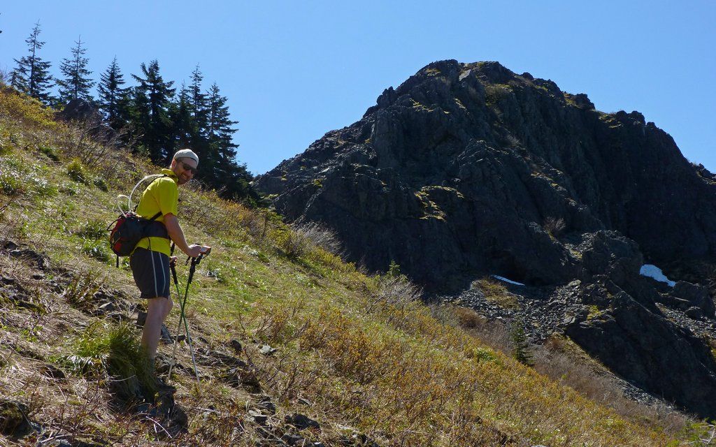
The south ridge trailhead is almost 700' lower than Grouse Vista, and offers about 2.33 miles of rocky jeep trail, climbing about 1750', before you enter the Yacolt Burn area. From that point on, you are seemingly above timberline, but only because for some reason the forest just hasn't regenerated in over 100 years. Navigation is all visual from there. We scrambled up the boulder knoll to the Indian Pits, then wandered along a few trails towards the summit, going cross-country at times too.
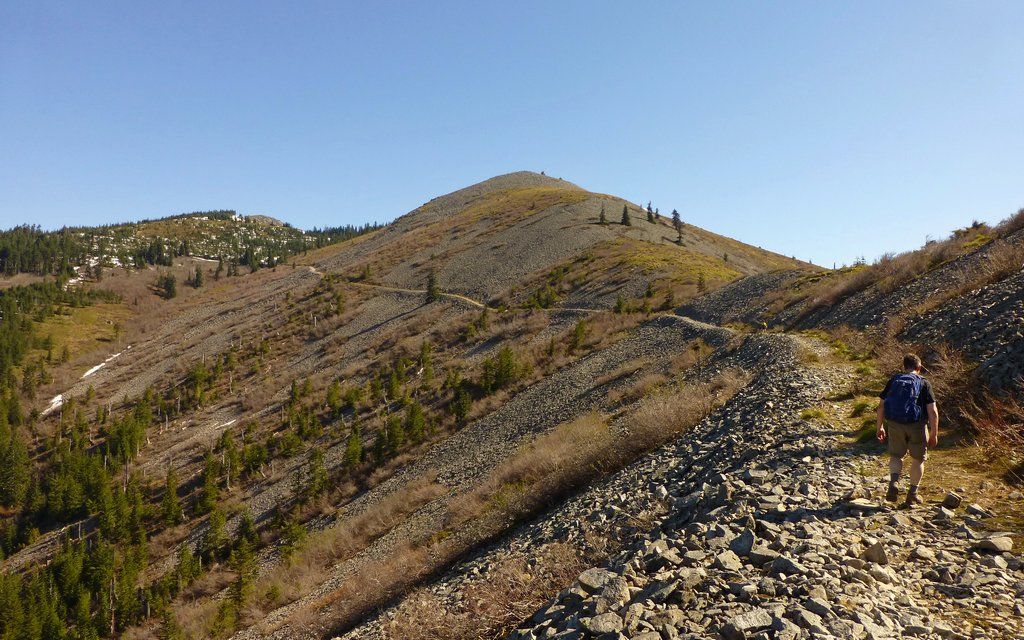
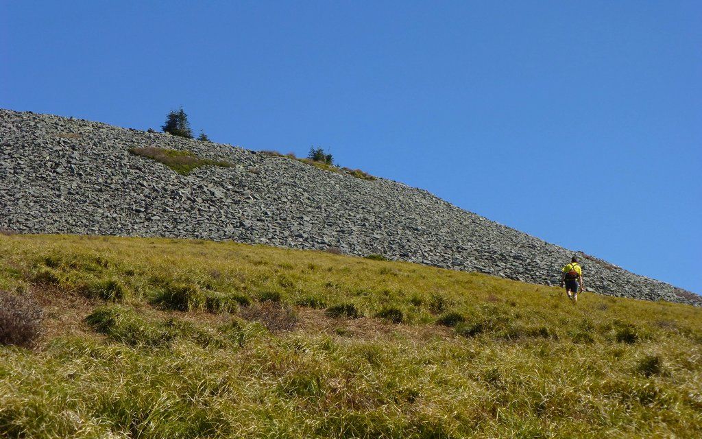
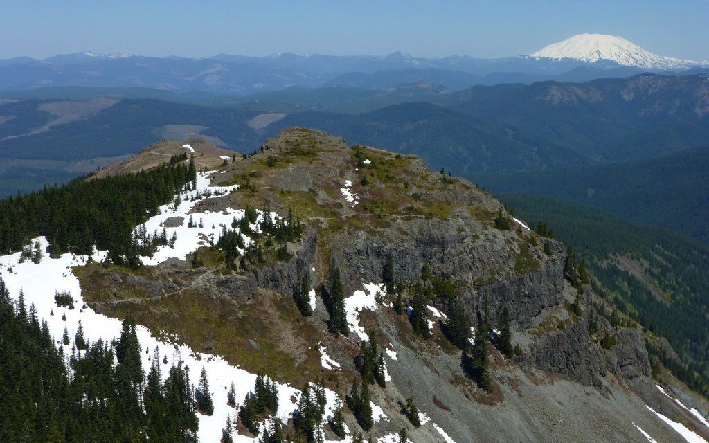
Completely snow-free south ridge. Indian pits atop knoll on right. Comfortable shoes required!
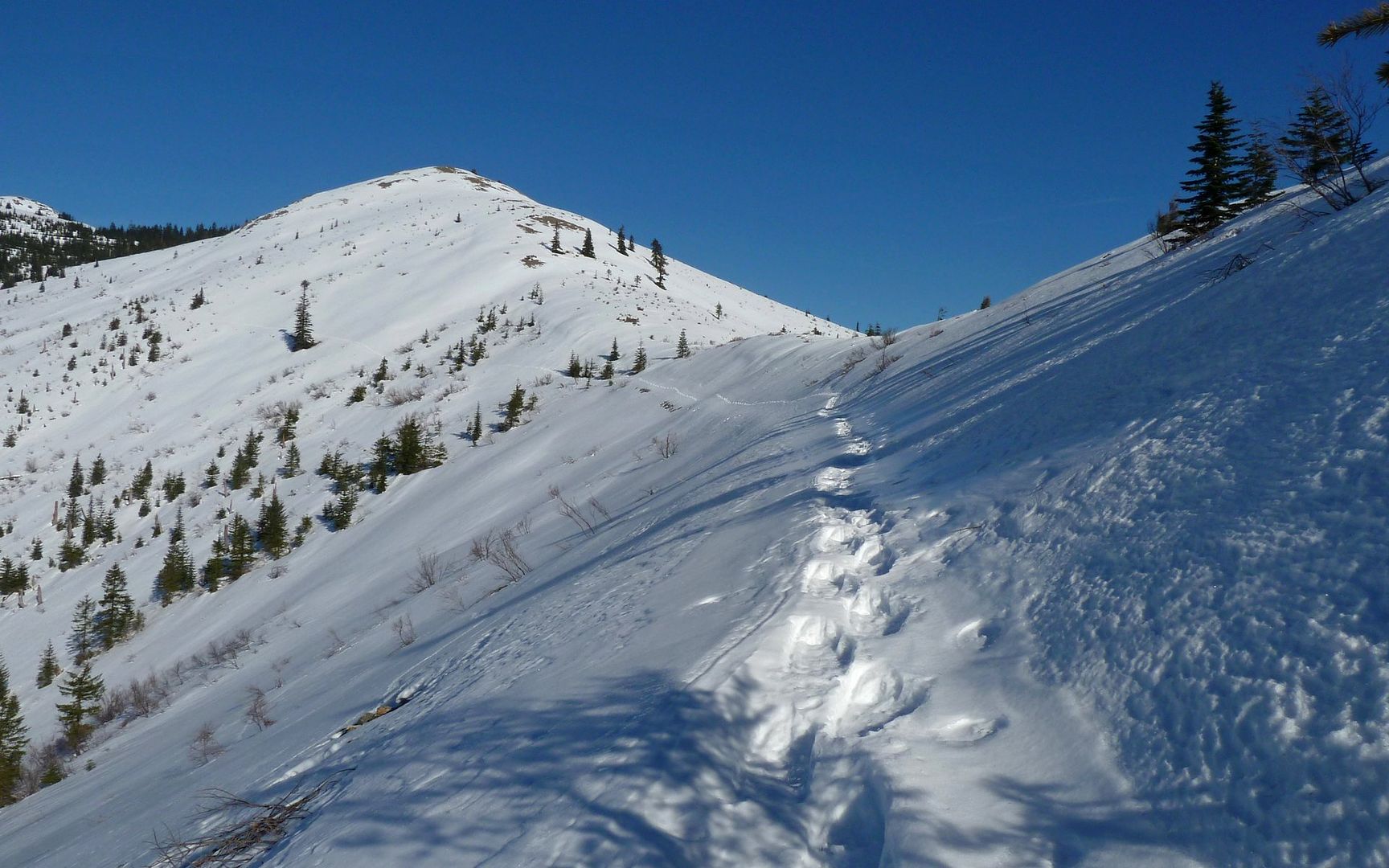
Same view, mid-January. Snowshoes required!
The first of many vision quest pits was just a few hundred feet from the main trail.
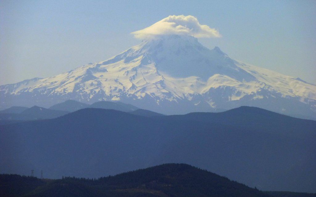
Mt. Hood was wearing a cap almost as fancy as EP's! It never developed into that totally classic lenticular, but was close.
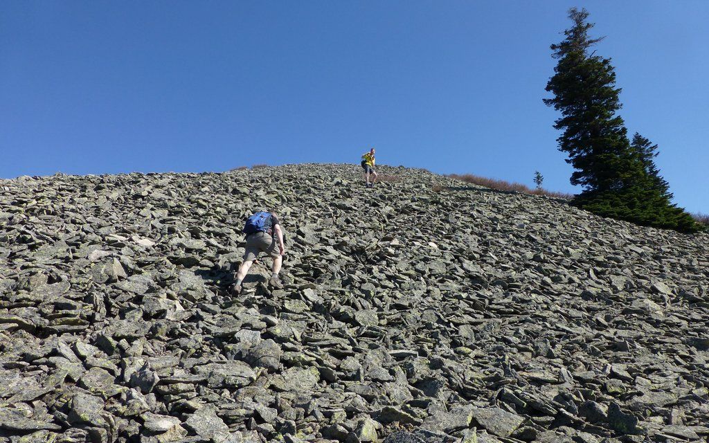
Sorta like Elevator Shaft, but clinkier. Actually the rocks are amazingly stable, and not too treacherous to navigate.
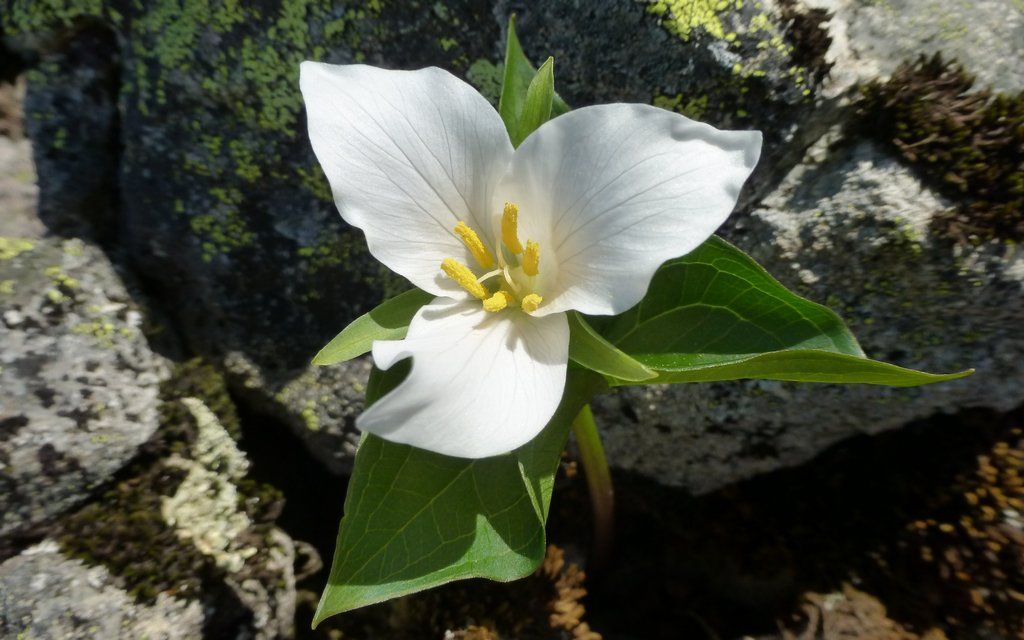
Not many flowers out yet, up on Silver Star, but there were a scattering of trilliums in the talus.
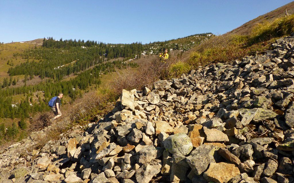
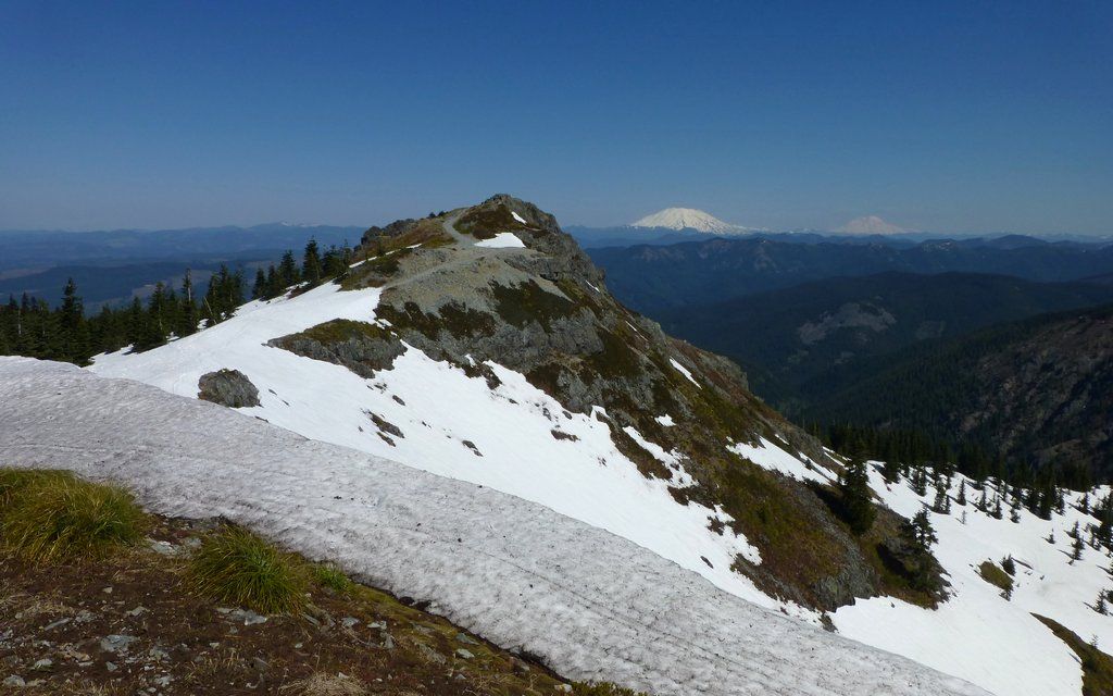
Scaling the Indian Pits hill, there are numerous "false summits," so just keep moving until it levels out.
Hard to convey the scramble from below, as well as from above. You really do just keep climbing and climbing, here.
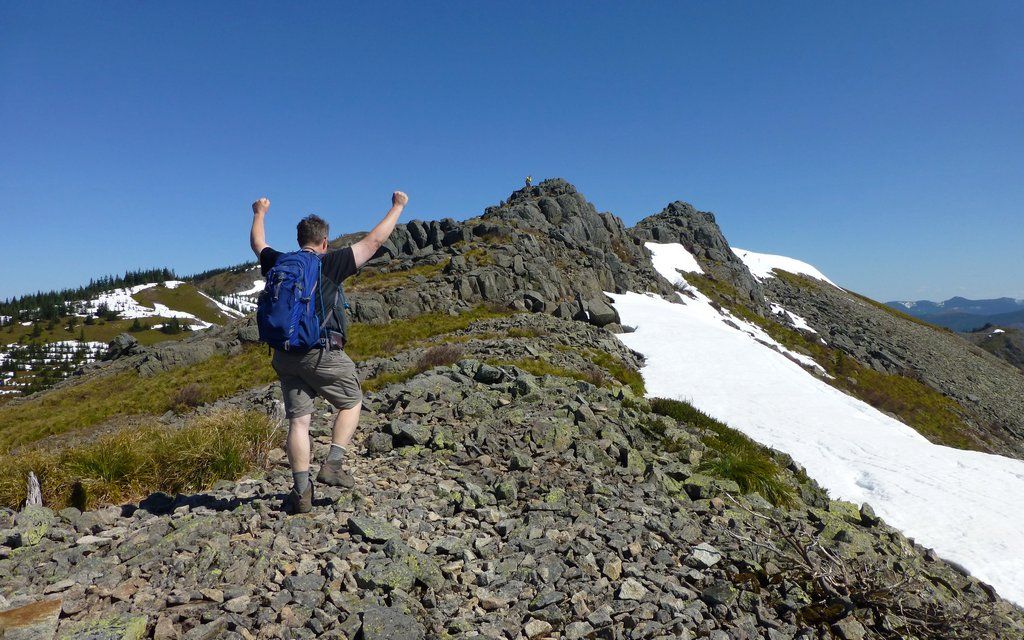
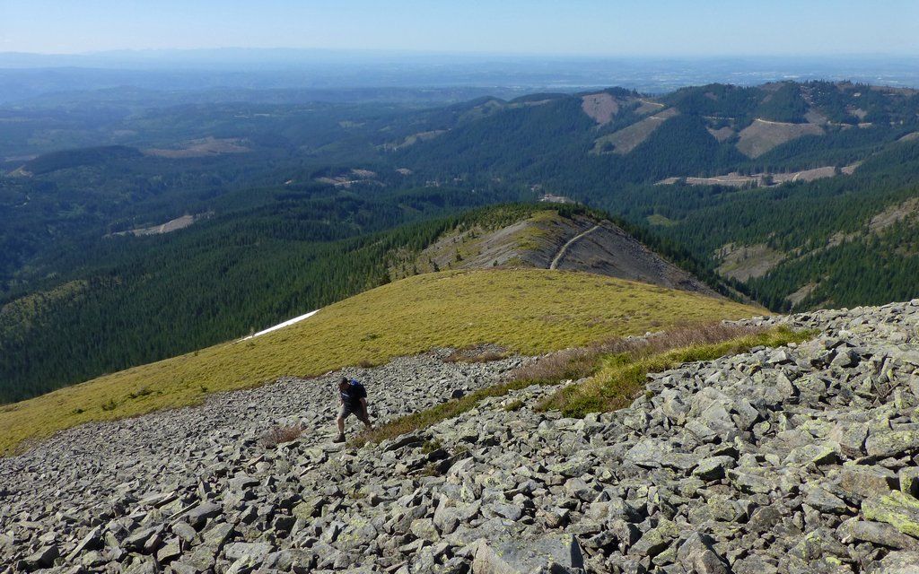
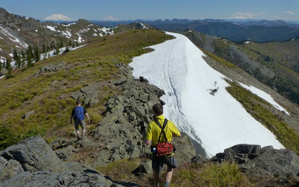
Worth It!!! The reward is absolutely breath-taking. The first of many summits today!
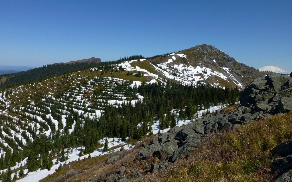
Love this view. Peaks include (l to r): Sturgeon Rock, Pt4060, Star 2, and Mt St Helens.
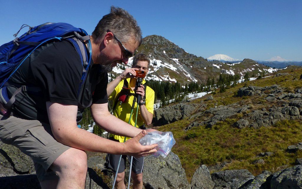
Tim found a geocache with a questionable Snickers and some other memories stashed away.
We pondered heading over to Little Baldy (point above EP) after the summit. Our ponderings provided endless amusement to one member of our party.
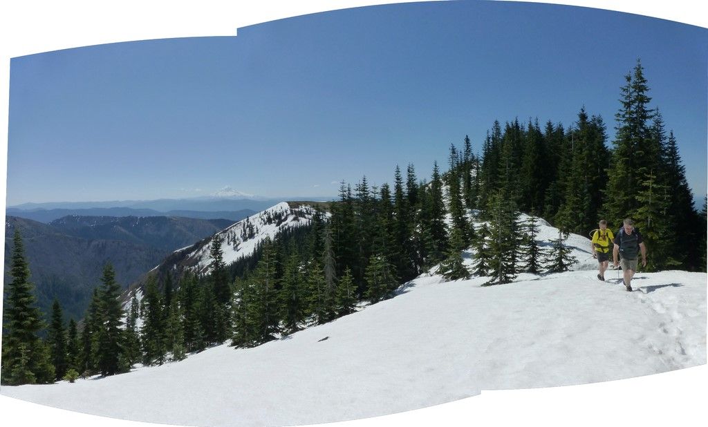
The ridge way over to Pt4060 provides sweeping views from Rainier to Three Sisters. Haze only allowed us to see to Jefferson today.
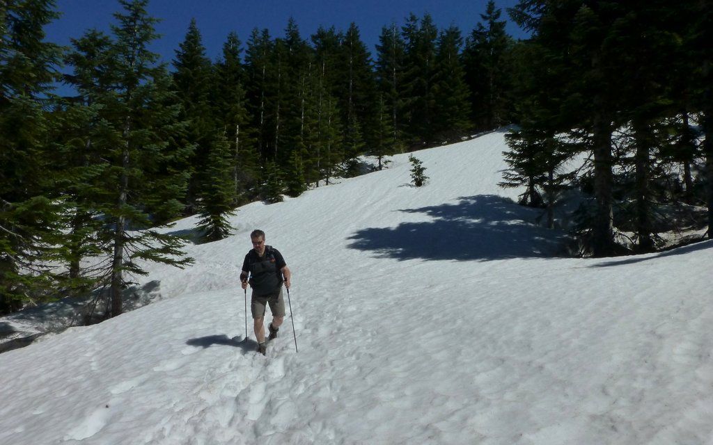
This was the deepest snow we had to deal with, on a route that tried to mostly avoid it. (Which we didn't, in the end!)
Highest point in Clark County!
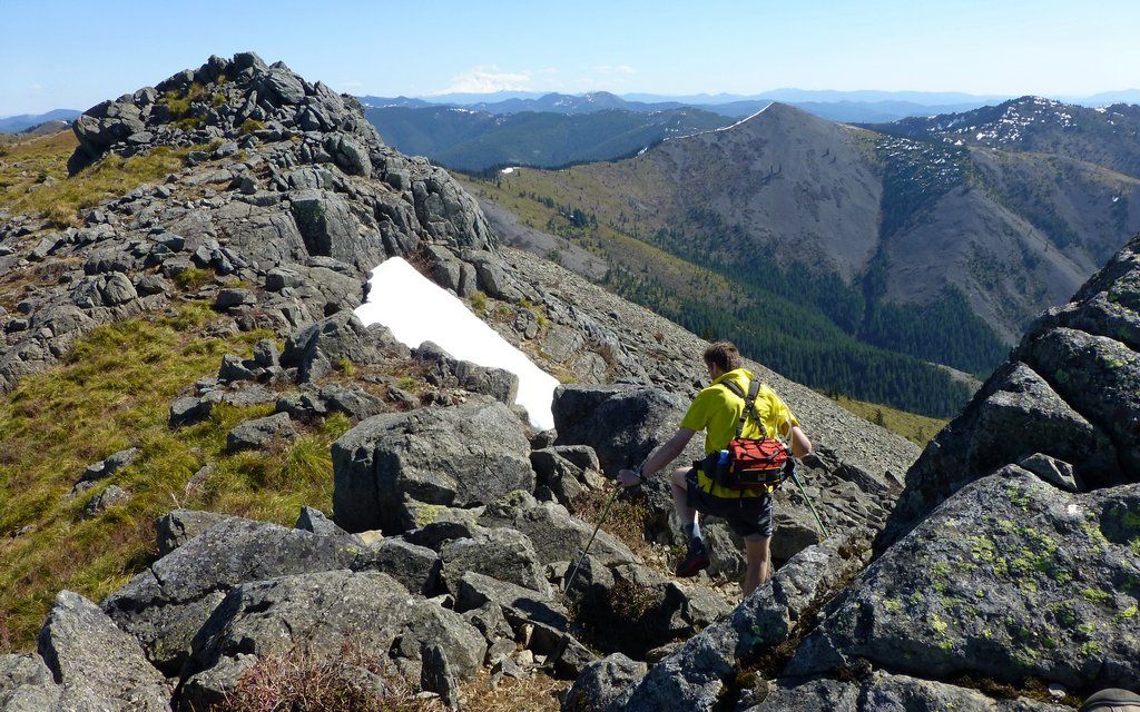
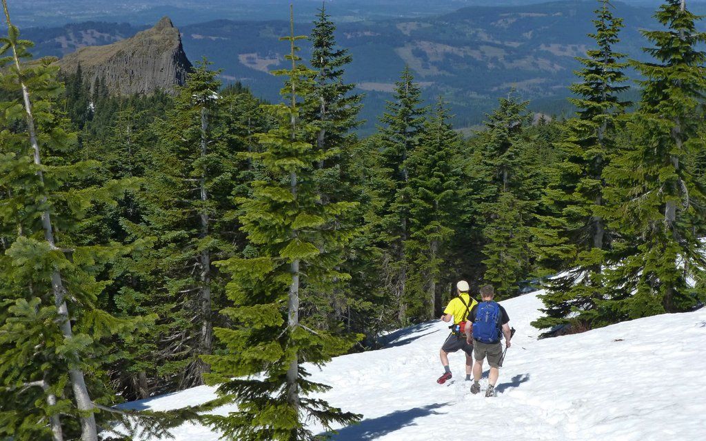
Screw the woods! Here's Tim making an escape over to the scruffy trail that leads straight up Star 2.
Pretty sure we were the first to summit yesterday? Or was, until mayhem reported meeting someone else coming down?
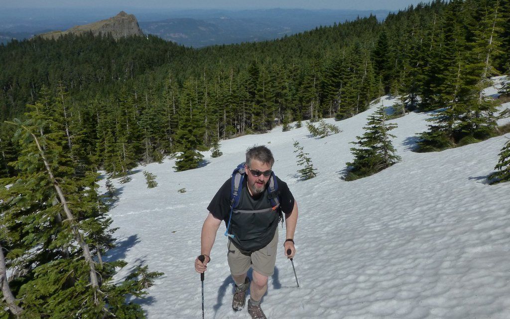
It was freakin' windy up there! Gusts over 50mph, for sure. Had to flip the hat back.
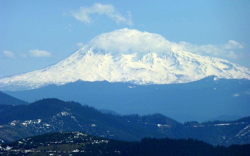
Adams was cloaked in a cloudcap, too.
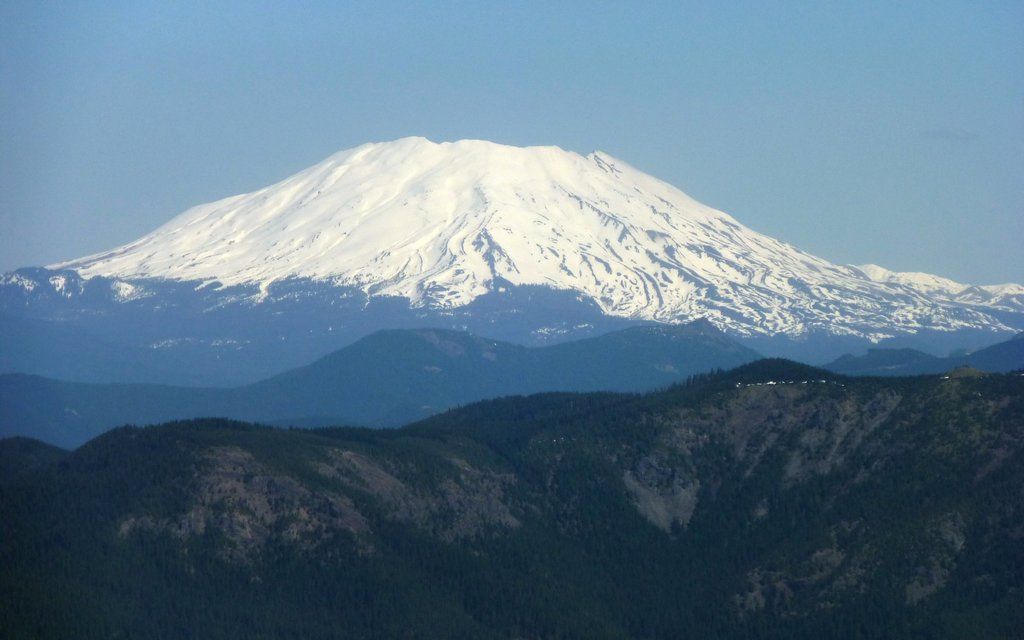
But it sure seemed to be a fine day to be climbing MSH!
Ed's Trail still looked a little dicey from just north of where it enters the forest. Probably okay?
We decided to take the highway back down towards Grouse Vista. Probably passed 50 people coming up!!!
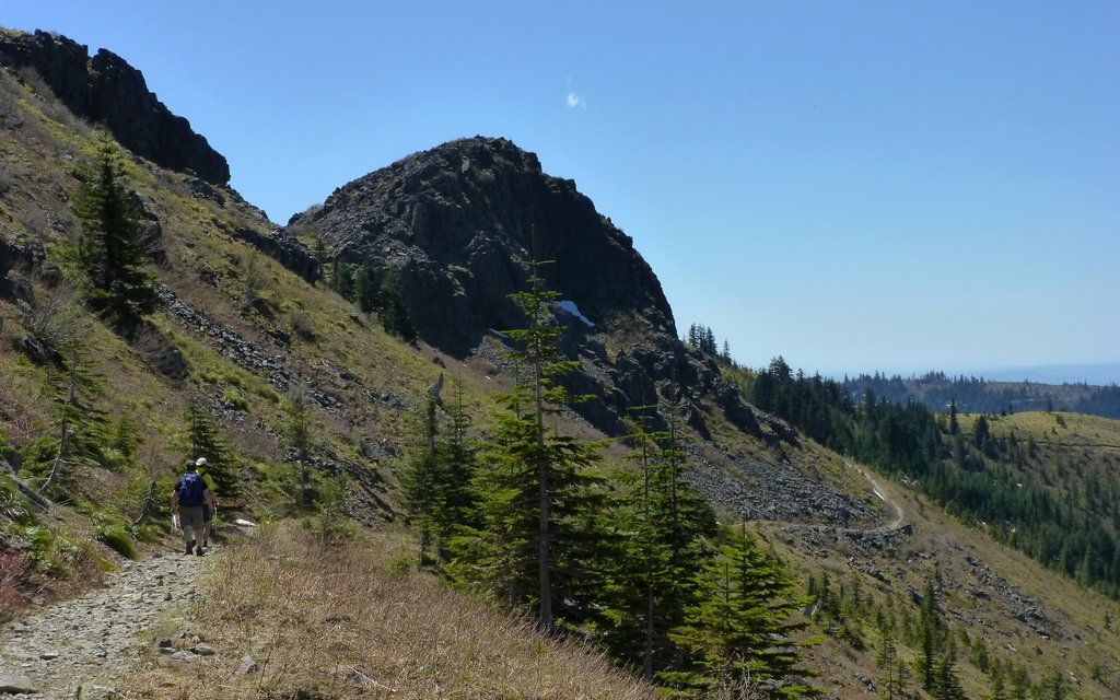
You really had to know where the 4-way junction was, if you were heading over to Sturgeon Rock.
After great and prolonged, toe-tapping debate, we determined we'd "wraparound" Pyramid Rock!
But EP got impatient and decided to head straight up from the west side of the ridge, while Tim and I completed the wraparound...

... and scaled the southeast side of the rock.
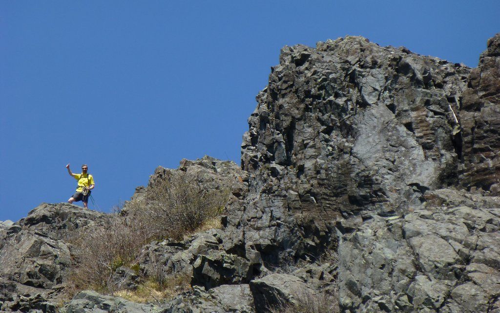
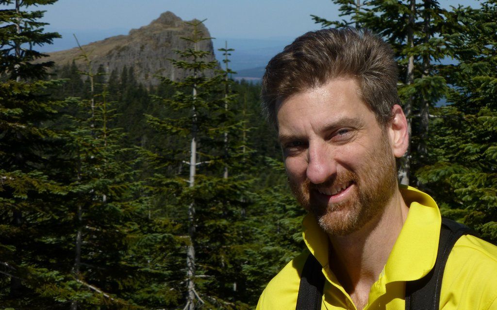
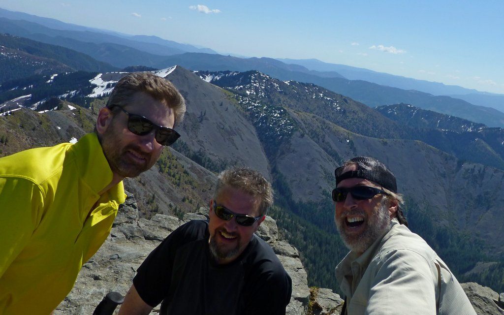
EP celebrating the Nth summit today.
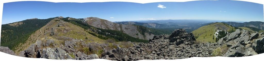
240°, 7-shot panorama from the top of Pyramid Rock. The gusts were now over 70mph!!!
Interactive version (zoom/scroll) on Photosynth.
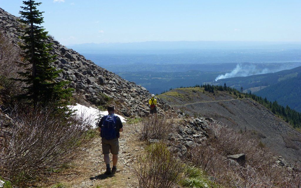
We continued up the east side of that ridge, then wrapped back around to the south ridge for our final, long, rocky descent.
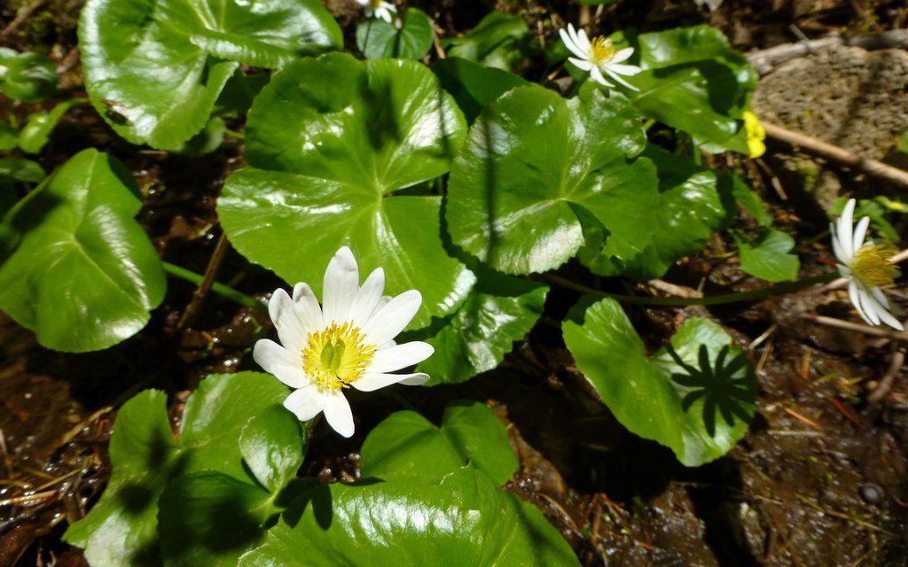
Any excuse to pause on that rocky road! No idea what this is? Was growing near a spring.
Our final stats were about 10.2 miles and roughly 4000' EG. (I swear, though, miles on SStar are harder than most!)
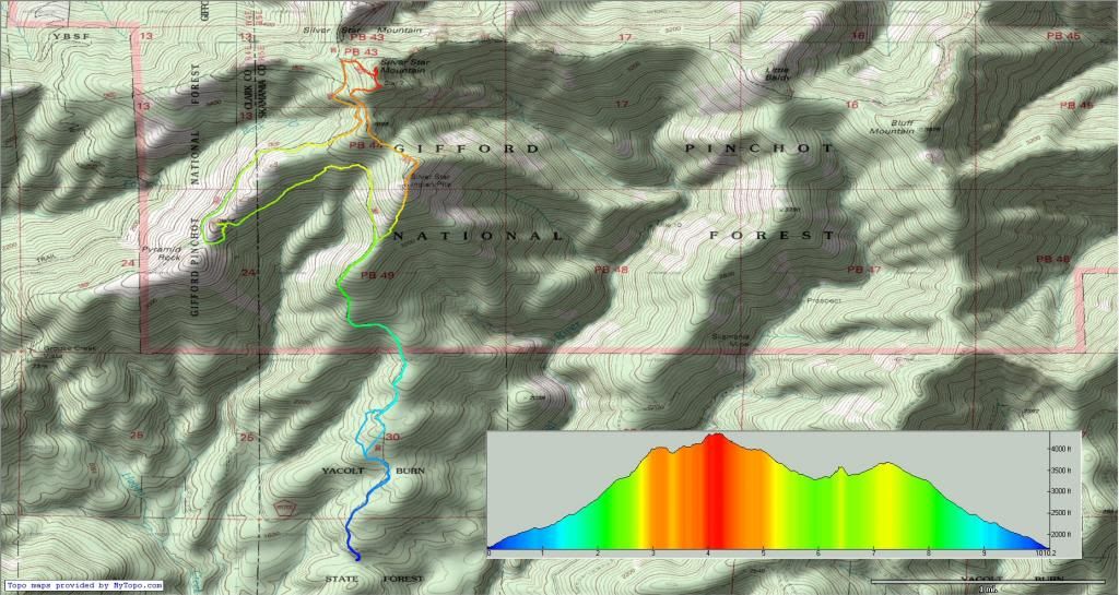
Click smaller version above to see full-sized map.
http://gpsfly.org/gps_map.php?gps_id=2363&w=645&h=440
Another great day in the burn!
Our plan was to meet at the Pendleton Outlet in Washougal. EP was in text contact with mayhem, and we honestly understood him to be hopelessly lost, and destined not to make the meetup. With regrets, we went on.
We heeded VM's advice and went up the south ridge of Silver Star yesterday. This route was entirely clear of snow, until Pt4060, where we were just a bit over a half mile from the summit. We actually could've summited with less than a 1/4 mile of snow travel, but we sort of oddly headed off into the woods at one point, and boy was it deep in there!
The south ridge trailhead is almost 700' lower than Grouse Vista, and offers about 2.33 miles of rocky jeep trail, climbing about 1750', before you enter the Yacolt Burn area. From that point on, you are seemingly above timberline, but only because for some reason the forest just hasn't regenerated in over 100 years. Navigation is all visual from there. We scrambled up the boulder knoll to the Indian Pits, then wandered along a few trails towards the summit, going cross-country at times too.
Completely snow-free south ridge. Indian pits atop knoll on right. Comfortable shoes required!
Same view, mid-January. Snowshoes required!
The first of many vision quest pits was just a few hundred feet from the main trail.
Mt. Hood was wearing a cap almost as fancy as EP's! It never developed into that totally classic lenticular, but was close.
Sorta like Elevator Shaft, but clinkier. Actually the rocks are amazingly stable, and not too treacherous to navigate.
Not many flowers out yet, up on Silver Star, but there were a scattering of trilliums in the talus.
Scaling the Indian Pits hill, there are numerous "false summits," so just keep moving until it levels out.
Hard to convey the scramble from below, as well as from above. You really do just keep climbing and climbing, here.
Worth It!!! The reward is absolutely breath-taking. The first of many summits today!
Love this view. Peaks include (l to r): Sturgeon Rock, Pt4060, Star 2, and Mt St Helens.
Tim found a geocache with a questionable Snickers and some other memories stashed away.
We pondered heading over to Little Baldy (point above EP) after the summit. Our ponderings provided endless amusement to one member of our party.
The ridge way over to Pt4060 provides sweeping views from Rainier to Three Sisters. Haze only allowed us to see to Jefferson today.
This was the deepest snow we had to deal with, on a route that tried to mostly avoid it. (Which we didn't, in the end!)
Highest point in Clark County!
Screw the woods! Here's Tim making an escape over to the scruffy trail that leads straight up Star 2.
Pretty sure we were the first to summit yesterday? Or was, until mayhem reported meeting someone else coming down?
It was freakin' windy up there! Gusts over 50mph, for sure. Had to flip the hat back.
Adams was cloaked in a cloudcap, too.
But it sure seemed to be a fine day to be climbing MSH!
Ed's Trail still looked a little dicey from just north of where it enters the forest. Probably okay?
We decided to take the highway back down towards Grouse Vista. Probably passed 50 people coming up!!!
You really had to know where the 4-way junction was, if you were heading over to Sturgeon Rock.
After great and prolonged, toe-tapping debate, we determined we'd "wraparound" Pyramid Rock!
But EP got impatient and decided to head straight up from the west side of the ridge, while Tim and I completed the wraparound...
... and scaled the southeast side of the rock.
EP celebrating the Nth summit today.
240°, 7-shot panorama from the top of Pyramid Rock. The gusts were now over 70mph!!!
Interactive version (zoom/scroll) on Photosynth.
We continued up the east side of that ridge, then wrapped back around to the south ridge for our final, long, rocky descent.
Any excuse to pause on that rocky road! No idea what this is? Was growing near a spring.
Our final stats were about 10.2 miles and roughly 4000' EG. (I swear, though, miles on SStar are harder than most!)

Click smaller version above to see full-sized map.
http://gpsfly.org/gps_map.php?gps_id=2363&w=645&h=440
Another great day in the burn!
Karl
Back on the trail, again...
Back on the trail, again...
Re: 5.4.13 Land of the Mayhem Lost ...Without my Amigos :)
Dang I was closer to you guys than I realized! It was you guys in the pits whole I was on the road talking to Rob! Kep can you send me the raw picture 8th one down ?
Bammm!

Bammm!
Last edited by mayhem on May 5th, 2013, 6:59 pm, edited 1 time in total.
Shoe Shine Boy Has Left The Building!