Sunday was supposed to be a fabulous day over on the east side. Neither Jim (Crusak) nor I had ever been to Coyote Wall, so we thought that'd be a good way to finally hike with each other a bit, after having hiked the same Double Dog Day together but separate. After pouring over trip reports here, and anything else was out on the 'net, we decided to do a nice little loop vibramhead had only recently posted to gpsfly. We'd heard, of course, of lots of trail work out there and thought that track not only looked interesting but also offered a lot of variety.
The basic idea was to meet at 8:30 (Lazy Sunday!) at the Coyote Wall trailhead, hike up through the Labyrinth, over to the Catherine Creek trailhead, northwest up the drainage before swinging back west across some broad meadows, then descending back down along Coyote Wall for the grand finale. So, in a nutshell, going counter-clockwise, (approximately) doing vibramhead's loop in reverse. Both of us felt this was an excellent choice, given how stunning that finale turned out to be!
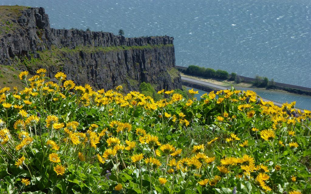
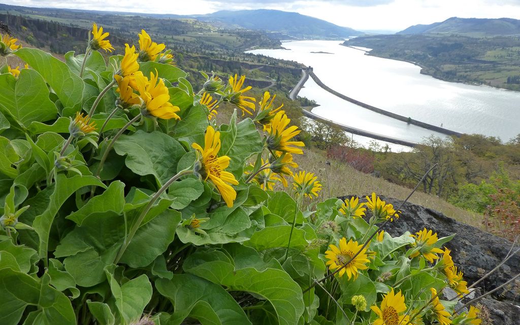
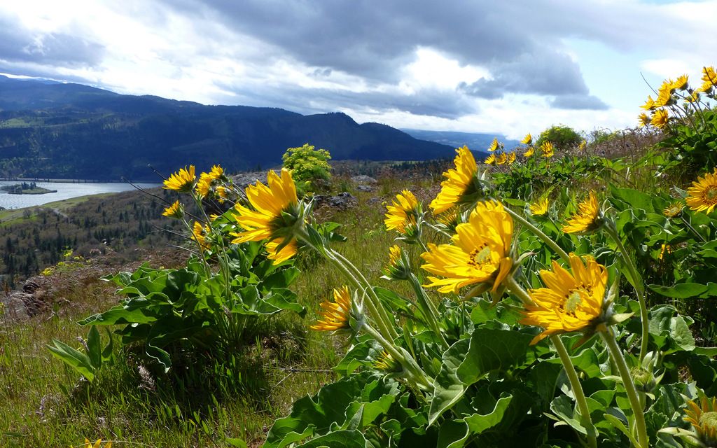
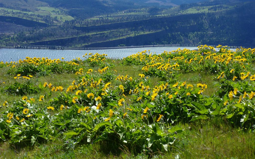
Starting out with the finish. Along the rim of Coyote Wall, the balsamroot was pretty prime!
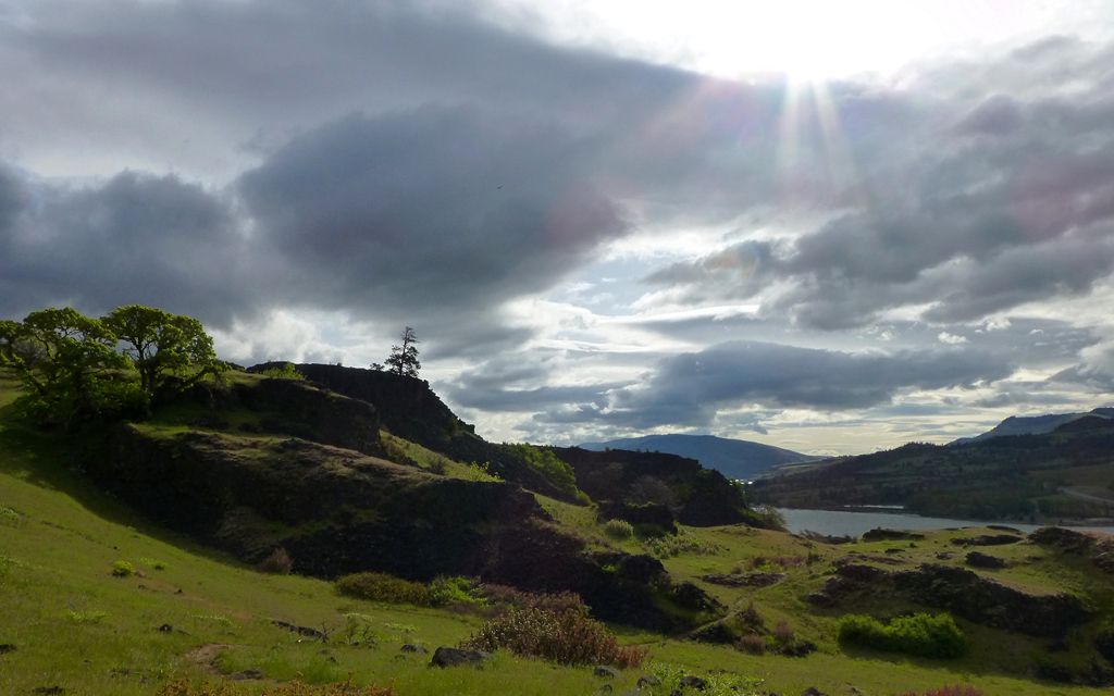
The day actually started out far more cloudy than forecast. We had only occasional sunbursts break through, during much of the morning. The Labyrinth was an intriguing place, and certainly worth being part of any agenda in this area!
Momentary sunbreak as we enter the Labyrinth - a series of rocky promontories the trail wends through.
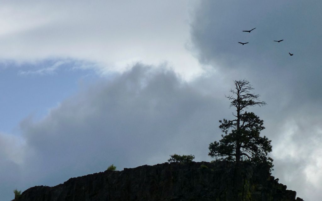
The turkey buzzards were having a great time, surfing the persistent westerlies.
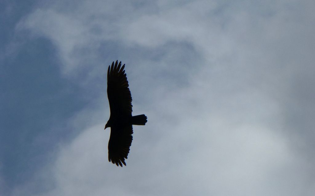
Up close.
Lots of scrub oak. (It wasn't really this dark, but sometimes the camera just "gets all artsy" on ya.)
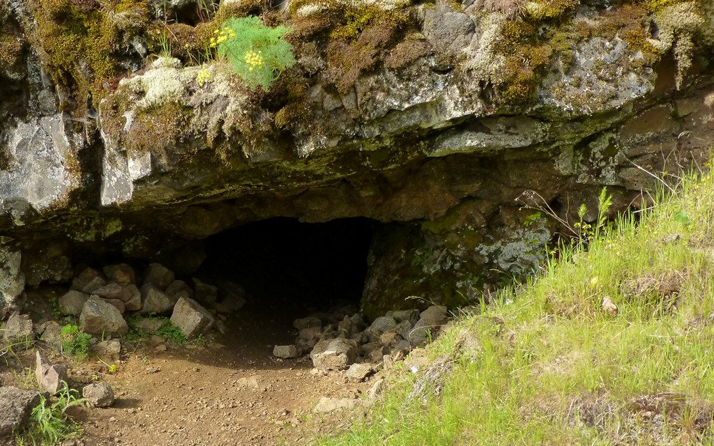
We passed a little cave, that seemed pretty deep. Neither of us felt much like finding out exactly how deep.
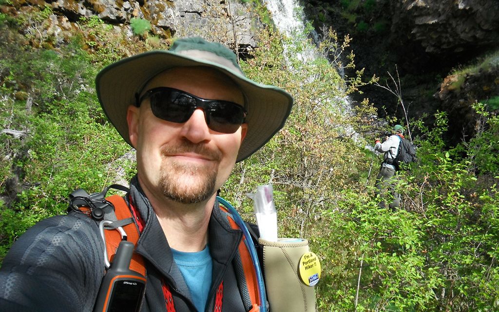
Jim's pretty good at taking self-portraits, but rarely posts them. (This is what happens when I get "voted" to do the TR!)
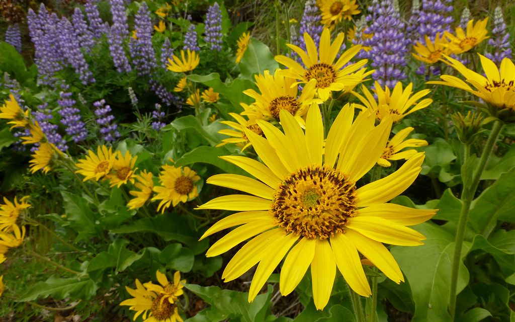
The lupine is just starting to kick into gear. The reddish three-leafed stuff, too!
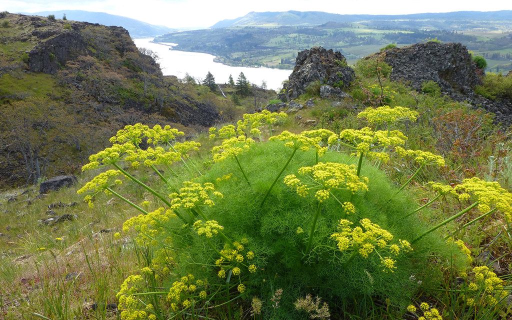
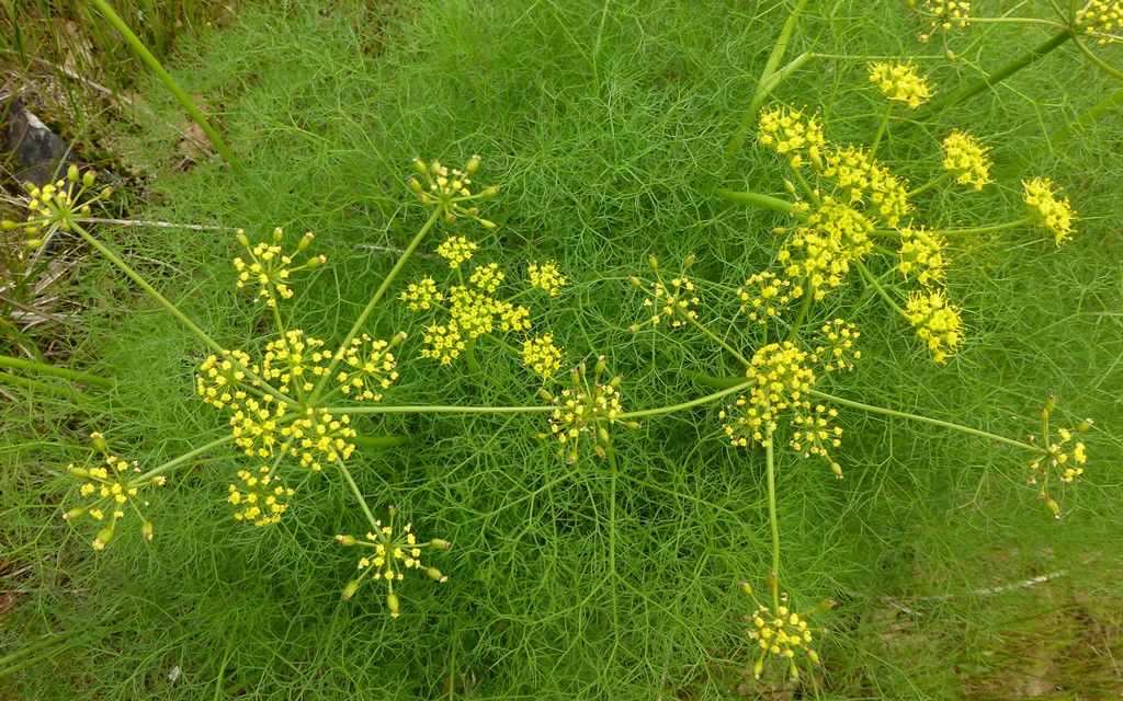
Lots and lots of that desert parsley stuff every here and there.
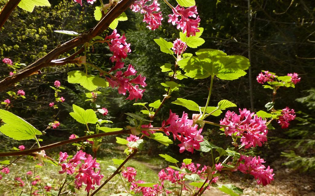
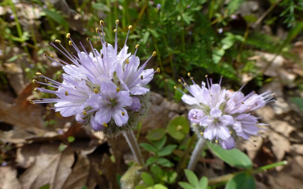
Then, there's what seems to be everybody's favorite... Just starting to 'splode all over!
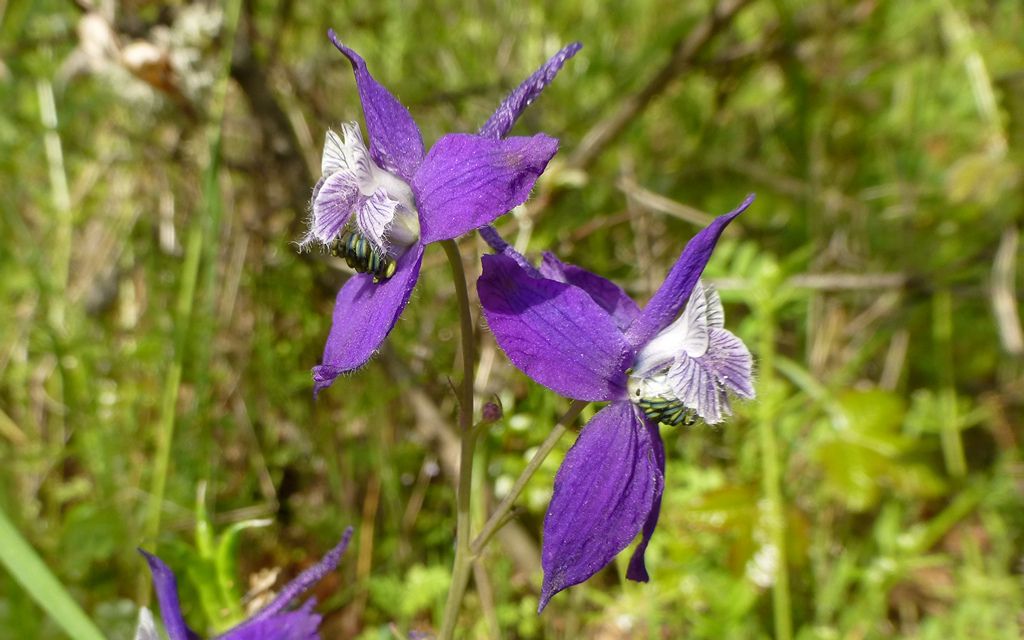
If you blink, you'll miss the little larkspurs popping up at the lower levels.
The high point on the trail over to Catherine Creek is only a bit over 800'. Of course, you give that all up, before climbing again.
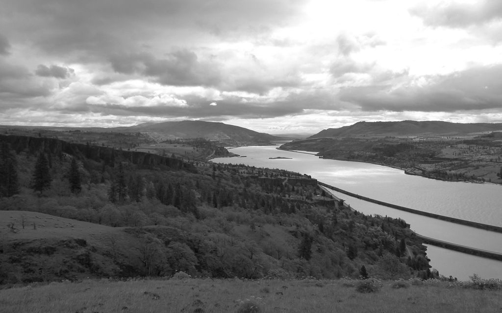
Tried the B&W mode on the camera, but honestly don't see any difference between this and just converting to grayscale after download?
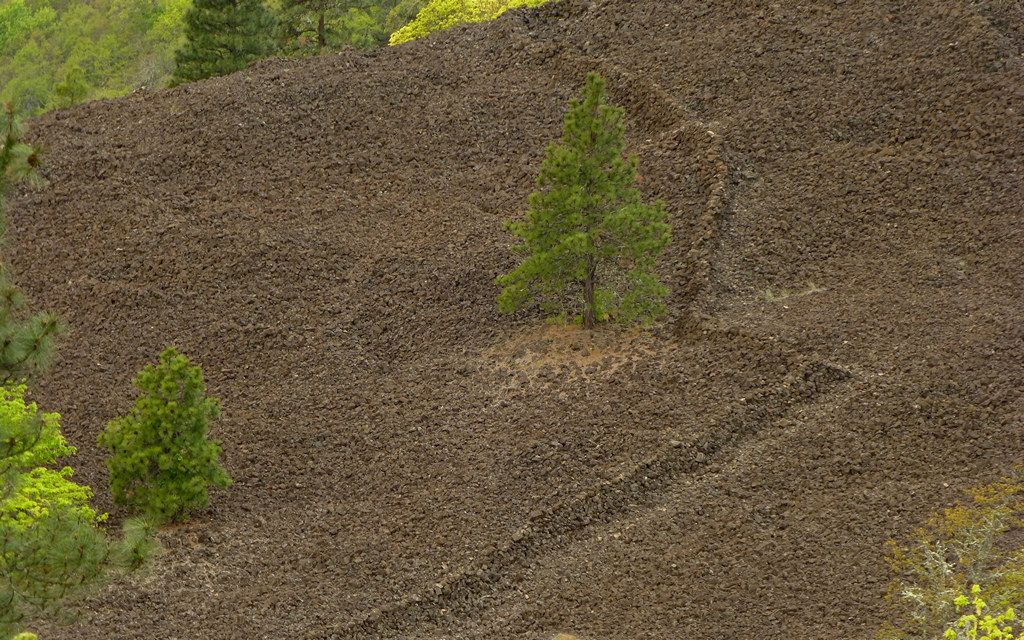
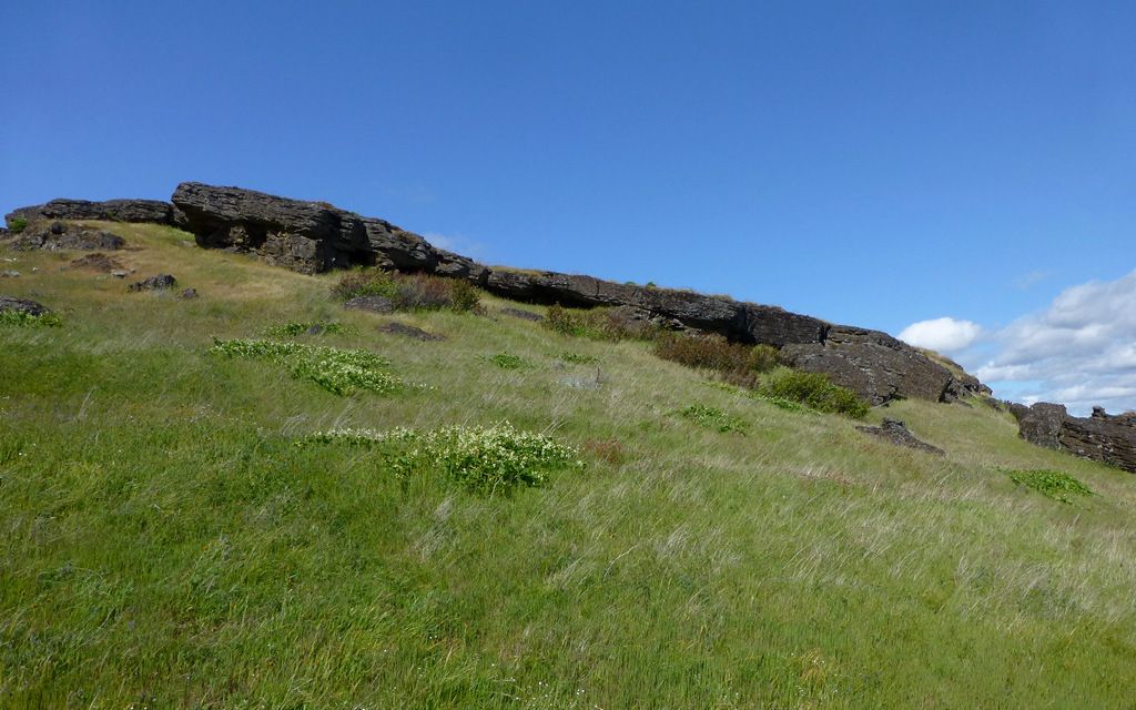
We passed within 100' or so of some vision quest pits, which were out in this boulder field. I was highly intrigued by the rock wall!
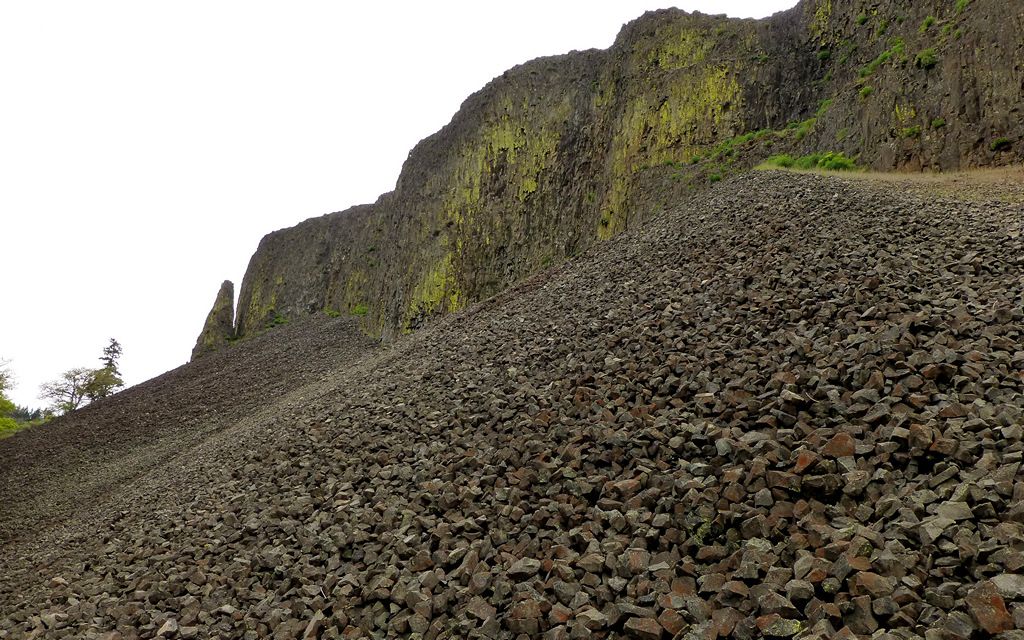
Where little boulders come from.
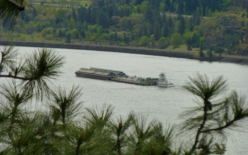
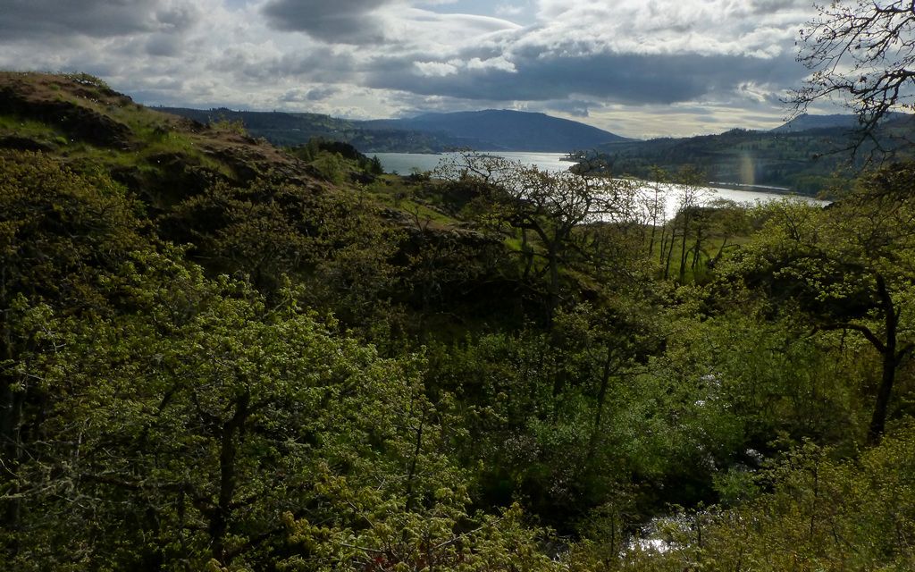
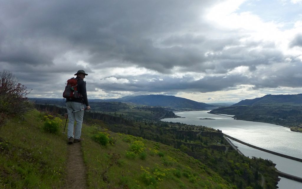
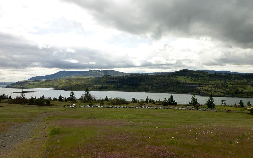
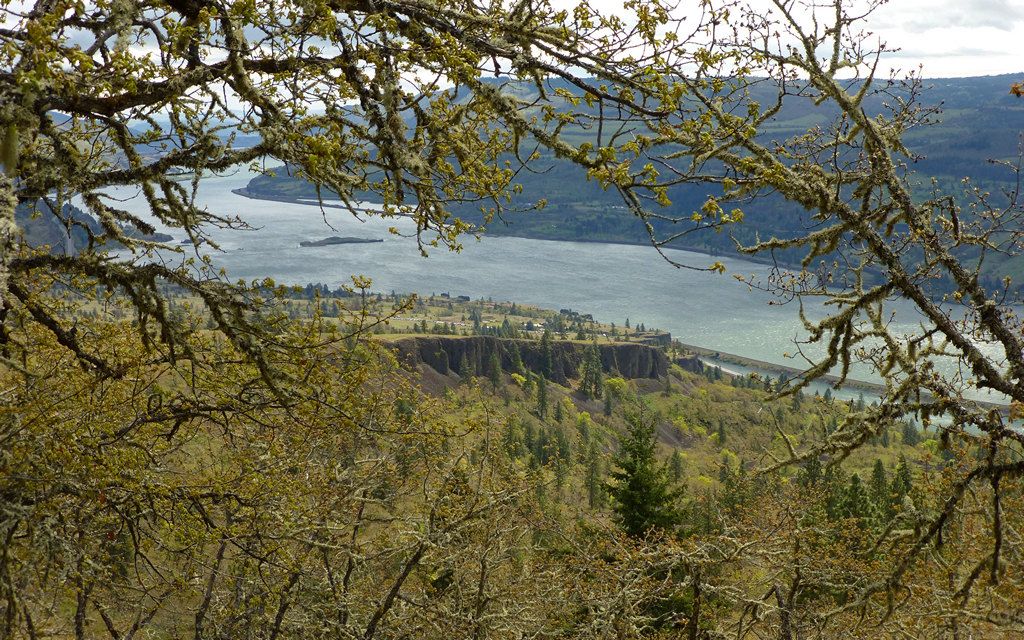
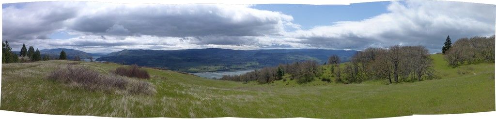
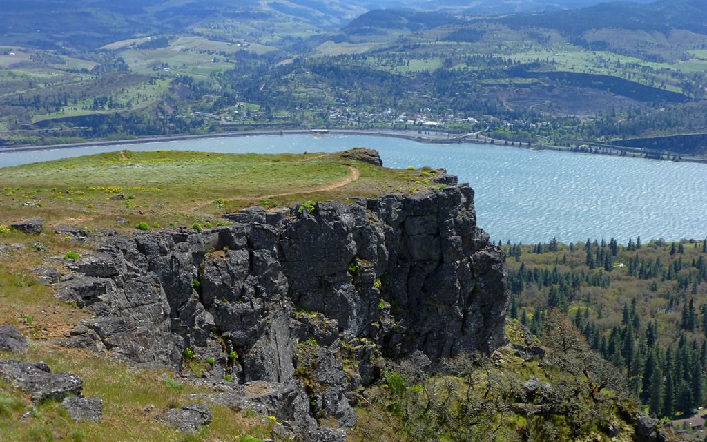
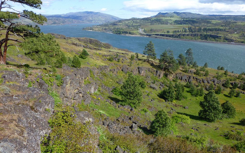
We held commanding views of the Columbia much of the day.
Descending to the Catherine Creek trailhead, we saw lots of very colorful little weeds in all directions. Most of these, I haven't a clue. A few, I'll try to label...
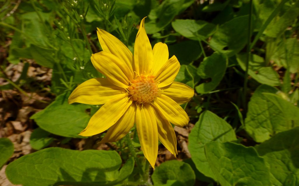
It'd just be gratuitous to label this one, right?
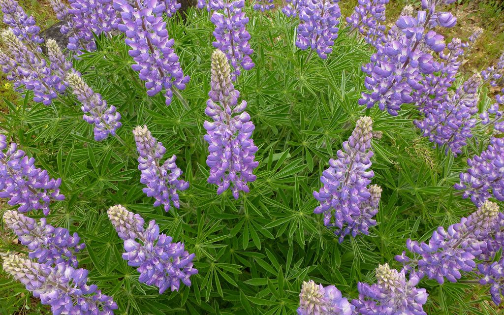
Loved the "burst" pattern of this little lupine bush!
No idea.
Not even very colorful, come to think of it.
Go Vikings! (It's okay, there's always next year.)
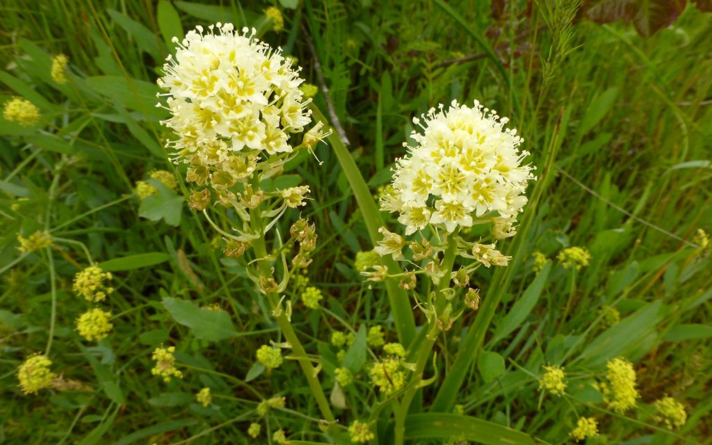
Frillier than desert parsley?
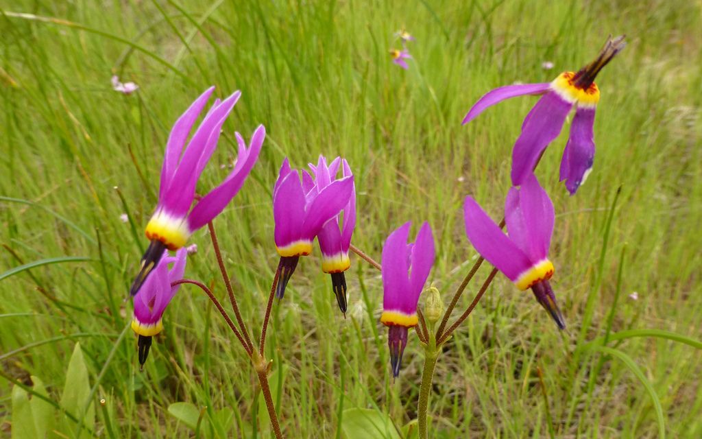
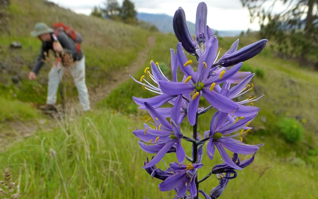
"What are shooting stars, Alex?"
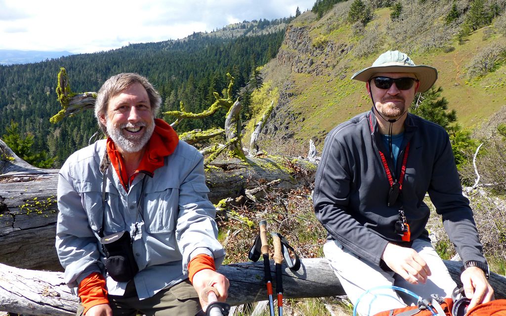
Group shot!
There were about 6-8 cars at our trailhead when we started. Catherine Creek, with its porta-potties, was crowded already!
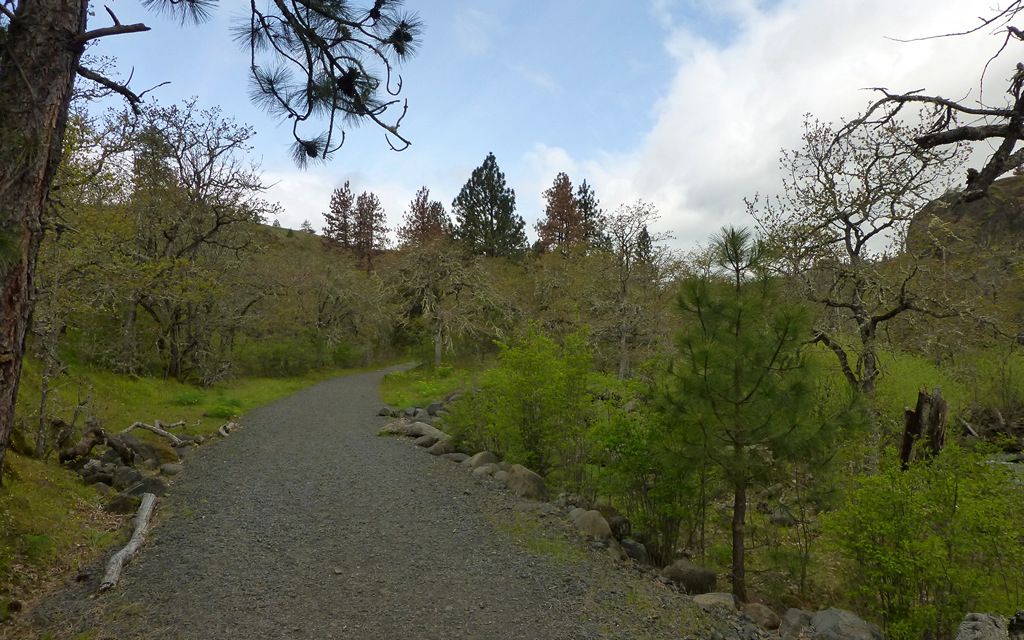
The "trail" northwest from Catherine Creek was actually a road. It got a good bit steeper (~17.5%) and less gravelly as we went.
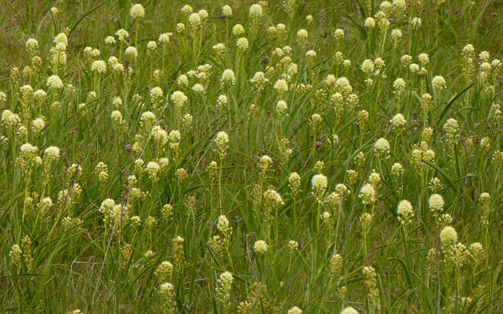
The forest changed from oak to Doug fir, and we saw these reddish pink things.
No idea. Some sort of dandelion from hell?
Cresting at around 1400', we were back in the scrub oak again.
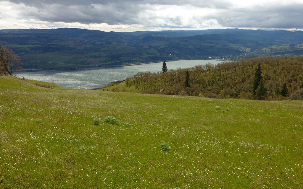
There were several largish groups of (6-10) folks picnicking across this meadow. Maybe we could've come straight up it, instead?
Another day.
Not too terrible of a pick-a-nick spot. A little breezy, and some light mist today, though. Probably more flowers in a week or three?
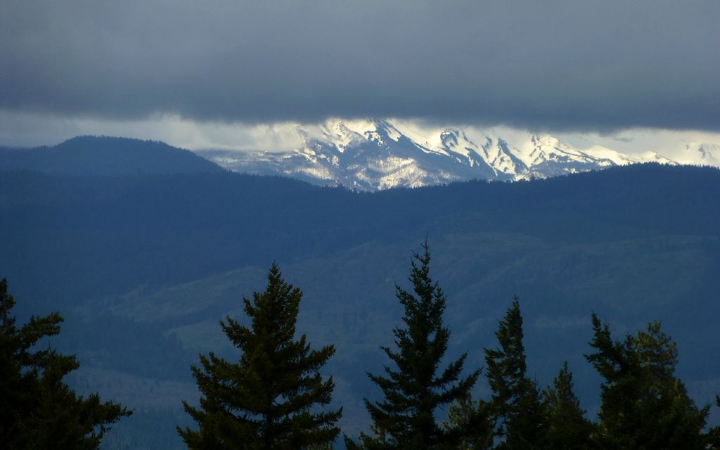
Totally Killer View of Mt Hood!
Crossing back along the top of this area, we did encounter a number of mountain bikers. But, to a one, they were all exceptionally polite. Could be that was only because we'd stepped out of their way? I dunno. But there ya go.
It does get hard staying off private property at the NW quadrant of this loop. In fact, I think we didn't quite succeed. Not that we didn't try! One trail we followed wasn't signed. Until we got to the other end. Damn.
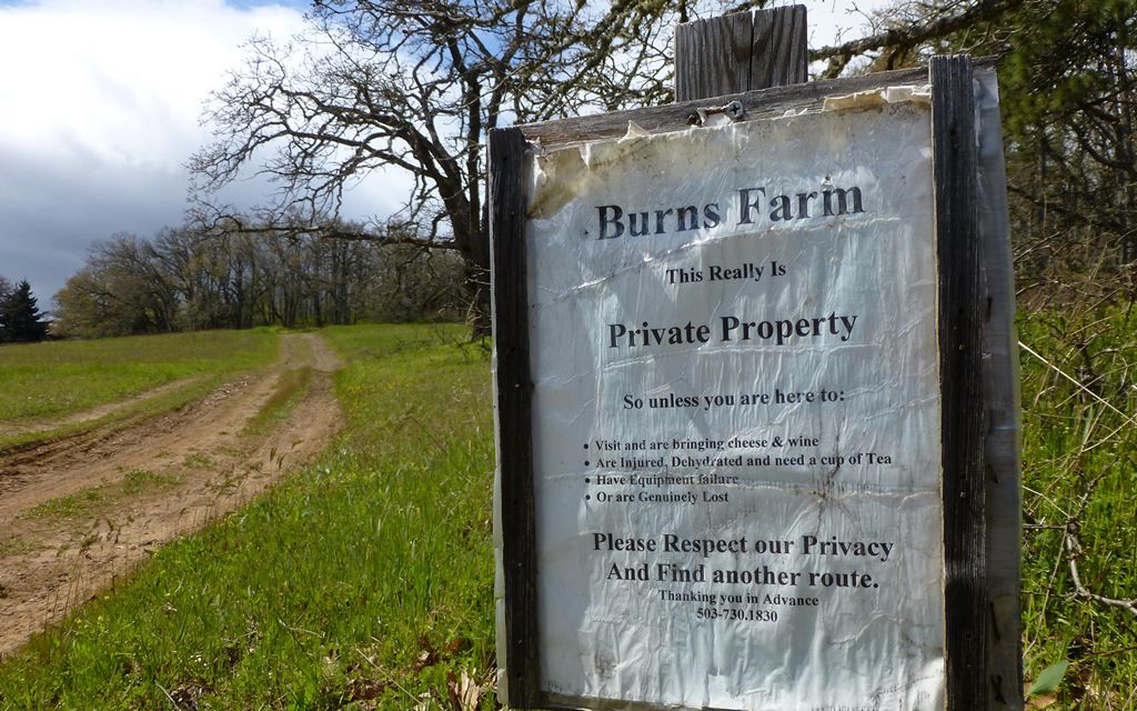
If you follow our track, go sharp left here instead of sharp right! At least the folks seem to have a sense of good fun about them.
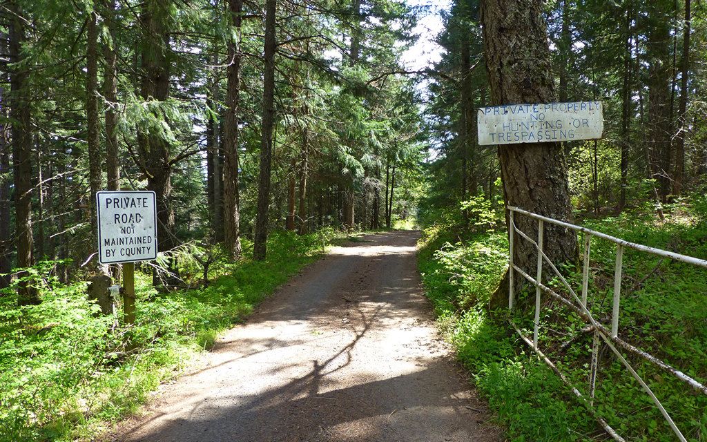
We had to turn around, from the way we had been going, to see these signs. Not cool.
The upper track follows unmaintained jeep trails through the forest. This was in the ditch.
We finally emerged at the top of Coyote Wall. The wind was howling, again. It was almost as fierce as on Slacker Butte, but more swirly and subject to change.
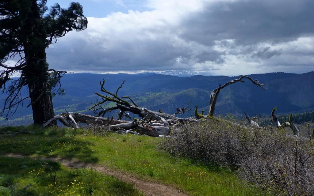
We took shelter behind this deadfall to enjoy a little lunch. Note killer view of Hood, had we been looking the other way!
Time to break out the StickPic. Hopefully, another movie may come of this. For now, just this lunch shot.
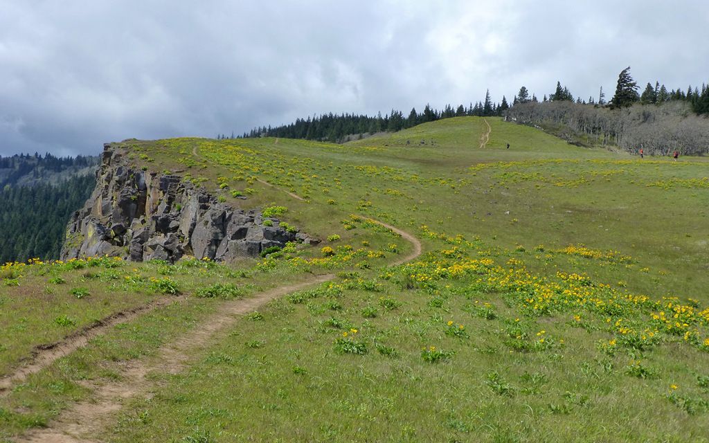
The last few miles down the edge of Coyote Wall was just a stunning grand finale for this hike! No need to narrate much here. Just soak in the balsamroot! (As long as you go in the next week or two.)
Crazy bike trail along the lip.
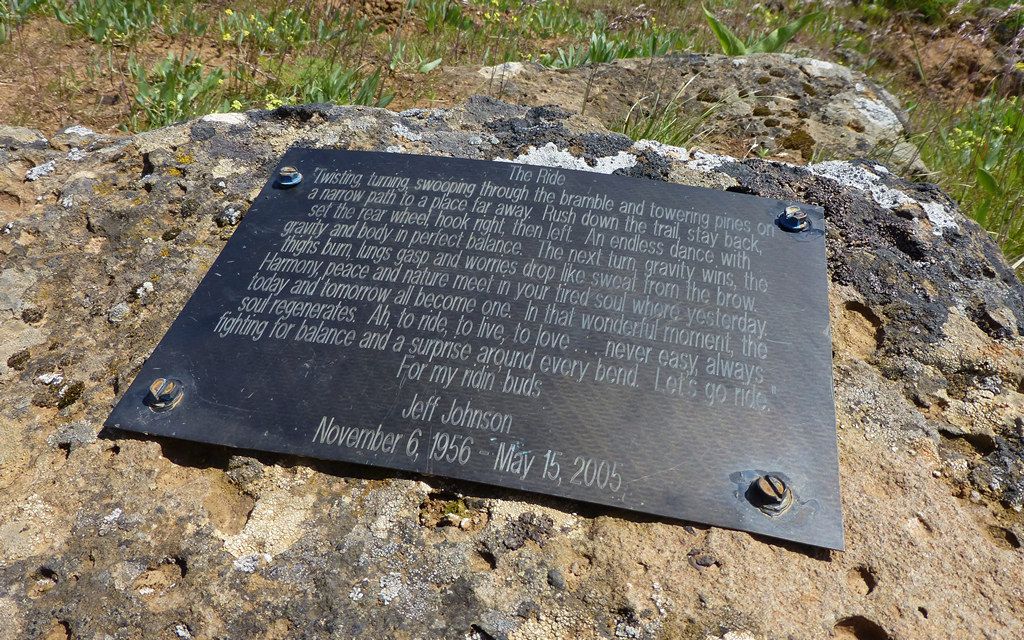
Memorial to a crazy biker. (One must presume.)
Blowin' in the wind!
Poles advised. The wind will knock you over here if you're offguard.
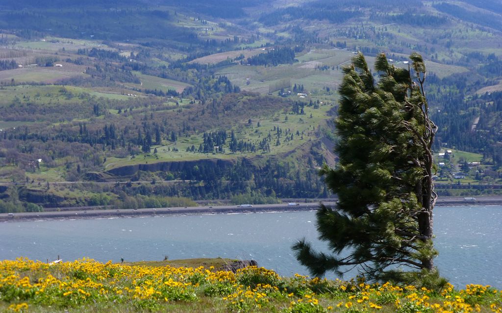
Consider what the wind has done to this tree!
Very cool syncline on the Oregon side, highlighted wonderfully at this sun angle.
Looking back up the wall. Standing too close, when a good swirl hits... oh boy!
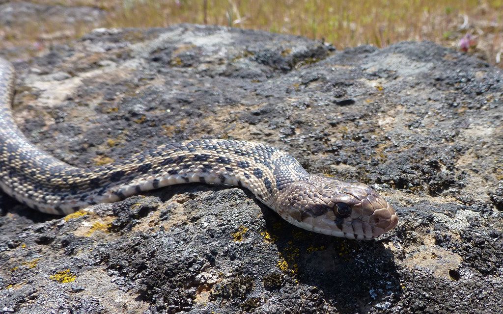
Jim stepped right over this guy. He was none too happy, but it did get him to move out of the trail and onto this nice hot rock.
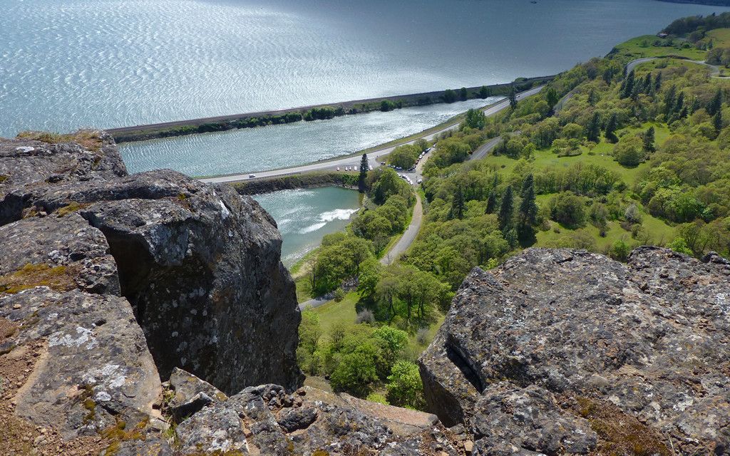
The turnout onto Courtney Road, for the trailhead (below), is actually very well signed.
Really turning into a darn nice day, as we wind down to the finish of our loop!
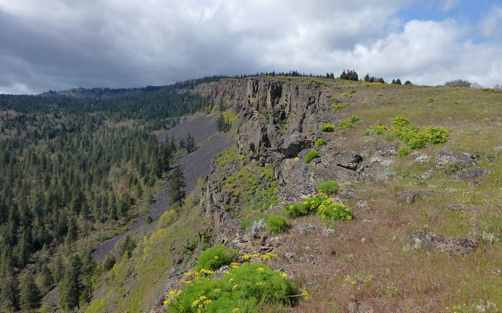
Rimrock's cool. In a deserty-sorta way.
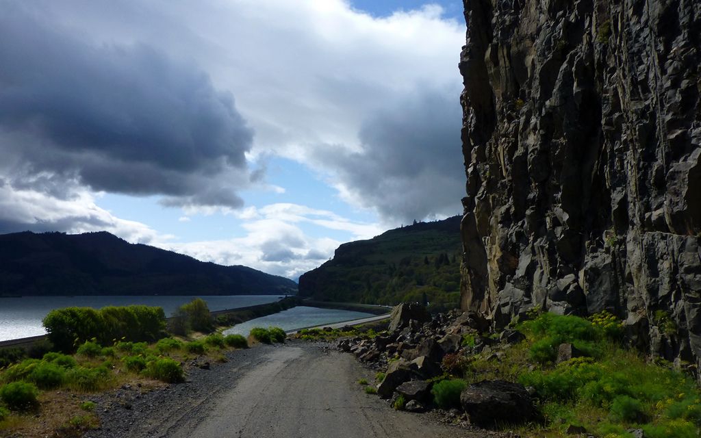
The old highway, back to the trailhead. Closed for good cause, clearly.
Altogether, this (highly recommended) loop and it's little deviations, were about 13 miles and 3600ish feet of EG.
Right-click, "View Image", for full-sized map.
http://gpsfly.org/gps_map.php?gps_id=2330&w=645&h=440
Another great (dry!) day in the desert!
Labyrinth to Catherine Creek to Coyote Wall , 21-Apr-2013
Karl
Back on the trail, again...
Re: Labyrinth to Catherine Creek to Coyote Wall , 21-Apr-201
That is a great loop and this is a great time to do it, Lyme Disease or no!
Looks like you took The Way of the Skull:
Re: Labyrinth to Catherine Creek to Coyote Wall , 21-Apr-201
Nice!! I cannot wait to see the video! The pictures make it seem all calm and nice Great to guys were able to hook up on a hike.
Isn't there some Kangaroo bones hanging from a tree out there too? Bobcat probably knows?
Shoe Shine Boy Has Left The Building!
Re: Labyrinth to Catherine Creek to Coyote Wall , 21-Apr-201
Great TR as always Karl. So jealous of the snakes you keep seeing. I have been trying to figure out for sure what hike I want to do out that way tomorrow, so this is for sure an idea to ponder...
Hannah
Only those who will risk going too far can possibly find out how far they can go.
-- T.S. Eliot
Re: Labyrinth to Catherine Creek to Coyote Wall , 21-Apr-201
Bobcat, "The Way of the Skull!"??? How cool is that?! I'm not sure how, but we missed that too! Somehow, we also walked right past the vision pits, even though we had each entered waypoints for them. I think it was just too fun getting to know one another, while enjoying all the most obvious scenery, to really take the time to notice quite everything offered.
Mayhem, it's a plan! I forgot to add, we ran into Helen (another PHer) and friend (sorry! name escapes!) going up, while we were on the way down that wall. They asked us how the heck we managed to stay standing, as they had watched us descend from below. The raptors were having a grand ol' time! The rest of us got by.
Hannah, just do it! It really is a nice area, and incredibly diverse. I think you could cut a tiny bit off that loop by following the meadow straight up, a bit west of the road we took. And staying on public land would've trimmed another mile, probably, too. Heh... Both those (shorter) options may have been a tad more scenic, if less different. Should be a gorgeous day! (PS-Good to see ya back out again!)
Thanks, folks!
Karl
Back on the trail, again...
Re: Labyrinth to Catherine Creek to Coyote Wall , 21-Apr-201
Thanks for shouldering the weight of doing the TR, Karl!
Something that KepNW left out of the story: he hiked 22 miles on Saturday, then joined me on Sunday for 13 more miles of hiking! Way to go, Iron Man!
I was so impressed with this area. It was much larger and grander than I expected. The variety of flowers, trees and terrain was really cool. In one canyon you're surrounded by evergreens and alders, but over the next hill you encounter oak trees (and poison oak). Mix in the interesting geology and it's well worth the drive. In a week or so the flowers should be even more awesome, I think.
This was a very good day on the trail. The grand finale of hiking the rim with that crazy wind was a nice bonus, as was seeing Helen and Molly out there, all smiles and enjoying the day like we were. For me it was good to finally get out further east than Mt Defiance in the Gorge for a hike. The experience definitely did not disappoint!
LOL I nearly stepped on that snake. Didn't even see it. I was plodding along and Karl spotted it slithering away from my size 12's.hlee wrote:Great TR as always Karl. So jealous of the snakes you keep seeing. I have been trying to figure out for sure what hike I want to do out that way tomorrow, so this is for sure an idea to ponder...
Re: Labyrinth to Catherine Creek to Coyote Wall , 21-Apr-201
I see that little downward "spike" in your route, right above the word "Rowland". Finding that connection up through the wall to connect back into Catherine Ck is not easy if you're not used to it. There are in fact two routes there, about 5 minutes apart. But it does look like you got the grand tour.
After some earlier explorations farther up that always lead to private properly, I now tend to stay lower down and on public land.
Re: Labyrinth to Catherine Creek to Coyote Wall , 21-Apr-201
Fantastic pictures Karl! Even better than usual...
Some people are really fit at eighty; thankfully I still have many years to get into shape…
- Splintercat
- Posts: 8334
- Joined: May 28th, 2008, 10:03 pm
- Location: Portland
- Contact:
Re: Labyrinth to Catherine Creek to Coyote Wall , 21-Apr-201
Ditto on your photos, Karl -- excellent DOF and focus on those flower shots..! I'm amazed you could get those with all the wind on Sunday..! Beautiful!
Tom
Tom
Re: Labyrinth to Catherine Creek to Coyote Wall , 21-Apr-201
Jim, what can I say? I really had a great day out there! Glad we finally put one together.
Dean, yeah, I think we felt like we'd pretty much circled the perimeter? We did realize a couple of times that perhaps we weren't following the trail we'd intended. Never thought much of correcting that, and got a bit better feel for the area. I used to be totally confused by the reports I saw from there, with so many seeming options! Now, I think I can geo-locate folks and their photos better, and see there are lots more options to choose from to add variety to future trips!
Peder, Tom, thanks so much! The trite response would be "with subjects like that...", but really! Heh... Tom, luckily, it was bright enough out I could go with a pretty darn fast shutter most of the time. Almost as problematic? Sometimes, it was me, not the flowers, that were being blown so violently I couldn't take the photo! <--literally, at the time
Addendum... Peder, thank you too for your invaluable thoughts and ideas as we were trying to decide what to see while out there!
Karl
Back on the trail, again...