Archer Mtn Loop 15-Feb-2013
Posted: February 15th, 2013, 5:01 pm
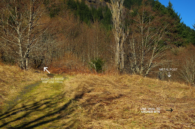
Archer Mtn came to mind because I'd never been there before and it seemed a short enough hike to allow me to pretend that I was only going to be away from work for the morning.  The overcast in Portland evaporated just past Camas and it was (of course) bluebird conditions by the time I reached the parking area at the end of the Smith-Cripe Rd. Using Don Nelsen's route description from SummitPost as a guide, I was soon off. At the "Y" in the road with the metal post, I made a sharp RT turn toward Archer - later I would find that the Ridge Top Trail comes out on this same road.
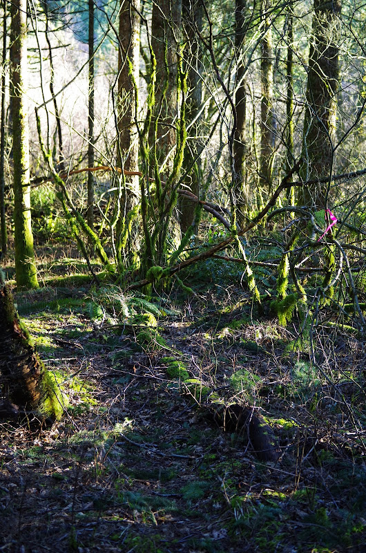
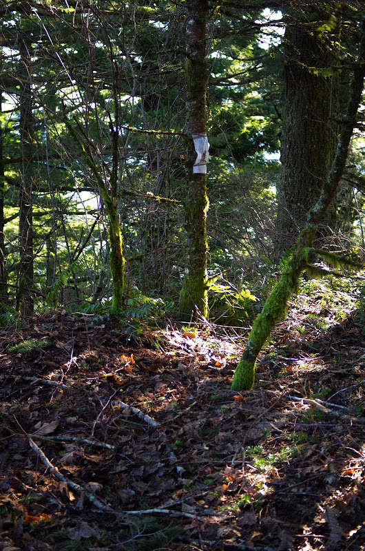
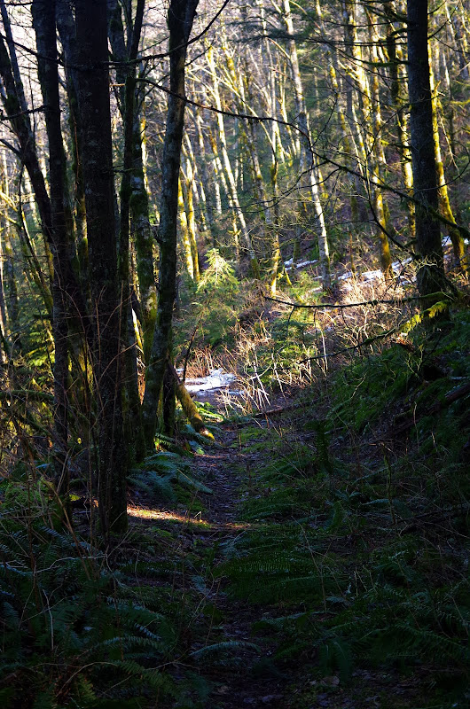
The route is all use trails and old roads but - if you pay attention - it's not too hard to follow.
Down, across the creek, and then up the side of Archer on a decent use trail, with a good view of my return route - the ridge top across the valley.
I had planned to cross the hanging meadows part way up Archer so as to contour out to the view point at its southern end but I became beguiled by some new flagging that went straight up toward the summit - and hence missed the meadow traverse (giving me a good reason to come back). Archer's summit is apparently not known for its views.
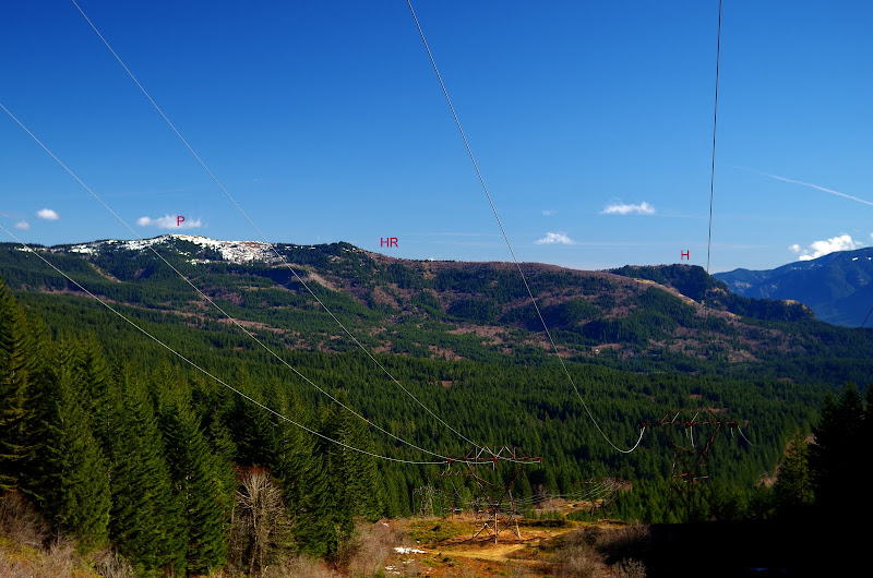
From the summit, I contoured down to meet a very old road/trail that took me N to the powerline service road.
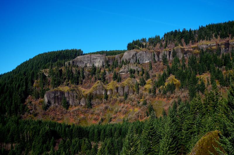
The service road climbs as it heads W, so you get a good view of Phlox Point (P), Hardy Ridge (HR), and Hamilton (H) to the E.
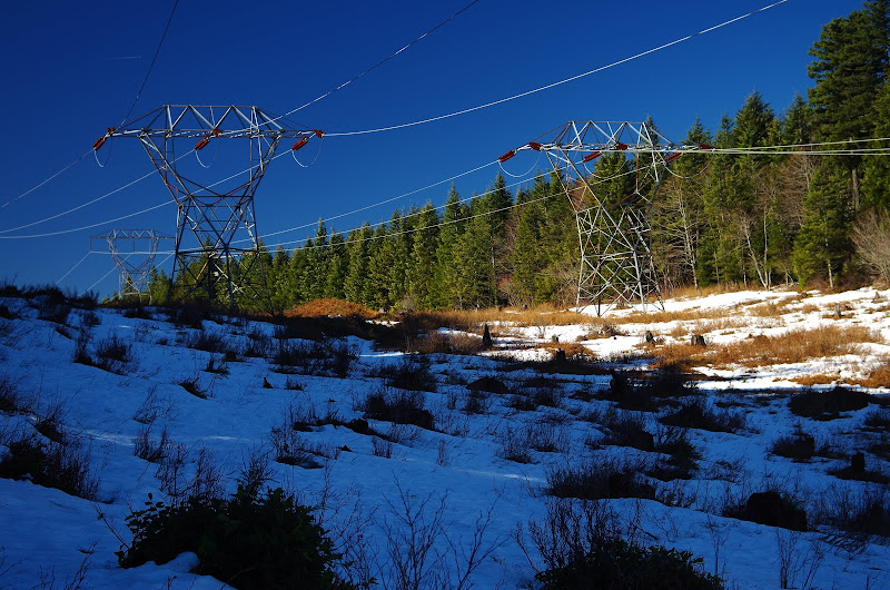
There was still snow at the top of the ridge - just enough and just soft enough to make walking on it tedious.
When the power line road topped out, I turned S and headed - more or less in a straight line - for the ridge top. The brush/snow mix inside the forest killed my enthusiasm for finding the view point for 214' Archer Falls (next time). After some thrashing - and passing 4 folks and a dog coming up the ridge - I found the old, old road that runs out to the end of the ridge. From there a really fun use trail takes you out along and down the ridge - think Munra Point but on a bigger scale.
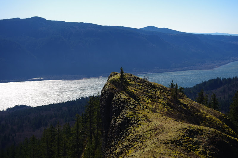
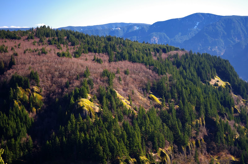
Walking along the ridge, I got a great view of Archer,
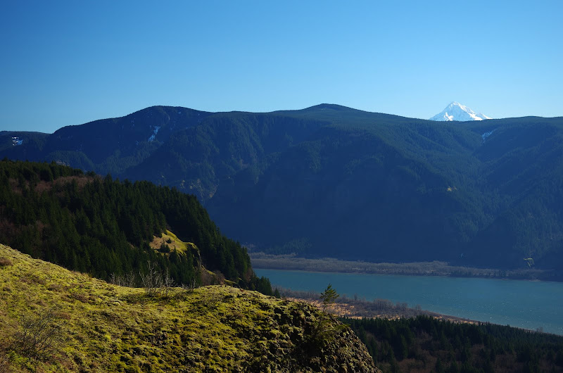
and of Archer and Hood.
The use trail down the ridge is only steep in a few places and, lower down, it turns into nice switchbacks which end at an old homestead just a short ways up the road from the turnoff to Archer. A perfect loop! Only 6.2 mi RT and 1600' EG, so I was - technically - back at "work" by early afternoon.
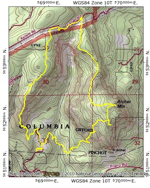
The route is all use trails and old roads but - if you pay attention - it's not too hard to follow.
Down, across the creek, and then up the side of Archer on a decent use trail, with a good view of my return route - the ridge top across the valley.
I had planned to cross the hanging meadows part way up Archer so as to contour out to the view point at its southern end but I became beguiled by some new flagging that went straight up toward the summit - and hence missed the meadow traverse (giving me a good reason to come back). Archer's summit is apparently not known for its views.
From the summit, I contoured down to meet a very old road/trail that took me N to the powerline service road.
The service road climbs as it heads W, so you get a good view of Phlox Point (P), Hardy Ridge (HR), and Hamilton (H) to the E.
There was still snow at the top of the ridge - just enough and just soft enough to make walking on it tedious.
When the power line road topped out, I turned S and headed - more or less in a straight line - for the ridge top. The brush/snow mix inside the forest killed my enthusiasm for finding the view point for 214' Archer Falls (next time). After some thrashing - and passing 4 folks and a dog coming up the ridge - I found the old, old road that runs out to the end of the ridge. From there a really fun use trail takes you out along and down the ridge - think Munra Point but on a bigger scale.
Walking along the ridge, I got a great view of Archer,
and of Archer and Hood.
The use trail down the ridge is only steep in a few places and, lower down, it turns into nice switchbacks which end at an old homestead just a short ways up the road from the turnoff to Archer. A perfect loop!
