Maxwell Lake (Eagle Cap Wilderness) - 8/11/12
Posted: August 23rd, 2012, 8:26 pm
Greg and I recently spent a week on the north side of the Wallowa Mountains. Before starting our backpacking trip on Sunday we did a Saturday day hike up to Maxwell Lake (map), a beautiful gem of a lake nestled high up above the Lostine River. It's one of the few trails in the wilderness that dead-ends and doesn't connect up with other trails.
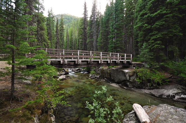
The trail starts at the Shady Campground, where we were camped. In fact, the trail went right past our campsite, and through the trees we could see parts of the footbridge over the Lostine River.
The trail soon crosses Maxwell Creek. There is no bridge, but this time of year it's pretty easy to cross on rocks or the logs that people have laid down.

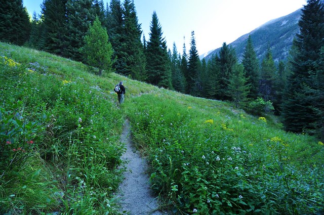
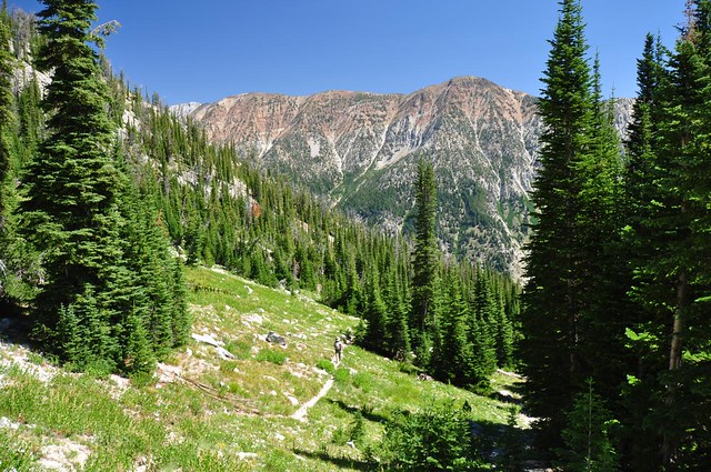
We hiked through a meadow, still deep in shadow since the sun hadn't gotten high enough to reach down into the canyon yet.
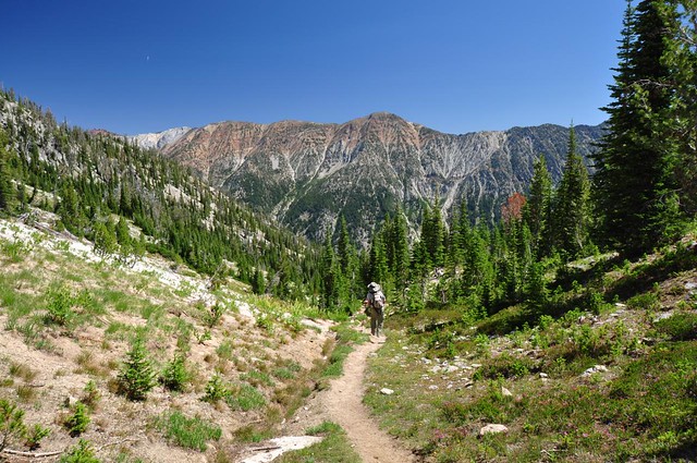
But soon our elevation gain and the sun's elevation gain joined up and we were hiking in sun. The first three miles of trail are well-graded switchbacks, passing in and out of trees.
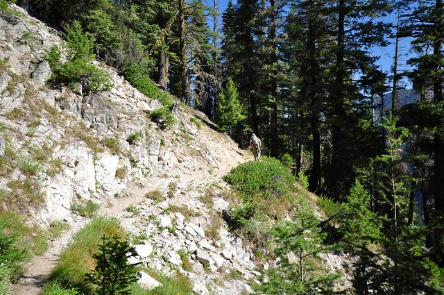
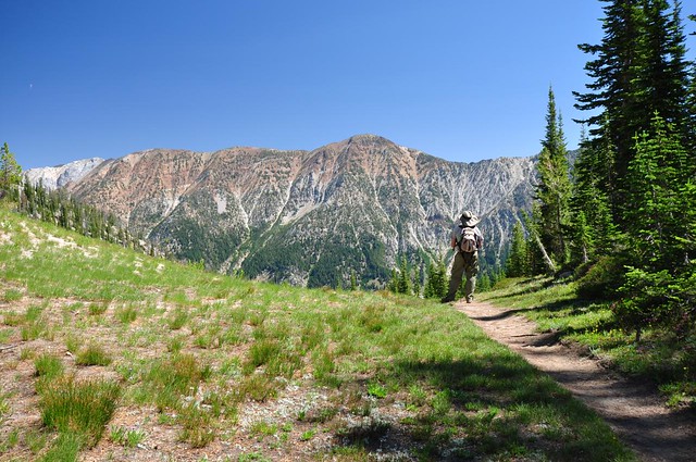
And then at the three-mile mark it's like the trail builders apparently said, "Man, enough with this switchback nonsense, let's just get this show on the road already." And the trail starts climbing straight up the mountainside. Needless to say, that last mile is quite steep, gaining about 1,000 feet of elevation. (It's also pretty rocky, so coming back down that part was no picnic either, slipping and sliding even with our hiking poles.) The picture below shows one small non-steep part, although it's not as flat as it looks!

And then the final stretch!

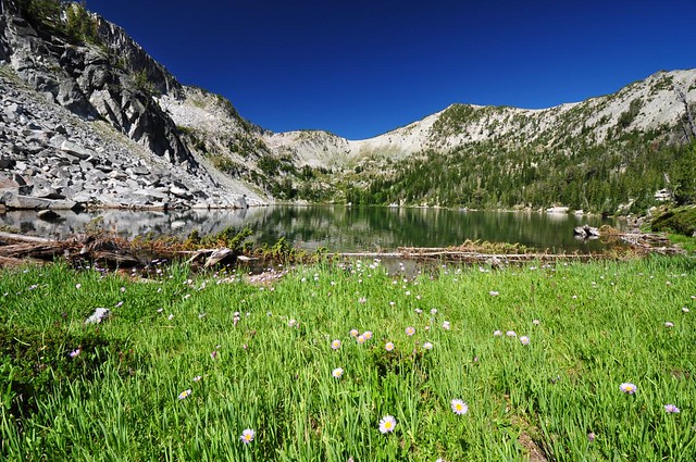
We had the place all to ourselves. The only backpackers who had been there the night before were headed back down as we headed up, and we had beat all the other day hikers. For the hour and a half that we were here we had the place to ourselves. It was gorgeous and peaceful and awesome. Plus, there were wildflowers and practically no bugs.
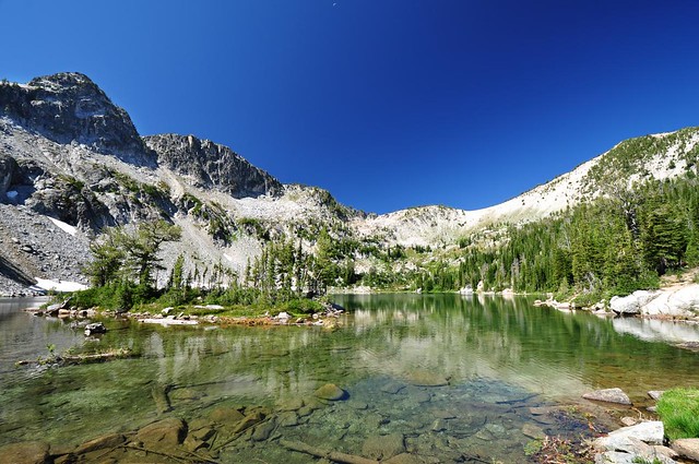
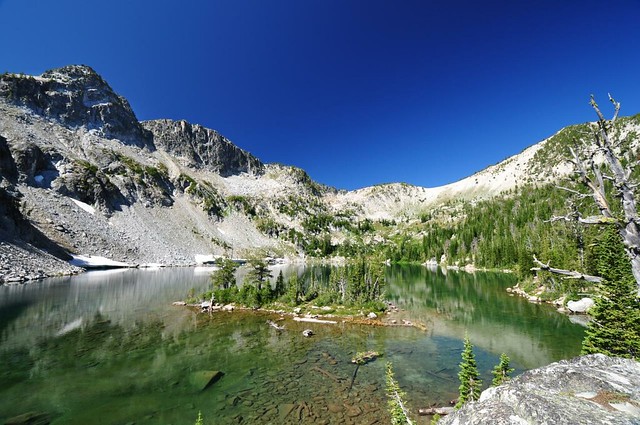
The lake has what Bill Sullivan calls a "cute little island", a phrase we chuckled at when we read the hike description beforehand. But when we got to the lake Greg yelled back to me, "It really IS a cute little island." Behold, the cute little island:
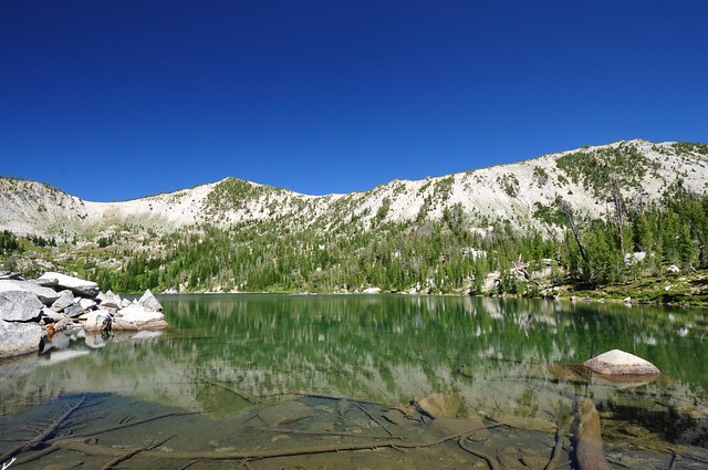
Here's the view from the east end of the lake (from this angle the island is indistinguishable from the landscape behind it).
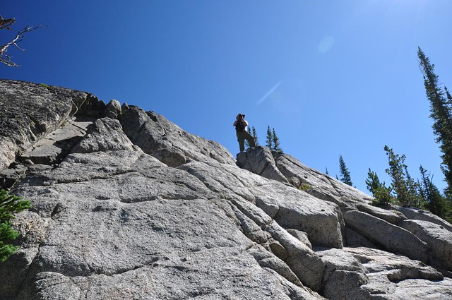
Greg taking a photo.
On the way back down we got a nice view of the surrounding mountains that had been so backlit by the morning sun on our hike up that we hadn't gotten a good look at them.

Our timing was great. As we hiked down we passed 24 hikers and backpackers headed up to the lake. We rolled back into our campsite at 1:45 and I have to say that it's REALLY NICE to be able to do that after a hike! Done hiking and BAM there you are at your campsite with a comfy chair, shade, and ice cold beers.
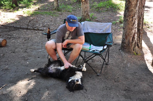
While we were enjoying those ice cold beers we got a visitor from a nearby campsite. She immediately pegged Greg for an animal-lover and rolled over for a tummy rub. Cute!
8 miles
2500 feet elevation gain
The trail starts at the Shady Campground, where we were camped. In fact, the trail went right past our campsite, and through the trees we could see parts of the footbridge over the Lostine River.
The trail soon crosses Maxwell Creek. There is no bridge, but this time of year it's pretty easy to cross on rocks or the logs that people have laid down.
We hiked through a meadow, still deep in shadow since the sun hadn't gotten high enough to reach down into the canyon yet.
But soon our elevation gain and the sun's elevation gain joined up and we were hiking in sun. The first three miles of trail are well-graded switchbacks, passing in and out of trees.
And then at the three-mile mark it's like the trail builders apparently said, "Man, enough with this switchback nonsense, let's just get this show on the road already." And the trail starts climbing straight up the mountainside. Needless to say, that last mile is quite steep, gaining about 1,000 feet of elevation. (It's also pretty rocky, so coming back down that part was no picnic either, slipping and sliding even with our hiking poles.) The picture below shows one small non-steep part, although it's not as flat as it looks!
And then the final stretch!
We had the place all to ourselves. The only backpackers who had been there the night before were headed back down as we headed up, and we had beat all the other day hikers. For the hour and a half that we were here we had the place to ourselves. It was gorgeous and peaceful and awesome. Plus, there were wildflowers and practically no bugs.
The lake has what Bill Sullivan calls a "cute little island", a phrase we chuckled at when we read the hike description beforehand. But when we got to the lake Greg yelled back to me, "It really IS a cute little island." Behold, the cute little island:
Here's the view from the east end of the lake (from this angle the island is indistinguishable from the landscape behind it).
Greg taking a photo.
On the way back down we got a nice view of the surrounding mountains that had been so backlit by the morning sun on our hike up that we hadn't gotten a good look at them.
Our timing was great. As we hiked down we passed 24 hikers and backpackers headed up to the lake. We rolled back into our campsite at 1:45 and I have to say that it's REALLY NICE to be able to do that after a hike! Done hiking and BAM there you are at your campsite with a comfy chair, shade, and ice cold beers.
While we were enjoying those ice cold beers we got a visitor from a nearby campsite. She immediately pegged Greg for an animal-lover and rolled over for a tummy rub. Cute!
8 miles
2500 feet elevation gain