Cooper Spur and Gnarl Ridge, 10-Aug-2012

This forum is used to share your experiences out on the trails.
User avatar
kepPNW
Posts: 6411
Joined: June 21st, 2012, 9:55 am
Location: Salmon Creek

Cooper Spur and Gnarl Ridge, 10-Aug-2012

Post by kepPNW » August 13th, 2012, 4:55 pm

Knocked off another of the "Must See Hikes" last Friday. I can't believe I've never gone up there before. It was superb! Easily deserves a spot on that list.

(Edit: Re-reading this as posted, I again apologize to the group for clearly overdoing the newb description for this hike! Hopefully you get a sense of how awesome I thought it was.) ;)

The day started with what I thought were the remnants of a head cold, so between that and that road up to Cloud Cap I got a pretty late start. At the trailhead, there were perhaps five other vehicles. I think I might've been the only high-clearance 4x4 there, too! Someone had actually driven a ZipCar up. I haven't decided if that's smart or twisted yet.

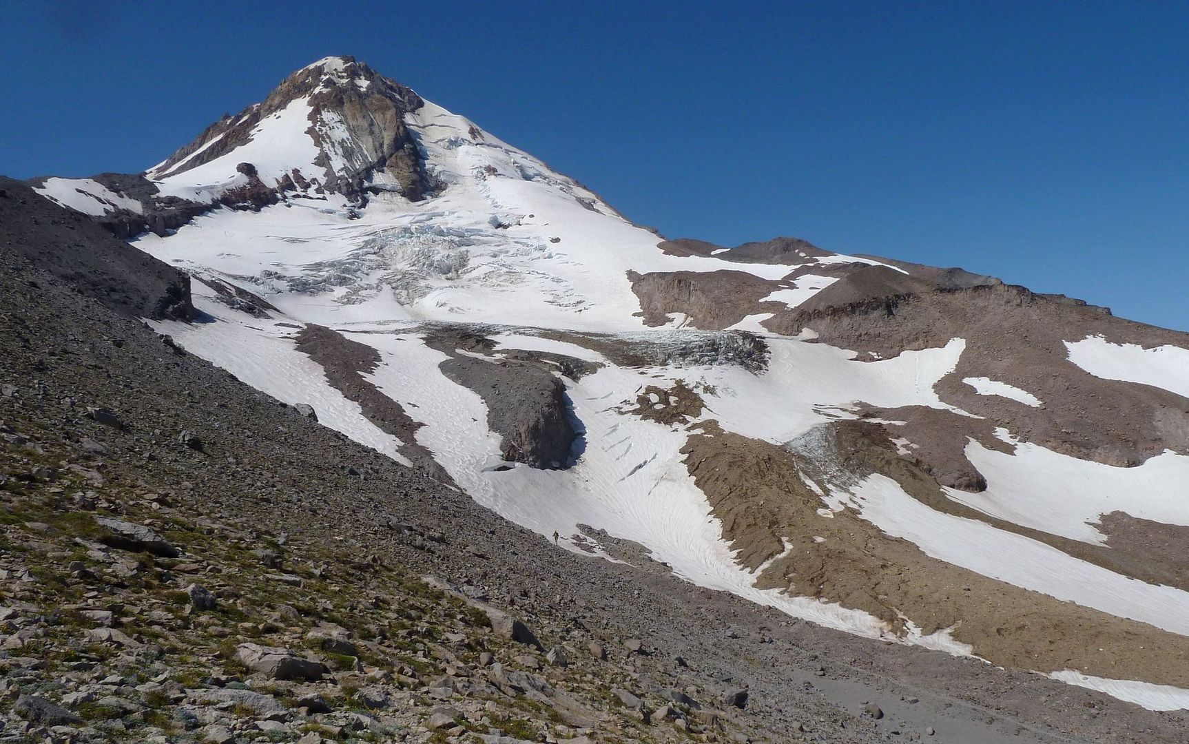
I was on the Timberline Trail just a bit after 10am. It actually surprised me how quickly I arrived at the Tilly Jane / Cooper Spur junction, and that almost right after that the shelter appeared. Looked farther on the maps. Being a Friday(?), I had the place entirely to myself. From other reports, I had really expected to be running into more folks here. And, as you can see, the weather was as perfect as it gets.

Image

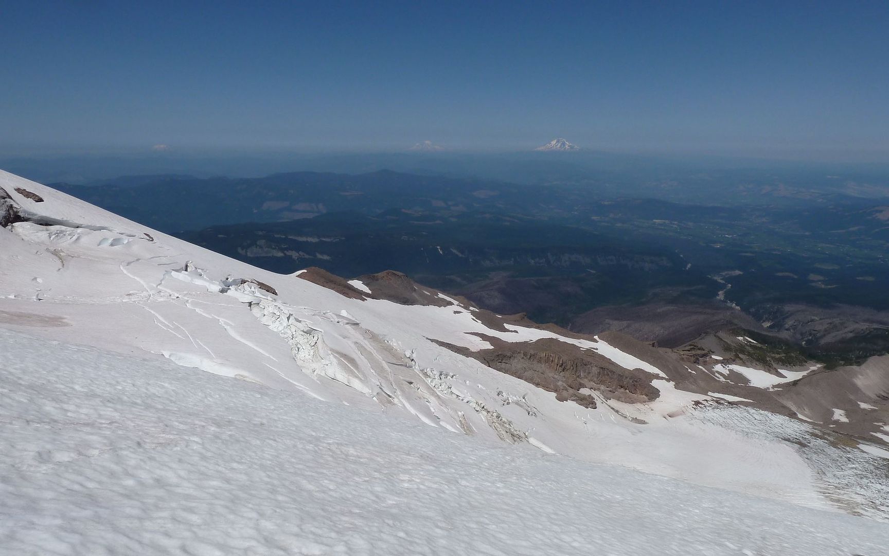
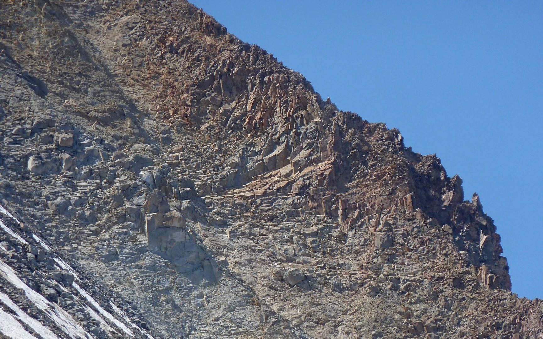
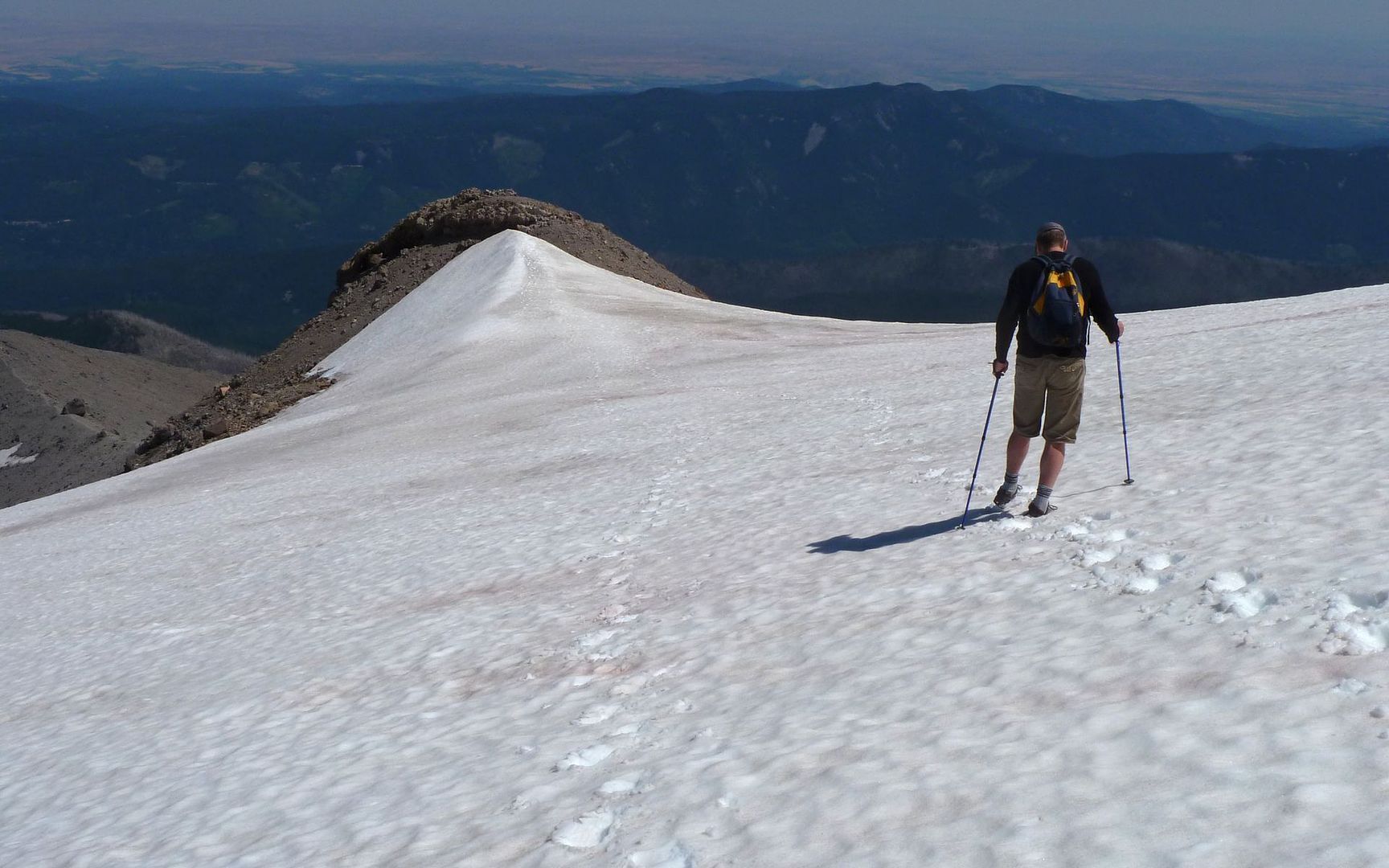
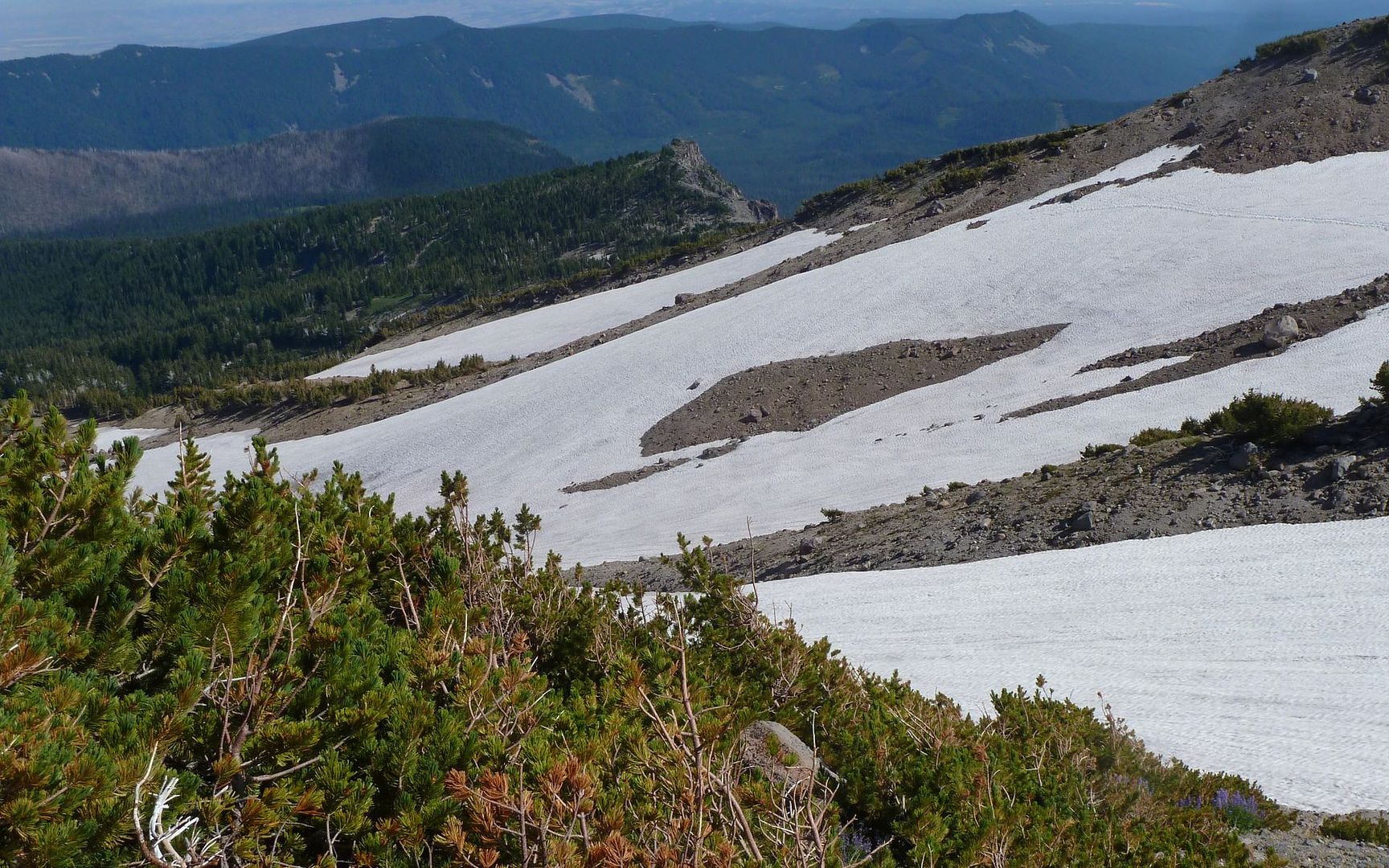
Continuing on, I took a side route over to the edge of the canyon, and saw another trail leading up the near lateral moraine. With people on it. More than I thought would likely be trying to cross the Elliot, so I really wondered about that.

Image
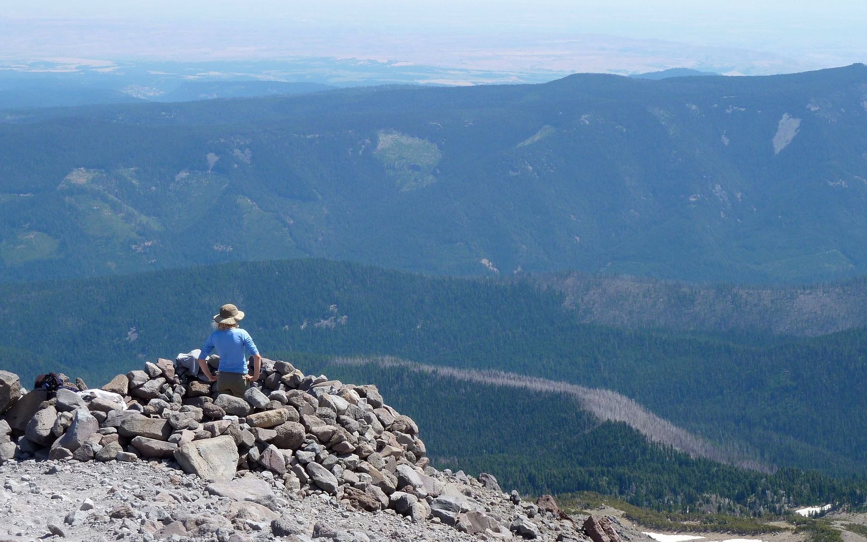
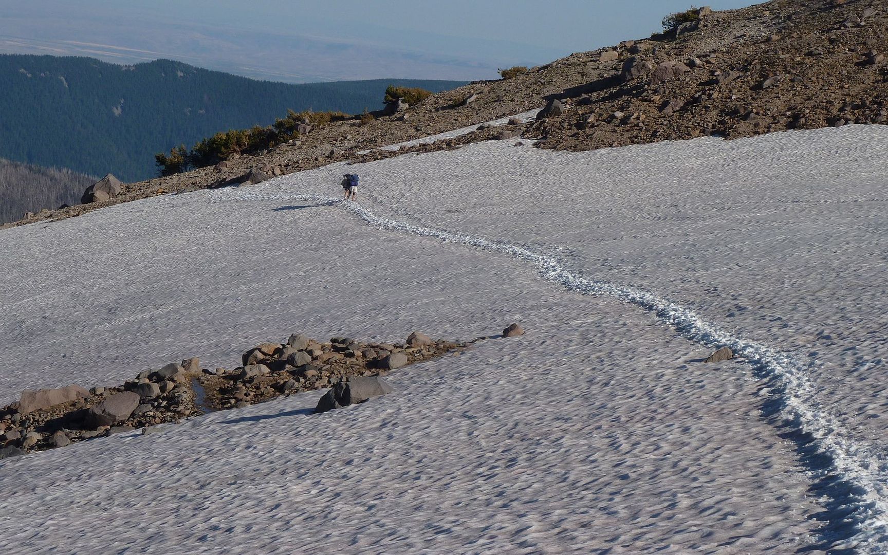
See the hiker in this shot? No? Click for a larger image.

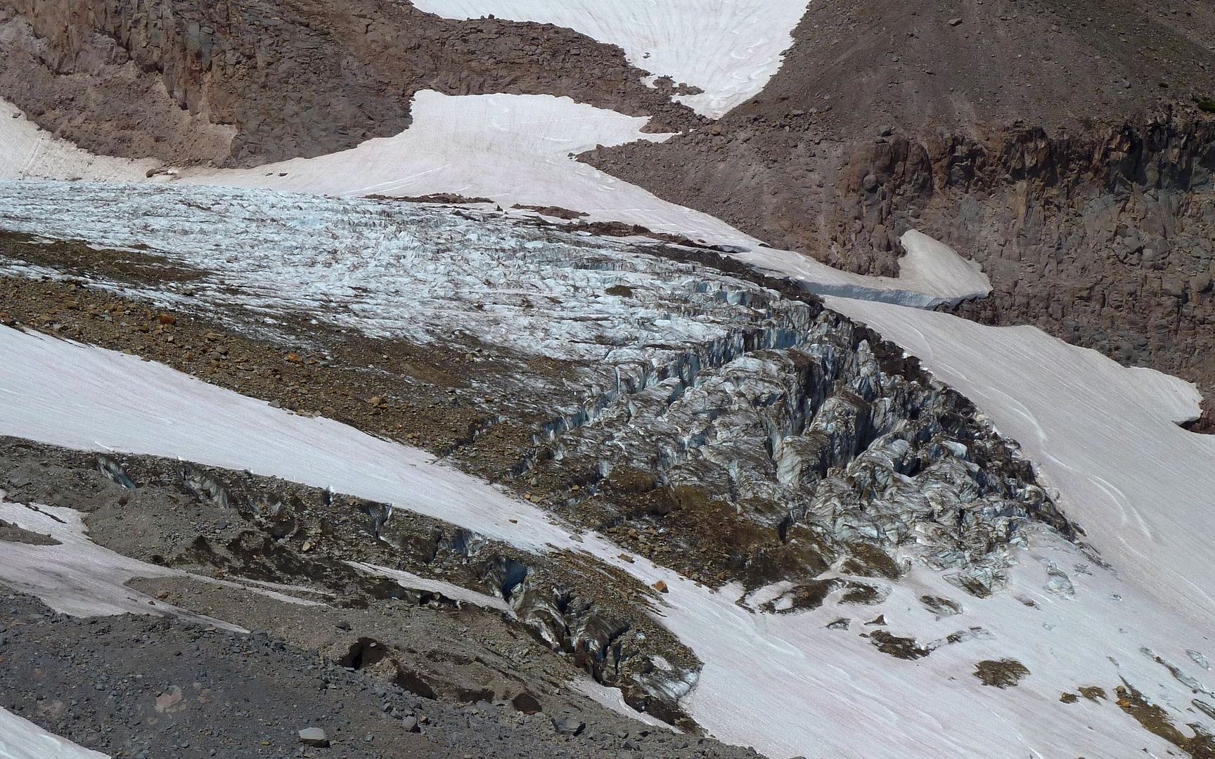
The view on the edge of the canyon was so nice, I didn't want to head back to the main trail, so I pretty much just went straight up from there for awhile. Taking waaaay too many crevasse photos along the way.

Image

Image
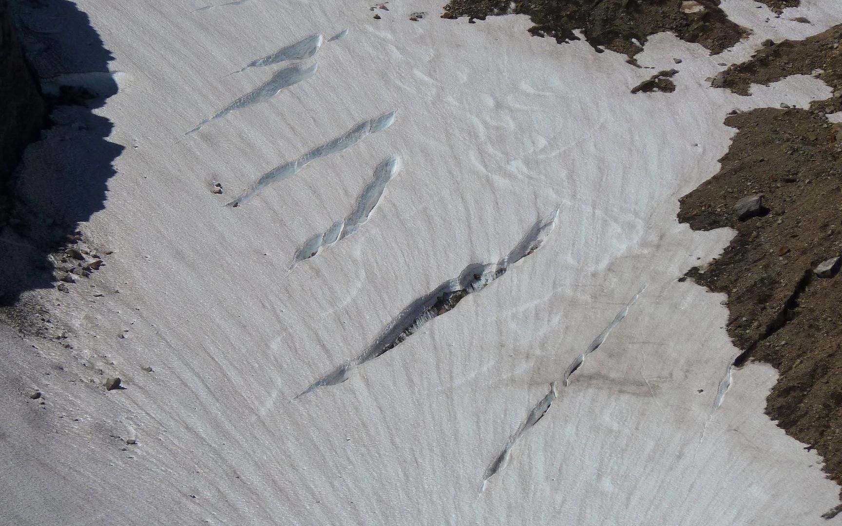
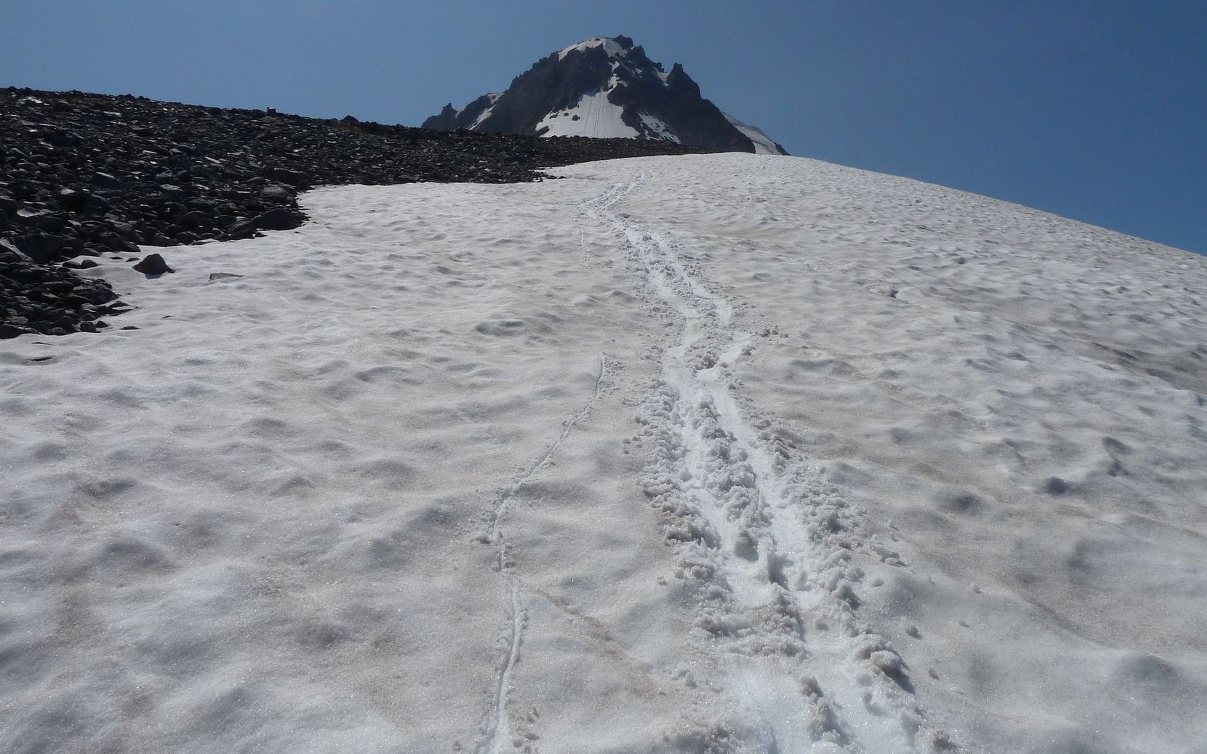
Ski tracks? Holy crap!

Not too much farther up, while I'm stopped to take yet another photo, the fellow I'd seen far below on the moraine appeared from behind a rock just a few paces away. We chatted a bit, and ended up hiking together much of the rest of the day.

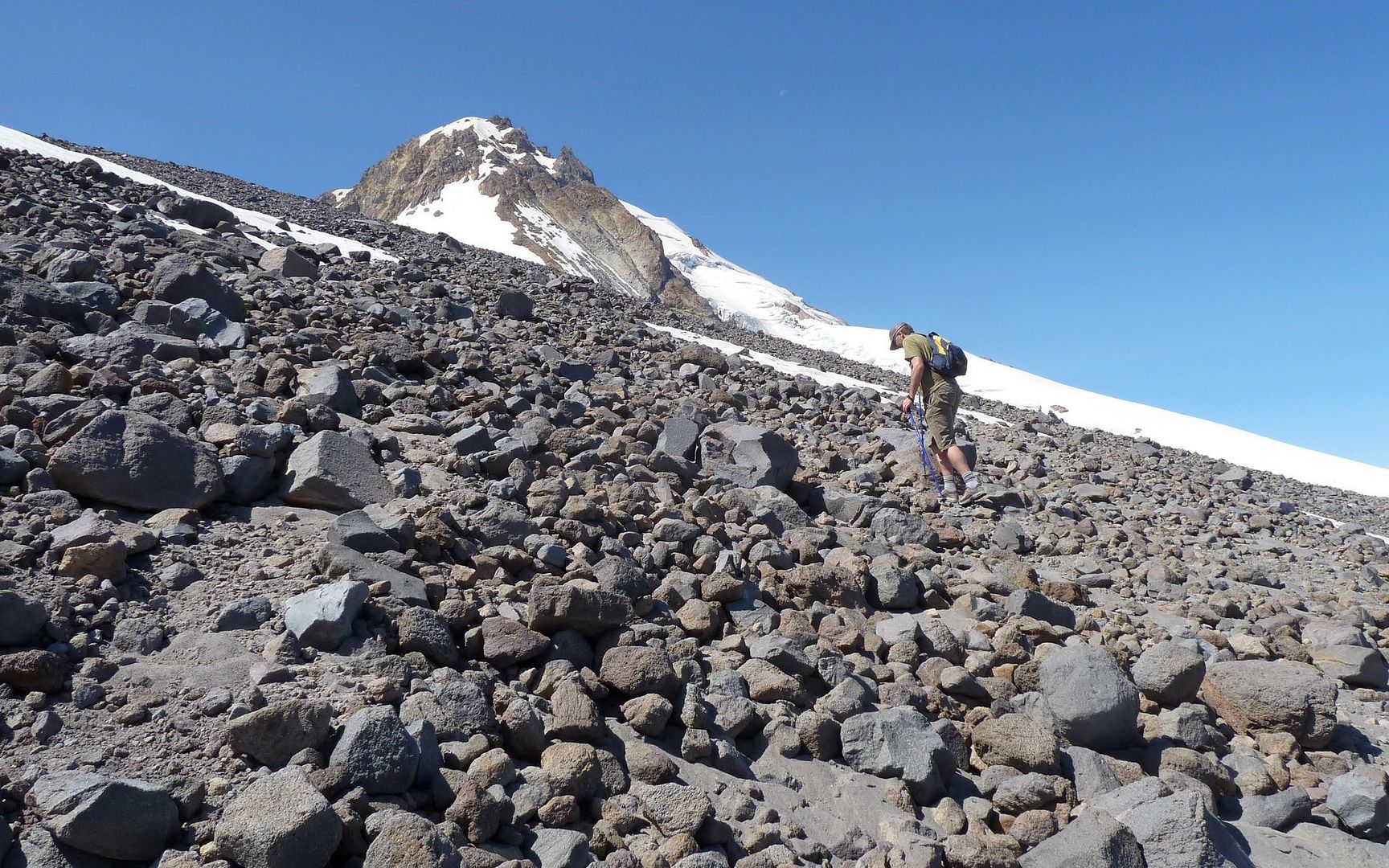
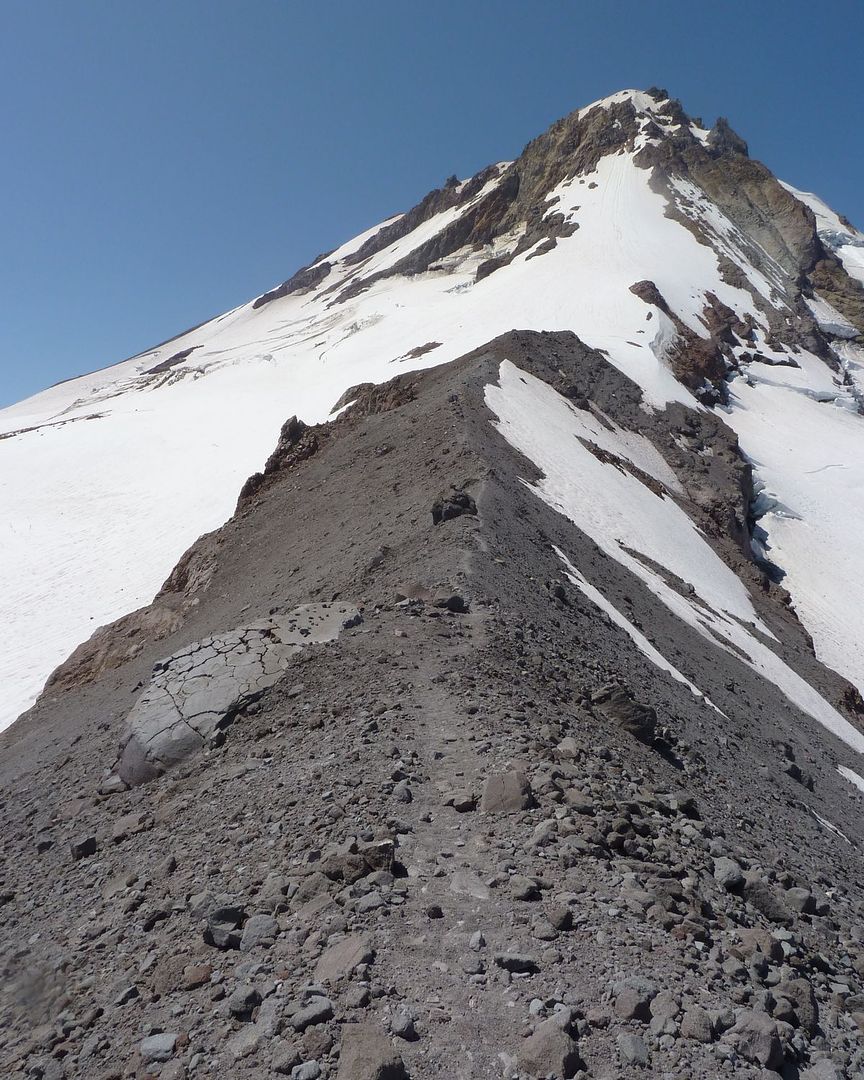
After continuing straight up the fall line for awhile longer, we decided to go back to the "main trail" such as it was, when it crossed not too far away. About four or five switchbacks later, the trail dove under a snow field that we couldn't see the other side of. Having no reason to think crossing it would offer any benefit at all, we just headed off straight uphill again.

Image

When we did arrive at Cooper Spur, there were two groups ahead of us, just soaking it all in.

Image

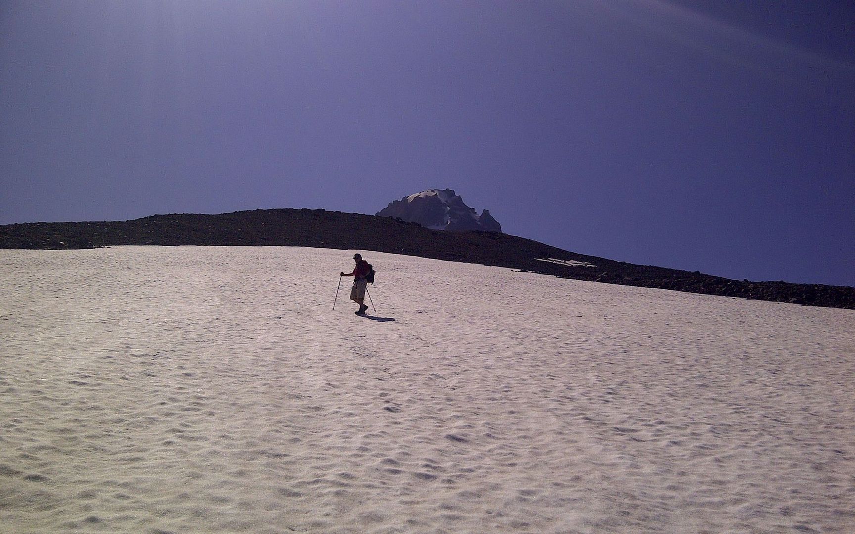
A couple handfuls of trail mix and a dozen or so photos later, it was an easy decision to leave Cooper Spur to the folks already there, and move on upward! Didn't see a soul above us. We were at about 8500', and understood we could easily get to 9000' following this ridge.

Image

I'd read all the TRs I found here, and have since done some Googling, but I'm still not sure which rock, exactly, is the one called "Tie-in Rock"? There were three suspects...

Image
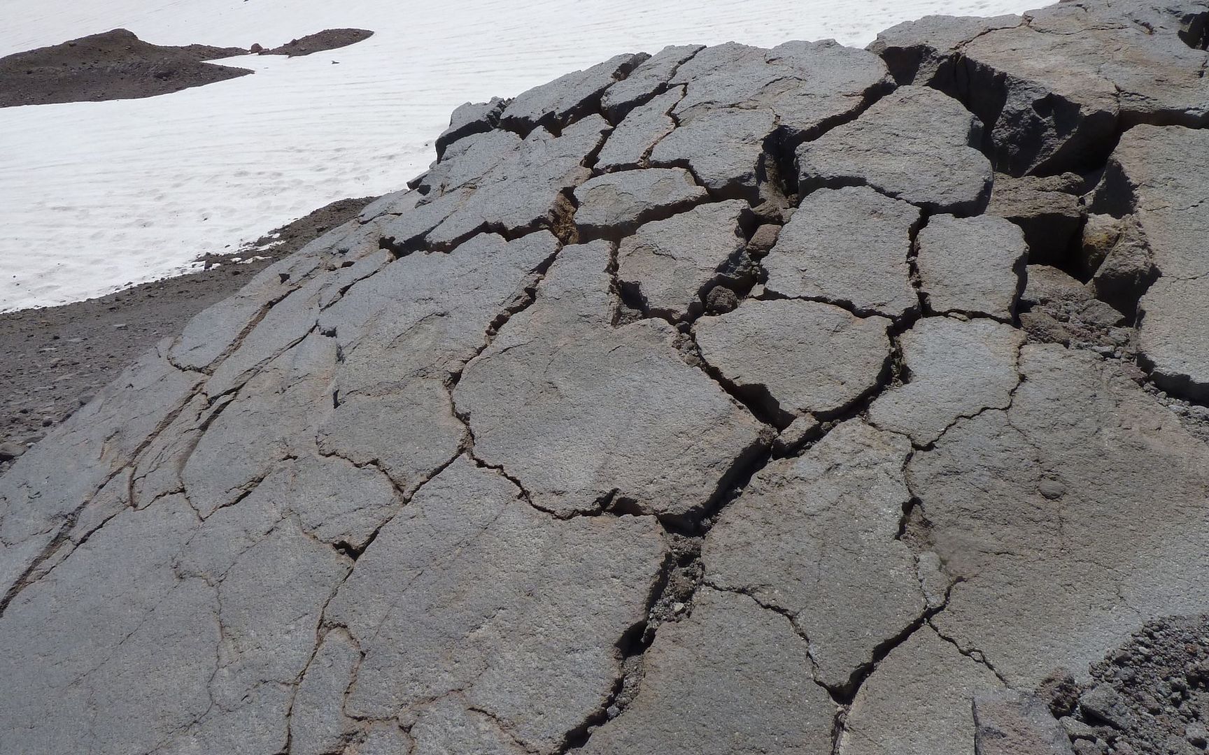
I really doubt it's this lava bomb, also seen in last shot, but the fracture patterns are pretty cool!

Image
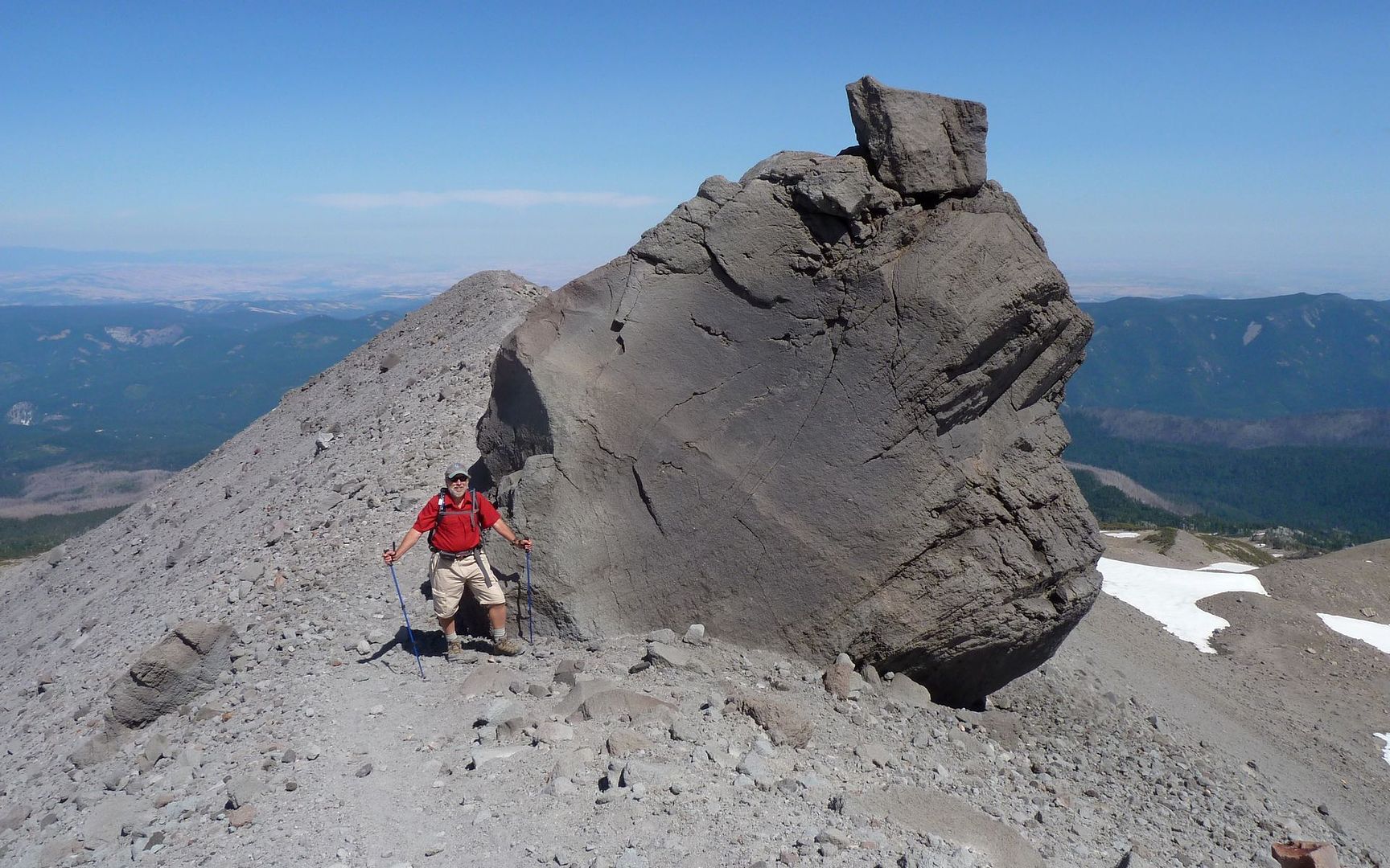
Certainly deserves a name, just for the sheer improbability of it being where it is! My money's here.

Image
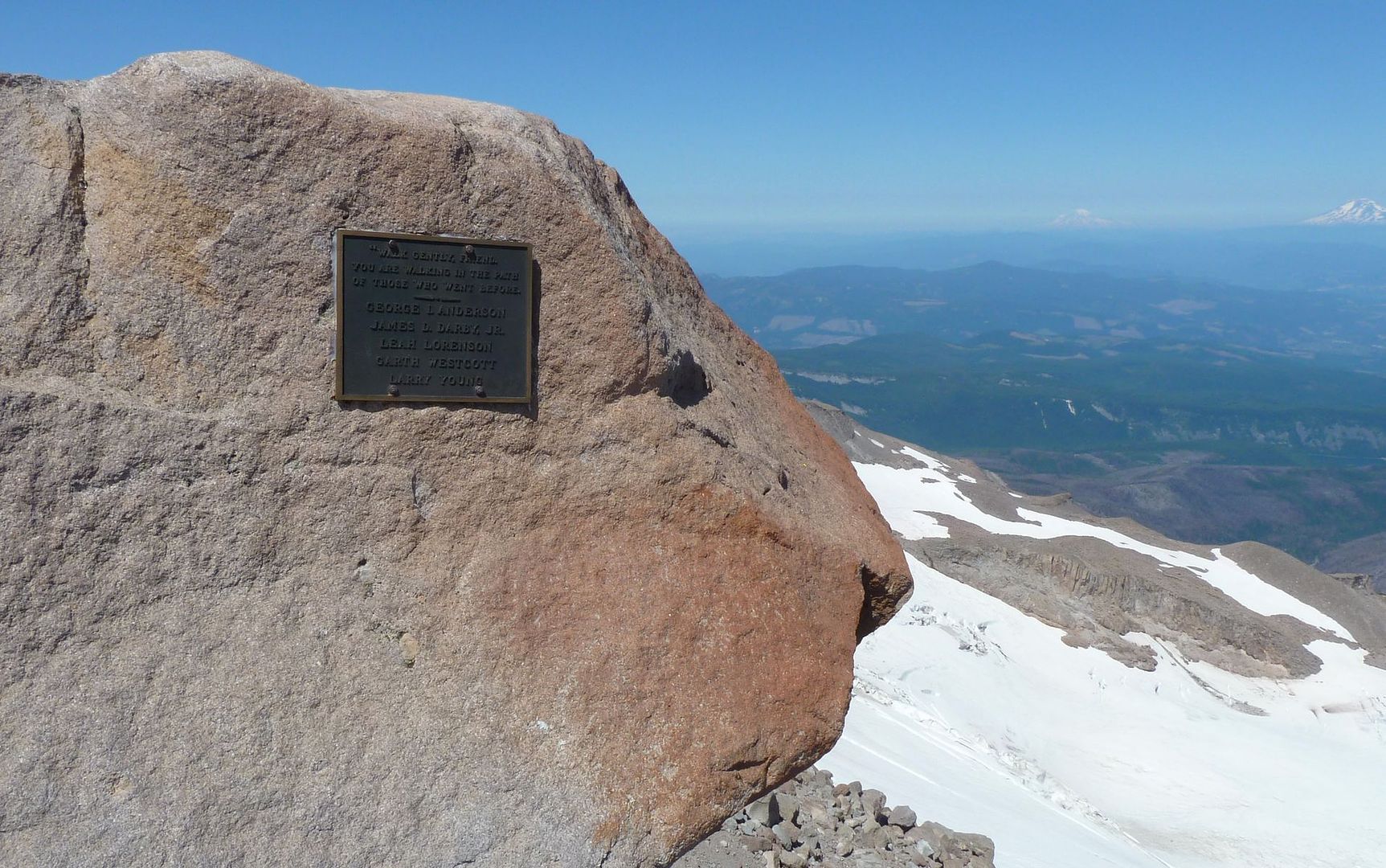
A memorial to five Mazamas who perished nearby. Perhaps fitting, but probably not this one?

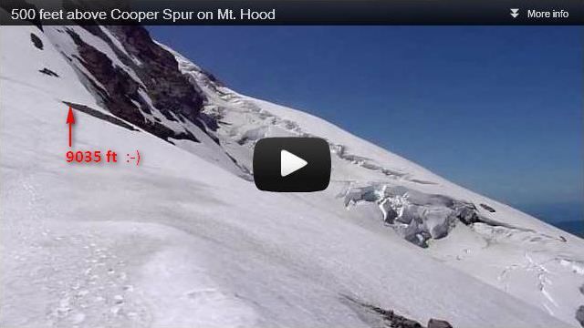
So we got to the permanent snow. There was a very short windbreak there. (And this was actually the first point, all day, with a noticeable breeze.) Quick check the GPS and, damn!, 8960 feet. Need 40 more feet. There's a rock outcropping ahead that looks like it'd make the claim legit. It's that first rock clump on the upper-left in the preview (or, the right side as the camera pans directly towards the summit)...

Image
Embedding this directly caused all subsequent photos to disappear?

We get there, and now the GPS is telling us we'd cracked through the 9000' level. Funny how successes are quantified, isn't it? Amazingly, just crossing that bit of snow, the temperature had now plunged from 62° to 45°, and the wind was very brisk. So the windbreakers came out not too far into our enjoyment of this magnificent perch. The views of glaciers on either side of us, the mountain above us (as well as other volcanoes from Rainer to the Sisters, and even beyond!), and the endless eastern Oregon desert below us were just marvelous.

Image
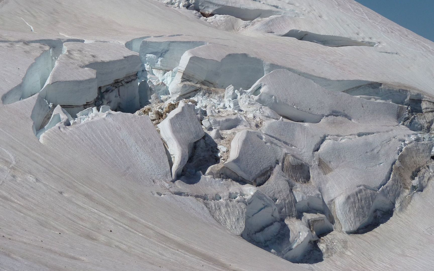
Probably took 100 shots of crevasses alone!

Image
Pulpit Rock?

Image
Descending back down to solid trail.

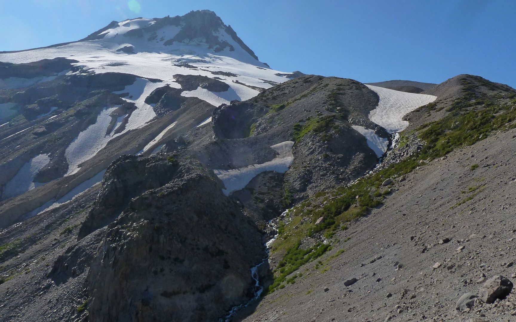
The day was still fairly young, and neither of us wanted to go back to the cars, yet. I suggested two options raised in another thread - the Langille Crags to our north, or Gnarl Ridge to the south. I was leaning towards the southern option, and my new trail friend agreed it sounded fun. Given the trail was buried anyway, and seeing the Timberline Trail away in the distance, we just took off cross country, sticking to the snowfields where we could.

Image

Image

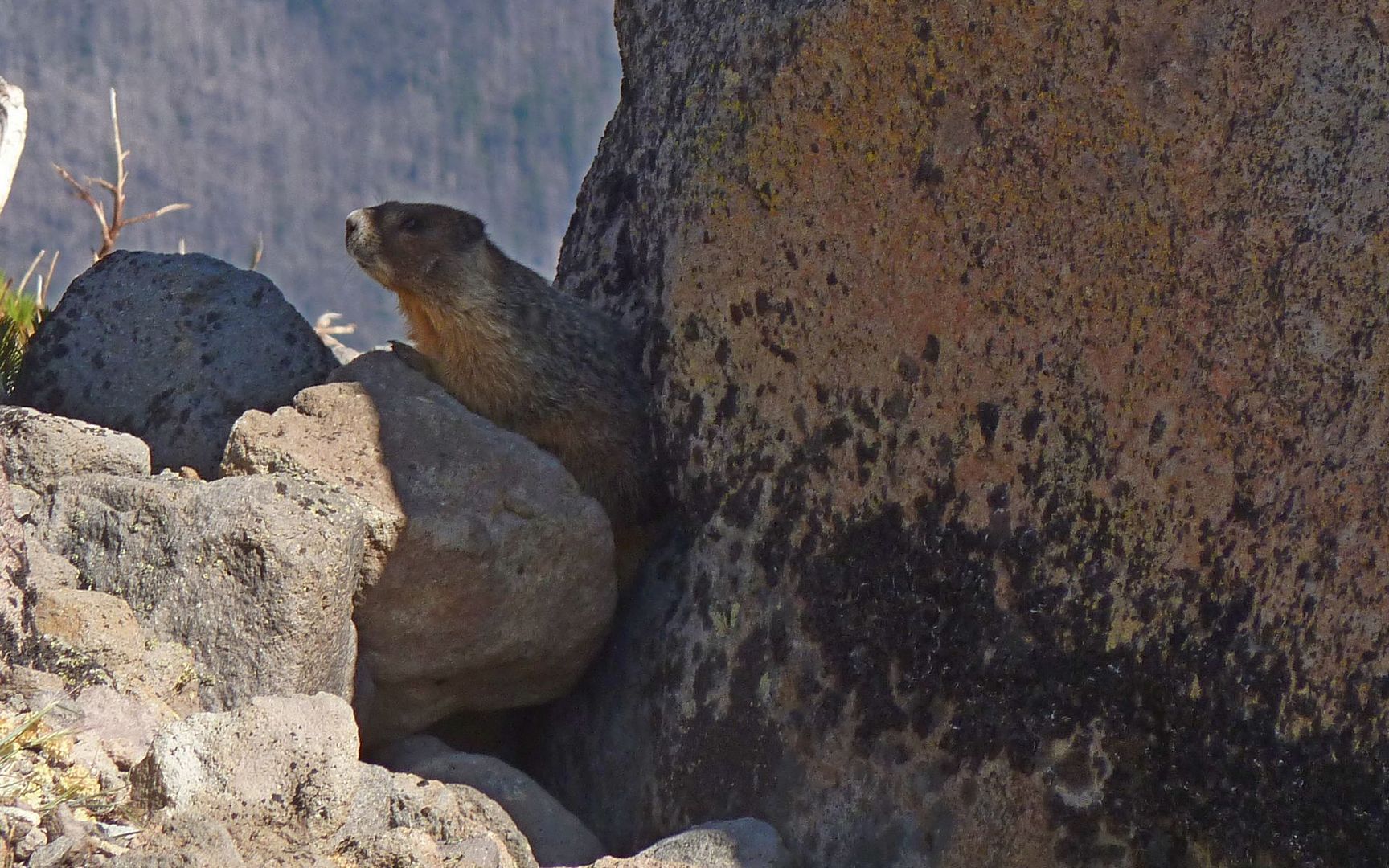
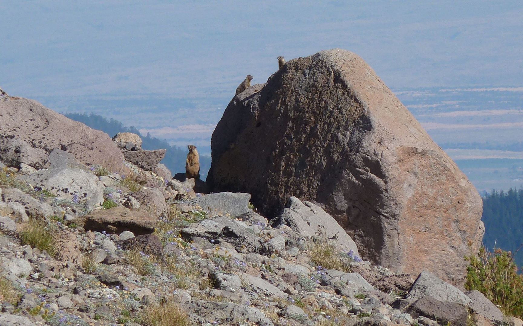
Not too long after hitting the Timberline Trail again, we encountered a family of Marmots who were clearly enjoying the beautiful weather as well.

Image

I had it in my mind that I'd try getting to Lamberson Butte, which really didn't look all that far away yet. The GPS, afterall, said it was only about 1.5 miles in a GPS kind of straight line way. When we got this view, my new friend decided it was time for him to call it a day and head back. I did point him to PH, though, so hopefully we'll be seeing more of him in the future.

Image

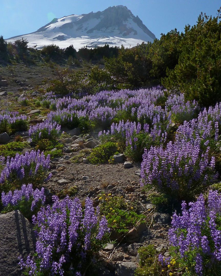
Much of the Timberline Trail, from this point onward, was still under snow. Although I could follow it, it really didn't seem to be necessary, so I did a little exploring from this point out. The lupine was (had to be!) peaking, with a smell that was at times nearly overwhelming.

Image

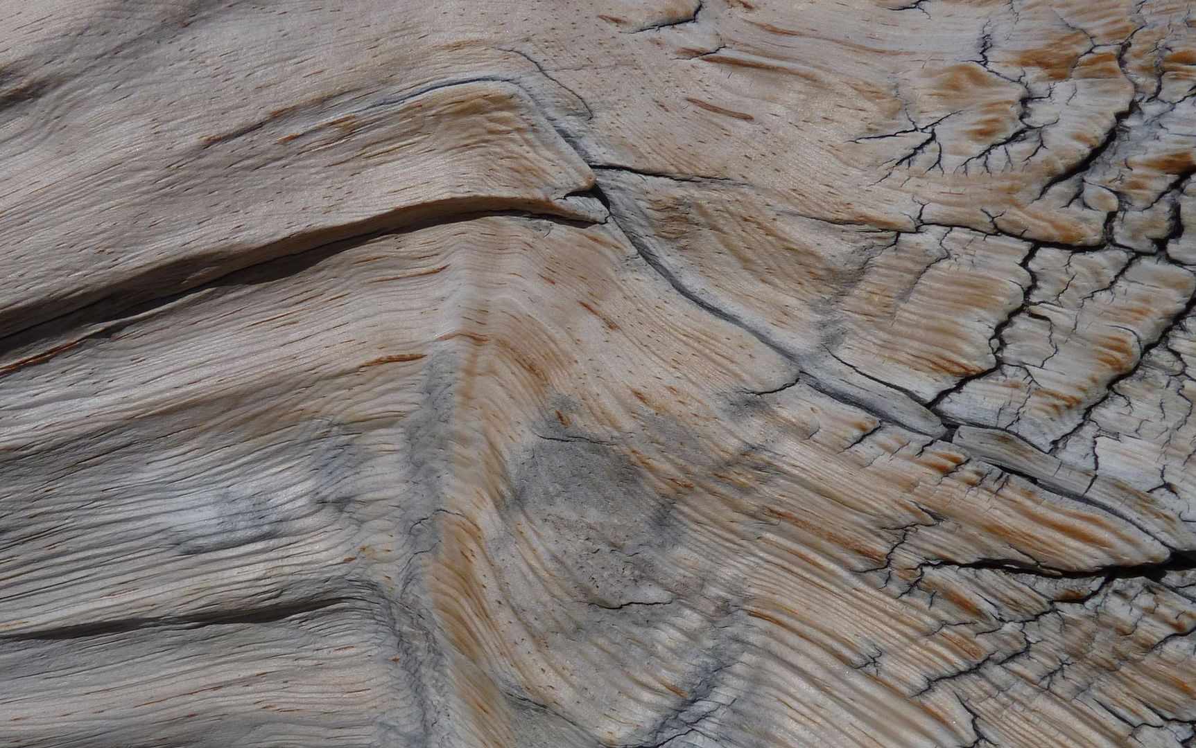
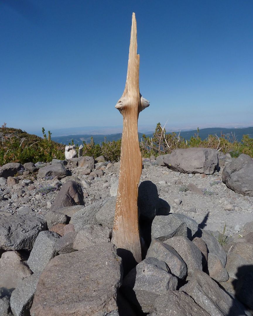
And I came to learn that Gnarl Ridge was truly rather gnarly! Dead wood of many different qualities was there to enjoy. Some polished like a Budda's belly, some rough and nasty attesting to a long and hard life, and some just whittled down to spears marking a trail.

Image

Image
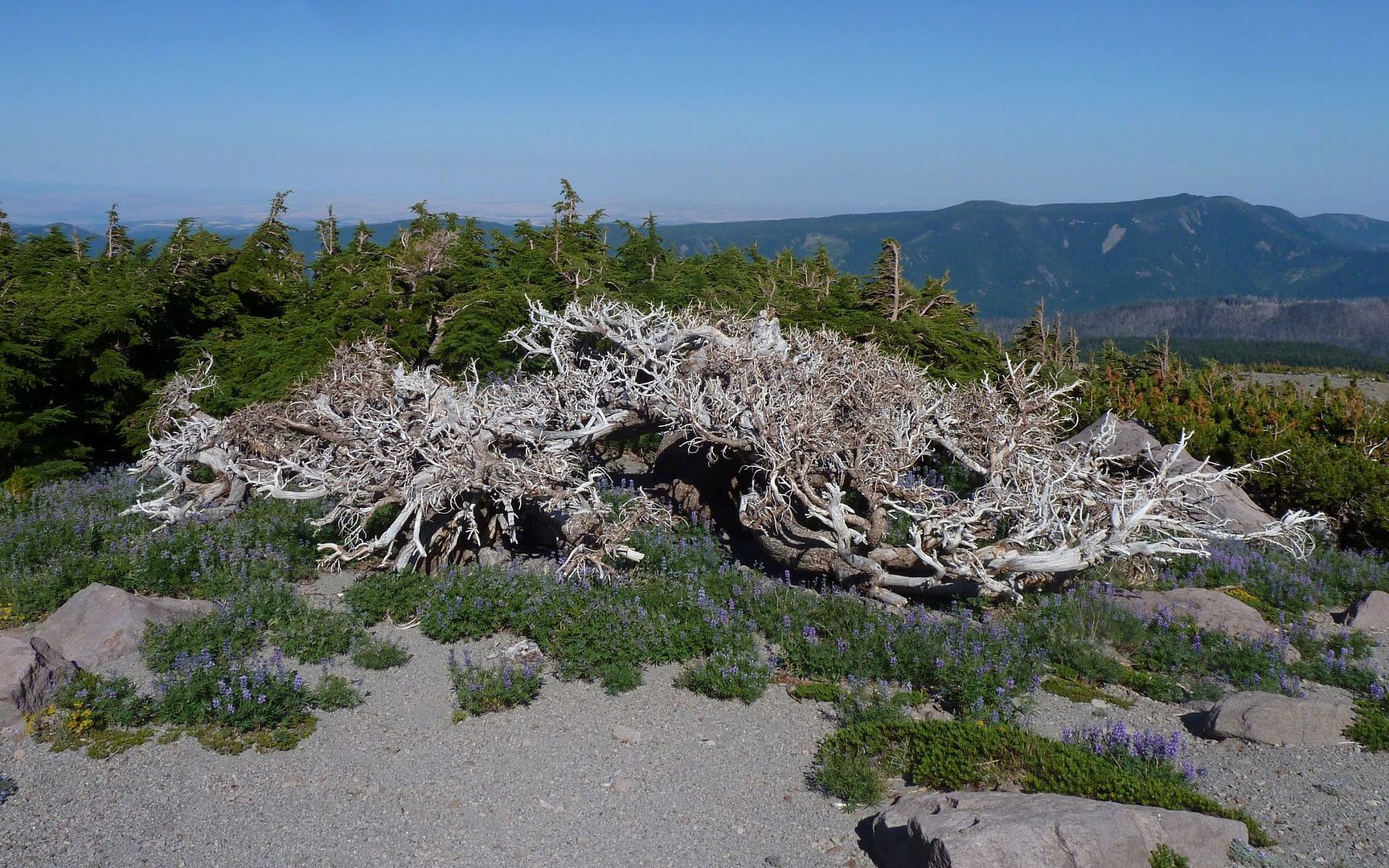
The trunk on this squat little guy was nearly 2 feet in diameter!

Image

All along, I was hearing the roar of water coming up from some depths below. I finally spotted what I later convinced myself was the headwaters of Newton Creek. (Correct me, if that's not the case?)

Image

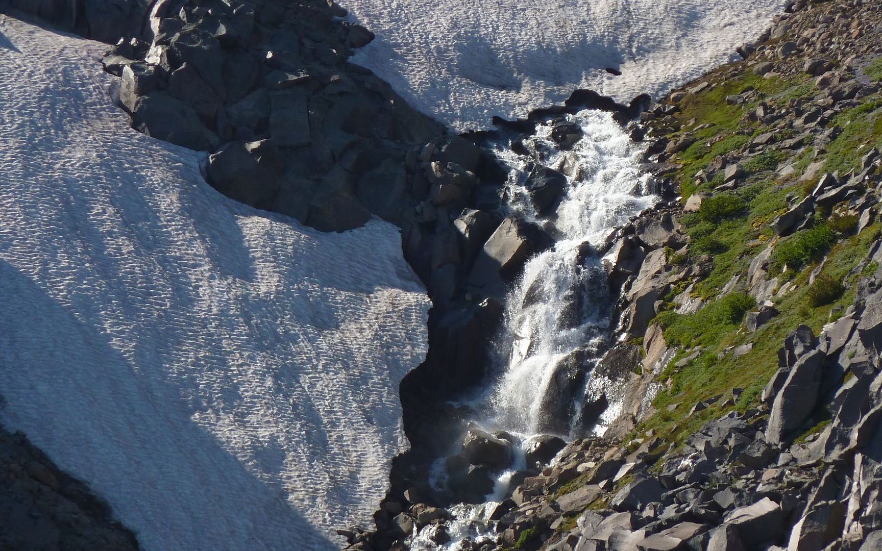
This magnificent (there's that word again) waterfall tumbled down the mountainside for many hundreds of feet.

Image

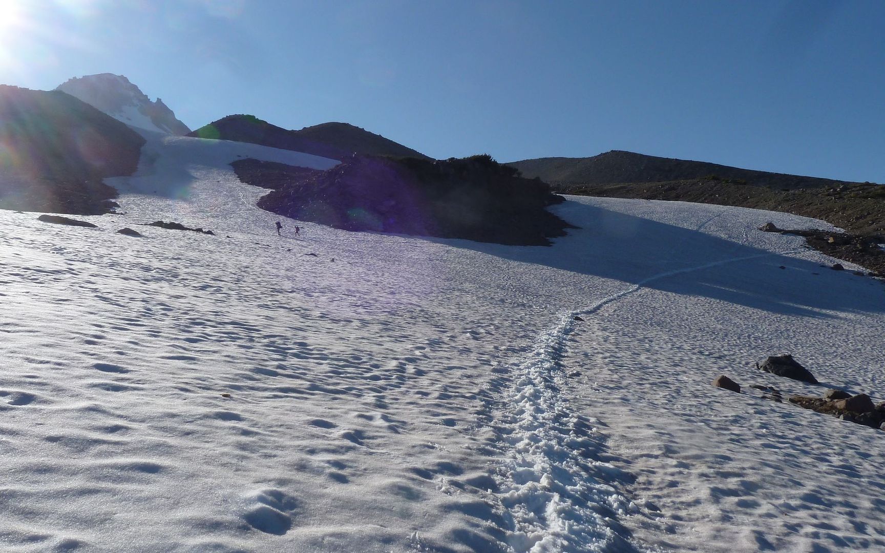
Heading back, there was perhaps nearly 1/2 mile of the trail under huge snowfields, in the mile or mile and a half north of Gnarl Ridge. I didn't find it very difficult walking across it with boots on, but met some folks in trail runners and full packs having a devil of a time with it. One was actually pretty freaked, and asking how much more was to come.

Image

Image

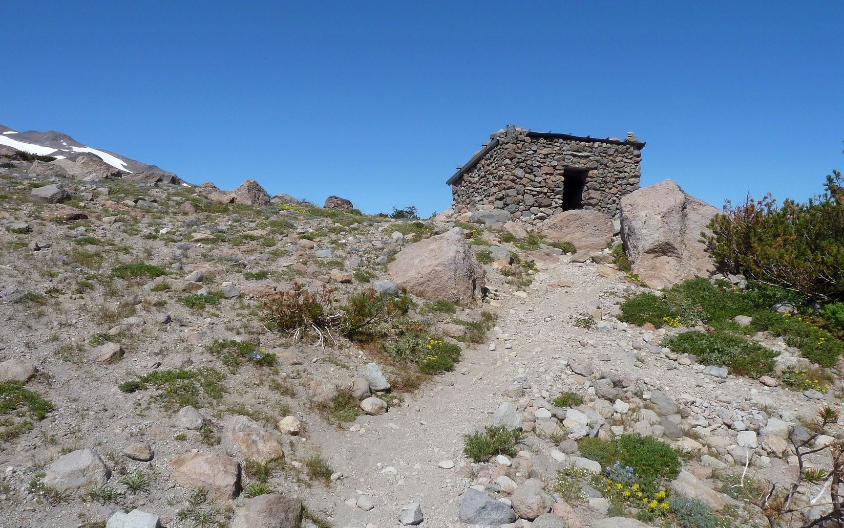
It ended up being farther than I'd thought back to the Tilly Jane junction. Which I turned down on, for the return. Hadn't ever been there before either, so I thought that'd be a nice way to wind up the trip. Fascinating history there!

Image
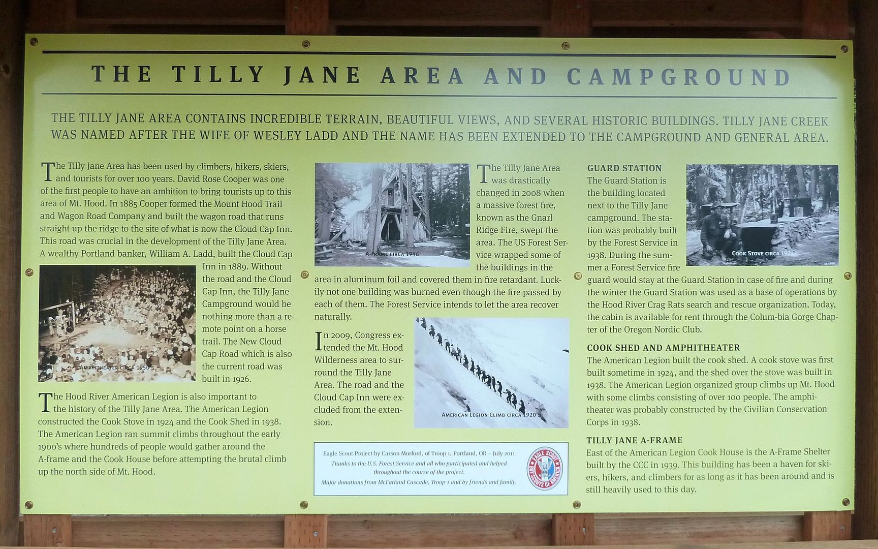
Click for larger version that's readable.

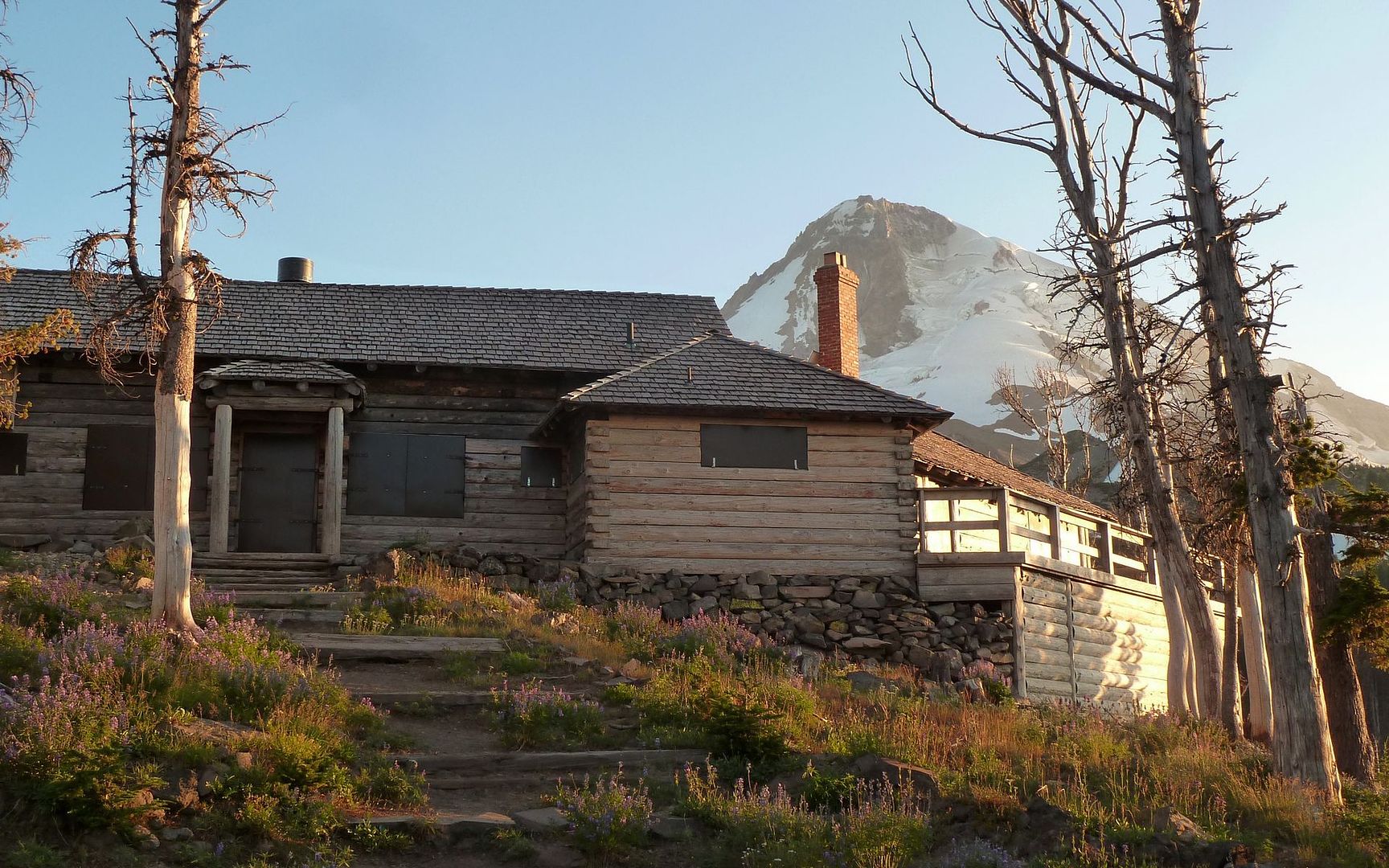
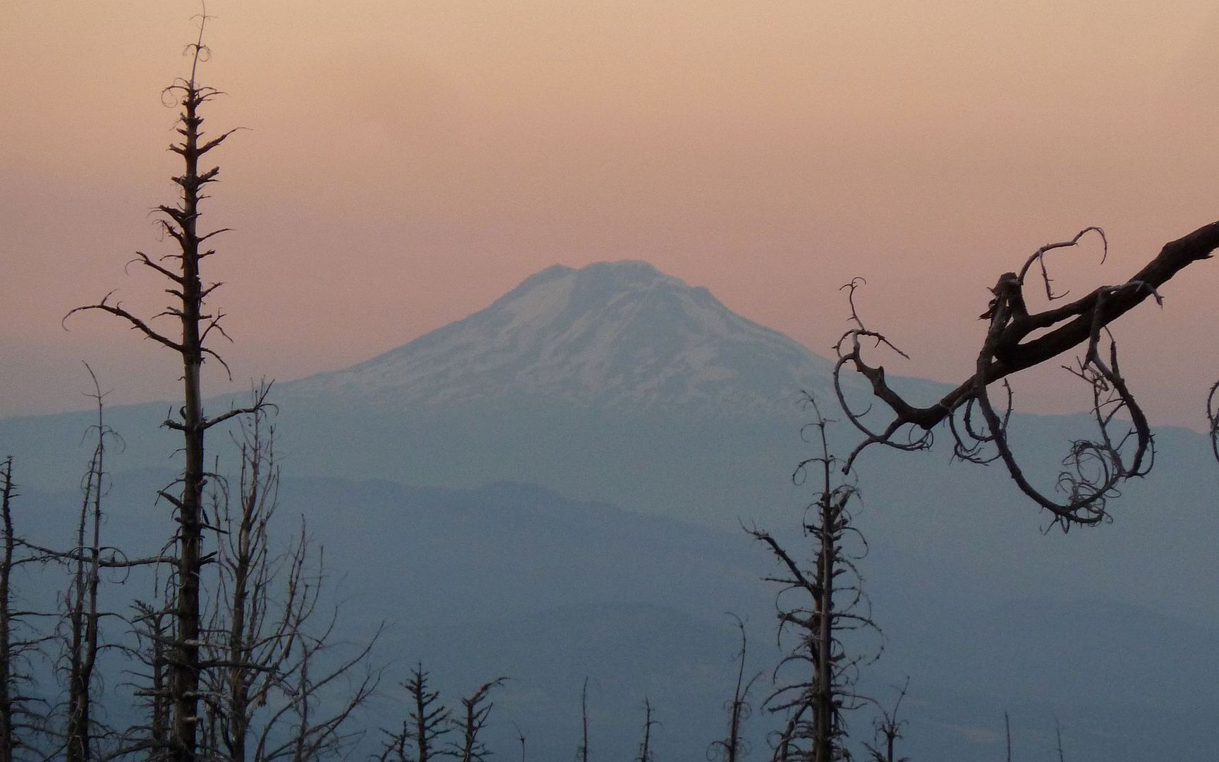
I still can't believe they saved all these structures, as well as Cloud Cap, from that fire in 2008! Wow, wow, wow. The hike back to Cloud Cap passed through some of the burned area. Recovery is still very slow. The fire appeared to have been far more recent than four years ago.

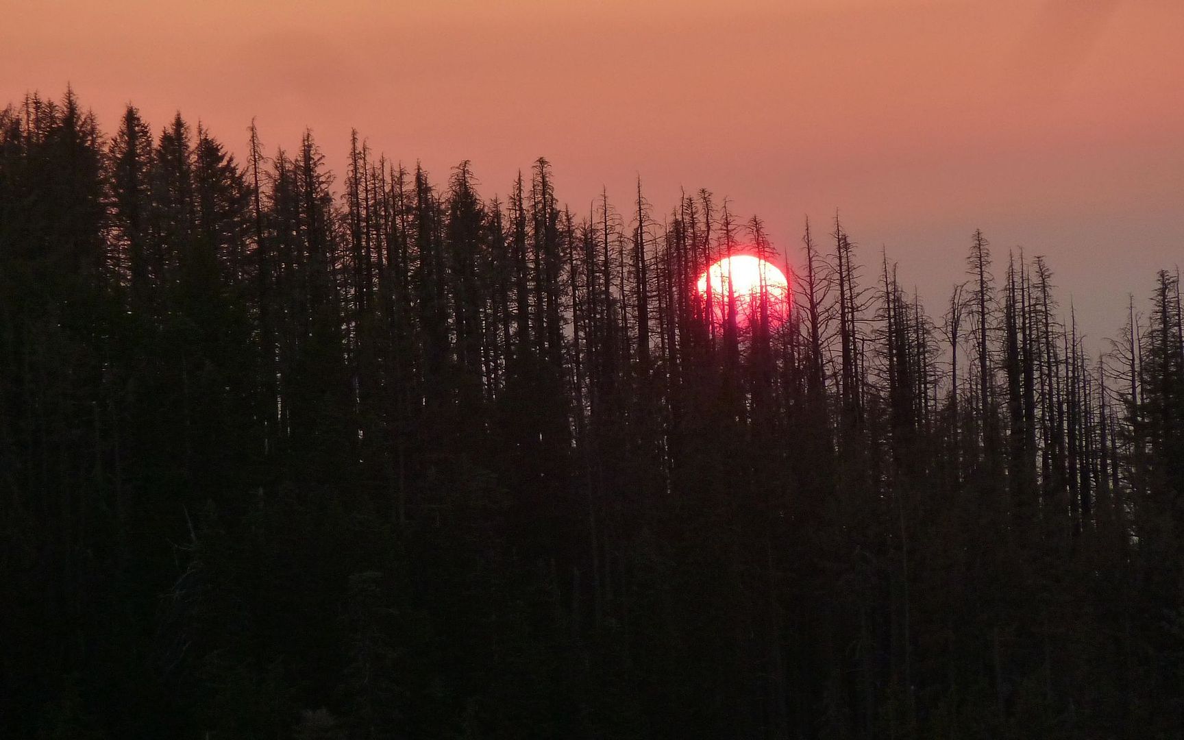
Got back to Cloud Cap just as the sun's rays were at their warmest yellows turning to reds.

Image

Image

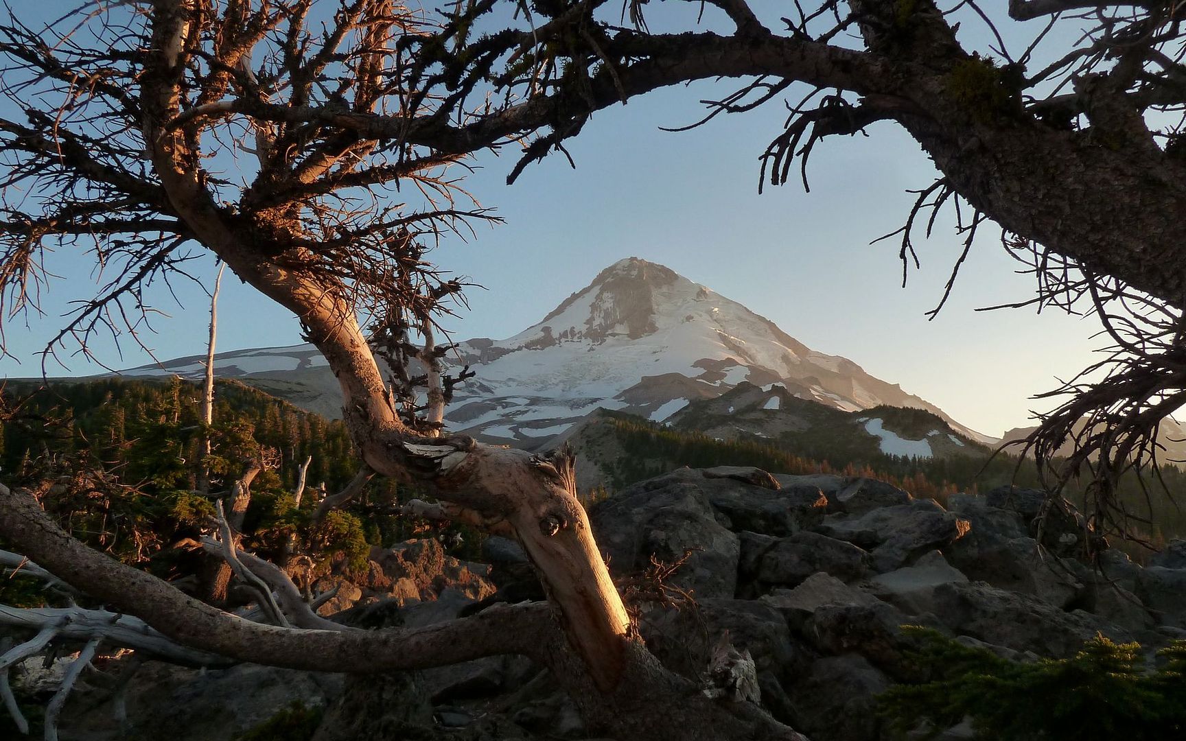
And started back down the road as the sun dropped below the charred horizon.

Image

Image

What a day! I apologize to the group for this newbish TR, gushing on and on about a place I'm sure many/most here are totally familiar with. But, well, I guess I'm the opposite of speechless over it, whatever that may be. I'll try to remember that, and keep this one high on the list of recommends for others who may not have had the chance to get up here before. :)

http://gpsfly.org/gps_map.php?gps_id=1721&w=645&h=440
According to gpsfly: 11.9 miles, 4600' EG
Last edited by kepPNW on August 14th, 2012, 5:30 am, edited 1 time in total.
Karl
Back on the trail, again...

User avatar
hlee
Posts: 513
Joined: April 16th, 2012, 12:41 pm
Location: St. Helens, Oregon

Re: Cooper Spur and Gnarl Ridge, 10-Aug-2012

Post by hlee » August 13th, 2012, 5:52 pm

IMO, there are too many TRs here that are just "Well, everyone here already knows everything about this trail, so I'll just post photos." Which is cool, but there's nothing wrong with giving more in-depth descriptions too. There's probably a lot more people curious about heading up Hood that have never been, especially right now. I'm sure they appreciate the fresh perspective.

Very interesting TR. Did you take any pics of the view?

Hannah

Only those who will risk going too far can possibly find out how far they can go.
-- T.S. Eliot

User avatar
Peabody
Posts: 524
Joined: August 12th, 2011, 8:37 pm

Re: Cooper Spur and Gnarl Ridge, 10-Aug-2012

Post by Peabody » August 13th, 2012, 6:29 pm

Excellent trip report! I enjoyed it very much. I'm planning on heading there this weekend for the first time. One thing I've noticed about trip reports, the trail may be the same but the impression it leaves on the hiker is always unique.
"I arise in the morning torn between a desire to improve the world and a desire to enjoy the world. This makes it hard to plan the day.”
― E.B. White

User avatar
kepPNW
Posts: 6411
Joined: June 21st, 2012, 9:55 am
Location: Salmon Creek

Re: Cooper Spur and Gnarl Ridge, 10-Aug-2012

Post by kepPNW » August 13th, 2012, 6:42 pm

hlee wrote:IMO, there are too many TRs here that are just "Well, everyone here already knows everything about this trail, so I'll just post photos." Which is cool, but there's nothing wrong with giving more in-depth descriptions too. There's probably a lot more people curious about heading up Hood that have never been, especially right now. I'm sure they appreciate the fresh perspective.

Very interesting TR. Did you take any pics of the view?
Appreciated! I sorta half wrote that thinking I was filling in the holes in the info I had turned up here and other places, before going up, yeah. I still can't believe I've lived here that long without doing that one.

There was some haze on the horizon, so most of the shots of other volcanoes didn't come out all that clear. For example, here's looking south from 8500'. The Sisters are there, but you can only just barely see them in this shot.

Image
Click for full-screen size.

The shot of the Mazama remembrance showed Rainier and Adams, and you can again see the haze. I suppose the 360° YouTube video probably has the best sense of it.

Most of my shots up high were of closer targets right on the mountain. Hmmm, here's one looking north at 9000' that shows St Helens, Rainier and Adams, all over the Elliot Glacier.

Image
Click for full-screen size.

The complete slideshow is over at EveryTrail. Actually, not "complete", just the 100 or so best. :lol:
Peabody wrote:Excellent trip report! I enjoyed it very much. I'm planning on heading there this weekend for the first time. One thing I've noticed about trip reports, the trail may be the same but the impression it leaves on the hiker is always unique.
Thank you! I'm sure that's the case, yep. And on this one, you have plenty of opportunity to find your own trail, given how well hidden they are in so many places! :)

It's a great time to be up high on that mountain! :D
Karl
Back on the trail, again...

User avatar
Splintercat
Posts: 8333
Joined: May 28th, 2008, 10:03 pm
Location: Portland
Contact:

Re: Cooper Spur and Gnarl Ridge, 10-Aug-2012

Post by Splintercat » August 13th, 2012, 6:59 pm

Thanks, Karl - that is still my favorite corner of the mountain. I love the broad expanse of tundra on the shoulder of Cooper Spur. VERY cool to see marmots up there! I've never seen them on Hood, so my hopes are up after seceral recent reports!

Not sure if you were asking, but the use trail on the moraine descends to Cloud Cap. I've included that loop in the field guide (the section from the shelter to the Cairn at the crest of the moraine is one of my adopted trails, along with the TT from Cloud Cap Saddle to the Tilly Jane junction).

Great photos and report!

Tom :)

User avatar
Waffle Stomper
Posts: 3707
Joined: May 28th, 2008, 10:03 pm

Re: Cooper Spur and Gnarl Ridge, 10-Aug-2012

Post by Waffle Stomper » August 13th, 2012, 7:14 pm

Excellent trip report, glad to see the hike through your eyes.
"When we try to pick out anything by itself, we find it hitched to everything else in the Universe." - John Muir

User avatar
kepPNW
Posts: 6411
Joined: June 21st, 2012, 9:55 am
Location: Salmon Creek

Re: Cooper Spur and Gnarl Ridge, 10-Aug-2012

Post by kepPNW » August 13th, 2012, 7:24 pm

Splintercat wrote:Thanks, Karl - that is still my favorite corner of the mountain. I love the broad expanse of tundra on the shoulder of Cooper Spur.

Yeah! That portion from the 4-way junction southward? That was a joy to walk through on my return. There were so many different (what's the word?) "regimes" on this journey. I probably doubled the FG mileage, as it really just became an exploration after making the main goal.
Splintercat wrote:VERY cool to see marmots up there! I've never seen them on Hood, so my hopes are up after several recent reports!
As is always the case, they saw us much before we did them. I was trying to figure out who was calling to us for a couple minutes before I focused in on them. Here's papa:

Image
Click for full-screen size.
Splintercat wrote:Not sure if you were asking, but the use trail on the moraine descends to Cloud Cap. I've included that loop in the field guide (the section from the shelter to the Cairn at the crest of the moraine is one of my adopted trails, along with the TT from Cloud Cap Saddle to the Tilly Jane junction).
Yeah, the fellow I was hiking with who came up that way told me he'd seen me in the parking lot. I'm not at all sure how we ended up on such very different trails, though. I only saw the Timberline going up from Cloud Cap. There's also a trail down into that valley from the shelter? That one I didn't see either. But there were, as you said, "informal" trails everywhere up there!
Splintercat wrote:Great photos and report!
Waffle Stomper wrote:Excellent trip report, glad to see the hike through your eyes.
Thanks, both of you, for the kind words!
Last edited by kepPNW on August 13th, 2012, 7:31 pm, edited 1 time in total.
Karl
Back on the trail, again...

User avatar
awildman
Posts: 918
Joined: June 6th, 2009, 5:20 pm
Location: Portland

Re: Cooper Spur and Gnarl Ridge, 10-Aug-2012

Post by awildman » August 13th, 2012, 7:27 pm

Excellent trip report! I like enthusiasm - especially about the wilderness.
Rambling on at Allison Outside

User avatar
kepPNW
Posts: 6411
Joined: June 21st, 2012, 9:55 am
Location: Salmon Creek

Re: Cooper Spur and Gnarl Ridge, 10-Aug-2012

Post by kepPNW » August 13th, 2012, 7:35 pm

awildman wrote:Excellent trip report! I like enthusiasm - especially about the wilderness.
Thanks, Allison! As you saw, I timed the turn-around almost to the minute for sunset. The day's are never long enough when you're in places like that, are they? :D
Karl
Back on the trail, again...

User avatar
bobcat
Posts: 2768
Joined: August 1st, 2011, 7:51 am
Location: SW Portland

Re: Cooper Spur and Gnarl Ridge, 10-Aug-2012

Post by bobcat » August 13th, 2012, 8:18 pm

Looks like a balmy, blue-sky day on the Spur! You placed your money correctly: the second of your three rocks is Tie-in.

When they had Cloud Cap closed off because of the burn, you had to hike this from down at the Cooper Spur Ski Area - now that was a memorable jaunt!

John

Post Reply