Whetstone Mtn / Silver King Lake 22-Jul-2012
Posted: July 23rd, 2012, 6:00 pm
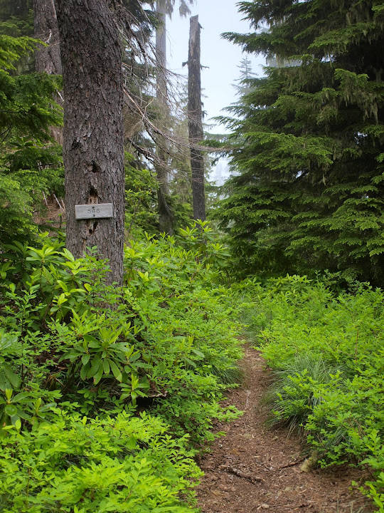
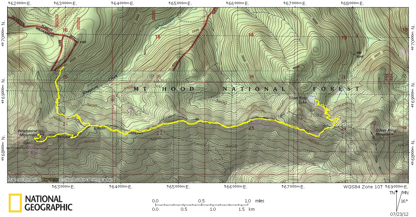
I'd been up Whetstone Mtn before from the Opal Creek side but this my first time from the N via Tr 546. This is Hike #38 in Lorain's 100 Classic Hikes in Oregon. The directions in the book will get you to the TH but I found that going up FR 7020 is a bit quicker than circling around via FR 7030. From the TH, Tr 546 heads S to reach the top of Whetstone Ridge in about a mile.
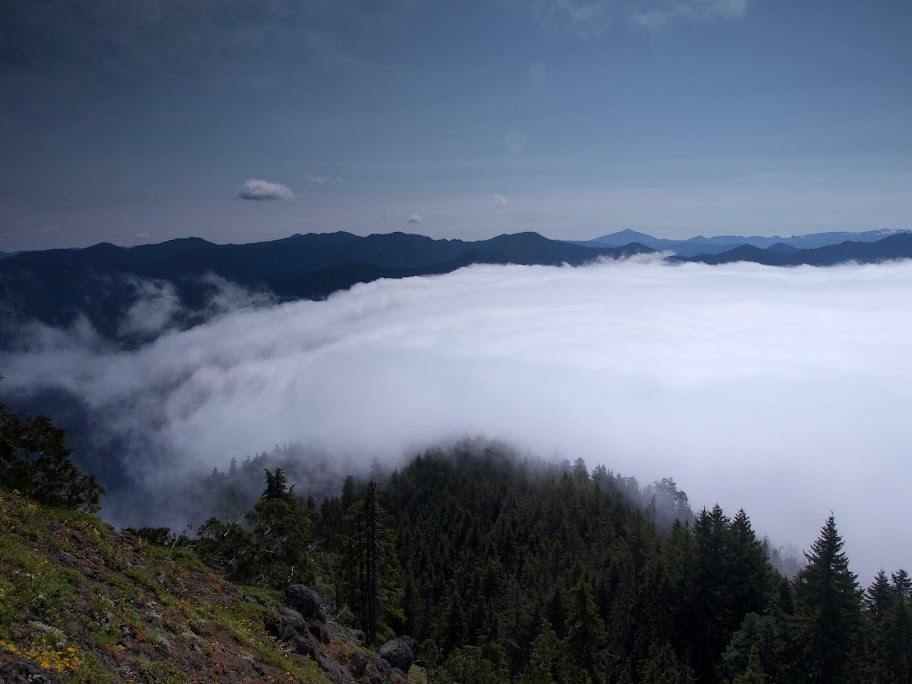
It was overcast in Portland and looked to be clearing over the ridge, but it seemed like a good idea to go for Whetstone Mtn and its views while I could. From the summit, I could see the clouds pouring over the ridge below.
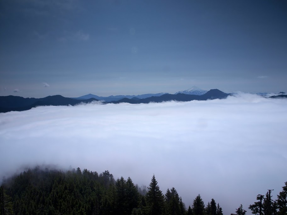
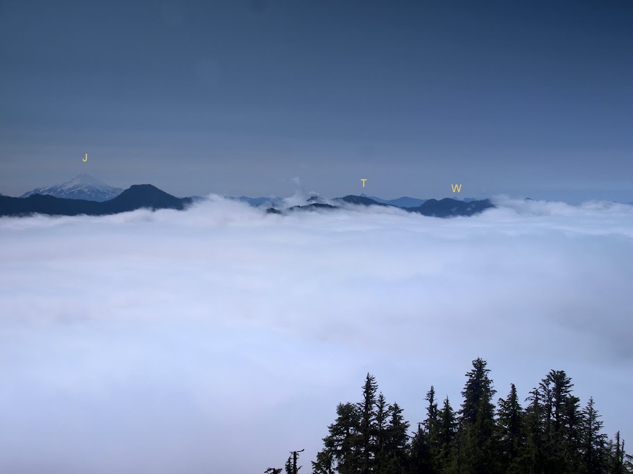
Jefferson was visible on the far horizon to the S, seemingly floating on a fluffy sea of clouds.
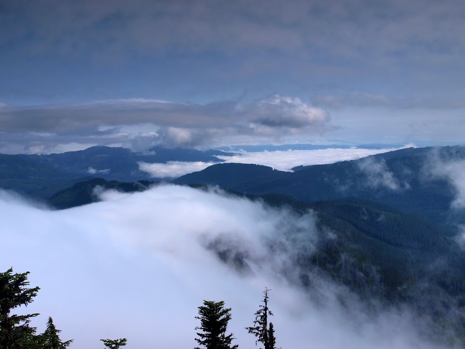
To the N, Hood was dimly visible amidst a constantly changing swirl of clouds.
After some squinting, I concluded that the pointy tips of Three Finger Jack (T) and Mt. Washington (W) were also visible on the far S horizon, just over from Mt. Jefferson (J).
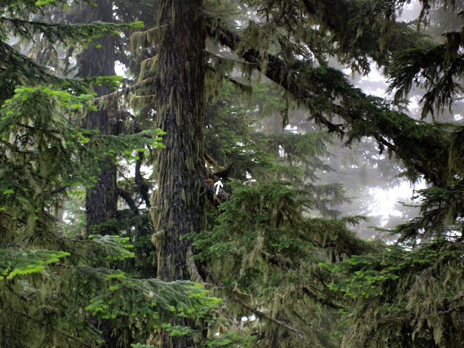
My original plan had been an out & back to Twin Lakes, so I headed E on TR 546. Along the way this grouse (arrow) started clucking and juvenile grouse shot, one after the other, out of the bushes on one side of the trail, directly past me, and into the brush near her. Thunder (or cardiac arrest) chickens in training.
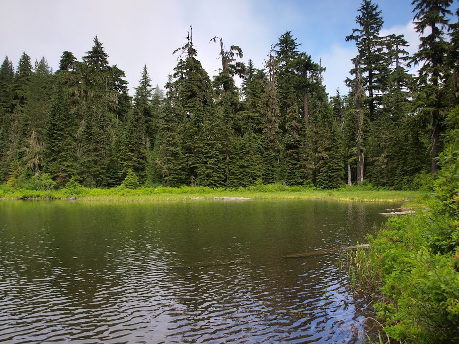
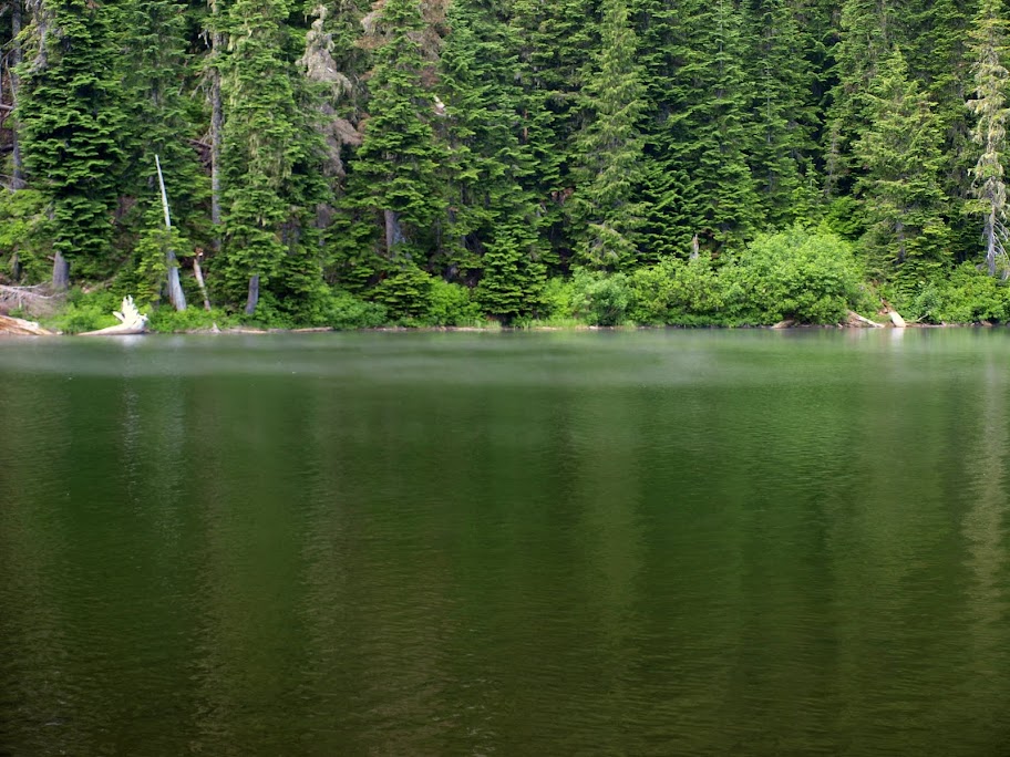
I kept going E and met two hikers who said it was clear toward Twin Lakes but the further E I went, the gloomier it got. At the Silver King Lake trail junction, I decided to see that lake instead of continuing on thru the mists. And, it actually looked like there might be a sun break over the lake (ha!). After a short trip down a sketchy in places but otherwise OK trail, I reached the lake and its retinue of mosquitoes. Even with the overcast, it's a pretty little lake.
When the mist started sweeping across the lake surface, I decided to head back.
Tr 546 is in generally good condition and starting at its higher TH gives you quicker access to a number of hiking opportunities in the area. Definitely worth another visit should a sunny day ever materialize when I'm not at work. 11.6 mi RT, 3000' EG (includes Whetstone and climb up from the lake).
It was overcast in Portland and looked to be clearing over the ridge, but it seemed like a good idea to go for Whetstone Mtn and its views while I could. From the summit, I could see the clouds pouring over the ridge below.
Jefferson was visible on the far horizon to the S, seemingly floating on a fluffy sea of clouds.
To the N, Hood was dimly visible amidst a constantly changing swirl of clouds.
After some squinting, I concluded that the pointy tips of Three Finger Jack (T) and Mt. Washington (W) were also visible on the far S horizon, just over from Mt. Jefferson (J).
My original plan had been an out & back to Twin Lakes, so I headed E on TR 546. Along the way this grouse (arrow) started clucking and juvenile grouse shot, one after the other, out of the bushes on one side of the trail, directly past me, and into the brush near her. Thunder (or cardiac arrest) chickens in training.
I kept going E and met two hikers who said it was clear toward Twin Lakes but the further E I went, the gloomier it got. At the Silver King Lake trail junction, I decided to see that lake instead of continuing on thru the mists. And, it actually looked like there might be a sun break over the lake (ha!). After a short trip down a sketchy in places but otherwise OK trail, I reached the lake and its retinue of mosquitoes. Even with the overcast, it's a pretty little lake.
When the mist started sweeping across the lake surface, I decided to head back.
Tr 546 is in generally good condition and starting at its higher TH gives you quicker access to a number of hiking opportunities in the area. Definitely worth another visit should a sunny day ever materialize when I'm not at work. 11.6 mi RT, 3000' EG (includes Whetstone and climb up from the lake).