
The elevation in the HCNRA ranges from 1,000’ at the Snake River to 9,393’ He Devil in the Seven Devils Mountains in Idaho. The terrain, climate and vegetation vary widely as well. Much of the area within HC is inaccessible by road. Only three roads reach the Snake River within HC and the canyon rim has only a few viewpoints accessible by car.
I had never been to that area before until I visited last year by car to the HC Overlook and to HC Dam. I became intrigued by all the trails on the map and thought that a backpacking trip was in order. Hence, early this year I began research on the trails, mileage, elevation, terrain, water sources, campsites and history of the area.
I ended up focusing on the road on the western rim, known as the Lord Flat Road, also known by other names such as the Summit Ridge Trail. The original goal was to start at Warnock Corral four miles from Hat Point, walk the road to Lord Flat, backtrack to Somers Point, descend into the canyon to the Bench Trail (a.k.a. High Trail) to Temperance Creek, then back to Warnock Corral.
To get to Hat Point, from Portland take I-84 260 miles to La Grande, Hwy 82 70 miles to Joseph, Hwy 350 30 miles north to Imnaha, 22 miles on a sometimes steep and cliffy gravel Hat Point Road to Hat Point, then another 4 miles to Warnock Corral. With one stop for gas and food in La Grande and three stops at viewpoints along Hat Point Road/Lord Flat Road, we made it to Warnock Corral in 8 hours.
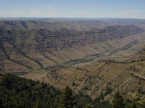
View Along Hat Point Road (Five Mile Observation Site)
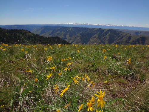
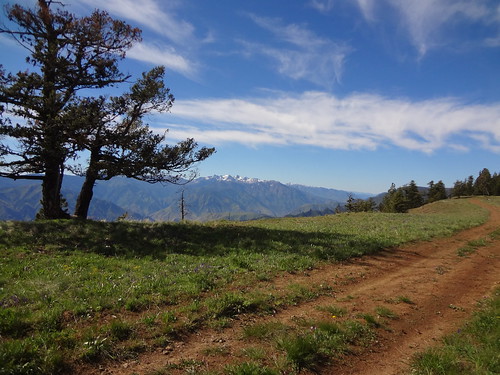
View Along Hat Point Road (Balsamroot/Wallowas)
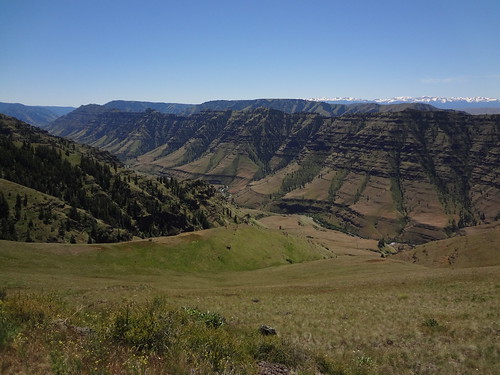
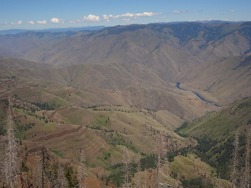
View Along Hat Point Road (Imnaha River Valley from Granny View Observation Site)
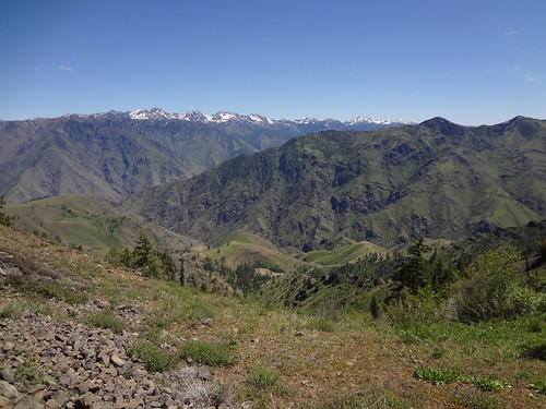
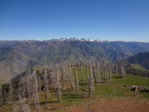
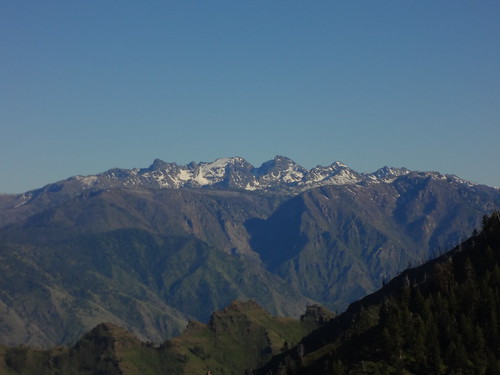
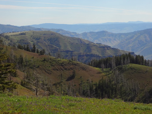
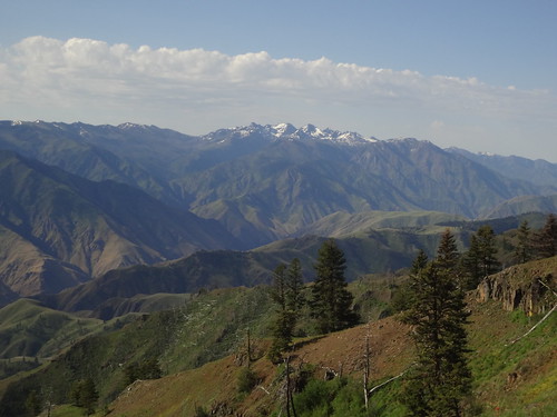
View Along Hat Point Road (Seven Devils Mountains)
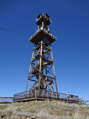
At Hat Point we (Hiker Chris and I) took the short walk to the lookout tower and climbed the steps 70 feet to near the top of the lookout. At 6982', Hat Point is the highest point on the western (Oregon) side of the HC rim and has views that can only be described with pictures. Hat Point got its name when, in the 1890's, a horse bucked a cowboy, causing him to lose his hat. The hat was later found and hung from a tree, where it stayed for over a year.
View From Hat Point Lookout (1)
View From Hat Point Lookout (2)
Hat Point 360 (0:47)
Hat Point Lookout
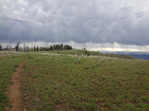
After stopping at Hat Point, we drove the four miles to the Warnock Corral trailhead. Most people who make it this far take the Temperance Creek trail down into the canyon, but Chris and I followed Lord Flat Road. Note: There is a spring at this trailhead.
Warnock Corral
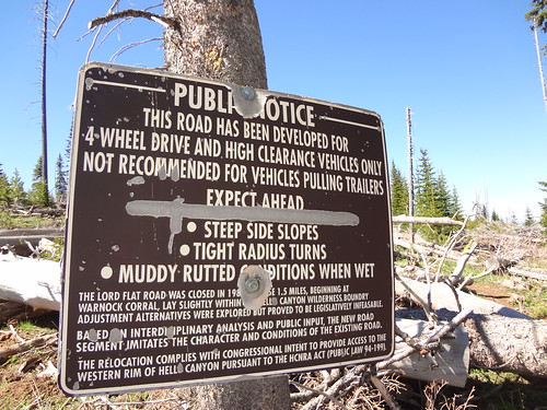
Lord Flat Road is open to motorized vehicle traffic, but only high clearance 4WD vehicles should attempt driving on it. While much of it is a good road that even passenger cars could drive, there are many spots I wouldn't want to drive my high clearance 4WD truck on. Because of this, very few vehicles drive the road. We saw one SUV near the start during our trip and that's it.
Lord Flat Road has been a subject of litigation due to, among other reasons, part of it was originally within the HCW. That part was re-routed to be outside the HCW. If you are interested in learning more about the litigation, here is a link to an informative article: http://www.lagrandeobserver.com/News/Lo ... st-Service
Sign on Lord Flat Road After Warnock Corral
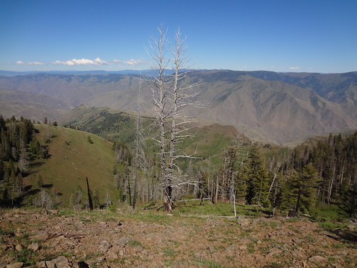
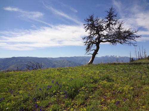
Right away, the views from Lord Flat Road became stunning. I quickly realized this trip was going to be one of my favorites - in the top 5 for sure.
First Great View From Lord Flat Road
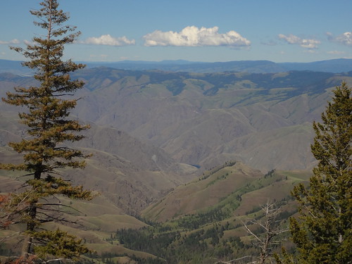
View From Lord Flat Road
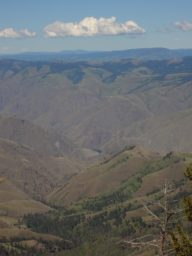
View From Lord Flat Road
View From Lord Flat Road/Seven Devils Mountains
View From Lord Flat Road/Showing Some Of The Ups And Downs Of The Road
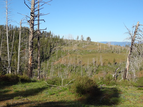
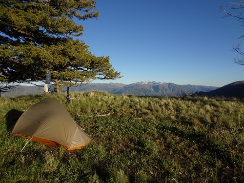
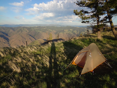
After 6.5 miles and much picture taking, we decided to make camp on a green knob after Indian Grave Saddle. There was supposed to be a historic gravesite, piped spring water and a good campsite nearby, but we never found any of them, although now I think I know where they are. Since we were OK on water, we just made our own campsite up on the knob.
Campsite First Night
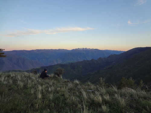
Nightfall First Night
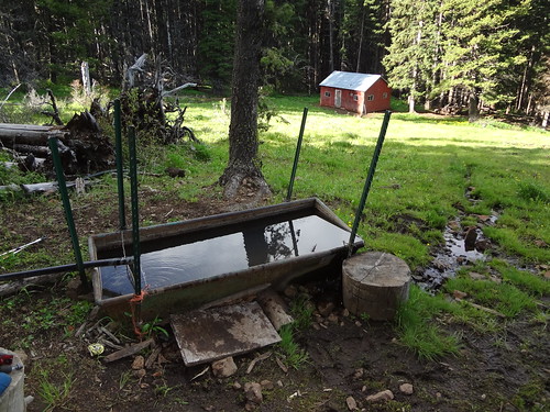
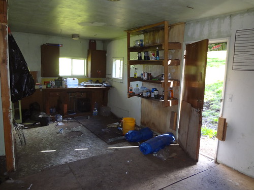
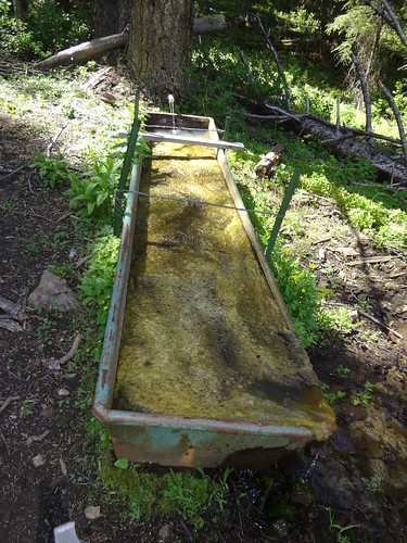
The next day, our first priority was to find water. There were some mud puddles on the road, but we were holding out for the spring that was supposed to exist a couple miles down the road after Ninemile Saddle (btw, Ninemile Saddle is at 7.4 miles). Sure enough, not too far after Ninemile Saddle was an unsigned track on the left that led to an old cabin. After looking around, we saw a water trough with piped water draining into it. The spring water was a refreshing 40 degrees and crystal clear. Nearby was a great campsite.
Spring/Trough/Cabin
Inside The Cabin
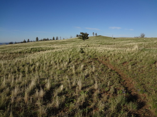
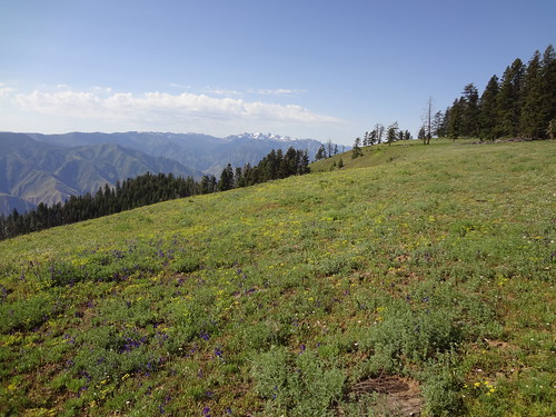
At around 9 miles we came to a place called "Parliament" on the map. It's hard to describe how beautiful this grassy, flower-filled area is, so I'll let the pictures and video do that. The Parliament section of the trail went on for at least a mile.
View From Lord Flat Road/Parliament
View From Lord Flat Road/Parliament/Somers Point
View From Lord Flat Road/Parliament
Parliament 180 (0:19)
Parliament 360 (0:38)
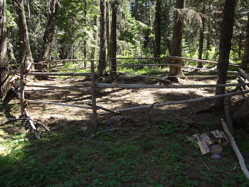
After another mile and a half or so, the road meets up with the first turnoff to Somers Point. That would be our eventual destination that night, but first we had to go another 5.5 miles to Lord Flat. Before that was the second turnoff to Somers Point where we found another spring and a hunters camp. Hunters sure do make elaborate camps.
Spring/Water Trough/Green Slime: The water coming out of the pipe was clean
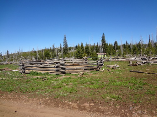
Hunters Camp Stuff/Corral
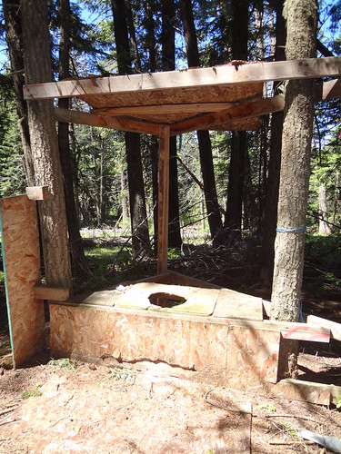
Hunters Camp Stuff/Outhouse (and I mean OUT-house!)
While we rested at the hunters camp we had a snack. As I ate my summer sausage, I spilled some of the juice on my pants. That made me concerned that I would be target for bears, as they have an excellent sense of smell. Fortunately, I never got attacked. I wasn't originally going to eat the entire 900 calorie summer sausage in one sitting, but it's amazing how much a hungry backpacker can eat.
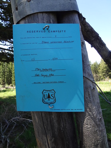
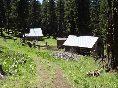
Continuing along Lord Flat Road, the trail moved away from the rim into a more forested landscape before becoming mostly meadows. Before coming to Lord Flat is Dorrance Cow Camp. I couldn't find much information about the history of this site, other than it is owned by the USFS. Besides the structures, there is also a piped spring. There was a sign posted there that noted that the camp had been reserved for a commercial outfitter from May 1st to November 30th. I wonder how they were able to reserve that awesome place for an entire outdoor season. Seems fishy to me.
Sign At Dorrance Cow Camp
Dorrance Cow Camp
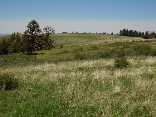
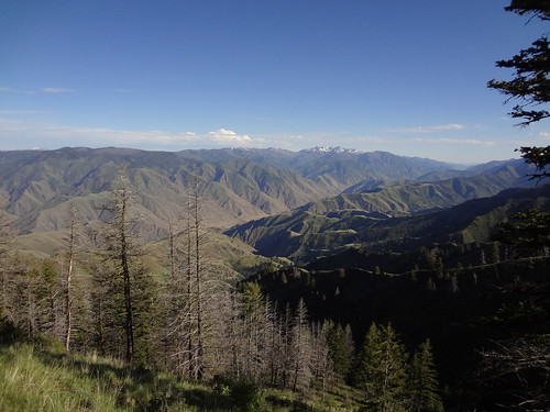
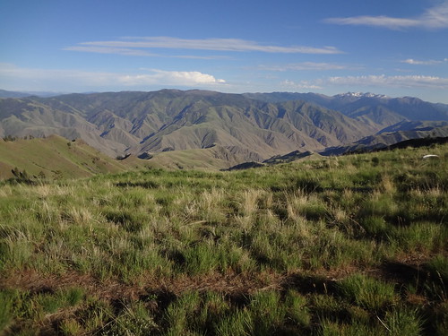
Shortly after Dorrance Cow Camp, Lord Flat begins. Lord Flat is a mostly flat, grassy area with views of canyons, the Wallowa Mountains and the Seven Devils Mountains. Again, I'll let the pictures and movies describe it better than I can in words.
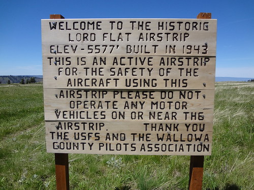
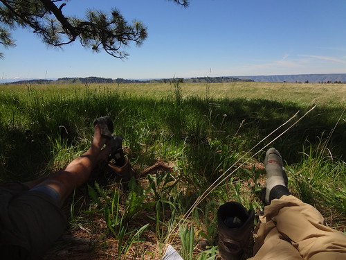
At the end of Lord Flat Road is the Lord Flat Airstrip, used mainly during hunting season. Chris and I took a long rest under a big ponderosa next to the airstrip. I could have stayed there for hours, but we eventually had to get to Somers Point later that day. While resting, people on two ATVs drove by on the airstrip
View From Lord Flat Road/Lord Flat
View From Lord Flat Road/Lord Flat
Sign At Lord Flat Airstrip
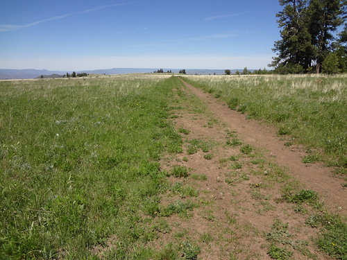
Lord Flat Airstrip
Kicking Back Next To Lord Flat Airstrip
Lord Flat 360 (0:36)
Lord Flat Walking (2:29) - Walking 3
After the rest at Lord Flat, we were on our way to Somers Point. Coming back we took the second turnoff to Somers Point. Going all the way back to the first turnoff would have added extra mileage. Good information to know about the trail at the second turnoff is that it goes towards the far left side of the small meadow, and not the more heavily used trail that leads to another hunters camp (with garbage). We had to search for the actual trail, as it faded into the grass. Also good to know is that Deep Creek, 1 mile from the second turnoff is a good source of water
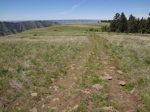
The trail to Somers Point gains and loses elevation several times, much of it on grassy ridge meadows with views that are hard to describe with words (I keep saying that, but it's true). We were headed for the very end of Somers Point where a source indicated there were places to pitch a tent. There was supposed to be a radio tower, but we never saw it. The tower was described as being unobtrusive, so maybe we didn't look hard enough or in the right place.
On The Way To Somers Point
On The Way To Somers Point
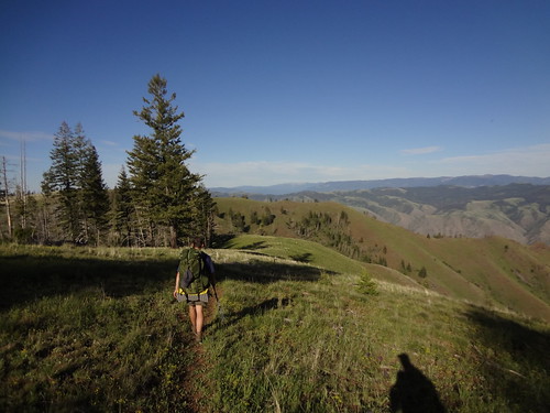
On The Way To Somers Point
On The Way To Somers Point
Towards the end of Somers Point, the trail became indiscernible from the grassy meadow, but it was obvious where to go. We were on the lookout for the Cougar Creek Trail, which we were planning on using the next day to descend to the Bench Trail. We found the sign for that trail, but could not see where the trail went. We figured we would worry about that the next day. After 20 miles the second day, we were finally at Somers Point. Wow! That's as good as I can describe the view from there.
There were plenty of places to set up a tent for that night. During the night, a squall came in with heavy winds and light sprinkles. It was so windy, even though I staked out the guy lines, my tent was bending sideways. The wind kept up most of the night, keeping me awake. Chris slept through the whole thing, except for the last half hour before we packed up. Eventually, the winds died down and the clouds moved off later that morning.
Somers Point 360 (0:26)
Campsite At Somers Point
Chris and I conferred about what to do that day. We both agreed that we had experienced what we came for. Specifically, I wanted to see Lord Flat and Somers Point. With that accomplished, we decided to head back to Lord Flat Road. We were also a little concerned about the weather forecast for that day and the next. It turned out to be a good decision because on the drive home and the next day it rained heavily and there were thunderstorms in the HC area.
The views were much the same on the way back, with different lighting. Still beautiful.
Coming Back Down From Somers Point
Animal Scat Emoticon

Coming Back Down From Somers Point/Panorama
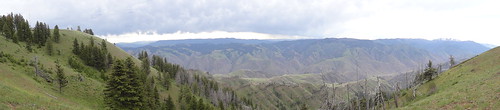
Coming Back Down From Somers Point
View From Lord Flat Road/Parliament (on the way back)
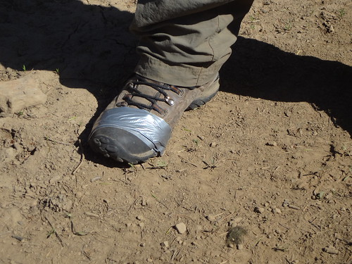
Chris' right boot had been developing a blowout, and eventually it got to a point where it was hurting his foot. He was able to perform emergency triage with duct tape. This just goes to show you that duct tape is a very versatile item that should always be part of a backpacker's gear.
Duct Tape Fixes Everything
Final notes:
• 5700' total elevation gain. Even though the starting point was 6700' and the low point was 5500', there were many ups and downs.
• 40 miles total.
• While there are campsites that have been made, you can make camp almost anywhere in the many meadows.
• My cell phone had 4 bars on Somers Point.
• Saw one mosquito the entire three days.
• Saw only one hiker, one vehicle and two ATVs the entire three days.
• Used Fred Barstad's "Hells Canyon and Idaho's Seven Devils Mountains" and Douglas Lorain's "100 Classic Hikes in Oregon" as resources. I was fortunate enough to speak with Fred Barstad a couple of weeks prior to this trip. Through his sources he confirmed the road to Hat Point was clear of snow and downed logs. You rock Fred!!
• Want to go back there again.
• I know there are a lot of picture and videos, but it was hard to decide which ones to include. I posted as many as I did for the enjoyment and information of others, in case they want to go to this area.
Link to all the pics on Flickr (yes, there are more pictures):
http://www.flickr.com/photos/54959080@N ... 254846694/
Good hiking,
Brad


