Spencer Butte/Meadow, Sister Rocks/Indian Heaven: 6/14-6/16

This forum is used to share your experiences out on the trails.
User avatar
Sean Thomas
Posts: 1647
Joined: February 25th, 2012, 11:33 pm

Spencer Butte/Meadow, Sister Rocks/Indian Heaven: 6/14-6/16

Post by Sean Thomas » June 16th, 2012, 10:22 pm

My girlfriend and I spent the least three days hiking some great trails in the Southern Washington Cascades. We left Portland early thursday morning and set up camp off dry creek road just east of Observation Peak and the Trapper Crk Wilderness.


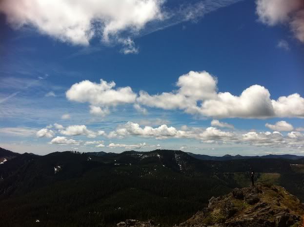
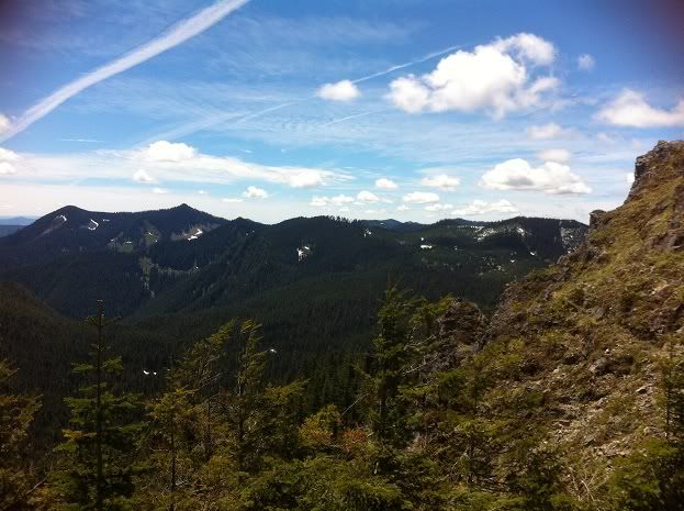
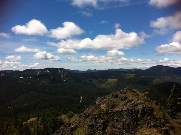
Standing on the summit of Sister Rocks:


Image


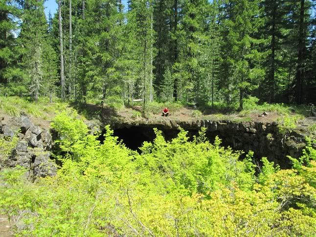
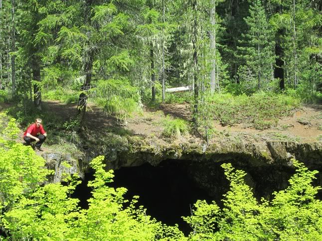
After setting up camp near Dry Creek we drove back toward Carson and turned onto Panther Crk rd. Heading past the campground and the falls we drove up to where rd 65 meets rd 67(about two or 3 air miles west of Red Mtn in the Indian Heaven Wilderness). Our plan was to check out some lava caves that can be accessed off the intersection with rd 601 and the Upper Falls Crk Trail. We found the caves after about a mile of rd walking and then planned to hike the upper Falls Creek Falls trail to its end at the Falls Crk Horsecamp. We didnt venture into the caves very far but they are incredible in most every way, heres me above one of the entrances:


Image


Image


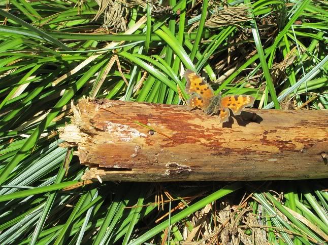
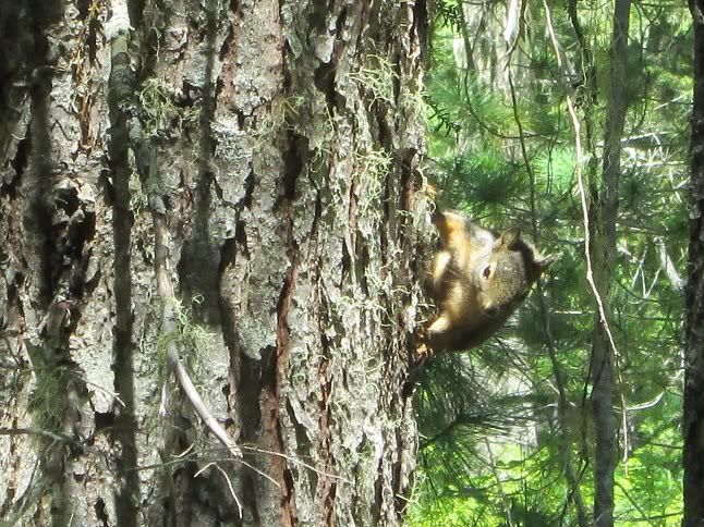
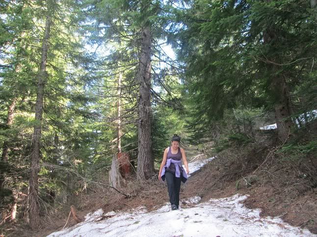
Working our way past the lava tubes and towards the Horse camp there were occasional views of Hood to the south and lots of late spring action from the locals:


Image


Image


We had a great lunch at the Horsecamp and with some time left before heading back we decided to push on into the Indian Heaven Wilderness. We followed the Indian Racetrack Trail #171 for about a mile before we had to turn around. There wasnt hardly a drop of snow on the Upper Falls Crk trail but as soon as we started ascending up the plateau proper the Race track trail was fully blanketed in snow. This was expected but the snow was consolidated and the trail was pretty simple to follow. We admired the wilderness for a bit and thought it best to head back to the car for a detour up to the McClellan Viewpoint off Curly Crk Rd.


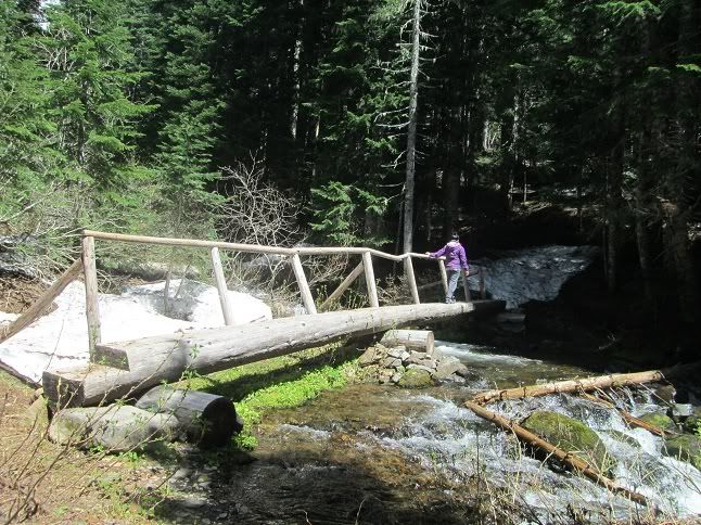
Jojomachine crossing Falls Crk on the Indian Racetrack Trail:


Image


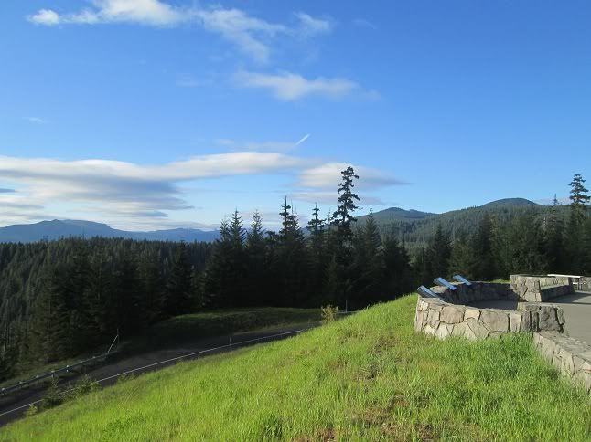
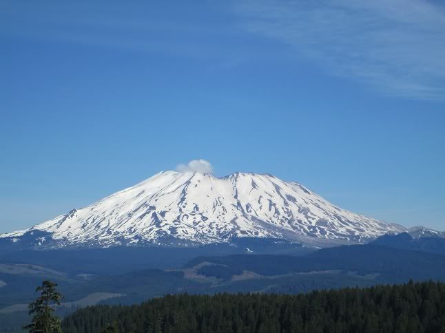
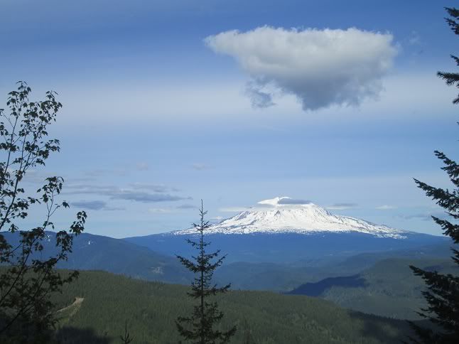
The viewpoint is accessed off Curly Creek Rd which connects Upper Wind River Rd and Forest Rd 90. It's an amazing viewpoint with St Helens dominating the skyline:


Image


Image


We got back to camp with about an hour of daylight left and enjoyed some warm food super-recliner style:
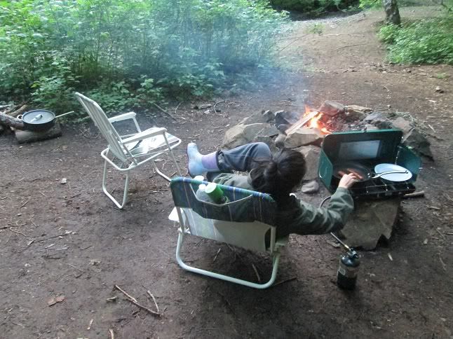
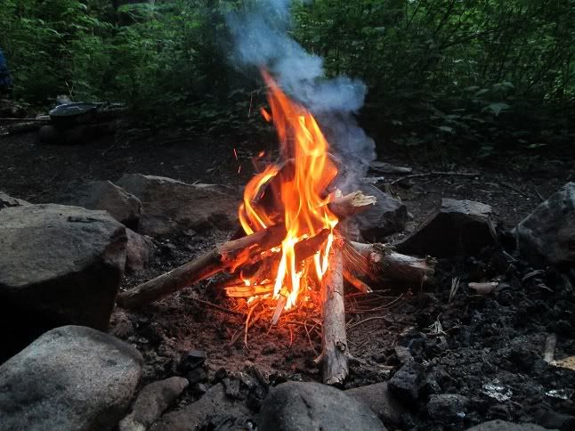

Image


With a warm fire:


Image


The next morning we set our sights on hiking to Spencer Butte and Spencer Meadow via the Bluff trail. Spencer Butte is about 8-10 miles east of the popular Lava Canyon and the eastern boundary of the Mt St Helens National Monument. It tops out at 4247 ft and its namesake trail runs high above on a ridgeline that seperates the Lewis River and Clear Creek Valleys. Normally the Spencer Butte Trail #30 is accessed via rd 93 making the hike to the top short and easy. But with rd 93 still snowed in we parked down in the Lewis River Valley and used the Bluff trail to reach rd 93 about 1700ft above.


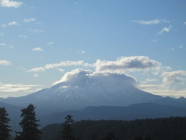
In order to reach the Spencer Butte TH from our camp we had to drive back past the McClellan Viewpoint friday morning. So we stopped in for breakfast and a clearer view of St Helens than the day before :)


Image


The Bluff trail is little used because of its steepness and probably more so for the fact that it ends on rd 93 about a mile or so from the northern Spencer Butte TH and about 2 miles from the southern TH. We headed north on 93 and found the rd that leads to the begginning of the trail. Rd 93 and the top of the Bluff trail were a little bit snowy but nothing unmanagable. The butte was almost entirely covered in snow but because the trail allows motorbikes as well it was wide and somewhat easy to follow. The up and down snow hiking was challenging after the Bluff trail but never too bad as the sun tried to break through the trees. It was a perfect time to visit as the motor bikes cant make their way up yet.


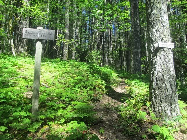
The Bluff Trail, which branches off the Lewis River Trail for three miles and termintaes at rd 93:


Image


Image


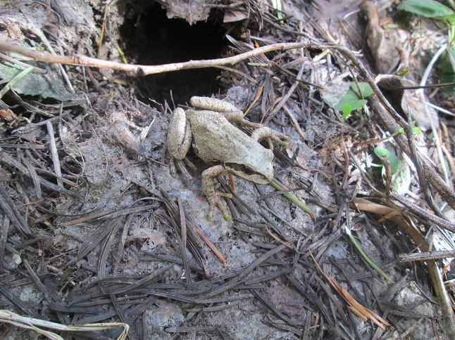
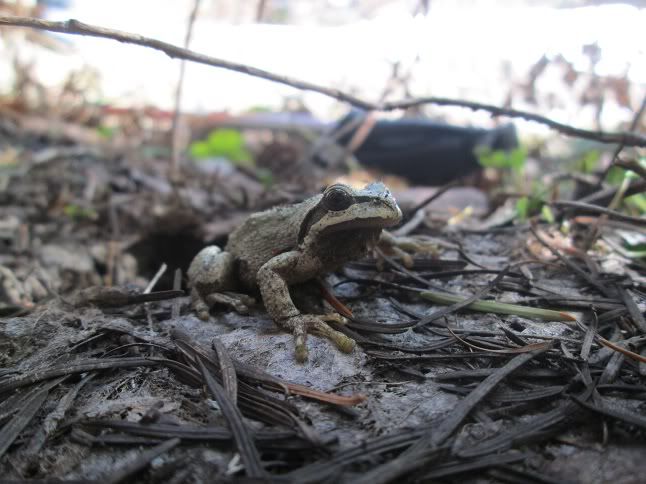
The Bluff trail crosses very close to the headwaters of Spencer Crk right before it ends at the road, this little guy was just popping out of the ground:


Image


Image


Dan Nelson's book from 2007 described good views from the summit of Spencer Butte but it seemed the best vantage point was on the trail just below the summit. Mt Adams from Spencer Butte and the old fire lookout pillars:


Image


Image


Spencer is the name of the game around here as there is a Spencer Butte, Spencer Meadow, Spencer Arch, Spencer Peak and a Spencer Bluff Trail. All of these trails/destinations are in close proximity to eachother. After lunch in a melted out spot a top the butte we took the trail back to rd 93 and stopped off at Spencer Meadow. The meadow is huge and easy to find from rd 93 boasting birds of many colors, shapes and sizes. The only hikers we saw all day had come up from the Cussed Hollow Trail off rd 90 to camp at the Meadow. The Cussed Hollow Trail is open to motor bikes as well and according to the hikers at the camp is in bad shape from tire tracks and erosion. Here's the meadow:


Image


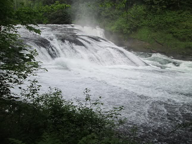
Back at FR 90 and the Lewis River we headed a little further up the rd to check out the Lower and Middle Falls:
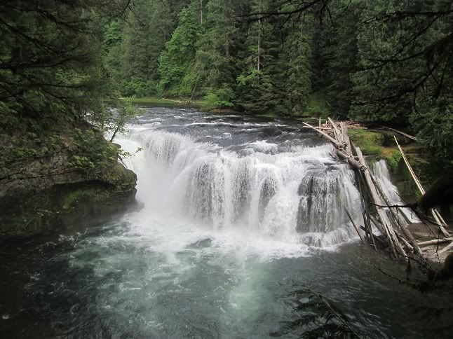
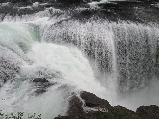

Image


Image


Middle Falls:


Image


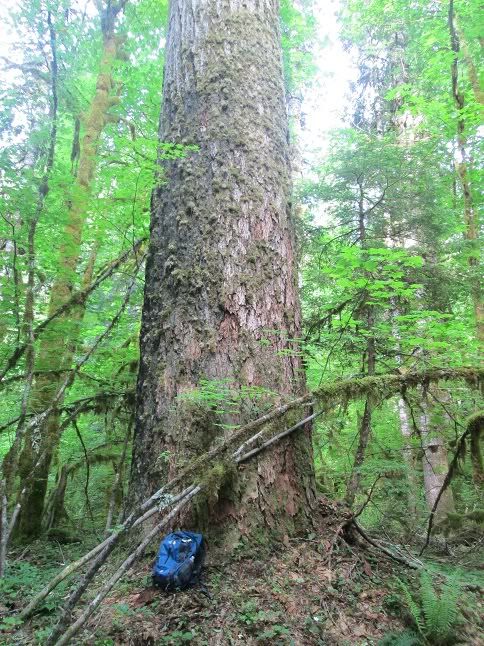
We stopped at the McClellan viewpoint again on our drive back to camp but the sunset was a little hazy and didnt turn out any good shots. Saturday morning I woke up early and walked across the street(dry creek rd) to the Big Hollow TH and spent the morning under some of my favorite old giants. The giants are just off the dry creek trail where it intersects the big hollow trail, here is a bag for scale:


Image


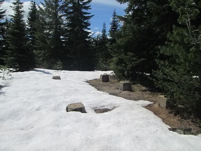
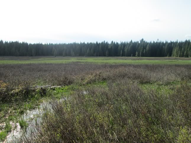
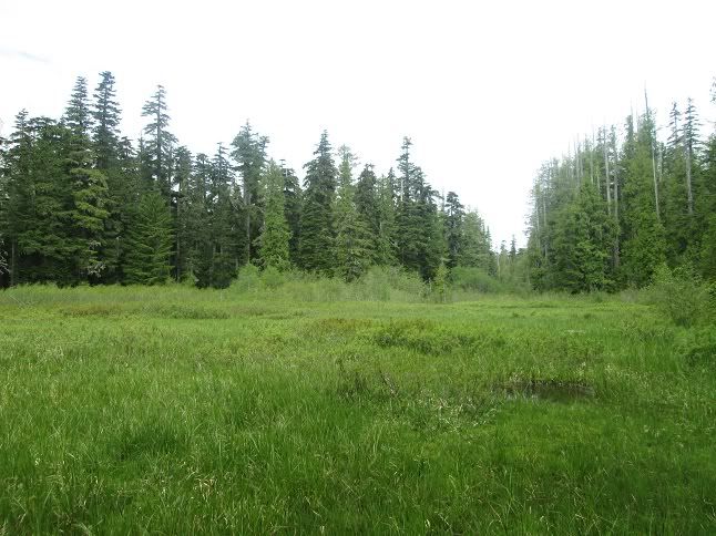
Our plan for the last day of the trip was to check a little known trail called the Paradise and Paradise Hills Trail. The Paradise trail runs north/south on the ridgeline east of dry creek and tops out a spot Called Rock Point around 3800 ft. The Paradise Hills Trail appears to be short serving as a connector trail from a marshy meadow off rd 225 to the Paradise Trail. What appeared to be a small lake on my map turned out to be a marshy area right near the Paradise Hills TH. We shwacked to the meadow and I spooked an Elk on the way, I screamed and Joie rolled her eyes at me after. Here's a picture of the marshy area:


Image


Image


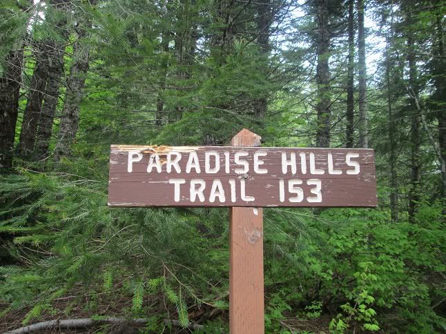
From the gravel rd driving toward the TH I could see the ridgeline off in the distance and it didnt look promising in terms of views. After spooking the Elk and finding the meadow we made the game time decision to leave the unknown Paradise Trail system and drive further up rd 58 to see if we could make it to the Upper Observation Peak TH. I have only hiked to Observation from the Lower TH's and wasnt sure if we would be able to get close at this point in the year. With luck we were able to drive our little honda civic until snow blocked road 58 around 3500 ft. This was just before it intersects with rd 223(about a mile from the TH). We walked the road which was snow free after a short drift where we parked and found the TH snow free. Heading for Sister Rocks and some of the best views around we made our way south on the Observation Trail #132. The trail was snow free for about the first 1/2 mile then intermittent snow covered the corridor until the intersection and Sullivans Boulder Viewpoint.


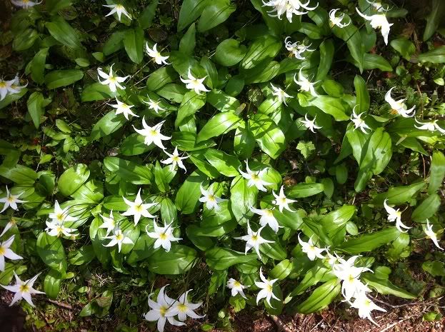
On the way we counted hundreds of White Fawn Lilies:


Image


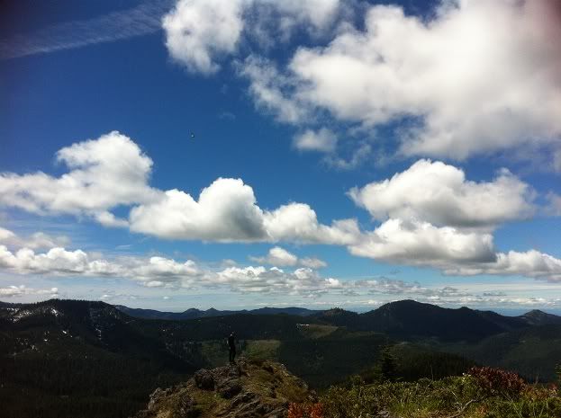
We left the viewpoint with a little over a 1/2 mile to go to the summit of Sister Rocks. Although snow covered the trail wasnt difficult to follow and past visits made it easy directionally. With a few wildflowers at our feet, breaking out onto the summit was more than the eyes could handle:


Image


Image


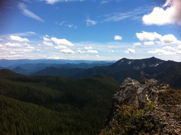
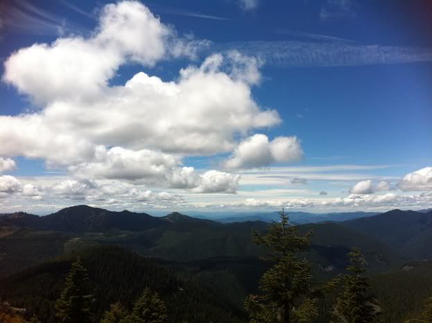
We had lunch in the shade for about 45 minutes and then headed back out to the top for a few more views of the big mountains, Soda Peaks, the Siouxon area and more:


Image


Image


Image


After bombing back to the car we drove back and packed up camp just in time to hit the old antique shop in Carson. Last year we found a gorge map from 1963 so I was curious was else there might be. Got super lucky and found a 1967 Gifford Pinchot Map, 1969 Mt Hood Forest Map(North Half) and a Washington Railroad Map from 1909. What a trip!

User avatar
jojomachine
Posts: 103
Joined: August 25th, 2011, 12:19 pm
Location: Portland, OR

Re: Spencer Butte/Meadow, Sister Rocks/Indian Heaven: 6/14-6

Post by jojomachine » June 18th, 2012, 11:44 am

We got lucky with the weather! I had so much fun hanging out and being lazy. lol. We gotta comeback and do more recliner camping!!! :) I'll post more pics later. :)
Ang pagkakataon sa buhay ay madalang dumating, Kapag narito na, ating samantalahin. [tagalog proverbs]

User avatar
drm
Posts: 6154
Joined: May 28th, 2008, 10:03 pm
Location: The Dalles, OR
Contact:

Re: Spencer Butte/Meadow, Sister Rocks/Indian Heaven: 6/14-6

Post by drm » June 18th, 2012, 1:45 pm

That's some wide-ranging exploring. I've been up on Paradise Ridge before, but never on FR93. It's on my list to try this summer - maybe. I still owe a trip to the Dark Divide from FR90. I found a shortcut to it last year, but need to go back when the snow really and truly gone.

User avatar
CuriousGorgeGuide
Posts: 260
Joined: March 28th, 2010, 10:48 am

Re: Spencer Butte/Meadow, Sister Rocks/Indian Heaven: 6/14-6

Post by CuriousGorgeGuide » June 19th, 2012, 9:00 am

Sean, have you ever seen the Spencer Arch?? I've been meaning to get up there to check it out, but I never have so far. I don't really know where it is...just some vague directions from a southern Wa geology guidebook.
If you're interested in exploring those Falls Creek caves, my book and blog probably have the only available directions as to the complicated route to get into the cave system, and how to make a fun underground loop once you are in the cave.
cheers.... scott

User avatar
mayhem
Posts: 3579
Joined: December 22nd, 2009, 7:46 pm
Contact:

Re: Spencer Butte/Meadow, Sister Rocks/Indian Heaven: 6/14-6

Post by mayhem » June 19th, 2012, 11:18 am

Once again TR it up Sean & Jojo!! Gives me tears thinking about hiking.
No idea where this it but it looks like you guys had a great time while I was pushing buttons!
Shoe Shine Boy Has Left The Building!

User avatar
bobcat
Posts: 2771
Joined: August 1st, 2011, 7:51 am
Location: SW Portland

Re: Spencer Butte/Meadow, Sister Rocks/Indian Heaven: 6/14-6

Post by bobcat » June 19th, 2012, 8:53 pm

Some interesting and wide-ranging adventures! I also have a question about the Spencer Arch: Where is it (Sean or anybody)? I was up there a couple of years ago doing a Cussed Hollow - Spencer Butte - Bluff Trail loop and looked for it trying to follow the SW Washington Geology book's directions. I dropped down the west side of the butte on a steep use trail and found a climbing wall and a spring but no arch.

User avatar
BrianEdwards
Posts: 2405
Joined: February 2nd, 2010, 1:32 am
Location: Oregon City, OR
Contact:

Re: Spencer Butte/Meadow, Sister Rocks/Indian Heaven: 6/14-6

Post by BrianEdwards » June 19th, 2012, 9:42 pm

Nice report.

Regarding the arch, I think I've seen a picture of it on Panaramio.
Clackamas River Waterfall Project - 95 Documented, 18 to go.

User avatar
Crusak
Posts: 3617
Joined: August 6th, 2009, 7:33 pm
Location: Oregon

Re: Spencer Butte/Meadow, Sister Rocks/Indian Heaven: 6/14-6

Post by Crusak » June 20th, 2012, 5:31 am

wow wow wow wow! Some eye-popping scenery there. I'm gonna have to figure out a way to hide in the trunk of your car on Friday nights, Sean, so I can tag along. :lol: On Saturday I was looking at MSH from a different angle, and what a day Saturday was. But Friday was even better!

Great adventure, Sean and Jojo. I really enjoy your reports.

Speaking of hiding people in trunks... we need to kidnap Mayhem one of these days and get him out on the trail. Soon. I'll bring the duct tape. Just leave Mrs. Mayhem the itinerary so she won't be too worried. :lol:
Jim's Hikes

Solvitur Ambulando

User avatar
Eric Peterson
Posts: 4097
Joined: May 11th, 2009, 5:39 am
Location: Oregon
Contact:

Re: Spencer Butte/Meadow, Sister Rocks/Indian Heaven: 6/14-6

Post by Eric Peterson » June 20th, 2012, 5:46 am

Awesome report guys!!

And rather jelly about those maps, meant to get over there to hit up that Carson
antique shop and maybe hit some others along 14 as well after you told me where to look 8-)

Too cool . . .

User avatar
Sean Thomas
Posts: 1647
Joined: February 25th, 2012, 11:33 pm

Re: Spencer Butte/Meadow, Sister Rocks/Indian Heaven: 6/14-6

Post by Sean Thomas » June 20th, 2012, 6:59 am

drm wrote:That's some wide-ranging exploring. I've been up on Paradise Ridge before, but never on FR93. It's on my list to try this summer - maybe. I still owe a trip to the Dark Divide from FR90. I found a shortcut to it last year, but need to go back when the snow really and truly gone.
Thanks drm, your trips in areas around sw washington have motivated me to go to areas like these. The Dark Divide is awesome and I cant wait to do a Snagtooth Mtn/Hat Rock/Shark Rock etc backpack later in the year. Its amazing up there.

CuriousGorgeGuide wrote:Sean, have you ever seen the Spencer Arch?? I've been meaning to get up there to check it out, but I never have so far. I don't really know where it is...just some vague directions from a southern Wa geology guidebook.
If you're interested in exploring those Falls Creek caves, my book and blog probably have the only available directions as to the complicated route to get into the cave system, and how to make a fun underground loop once you are in the cave.
cheers.... scott
bobcat wrote:Some interesting and wide-ranging adventures! I also have a question about the Spencer Arch: Where is it (Sean or anybody)? I was up there a couple of years ago doing a Cussed Hollow - Spencer Butte - Bluff Trail loop and looked for it trying to follow the SW Washington Geology book's directions. I dropped down the west side of the butte on a steep use trail and found a climbing wall and a spring but no arch.

Thx Bobcat and Scott. While Joie was having lunch in a melted out spot on the top of the butte I searched for the trail down to the arch but most of it seemed to be covered in snow still. I did end up dropping down the west side like you mentioned and found some flags and a few little melted out sections that seemed to be a trail. But I never lost enough elevation to get out of the trees or find the arch. From my map it seems the arch trail is just south of the butte's summit. It looks to lose quite a bit of elevation and like you said, a spring should be seen before you drop the last quarter mile or so down to the arch. The web offers no help surrounding this area and I'm curious about Spencer Peak and Breezy point too, which are just south of the Butte/Arch.


Awesome, Scott. We did the upper and lower ape caves the weekend before and were excited to find your caves. They eluded us when we tried to find them starting from the falls creek th off wind river last month. I will definitely look into that and look forward to exploring those caves some more in the future.

BrianEdwards wrote:Nice report.

Regarding the arch, I think I've seen a picture of it on Panaramio.

Thx Brian, it was an awesome trip :)

mayhem wrote:Once again TR it up Sean & Jojo!! Gives me tears thinking about hiking.
No idea where this it but it looks like you guys had a great time while I was pushing buttons!

Crus is right, we must kidnap you and take you hiking! Someone start the ransom note!

btw, I just saw that bird vid you posted. That's awesome, I see a career in wildlife photography for you :)


EP, the shops are fun to snoop around at and there are definitely some more old maps and things left. We didnt go across the street to the other shop either so who knows what gems are hiding in there. The 63 map I found shows many of the old bull run trails along with the old lindsey creek trail.

Post Reply