
Hiker Chris and I were originally planning to do some backpacking in the Hells Canyon area beginning 6/7/12. I had done the usual research I do when going to a new place. Even though the planned route would have taken us up to 7000’, that elevation was only at one spot along the route and it was verified that all other areas along the trails where we would be were virtually snow-free.
I was fortunate enough to speak with Fred Barstad, author of “Hiking Hells Canyon & Idaho’s Seven Devils Mountains” and other hiking books. He lives in Enterprise, OR, not too far away from the Hells Canyon area. Fred had recently spoken with a local pilot who had flown over the area and was the best source of information.
But alas, the weather forecast over there was not good. I can handle some cold and some rain, but constant cold with likely much rain does not equal fun backpacking in my mind. Perhaps the weather there will cooperate for our as-yet-to-be-decided June 20-24 trip.
Both Chris and I were lucky enough to be able to push our trip back two days. This allowed us to select option #2: The Rogue River National Recreation Trail (RRNRT). The weather in Southwestern Oregon during that time frame looked good – and it was. In springtime, when many other areas in the Pacific Northwest higher in elevation are still snowed in or are very cold, the RRNRT is dry, warm and sunny.
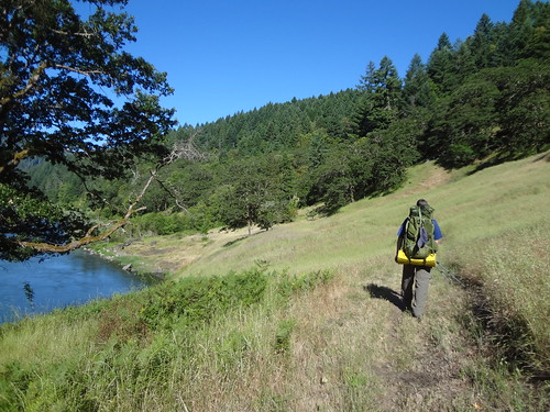
The RRNRT, stretching over 40 miles on the north side of the Rogue River, offers some great hiking and backpacking experiences. The western half of the trail is within the Wild Rogue Wilderness. Chris and I backpacked the western half in 2004, so we decided upon the eastern half this time.
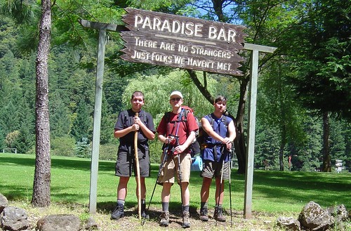
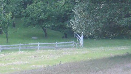
Picture from 2004 trip. I look so young and skinny!
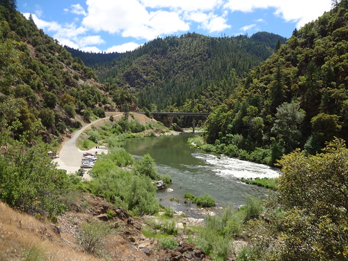
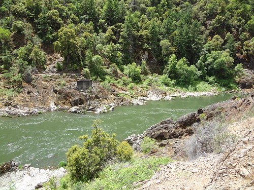
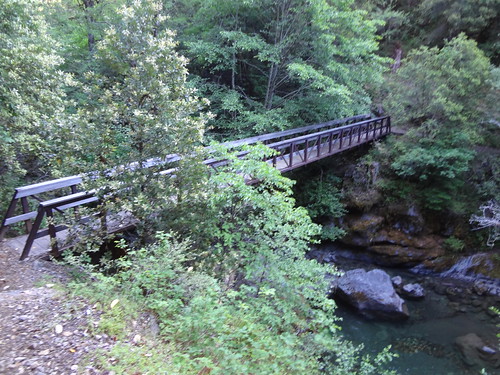
After 5 hours of driving and a stop for lunch, we began our trip at the Grave Creek boat ramp at 12:30 PM. Grave Creek is named so after the grave of Martha Leland Crowley, daughter of a pioneer couple, who was buried under an oak tree near the stream in 1846. Within a half mile is the Sanderson Home Site. In 1940 the Sanderson brothers built a cabin home and mined in the area. The cabin was dismantled in 1971 and all that remains is a concrete foundation. Like many sites along the Rogue River, evidence can be found of old gold mining operations.
Grave Creek boat ramp/Grave Creek bridge
Note: The historical information I am providing comes from the BLM website. It has all the information you need to plan a trip there. Just make sure to use the trail guide for mileage and not one of the pages that has river miles for rafters. Here is a link to the website: http://www.blm.gov/or/resources/recreat ... -trail.php
I was going to make comments about the campsites, but the BLM website was incredibly accurate in describing them. Keep in mind, if you want a quieter experience, stay away from the large campsites down by the river used by rafters. Rafters seem to be a loud crowd, bringing everything including literally the kitchen sink.
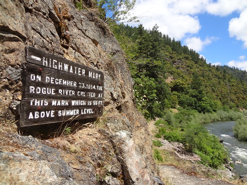
Sign near the start noting the high water mark of the 1954 flood:
At 1.2 miles, the remains of the concrete piers on both sides of the river of the Sanderson Bridge can still be seen. The bridge, used by pack mules and foot traffic, was destroyed by a flood in 1927.
What's left of the Sanderson Bridge:
At 2.2 miles is China Gulch on the north bank. Named after the Chinese miners who worked in the area in the late 1800s. Around 1946, Joe Utassey (a miner) built a cabin on the north side of the river and planted apple and pear trees.
At 3.3 miles is Rum Creek, on the south bank. “Bedrock” Nell (a miner) lived on Rum Creek in the late 1920s and 1930s. Rum Creek is approximately ten degrees cooler and fresher than other creeks and salmon can often be found schooling at the mouth of the creek.
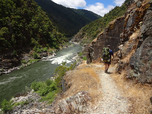
Sometimes the trail is right next to a cliff. Not a good place if you are afraid of heights.
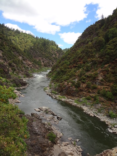
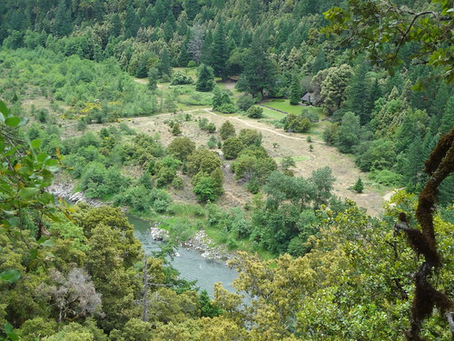
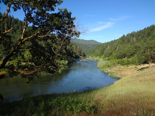
View of the Rogue River:
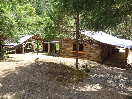
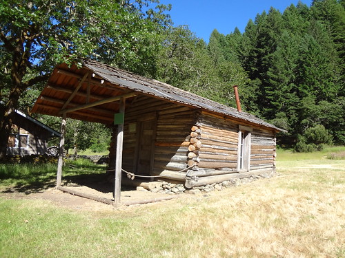
At 3.3 miles on the north bank is Whiskey Creek. About 1/4 mile up the creek is Whisky Creek Cabin. This cabin was built by a placer miner around 1880. Whisky Creek Cabin is on the National Register of Historic Places, and offers a glimpse into the pioneer history of the Rogue River. In 1973, the Bureau of Land Management purchased the deed to the cabin. This and other cabins along the river are part of our national heritage and are for viewing only.
Whiskey Creek cabin:
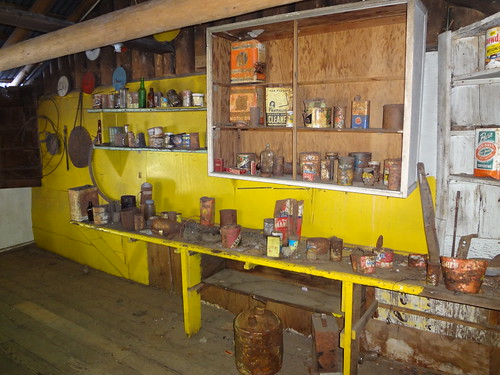
Relics of the past inside the cabin:
At 3.8 miles is Big Slide on the north bank. In the late 1800s, a landslide blocked the entire river, causing it to back up as far as Hellgate Canyon (15 miles upriver). Another small more active slide can be seen in the sheared rocks of the Cedar Mountain Fault zone just across the river. There is a fantastic campsite there, which we stayed at on the third night.
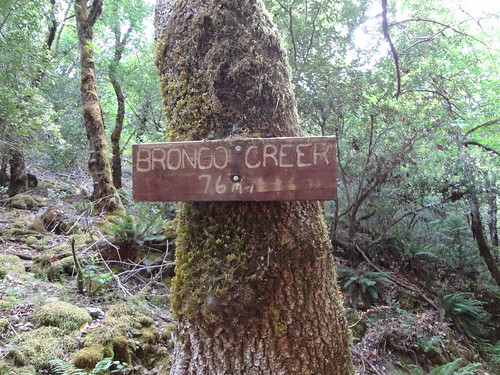
At 7.5 miles is Bronco Creek on the north bank. This was originally Jackass Creek (1855), named so because of the loss of a pack burro during an Indian skirmish.
We initially thought the sign read "Brondo Creek". If you are a fan of the movie "Idiocracy", you will know why Brondo amused us. It's got electrolytes!
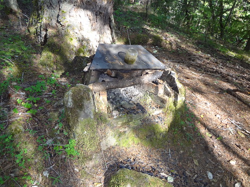
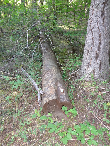
Remnants of history are all over if you are observant enough:
The trail was incredibly well maintained. All of the major creek crossings had bridges. There were only a few downed trees. Even the poison oak and other foliage had been trimmed back. Whoever is responsible for this trail should be given an award.
At 9.3 miles is Black Bar Lodge on the south bank. Black Bar is named after William Black who was killed here, put into his boat, and shoved into the river by his assailant (see mile 13.2, Meadow Creek). The lodge was built in 1932 and has operated as a commercial lodge since the 1950s. The lodge has been owned and operated by the same family since the 1960s. Reservations are required.
Black Bar Lodge:
At 11.4 miles is Horseshoe Bend. This tight horseshoe-shaped curve was formed as the harder rock across the river forced the water into the adjacent softer rock.
At 13.2 miles is Meadow Creek on the north bank, where we decided to make camp.
Henry Rosenbrook, otherwise known as Dutch Henry homesteaded, raised cattle and grew fruit at this site. Dutch Henry was a German miner best known as a “gangly murderer.” He was tried, but acquitted, for the murders of his two mining partners. William Black (see mile 9.3, Black Bar Lodge) was Dutch Henry’s second victim. Dutch Henry died in the 1920’s leaving his name on the homestead and also his bones in the ground.
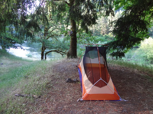
Once we decided to make camp, it was time to set up my new tent. For years I had been using a 1-person REI Roadster. For the price, it was light and effective. But I wanted something lighter, free-standing and quicker to set up. Lighter and quicker set up are easy to explain. The reason free-standing was important to me is because there have been occasions where, either the ground was too hard (rocky) or too loose (sand) to use the necessary stakes.
So far this year I have tested three different tents before deciding upon the Big Agnes Copper Spur UL1. It met all of my specification requirements and then some. Even though the price was somewhat high, sometimes you have to pay more to get a higher quality and better engineered product. This is the tent I will be using for years to come.
My new tent:
For this tent, instead of purchasing the custom-made footprint for $50, I made my own by cutting a blue tarp in the shape of the tent floor. It doesn’t look as good and weighs a couple of ounces more than the custom-made footprint, but it saved me $45. I may further improve my self-made footprint by adding corner straps and grommets so it can be used as a fly/footprint-only setup. Hint: Painter’s plastic can also be used to make a footprint.
One of the many snakes we saw:
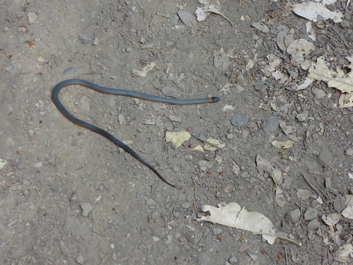
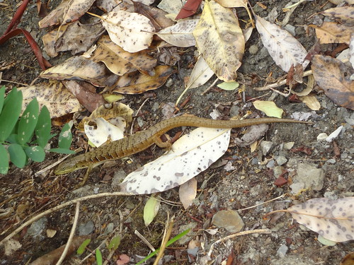
These lizards were all over. I think it might be an alligator lizard.
Since Chris and I knew snakes were in the area, including rattlesnakes, and because we saw them on our recent CA trip, we were on the lookout for them. Before this trip, my wife, Dawn, and I jokingly talked about me getting a rubber snake and putting it in Chris’ sleeping bag inside his tent when he wasn’t looking. Funny as this sounds, I wouldn’t want anybody doing that to me. Plus, paybacks are a you-know-what.
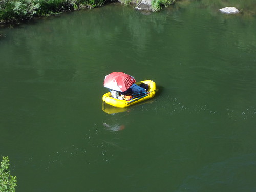
A flotilla of watercrafts:
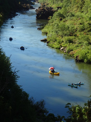
This guy has the right idea on how to stay out of the sun. I think an umbrella hat would be better
On the second day we continued heading west downstream with no destination in mind.
Soon we were at Winkle Bar, at 17.3 miles on the north bank. Western writer Zane Grey bought the mining claim for this site from a prospector in 1926. Grey then had his cabin built and used it for a place to stay while he was fishing and writing. The land there is privately owned, but visitors are allowed to mosey around.
Winkle Bar:
Zane Grey's cabin:
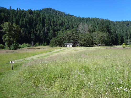
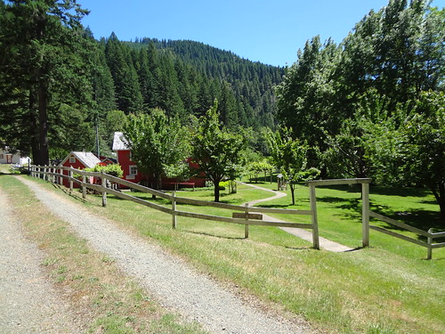
At 22.7 miles is the Rogue River Ranch on the north bank. The terraces on both sides of the mouth of Mule Creek (viewed from the ranch) were seasonal Indian camps for over 8,000 years. The two-story main house is now called the museum. The main house was built in 1903 by George Washington Billings (oldest son of John and Adeline Billings). George operated a trading post, post office and boarding house here with his wife, Sarah Ann. The ranch was a popular gathering place with a barn known as the “Tabernacle” serving as a focal point. The ground floor of the tabernacle was used to stable horses and mules and the top floor was used for storage, dances, parties and Sunday worship services.
In 1931, George Billings sold the ranch for $5,000 to Stanley Anderson who expanded the house and added a caretaker house, bunkhouse, tackroom, woodshed and storage shed. The Andersons used the ranch as a recreational homesite until 1970, when they sold it to the Bureau of Land Management under the National Wild and Scenic Rivers Act. The ranch is on the National Register of Historic Places. Visitors are welcome to visit the ranch area and look inside the museum. BLM volunteer caretakers maintain the Ranch and keep it open for visitors. The ranch is owned by the public and visitors are welcome.
The Rogue River Ranch:
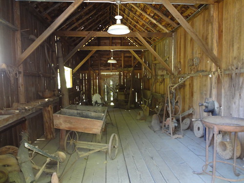
Lots of stuff inside the museum to see:

Blacksmith shop:
Chris got a picture of a mamma bear and her cubs while we were at the Rogue River Ranch (the second cub is in the tree but can't be seen in the picture):
Throughout the day, I had been developing blisters on my feet. I had waited too long to put on moleskin and tape them up. Because of the blisters, we turned back at the Rogue River Ranch.
While the moleskin stopped the blisters from getting worse, there was still discomfort that got progressively worse. Each step became slower than the one before. I wasn't looking forward to limping back 20+ more mile over the course of three days.
Then I remembered something I had read about what some other people had done who had been in the same situation. They had taken off their boots and worn their sandals, flip-flops or Crocs.
I had my beat up Croc knock-offs (Croc-offs) I got years ago for $5 with me, so I gave them a try. OMG! I could walk again without pain. It's somewhat ironic that those $5 shoes were more comfortable than the very expensive boots.
I can't figure it out. I have never gotten blisters like that before in all my years of hiking. The boots were new, but I had broken them in on a few long hikes. Oh well, I guess it's back to the old boots for the rest of the summer. I have too many epic trips planned to be ruined by painful feet.
The return trip had the same views as before, but it was still beautiful the second time. We got a chance to see things from a different direction and catch things we missed the first time.
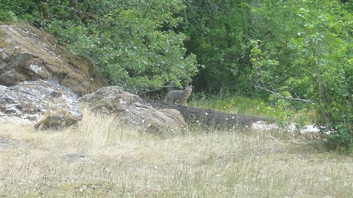
Fox at Meadow Creek campsite (Chris’ picture):
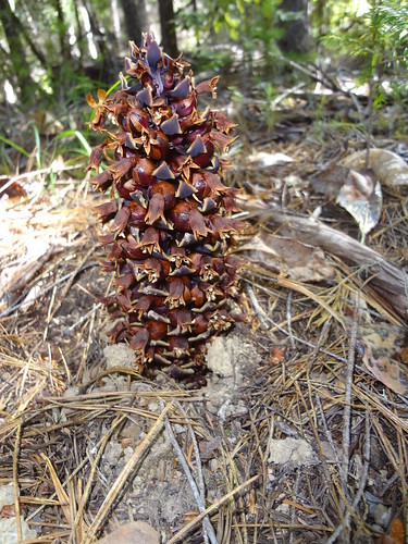
Anyone know what this is? At first, I thought it was a pine cone lodged in the ground, but it's actually growing out of the ground.
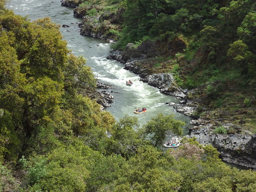
It's kind of fun watching rafters going through rapids:
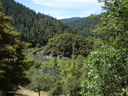
Another great view:
Final notes:
• Once again used my Ipod for TR voice notes and writing the TR at night.
• Poison oak was everywhere. Again, the trail maintenance was phenomenal keeping it out of the trail path.
• Hiking on rocky ground is hard on the feet, especially in Crocs.
• Mosquitoes swarmed us but didn't land or bite that much.
• I was surprised at how much of the trail was in the shade. Overall, I would guess that shade coverage was 70% or more.
Link to all the pics:
http://www.flickr.com/photos/54959080@N ... 87/detail/
Good Hiking,
Brad


