Central Salmon River - 06.22.2008

This forum is used to share your experiences out on the trails.
Post Reply
User avatar
zombie
Posts: 180
Joined: May 28th, 2008, 10:03 pm
Location: Clackamas, OR

Central Salmon River - 06.22.2008

Post by zombie » June 22nd, 2008, 3:28 pm

Today I just wanted something to stretch the legs...something I hadn't done before, but something not overly ambitious due to plans this evening. I went with Salmon River in the hopes that the relatively low mileage to the viewpoint would have a nice payoff. It did!

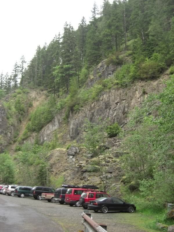
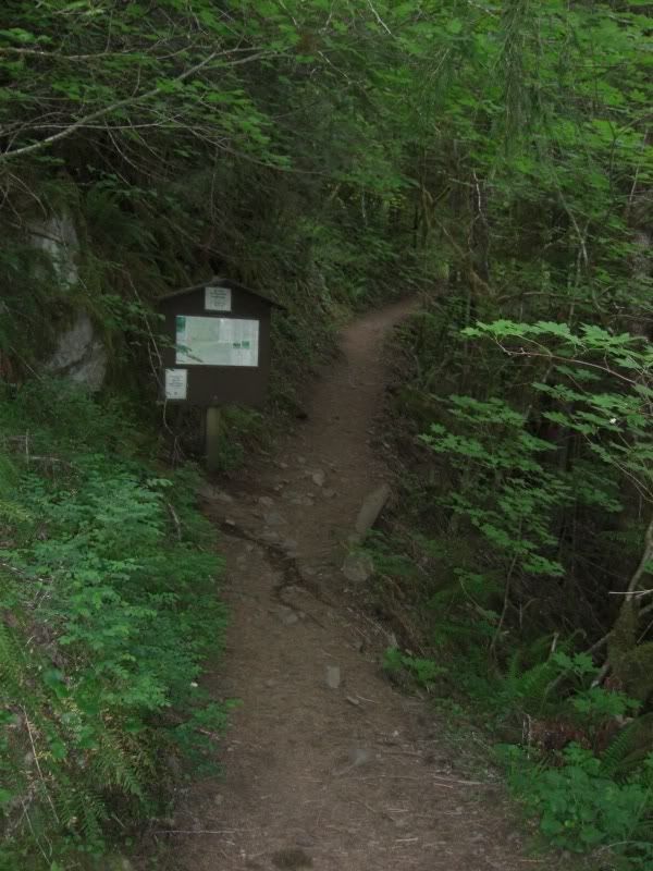
I obviously was not the only one who thought Salmon River would make for a nice getaway, as the entire length of the 5 mile road leading to the trailhead was car after car, tent after tent. Upon reaching the trailhead itself, I was stunned by the amount of vehicles parked there from the night before. That was right about when I noticed the signs leading to a "Drum Circle" event from the night before.

Image

I got the heck outta Dodge before these hipsters started awaking in the off chance that some of them weren't done making "music"! Lucky for me, I arrived early enough (about 8:00am) that the 20+ tents I passed in the first mile of trail were all zipped up tight and I still had things pretty much to myself.

Image

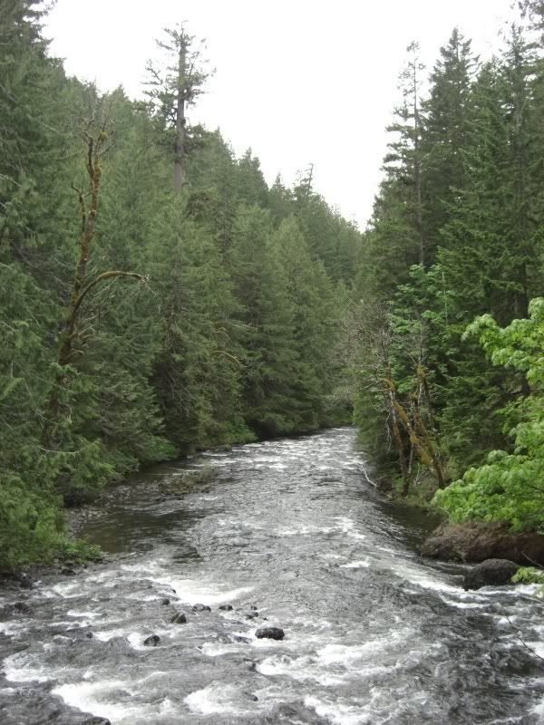
The Salmon was raging and I was amazed at just how clear and deep some stretches of this river are! At times I was reminded of wandering along the American River outside of Tahoe when I was younger...only with a lot less rafts here!

Image

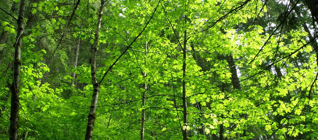
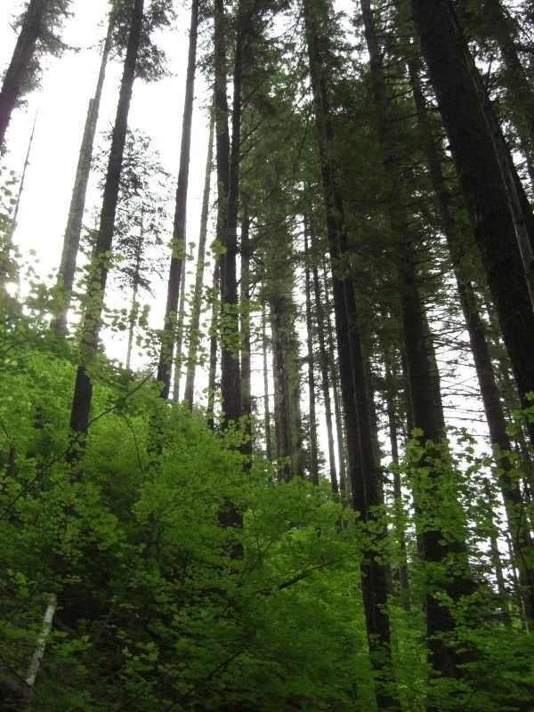
The trail stays amazingly flat as it works through the first couple of miles, climbing only for about the last mile of my trek. It was pleasant to rise above the river basin as things brightened up substantially and the entire flora makeup of the forest began to change.

Image

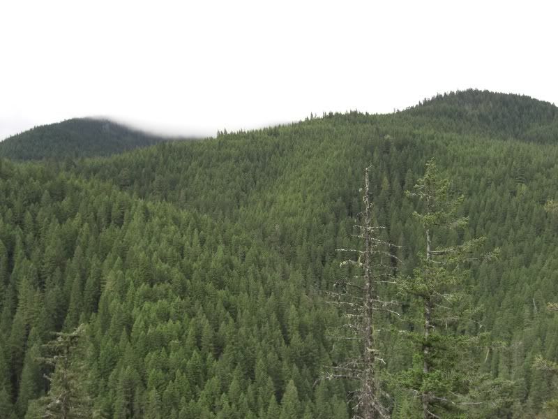
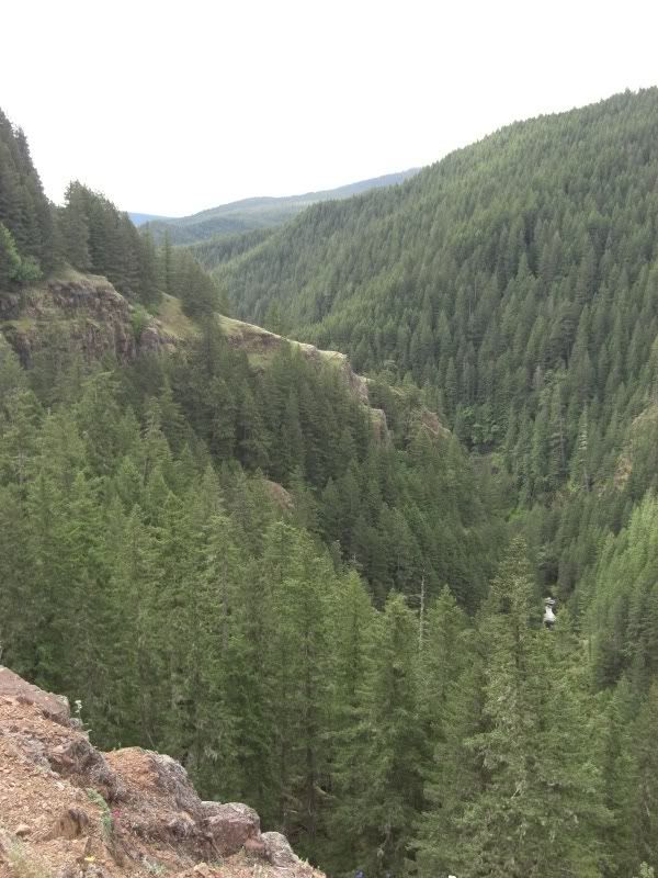
At about the 3 mile mark, the trail finds its way out of the tree cover and I started getting those views I was hoping for. I am fairly sure that I was looking across at Salmon Butte and Hambone Butte (I'm sure one of you can correct me if that is not the case).

Image

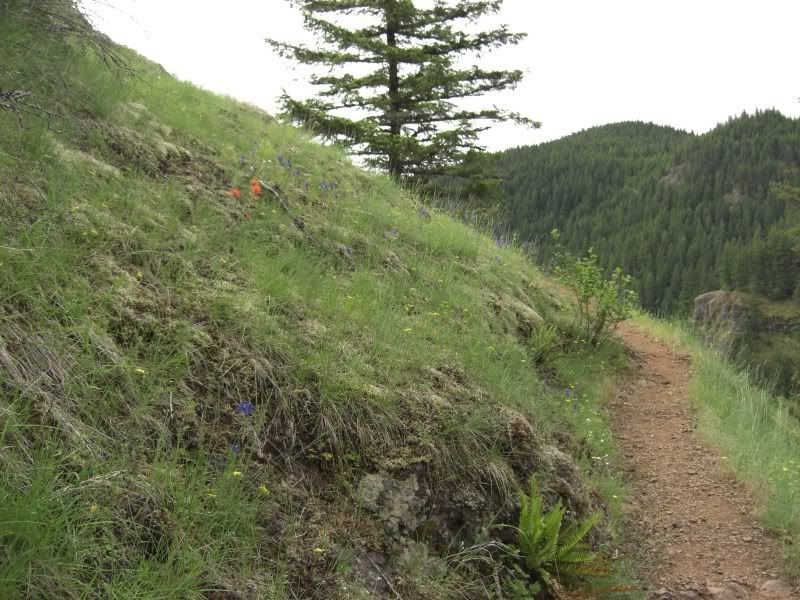
The viewpoint itself is a great narrowtrack on a mild exposed hillside (at times a bit more cliff-like) with just enough flowers scattered about to add some color.

Image

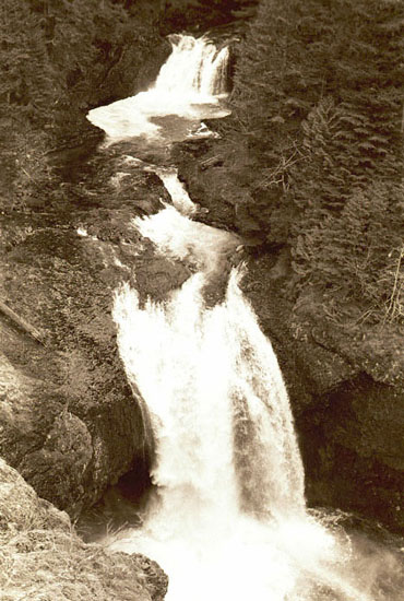
Looking farther east (deeper into the Salmon River Basin) I was already planning my trip down this trail all the way to Trillium lake, but for now was content with listening to Frustration Falls 600' below and getting some peeks at the Salmon River through the dense cover.

Image

That was about it for this morning's quick trip, so I powered my way down and out. Passed a great deal of folks both on the trail and striking their camps, both of which made me happy to have started out early. Stats for the day: 7 miles / 2.5 hours / about 1250 total gain.

mcgib
Posts: 25
Joined: May 28th, 2008, 10:03 pm

Re: Central Salmon River - 06.22.2008

Post by mcgib » June 22nd, 2008, 7:04 pm

Nice last picture, you really capture the grandeur of the scene. After visiting this trail 2 years ago during my first spring in Portland, I've returned a few times b/c it's a such great quick escape into the wilderness. Glad you avoided the hipsters too!

Re: Salmon Butte. I'm not sure, but I have a feeling that Salmon Butte is higher and rocky on top and deeper into the wilderness from that vantage point . . .

User avatar
Waffle Stomper
Posts: 3707
Joined: May 28th, 2008, 10:03 pm

Re: Central Salmon River - 06.22.2008

Post by Waffle Stomper » June 22nd, 2008, 9:10 pm

I went up there Friday with a couple of friends. It was packed then too. There were two large hiking groups when we got there and the parking lot had really filled up by the time we left. It seems that this trail is much more populated than it has been in the past because of the shortage of destinations due to low snow levels.

Afterwards we drove up to check out the trail head to Salmon Butte. The sign had been either broken off or shot off I'm not sure, I did not look close. We were going to hike in there to scout out the trail but felt a bit creeped out by some pretty shady looking people hanging out there and along the road between the campground and the parking spot. When you get that uncomforteable feeling it's best to go with it. Since it was just three women it just did not seem safe.

I've seen that trailhead decline over the last few years even though I can see the Forest Service has been making an effort to keep it clean. Makes me sad.

The forest canopy on the first day of summer.
Image
"When we try to pick out anything by itself, we find it hitched to everything else in the Universe." - John Muir

User avatar
Splintercat
Posts: 8333
Joined: May 28th, 2008, 10:03 pm
Location: Portland
Contact:

Re: Central Salmon River - 06.22.2008

Post by Splintercat » June 22nd, 2008, 10:08 pm

Great report, Aaron! (I keep wanting to call you "Rob"... for obvious reasons... :D ) Sorry I didn't get to meet you at the last Trailkeepers project - next time, maybe!

For some prehistoric photos of the Salmon River Canyon, here are some somewhat dusty pages that I put together many years ago:

Salmon River Gorge

Please excuse the dead links and whatnot - someday I'll tidy it up a bit. But hopefully the photos will entice you to climb down into the canyon and visit some of the waterfalls. Definitely a sport for the young, since the trip to the upper waterfalls includes a long hike PLUS a bushwhack... but the scenery is unparalleled. These days, kayakers call this the "Everest of Oregon" and make the trip some increasingly regularity. But it's still very quiet down there, away from the busy trail scene.

Tom

ceiliazul
Posts: 20
Joined: June 20th, 2008, 11:32 am

Re: Central Salmon River - 06.22.2008

Post by ceiliazul » June 23rd, 2008, 6:29 am

I was a backpacker in a group of four this weekend. We arrived on the trail Friday night at 6:00, and slept at the last spot before the wilderness boundary.

Saturday afternoon we dropped most of our gear at Goat Camp and walked 3 miles further to find Split Falls. The trail is still several hundred feet above the river when the sound of the falls is loudest. We followed a vague trail downward, but it quickly became a scramble. We saw the waterfall that was making all the noise, and it was indeed split by a boulder in the middle of the river. The river is so high that the boulder is almost getting washed under, and the falls only drops 15-20 feet vertical. We scrambled back up, and trudged back to camp to end a 10-mile day.

As we were cleaning up dinner at dusk, a group of at least 8 backpackers crossed Goat Creek. They said they didn't intend to walk so far, but that *every* camp spot was full along the way. We knew from our afternoon exploring that the upriver spots were also claimed.

Goat Camp is huge, occupying a plateau at least 80 feet long and perhaps 30 feet wide along the creek. There are 2 fire rings and lots of flat spaces. Our youngest group member showed why Jesus loves children, and invited the weary walkers to take the 2nd spot. They didn't want to intrude, but with a group that size and the the sun below the horizon, they were easily convinced.

On Saturday we did get a report of a black bear wandering around near the Kinzel Trail junction. We ran into 2 backpackers heading downriver, they said they had tried Kinzel Trail but the snow still blocks the lake. They estimated the snow level at 4000 feet, and were sure the lake was near. The same pair mentioned the bear, but we never had an encounter.

The trip was a success, and the "chance of rain" never materialized. The temperatures were perfect for hammock camping, which two of us enjoyed. There are still several trees down after the wilderness boundary, but nothing that will force people to leave the trail.

I agree that the shortage of gorge destinations is increasing traffic on the Salmon River. Our group was looking into Larch mountain, but the gorge peaks are all still snowed in.

The C-Ws
Posts: 337
Joined: May 28th, 2008, 10:03 pm
Location: SW Portland
Contact:

Re: Central Salmon River - 06.22.2008

Post by The C-Ws » June 23rd, 2008, 9:26 am

Does viewing Frustration and Final Falls require a rope for safety, or is it OK without one if you tread carefully? Also, is it best to descend into the canyon at the trail's first viewpoint, or at the side path a little ways beyond. Last time I hiked the trail, there was snow up there, so I didn't think it was safe to do much bushwhacking. I'm going backpacking there this weekend in the hope of checking out some of the waterfalls. Hopefully the campsite scene will be better than last weekend. I'll post a TR if I'm successful.
Casey

ceiliazul
Posts: 20
Joined: June 20th, 2008, 11:32 am

Re: Central Salmon River - 06.22.2008

Post by ceiliazul » June 23rd, 2008, 10:06 am

One of my hiking partners from this weekend is a climber, and he is smitten with the idea of going down to the falls. We are also aware that at least one guy has died trying. I haven't been able to find any info about it, I look forward to your trip report!

User avatar
Splintercat
Posts: 8333
Joined: May 28th, 2008, 10:03 pm
Location: Portland
Contact:

Re: Central Salmon River - 06.22.2008

Post by Splintercat » June 24th, 2008, 12:41 pm

Hey Casey - there are several boot paths that descend down to the viewpoint above Final Falls, and any will do. The most obvious simply drops from an overlook in a pair of paths that converge as the slope steepens. Rope are not necessary, but the treacherous part of the Final Falls viewpoint is that it's a convex slope that just keeps getting steeper until it becomes a vertical drop into the falls. You can get to this view reasonably safely, if the weather conditions are favorable:

Image

But for most, this would be a dangerous spot. You just have to gauge your experience level, since the main hazard is loose scrabble on a very steep slope. The drop to the splash pool is nearly 200 feet here -- so even though a few kayakers have jumped off the falls (90 feet), I doubt an accidental fall from this spot would be survivable. The falls between Final and Frustration is quite nice, too - easily viewed without getting as close to the edge.

To get a profile view of Frustration, head up and to the right from the Final Falls overlook. The view is limited from this angle, but still very impressive -- plus you get to see "Little Frustration", the tall side cascade that drops in opposite the main falls. It's also possible to get to the shelf opposite Frustration without ropes, but the accounts I've read sound rugged! I've not been there. It can be reached by working your way downstream from Goat Creek. BTW, Little Niagra and Vanishing Falls are highly accessible from Goat Creek.

The upper waterfalls are the best, but require the most effort. When I visited Split Falls many years ago, we needed a rope for the last 15-20 feet, but there may be a way down without rope. From Split Falls, it's a very manageable bushwhack along the river to Stein Falls, with some really beautiful terrain along the way. Stein Falls is very, very impressive. It's tall, and similar to Sahalie Falls on the McKenzie River in terms of force. Plus, the surrounding canyon is MUCH taller and more impressive than anything on the McKenzie. It's really too bad that there's not a bonafide trail to this one - it deserves to be seen my more visitors. You don't have to backtrack all the way down to Split Falls to exit the canyon - there's a steep gully just downstream from Stein Falls that continues all the way to the main trail. I wouldn't recommend it for a descent, but it's an excellent exit point.

Hope you make it up there, Casey. An overnighter is the perfect way to explore the canyon!

Tom

Post Reply