Hamilton-Hardy: The Big Loop 28-Jan-2012
Posted: January 29th, 2012, 8:39 am
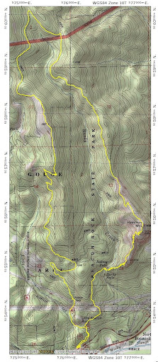
I did this loop almost a year ago to the day (HH 2011). At that time the weather offered few views and I didn’t have a GPS to record my track. So, with good weather in the offing for Saturday, I decided to repeat (now with a GPS and a Discover Pass) this big loop around Hamilton Mountain and Hardy Ridge. After putting my pass on prominent display in the car window, I left the lower parking area (gate to the upper lot is closed for the winter) and headed up and over Hamilton Mtn to the saddle N of the summit. There were a few patches of snow on the trail up to the summit and solid snow from the summit to the saddle but nothing I couldn’t just walk over. I’d contemplated bringing snowshoes but didn’t – which was a good call because there was never enough soft snow on the whole route to justify carrying the extra weight. From the saddle, I headed due N on an old road that connects with a service road (CG 1420?) on the N boundary of the park. This section was almost all snow-covered.

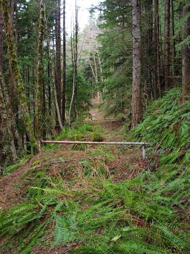
There’s an old gate about half way to the service road. Last year, at this same time, it was surrounded by plant life.
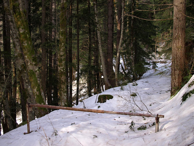
This year, everything was buried in snow.
Last year, the service road was completely snow free.

This year, it was covered with 4’+ of untracked – save for those of a host of small critters – firm snow. My tracks were the only people tracks.

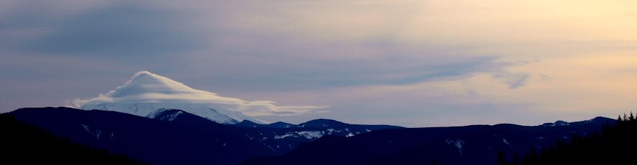
Thanks to beag for mentioning last year that you get a great view of Mt. Hood just past where the service road crosses upper Hardy Creek. And so it was – with Hood flying several lenticular formations.
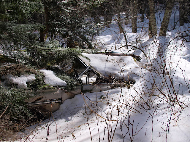
The road system in this area is poorly and erratically mapped, but if you stay on the main, level road, it will eventually climb to the right past a wrecked car (I’d love to know the story behind this one!),
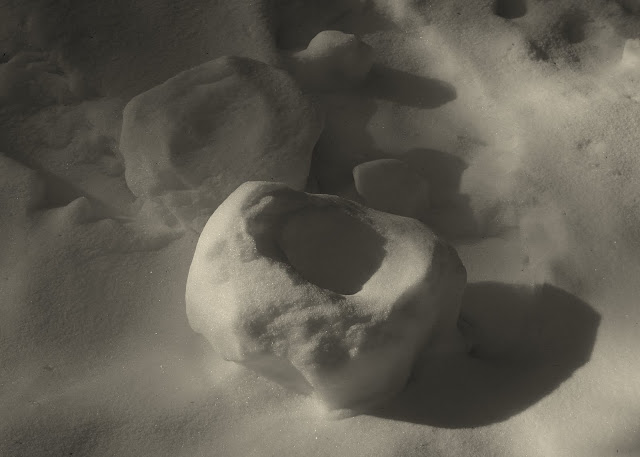
to a road junction, where I went to the left on CG 1440(?). The snow, which was still deep in this area, had rolled down a small incline to form a bowl.
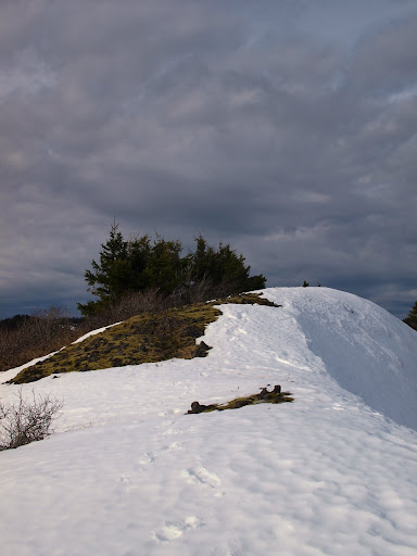
Last year I’d stayed on the road until it came abreast of Phlox Point, the high point on Hardy Ridge, then headed straight up. This time, I left the road further N so as to get on the ridge sooner, which turned out not to be such a great idea since the ridge is chocked with brush – much better to stay on the road as long as possible. Last year, Phlox Point was snow-free and viewless,

whereas this year it had snow and the great views that make this hike so enjoyable. It was also warm and totally calm – first time I’ve been on either Hamilton or Hardy when there was no wind.
There was Hood to the S surrounded by various cloud formations,
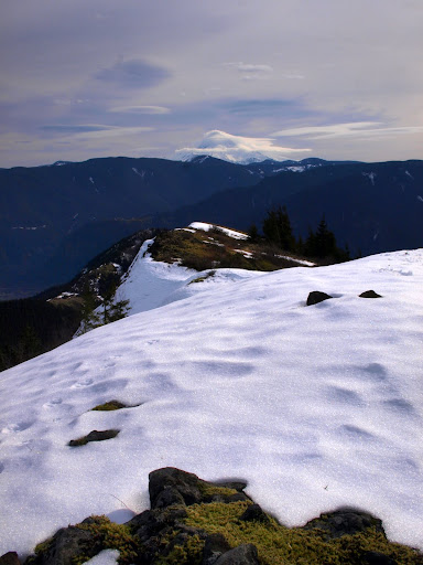
while, to the E, I could see Table (T), Big Huckleberry (H), Augsperger (A), Dog (d), Wind (W), and Defiance (D).

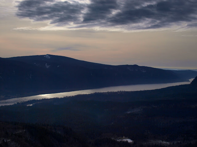
After taking in the view (and a sandwich), I headed down the trail/road on the W side of ridge, which gave me an expansive view of the shining Columbia.
Once I reached the road heading to the equestrian TH, I turned W to where this road makes a sharp turn at the 1000’ contour. I left it here and headed XC for 0.3 mi to the water tank that serves the Beacon Rock campground. Except for the blackberries that guard the tank, this was an easy way to make this hike a true loop. I returned to the lower parking lot to find it full and being steadily patrolled by a park ranger {I could say something about how free parks are more important than some of the other foolishness that our elected leaders spend our money on, but I won’t}. Despite all the cars, I only saw two people as I was enroute to Hamilton, none between Hamilton and Hardy, and only four between Hardy and the upper parking lot. So solitude is possible if you’re willing to walk a little further (14 mi, 3400’ EG). Overall, a wonderful hike on a great day!
There’s an old gate about half way to the service road. Last year, at this same time, it was surrounded by plant life.
This year, everything was buried in snow.
Last year, the service road was completely snow free.
This year, it was covered with 4’+ of untracked – save for those of a host of small critters – firm snow. My tracks were the only people tracks.
Thanks to beag for mentioning last year that you get a great view of Mt. Hood just past where the service road crosses upper Hardy Creek. And so it was – with Hood flying several lenticular formations.
The road system in this area is poorly and erratically mapped, but if you stay on the main, level road, it will eventually climb to the right past a wrecked car (I’d love to know the story behind this one!),
to a road junction, where I went to the left on CG 1440(?). The snow, which was still deep in this area, had rolled down a small incline to form a bowl.
Last year I’d stayed on the road until it came abreast of Phlox Point, the high point on Hardy Ridge, then headed straight up. This time, I left the road further N so as to get on the ridge sooner, which turned out not to be such a great idea since the ridge is chocked with brush – much better to stay on the road as long as possible. Last year, Phlox Point was snow-free and viewless,
whereas this year it had snow and the great views that make this hike so enjoyable. It was also warm and totally calm – first time I’ve been on either Hamilton or Hardy when there was no wind.
There was Hood to the S surrounded by various cloud formations,
while, to the E, I could see Table (T), Big Huckleberry (H), Augsperger (A), Dog (d), Wind (W), and Defiance (D).
After taking in the view (and a sandwich), I headed down the trail/road on the W side of ridge, which gave me an expansive view of the shining Columbia.
Once I reached the road heading to the equestrian TH, I turned W to where this road makes a sharp turn at the 1000’ contour. I left it here and headed XC for 0.3 mi to the water tank that serves the Beacon Rock campground. Except for the blackberries that guard the tank, this was an easy way to make this hike a true loop. I returned to the lower parking lot to find it full and being steadily patrolled by a park ranger {I could say something about how free parks are more important than some of the other foolishness that our elected leaders spend our money on, but I won’t}. Despite all the cars, I only saw two people as I was enroute to Hamilton, none between Hamilton and Hardy, and only four between Hardy and the upper parking lot. So solitude is possible if you’re willing to walk a little further (14 mi, 3400’ EG). Overall, a wonderful hike on a great day!