Augspurger Mountain (SE Ridge) 07-Dec-2011
Posted: December 7th, 2011, 5:36 pm
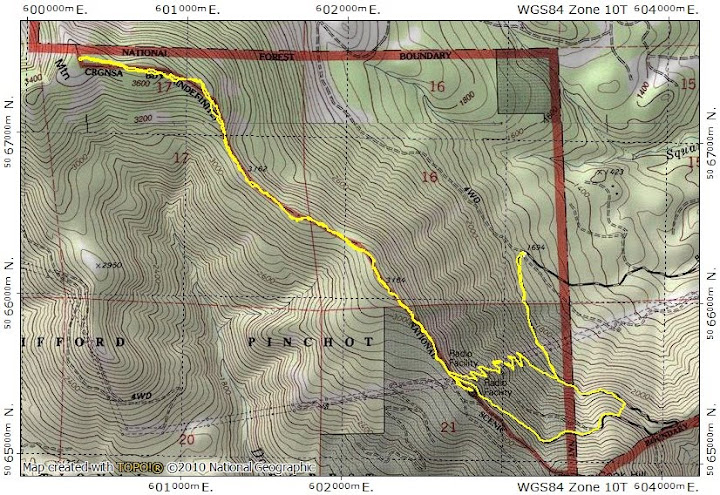
As much as I love the classic Gorge hikes, I'm always looking for new (to me at least) or different hikes. The "official" trail to Augspurger Mtn starts at the Dog Mtn TH and heads north (Augspurger & CCT). However, I heard tell that it's possible to reach Augsperger's summit from the road leading to the radio facility on its SE ridge. I had to check this out. I drove past the Dog Mtn TH on Hwy 14 to Cook, then headed N on the Cook-Underwood Rd. After about 2 mi, I turned left onto Bunker Keys Rd and parked at the 1700' level. It's a good dirt/gravel road all the way to the radio facilities, so I could have driven higher, but I felt guilty not hiking. I had come out from under the gloomy overcast at Cascade Locks, but the wind was still pushing clouds over ridges and into the valley.

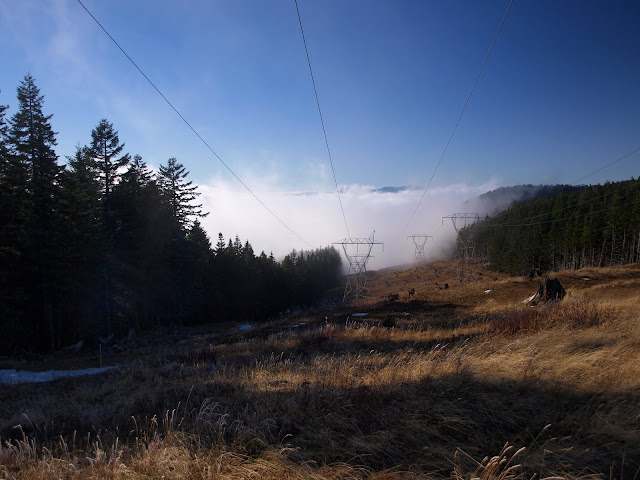
I hiked up the road to where it went under the powerlines, then followed smaller service roads under the lines directly up to the ridge. Adams spent all day calling attention to itself.

When I got to the top of the ridge, the clouds were seething and boiling in the valley below, and occasionally being pushed over the ridge.
There aren't too many hikes where it's this easy to calibrate your GPS.

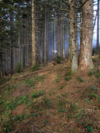
I was bracing for a thrash up the ridge, but was pleased to find a pretty good use trail - marked with can lids nailed to trees (arrow) - from the radio facility all the way to the summit. There were only a few spots where the trail was overgrown, vague, or buried in snow - otherwise it was easy to follow (this is why I didn't put this TR under "lost trails").
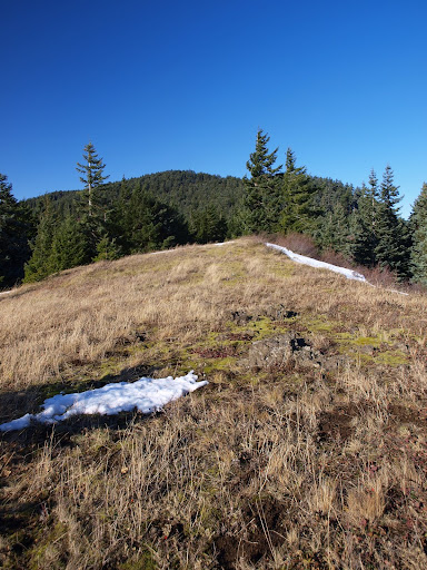
The trail opens out into meadows from time to time, so I got plenty of views of Adams and Hood. This is looking toward the summit of Augsperger.
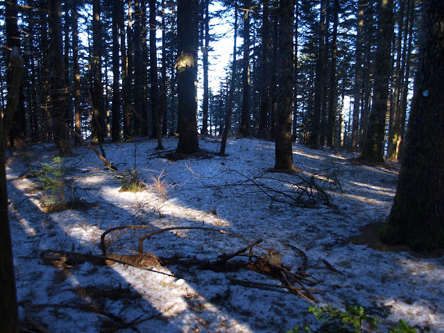
There was some snow on the trail but nothing more than an inch deep - I only postholed when snow was covering a bush or gap in the rocks.
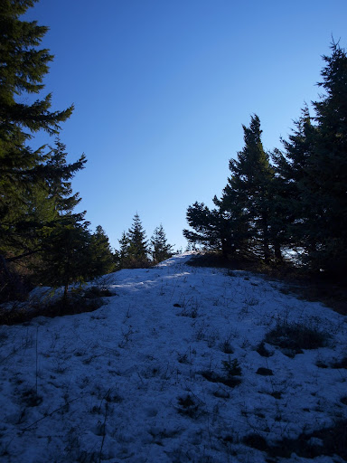
There is nothing particularly "special" about the top of Augsperger - no views, no weird rock formations, no Sasquatch - and, despite the sun and clear skies, it was also pretty windy and cold.
I retreated back down the ridge to get out of the wind for a break. From there, I could see Portland completely smothered in low clouds to the W,
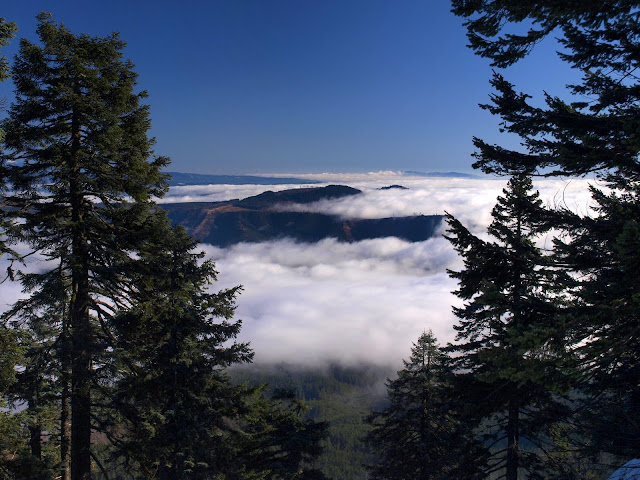
and Hood and Mt. Defiance poking above those same clouds to the S. You can see Hood and Defiance somewhat superimposed on each other from the top of Dog, but here I was far enough E to see them as separate summits.

I retraced my steps to the radio facility and gave some thought to hiking over to Cook Pt - but it was enveloped in uninviting cold wind and clouds, so I headed down the service road. This road makes a long loop to the SE, so after about 0.5 mi I went XC straight downhill to cut out the loop and get back to the car sooner. A fun little hike (8 mi RT, EG 2800'), with some views you can't get elsewhere. It would be interesting to see what it would be like as a snowshoe (if it ever snows again ).
).
I hiked up the road to where it went under the powerlines, then followed smaller service roads under the lines directly up to the ridge. Adams spent all day calling attention to itself.
When I got to the top of the ridge, the clouds were seething and boiling in the valley below, and occasionally being pushed over the ridge.
There aren't too many hikes where it's this easy to calibrate your GPS.
I was bracing for a thrash up the ridge, but was pleased to find a pretty good use trail - marked with can lids nailed to trees (arrow) - from the radio facility all the way to the summit. There were only a few spots where the trail was overgrown, vague, or buried in snow - otherwise it was easy to follow (this is why I didn't put this TR under "lost trails").
The trail opens out into meadows from time to time, so I got plenty of views of Adams and Hood. This is looking toward the summit of Augsperger.
There was some snow on the trail but nothing more than an inch deep - I only postholed when snow was covering a bush or gap in the rocks.
There is nothing particularly "special" about the top of Augsperger - no views, no weird rock formations, no Sasquatch - and, despite the sun and clear skies, it was also pretty windy and cold.
I retreated back down the ridge to get out of the wind for a break. From there, I could see Portland completely smothered in low clouds to the W,
and Hood and Mt. Defiance poking above those same clouds to the S. You can see Hood and Defiance somewhat superimposed on each other from the top of Dog, but here I was far enough E to see them as separate summits.
I retraced my steps to the radio facility and gave some thought to hiking over to Cook Pt - but it was enveloped in uninviting cold wind and clouds, so I headed down the service road. This road makes a long loop to the SE, so after about 0.5 mi I went XC straight downhill to cut out the loop and get back to the car sooner. A fun little hike (8 mi RT, EG 2800'), with some views you can't get elsewhere. It would be interesting to see what it would be like as a snowshoe (if it ever snows again