For the last few years, I’ve been dreaming about this loop around Glacier Peak that Spring and Manning describe in one of their old Mountaineers guides—like the Wonderland around Rainier, but a little longer and considerably more remote. The route pieces together bits of other trails: a path, already faded in the 70s, through the Napeequa River Valley, which Manning describes as a sort of abandoned Shangri La; a trail, then well-maintained but since abandoned, up the White River; the Pacific Crest, which Manning calls, after Beckey, “the new Crest Trail”; and finally a pass over Miner’s Ridge—an area threatened by mining when the guide was published, but since saved, in part by Manning’s efforts, and made statutory wilderness.
After almost doing the loop in 2017 and 2018—getting derailed first by fires, then by some medical junk—I finally got to do it this past summer, in 2019. My route largely followed Manning’s suggestions, but deviated in a couple key places.
- Start on the Chiwawa River Road, drive up as far as our little car can make it, then ford the Chiwawa River—there was a bridge decades ago, and a campground on the other side, but both are gone now—and climb up Little Giant Pass.
- Descend into the Napeequa, ford the Napeequa River, and climb up to Boulder Pass.
- Drop from Boulder into the White River, and bushwhack, via either the White River or Indian Creek, to “the new Crest Trail.”
- Follow the Crest north over White and Red Passes, over Fire Creek Pass, down into Milk Creek’s massive drainage, over into the Suiattle, and finally up Miner’s Ridge.
- Leave the Crest Trail, climb over Buck Creek Pass, and return, finally, to the car via Buck Creek and the Chiwawa River Road.
This may already be a bit overlong, but if you want to read still longer entries with a few more pictures, they’re already posted at my blog.
July 27: Chiwawa River Road to Napeequa Valley
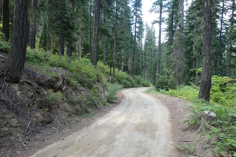
We spend the night before our start in Wenatchee, sleep until seven, eat a hotel breakfast, then drive up to near Stevens Pass and north to Lake Wenatchee. Resort residents are just waking up to the weekend.
Krista’s heading up the PCT, starting a bit south of me, so we drop her first at the Little Wenatchee Trailhead. The road there is mostly great pavement until it’s mostly awful dirt, but our little Honda makes it, and we say a hurried goodbye as it begins to rain. The plan is for her to head north from here to near Suiattle Pass, and for me to come in from the east and catch up at some indeterminant point. “I’ll see you… in a bit.”
Then back to Lake Wenatchee, and up Chiwawa River Road for 20 bumpy miles to the tiny pullout that marks the Little Giant Trailhead, where I’m set to start.
*
I fuss around with my pack for a while, worrying whether to bring more food or stuff for snow travel. By the time I finally set off, it’s after noon.
The first order of business is fording the Chiwawa River. Fifty years ago, there was a bridge here, and a bustling campground on the other side, but, like a lot of infrastructure in this part of Glacier Peak, things have faded. There’s already a backpacker at the crossing, making a meal of changing out of Crocs and into boots. I assume he’s just crossed until he starts talking. “I don’t think it’s passable,” he tells me, somewhat sagely. “I was going to circumnavigate the mountain, but I think I’m going to head up Buck Creek instead. Keep it safe.”
I thank him, then cross in my trail runners. The water’s fast, but there’s a long, flat, unobstructed runout, and at its highest the water’s just past my thighs.


*
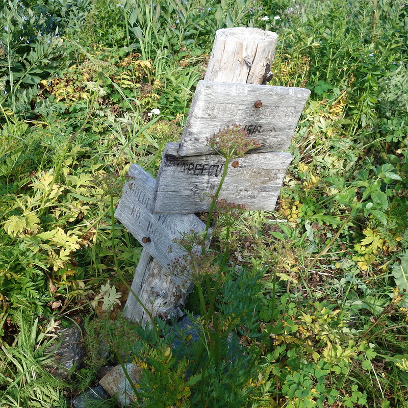
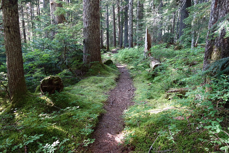
There’s a flat floodplain on the other side, full of moldering remains of the area’s old life: fire rings covered in moss, bits of old metal, a signpost that’s lost its sign. The trail is hard to find at first, but I eventually catch it switchbacking up along Maple Creek, away from the plain.
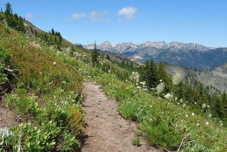
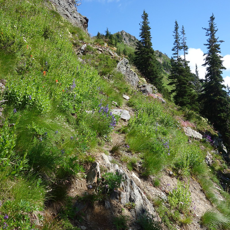
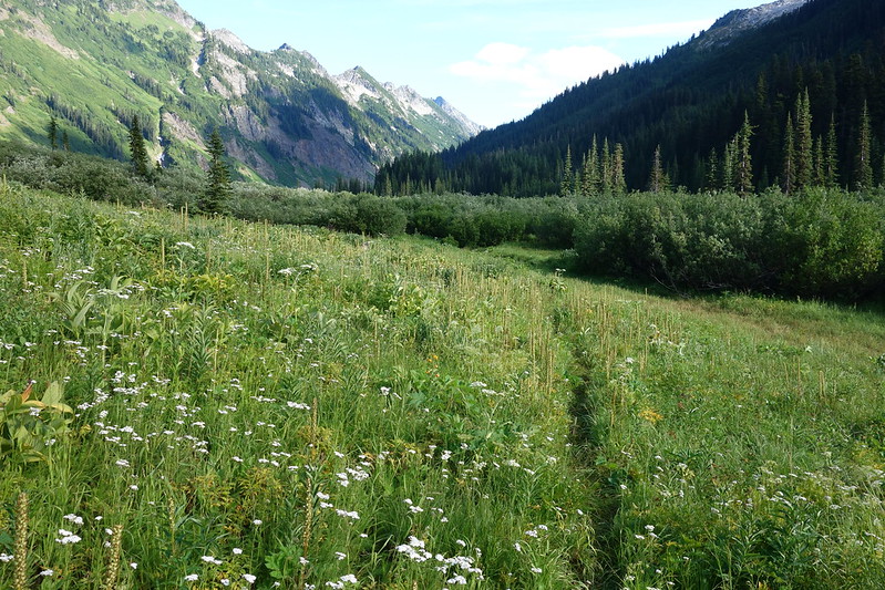
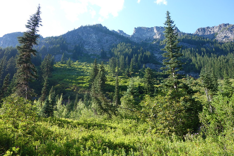
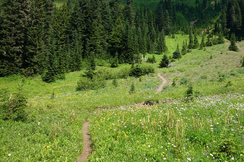
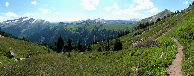
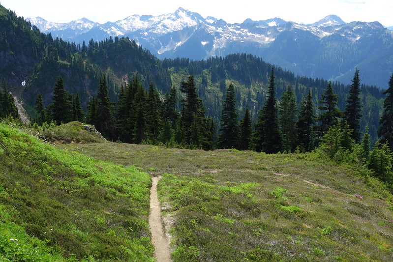
The first few miles climb somewhat steeply out of the Maple Creek drainage and toward a minor fork of Little Giant Creek, which the trail crosses in the first of many meadows. Past the crossing, the trail steepens into subalpine groves of burnt snags and beautifully bare granite. And flowers. Flowers blooming to the horizon.


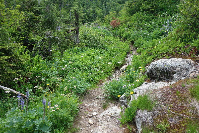

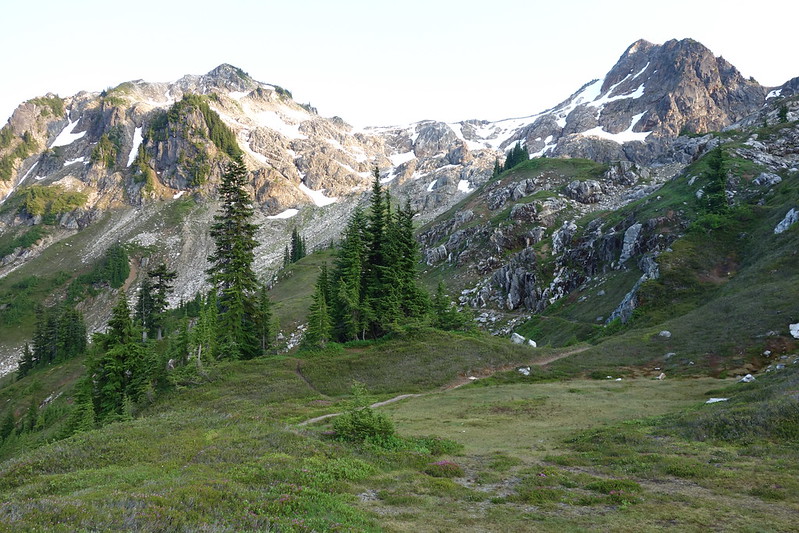
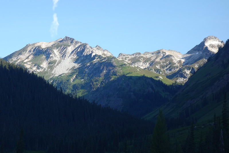
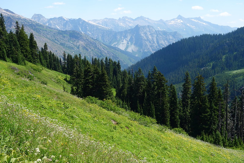
I lose the trail at a steep, open rockface, but climb up the line of least resistance and find it again beyond the rock, in a tangle of blooming bistort. Then more meadows and more rock, an ancient campsite on the lip of an old avalanche track. Finally, the trail juts north for one last, long switchback, and views open in every direction: south to the Alpine Lakes; east to the Entiat; north Mt. Maude and the North Cascades; and west to my pass—it must be up there somewhere in that jumble.


*
Little Giant Pass is a minor notch on Chiwawa Ridge, nestled below Little Giant Peak. The ridge is thin—just five or ten feet across—but wide enough for me to sit in the wind for a while and eat a late lunch.
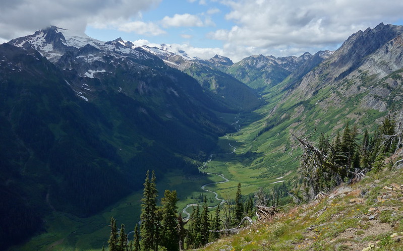
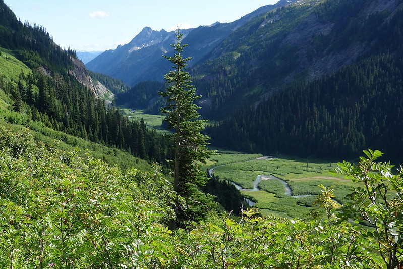
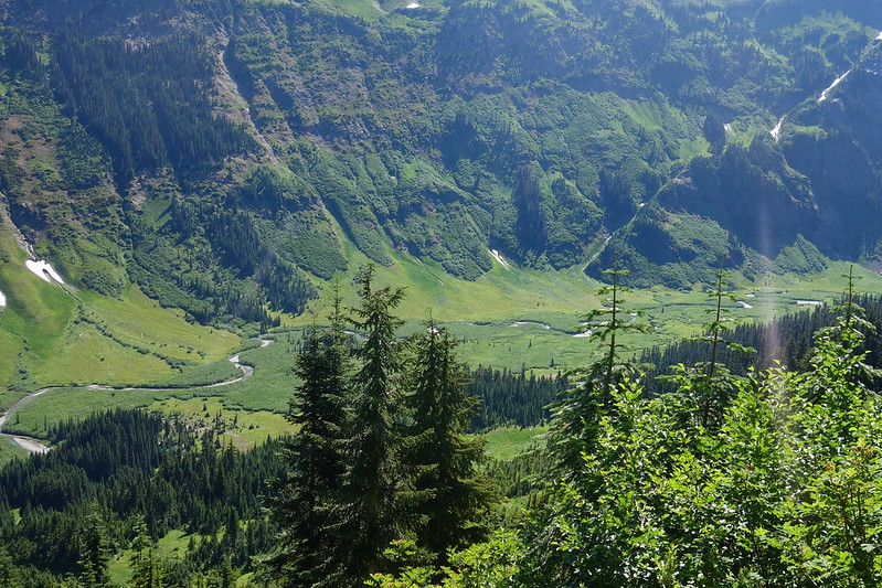
Thousands of feet down to the west, the Napeequa River meanders through its broad valley. I’ve been reading about this valley for years, but nothing has prepared me for how grand it is in person. The valley floor is so flat that the river’s free to roam, and it does—a broad band of blue water, wandering from one side of the valley to the other in sweeping half-mile strokes.
Without really realizing it, I tear up at the ridiculous grandeur of it all.
*
The descent into the Napeequa from Little Giant turns out to be… a little less grand. There’s a trail at first, but it quickly fades and braids, and the slope down is steep. Several times, I find myself going hand-over-hand, or clinging onto the bits of brush that constantly intercede on the trail.


“Trail.”
The trail doesn’t so much switchback as drunkenly stagger, but it goes, and after a few spicy sections I’m on a safer slope, gently descending to the valley floor.

*
When it reaches the floor, the path becomes less distinct still—almost indistinguishable from the dozens of game trails that crisscross the valley. But the whole idea of a “correct” trail here feels a little academic, as all of the routes are equally overgrown. And equally magnificent.


A mile in, I meet a deer, standing in the center of what I’d taken to be my human trail, utterly uncertain what I’m doing here. Then, a half mile later, I startle a big black blob—a bear—who runs through what I’d taken to be impenetrable brush.

*
After a few more miles of traipsing through overgrown grass and slide-alder and mud, I reach a faded old sign marking the Boulder Creek Trail, which I follow for a few hundred feet until it dead-ends at the river.
I’ve been warned about this.
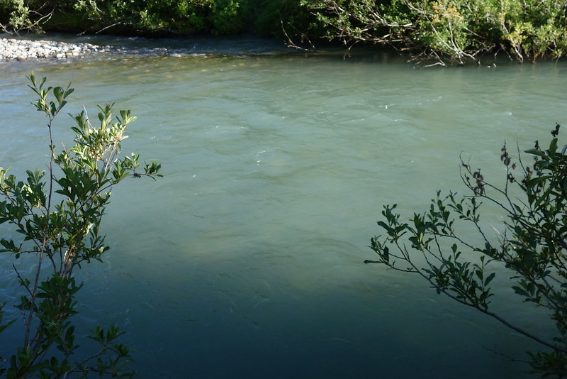
In contrast with the Chiwawa this afternoon, the Napeequa here is slow but obvious very, very deep. I’m also hitting it at probably the worst possible time, when the afternoon snowmelt, and thus the river’s flow, is at maximum.
I have no idea how deep it is, and no way of knowing without just jumping in. So I take off my pack and start in just to check. Immediately, it’s up to my mid-thigh, but it’s slow enough that it feels safe: if I fall, it’ll just be a question of swimming through the gentle current. At its deepest, it’s halfway up my chest, but I’m able to stand the whole time, so I go back for my pack, hoist it above my head, and gingerly make my way through.
On the other side, just above the bank, there’s a family of deer, who have seemingly been watching me this whole time, betting on my chances.
*
Past the main channel, there are a few smaller branches to cross, but nothing’s above my thigh. And beyond the river’s floodplain, the trail’s suddenly fantastic. I follow it up a few small switchbacks, and find a perfect old camp hidden in the trees.

The deer family’s followed me up, and we all have a lovely dinner a few hundred feet from camp—them on the valley’s new spring foliage, me on some freeze-dried thing that feels weirdly out of place in such a grand old setting.
*
After dinner, I wander back down to the floodplain, and watch the evening close-in on Clarke Mountain and the upper valley. Upriver, another family of deer’s frolicking through the meadows, their shadows dancing on the dark blue water.
July 28: Napeequa Valley to Upper Indian Creek
The next day begins with a half-dozen deer running through the woods, from the hills above to the river below. I poke my head through the door of my tent and watch as my friends from last night thud through the thin forest just a few feet from me.
This place is magic.
*
Then the usual morning chores: down to the river to filter some water, a quick breakfast at camp, stashing my food for the day in the outside pocket of my pack.
The trail this morning’s overgrown, but considerably better-tended than the one on the other side of the Napeequa. It sidehills for a long time—through avalanche tracks full of lilies and lupine, and bits of old-growth cedar—before switching back and climbing more seriously toward Boulder Pass.


Leaving the valley feels a little wrong, like I’m not done here yet. I promise myself I’ll be back soon.
*
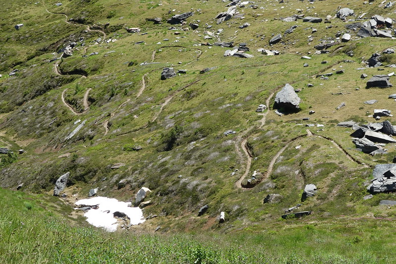
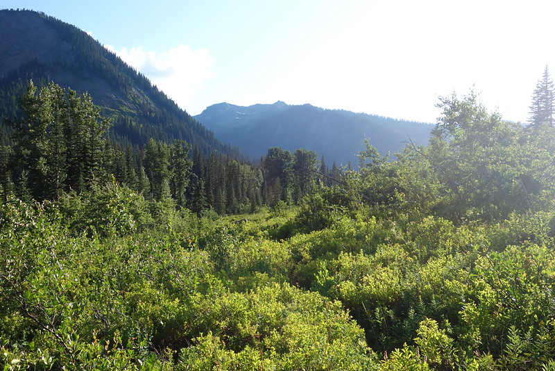
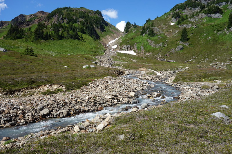
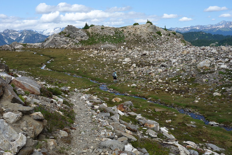
The pass is a broad chain of meadows settled between White and Clark Mountains. To the west, a series of springs stream together to form Boulder Creek. I sit for a while among the headwaters, eating almonds and watching a pair of marmots chase each other through the blooming heather, then follow the creek down through a few cliff bands to Boulder Basin—a wide blooming bowl, lined with granite towers and more avalanche tracks.


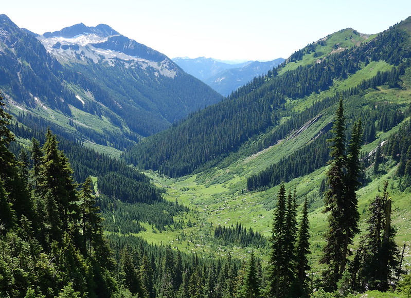

The trail disappears below the Basin in a confusion of talus and chest-high tiger lilies, but the terrain is easy enough to follow, and soon I find myself back on the path, descending to the White River through a cool stand of fir.
*
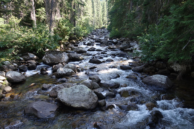
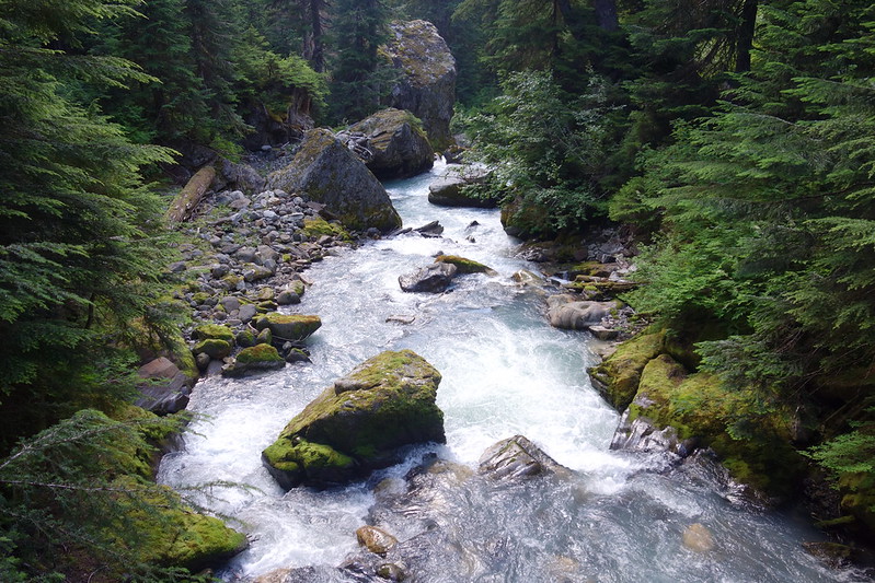
I stop for lunch along the River, and think through my options. From here, the trail continues down the River for five or six miles, then crosses on a good bridge and heads back up the other side another five or six miles to Indian Creek, where it turns up, toward the PCT. If I can somehow wade across and find the trail on the other side, it’ll save me ten miles of overgrown tread. But the river is wide and deep and fast.

I walk down the River for a few miles, looking for a safe place to cross, and eventually find a broad, relatively shallow eddy, where the water runs quick over well-rounded rocks the size of bowling balls. No way to know if it’s doable other than to try to do it, so I take off my pack, drop it on the shore, and worriedly walk in. It’s tough to get traction on the slick rocks, but the water’s not too fast, and soon I’m to my waist just past the halfway point, then soon again at the opposite shore. I turn back, put on my pack, and do the whole thing again, a bit more gingerly.

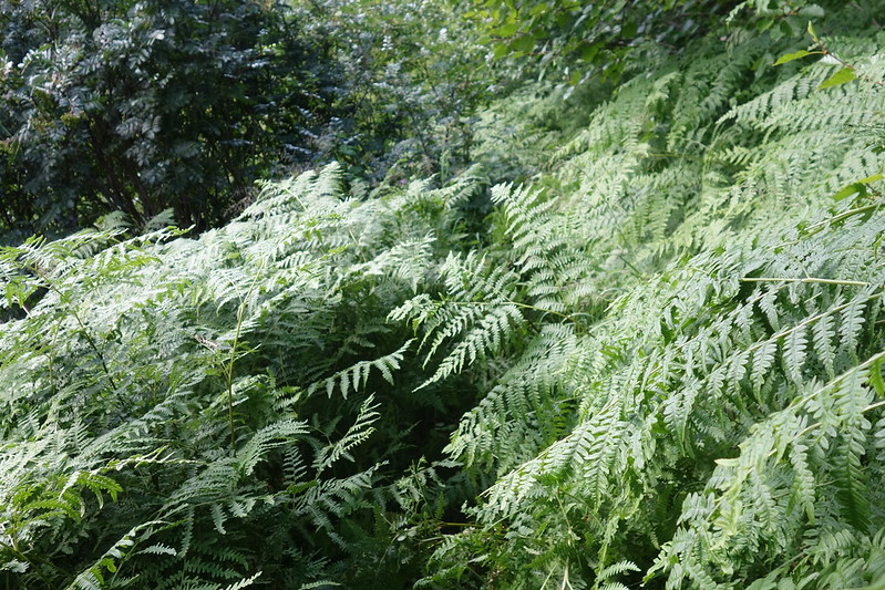
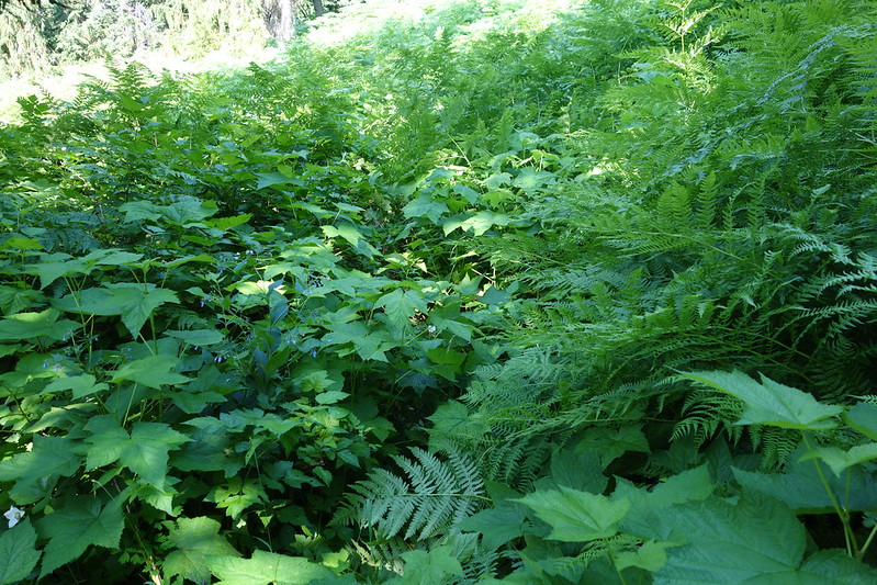
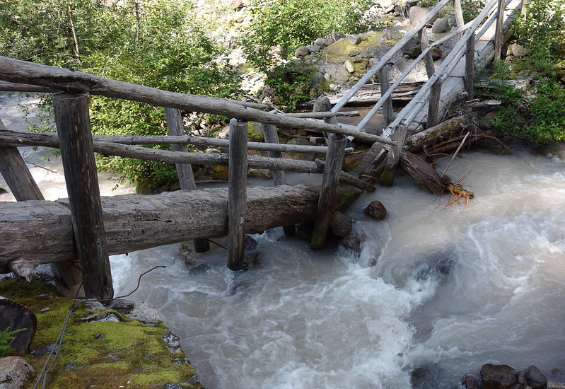
The opposite shore’s a tangle of devil’s club and fern, and it takes me twenty minutes to thrash through a quarter mile of it to the trail. But I do eventually find the trail—here a series of moldering old puncheons—and happily follow it to an ancient, overbuilt bridge across Indian Creek.
*
From the bridge, the trail climbs steeply up a series of decreasingly clear switchbacks, then promptly disappears wall of willow, huckleberry, and nettle.
It won’t really reappear for another dozen miles.
*
Indian Creek flows down a wide, flat glacial valley, lined on either side with steep granite walls. The trail, insofar as there is a trail, zigzags up through thick foliage and across unstable new rockslides. I startle a bear, then several deer, then some sort of large cat.
I try, for the first four or five miles, to follow something like the trail’s original tread, but eventually give it up, and just try to walk where the trail ought to be. More often than not, it seems it actually was once there.
*
The sun begins to set, and I resign myself to somehow night-hiking through this. I’ve been bushwhacking for nine or ten miles, and haven’t yet seen a single place where one could even conceivably put a tent, or even just a sleeping pad. Also, my legs are covered in blood.
Maybe I just hike through the night?
The sun sets for hours. Light climbs up the hills and the sky goes from blue to red and back to blue. I startle another bear, but this one moves more slowly.
We’re all getting a little tired.
*
Just as I’m fidgeting with my headlamp to get ready for the night, I bumble on an ancient camp—several large clearings, a mossed-over fire-pit, and even a nearby stream. I start to cry with relief.
I set up in one of the clearings, wash most of the blood off my legs, and make dinner by headlamp as the first stars start to shine. As I take my first bite, I hear half a heard of elk thundering through the clearing just ahead—down, I think, to the creek for an evening drink.
We’re all getting a little tired.
*
I sit out until late, eating and drinking and watching the stars.
There’s this magic trick that places like this play. The visitors stop coming, then the trails fade and with them all evidence that we’ve been here. The wild returns, as though it never left: the cats and bears and elk. The world as it was. The real world, the one that seems to stand still, from the vast past to the endless future, whenever we leave it alone for long enough.
I sit out and watch that world, a little blood still clinging to my legs, and begin to fall asleep in the dirt.
July 29, 2019: Upper Indian Creek to Baekos Creek
I let myself sleep in, and only wake once the sun’s bushwhacked its way down through the valley and into my little clearing. The birds have been singing for hours.
I eat breakfast over my maps. It’s only three miles from here to the PCT, but I have no idea what condition the trail’s in, and after yesterday my legs aren’t looking forward to too many more brambles.
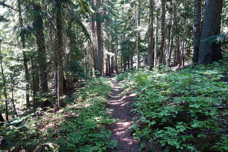
But the tread, it turns out, eases as it approaches the PCT. The trail switchbacks up Indian Creek’s ancient glacial wall, first through overgrown meadows and avalanche tracks, then through beautiful old forest. Puncheons and turnpikes begin to appear, then drain dips and rock walls and even a bridge. By the time I reach the PCT at Indian Pass, it’s almost as though I’ve been on a proper trail.


*
The PCT’s tread is so easy that the walking’s like floating through a dream.

*
I’m roused from my walking dream by a big group of volunteers on the trail above the White River, all swinging pulaskis and clipping through minor brush, all wearing bug nets on top of their helmets. It takes me a second to find my voice, but when I do, I thank them all as deeply as I can muster. Tell them about the contrast between this and Indian Creek, try to say something about the years their days create.

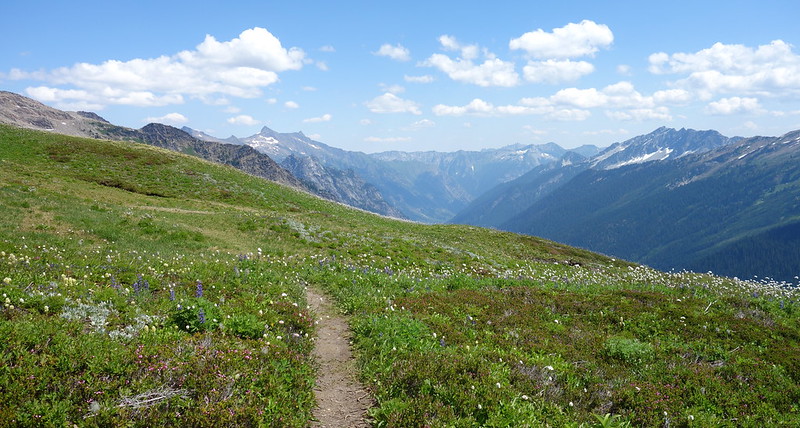
I follow the PCT for several enchanted miles, past Reflection Pond and acres of blooming flowers, and fall again into a sort of walking dream.


*
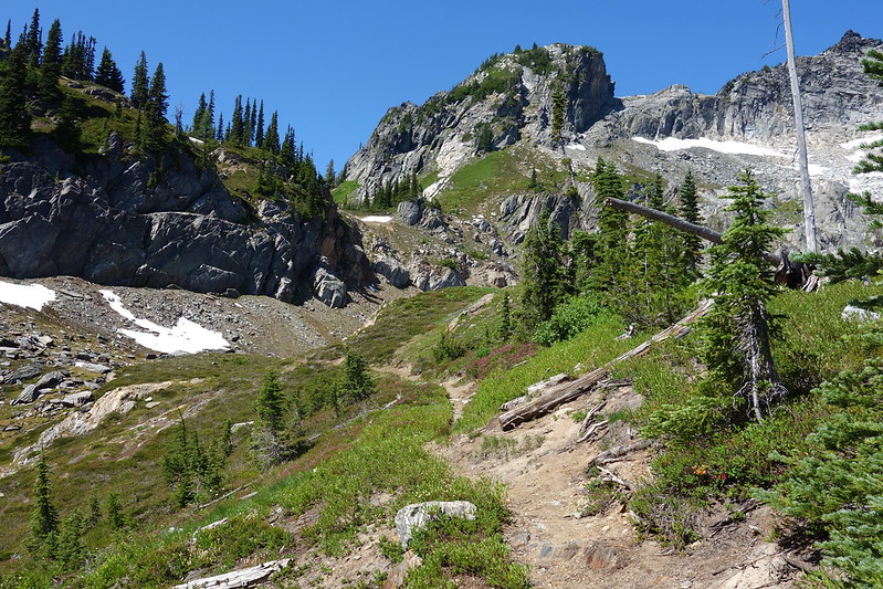
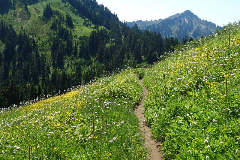
At White Pass, I turn off the PCT and onto the main climber’s route for Glacier Peak, here called the Foam Creek Trail. It’s at least as well-worn as the PCT, but made more from roots and rocks than manicured tread.
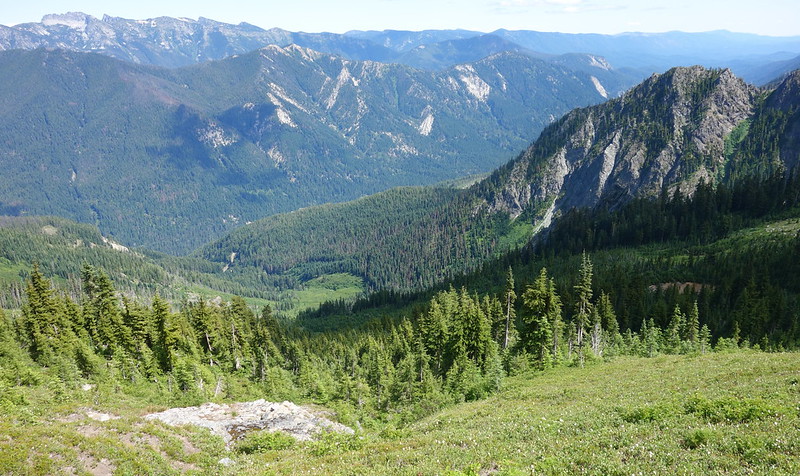
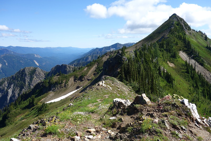
The trail bumbles up and down along the headwaters of the White River as views open to the south and east: Indian Head, Clark Mountain, my route so far. I get passed by a climber who’s straight up running in her plastic mountaineering boots. She looks back slightly after passing and happily shouts: “Single day summit!”
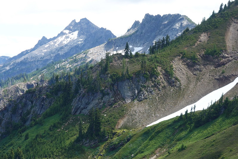
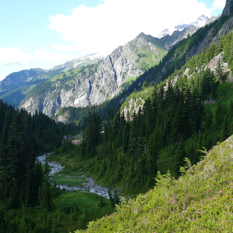
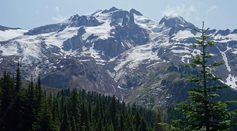
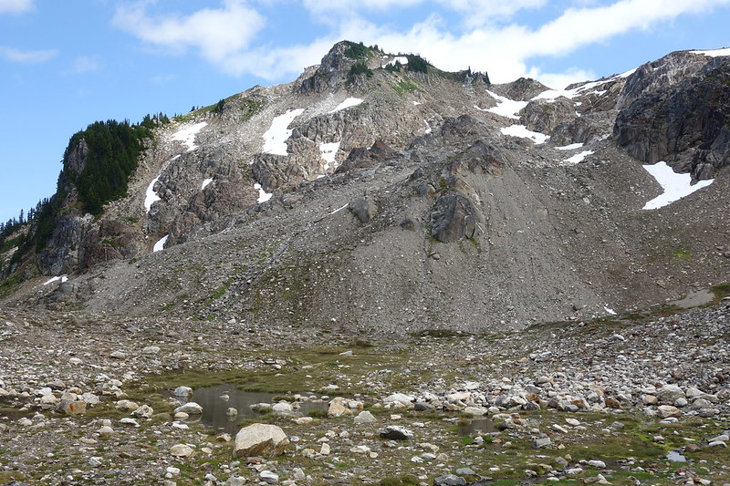
After a couple miles, I cross a steep gully into the White Chuck River drainage, then climb through the ghosts of glaciers to Glacier Gap, where one foot faces the White Chuck and the other faces the Suiattle River, which I won’t see again for several days—after I’ve made it most of the way around the mountain.


*
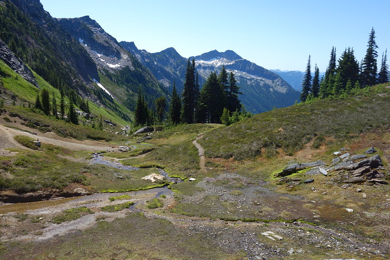
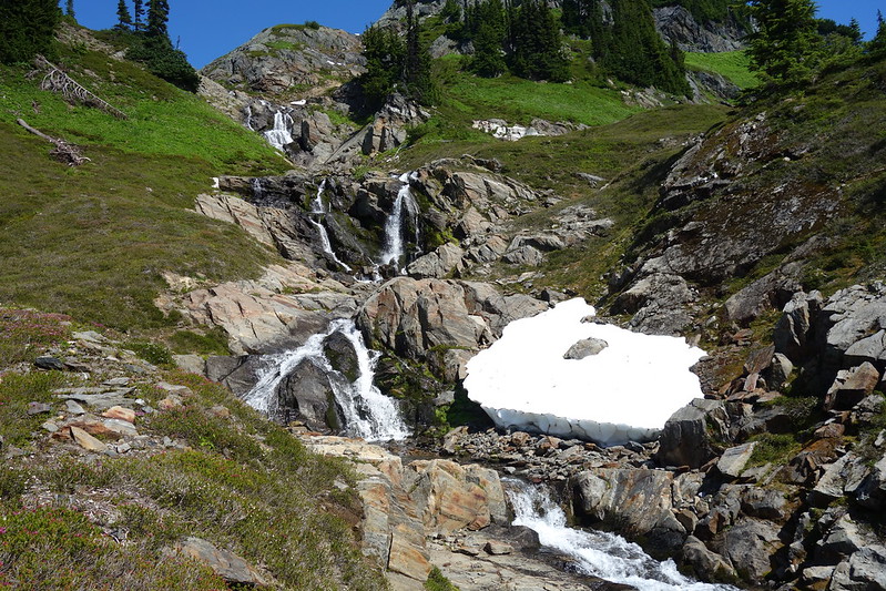
I slide down from Glacier Gap on bits of rock and soft summer snow, then stop by a small seasonal tarn to eat and plan my next move. The PCT’s a thousand feet below, in the White Chuck Basin, and there isn’t really a trail between here and there. But the terrain’s easy enough, and I settle on a snaking route that parallels the PCT.

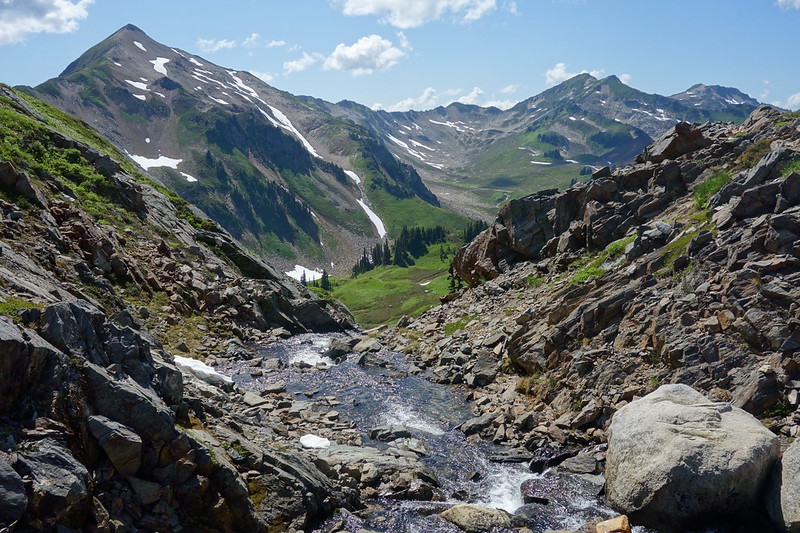
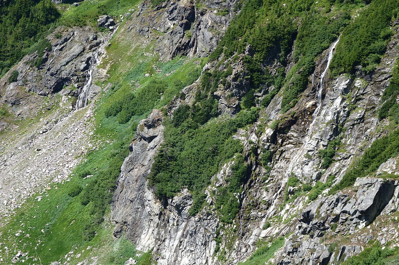
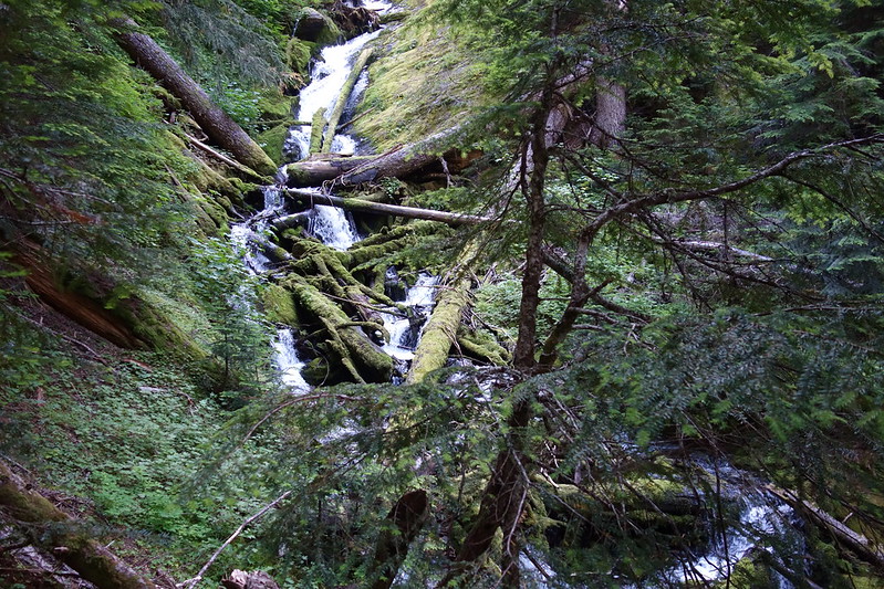
The route turns out to be the most fun I’ve had in months: steeply along a series of waterfalls, then through fresh talus, then along the edge of a marshy glade full of new blooming flowers. Every so often something almost like a trail will appear, but I’m never sure if it’s human or animal or just a mirage, and anyway the going’s so easy that there’s no need for trails at all.

Eventually I end up walking along the east side of White Chuck River, waiting for an easy spot to cross. And I find one at the northern edge of the Basin, just above where the water drops steeply into deep forest. From the crossing, I climb up toward the PCT, and meet it at an old camp I remember from years ago.
There are already two people there—southbound thru hikers drying their shoes in the sun—and they call out to me. “Are you Robin?” I laugh, and ask how they know. “We met your wife just about ten miles north of here. She’s hilarious!”
*
From the end of the Basin, the PCT drops down a few thousand feet into the most beautiful old growth forest. The main access route to this part of the trail—up through Kennedy Hot Springs—washed out decades ago, making this stretch one of the most remote along the entire PCT. And it feels remote. I amble through bands of ancient cedar and pine, through avalanche shoots and long stretches of mud. The evening’s coming, and it seems most hikers are in for the night. But the deer are all out for dinner, frolicking above, always just barely visible.
I reluctantly stop at Baekos Creek, knowing that this is may be the last good spot for quite a while, and set up in a clearing a couple hundred feet south of the water. As I’m setting up for dinner, a man about my dad’s age limps by, obviously looking for a spot. I call out to him, offering to scoot my tent over a bit to make room for his. He waves the idea away, but returns a few minutes later, having found nothing. He shouts from the trail, as if asking permission to enter. “I might take you up on that offer after all.” I shout back. “I hoped you would!”
July 30, 2019: Baekos Creek to Mica Lake
I wake in the rain to the sound of last night’s deer running through camp on their way to the river. My friend from last night’s still asleep—loudly—and I leave him a little note before heading out.
Then off, fast, into the still-dark woods. Maybe if I’m fast enough I can catch Krista today.


*
I stop at Chetwood Creek—the last clear stream I’ll cross for a while—to filter water and eat a quick breakfast. While sitting, watching the rain clouds burn off into sun, a tall guy with a tiny pack comes bounding down the direction I’m headed.
“Hey Robin!” He shouts happily, as though knowing a stranger’s name is a pretty normal part of his life. “Slept with your wife last night.” I laugh. “I mean, in the same basin. She’s just a few miles ahead.”
*
The next few miles—across Kennedy Creek’s famously broken bridge, up a few thousand feet on Kennedy Ridge, through Pumice Creek’s blooming basin, a bunch of freaking pointless ups and downs—all pass quickly, and soon I’m climbing the weirdly eroded switchbacks toward Fire Creek Pass.


There’s a small blue dot on top of the pass, topped by a pistachio tip. I see it for a quarter mile through the last of the switchbacks, but only realize until I’m fifty feet away that it’s Krista. I shout out our pre-ordained signal: “Ca-caw!” The pistachio tip—her beany, it turns out—swivels around. “Ca-caw!” Then all at one she’s running and I’m running and we’re in the middle of the trail, stinky-hugging. I laugh. “I can’t tell if you smell bad or if it’s me?” It’s probably me.
*
She got soaked in last night’s rain, and has been up here yard-sale-ing her stuff in the dappled midday sun. It’s all mostly dry and she was just getting ready to go, but waits a bit for me to eat a quick lunch. I want to say a million things, about the Napeequa and Indian Creek and the magic pass by Glacier Gap, but I’m also suddenly very hungry. And very, very tired. “So…” I test the waters. “So how far were you planning to go today?” She’s ambitious but flexile, and we decide to stop just a couple miles down the way at Mica Lake. I’ve always wanted to camp there.
*
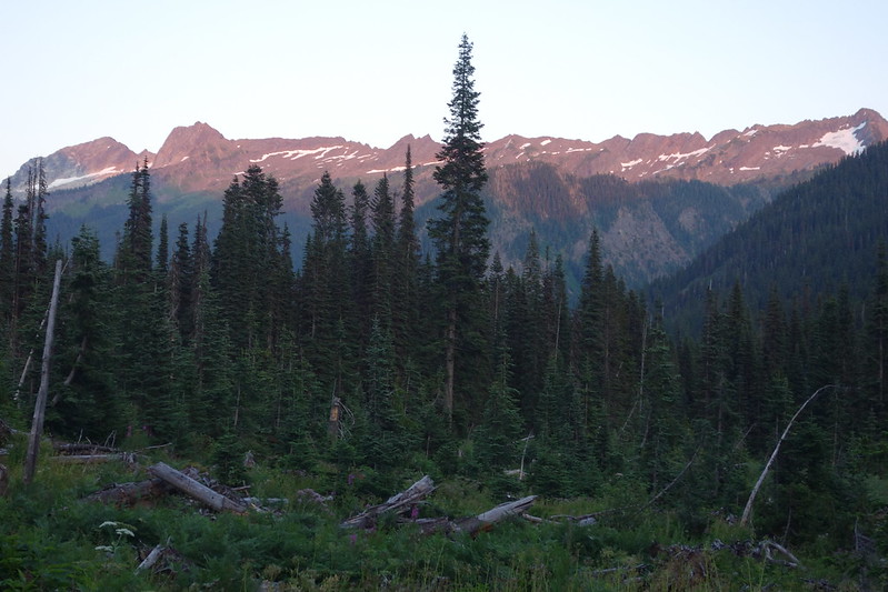
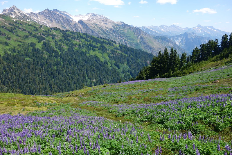
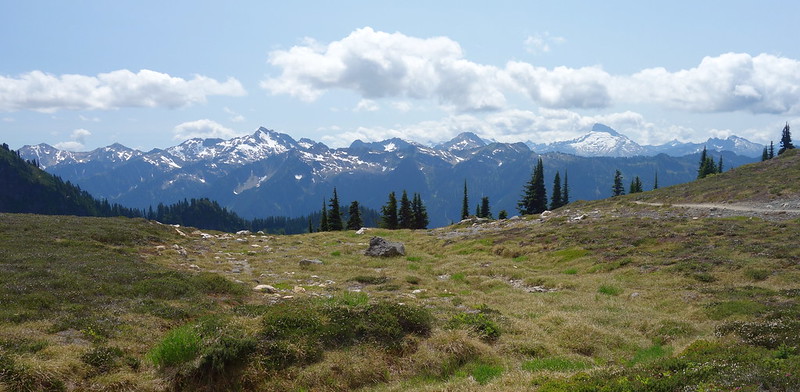
We eat and talk and take a thousand pictures that don’t really turn out. I love this spot: it’s the first time you can really see the North Cascades from Glacier Peak, the first time you realize the enormity of the range you’ve been wandering through. But it’s also weirdly difficult to photograph. Maybe feelings always are.


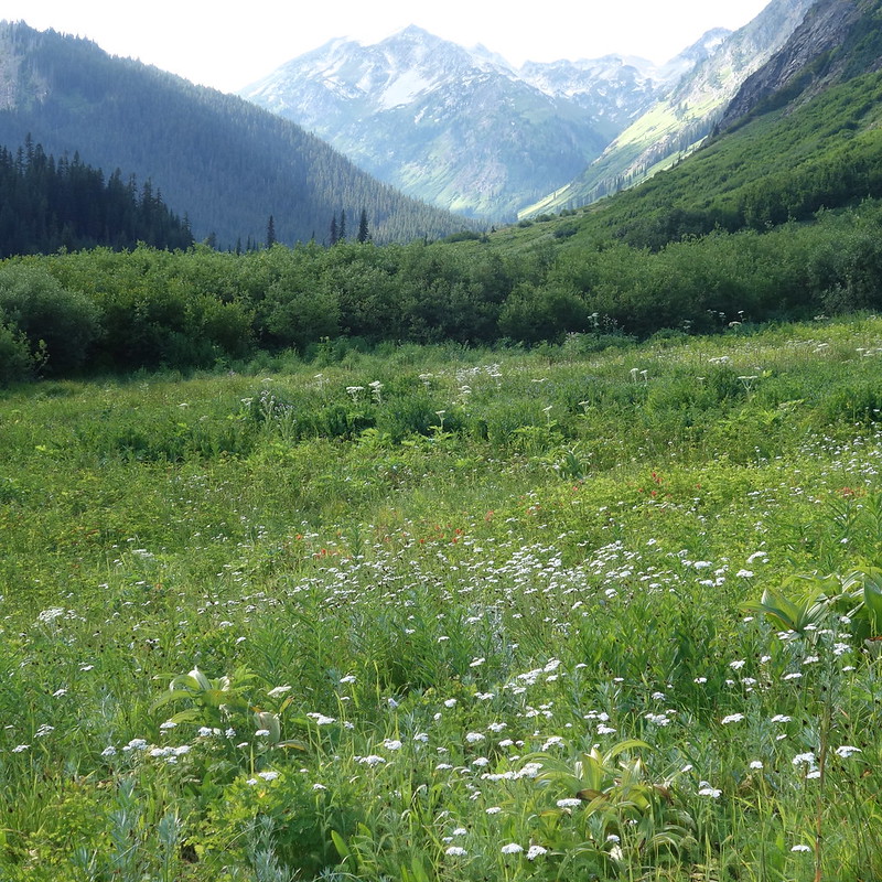
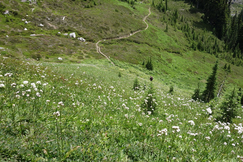
From the pass, the trail switchbacks steeply down the southeast shoulder of Fire Mountain and into an open parkland at the base of what was once the Milk Lake Glacier. There are still snowfields here and there, and a few deep blue ponds to mark the old moraine. Little streams streak through bright green fields of flowers. It feels like paradise, just on the far side of spring.
*
There are only a few spots big enough for tents around Mica Lake. Since the washouts a few decades ago the only real traffic this area sees comes from long-distance hikers. But we find a beautiful old place a few hundred feet above the lake big enough to accommodate our two little tents, and set about setting up for the night.

The rest of the day passes in a happy blur. We scramble down to the lake to swim—well, okay: Krista soaks her legs and I do the sort of panicked splashing I call swimming when the water’s this cold—then spend the evening watching the sun set and clouds turn purple. What a luxury to be still.