Potato Butte / Red Lake Trail 6.30.09

This forum is used to share your experiences out on the trails.
Post Reply
User avatar
zombie
Posts: 180
Joined: May 28th, 2008, 10:03 pm
Location: Clackamas, OR

Potato Butte / Red Lake Trail 6.30.09

Post by zombie » June 30th, 2009, 7:32 pm

I pulled this one out of 100 Hikes in Northwest Oregon pretty much at random last night. Viewpoint, check. Water features, check. Decent mileage, check. Elevation gain that would leave me able to walk for my shifts the next five days, check. Wrote the directions on the back of a receipt this morning (printer is out of ink and I try not to peruse books whilst motoring) and I was off!

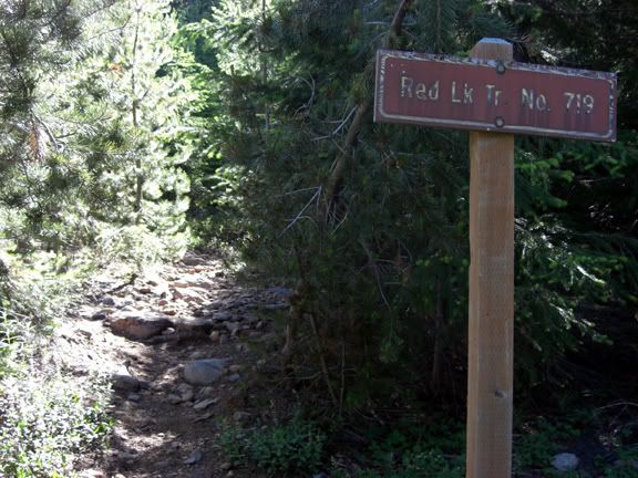
First, this hike is a cinch to get to! A good amount of milage to be sure, but all paved and well maintained roads until your last mile which is an equally well maintained gravel stretch which just about any vehicle could tackle easily. I arrived at the trailhead around 9:30 and was the third vehicle there. I would later discover the other two vehicles must have belonged to the two sets of tents I would come across.

So here we go...

Image

There were a few bugs out and about, but nothing like what I expected. With four lakes and an equal number of unnamed ponds along the route, it surely could have been worse. My 40% deet held up just fine and I didn't need to reapply.

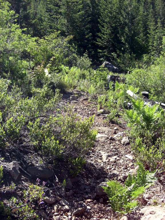
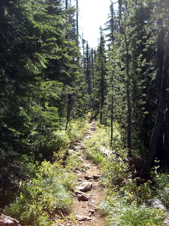
But for all the attention I didn't need to pay to the insect population, I was forced to focus on my feet. Albeit intermittently, a good deal (50% plus) of this trail has become melt-off/lake overflow stream bed...making for a trail of stones that wears out the insteps and threatens the ankles.

Image

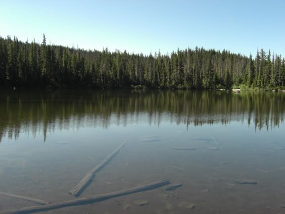
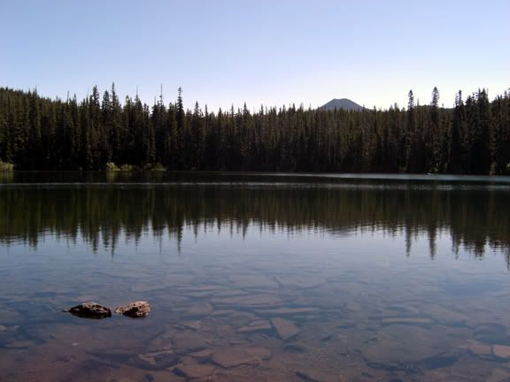
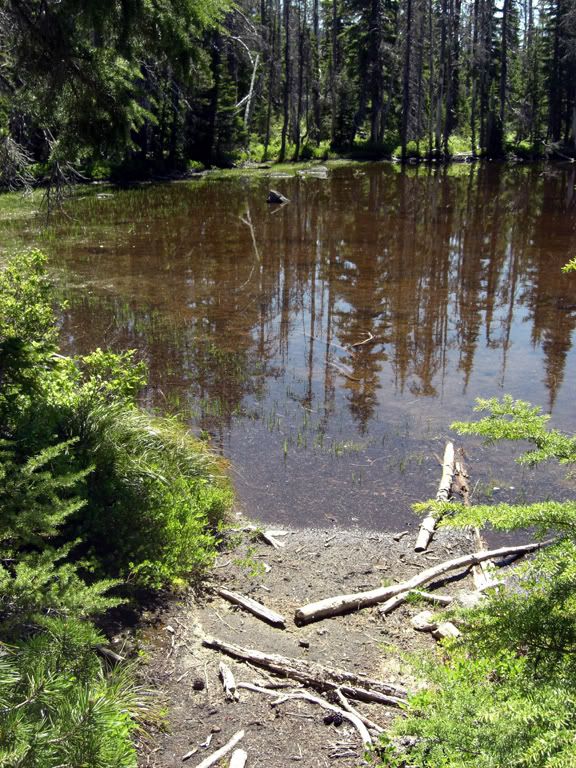
Most of you elevation gain here is in the first mile and in a significant quarter mile push at the end. After only a mile and a half you get to your first body of water, Red Lake. I'd like to officially point out that the lake really is more of a greenish brown...

Look close and you can see Jefferson peeking over that tree line to see what I was up to.

Image

the next two miles of this hike are relatively flat and will take you past no less than 6 more bodies of water...and while, in truth, they all look the exact same, I am still going to show them to you! ;)

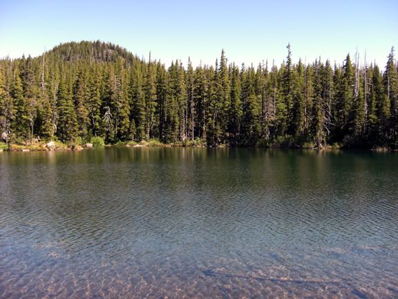
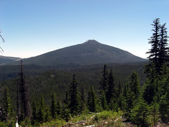
Averill Lake is up next, and was distinguishable by the fact that its bottom was chock full of mountain-spewed lava chunks. That, and it was the only one with a sign that said "Averill Lake". BTW, that is ginormous Olallie Butte sticking up back there...we have not seen the last of her.

Image

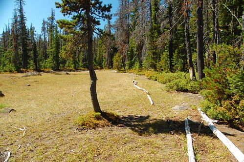
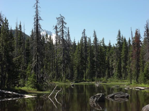
I'm assuming Wall Lake is so named because it sits on a shelf 200' higher than its first two siblings. Climbing the trail, one minute you are looking at a wall you're about to crest...after a few steps and a little climb...voila! A lake. That's our destination, Potato Butte sticking up back there...but we have another half mile forward and one mile back to get to her. Note the large boulder patch on the upper right flank; that is where the Jefferson views can be found.

Image

Let's check back in with the trail and see how that is going... Ya, still rocky.

Image

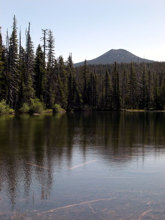
This here is Sheep Lake, so named because...well, I don't really know why. I DID however spend a few minutes studying the shoreline to see if the lake was shaped like a sheep. My official answer is: I dunno. BTW, these are not all pictures of the same lake, I swear. You can tell because now Olallie is closer! :D

Image

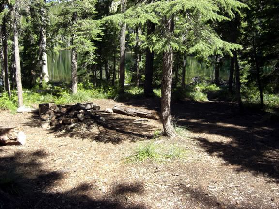
There were fantastic camp sites at every lake, with spur trails leading to sites on all sides. Each site I passed was smooth, litter free and featured a safe and well built fire ring.

Image

Just at the base of Potato Butte's 400' climb sat this unnamed pond/lake. I stepped to the edge to snap this shot of Jefferson in the background and when I turned back around I noticed the trail was gone. What was once a clearly defined cut through the countryside was now a 10' dirt patch with faint trails leading in at least three directions...none of them where my GPS said they should be. I took the one that pointed off toward Potato and managed to get about 500' before it too was gone completely. Well, the hill was obvious, so bushwhack it would be...up and around yet another nameless pond I went, eventually reconnecting with the original trail exactly where it was supposed to be. Hmm, odd.

Image

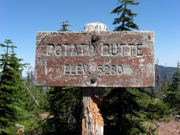
Regardless, a short calf-warming climb up a loose rock trail brings us to the summit, where I noticed with all my grade school humor that I had just joined the mile high club.

Image

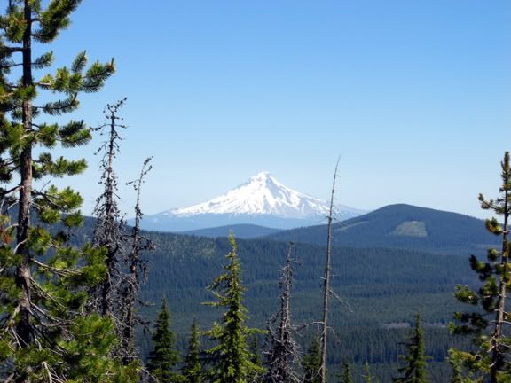
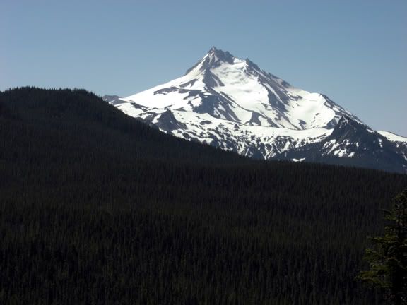
Looking north from the summit brought Mt. Hood into focus, proudly reminding us all who the queen of Oregon volcanoes is...

Image

But a short side trip out onto those boulders I mentioned earlier gave the great views south...and made it apparent that Jefferson was up to Hood's challenge.

Image

Of course, ugly step-sister Olallie showed everyone that just because your only 7200' tall, you can still be three miles wide!

Image

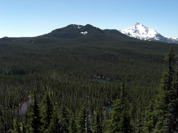
One more shot of the surrounding area shows off a few of those lakes and ponds, as well as Jefferson showing up Double Peaks Mountain.

Image

Oh and on the way back I figured out the mysterious missing trail situation. Turns out the very pond/lake that I was standing next too when I noticed the path went missing...is the one who ate it. So if you are heading up here anytime soon and don't want to bushwhack...bring your waders. Actually a small detour along the waters edge will do just fine.

Image

It was a great day to be on the trails today! This one logged in at right around 8 miles (counting side spurs and detours), with 1700' of total gain.

Image

-aaron
Last edited by zombie on June 30th, 2009, 9:22 pm, edited 1 time in total.

User avatar
markesc
Posts: 1530
Joined: May 28th, 2008, 10:03 pm

Re: Potato Butte / Red Lake Trail 6.30.09

Post by markesc » June 30th, 2009, 8:59 pm

Awesome report! I need to get out there!

User avatar
Stevefromdodge
Posts: 2508
Joined: May 28th, 2008, 10:03 pm

Re: Potato Butte / Red Lake Trail 6.30.09

Post by Stevefromdodge » June 30th, 2009, 11:27 pm

Is this the same hike Cheryl has outlined in the Field Guide?

http://www.portlandhikersfieldguide.org ... Butte_Hike

User avatar
fettster
Posts: 1720
Joined: May 28th, 2008, 10:03 pm
Location: Hillsboro, OR

Re: Potato Butte / Red Lake Trail 6.30.09

Post by fettster » July 1st, 2009, 6:50 am

That's a great viewpoint from Potato Butte south to Jefferson. It would be fun to be a bird and be able to soar over that open and uncut terrain. We did this one year in November when the lakes were just starting to freeze and the butte had a few inches of fresh snow. How were the bugs with all the lakes melted?

User avatar
zombie
Posts: 180
Joined: May 28th, 2008, 10:03 pm
Location: Clackamas, OR

Re: Potato Butte / Red Lake Trail 6.30.09

Post by zombie » July 1st, 2009, 9:35 am

Stevefromdodge wrote:Is this the same hike Cheryl has outlined in the Field Guide?

http://www.portlandhikersfieldguide.org ... Butte_Hike
Yup! Looks like it is exactly the same one. Give it a go, it was a lot of fun!

-aaron

User avatar
zombie
Posts: 180
Joined: May 28th, 2008, 10:03 pm
Location: Clackamas, OR

Re: Potato Butte / Red Lake Trail 6.30.09

Post by zombie » July 1st, 2009, 9:36 am

fettster wrote:That's a great viewpoint from Potato Butte south to Jefferson. It would be fun to be a bird and be able to soar over that open and uncut terrain. We did this one year in November when the lakes were just starting to freeze and the butte had a few inches of fresh snow. How were the bugs with all the lakes melted?

I honestly thought the bugs would have been a lot worse...but overall it wasn't too bad. I used a 40% deet just on my arms and the back of my neck and had no issues other than the constant buzzing!

-aaron

justpeachy
Posts: 3067
Joined: May 28th, 2008, 10:03 pm
Location: Portland, OR
Contact:

Re: Potato Butte / Red Lake Trail 6.30.09

Post by justpeachy » July 2nd, 2009, 9:06 pm

Looks like the pond that "ate" the trail hasn't dried up yet. When it does, it becomes a meadow and the trail is slightly easier to find, although it can still be confusing. To anyone reading this who ventures up there, you need to skirt the edge of the meadow (or pond, as the case may be) and then you'll see the trail re-entering the woods on your right.

Image

Japhy
Posts: 19
Joined: May 28th, 2008, 10:03 pm

Re: Potato Butte / Red Lake Trail 6.30.09

Post by Japhy » July 5th, 2009, 2:58 pm

I backpacked this trail this weekend (7-4 into 7-5). It's really unpleasant right now due to the mosquitoes. I've never been attacked by such a persistent onslaught of blood suckers before.

Beware!

I hiked up to Top Lake and there didn't appear to be many mosquitoes up there. At least, not yet!!

User avatar
Don Nelsen
Posts: 4380
Joined: May 28th, 2008, 10:03 pm
Location: Vancouver, WA

Re: Potato Butte / Red Lake Trail 6.30.09

Post by Don Nelsen » July 5th, 2009, 3:54 pm

Nice pics and nice writing, Aaron. Thanks for the report - yet another place I need to check out.

dn
"Everything works in the planning stage" - Kelly

"If you don't do it this year, you will be one year older when you do" - Warren Miller

AGHiker
Posts: 8
Joined: September 15th, 2008, 10:14 pm

Re: Potato Butte / Red Lake Trail 6.30.09

Post by AGHiker » July 21st, 2009, 5:40 am

I and 7 others went on 7/19/09. Sure the trail is a little rocky and you have to watch your step, and the climb up to Potato Butte is on high pitch/loose rocks (walking sticks help), but the view of Jefferson and the swimming in Averill Lake can't be beat. There are some camping spots around the lake that have me thinking this would be a good, short backpack trip. (oh the bugs weren't terribily noticeable, until 2 days later).

It's a nice little hike ... it will be a favorite of mine for the warm days / swimming in the lake possibilities. :P

Post Reply