
Here's Mine:
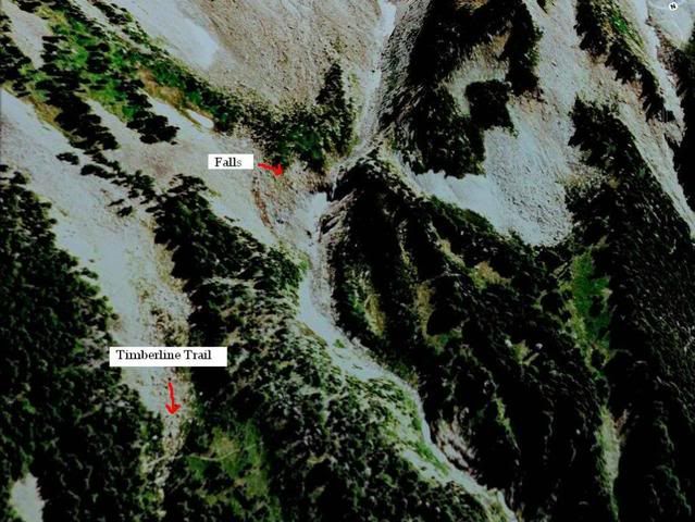
---- Coe Branch & Compass Creek waterfalls
Both of these creeks on the North face of Mt Hood have been on my list for several years now. Tom recently dusted this one off a bit (http://www.portlandhikers.org/forum/vie ... =10&t=5229). This would be a fairly intense day-trip from Cloud Cap Inn on the Timberline Trail. On Compass Cr, there are falls above and below the trail. The most impressive being way below.
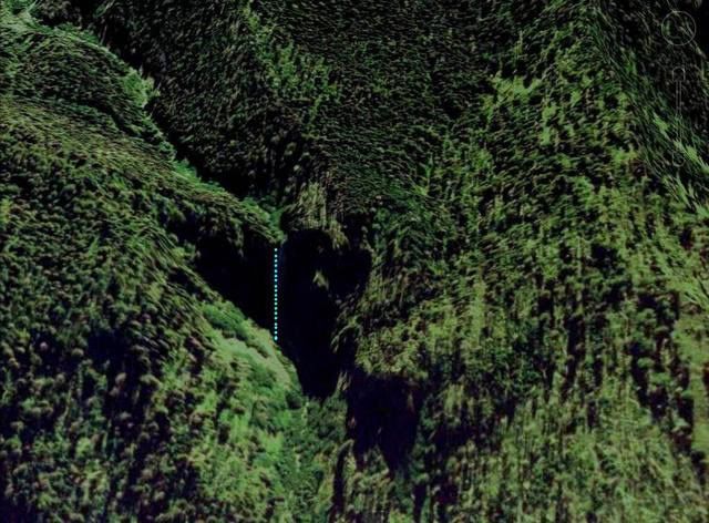
Upper Compass Cr Falls
The main attraction: Compass Cr Falls.
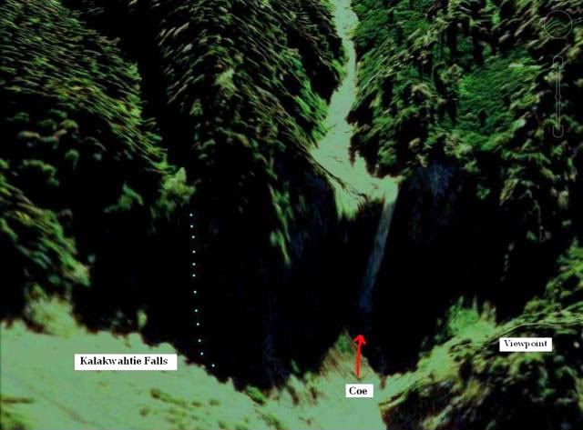
One drainage over is the Coe Branch.
----Breitenbush Cascades.
Breitenbush has the chance to be Oregon's tallest waterfall. The topo's show atleast 900 ft of elevation that is potentially one falls after another in many tiers. This one has been explored by fellow Portland Hikers a bit, but so far nobody that I'm aware of has documented it top to bottom. I need to take a good day or two and knock this one out.
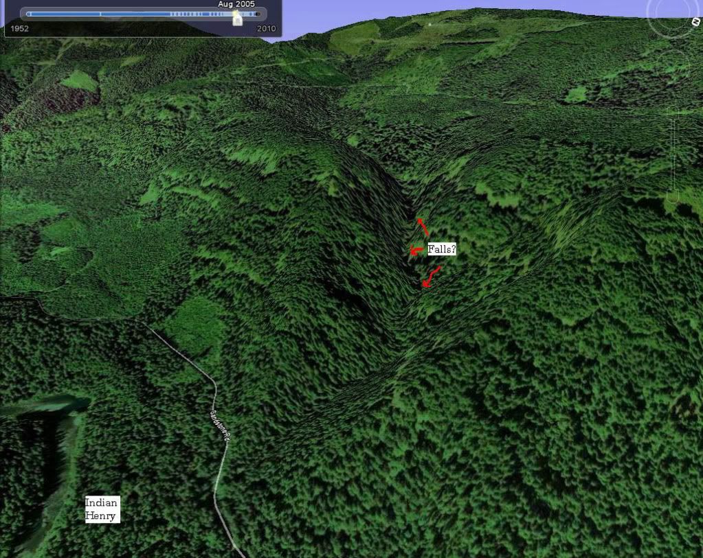
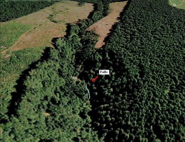
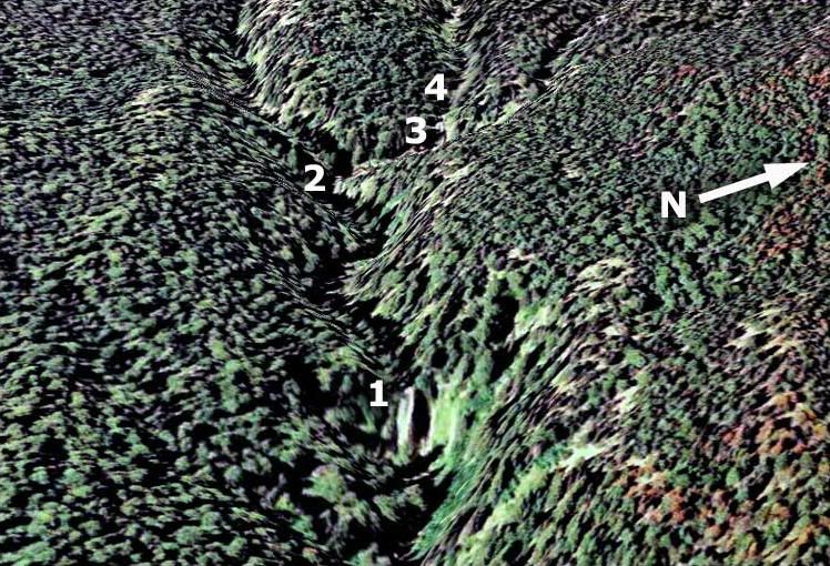
----Whale Creek - Indian Henry/Clackamas
With Pup Creek being a smashing success earlier this year, nearby Whale Creek has many of the same terrain features and elevation loss. This would be a long shuttle with two cars, but looks totally doable in just a few hours.
----French Creek Basin
Just north of Detroit lies French Creek and a basin completely filled with waterfalls. Many of them are close/right off the road but there are many others tucked up in that need a photo. Atleast two, possibly three break the 200 ft mark, with Marten Butte falls nearing 300ft. As of late though, the road has been closed in multiple spots due to slides, so this one may have to wait pending access.
----Hideaway Falls
Tom dusted this one off as well lately (http://www.portlandhikers.org/forum/vie ... =10&t=5148). Any exploration in the upper reaches of the Salmon River is a very committed undertaking. The prevalent riverside cliffs and deep pools make fording/accessing any west side falls difficult. I may take FR 5850 to its end, and then make a bee-line through the bush 1.5+ miles to the creek, which would allow avoiding the treacherous Stein Falls area.
----Gnat Creek Falls
Supposedly down in this canyon east of Astoria is a major multi-tiered falls totaling 250 ft or more. A recent logging operation punched a road in very near the falls, so access to the rim won't be too complicated. Getting down in remains the question.
----Lamberson Branch Falls
This one was introduced to me by the ever resourceful Splintercat
This is Tom's image
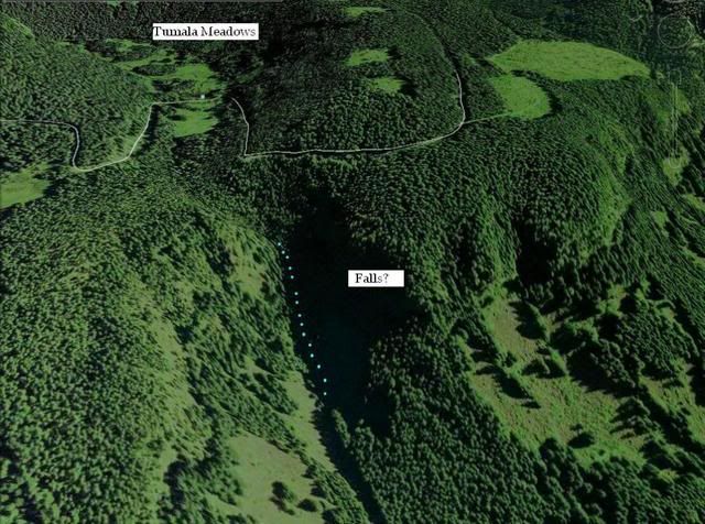
----Tumala Creek Falls
This is the old Squaw Meadows area off 4610/Abbot Rd near the Roaring River. ~4 years ago I was in the area and seen the severe elevation loss this creek encounters, but didn't actually see a falls itself. There's definitely gotta be a falls or two on the creek, but of any significance? I don't know at this point.
On 6/26/10, me and another member here sucessfully reached the base of the big 250 ft falls near Opal Lake, trip report coming soon.
There are many more falls in the central and southern part of the state that are just-as or more impressive than any of these, and would be quite rewarding to any WF-hunter. The Upper Middle Fork of the Willamette, Linton Falls, etc come to mind. But for a weekend warrior like myself these would take ALOT of commitment.
Anyway I'm very curious to see anyone else's must see falls list


