Update June 30, 2013
The USFS took down the trail data that this map displayed.
In trading email with a server admin at their HQ I learned that this trail data has not yet been fully blessed for public release.
I lobbied in favor of a phased approach to making this data public. Since the trail data for Region 6 (WA and OR) is in reasonably good shape, that data should be placed online even though the trail data for at least some other FS regions might still need a fair bit of work.
This guy also gave me a great tip that led to an undocumented feature in ESRI ArcServer. The upshot is that I will be able to make Gmap4 into a general purpose GIS viewer for data that is available via either the WMS interface or REST interface.
----------------------------------------------------------------
I’m still wrapping my head around the possibilities that come from being able to display almost any data hosted on WMS servers. It turns out that sometimes the hard part is simply finding the address (‘endpoint’ in GIS-speak) for the server.
Yesterday I stumbled across a WMS server run by the USFS with the catchy name:
http://apps.fs.fed.us/ArcX/services/wo_nfs_gstc/GSTC_IVMRoadsAndTrails_01/MapServer/WMSServer
Whadayaknow! This is where they tucked away
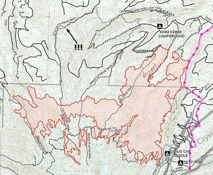
all the national forest trail data for the USA. The beta version of Gmap4 can display all of this trail data.
I tried to embed this map but the foum software choked on the complex link. Reminder - this map is produced by the Gmap4
beta code.
<
Edited to add a layer with recreation symbols. Zoom in and you see the names of trailheads.>
http://www.mappingsupport.com/p/beta/gm ... ation_site
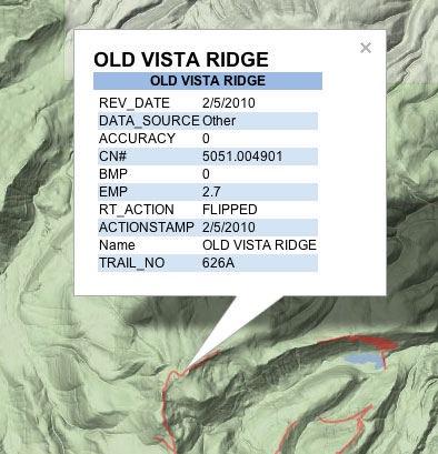
If you zoom in on the map then you will see trail numbers. If you zoom in more then you will see trail names. To easily read the trail names, change the basemap to ‘All white basemap’.
To change the overlays that are turned on and their stacking order, open the 'map type' menu by clicking 'T1 Terrain' and go to the last part of the dropdown menu. A higher numbered overlay covers up a lower numbered overlay.
Try this: Turn off all overlays.
Turn on mountain bike overlay
Toggle the non-motorized overlay back and forth
I panned to a random forest in Montana and got the same data.
To get the link that starts this map, click Menu ==> Link to this map.
Joseph, the Gmap4 guy