We hit the trail mid-morning, thinking that the USFS wilderness map was accurate -- and we'd be at Echo Lake in a couple hours, enjoying the late summer weather. Wrong! After a fairly straightforward hike along the valley floor, the trail forked, and we started up one of those endless sets of switchbacks that the Wallowas are famous for. I took another look at the map -- a terrible USFS contour map from the 1980s, and started counting the 80-foot contours that crossed the "straight" trail to the lake... gulp! I starting thinking about Polaris Pass, and wondering how MANY unmapped switchbacks lie ahead..!
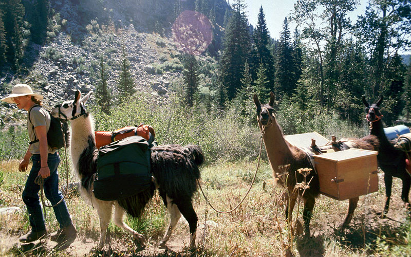
Well, needless to say, my wife was rather unhappy with this turn of events, as I had advertised the hike as an easy jaunt..! Worse, the slope we were climbing faced southwest, and we were really starting to bake at this point -- and run low on water. Ugh! Partway up the slope, we were passed by a llama packer, and I was pretty sure my wife was going to throw herself over a llama, and demand a ride to the top!
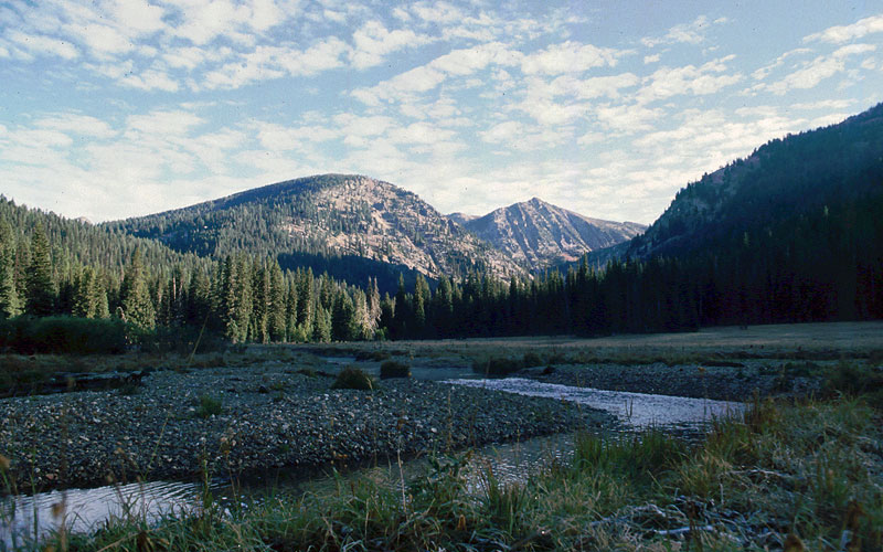
Looking back on the easy part of the hike from above the first few switchbacks:
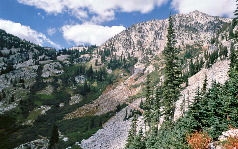
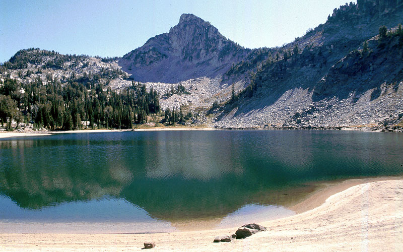
...and looking ahead (...uh-oh...) at the slope ahead of us. Echo Lake is at the base of the peak, in the upper right (this peak is also visible in the first photo, for reference):
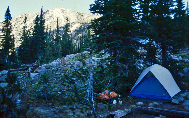
After a long, hot, slow climb up the canyon headwall, we finally arrived at Echo Lake in late afternoon, and pitched our tent just in time to collapse. My wife had been in tears a couple of times along the trail, and at this point, I was in the doghouse for MONTHS -- maybe years -- for my impeccable planning on this one!
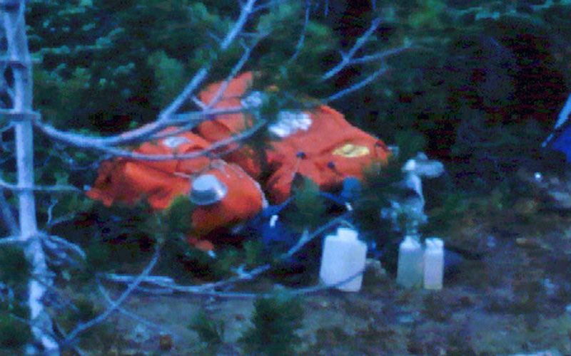
Oh, and we still have that tent, by the way! Okay, for old-timey gear junkies, here's a CSI close-up of our bright orange backpacks, external frame of course -- and good 'ol soft-plastic water bottles... so very old school! Also, a Sierra cup hooked onto the back of my wife's pack... and I'm sure the Bluet stove is lying around there, somewhere:
The next couple of days were much better! We spent the second day hiking up to Traverse Lake and Wonker Pass, sans backpacks! The going was much easier, as I carried the water and food, and my wife carried a small fanny pack. I think she actually enjoyed this part! Not that I was out of the doghouse, of course... but at least I knew it wasn't going to be a life sentence....
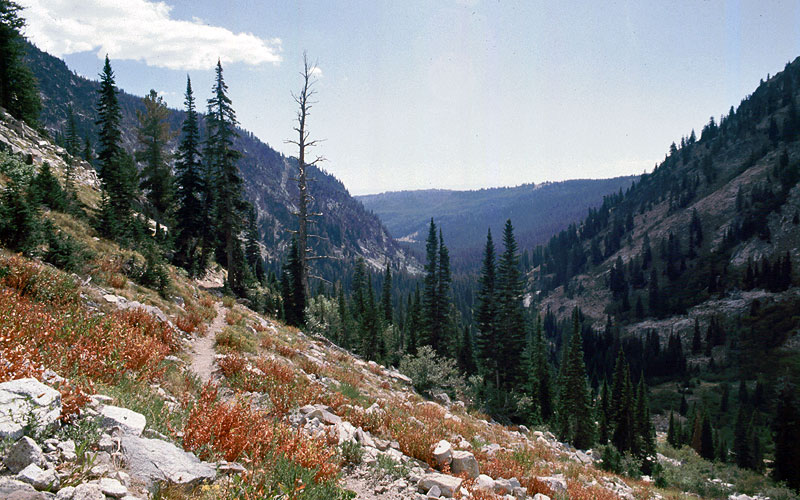
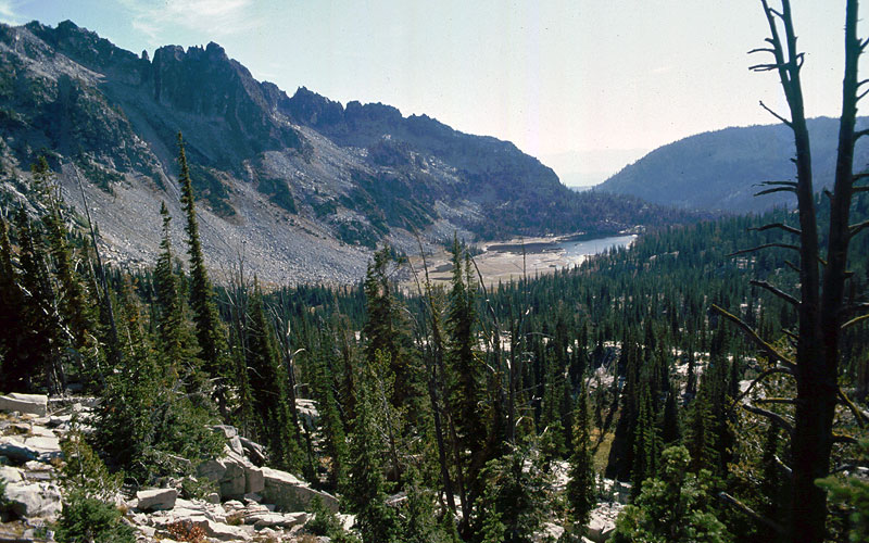
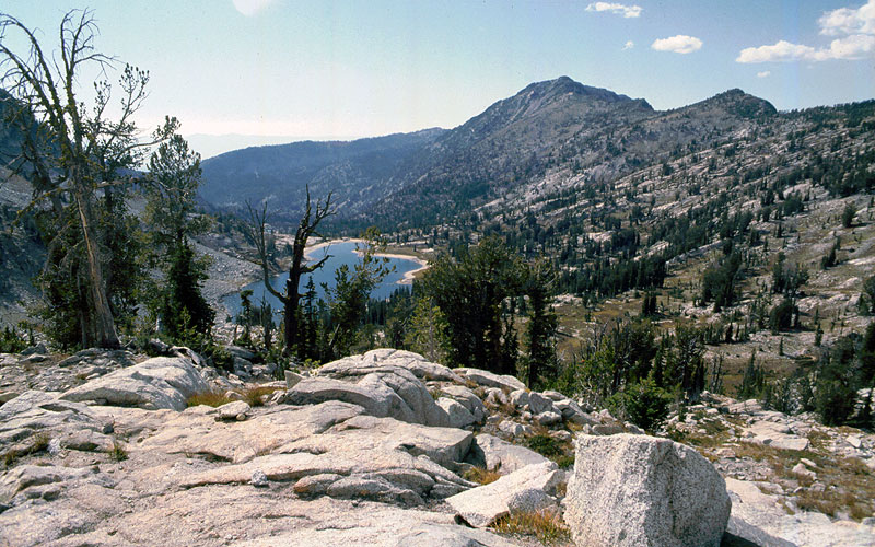
The trail to Traverse Lake was pleasant, with this view back to Echo Lake after a series of winding switchbacks:
Soon, we were at Traverse Lake, which provided a VERY COLD swimming spot on uniquely sandy shores, and incredible views up to The Horn:
We didn't swim for long, but did enjoy lunch along the shore, with our feet chilling in the water before heading back up the trail, toward Wonker Pass.
The hike above Traverse Lake is a particularly scenic trip through alpine meadows and boulder gardens. There are more great views of The Horn, plus a nice look back to Traverse Lake:
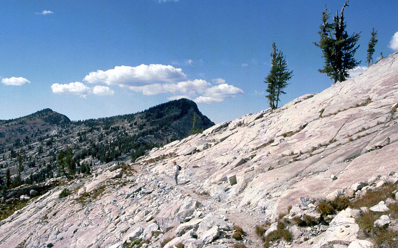
Soon, the trail climbs above the tree line. Here's my wife just below Wonker Pass, where the trail is cut into glacier-polished granite:
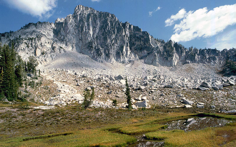
We spent some time at this rugged pass before heading back to our campsite at Echo Lake. On the way down, The Horn was beautifully lit with afternoon light -- a pleasant surprise! This scene is from a pair of tarns above Traverse Lake, and is my lasting visual memory from the trip, since I'd been somewhat obsessed with visiting this particular peak after hearing Doug Lorain's rave reviews and seeing his photos (he has since included this trip in his hiking guides):
I still call the lake "TRAH-verse Lake", which is how Doug pronounced it -- but I suppose the proper pronunciation would be "truh-VERSE Lake". Not sure, but Doug's not one to mispronounce a name without good reason, so I've stuck with "TRAH-verse" for all these years.
Here's a topo that covers the trip -- and oh-my, if I'd only had this trail track and contour detail on the map I was using back in the day!
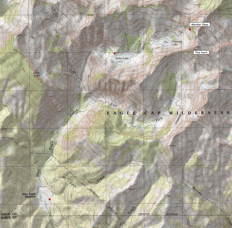
So, if I've piqued your interest, I'm guessing the hike from the West Eagle Meadow to Echo Lake was about 5 miles, and then maybe another 3 miles to Wonker Pass. This makes for a great 3-day, 2-night backpack for Portlanders. We were able to make it back to Portland on the same day we hiked out from Echo Lake, thanks to gravity helping us make good time on the trail, but buff hikers would have no trouble arriving in early afternoon and making it to Echo Lake in 3-4 hours on the first day, exploring Traverse Lake the second day, then hiking out and making it back to Portland on the third (albeit with a lot of driving).
-Tom