...here is a terrific aerial shot of Spirit Lake and Mount St. Helens by Oregon photography legend Ray Atkeson. I especially like that he cropped a corner of the Mt. Margaret backcountry into this view. Gorgeous!
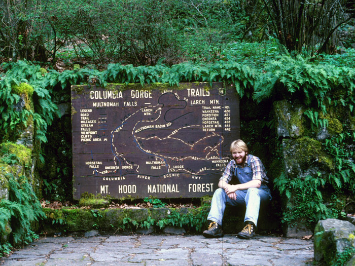
Truly a magical place that lives on in our memories... and a few photos, too!
- Tom
...for those who arrived here after May 18, 1980...
- Splintercat
- Posts: 8334
- Joined: May 28th, 2008, 10:03 pm
- Location: Portland
- Contact:
- retired jerry
- Posts: 14425
- Joined: May 28th, 2008, 10:03 pm
Re: ...for those who arrived here after May 18, 1980...
What's interesting is you can sort of see the old crater that's similar to now, with a cinder cone coming out of it.
I think that's "Dog's Head" to the left, and a rock outcropping to the right.
I've seen photos from a slightly different angle where you can see it better.
Or, maybe it's just my imagination
I think that's "Dog's Head" to the left, and a rock outcropping to the right.
I've seen photos from a slightly different angle where you can see it better.
Or, maybe it's just my imagination
- Eric Peterson
- Posts: 4097
- Joined: May 11th, 2009, 5:39 am
- Location: Oregon
- Contact:
Re: ...for those who arrived here after May 18, 1980...
Kind of a bummer really, I was 10 watching the ash blow from NE Portland and
have no memory of what the mountain looked like before the top blew off.
Kind of looks like South Sister though!
And we still have all the other volcanoes more or less intact to climb on and around
BTW, is Hood next to reshape
have no memory of what the mountain looked like before the top blew off.
Kind of looks like South Sister though!
And we still have all the other volcanoes more or less intact to climb on and around
BTW, is Hood next to reshape
- Splintercat
- Posts: 8334
- Joined: May 28th, 2008, 10:03 pm
- Location: Portland
- Contact:
Re: ...for those who arrived here after May 18, 1980...
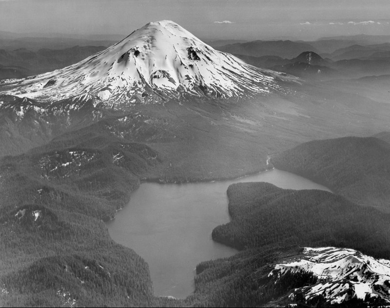
Could be -- it has had a bunch of events over the past 300 years that have pretty much shaped the south side as we know it, plus laid down today's floor of the upper Sandy River valley. Every time I pass the log mansions on E. Lolo Pass road, I wonder just what that area will look like when a really large lahar cuts loose on what's left of the ZigZag glacier!BTW, is Hood next to reshape
Back when they made a motion picture based on St. Helens, they used Mt. Bachelor as a stand-in. It kind of works, but the treeline is way too high on Bachelor (even on the north side), and it obviously lacks the ice needed to be a true stand-in. But for most people, I guess it was close enough. I agree, Eric, that South Sister is a better option, especially from the SW side.
Tom
- Stevefromdodge
- Posts: 2508
- Joined: May 28th, 2008, 10:03 pm
Re: ...for those who arrived here after May 18, 1980...
The other volcanic feature that's obvious in this picture, is the apron of material that came down during the Goat Rock phase in the early 1800s. It mimics today's Pumice Plain.
Re: ...for those who arrived here after May 18, 1980...
Thanks for the photo, I don't remember that version of Mt. St. Helens very well because I was -7 at the time it erupted
- Waffle Stomper
- Posts: 3707
- Joined: May 28th, 2008, 10:03 pm
Re: ...for those who arrived here after May 18, 1980...
Eric Peterson wrote:Kind of a bummer really, I was 10 watching the ash blow from NE Portland and
have no memory of what the mountain looked like before the top blew off.
Why do I feel old?theradpotato wrote:Thanks for the photo, I don't remember that version of Mt. St. Helens very well because I was -7 at the time it erupted
"When we try to pick out anything by itself, we find it hitched to everything else in the Universe." - John Muir
- Splintercat
- Posts: 8334
- Joined: May 28th, 2008, 10:03 pm
- Location: Portland
- Contact:
Re: ...for those who arrived here after May 18, 1980...
I can relate, Waffle..!
Let's see... in 1980 I was 18 years old and still had my hair... and 30 fewer pounds!
I think that was actually 1981... but close enough.
I watched the May 18 eruption from the nursery I was working at on SW Barbur Boulevard. We could see it very clearly, though there was a very high overcast that the ash column was pushing into. Lost a high school friend and her mom to the May 18 eruption (they were up there with a PCC photography group). Hadn't met my wife yet, but she lost two friends in the eruption, too -- their car is one of the "artifacts" along the drive to Windy Ridge.
It all seems very long ago, now... but I can also remember it vividly. Must be that aging process at work...
-Tom (who turns 50 next week!)
- retired jerry
- Posts: 14425
- Joined: May 28th, 2008, 10:03 pm
Re: ...for those who arrived here after May 18, 1980...
I just happened to go for a hike on Silver Star Mt. that day.
Too bad I didn't have a camera with me.
Fortunately, the wind was blowing in the other direction.
Too bad I didn't have a camera with me.
Fortunately, the wind was blowing in the other direction.
- Dustin DuBois
- Posts: 789
- Joined: September 19th, 2011, 1:24 pm
- Location: Beaverton, OR
Re: ...for those who arrived here after May 18, 1980...
I've tromped around a bit in the wake of the eruption but I really wish I could've been around to have known the mountain beforehand. Yeah I was still 4 years away when St. Helens popped so I've never known it as anything but the broken volcano of the NW Cascades. That's a great photo. I enjoy looking at side-by-sides and trying to identify how things have shifted. It kind of makes me sad to see it now that I know I'm missing though. But, the new landscape offers new experiences - especially for those who traversed it before May 1980.
Hi!