#501 Eagle Creek extension to Plaza Trail - Sept 28, 2008

Discussions and Trip Reports for off-trail adventures and rediscovering lost trails
Post Reply
pablo
Posts: 1451
Joined: May 28th, 2008, 10:03 pm

#501 Eagle Creek extension to Plaza Trail - Sept 28, 2008

Post by pablo » October 1st, 2008, 10:12 pm

Tying up some loose ends from previous hikes. This one is a leftover from Splintercat's Chak Chak Falls adventure. After joining the bunch for Chak Chak I'd planned to investigate the abandoned extension of the #501 Eagle Creek trail to the Plaza trail just east of Coffman Camp but I ran into snow early on that scuppered the chance of seeing any kind of trail. On the map it looked like a trail graded for horses given the long switchback at the beginning so I was hoping for a remnant trail bench. I'm under no illusions on these lost trails, after 40 years there's not likely to be much left and so it is in this case. I saw no trail but turns out the understory is so clear no trail is necessary. Here's the 1963 version of the #501 and the segment of interest heading northeast from the end of the 501 to the Plaza trail. The #504 Eagle Creek cutoff trail heads south just beyond the jumping off point for the segment going north.

Image

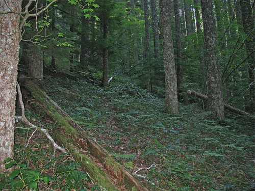
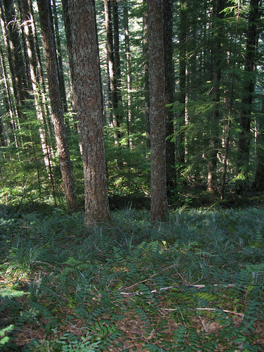
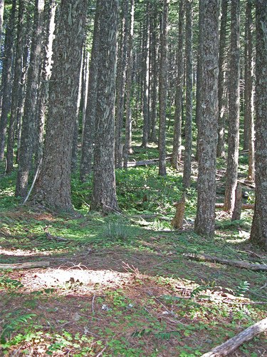
I reached the jump off spot near the present end of the 501 and was anticipating a nasty pointless bushwack through dense thickets of rhodies. There was pretty mature forest to start so I started up in an understory of oxalis and old nurse logs. Very nice start. I saw no blaze nor trail bench. I kept looking for the barricade of brush but the way was surprisingly clear. I left the older trees along the creek and went up the hill in a young 40-50 year old forest of even aged Doug fir; clearly when this route was used the hillside was either bare or brushy from some fire 50-60 years ago. There was no blaze or maintenance. Here's some samples, dense canopy, little blowdown, nice stuff in the understory, dwarf oregon grape, beargrass, spotty rhododendron, and vine maple all the way to the top.

Image

Image

Image

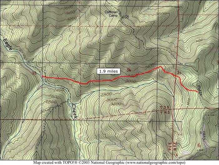
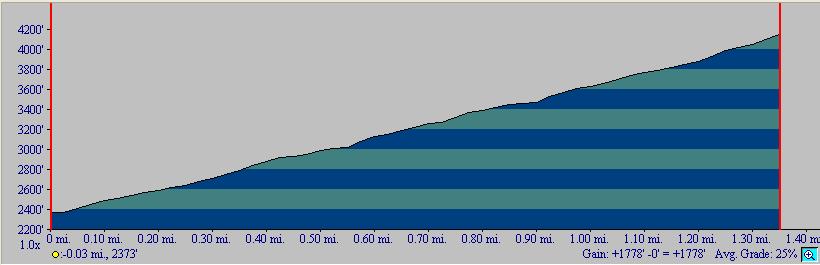
The slope was easy and fairly constant as can be seen by this profile of just the segment out of Eagle Creek - average slope is claimed to be 25%:

Image

My route took me to the top of a knob above the Plaza trail so I just went over to intersect. A better route would have been to just follow the knob west to intersect Plaza in a saddle as the rhodies did get a little dense on the north side of the hill.

Once on the Plaza I made the intersection with the Douglas trail and on to Wildcat Mtn. A couple of rock outcroppings afforded some views of the big mountain.

Image

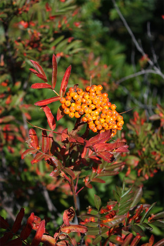
Some colorful berries nearby in fall colors.

Image

Once beyond Wildcat Mtn, I started seeing people, likely coming up from the gravel pit trailhead. I did not know this but there is a trailhead even closer to Wildcat Mtn than the gravel pit, there is a short trail branching off from Douglas trail that leads to a road that's not marked on any map I have. There was a car parked there so clearly it's accessible from some route. Cuts about a 3/4 mile off the gravel pit TH. On the attached map the road would be right about where the 'O' in Hood is on the map. It's just west of the McIntyre Ridge intersection.

The Douglas trail west of the gravel pit is very nice, I doubt it sees much hiker use compared to the segment from the pit to Wildcat Mtn. and its in recovery from ATV abuse.

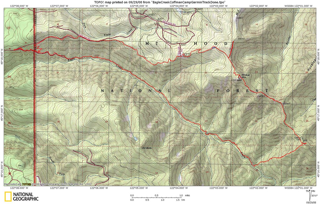
This cutoff route makes a nice loop with Eagle Creek. Right now the only loop with trail is to go up Eagle Creek, south up the Eagle Creek Cutoff, then round the ridge on the Plaza Trail about 25 miles. I will say the views are much better and more interesting on the longer loop.

18 miles, ~4200'

Image
The future's uncertain and the end is always near.

User avatar
Peder
Posts: 3401
Joined: May 28th, 2008, 10:02 pm
Location: Lake Oswego

Re: #501 Eagle Creek extension to Plaza Trail - Sept 28, 2008

Post by Peder » October 3rd, 2008, 10:31 am

Thanks for the report. I hope to do the hike next year, once the days are longer. It looks like a fun loop.
Some people are really fit at eighty; thankfully I still have many years to get into shape…

User avatar
Splintercat
Posts: 8334
Joined: May 28th, 2008, 10:03 pm
Location: Portland
Contact:

Re: #501 Eagle Creek extension to Plaza Trail - Sept 28, 2008

Post by Splintercat » October 3rd, 2008, 11:14 am

Hard to keep up with you, Paul - another cool bushwhack! Thanks for the report and photos. That slope IS amazingly open - the rhododendron gods were smiling upon you... :)

I'm a bit puzzled with your map - this is a map I posted at least a year ago, and is my translation of a trail alignment that the late Howard Rondthaller sketched on a topo for me, some 25 years ago. I think I posted it here, at one point, and somebody commented on the details of the lower alignment. Were you part of that conversation?

Image

It may be that your cross-country route was less painful than following this corridor, even if a trail still exists here. I also recall somebody commenting on the upper junction still being visible.. but not positive.

Tom

raven
Posts: 1531
Joined: May 28th, 2008, 10:03 pm

Re: #501 Eagle Creek extension to Plaza Trail - Sept 28, 2008

Post by raven » October 3rd, 2008, 8:21 pm

I may have commented. A number of years ago, I found found a likely trail--quite definite and marked by somone--at the top of the alignment you (Tom) marked. I had no time that day to follow it beyond where it went around the knob, and never got back to check it out. (The problems of living in an area with many options, coupled with a preference for snow travel.)

Steve

pablo
Posts: 1451
Joined: May 28th, 2008, 10:03 pm

Re: #501 Eagle Creek extension to Plaza Trail - Sept 28, 2008

Post by pablo » October 5th, 2008, 9:41 pm

Splintercat wrote:[...] the rhododendron gods were smiling upon you... :)
More like laughing as I got another poke in the eye from about the only rhodie bush in sight bad enough I missed a day of work. I walked right into it.
Splintercat wrote:I'm a bit puzzled with your map - this is a map I posted at least a year ago, and is my translation of a trail alignment that the late Howard Rondthaller sketched on a topo for me, some 25 years ago. I think I posted it here, at one point, and somebody commented on the details of the lower alignment. Were you part of that conversation?
Yes I recall the map you posted at the end of the TR posted here. In this case I preferred the alignment of the route from the 1963 map as I like the straight up the hill part and was hoping something would be there - side hill bushwhacking can be brutal.

In reviewing your map and the 1938 map I would tend to agree that the trail likely did not follow the 1963 route. Steve's comment provides more evidence. In the 1938 map (and the 1946) the route goes to a saddle on the Plaza to the north of the intersection on your map although your intersection is closer to the Salmon Mtn trail. 1938 map has this section of the Eagle Creek trail drawn as a more maintained trail so another trip to this area is warranted.

Attached is a snippet from the 1938 map. There's lots of routes on here I want to do. The 'lesser standard' routes off Wildcat Mtn to Eagle Creek and that shortcut off Salmon Mtn. to the Salmon GS look like fun.

Coffman Camp trail up from Cheeney Creek is high on my list so there's an opportunity to revisit this one. Also high on my list is a return to Chak Chak and bag Old Baldy Lake.

1938 map snippet to consider.
Eagle1938.jpg
The future's uncertain and the end is always near.

User avatar
Splintercat
Posts: 8334
Joined: May 28th, 2008, 10:03 pm
Location: Portland
Contact:

Re: #501 Eagle Creek extension to Plaza Trail - Sept 28, 2008

Post by Splintercat » October 5th, 2008, 10:24 pm

Hmm... more questions than answers from that darned 1938 map, as usual! (I made the mistake of looking west on Eagle Creek... lots of odd stuff over there) The protractor-generalized curve is suspect on this version of the EC Cutoff -- since I am just old enough to have learned cartography the old fashioned way, I'm always suspicious when curves on inked maps start matching a French curve or protractor..! :)

The really odd part is the status of the Cheeney Creek trail as a "dotted" path. I would have thought it to be in fine shape at that point. Also puzzling is the phone cable shown zipping right up Salmon Mountain. Odd. They were as active as they were superhuman back in those days, so nothing really surprises me!

Paul, if you do go up Baldy Creek to the lake, please take PROFUSE photos of the creek (more waterfalls, perhaps?) and scree sections. That's yet another that I'm trying to document for TKO purposes - here's a MaddenMap™ that shows what I've been thinking at the upper end. There appears to be a viewpoint (or at least an open slope) above the lake that might provide a rather nice view of both the lake and Mount Hood. As you know, the summit of Old Baldy is under forest canopy nowadays.

Image

Tom

Post Reply