I've located another "lost trail" segment that might be fun to explore -- and who knows, maybe reopen? This one is a piece of the Bennett Pass Trail, that was generally replaced by the Bennett Pass Road in approximately the 1930s. Here's the talus slope where the trail bench can be clearly seen in modern air photos (I've marked it):
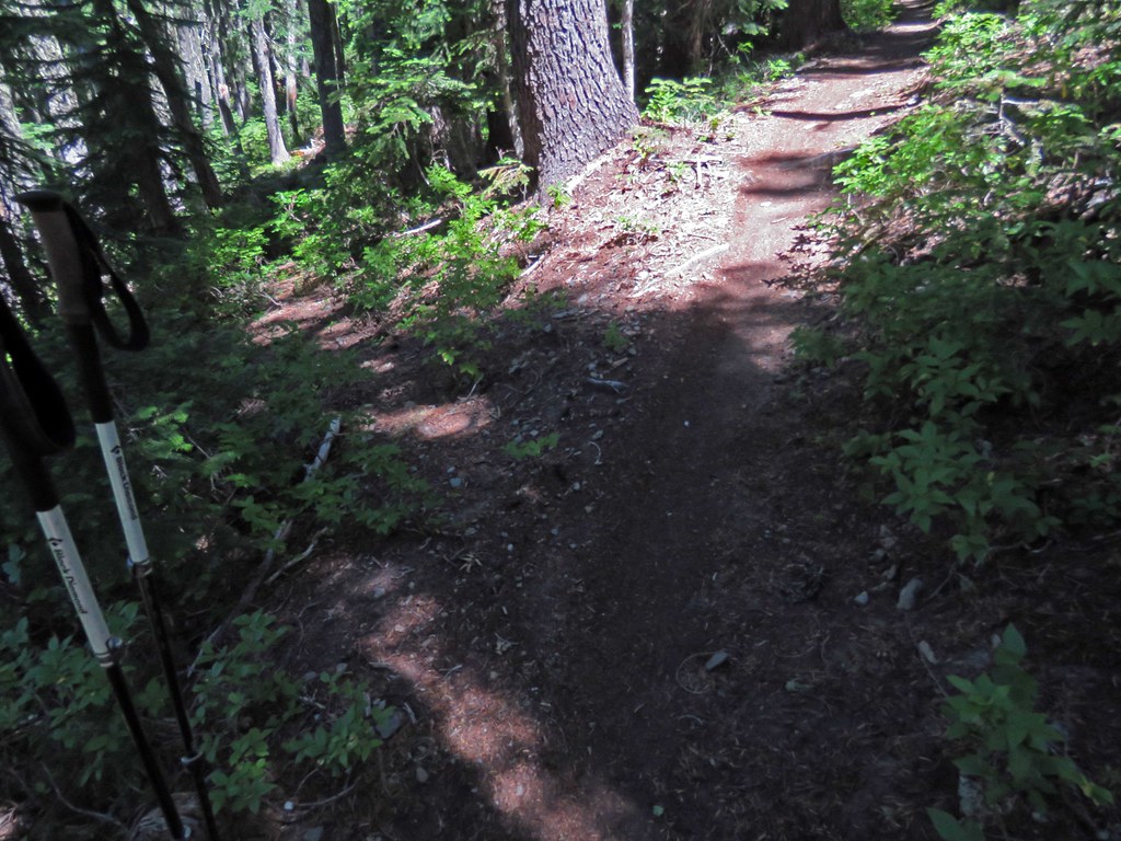
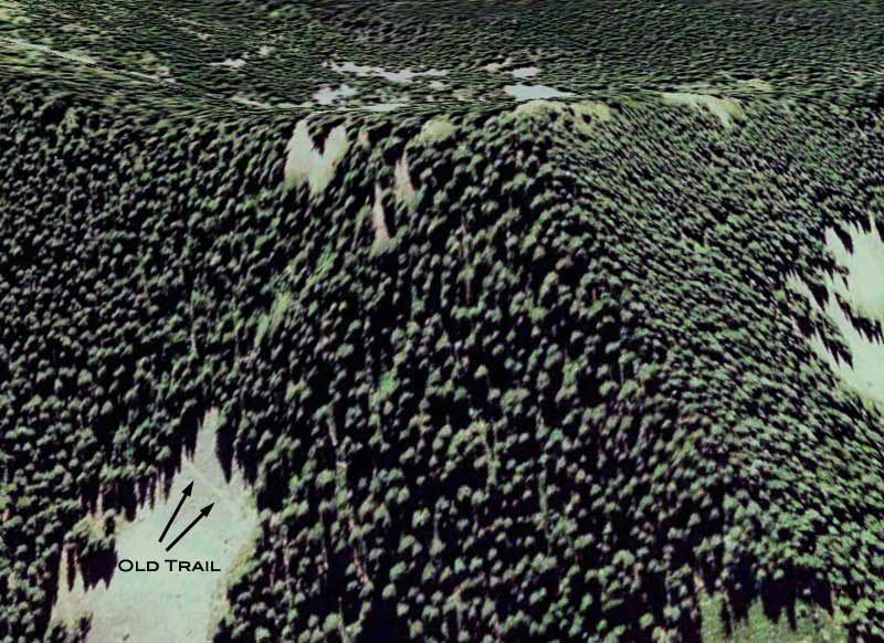
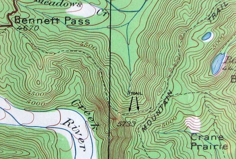
So, looking back at 1920s-era topos, the old trail did cross this slope - again, marked with an arrow:
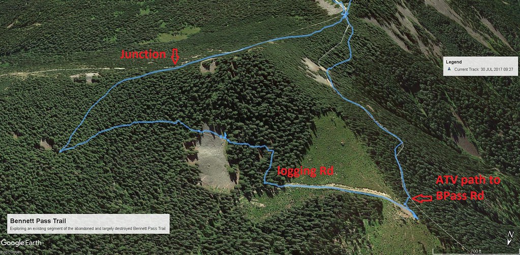
Compare that to a modern topo, and you can see that the road follows the bulk of the trail alignment from Bennett Pass to the junction with the Lookout Mountain Road, but this segment of trail is outside the road alignment -- and, even more interesting, there appear to be other segments that weren't obliterated:
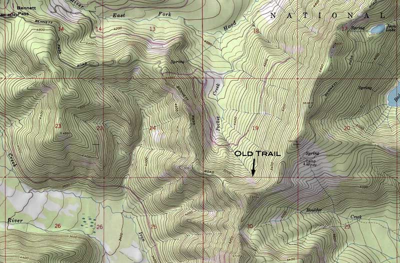
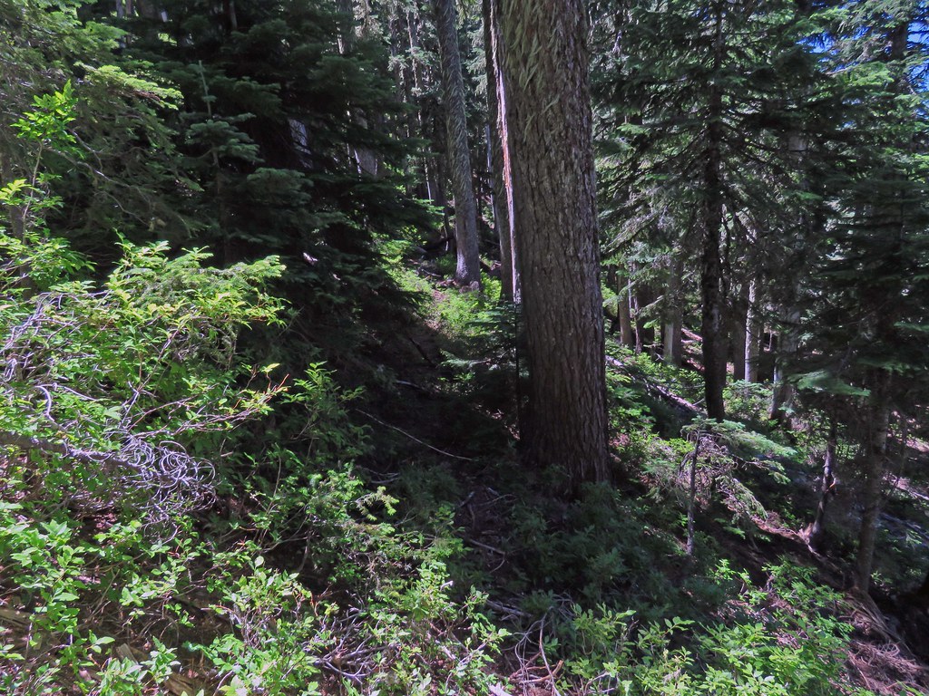
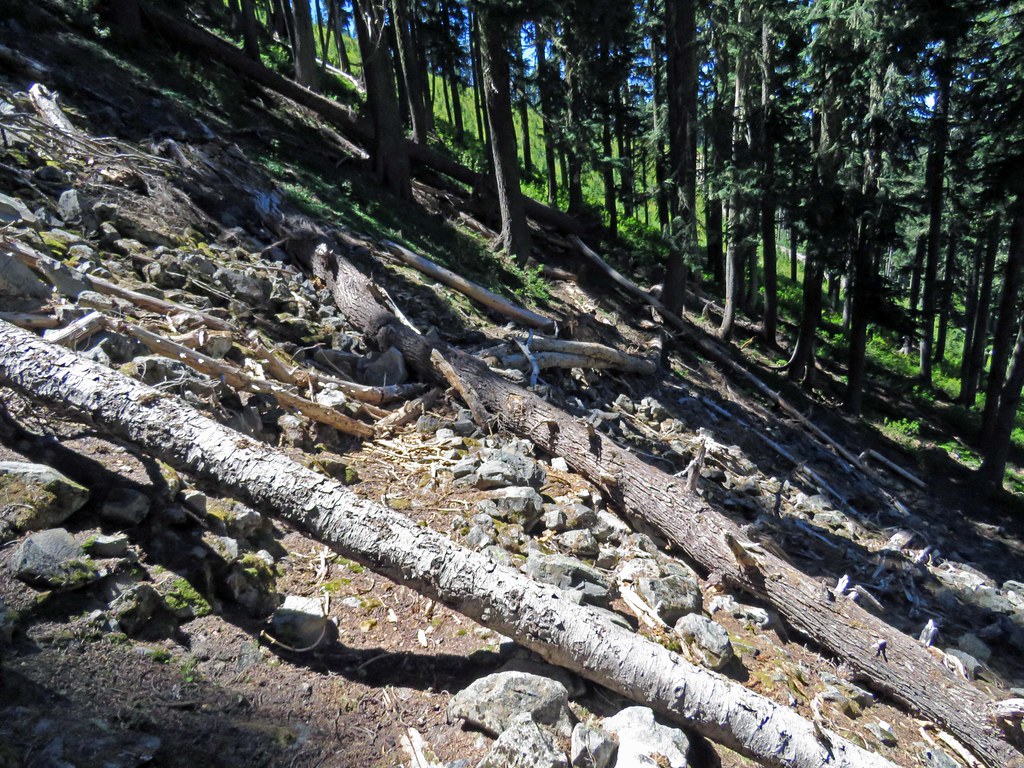
The north slope of this ridge has been heavily logged, so it's likely that just a few trail remnants remain, but it would be a nice route to have back -- I could see this being a great bike and/or equestrian alternative to Bennett Pass Road if it were somehow re-created.
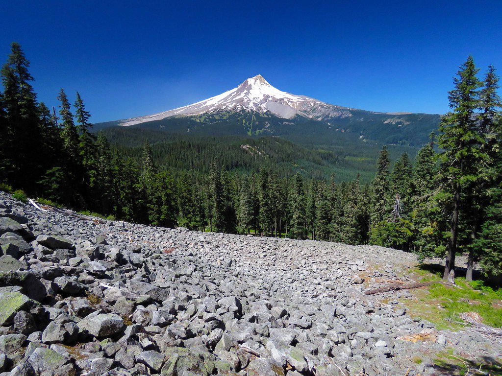
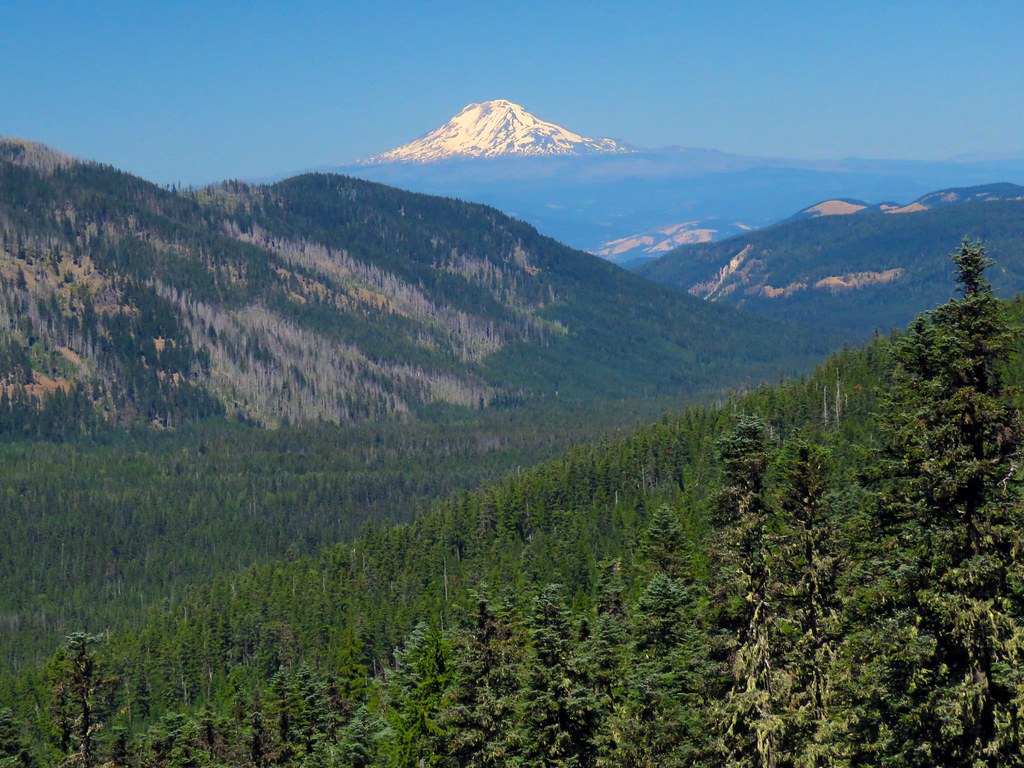
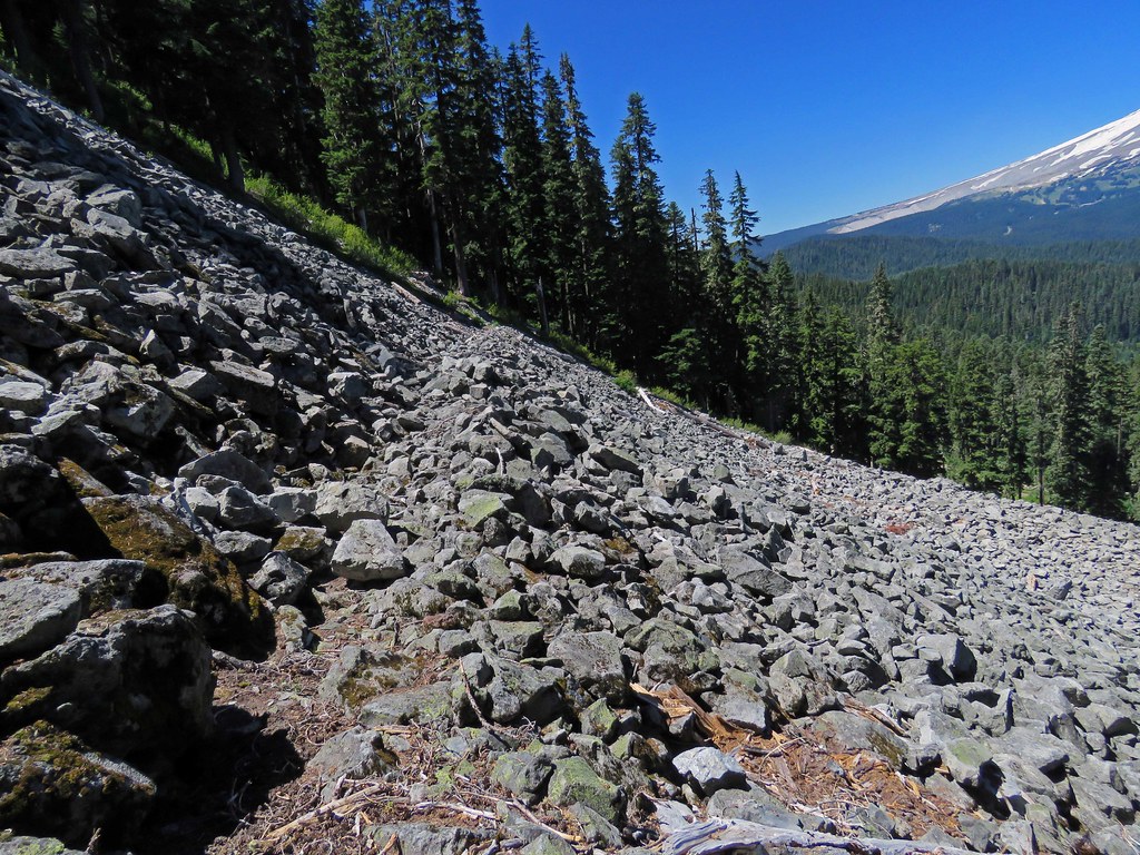
Meanwhile, here's why I'll try to find it on that talus slope next summer:
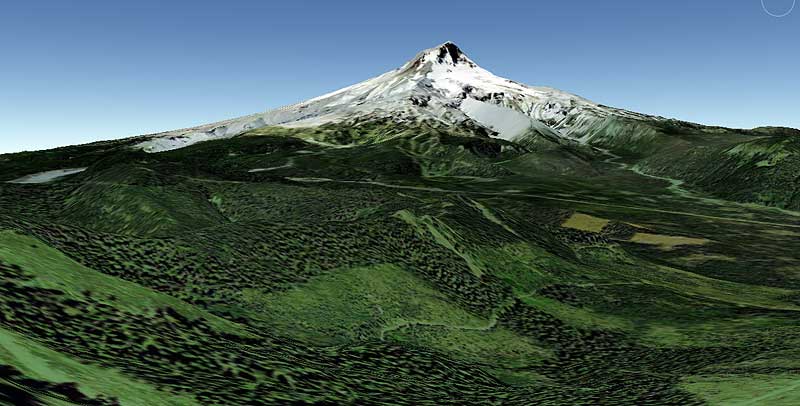
Looks like a great view! If anyone has explored this, or knows about it, let me know!
Tom
Bennett Pass Lost Trail
- Splintercat
- Posts: 8334
- Joined: May 28th, 2008, 10:03 pm
- Location: Portland
- Contact:
- Don Nelsen
- Posts: 4381
- Joined: May 28th, 2008, 10:03 pm
- Location: Vancouver, WA
Re: Bennett Pass Lost Trail
Nice find, Tom! That's one I've not heard of - I'm up for an exploration next summer. Thanks
Don
Don
"Everything works in the planning stage" - Kelly
"If you don't do it this year, you will be one year older when you do" - Warren Miller
Re: Bennett Pass Lost Trail
I notice this one time years ago when I bike camped up Bennett Pass Road. I rode from the highway to Gumjuwac, and noticed this little trail to the left of the road at some point. At least. . . I think I remember. I didn't take any pics, so there's no evidence!
Believe it or not, I barely ever ride a mountain bike.
Re: Bennett Pass Lost Trail
Charley, I'm sure you are correct. Once, probably early season on skis, I saw a sign and the obvious trail close to the road between the "Terrible Traverse" and the road fork that follows to the east. IIRC, the place was by the three bumps just north of the Bennett Pass Road, the trail being on or very near the ridge line.
- Splintercat
- Posts: 8334
- Joined: May 28th, 2008, 10:03 pm
- Location: Portland
- Contact:
Re: Bennett Pass Lost Trail
Interesting! It looks like a clearcut (lower edge of the Google Earth view) wipes out a portion of the trail between the spot Raven describes and the talus slope, so I was thinking of looking for this on the SE end, where it should intersect Lookout Mountain Road, near the saddle (and below the unnamed butte at the end of Gunsight Ridge).
BTW, I drove the "terrible traverse" a few years ago in my compact SUV, and will NEVER do that again - it has gotten just too scary... plus, I encountered a large SUV within a minute of passing through this second, so thoughts of meeting another vehicle halfway through were in my brain... yikes!
I really like that area -- for me, it's sort of how the Zigzag Mountain area used to be -- the quiet corner of the mountain.
Tom
Re: Bennett Pass Lost Trail
I have to correct my previous post by taking out the "three bumps" mention. Examining maps more closely (on the web, not my Green Trails) I note the bumps are the other side of the traverse. I saw the trail near where it would have diverged from the road en route to the talus slope, if Splintercat is looking at the same trail. Sounds like it will be a sweet section of trail, if it can be connected to an interesting Highway 35 approach.
When I saw the trail it wasn't lost! That's why I thought nothing of it at the time. I just found a section of a 1986 Green Trails map showing the trail. A fragment, not extending to the traverse. I'll scan that section when I have a chance.
Re: Bennett Pass Lost Trail
Here is the relevant section of the map mentioned in the last post.
- Splintercat
- Posts: 8334
- Joined: May 28th, 2008, 10:03 pm
- Location: Portland
- Contact:
Re: Bennett Pass Lost Trail
That's amazing, Raven - given the light travel on that road, it would be very cool is the trail were salvageable. The popular/well-used portion of the Divide Trail over Gunsight Butte crosses Lookout Mountain Road several times, but it's hardly noticeable, given the light vehicle use of the road.
Tom
Tom
Re: Bennett Pass Lost Trail
The following bit is part of a hike I did this past Sunday. I was scouting a much longer hike 'n bike from Bonney Butte to the end of Gunsight Butte and in the course of viewing the route in Google Earth I ran across the trail segment that prompted this post. It looked familiar so I poked around and a search turned up this post. Rather than add it to the TR for the main hike I thought I'd resurrect this thread for the visit to the trail segment. This detour took a little more time to explore than I allocated and it wound up clobbering my plans but it was worth it.
GE imagery has much improved - compared with the original from 2011 above. The blue is my GPS track. While the trail is overgrown and some nasty blowdown, there was tread the entire way. Except for the switchback I did not have a problem following the trail. Trail bench is in pretty good shape but ends at the clear cut.
GEMap by pauljess999, on Flickr
The junction was obvious like raven described - path going off to the left from the main trail.
IMG_6084 by pauljess999, on Flickr
Tread goes right down the middle in this photo, doesn't look like much but on the ground is easy to follow. I experienced some confusion at the switchback but by retreating a few feet I was able to spot the continuation.
IMG_6085 by pauljess999, on Flickr
This I did not anticipate, great views from the cut across the boulder field.
IMG_6089 by pauljess999, on Flickr
Down 35 to Adams.
IMG_6102 by pauljess999, on Flickr
Trail bench across the boulder field. Rock fall from above has made footing less than optimal.
IMG_6091 by pauljess999, on Flickr
In the woods just before the clearcut, nice tread.The brush in the clearcut is all huckleberries. That unit must have been logged in the 80's as Google historical imagery back to the early 90s shows the cut. Trees are not growing back very fast.
IMG_6134 by pauljess999, on Flickr
I bailed down to the logging road that was constructed for this cut and oddly enough at the landing (more great views) next to Bennett Pass Road there is no official connection even though only about 100' separates the landing from BP Rd. ATVers remedied this lack by making their own connection.
So this segment is out there, hikers and the mountain bike crew would likely use it were it cleared.
--Paul
The future's uncertain and the end is always near.
- Splintercat
- Posts: 8334
- Joined: May 28th, 2008, 10:03 pm
- Location: Portland
- Contact:
Re: Bennett Pass Lost Trail
Thanks, Paul - great recon! I'll add this to the TKO list, though I think 44 Trails might be interested in this one. Love the view form the talus slope! I've walked over to the landing from the BPR side, and agree - weird that it didn't connect up.
Tom
Tom