Boundary Point Bushwhack - Aug 17

Discussions and Trip Reports for off-trail adventures and rediscovering lost trails
Post Reply
User avatar
Splintercat
Posts: 8333
Joined: May 28th, 2008, 10:03 pm
Location: Portland
Contact:

Boundary Point Bushwhack - Aug 17

Post by Splintercat » August 18th, 2008, 12:05 am

Boundary Point is the working name for a rocky overlook above Ladd Canyon in the Mount Hood Wilderness that I have been researching for awhile. The name comes from proximity to the wilderness boundary, but is also reflective of the sad fact that one of the worst logging shows in the MHNF took place here in the 1980s and early 90s, with a massive clearcut covering hundreds of acres, and abutting the wilderness boundary for more than a mile. This area map tells the story:

Image

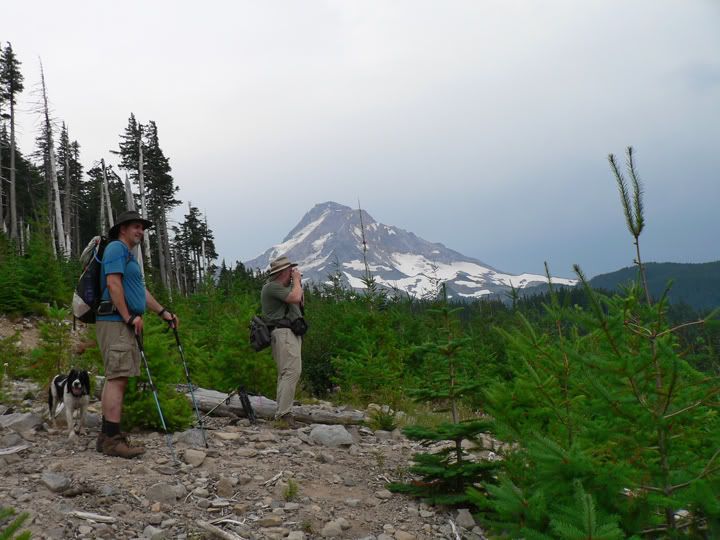
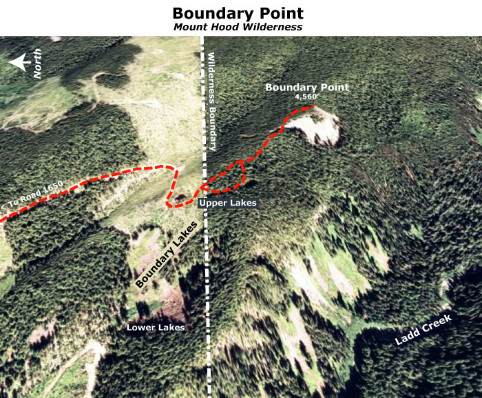
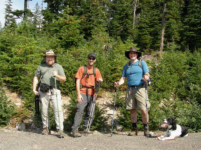
Also shown on the map are the tiny Boundary Lakes - there are two groups, upper and lower. Today, Jeff Statt and Jamie Chabot joined me for a pleasant bushwhack to Boundary Point that included the upper lakes in the tour. Our trip started at the head of the now-decommissioned road that once led to the upper lakes - here's the intrepid crew, along with Dodger, Jeff's faithful springer spaniel:

Image

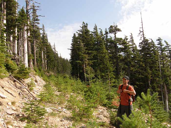
The decommissioned logging spur is gradually filling in with conifers, and not a particularly pleasant walk. On this day, the muggy heat added to our motivation to get this part of the hike behind us -- here's Jamie on a typical section of old logging road:

Image

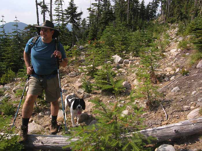
...and here's Jeff and Dodger a bit further down the boulder-hop that was the "road" - Dodger's tongue tells the story... it was hot!

Image

Soon, we could see the wall of intact forest that marked the wilderness boundary, and the start of the more pleasant part of our hike:

Image

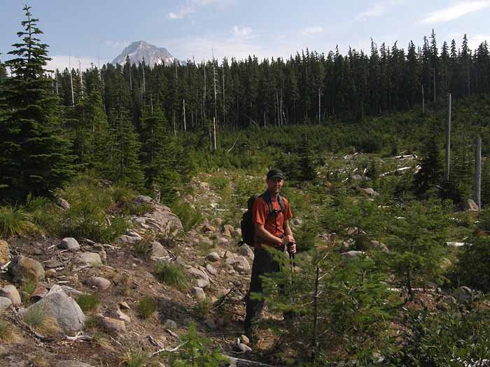
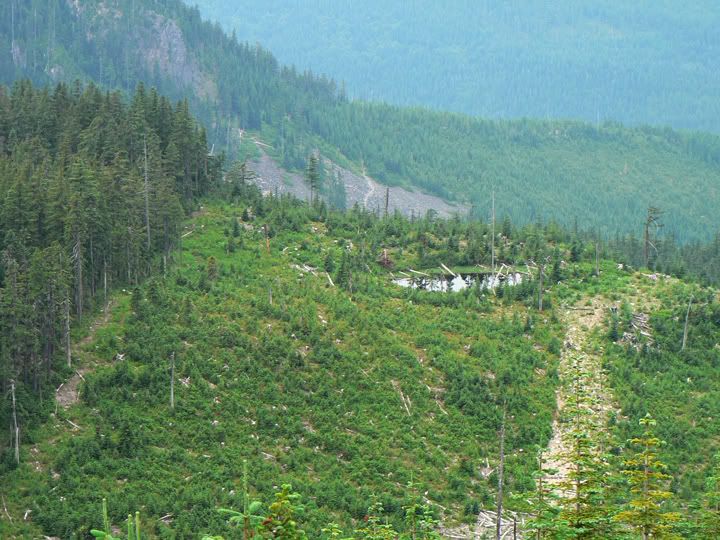
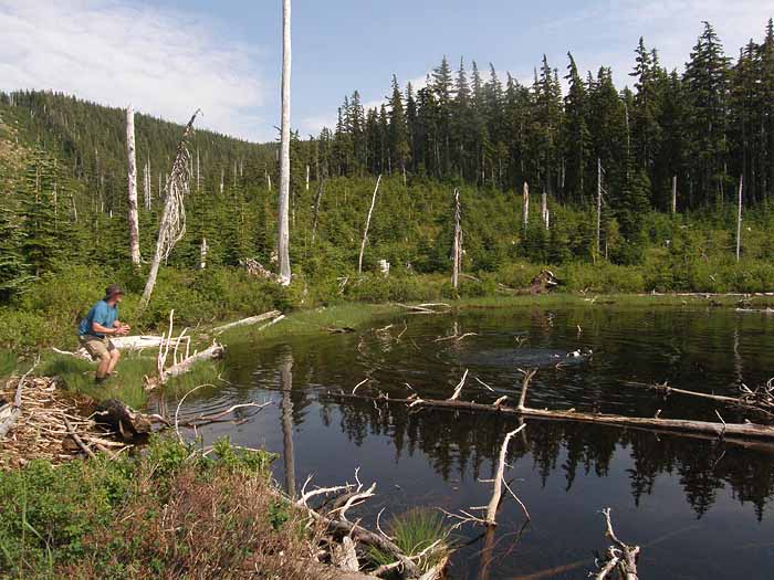
Our jump-off point into the forest was as the northern of the two upper Boundary Lakes. This must have been a very pretty pond before it was completely clearcut -- hard to imagine something like this happening so recently, but the cutting in the 80s was fast and furious in this area. Our route enters the trees just beyond the lake. Jeff is helping Dodger cool off with a little game of fetch:

Image

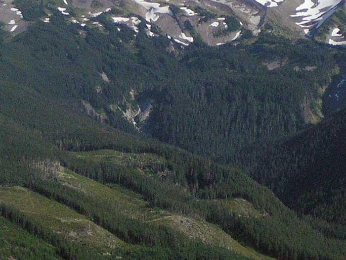
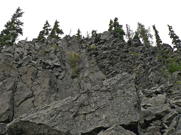
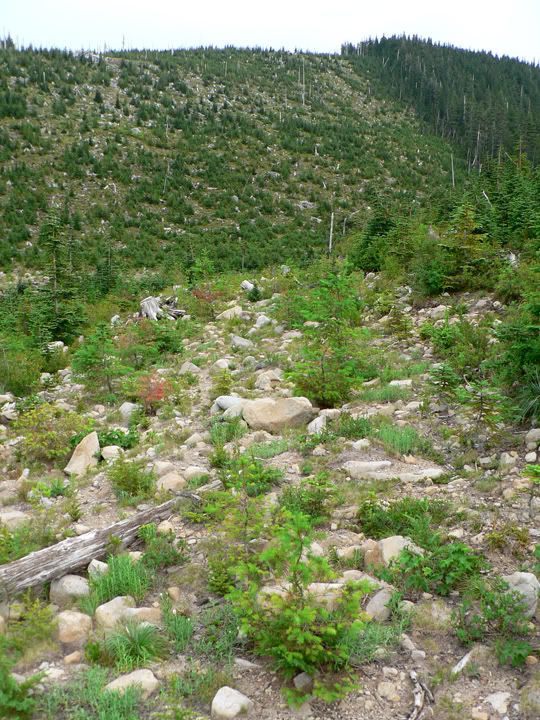
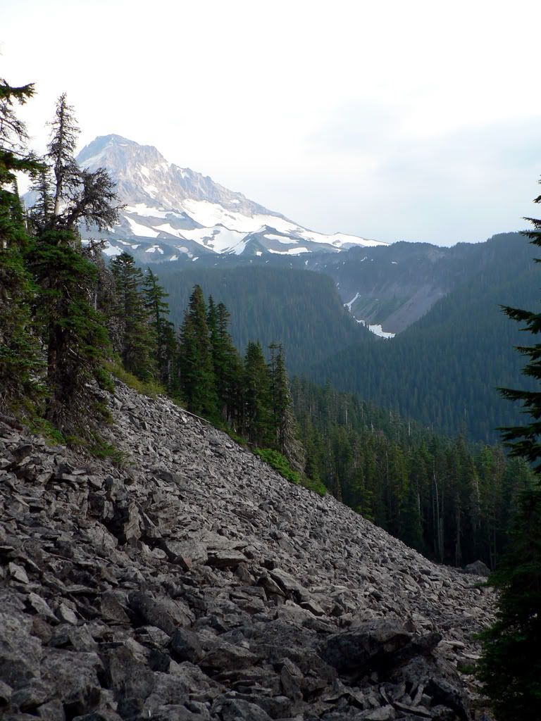
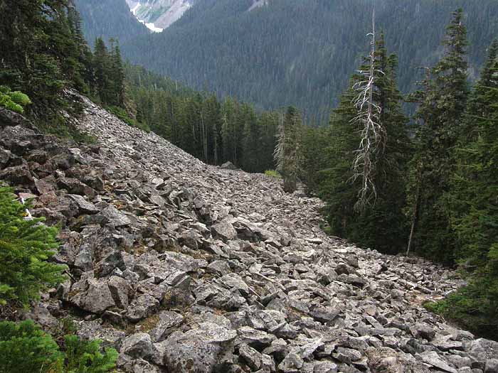
Once in the trees, we were in welcome shade, and made our way uphill through open noble fir stands. After a short climb, we reached the lower slopes of Boundary Point, marked by a huge talus slope that extended deep into Ladd Canyon:

Image

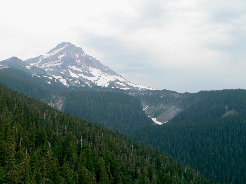
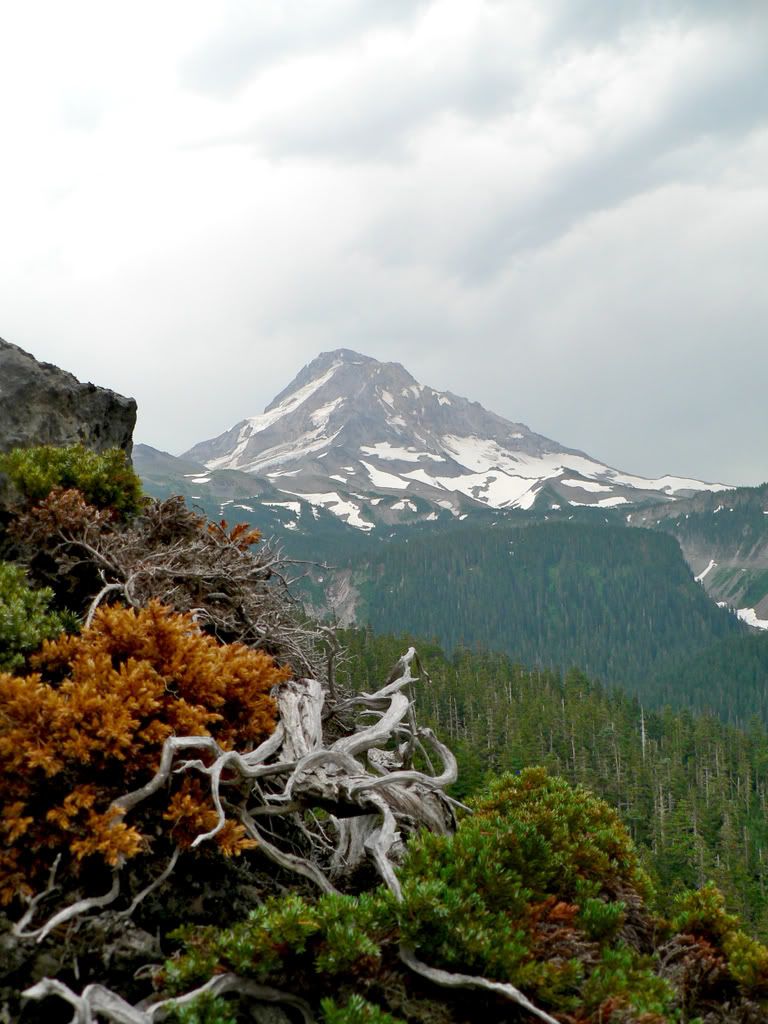
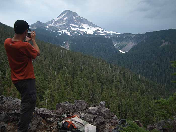
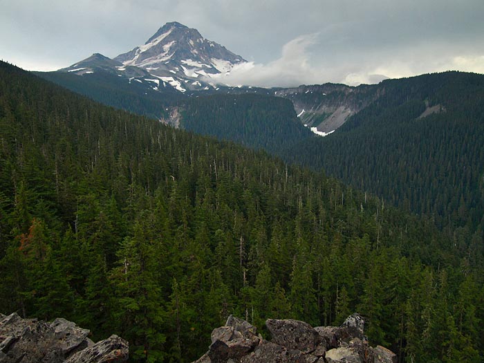
One last push beyond this talus outcrop, and we found ourselves at the top of 150 foot, sheer cliff with a lovely view of the mountain - here's Jamie capturing the scene:

Image

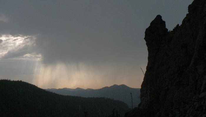
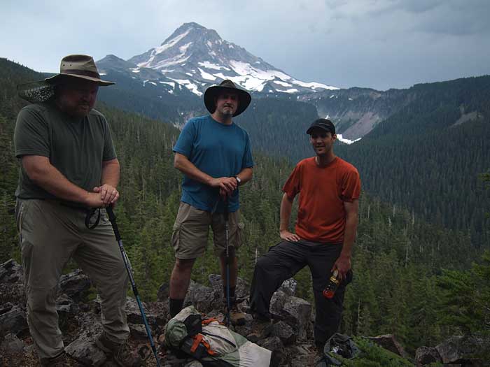
...and another view of the crew -- at this point, enjoying the view, but also noticing that clouds were rolling in rapidly from the south, with flashes of lightning and the rumble of thunder:

Image

The light wasn't what I'd been hoping for, so this is the best portrait view from Boundary Point -- I'll be heading back when the conditions are better, that's for sure. It's a lovely spot, and one that would be particularly photogenic in late afternoon. Note the clouds beginning to sweep across the mountain at this point in our trip:

Image

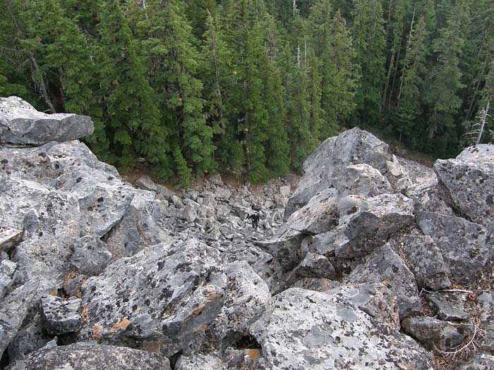
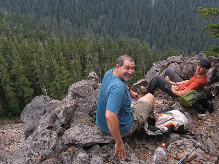
Jeff and Jamie recharging for the return trip - this view also shows the dramatic drop-off to long scree slope below the cliffs. Jamie explored the area below the cliffs, and hopefully will be posting some images from that angle:

Image

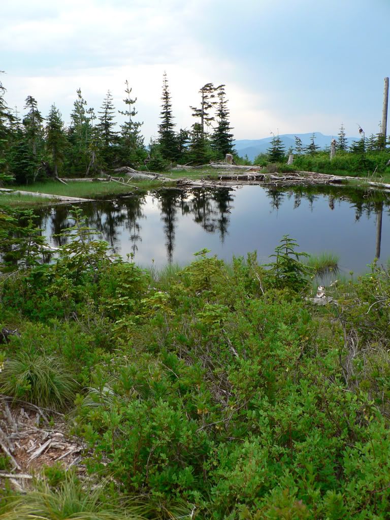
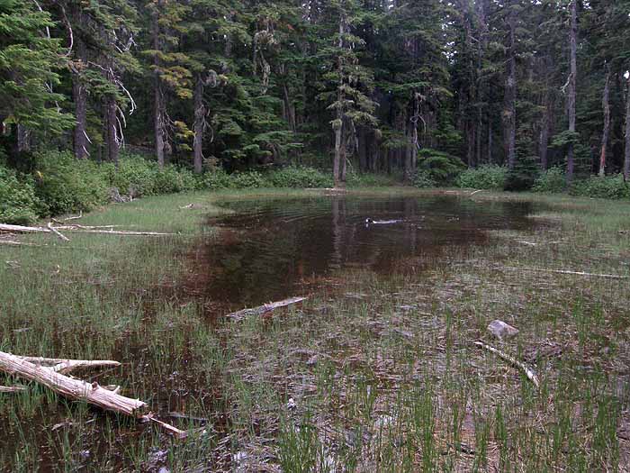
After taking in the view from Boundary Point, we retraced our steps, then detoured to visit the second of the upper Boundary Lakes -- this little pond is well inside the wilderness boundary, and was just deep enough for Dodger to have another swim:

Image

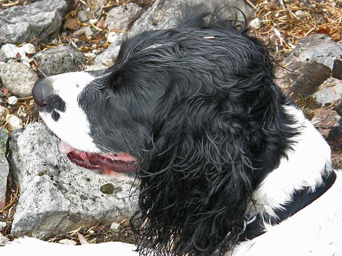
As the clouds continued to build, so did clouds of mosquitos that were waiting to ambush us at this pond! We hoofed it back down to the boundary clearcut, and back up the decommissioned logging spur fairly quickly to stay ahead of the bugs, but Dodger still managed a second swim in the first pond on the way by. This is what a happy spaniel looks like:

Image

This is an easy bushwhack with a bit of preparation -- the most difficult part is navigating your way through the maze of unmapped logging spurs in the area. If you do make the trip, please do not mark the route with flagging, since the proximity to the clearcut means that ATVs likely visit the adjacent area.

Thanks for a great trip, Jeff and Jamie (and Dodger)!

Tom :D

pablo
Posts: 1451
Joined: May 28th, 2008, 10:03 pm

Re: Boundary Point Bushwhack - Aug 17

Post by pablo » August 18th, 2008, 8:39 pm

Tom,

Nice place, looks like you had some fine company - I'm curious, how did you manage to land on this particular location? Everything is unnamed on the map I'm looking at, did you see Boundary Point from some other spot? You seem to have an eye for finding the out-of-the-way viewpoint.

--Paul
The future's uncertain and the end is always near.

User avatar
Splintercat
Posts: 8333
Joined: May 28th, 2008, 10:03 pm
Location: Portland
Contact:

Re: Boundary Point Bushwhack - Aug 17

Post by Splintercat » August 18th, 2008, 9:54 pm

Well, I am always looking for a new waterfall or little known perspective on the mountain - in this case, I had shot this view of what seemed to be a falls on Ladd Creek several years ago from Lost Lake Butte, and then became focused on the lakes (you can see the basin of the lower lakes in this image) and viewpoint the more I studied the area:

Image

I'm also really interested in restoring areas that have been abused, with the first step being an inventory of little jewels left among the clearcuts. That's how I became focused on the Owl Point area, which is just east of here.

Jamie is probably too swamped this week to post his photos of the area, so I'll post a couple that he previewed to me -- hope that's okay, Jamie! These are shots that Jamie took from directly below the cliffs of Boundary Point. Look closely in this first view, and you can see Jeff peeking over the cliffs, dead-center"

Image

In this view, Jamie photographed the big pinnacle that forms the southern arm of Boundary Point:

Image

Here's a dramatic view of the pinnacle as the thunderstorms began rolling in - in silhouette, it looks a bit like Sasquatch watching over the valley:

Image

Great pictures, Jamie! Finally, here's a photo I took from the top, looking down at Jamie shooting the cliffs from below:

Image

Tom

User avatar
jeffstatt
Posts: 3820
Joined: May 28th, 2008, 10:03 pm
Location: Vancouver

Re: Boundary Point Bushwhack - Aug 17

Post by jeffstatt » August 19th, 2008, 12:19 pm

This is a really nice find Tom. Glad I had the opportunity to join you.

It is striking to me what a strange mix of unexplored areas, swaths of clear cuts, and regions overrun by OHVs are present all over the north side.

Nowhere is it more striking as we hiked out an overgrown abandonned forest road past empty beer bottles, to a large clear cut, then once passing the wilderness boundary into the quietest most remote section viewpoint of Mount Hood as I've seen.

This is certainly an area worth preserving!

User avatar
chameleon
Posts: 1795
Joined: May 28th, 2008, 10:03 pm
Location: Oregon
Contact:

Re: Boundary Point Bushwhack - Aug 17

Post by chameleon » August 19th, 2008, 7:29 pm

Great photos Tom. That's a pretty incredible view of the mountain - very wildernessy. I'd imagine it would be terrific after the first snow too - when all those trees in the foreground are coated!

User avatar
jaimito
Posts: 850
Joined: May 28th, 2008, 10:03 pm
Location: Kenton
Contact:

Re: Boundary Point Bushwhack - Aug 17

Post by jaimito » August 19th, 2008, 9:02 pm

OK Sorry guys I've been pretty busy as of Monday morning and the wifes morning sickness has added a bit of delay in my posting : ) So I'll just post a few shots from the beginning showing the clear cut damage and a shot or two of the lake and of course the great view point Tom has found.

Here's a shot of the crew scouting our approach.

Image

While scouting our approach, this is a shot of the small lake near the clear cut line along the wilderness boundary.

Image

This is a shot looking north from the little lake back at the line cut along the boundary.

Image

This is the same lake, but this shot was taken on our exit.

Image

Skipping A little forward this is a shot of the rock field we crossed just before arriving at the view point.

Image

So without further to do here are 2 shots or so from the viewpoint. Thanks again Tom and Jeff for a fun day, Sorry for the delay.

Image

Image

User avatar
Splintercat
Posts: 8333
Joined: May 28th, 2008, 10:03 pm
Location: Portland
Contact:

Re: Boundary Point Bushwhack - Aug 17

Post by Splintercat » August 20th, 2008, 6:20 am

Thanks, Jamie - nice shots. That lost shot came out especially nicely!

Tom

Post Reply