Return to "Badlands Basin" (Aug 3)
Posted: August 5th, 2008, 9:52 pm
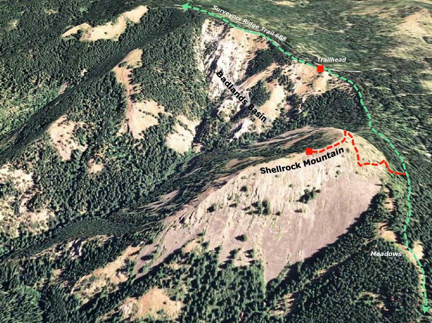
On the way down from Cloud Cap on Sunday, I had planned a detour to re-shoot the view across the "Badlands Basin" toward Shellrock Mountain and Hood with some soft, evening light. But darn it, impatience got the best of me, and I ended up descending into the Badlands for a bit of exploration, and got a much better feel for this bizarre area. Here are some highlights, starting with a map of the area that shows my earlier trip to Shellrock, the Surveyors Ridge Trail and the Badlands Basin:
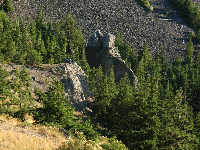
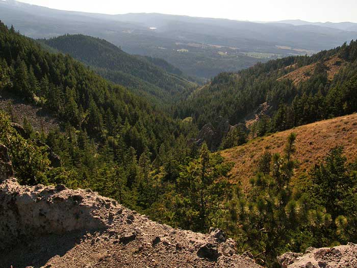
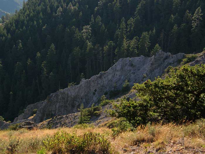
The first stop was a close-up view of the uppermost rock in the southern draw -- I compared it to a couple of elephants from behind, but upon closer inspection, it's clearly a hippo! From this view part way down the descent, you can see the cool, ramp-shaped "catbird seat" that was my destination, right in front of the rock:
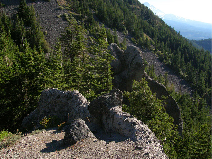
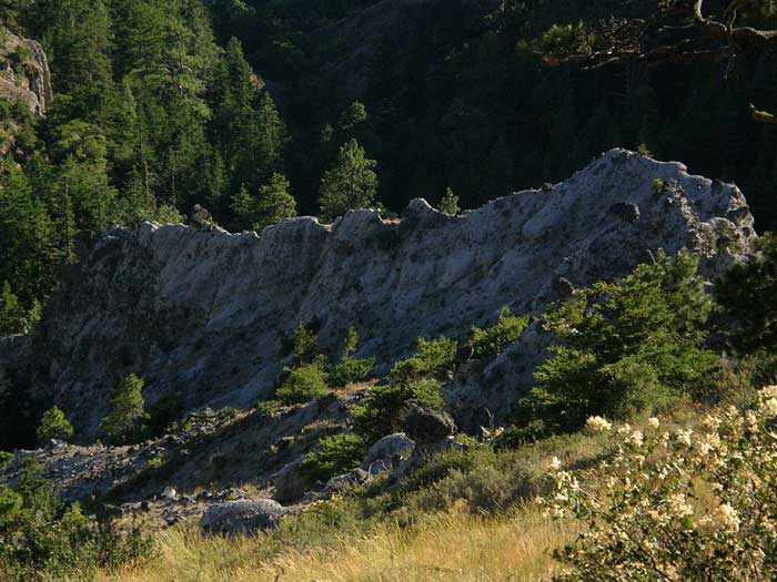
Once down on this viewing platform, I finally had a good look at the formations up-close, including a near view of the "hippo", and a bit of a startling drop-off from this viewpoint - more sketchy than I'd guessed from above, with a sheer 120 foot drop off to the right:
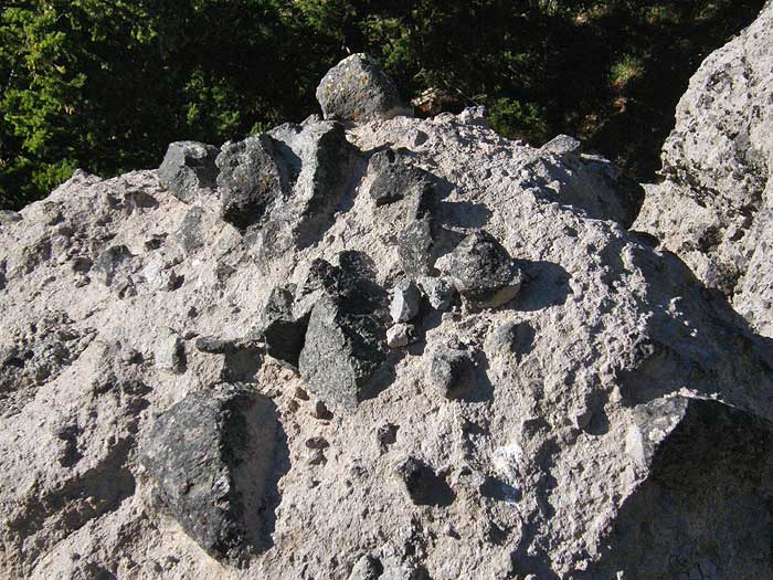
A closer look at the rock also revealed that these formations are not just ash deposts, but actually an interesting pyroclastic flow breccia, with tell-tale sharp-edged fragments of what is probably andesite in an ash matrix. I don't know the geology of the area, but since this is a long fault scarp this could be an early Mount Hood volcanic deposit that has been exposed through upthrust - need to do more research on this! Here's a sample of the rock:
Another view from the "catbird seat", this time looking down Cat Creek canyon to Highway 35 and the East Fork Hood River, and beyond, to Owl Point -- the high spot on the horizon. The north slope of Hood drops in from the left:
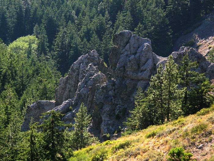
Also from this viewpoint, a closer look at what I ended up calling "Grizzly Rock" for obvious reasons - a very impressive group of 150-foot spires rising out of the south draw of the canyon:
After poking around a bit in the southern draw, I climbed back out of the canyon, and hiked north, to this drop-in spot in the northern, much more rugged draw:
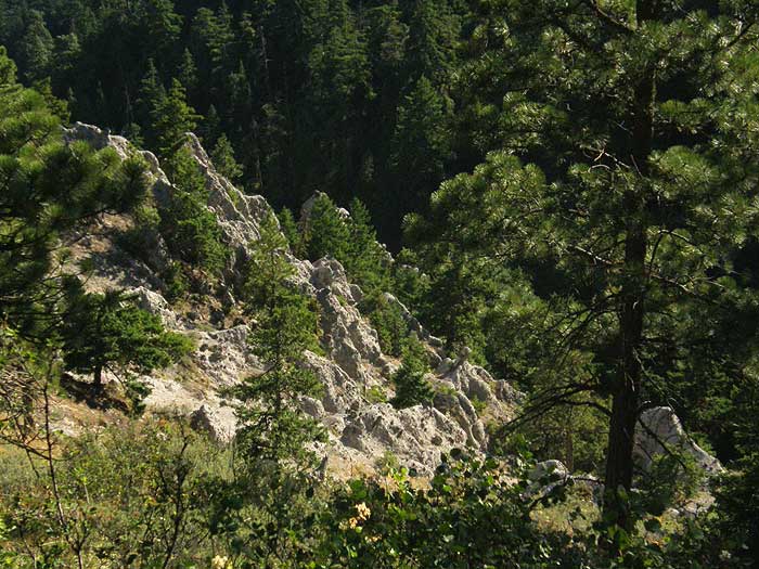
In this area, you get a fine view of the many goblins and hoodoos that form the core of the Badlands formation - very rugged, but more easily explored than I would have guessed, with steep meadows surrounding most of the rock outcrops:
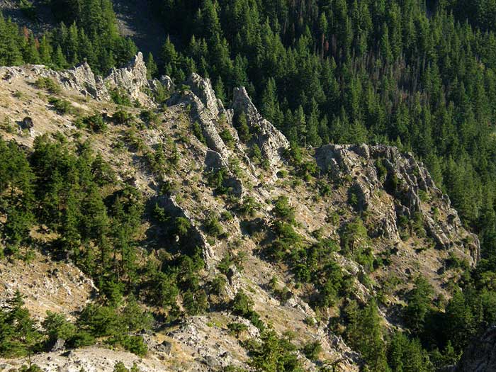
The north edge of the northern draw is defined by the "iguana", an enormous spine running from th bottom of the basin nearly to the lip of the canyon:
Another view of the "iguana", showing the lizard's head:
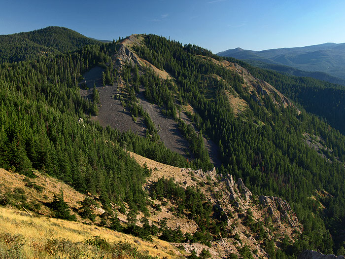
After exploring the upper reaches of the Badlands a bit more, I climbed back up to the lip of the canyon for some landscape view with my big camera. Here's the view of Shellrock Mountain rising above the Badlands in early evening light, with the "hippo" rising from the trees in the upper left, and the main group of pinnacles in the lower right:
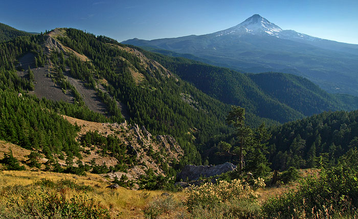
Here's another, wider view, showing the very rugged terrain with Mount Hood as the backdrop. Within the Badlands Basin, you can see the "hippo" on the left, rising out of the trees, the main complex of hoodos and goblins in the center and the "iguana" in the lower center, beyond the big pine:
Really a fun and beautiful area to explore! Watch for bikes on the Surveyors Ridge trail, though - hikers are in the minority here, and the cyclists aren't expecting them. Walking along the bike trail was probably the most dangerous part of this trek, as a result..!
Tom
The first stop was a close-up view of the uppermost rock in the southern draw -- I compared it to a couple of elephants from behind, but upon closer inspection, it's clearly a hippo! From this view part way down the descent, you can see the cool, ramp-shaped "catbird seat" that was my destination, right in front of the rock:
Once down on this viewing platform, I finally had a good look at the formations up-close, including a near view of the "hippo", and a bit of a startling drop-off from this viewpoint - more sketchy than I'd guessed from above, with a sheer 120 foot drop off to the right:
A closer look at the rock also revealed that these formations are not just ash deposts, but actually an interesting pyroclastic flow breccia, with tell-tale sharp-edged fragments of what is probably andesite in an ash matrix. I don't know the geology of the area, but since this is a long fault scarp this could be an early Mount Hood volcanic deposit that has been exposed through upthrust - need to do more research on this! Here's a sample of the rock:
Another view from the "catbird seat", this time looking down Cat Creek canyon to Highway 35 and the East Fork Hood River, and beyond, to Owl Point -- the high spot on the horizon. The north slope of Hood drops in from the left:
Also from this viewpoint, a closer look at what I ended up calling "Grizzly Rock" for obvious reasons - a very impressive group of 150-foot spires rising out of the south draw of the canyon:
After poking around a bit in the southern draw, I climbed back out of the canyon, and hiked north, to this drop-in spot in the northern, much more rugged draw:
In this area, you get a fine view of the many goblins and hoodoos that form the core of the Badlands formation - very rugged, but more easily explored than I would have guessed, with steep meadows surrounding most of the rock outcrops:
The north edge of the northern draw is defined by the "iguana", an enormous spine running from th bottom of the basin nearly to the lip of the canyon:
Another view of the "iguana", showing the lizard's head:
After exploring the upper reaches of the Badlands a bit more, I climbed back up to the lip of the canyon for some landscape view with my big camera. Here's the view of Shellrock Mountain rising above the Badlands in early evening light, with the "hippo" rising from the trees in the upper left, and the main group of pinnacles in the lower right:
Here's another, wider view, showing the very rugged terrain with Mount Hood as the backdrop. Within the Badlands Basin, you can see the "hippo" on the left, rising out of the trees, the main complex of hoodos and goblins in the center and the "iguana" in the lower center, beyond the big pine:
Really a fun and beautiful area to explore! Watch for bikes on the Surveyors Ridge trail, though - hikers are in the minority here, and the cyclists aren't expecting them. Walking along the bike trail was probably the most dangerous part of this trek, as a result..!
Tom