Page 8 of 12
Re: Memaloose Falls and South Fork Clackamas River
Posted: February 13th, 2011, 11:26 pm
by BrianEdwards
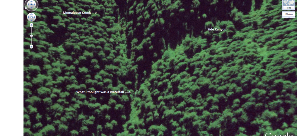
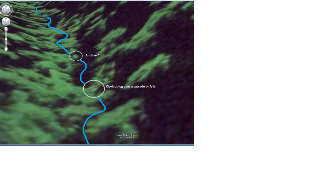
Heres a little ways upstream of the big Falls on Memaloose Creek, the first side canyon on the map is whats shown in this Google Earth View
Re: Memaloose Falls and South Fork Clackamas River
Posted: February 13th, 2011, 11:33 pm
by BrianEdwards
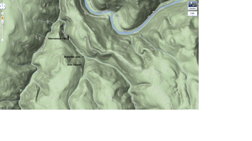
Here's a terrain view so you can see where I'm talking about. I don't think theres any more big drops on Memaloose, maybe just another 30-footer tucked away. But that canyon is so hard to bushwack, I'm not sure I'll ever tackle it
Re: Memaloose Falls and South Fork Clackamas River
Posted: February 13th, 2011, 11:38 pm
by BrianEdwards
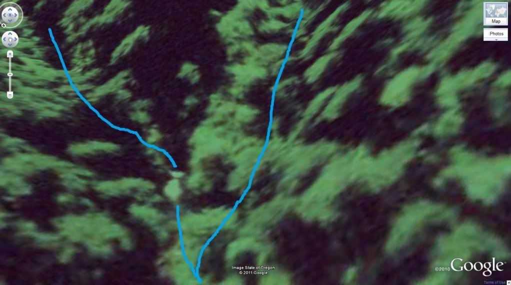
You can see why I thought it was a waterfall

Re: Memaloose Falls and South Fork Clackamas River
Posted: February 14th, 2011, 2:45 pm
by HikingisaMustDo
Nice illustrations Brian!
Re: Memaloose Falls and South Fork Clackamas River
Posted: February 14th, 2011, 10:52 pm
by Sore Feet
Yeah, it does look misleading. Which may actually be the reason for the mark on the map - if the drainage was mapped by aerial survey, which seems to be how a lot of waterfalls in more rugged terrain get marked on the quads, then that slide may have been very easy to mistake for a legitimate waterfall.
Re: Memaloose Falls and South Fork Clackamas River
Posted: February 15th, 2011, 8:02 am
by Splintercat
Great maps, Brian! I looked around last night, but couldn't find a reference that I remembered to an upper falls on Memaloose Creek -- I thought it might be on Pete Giordano's kayaking site, but no luck there. I distinctly remember reading a report of a 15-foot block falls upstream from the main falls... just not sure where. So, I would agree with Bryan that this might be a case of the USGS notation being shifted downstream a bit.
Tom
Re: Memaloose Falls and South Fork Clackamas River
Posted: February 15th, 2011, 6:34 pm
by BrianEdwards
Thanks fella's. Tom, you have me
very intrigued by your memory of there maybe being a fifteen footer.. My memory of the upper creek isn't very good, I just remember turning around a ways passed a nice creek coming in on the right. GPS doesn't work down in the narrow/old growth canyon. The more I look at the map, the more I need to go back and make a bee-line through the trees to the confluence of the obvious west-side big creek coming in.
This just looks too good to not be something, cause the creek isn't that big.
I don't remember anything approaching that kind of scale on my bushwack last winter. Yep, a return trip is needed
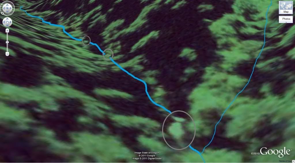
Here's the two upstream of that.
My next hike, this is where I'm going.
Re: Memaloose Falls and South Fork Clackamas River
Posted: February 15th, 2011, 10:50 pm
by Splintercat
Brian, I looked at your photos from the above the main falls that you posted last spring, and I'm thinking that a couple of them are large enough to have been described as "fifteen feet" in the earlier report that I'm thinking of -- I'm not sure you'd find anything larger... but on the other hand, you might!
Tom
Re: Memaloose Falls and South Fork Clackamas River
Posted: February 16th, 2011, 8:00 pm
by BrianEdwards
Decided to go to the 'spot' on the map today that's shown in the above maps. Had snow falling on my way out there, but the roads were clear. I once again parked at the trash-filled spur road and took off. I walked to the end of the road where the make-shift shelter is located, and kept going on the old squatter trail into the deep woods. After a ways, I found the old camp at the end of the trail, and the bushwack began! I was glad I suited up in full rain gear as it was rain/snow mix

Anyway, as I finally approached the 'spot' on the map, I could hear the ominous sound of falling water, sweet! When I got down the hill enough to see, I confirmed my earlier suspicions that it's just another 10ft slide. Still a scenic spot, with the side creek and canyon coming into Memaloose Creek, and the deep pools.
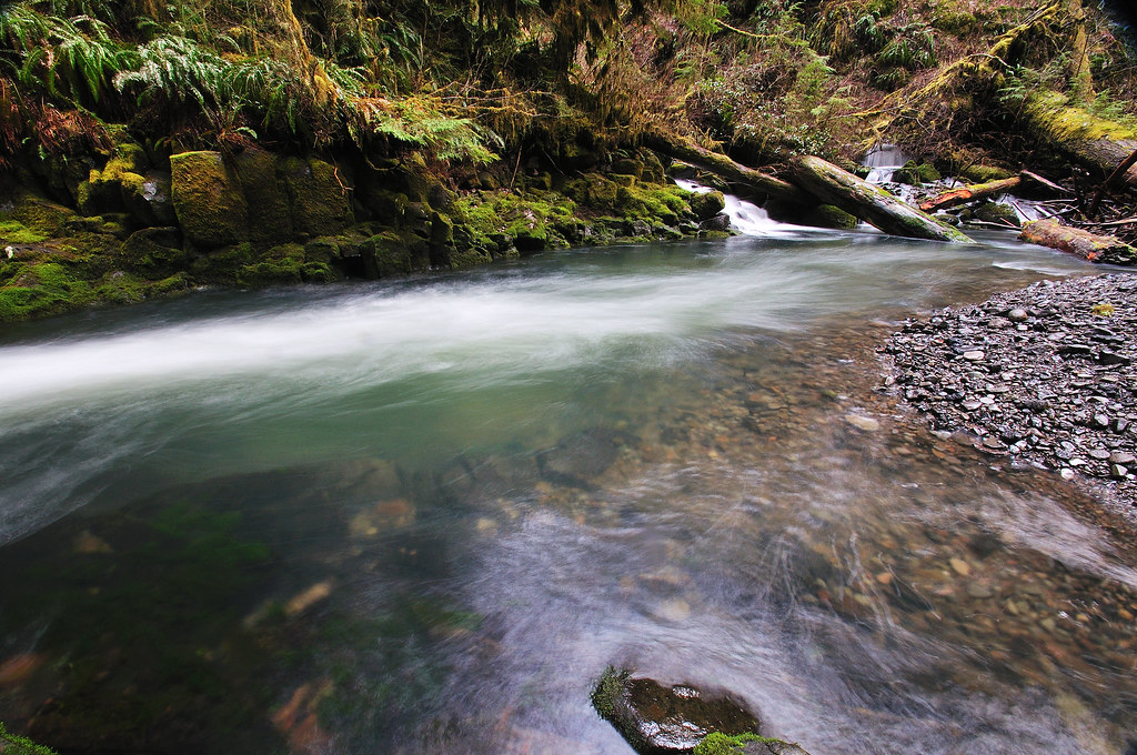
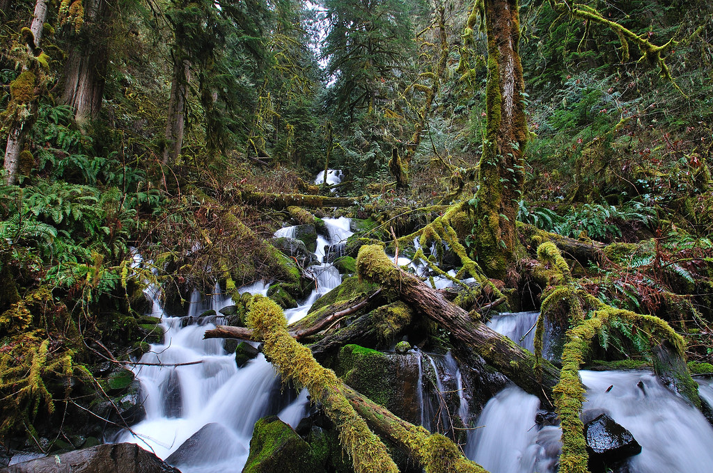
Memaloose Creek and the 'spot' is the left/main stream. The side creek/canyon is straight across

Nice deep pool
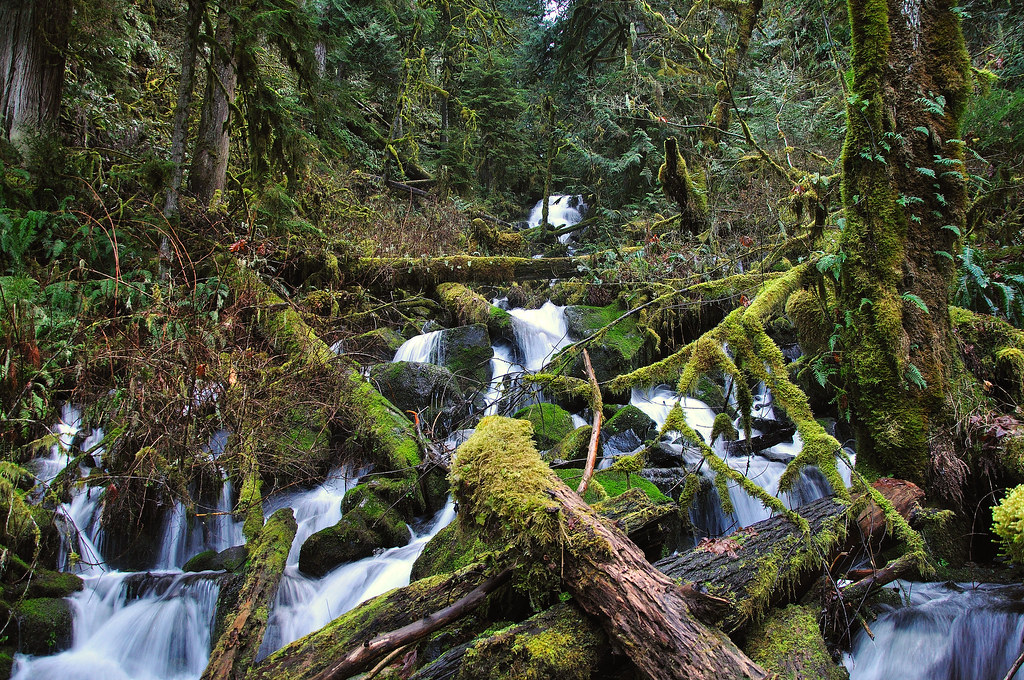
Working my way up toward the noise
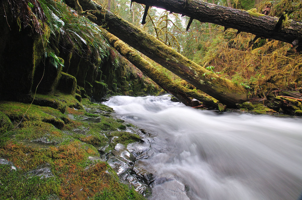
Closer

The source of the noise and spot on the map
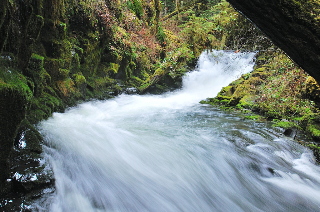
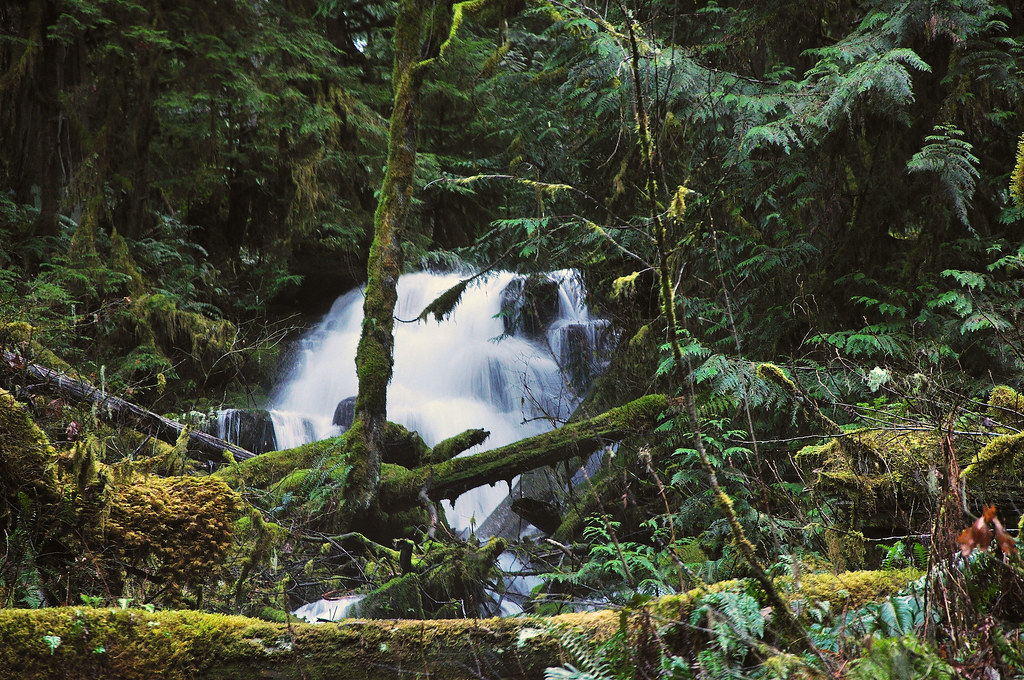
Nice pretty spot, I wasn't sorry I made the effort to get out here. Back on the gravel bar below, I took a break on a log. After looking up the side canyon long enough, I spotted a sliver of what looked like a waterfall waaaay up at the top. Time to cross the log jam and head up! The stream-bed of the side stream is a bouldery/old landslide type mess with big trees laying across at every step. After 25 minutes of bushwacking up the stream, I got a view of the waterfall. it was only 20-25 ft, but still cool.
A little closer
Finally I decided to settle on a zoom shot, as it was getting late.
After that, I headed back down the hill, I angled upstream on Memaloose so I could get a peek upstream. Well, when I got to the stream, it appeared flat for a long ways, so I crossed on another log jam and headed back up, and out. By the time I got back to the truck, it was dark and snowing but all was well.
Re: Memaloose Falls and South Fork Clackamas River
Posted: February 16th, 2011, 8:34 pm
by Splintercat
Love those moss-covered basalt columns along the Memaloose slide, Brian - very nice! Great shot of the confluence, too. Good to see you giving your new camera a workout!
Tom