It turns out that this approach GREATLY eased my exploration of the Viento Bluffs yesterday. Some photos and narrative to follow, but the exciting conclusion is that this is a terrific candidate for a TKO partnership with Oregon State Parks to create a new trail(s) that are family-oriented, and could be constructed by volunteers. Here's an updated map, showing my routes, as follows: green is the existing Viento Creek Trail, yellow is generally very rustic access road or heavily traveled game trail, and red is cross-country travel. Note that I've expanded the scope of the map, because I can see a trail network with three viewpoints as destinations:
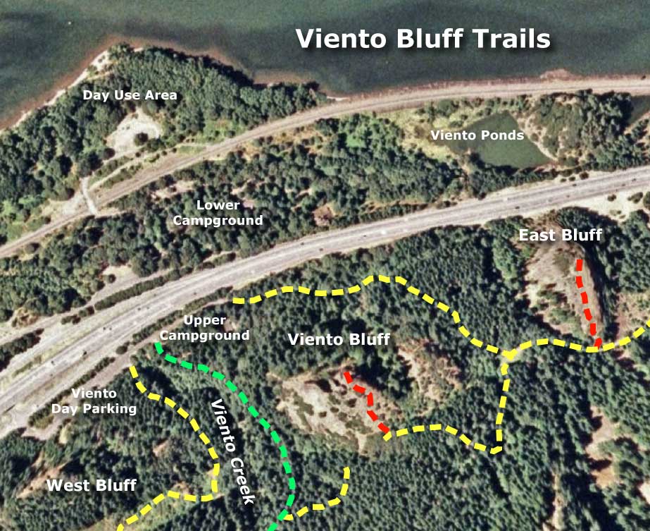
I've also included the relevant destinations within Viento State Park, itself - since the great appeal for trails here is proximity to existing campgrounds and day use areas, all served by full-interchange access to I-84.
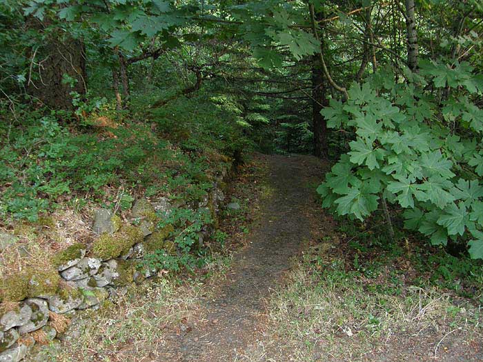
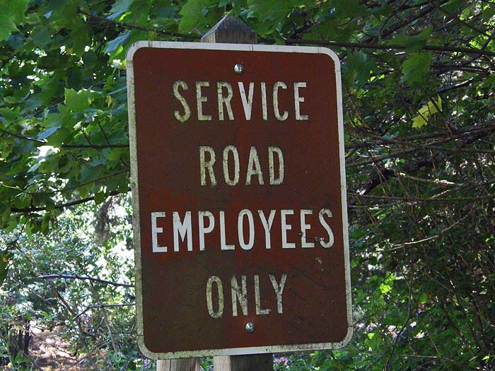
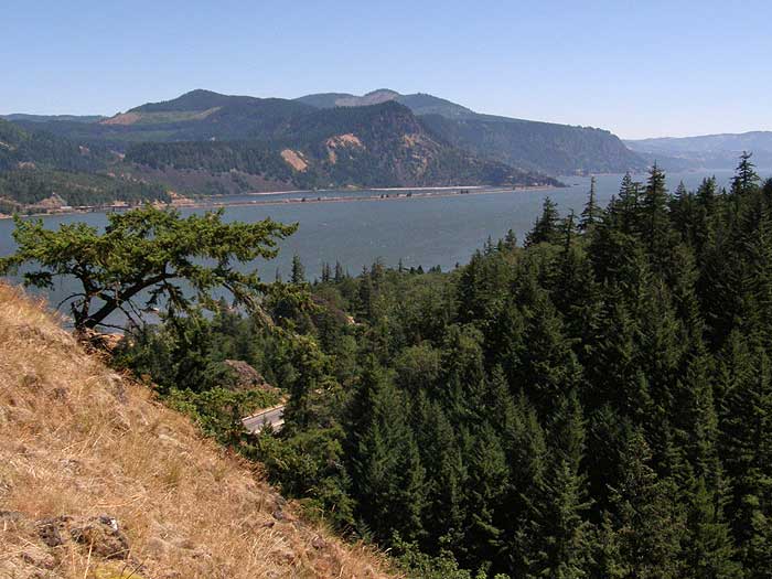
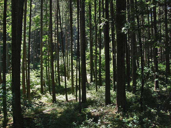
Starting from the sign above (and I would advise using your own discretion in walking past it - I don't think a closure to pedestrians is actually even legal, so the main question is whether an ODOT or BPA worker would stop hikers), the service road begins just past a lovely row of dumpsters, then parallels I-84. It's not an auspicious start, but the scenery improves quickly and dramatically. After traversing the base of Viento Bluff, the poorly maintained dirt path turns steeply uphill under forest canopy, then reaches a t-intersectino at an opening in the forest, between Viento Bluff and the East Bluff. This is the view west, toward Viento Bluff:
For my trip, I turned east to visit the East Bluff first, following the access road until an obvious route to the bluff opened up at saddle. Here, I left the road and started up the steep, but grassy slope, and views began to open up below, first to the east:
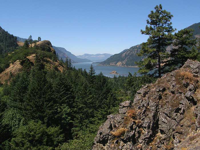
A bit farther up the slope, and the west view opened up, with a look to the main Viento Bluff and down river to Table Mountain and Greenleaf Peak:
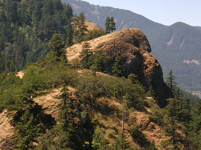
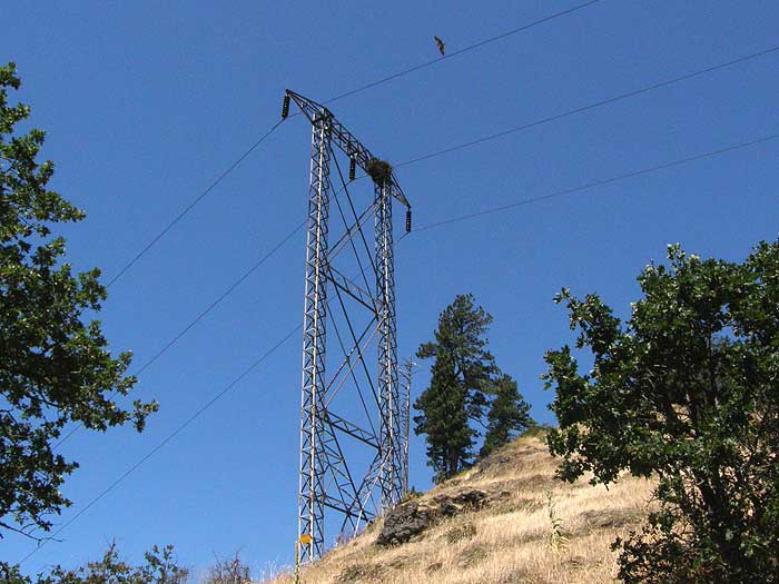
At this point, I stopped to study Viento Bluff and plan my route. In this close-up view, you can see a transmission tower with an osprey nest on the far right -- this is the starting point for the cross-country climb to the top. The summit is the obvious rounded know, with two ponderosa pines just to the left of the summit:
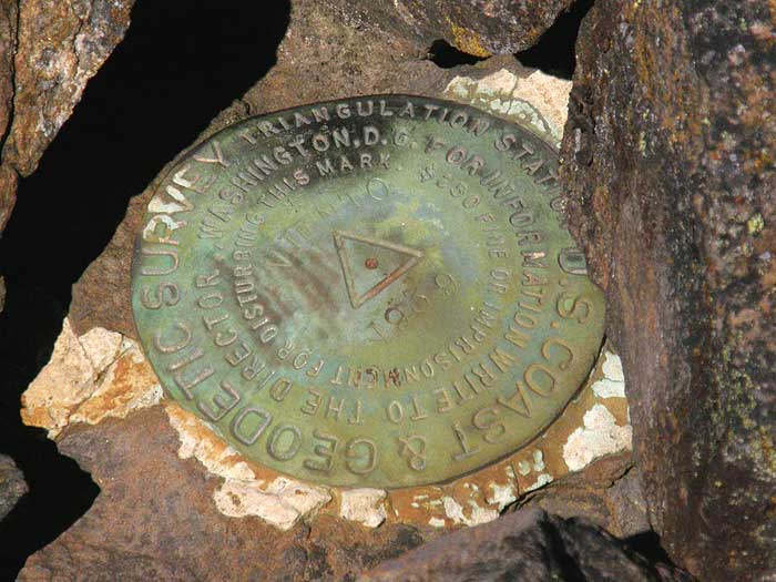
But first, more climbing to reach the summit of the East Bluff. Once on top, I found TWO USGS benchmarks! One was dated 1958 (the modern version) and the classic 1939 edition appears as follows, sheltered in a small cairn:
The views from the top of the East Bluff are sweeping, and provide a wonderful spot to study the finer points of the terrain below, or contemplate just how much the world has changed since some surveyor mortared that benchmark to the rock.

The summit of the East Bluff is broad, and has a number of view pockets, though there are patches of poison oak to be dodged here and there. It's sort of like a smaller version of Angels Rest, with save navigation around the top, but abrupt cliffs on three sides. I would make a fun and rewarding destination for families, since kids can look down on all of the freeway, railroad and ship activity below, as well as the campground.
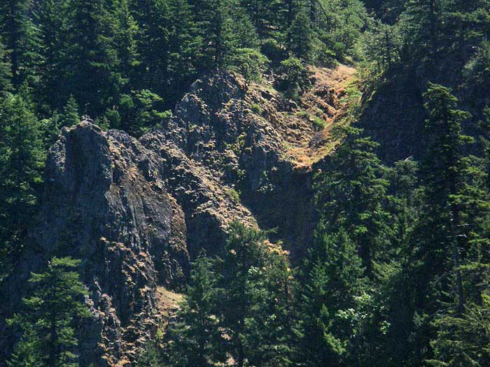
After enjoying the views, I retraced my route back to the service road, hiked down to the t-junction, then started up toward the wooded saddle below Viento Bluff. The access road makes a tight turn as it reaches the saddle (and a large tree has fallen across the road at this point) and curves along the forest margin, avoiding the Amazon-jungle-like expanse of poison oak that I encountered here on my aborted attempt from Viento Creek. In this view from the access road, I could see the spot that I reached from the opposite side in the extreme right edge of the photo:
This was encouraging, because it meant that a connection from Viento Creek to the bluffs was possible without too much poison oak clearing! I should also mention that there were patches of poison oak through the approach described in this report, just not on the epic scale of the Viento Creek approach. However, I did manage to bring home a couple of ticks, and that's something to keep in mind if you explore this area - the same goes for anything east of Horsetail Creek in the Gorge, for that matter, but especially in areas where you will be pushing through brush.
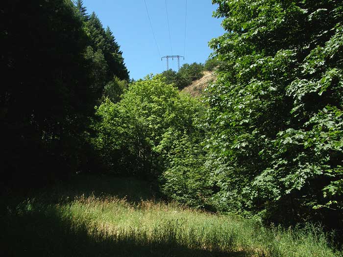
The service road continues to face before finally terminating below this transmission tower, on the lower slopes of Viento Bluff. This is the same tower that is visible in the view from the East Bluff, complete with irritated osprey circling above. He or she continued to scold me as I passed under the tower, and I wondered whether my hat resembled a salmon from above..?
Climbing beyond the tower, expansive views began to open up in all directions, beginning with an interesting look at the very rugged slopes of Wygant Peak. Here, I photographed what is likely a seasonal waterfall, blocked from view below by Viento Bluff -- I might need to make a winter trip up here, when the water is flowing!
As the Washington side of the Gorge came into view, the first columns of smoke from the Mount Adams fire appeared:
Soon, I reached the summit area - more compact than the East Bluff, but very safe to navigate. The views from this spot are spectacular, beginning with a dramatic look to the East, including the East Bluff and Mitchell Point in the distance:
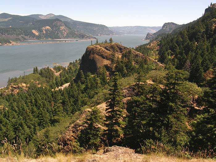
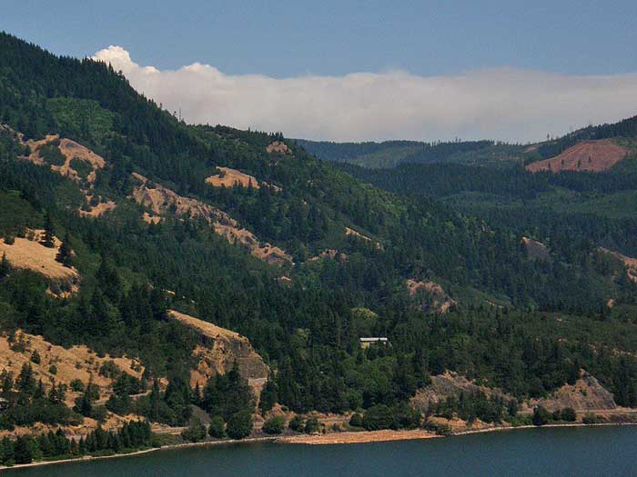
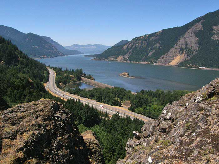
A similar sweep extends to the west, with an aerial view of the local terrain, below, and a long view down river to the Table Mountain complex, on the horizon:
The bluffs are airy enough that highway and rail noise is distant. Most importantly, these would be safe places for kids to learn the thrill of exploring and the satisfaction of reaching a summit -- so this is definitely an intriguing possibility for new trails.
I've also shown the West Bluff on the map -- that one will have to wait until winter for exploration, since the summit is clearly a poison oak paradise. But the open edge facing the river appears to be much like the lower viewpoint on the Wygant Trail, or along the Bridal Veil Bluffs, and could provide a similar, easy viewpoint destination.
The best part is that you don't have to wait for the TKO trails to explore this area - just follow the existing routes, and watching a bit for the three-leafed stuff. Well worth the modest effort required!
-Tom