Fall explorations in the Gifford, Lost Creek, Dry Creek and unknown bonus

Discussions and Trip Reports for off-trail adventures and rediscovering lost trails
Post Reply
User avatar
pinecone
Posts: 47
Joined: August 26th, 2021, 2:50 pm
Contact:

Fall explorations in the Gifford, Lost Creek, Dry Creek and unknown bonus

Post by pinecone » November 16th, 2023, 1:00 pm

I’ve been spending much of my field time the last few months exploring the Gifford Pinchot National Forest and collecting data for constructing maps, focusing around Indian Heaven for a map focused on that area first, but ultimately building out the whole forest for an atlas style project, so I’ve gotten to explore all sorts of fun spots. With some of the rains and weather returning I’ve been in working on my databases, so I’ve been staring at LiDAR of the area quite a bit, which just gets me excited to explore. Incredible to look at the bare earth lidar and see all the collapsed lava tubes, potential entrances, shield volcano and glaciated geology. Looking at lidar models makes waterfalls stand out pretty well, so I noticed some of those and tracked down what info I could on my two favorite resources on the subject, OregonHikers.org of course, and NW Waterfall Survey.

One fall/cliff in a potential seasonal watercourse wasn’t listed and I couldn’t find anything on but I figured now would be a good time to see if there is any above ground flow. It was also in the area northeast of Forlorn Lakes around Dry Creek Falls and Lost Creek Falls, so the perfect excuse for an adventure.
I headed out 14 Nov early morning, temperatures up there just above freezing with ice in the potholes and sun in the sky making the remaining foliage on the larches glow wonderfully. I first trekked the short off trail from 6035 to the delightful and icy Lost Creek Falls. Important to layer up in red/orange for the wandering, hunters out there now, although I saw no one all day and just passed a few trucks parked near the lakes.

Image
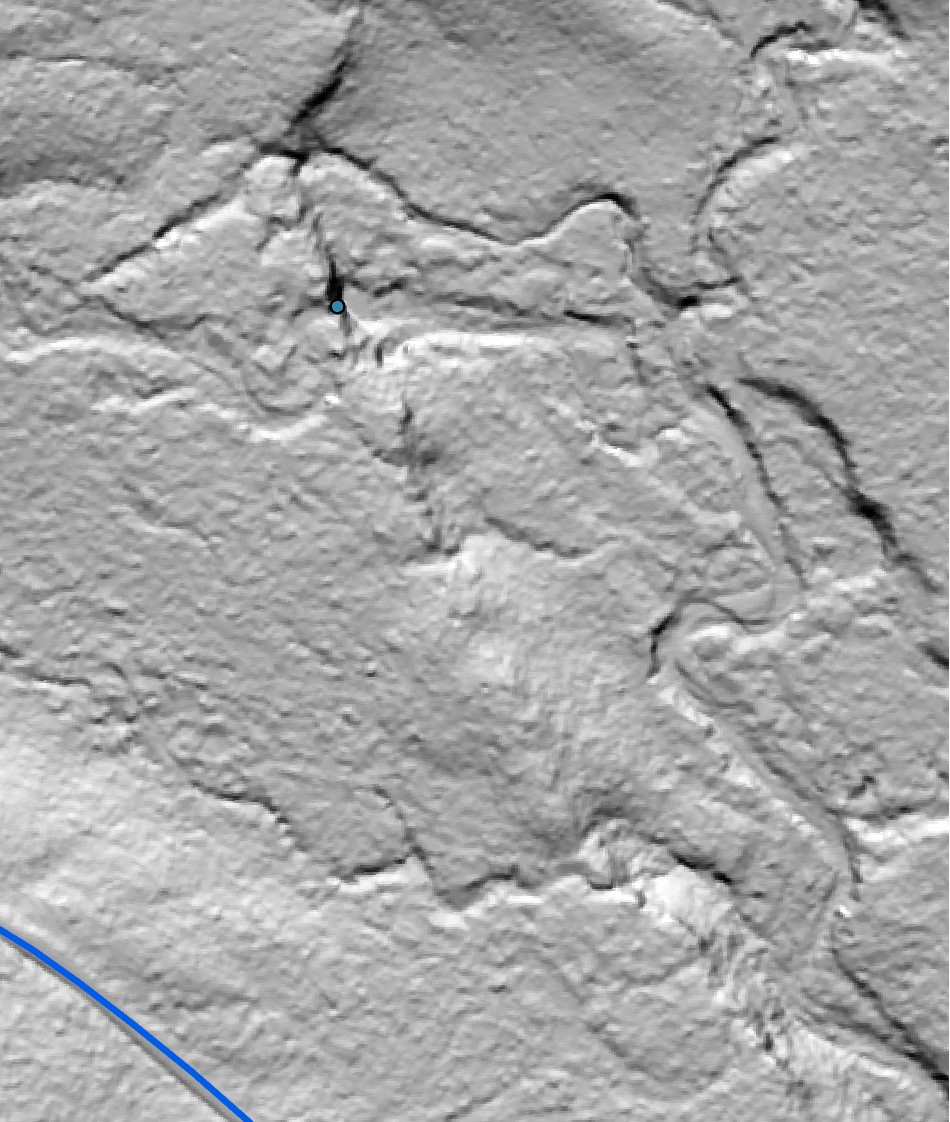
Dry Creek Falls on LiDAR

Image
Dry Creek Falls

Then I headed back and parked at the south end where 6030 heads north. The crossing of Dry Creek is on a concreted slab in the creek, with about 8 inches of flow over, immediately after which the road is dramatically rutted with water damage heading uphill that only very high clearance vehicles should attempt. But I was on my gravel bike, which I’ve started to utilize for exploring the roads here where the Subaru doesn’t happily go.

Image
My route and destinations of Gaia GPS

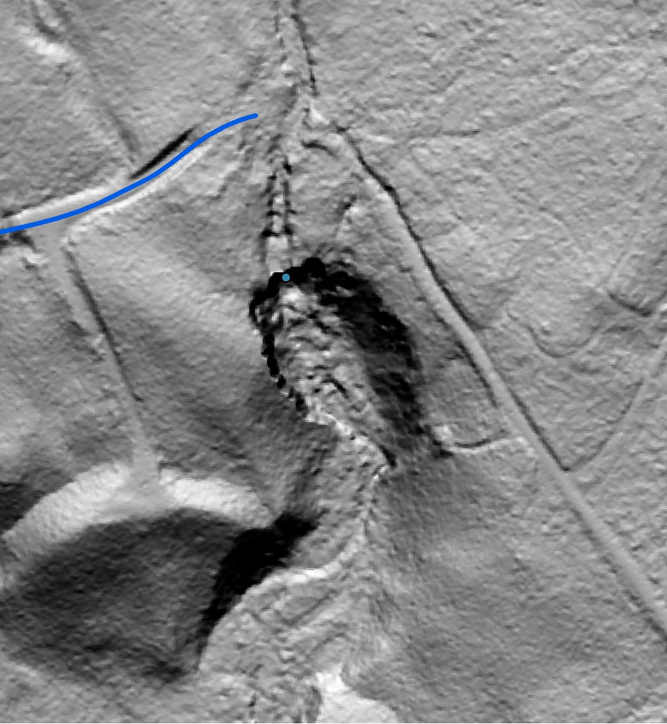
The mystery seasonal falls was off a spur road 6030-061, so I headed there first, dropped the bike and went downhill to enter the small canyon below where the falls would be. It was dry there, with pockets of still water, but scrambling up the canyon cut through some nice exposed water carved lava flow and I could hear water moving higher up. Finally, the drop came into view, and a nice large log offered a climb up to the base of the largest fall/cascade section. Not a heavy flow, but a nice little two tier bouncing along the wall of lava flow of maybe 24 feet or so, with a small pool at the bottom before another short drop into the canyon. Up at the top of the falls the creek has a couple nice small pools. Signs of higher flow from earlier in the month evident. Not a super exciting fall, but cute and a fun exploration. Anyone ever visited this one?

Image
Mystery tiny fall on LiDAR

Image
Looking down at the first, largest tier from the side

Image
Up on top of the little fall

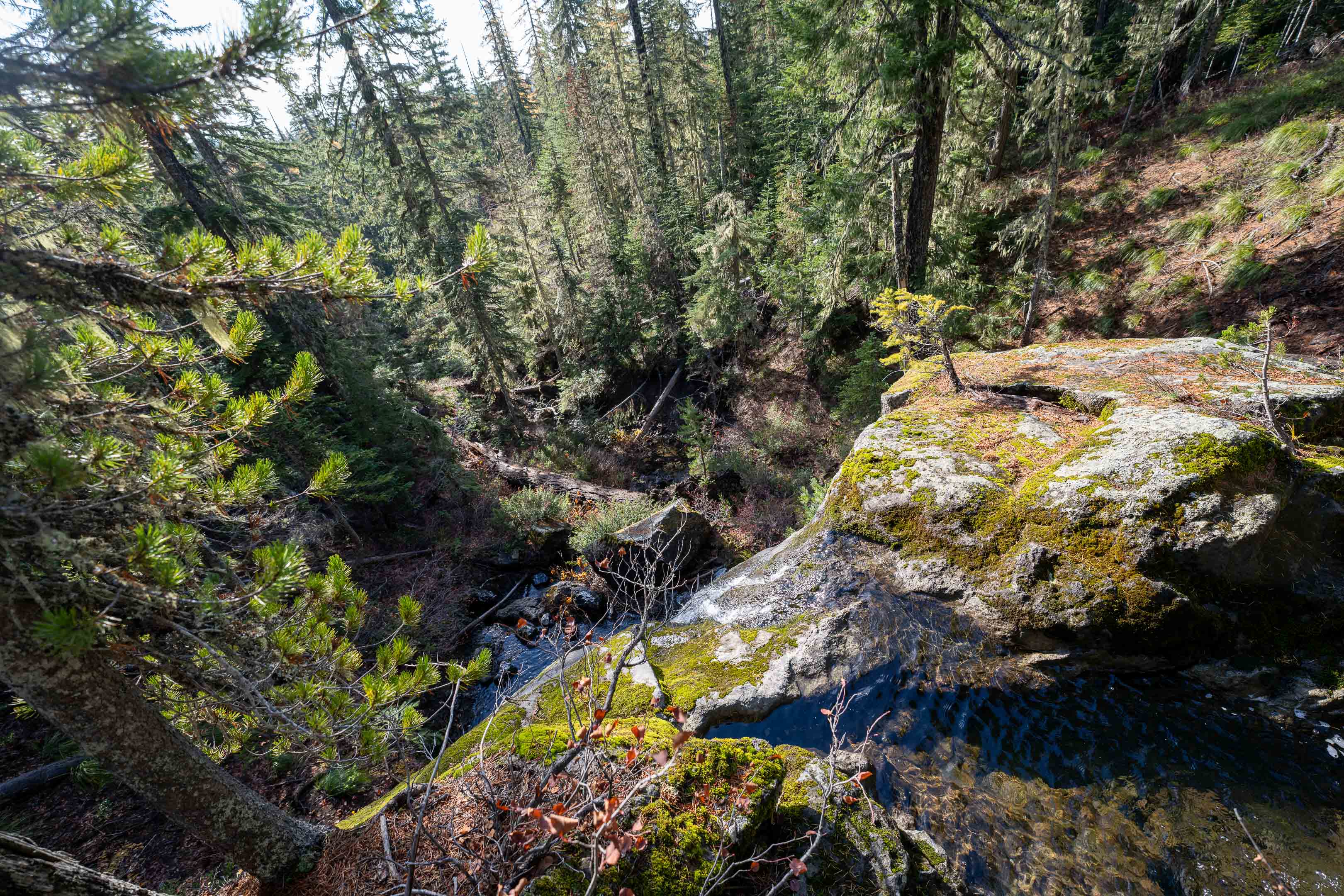
I then biked to 080 road, which is still open for about a third of a mile before it’s decommissioned. Dropped the bike and headed the rest of the way along the overgrown road bed to Lost Creek, explored uphill a bit through the nice somewhat open forest and in the creek checking out for interesting rocks before heading down the top of the falls. Really fun view standing from the top, and then a scramble around and down to the bottom.
Wow! Stunningly beautiful fall and pool, alight in the sun. An instant favorite.

Image
Lost Creek Falls on LiDAR

Image
Lost Creek Falls from the top

Image
Observing the falls down by the pool

Image

User avatar
EricInVancouver
Posts: 13
Joined: May 24th, 2020, 10:26 am

Re: Fall explorations in the Gifford, Lost Creek, Dry Creek and unknown bonus

Post by EricInVancouver » November 16th, 2023, 4:45 pm

Great efforts and thanks for posting your TR! GPNF has so much to offer that gets explored so little.

Webfoot
Posts: 1767
Joined: November 25th, 2015, 11:06 am
Location: Troutdale

Re: Fall explorations in the Gifford, Lost Creek, Dry Creek and unknown bonus

Post by Webfoot » November 18th, 2023, 9:07 am

Thanks from me too!

Nwcanyoning
Posts: 44
Joined: August 23rd, 2022, 9:19 pm

Re: Fall explorations in the Gifford, Lost Creek, Dry Creek and unknown bonus

Post by Nwcanyoning » December 18th, 2023, 11:00 pm

Nice to see the main drops still flowing. Lost normally dries up and rarely comes back on until the spring. I went to Dry 7/1/23 with crumby shooting conditions. The sun and the mosquitoes were plenty 🤣 I last went to Lost 6/12/22.
Attachments
262D54D9-D0E4-4DB1-9630-1114DD3D9417.jpeg
A70F2FC6-3EED-4462-B3D5-06120AF35AA3.jpeg

User avatar
Charley
Posts: 1839
Joined: May 28th, 2008, 10:03 pm
Location: Milwaukie

Re: Fall explorations in the Gifford, Lost Creek, Dry Creek and unknown bonus

Post by Charley » December 19th, 2023, 2:21 pm

That's so cool!

How are you accessing this LiDAR info? I've noticed that, on Cal Topo (which I use constantly), some areas are frustratingly low-resolution.

For instance, I hiked up the Bonanza area, I was fascinated by the very high, very steep clearcut along the MHNF boundary:

Screen Shot 2023-12-19 at 2.17.25 PM.png


Screen Shot 2023-12-19 at 2.18.01 PM.png

I was trying to figure out how the loggers got the trees out of there, and I wanted to check LiDAR for road grades, but found that layer not only too heavily shaded, but also very low-res (it looks like they only have higher res imagery closer to the developed areas of the US 26 corridor):

Screen Shot 2023-12-19 at 2.19.56 PM.png
Believe it or not, I barely ever ride a mountain bike.

User avatar
pinecone
Posts: 47
Joined: August 26th, 2021, 2:50 pm
Contact:

Re: Fall explorations in the Gifford, Lost Creek, Dry Creek and unknown bonus

Post by pinecone » December 19th, 2023, 7:00 pm

How are you accessing this LiDAR info
I download LiDAR from the source, Oregon Department of Geology and Mineral Imagery (DOGAMI) it's the same data that is used by CalTopo, Google Maps, everyone else, but by accessing it straight you can acquire the full, 1 meter resolution. They are hefty file sizes, and the load time and storage sizes for such data would make the apps quite slow/data usage high if they were full resolution. They have a viewer at https://gis.dogami.oregon.gov/maps/lidarviewer/ where you can select to view the Bare Earth Lidar, or Highest Hits (canopy/structure cover) and download it to use if you like. I download the DEMs and then create my own hillshades and maps in ArcGIS Pro, which is what I use for my cartography. The commercial license is intense, but a personal use (no selling stuff) license is only 100$ a year to make maps and have access to all their layers and tools, and you can be export as PDFs to use in apps like Caltopo or Avenza. One could also manipulate and use the data for free in the opensource program QGIS.

You're right about the High-Res cut-off, that's where LiDAR has not been collected/uploaded, and the fill in is with (I believe) 10-meter resolution data. There are chunks of MHNF that currently don't have coverage, mostly in the Wilderness areas, away from rivers. All around the mountain proper is covered, but for example, not all of the Zigzag range nearby. DOGAMI requisitioned a lot of fresh LiDAR and much was collected this past summer, but is still being processed and is not yet released yet. Subsequently a bunch of my Mt. Hood projects are sort of waiting for that release to utilize the better resolution data. But that's okay, because it pushed me to spend more time in the Gifford and around Mt. St Helens this year.

jvangeld
Posts: 157
Joined: May 29th, 2018, 6:36 pm
Location: Proebstel, WA

Re: Fall explorations in the Gifford, Lost Creek, Dry Creek and unknown bonus

Post by jvangeld » December 20th, 2023, 12:38 pm

In Washington the best source is the DNR Lidar Portal You can download data from there, but I have been happy with the hillshades.

I have it set up for editing OpenStreetMap with the tips at this link: http://www.jakelow.com/blog/using-wa-dn ... gery-in-id
Jeremy VanGelder - Friends of Road 4109

Post Reply