
When: 7/20/21
Who: Just Me (Born2BBrad)
This will be a mini trip report, focusing on one small section of a larger Broken Top/South Sister loop.
A few years ago, while exploring on Google Earth, I spotted something interesting. On the SW of South Sister there is a geographical feature called Rock Mesa, a large lava flow. On the S-SE side of that seemed to be a trail snaking through it to an ending point. No trail appeared to lead to the Rock Mesa mystery trail from any direction.
I thought to myself, “What the heck? Why is a trail there? What does it lead to? Who built it?” My best guess was that it led to a measuring device, measuring bulging South Sister.
Looking closer, a faint trail leading from the Le Conte Crater trail could barely be seen from Google Earth. It looked like a double-track trail, meaning possible use by a vehicle many years ago.
-----------------------------------------------------------------------------------
General Information
Topographical Overview:

Google Earth With Line:

Google Earth Without Line:

Mystery Trail Profile:

-----------------------------------------------------------------------------------
Trip Narrative and Pictures
This summer of 2021, I finally got around to investigating the mystery trail. I had to find out what that trail led to. The plan was to bypass the faint double track trail leading from the Le Conte Crater Trail, and take a more direct off-trail route to the beginning of the mystery trail.
Once off-trail, I saw other footprints going to the start of the mystery trail, going to and from there. So it was clear someone else knew about it. Upon reaching where the start of the trail should be, it was right there, leading up the side of Rock Mesa.
Trail Leading Up The Side Of Rock Mesa:

It didn’t look like it gets much use, but it was as clear as day. There was no doubt where the trail was.
It Was A Clear Trail:

In order to make this trail, many rocks and boulders had to be moved and placed just in the right place. It was a very good trail, for going through a boulder-filled lava flow. Navigating through the lava flow without a trail would be incredibly difficult.
A Lot Of Work Went Into This Trail:

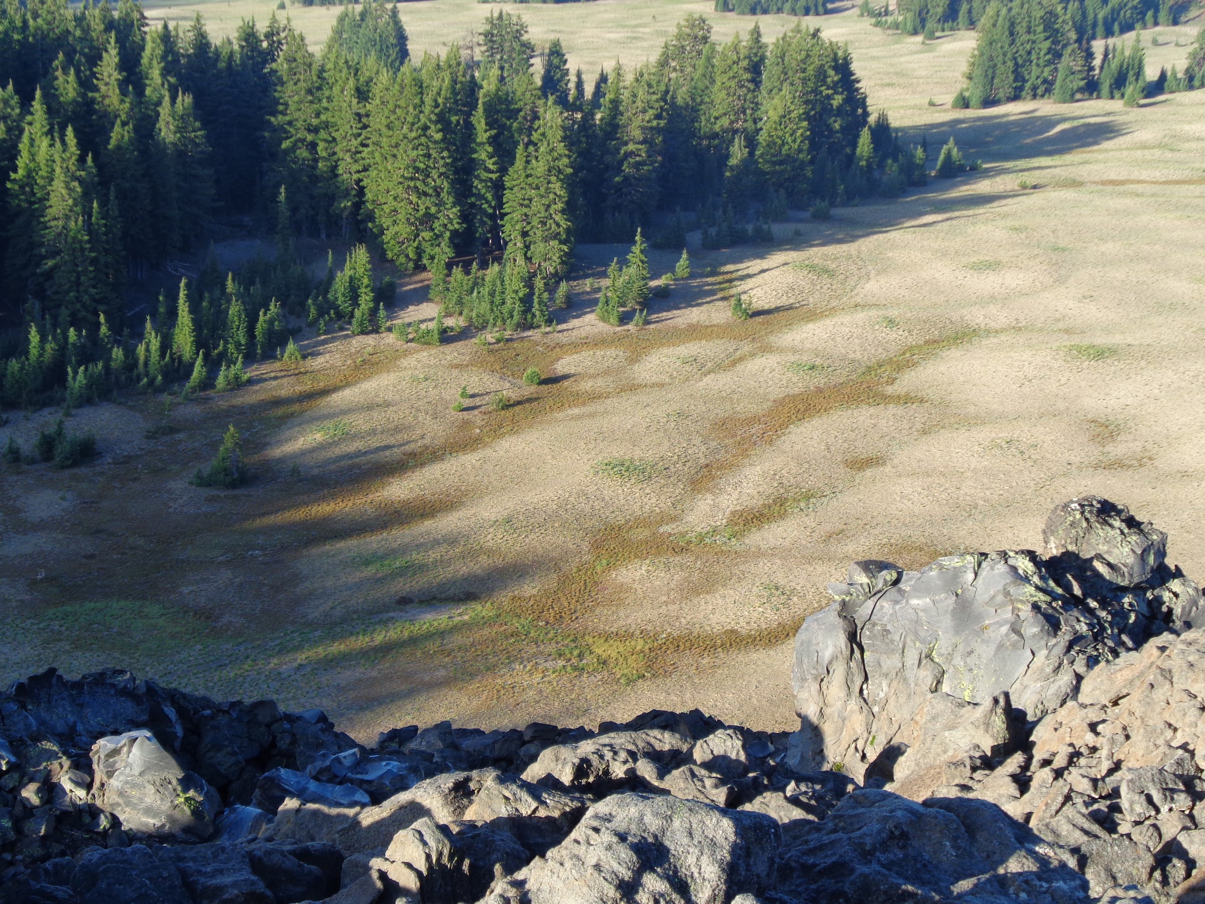
The trail snakes through the lava flow, mostly going downhill. Just after one mile, the trail ended. Guess what was there. Absolutely nothing. No measuring device, no remnant of a lookout, no Indian Pits, nothing that wasn’t just plain rock. Very anticlimactic.
View From Where The Trail Ended:

From the end of the trail, I could better see the faint double-track trail. That trail clearly looked like it was a true double-track trail used by vehicles.
Faint Double-Track Trail:
I briefly considered climbing down the edge of the very steep and rocky lava flow to the plains below, rather than backtrack on the mystery trail. It was only 200’ down and 200’ in distance. I thought better of it, since I didn’t feel like bouldering. I had a long way back to the trailhead and falling on sharp rocks didn’t sound fun.
OK, so now I’m even more curious. Why is there a one mile, well-built trail leading to and from nowhere through a lava field? There are some Oregon Hiker members who seem to be able to find old maps with trail, pictures and information on things like this. OH sleuths, see what you can find.
Final note: I hesitated to post about this, but my curiosity got the better of me. Plus, I don’t think too many people will physically investigate this. It’s off-trail and doesn’t lead anywhere or to anything. So not much of a draw. Knowing what I know now, I would rather spend my time and energy doing other things in this area.
Brad


