Shellrock Mtn Summit (Gorge) - Jan 25, 2019
Posted: January 26th, 2019, 4:10 pm
Now that more of the Gorge has opened I've been going out to visit old haunts to view current conditions. A couple of weeks ago I explored Lindsey Ridge (the ridge to the west of Lindsey Creek) and it has its own set of problems from blowdown in unburned areas but once in the burn zone to the south the ridge is clear. The goal today was to summit Shellrock Mtn and proceed south on the ridge that takes off from Shellrock to visit the vision quest pits at 3700' and return on Lindsey Ridge. Unfortunately the parts of the trail beyond the boulder field trail coming up from I-84 have been obliterated. The trail from the exit of the boulder field on the north-side to the weather station is extremely difficult to navigate, no tread, extremely steep and loose slope with the under-story and ground cover that held all the rocks and dirt together being gone. Beyond the weather station the previously faint trail going on to the summit is also gone but the ground is less rocky and travel is a little easier. As the summit is approached the slope moderates and is not bad. Still no trail to speak of. I will never go this route again and I doubt in what remains of my lifetime no trail following the original route to the summit of Shellrock Mtn will ever exist. Going to take years for the slope there to stabilize - whatever held it together is gone from the burn. There are other routes like the Gap or the nice boulder field on the west side that would be preferable to what I traveled today.
I rode a bike to the new bridge across Lindsey Creek and went up Lindsey Creek a bit and made a beeline for the powerline road that took me to my first destination:
Summit Creek Falls on the northeast side of Shellrock Mtn
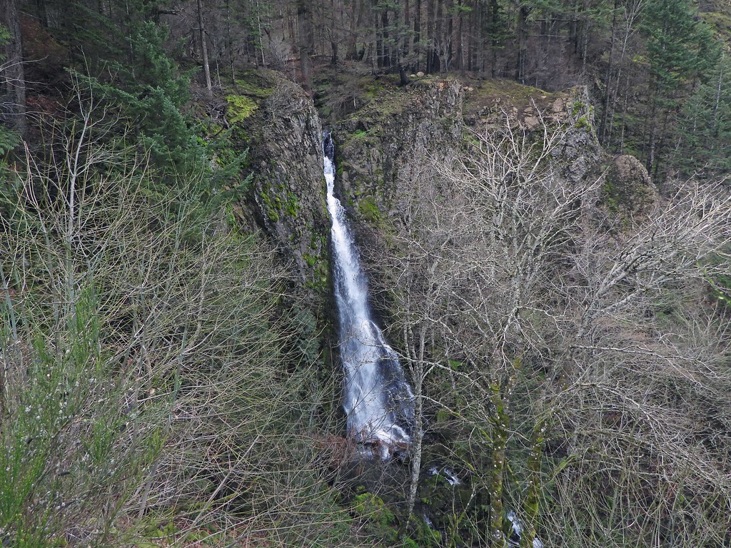 SummitCreekFalls by pauljess999, on Flickr
I stayed away from construction but I will watch with interest how access will be provided to the wagon road and the usable parts of trail up Shellrock. The viaducts being constructed are very impressive structures and I look forward to the completion of this project.
I crossed Summit Creek in a spot covered with downed red cedars but as bad as it looked, getting across was easy. There is access to the top of the falls for the brave/foolish.
There is a benchmark called Backbone that I thought I'd visit, worth it. The way there is easy as pretty much everything was burned away.
Way there:
 ToBackbone by pauljess999, on Flickr
Looking out towards the end, I see how it was named, it is a narrow ridgelet. Views are nice.
 Backbone00 by pauljess999, on Flickr
From the Backbone I could see the parking lot at Starvation Creek where I was parked. For X-mas I got myself a Nikon P1000 that has a 125x zoom, this is from ~2 miles away - a little blurry:
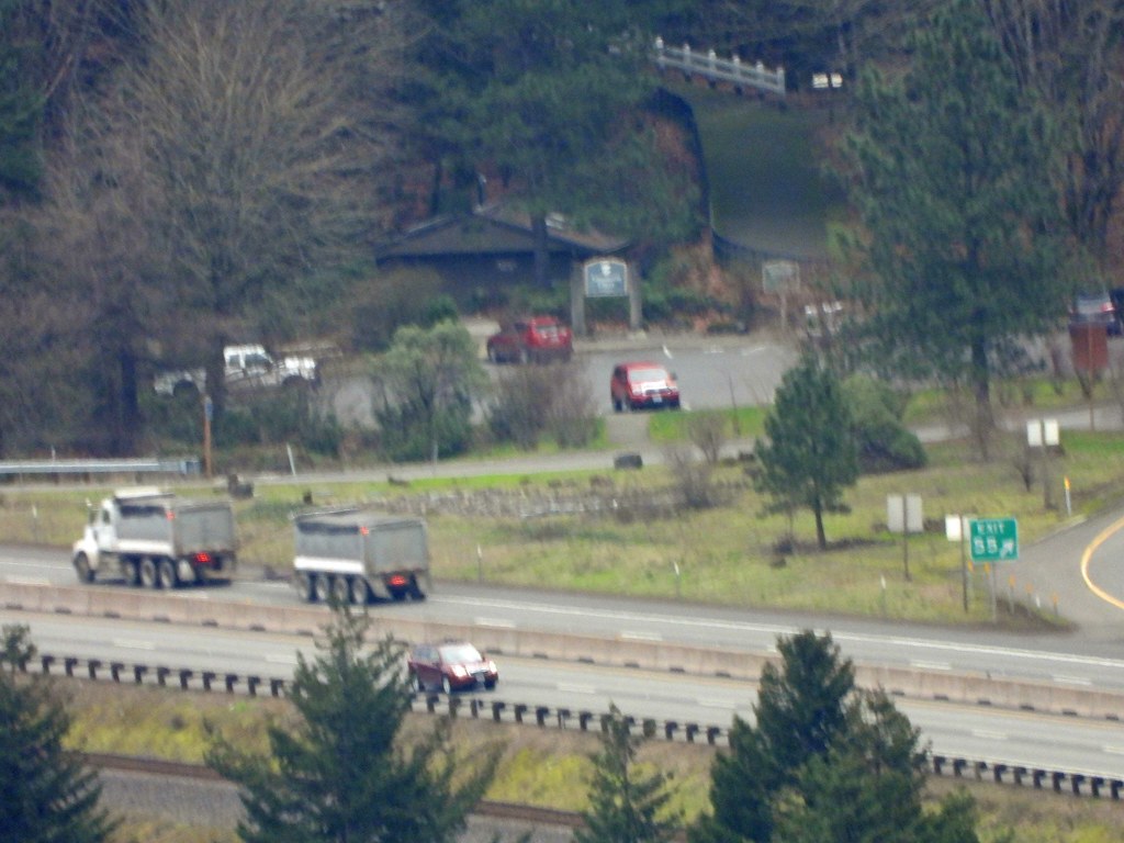 BigZoom by pauljess999, on Flickr
From there I hopped over the saddle to the west and joined the existing trail coming up from I-84. This part is in good shape and I was hoping that the rest might be like this, but no.
The lines of the many switchbacks are visible down to I-84.
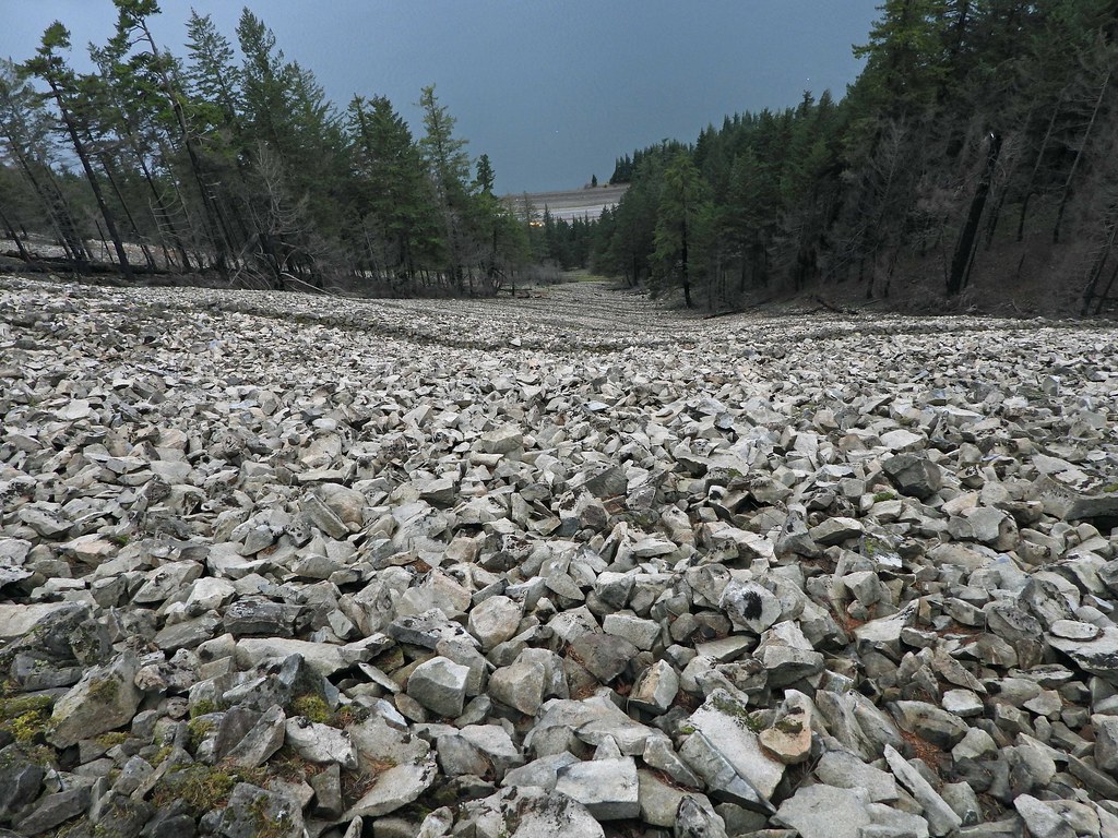 BoulderFieldTrail by pauljess999, on Flickr
Once at the top of the boulder field, the trail used to dive into the forest; gone, all gone. I'm pretty sure the trail ran along here.
 Trail by pauljess999, on Flickr
Here is a short segment of existing tread about 50-100 feet from the weather station. Here there is blowdown to negotiate so what trail that does exist isn't useful.
 TrailToWStation by pauljess999, on Flickr
The frame and the 'Danger' sign are still there, views are not bad but not worth the pain of getting there. Like 2 feet forward and 1 foot back on a severely unstable steep slope.
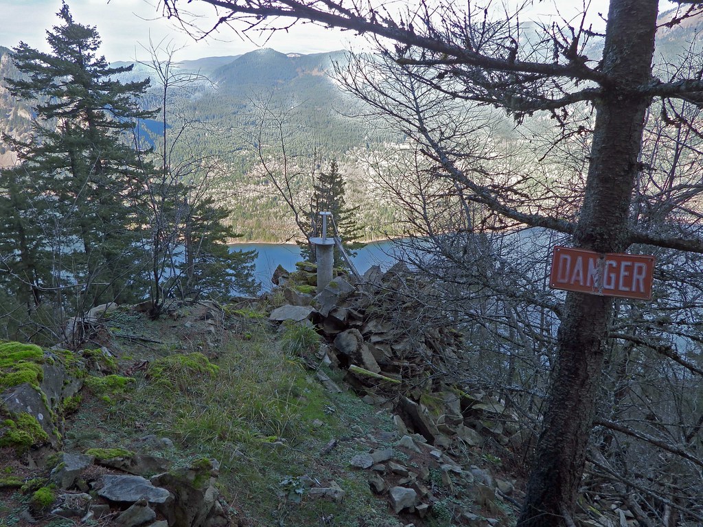 WeatherStation by pauljess999, on Flickr
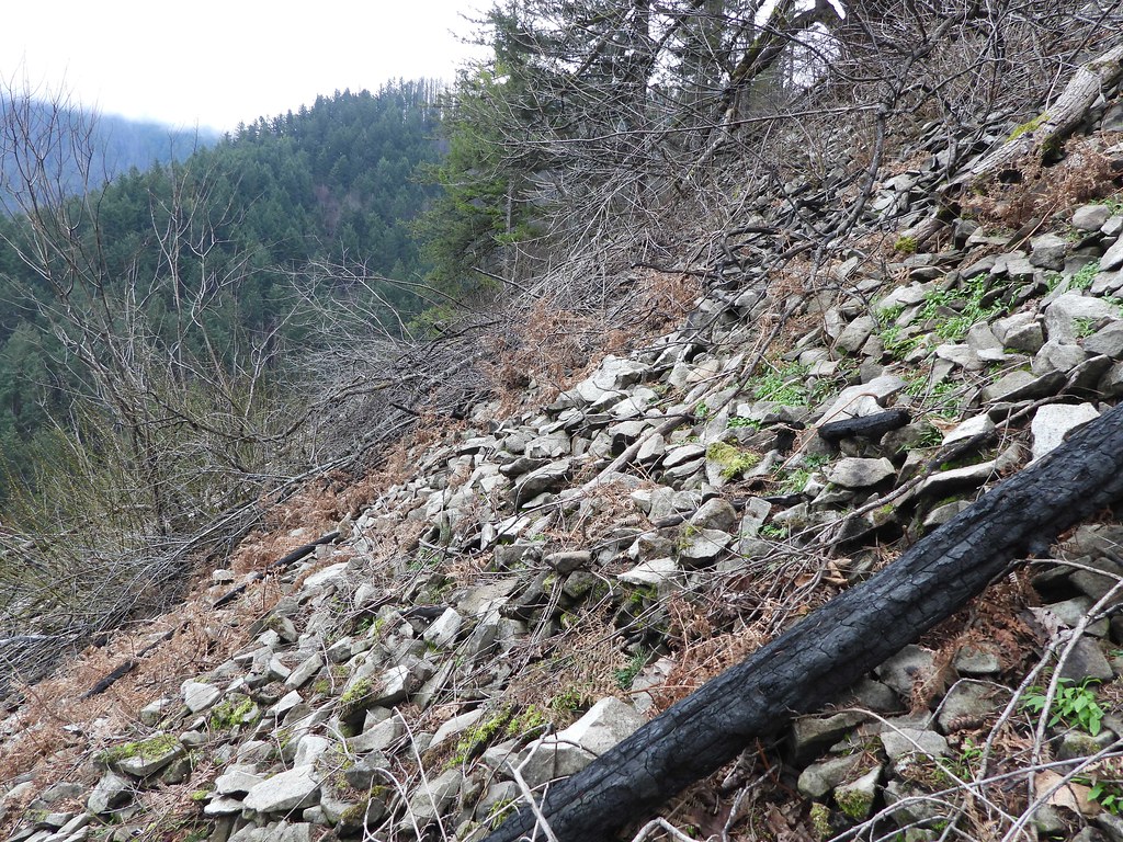
Steep slopes, loose rock and soil and not much to hang on to like this:
 Steep by pauljess999, on Flickr
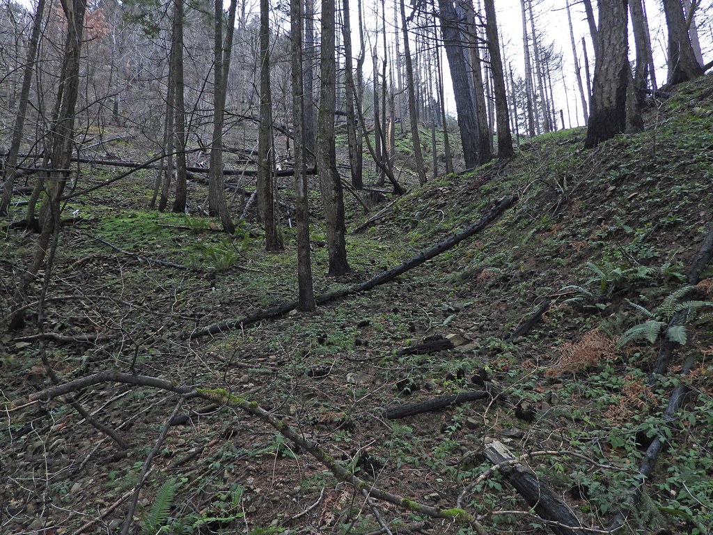
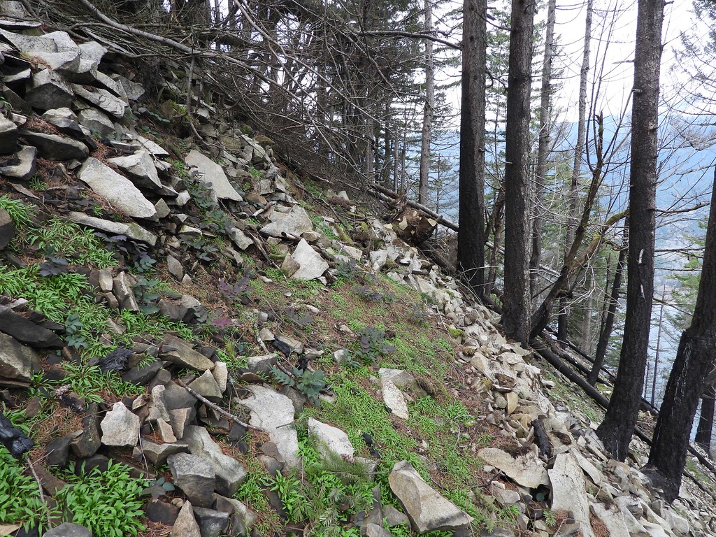
Beyond the weather station the situation improves considerably, still no useful tread.
 AboveWeatherStation by pauljess999, on Flickr
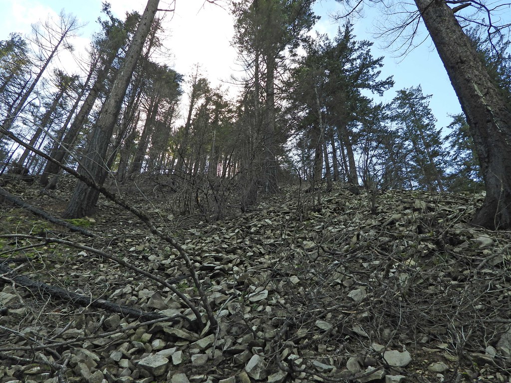
The summit, no cairn, no views, kind of anti-climatic but in the original plan this was not a stopping point - the plan was to go south and return on Lindsey Ridge but it took too long to get to the summit to proceed so I went back the way I came.
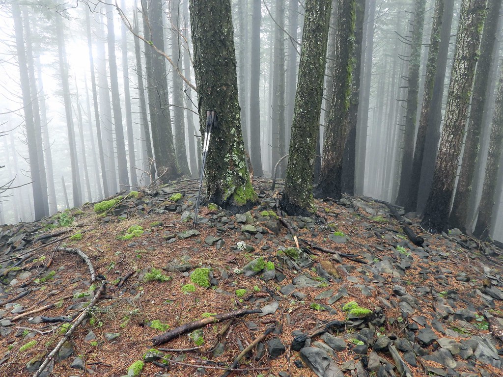 Summit by pauljess999, on Flickr
The parts that were miserable on the way up were as miserable on the way down - I actually down climbed a lot of it.
Here are my meanderings of both Lindsey Ridge and Shellrock Mtn - eventually I'll put it together for the loop.
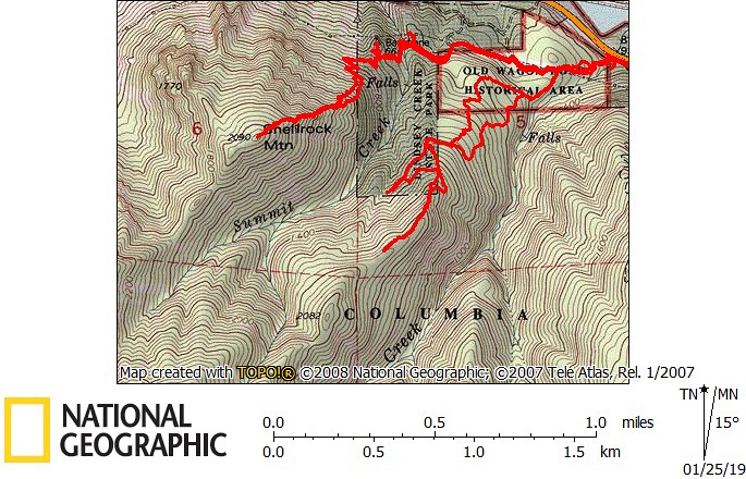 ShellrockLindsey by pauljess999, on Flickr
I rode a bike to the new bridge across Lindsey Creek and went up Lindsey Creek a bit and made a beeline for the powerline road that took me to my first destination:
Summit Creek Falls on the northeast side of Shellrock Mtn
SummitCreekFalls by pauljess999, on FlickrI stayed away from construction but I will watch with interest how access will be provided to the wagon road and the usable parts of trail up Shellrock. The viaducts being constructed are very impressive structures and I look forward to the completion of this project.
I crossed Summit Creek in a spot covered with downed red cedars but as bad as it looked, getting across was easy. There is access to the top of the falls for the brave/foolish.
There is a benchmark called Backbone that I thought I'd visit, worth it. The way there is easy as pretty much everything was burned away.
Way there:
ToBackbone by pauljess999, on FlickrLooking out towards the end, I see how it was named, it is a narrow ridgelet. Views are nice.
Backbone00 by pauljess999, on FlickrFrom the Backbone I could see the parking lot at Starvation Creek where I was parked. For X-mas I got myself a Nikon P1000 that has a 125x zoom, this is from ~2 miles away - a little blurry:
BigZoom by pauljess999, on FlickrFrom there I hopped over the saddle to the west and joined the existing trail coming up from I-84. This part is in good shape and I was hoping that the rest might be like this, but no.
The lines of the many switchbacks are visible down to I-84.
BoulderFieldTrail by pauljess999, on FlickrOnce at the top of the boulder field, the trail used to dive into the forest; gone, all gone. I'm pretty sure the trail ran along here.
Trail by pauljess999, on FlickrHere is a short segment of existing tread about 50-100 feet from the weather station. Here there is blowdown to negotiate so what trail that does exist isn't useful.
TrailToWStation by pauljess999, on FlickrThe frame and the 'Danger' sign are still there, views are not bad but not worth the pain of getting there. Like 2 feet forward and 1 foot back on a severely unstable steep slope.
WeatherStation by pauljess999, on FlickrSteep slopes, loose rock and soil and not much to hang on to like this:
Steep by pauljess999, on FlickrBeyond the weather station the situation improves considerably, still no useful tread.
AboveWeatherStation by pauljess999, on FlickrThe summit, no cairn, no views, kind of anti-climatic but in the original plan this was not a stopping point - the plan was to go south and return on Lindsey Ridge but it took too long to get to the summit to proceed so I went back the way I came.
Summit by pauljess999, on FlickrThe parts that were miserable on the way up were as miserable on the way down - I actually down climbed a lot of it.
Here are my meanderings of both Lindsey Ridge and Shellrock Mtn - eventually I'll put it together for the loop.
ShellrockLindsey by pauljess999, on Flickr