“Recovering the plane part”
10/13/18
Rating: 4 Stars
Miles: 4.9
Time: 4 hrs, 50 min
Avg MPH: 1.0
Elev Min: 5,900’
Elev Max: 7,600’
Total Ascent: 2,500’
Steps: 16,500
Flights of Stairs: 255
Time Up: 6:00
Sleep Hours: 6:30
Start Time: 8:45
Temp Low: 40
Temp High: 55
Other hikers: 3
Male:Female hikers: 67%/33%
Longest time without seeing a hiker: 4:30
Wildlife: Birds
Verizon Cell Service: LTE except down in the canyon
Approach Road: Paved
Parking Permit Required: None
Parking Lot: Giant
Bathrooms: Lodge
Mt Hood * Timberline Lodge * White River * Mimie Falls * White River Glacier * Snowmobile? Part * Airplane Part * ALDHA West * Chardonnay * Jennifer Pharr Davis * Triple Crowners
Opening Shot: Looking down the White River and Mimie Falls
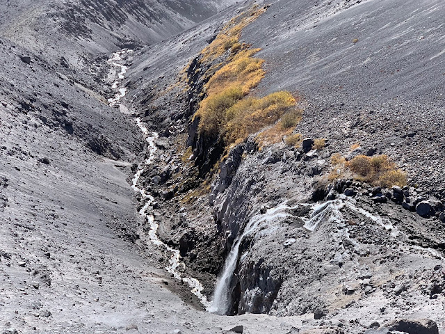
Finally, it looked like I was going to get my weather window for this hike! I’ve really been wanting to get this hike in before the winter sets in on Mt Hood. It will serve two purposes. It will give me a do-over on my very last portion of my Mt Hood High Route journey that I completed a few weeks ago, and it will be an opportunity to go recover the plane part I found on that same hike as the FAA is interested in looking at it to determine where it came from and why it ended up there. I also had a great opportunity to get another rare hike in with my hiking friend “Wired”.
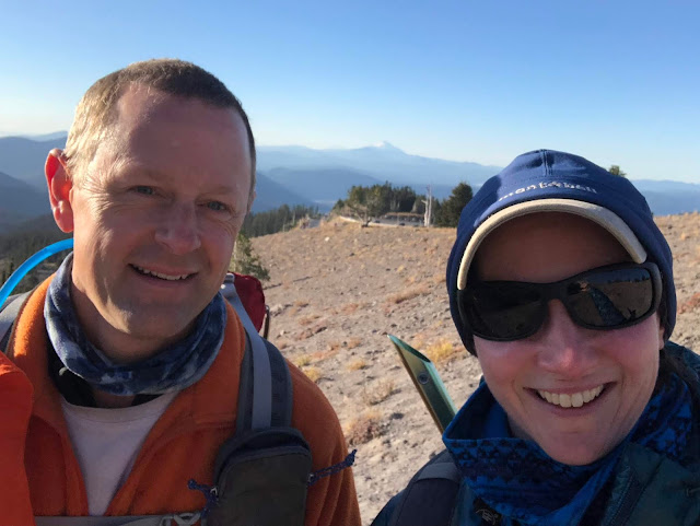
We arrived at Timberline with gorgeous sunny skies. That part we knew would be good, but the wild cards would be the temperature and the wind speeds. We were pleasantly surprised with the temps as it was already 40 degrees when we arrived. We both wore long underwear under our pants as we were concerned with the cold. We also opted for hiking boots rather than our normal trail runners for the same reasons. Up the climber’s route we went to start our morning.
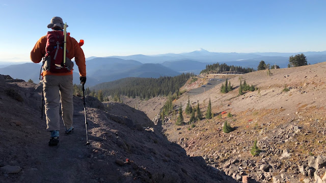
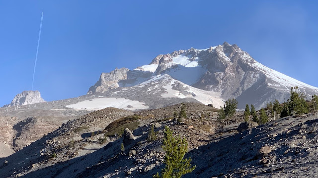
It’s pretty much exactly a mile to get to the drop-in point down to the White River Glacier, which took us 40 minutes to get to. On the way up, Wired noticed that it looked like a rocket taking off from Illumination Rock. Of course it was only an airplane contrail, but the effect was fun to see.
We dropped down the wash to the White River. It was pretty fun to sort of glissade down the sand. I can guarantee it was more fun than the 1/2-hour slog out at the end of my hike with my overnight pack! It took us ten minutes to get to the bottom.
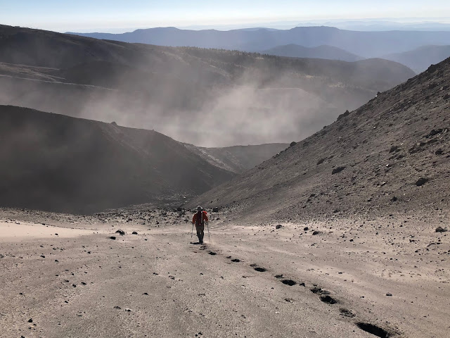
Here comes Wired following behind.
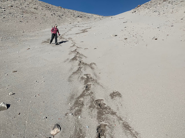
About 3/4-down it comes to its final drop, which is a bit steeper. I had come directly up the creek bed of the spring to get solid footing on rock on my prior hike, but this time we simply continued our glissade on the left side which was great. After we hop over the White River, we’ll be on new ground, hopefully, we'll be ascending the crest of that moraine that is right above my head in this picture.
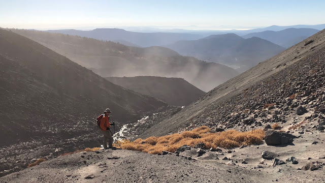
We were just below the headwaters of the White River where it escapes the glacier. The elevation here is now essentially the same as Timberline Lodge.
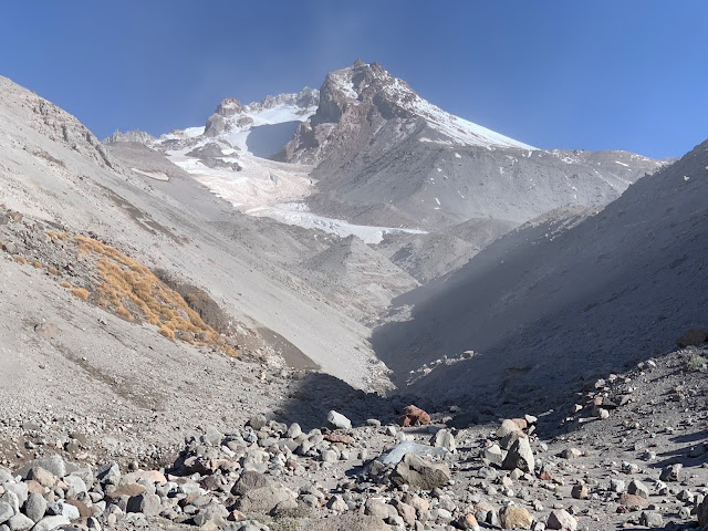
After hopping the river to head down to the base of the moraine crest, we ended up hopping back over, as it was flatter and easier to get there. Our target was almost the exact location of the top of Mimie Falls. At this point we were at 1.3 miles and 1.3 mph pace for the hike.
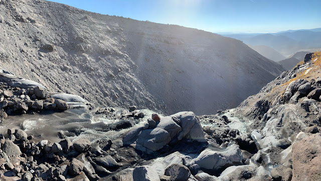
Here is a video at the top of the falls.
2018-10-13 01 Mamie Falls from Michael Irving on Vimeo.
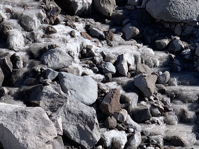
We went back just a few yards from the falls, hopped the river again, and started up the nose of the moraine wall. We had to watch our footing a bit around the creek as there was ice caked on the rocks where the river water was splashing.
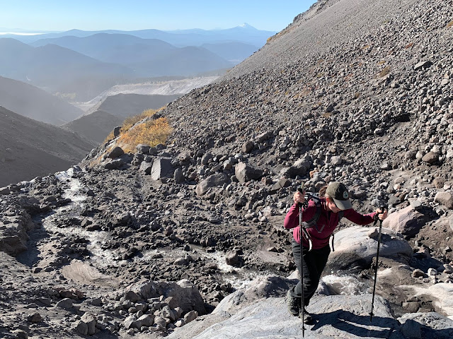
This is looking down to Mimie Falls from the top of the front of the moraine crest.
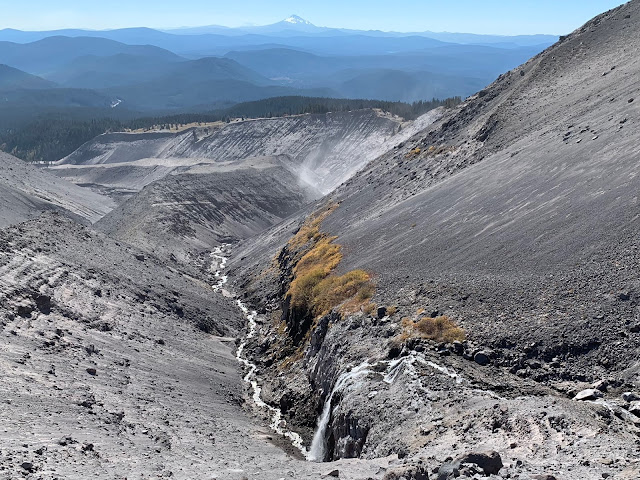
Here’s a video clip from the top of the front of the moraine crest.
2018-10-13 02 Moraine Crest from Michael Irving on Vimeo.
Looking back behind our path, we got a great view of our drop-in point. this is the wash across the river. There are three sections to it. The top is the least steep and pretty easy going. Then you can see it drop off a rocky ledge that isn’t scrambling, but pretty steep on the reasonably consolidated rock. Then, the final drop contains the two creeks coming from the spring. These are nice to go up due to solid footing, but we just glissaded down to the right of both of them (left of them from the coming down perspective). there is snow in this wash earlier in the summer, so be aware of that possibility.
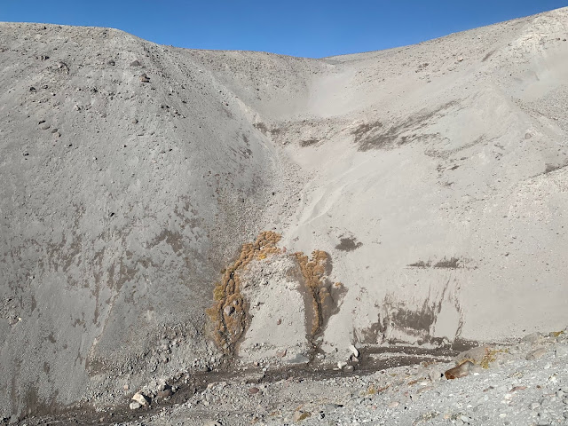
On up the moraine crest we went. It was great hiking and nice to not have to keep our head on a swivel for rock fall which we had to do down in the river and in the wash on the opposite side. With the active winds, it almost sounded like it was raining with all the rock fall coming down…mostly small rocks.
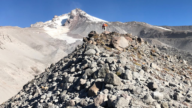
Looking back you can see Wired making her way up and the blustery sand and wind combination.
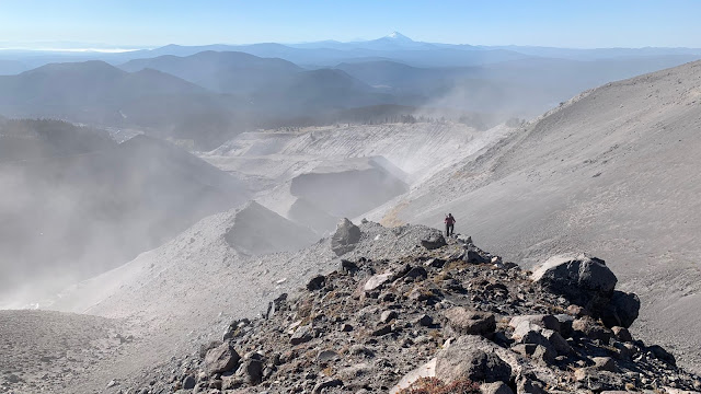
We kept on heading up the crest, it was really a great route…SO much better…maybe about a million times better than my High Route path that I took a few weeks ago where I went down the bed of the White River. It was a nightmare that you can read about in that post if you’re interested in the link provided at the bottom of this post. In the picture below, you can see the snow chute that drops down from the left-to-the-right in the upper-right-corner of this picture. At the base of that is about where we’re aiming to recover our airplane part.
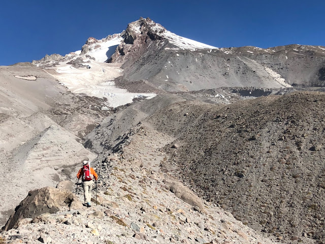
About half-way up, the lower moraine crest kind of dropped down into a gully between two new crests. This was just great as it was a very pleasant walk.
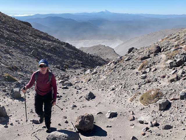
This is looking down to the White River where I walked down a few weeks ago…lot’s of rock fall coming down that other side!
Here’s a view of another of the new crest, the upper one was a little more knife-edgy, but not too bad.
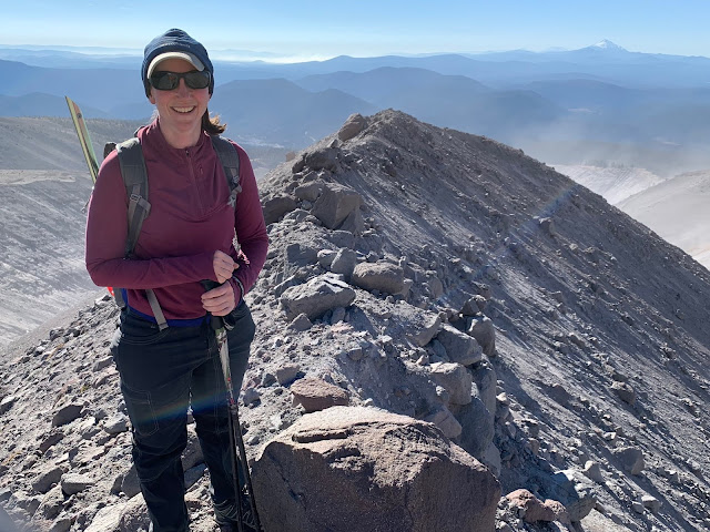
As the moraine crest blended into the mountainside, we started to hang a right, to get over the glacier.
Just as we did that, I made this find!
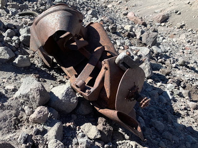
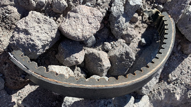
I was perplexed with what it was. I found a belt with teeth for the pulley wheels and this marking which looks like a disc brake caliper.
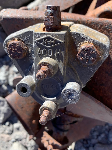
When I was home I Googled the stamped letters and numbers and saw that "K-H", stood for Kawasaki Heavy Industries, which is the parent company of Kawasaki. The 400 looked to be related to the Kawasaki KH-400 which was a motorcycle manufactured from the mid ’70s to the mid ‘80s. I was also wondering if that part was also used on their lines of snowmobiles, which might be the more likely thing to find up here, although a motorcycle could conceivably get up here too I suppose from down near the Highway 35 snow park. I’m open to any additional thoughts and ideas! Here is an internet image of a Kawasaki KH-400 and also a Kawasaki snowmobile of a similar vintage I’m guessing. Notice the motorcycle has a chain-drive. And notice the track assembly under the back of the snow mobile.
Here’s video clip, rotating around the part. As I look at this video again, I think I’m even more convinced it’s from a snowmobile, due to the orientation of the pulley-wheels that seem to be side-by-side and about the right spacing for a snowmobile.
2018-10-13 03 Kawasaki from Michael Irving on Vimeo.
Here is the belt piece I found too.
We continued across the glacier. At this point we were on rock that was likely mostly over glacial ice. We had to go up and down through some small gullies and again had to watch for ice near the waters.
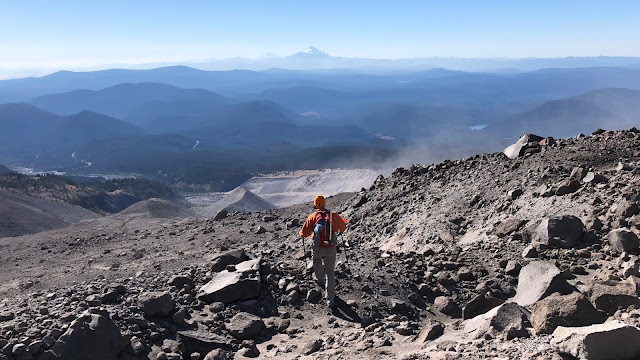
Once over the mid-section, we dropped down to where I thought the plane part would be.
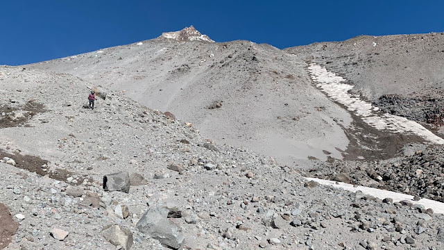
Here comes Wired, you can see that same snow chute that I had mentioned earlier in the post…we’re here now. In regard to my High Route adjustment plan, I think my new recommendation is to go up/down the subtle moraine crest just to the left of the snow chute. It would actually probably be easiest to go up the chute with micro-spikes or plunge-step down the moraine crest. There is another moraine crest to the left of this one that looks even better, so that may be an even better option if it’s free of glacial ice/snow to get to it. On my route a few weeks ago, I came down a loose, rocky hillside that wasn’t that great, and very unconsolidated.
We had to hunt around a bit, even though I had marked the GPS coordinates, but we found it!
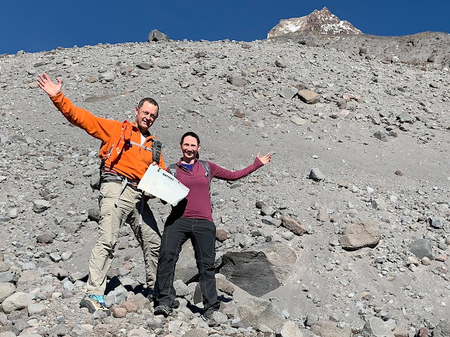
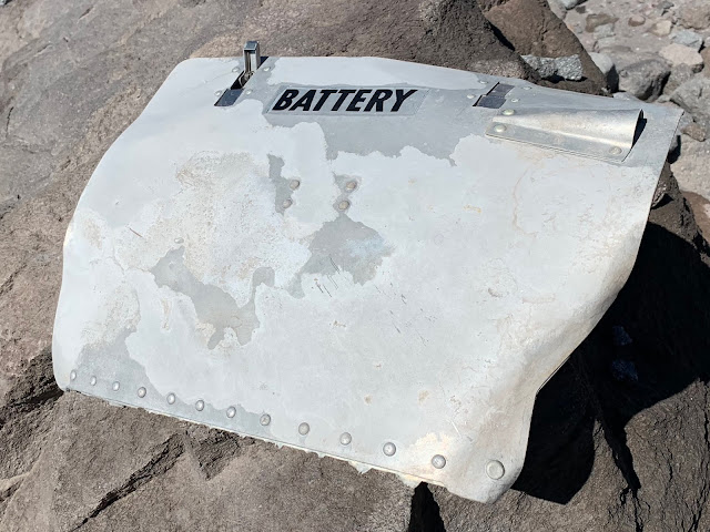
Here’s the part. It appears to be a battery door to a small aircraft. (Pretty smart of me to figure out that it’s battery related huh?!) There are two spring levers on top to open/close it and the bottom edge was hinged along its entire length. the rivets are raised, suggesting a smaller, lower speed aircraft, and that raised horn-shaped piece has a vent hole under it that I’m guessing might be to vent fumes or to assure that the air pressure is always equalized, regardless of elevation??
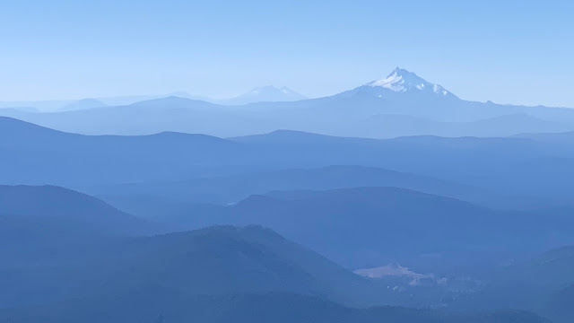
It took us 2:45 to get here in 2.6 miles and 0.9 mph pace. We packed it up in the back of my pack and soaked in the surroundings before heading back down. This picture has Mt Jefferson on the right, the Three Sisters in the center, and Broken Top on the left of them.
We took a slightly lower way back as we had inadvertently got a little on the high side on the way over to the part. We had to drop down into this small gully (see Wired?) which wasn’t too bad. (It looks worse than it was)
Wired saw a big boulder that she thought would be fun to get a picture on top of, so we free-climbed to the top of it. (Just kidding, we went around back and as luck would have it, it was an easy step from the raised sand to a notch in the rock up to its flat top.) That’s the summit of Mt Hood on the upper-right.
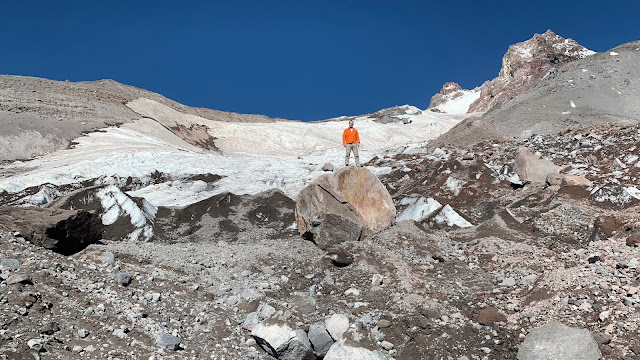
We were right at the leading edge of the primary glacier, so the ice was quite something to look at.
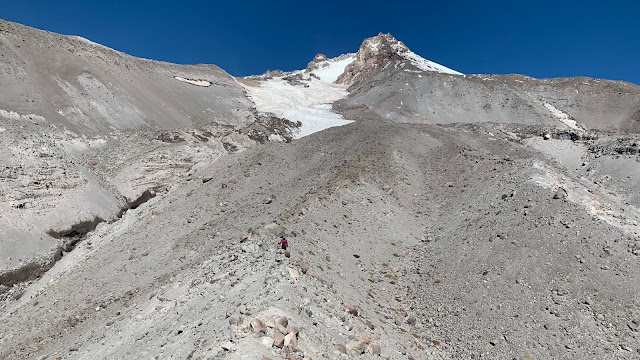
Down we went, back from where we came. In this picture you can see the gully that tricked me into going down to the river bed on my High Route hike. Over on the right you can see that nice descent down to the river. At the time, I was worried that the moraine crest would be too steep to get off of at the end. That was a very unfounded worry! This time we aimed dead-center and went for the crest.
Here I go, starting the descent down the crest.
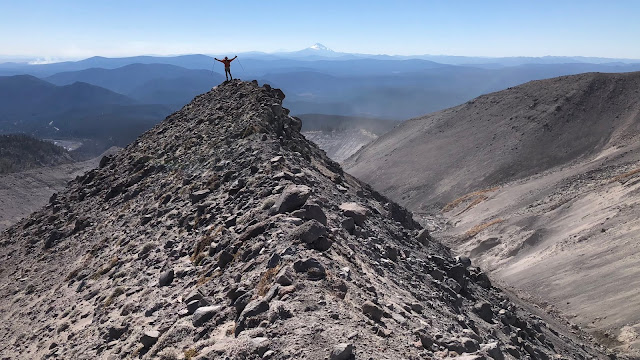
Here’s Wired, coming down behind.
It does undulate up and down a bit, which makes for nice photo ops! (See our out-chute on the right side, with the growth in the creeks?)
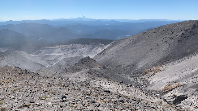
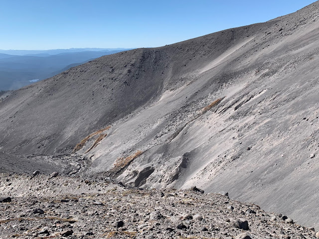
Here is another good angle showing the out-chute path to get out and back up to Timberline Lodge.
We were back to the top of the nose of the moraine crest with our great views of Mimie Falls.
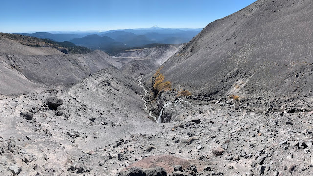
This time, Wired had a good idea to cut back up the mountain, along the moraine wall. It wasn’t as steep as we thought, and it was nice going side-hill on the way down rather than straight down the relatively steep nose of the crest. This would be the best option to go up and down in my opinion, but I’d make the effort to go see the top of Mimie Falls, and if going both ways, make that effort when you’re going up, as the nose is easier going up than down. It took us an hour and twenty minutes to get down here from the plane part. We were at 2.6 miles and 0.9 mph pace still.
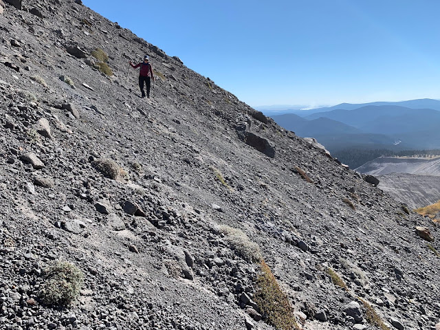
Then we headed back up the wash. We decided to just go up the way we came…next to the creeks. It was kind of a “2 steps forward, 1 step back” kind of experience, but it was short-lived. We kept our heads on a swivel for rocks again, (particularly me, since Wired was leading).
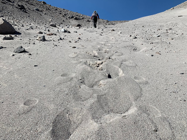
Here is a video clip of the arduous climb.
2018-10-13 04 Chute from Michael Irving on Vimeo.
And just like that, 20 minutes from the bottom, and we were back on the top!
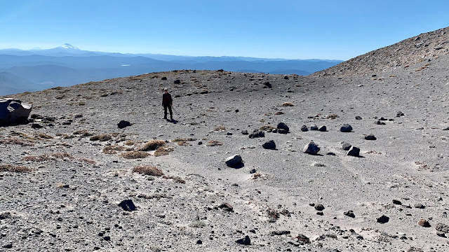
We scampered back down to Timberline Lodge in 20 minutes and we successfully completed our goals for the day! It was great to get in a last hike for the nice part of the fall season.
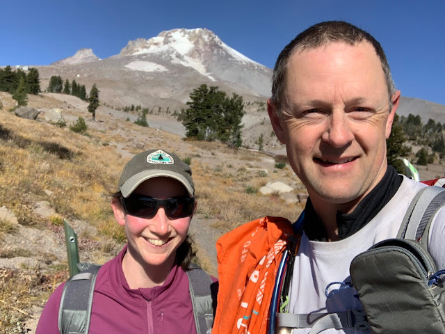
But wait! A hike isn’t a hike until there are Subway sandwiches eaten!
Then it was on to the ALDHA West annual gathering at the Kiwanis Camp down between Government Camp and Rhododendron. This was actually the initial plan for the day, we just tacked the hike on as the weather was so good. The American Long Distance Hiking Association (Western United States chapter), has the honor of distributing the “Triple Crown” awards each year. This award goes to everyone who completes all three of the major long-distance national scenic trails in the United States. These include the Pacific Crest Trail (PCT: 2,650 miles), the Continental Divide Trail (CDT: 3,100 miles), and the Appalachian Trail (AT: 2,200 miles). That’s 7,950 miles of hiking! Wired was awarded her triple crown a few years ago. This year, there were about 60 recipients, and almost half of them were at the gathering. It was really cool to see and visit with so many accomplished thru-hikers.
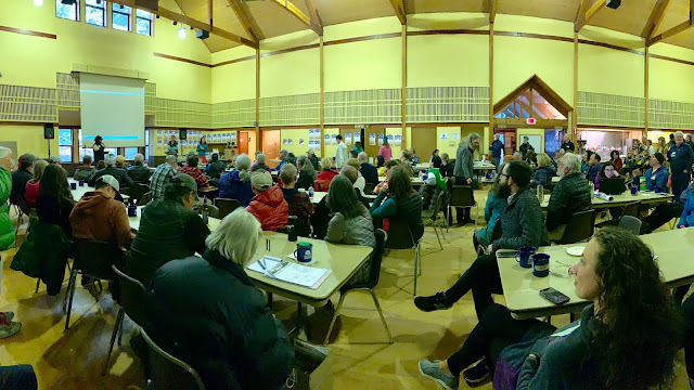
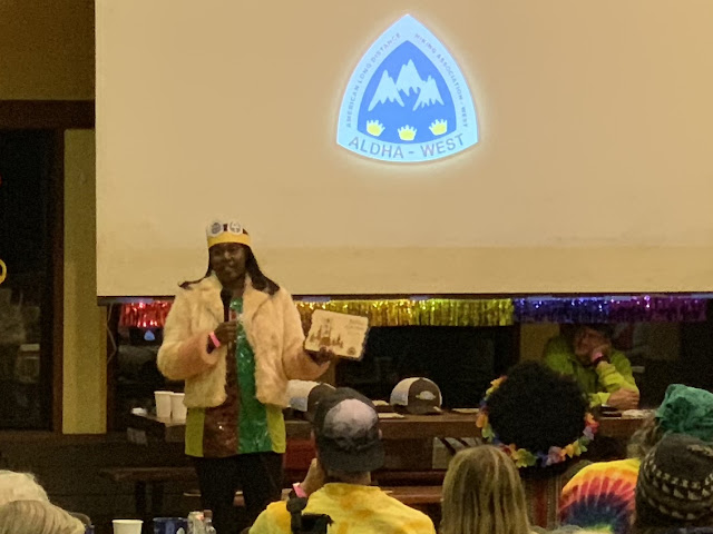
I was able to see “Chardonnay” receive her triple crown as the first African American to ever complete the triple crown. Pretty cool! (The theme of the night was to dress like 1968 to celebrate the 50th anniversary of the national scenic trails designation...Chardonnay won that contest too.)
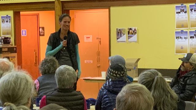
I also was able to hear Jennifer Pharr Davis as the keynote speaker. She held the fastest known time (FKT) of the AT when she broke the record in 2011 with a time of 46 1/2 days, averaging 47 miles per day. This record includes men too. She was awarded the National Geographic Adventurer of the Year award in 2012, after her hike. Her talk was very inspirational. I had a chance to visit with her afterwards and she was so personable and interested in talking with me in a very genuine way. I was very impressed with her and glad to have had a chance to meet her.
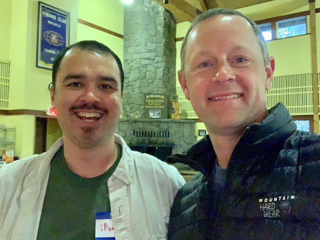
There was a bunch of social time too, so I was able to meet the Princess of Darkness (P.O.D.) from The Trail Show podcast I listen to, and many others. I had several people come up and introduce themselves again to me to thank me for the trail magic I had given to them on the PCT when they had hiked it. This was a fun and rewarding experience too, to be able to be considered part of this amazing community. One person I met again was iPod. We met at McKenzie Pass way back in 2012. We both remembered it quite clearly. (Yes, he was listening to his iPod when we met.)
We finally finished up around 10pm...time to head home! It was a long day, but a very rewarding one!
On Monday, I called my local FAA contact and I plan to drop the part off at their offices this week. He said that anytime a part is noticed to be missing off an aircraft that it is supposed to be reported to the FAA and they have no record of this part missing. Of course this is not always done. Stay tuned and I'll report back what I find out.
Summary:
What a hiking extravaganza today! I was very pleased with my new addition to my High Route path and that we recovered the plan part and that ALDHA West was a blast. Thanks to Wired for coming along as I really was ready to have a change from all the solo hiking I did on the High Route.
Favorite experience of the day:
Finding such a great alternative route to switch to for my Mt Hood High Route hike & experiencing ALDHA West.
Least favorite experience of the day:
The wind kicked up the sand quite a bit, but it wasn’t too bad.
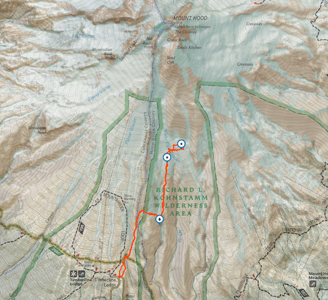
Today's route:
The upper star is where I recovered the plane part. The lower star is where the (snowmobile?) part was located.
Today's elevation (left-to-right):

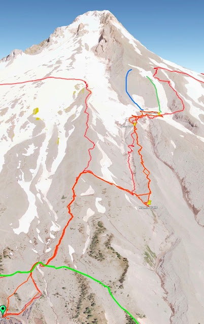
Google Earth with Track:
The green line at the bottom is the Timberline Trail. The red line that goes up and curls left is the climber's route to the top of Palmer. We dropped down to the right to White River. On the way up we dropped down to Mimie Falls and then up the nose of the moraine crest. On the way down the moraine crest you can see where we cut back to the river just before dropping down the steep nose, it worked well. The other red line that goes up/down White River bed is where I came down on my High Route a few weeks ago. It SUCKED! Don't go that way! It was SO much better on the moraine crest. The blue line at the top I drew-in on the picture to show the best route up to the high route...I think...but I haven't done it. This assumes you can get to the base of the blue route safely over snow and glacial ice, which might be tricky earlier in the year. The green line up high is another subtle crest to go up/down right next to the snow chute. This would be fine too, but might be more sandy and slow progress to go up, but could be a good plunge step coming down (I haven't done it). Going up the snow chute with micro-spikes and an ice ax, might be easier for going up and then going down on the green line (or blue). The red line on the far right is where I came down on the High Route a few weeks ago. It's pretty steep and has bigger rocks that you have to be careful of rockfall, so I think it's the worst of the three in my opinion. (YMMV)
GPS Track:
https://www.gaiagps.com/public/XDqI6O3Hl5VybBj56csYSWkC
Here is a link to the 3rd day of my High Route hike that covered this same area a few weeks ago if you're interested in seeing the comparison.
https://goaltechhikes.blogspot.com/2018 ... ooper.html
-GoalTech (aka Mike)
www.GoalTechHikes.com
@goaltechhikes (Instagram)