Scouting Viento Creek & Viento Bluff

Discussions and Trip Reports for off-trail adventures and rediscovering lost trails
User avatar
Splintercat
Posts: 8333
Joined: May 28th, 2008, 10:03 pm
Location: Portland
Contact:

Scouting Viento Creek & Viento Bluff

Post by Splintercat » July 4th, 2008, 8:44 pm

This is a scouting report on a potential Trailkeepers of Oregon project that I've been working on. The concept is to provide a family-oriented trail from the upper campground at Viento State Park to the top of Viento Bluff. My first trip to the area was to investigate the "trail" shown on Oregon State Park maps, following the west side of Viento Creek. It turns out to be dirt road leading up to the BPA lines that trace the cliffs in this section of the Gorge. It's a nice enough walk, but quickly turns west, to follow the powerlines.

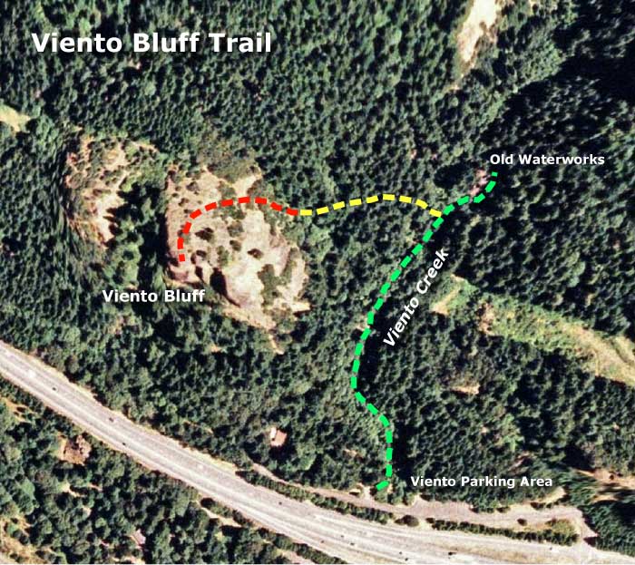
So on my return trip, yesterday, I scouted the east side of the creek, looking for a bushwhack route to the top of bluff. As it turned out, there's a wonderful little trail following the creek, ending at an old waterworks that presumably serviced the campgrounds and private homes that once existed at Viento. This trail is shown in green on the sketch map, below. The yellow route is the bushwhack that I completed yesterday, and the red is the remaining piece to be scouted - more on that point follows.

Image

The orthophoto gives a pretty good sense of the bluff area, but here's what Viento Bluff looks like from below, at the Viento interchange:

Image

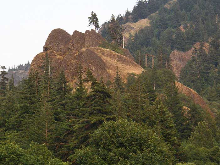
The goal is to reach the backside of these cliffs, which are gently sloped and should be easily ascended... right? :D

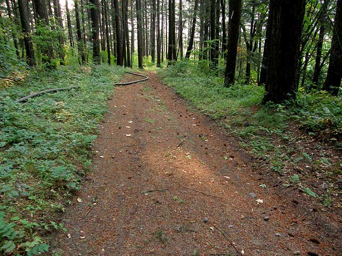
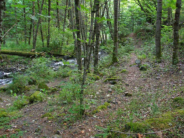
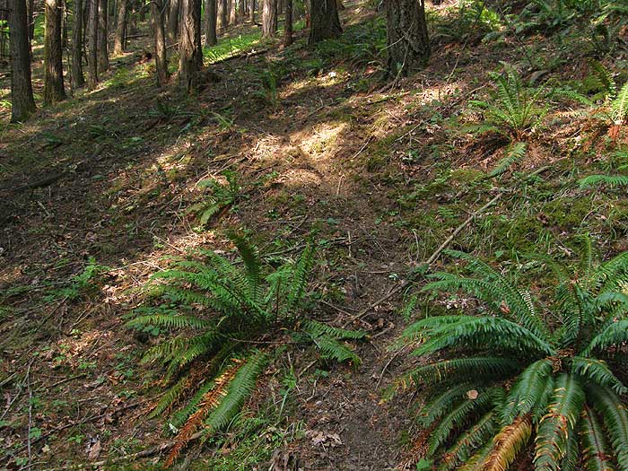
So in scouting toward that goal, here are some photos from my visit yesterday, starting with the surprisingly intact trail that departs the first camping spot in the upper loop:

Image

Another view of the opening stretch of trail, traversing Viento Creek:

Image

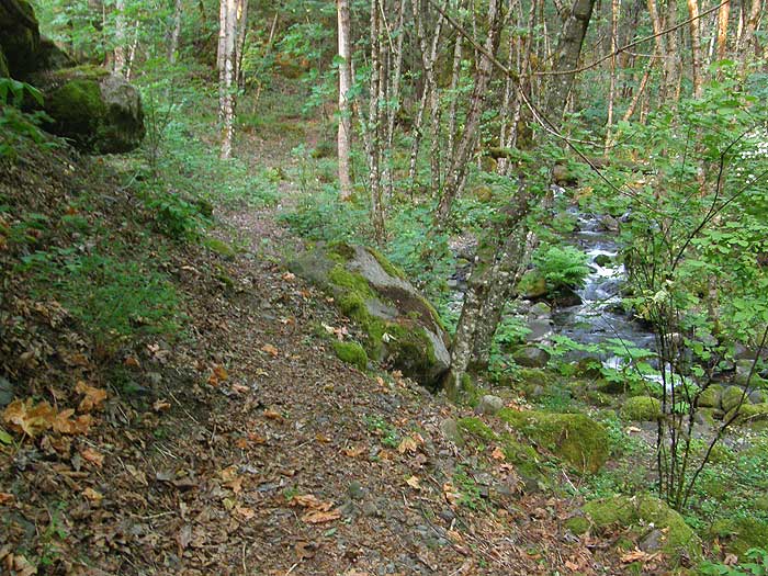
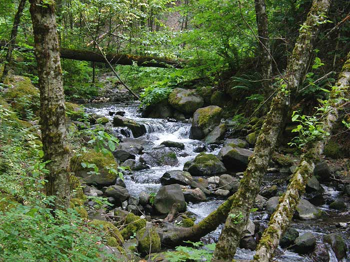
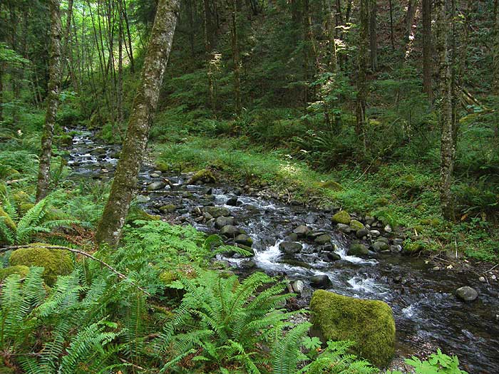
Viento Creek from the lower trail:

Image

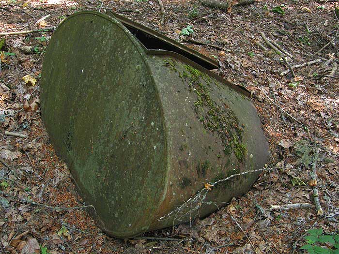
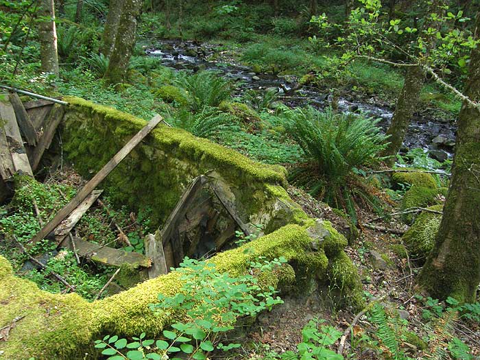
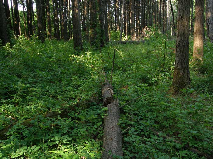
This one is for Don Nelson - the first of several artifacts, melting into the floor of Viento canyon... what is it, Don..?

Image

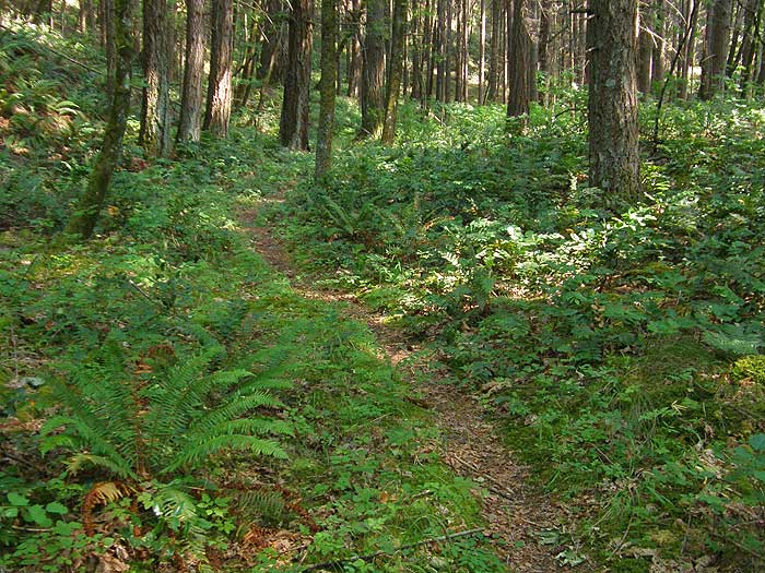
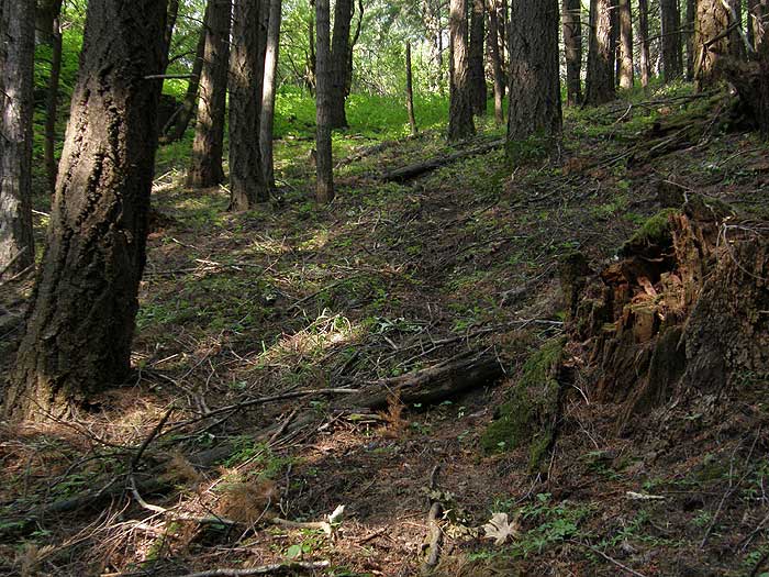
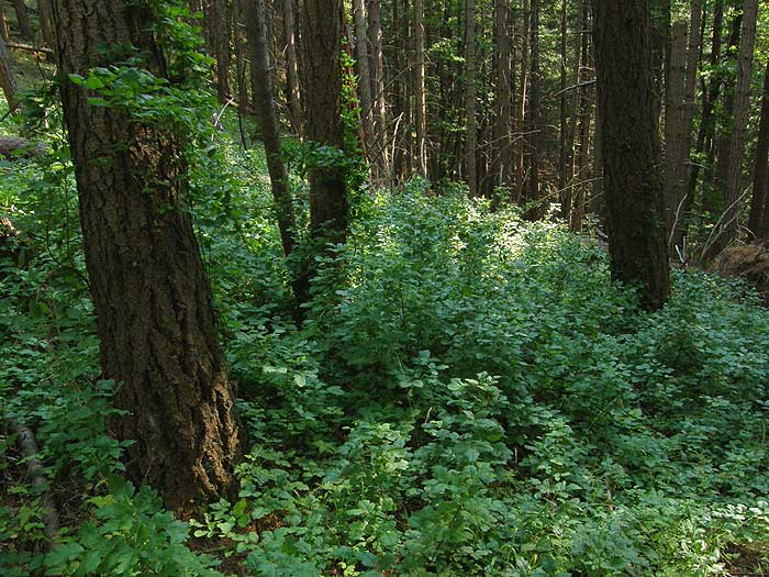
A bit farther on this pleasant path, the route swings away from the creek a bit, through dense Douglas fir stands:

Image

Soon, the trail curves back to the creek, and ends at the ruins of what appears to be some sort of waterworks structure, complete with a mortared river rock foundation:

Image

This section of Viento Creek is particularly attractive, and I'll be bringing back my big camera to give this scene the attention it deserves -- this is also the spot where I nearly stepped on my first Rubber Boa (over in the ID discussion):

Image

At this point, I retraced my steps for a few yards, and began the cross-country portion of the trip shown in yellow, on the map above. Calling this a "bushwhack" would be a stretch - I simply followed these criss-crossing elk trails that climb the slope toward Viento Bluff:

Image

Gee, this is going to be a cakewalk, right? Nope. After an easy climb up the canyon wall, the saddle that connects Viento Bluff and the main Gorge wall came into view... and an ominous band of green between me and the bluff...

Image

As I reached the greenery, my worst suspicions were confirmed: a solid jungle of poison oak! If it's green in this photo, it's poison oak. Lots of it. But sensing that I was within a few hundred yards of open bluff terrain, I pressed on, walking on fallen logs where I could, and simply wading through the stuff where there wasn't an option:

Image

Okay... now I've waded through this stuff far enough to be getting a bit nervous about my 40-year streak of NEVER developing a poison oak rash... then turned around, to see what I'd gotten myself into:

Image

Yikes! Yes, it's all poison oak - including the vines headed up the trees! I'm surrounded! Retreat! Retreat! :shock:

So, that's where my scouting trip stands. The upper section, shown in red on the map, will have to wait until after the poison oak leaves fall (November) or maybe before they re-emerge (next March). Ugh.

I still think this to be a very promising "easy" project for Trailkeepers. The traverse from the creek to the saddle could be designed without a switchback, and the stretch through the poison oak is perfectly manageable, at the right time of year. What I don't know is how the summit of the bluff would work. If it's a nice, flat table - great. But if it's sketchy, then this would best remain a bushwhack. It looks like a powerline maintenance road approaches from the east, and I may explore that at some point.

But I still like the idea of a "kids trail" that has creeks and a nice "summit" destination for those beginning hikers... and lots of Trailkeeers maintenance to keep that itchy stuff away from the footpath..!

Tom (...feeling phantom itches as I type this...) :D

pablo
Posts: 1451
Joined: May 28th, 2008, 10:03 pm

Re: Scouting Viento Creek & Viento Bluff

Post by pablo » July 4th, 2008, 9:18 pm

Tom, really neat scouting expedition and a worthy project. The section of trail along Viento Creek you did looks very nice I wonder how far up it goes. On the '63 MHNF map this trail apparently went all the way up to the headwaters and connected to a road. I passed over it when looking for lost trails in this area as it looked like a nasty creek bushwhack (and probably is) but maybe I'll put this on the list and add Viento Bluff.

Maybe in addition to avoidance you are immune to poison oak, it doesn't seem to bother me.

--Paul
Attachments
VientoCreek.jpg
The #415 Viento Creek trail
The future's uncertain and the end is always near.

User avatar
Splintercat
Posts: 8333
Joined: May 28th, 2008, 10:03 pm
Location: Portland
Contact:

Re: Scouting Viento Creek & Viento Bluff

Post by Splintercat » July 4th, 2008, 10:13 pm

Thanks for the map snippet, Paul - had I seen this before I went up there, I probably would have worked my way up the canyon a bit more. There was a fairly obvious boot path beyond the waterworks, but it was a major drop in condition and level of use from the trail below that point. One cool aspect of the canyon that was evident from that point is that much of the east wall is open or lightly covered with scrub oak savannah. Very pretty, and it looked to continue upstream as far as I could see.

The other interesting bit on your map clip is the trail along the ridgetop between Viento and Starvation canyons. This looks to be a continuation of the road that I had scouted earlier. I stopped when the road turned and began to follow the powerlines in a westward direction. But from your map, it looks like a spur continues on up the ridge. Here's what the lower section of the road looks like - well maintained, and signs of active use, including some sort of water or drainage project in the works (flexible ABS pipe visible in this photo):

Image

I suspect you're right about my poison oak immunity -- I've just never wanted to take it for granted, so I'm very careful. But having spent 40+ years hiking in the Gorge, I think I would have had a reaction by now, if I were susceptible..!

Tom

User avatar
pyles_94
Posts: 1163
Joined: May 28th, 2008, 10:03 pm
Location: Portland Area
Contact:

Re: Scouting Viento Creek & Viento Bluff

Post by pyles_94 » July 5th, 2008, 8:18 pm

do you think there might be any waterfalls in the veinto canyon??
Jamey Pyles

User avatar
Splintercat
Posts: 8333
Joined: May 28th, 2008, 10:03 pm
Location: Portland
Contact:

Re: Scouting Viento Creek & Viento Bluff

Post by Splintercat » July 5th, 2008, 10:07 pm

There's only one way to find out, Jamey! One thing is for sure: it's very steep, and there's lots of basalt poking out in the lower reaches of the canyon. So the chances are good - plus it might be that the old trail exists in some form.

Tom

User avatar
Sore Feet
Posts: 743
Joined: May 28th, 2008, 10:03 pm
Location: Seattle, WA
Contact:

Re: Scouting Viento Creek & Viento Bluff

Post by Sore Feet » July 5th, 2008, 10:20 pm

I have to imagine there are falls on both Viento and Perham Creeks. I'd say best chance for Viento Creek is between the 600 and 750 foot levels, and around the 400 to 600 foot range on Perham Creek (just above where the maps place the footbridge). Casey, Zach...get crackin'. ;)

The C-Ws
Posts: 337
Joined: May 28th, 2008, 10:03 pm
Location: SW Portland
Contact:

Re: Scouting Viento Creek & Viento Bluff

Post by The C-Ws » July 6th, 2008, 5:56 pm

I'll keep Viento Creek in mind. However, I don't think I'll be heading up Perham Creek any time soon, as the Wygant Trail (which accesses the footbridge) is more overgrown with poison oak than any other trail in the gorge that I have ever seen.
Casey

mandrake
Posts: 389
Joined: May 28th, 2008, 10:03 pm
Location: Portland, OR

Re: Scouting Viento Creek & Viento Bluff

Post by mandrake » July 6th, 2008, 6:58 pm

To get up on the Viento crags evading the poison oak, take the access road east (parallels I-84) and follow the road up to the powerline. Hike east and west to the top of both crags; pretty interesting unvisited area. I thrashed up the route your drew in the late fall (the oak wasn't leafed out) and found the easy way down.

User avatar
Splintercat
Posts: 8333
Joined: May 28th, 2008, 10:03 pm
Location: Portland
Contact:

Re: Scouting Viento Creek & Viento Bluff

Post by Splintercat » July 6th, 2008, 11:33 pm

Thanks, Mandrake - and do you mean the access road that is signed "personnel only" or whatever.? The road that continues east from the upper campground (and past the shop building?

Tom

mandrake
Posts: 389
Joined: May 28th, 2008, 10:03 pm
Location: Portland, OR

Re: Scouting Viento Creek & Viento Bluff

Post by mandrake » July 7th, 2008, 8:21 am

Yep, that's the one. Don't recall the sign you mention, but this was a couple years ago.

Post Reply