Extend the 400? + Lindsey Ridge to Wyeth Loop, June 7, 2009

Discussions and Trip Reports for off-trail adventures and rediscovering lost trails
Post Reply
pablo
Posts: 1451
Joined: May 28th, 2008, 10:03 pm

Extend the 400? + Lindsey Ridge to Wyeth Loop, June 7, 2009

Post by pablo » June 7th, 2009, 11:49 pm

Tom posted to this forum a query about a trail trace following the power lines on Shellrock mountain. The meta-purpose was to find some way to extend the 400 eastward from Wyeth to Starvation so I thought I'd go take a look. Another reason for extending the 400 is motivated by another thread where the powers-that-be appear to be enforcing no parking/access restrictions along I-84. Mandrake provided some beta on the power line trail, cautioning readers to avoid certain areas, ladders, cables, exposure, and such stuff - after that, I had to go see these things for myself. I parked at Wyeth and headed up the hill on the trail and when close enough to the power line road (Wyeth trail crosses it) I scrambled up and went the rest of the way on the road in the direction of Shellrock Mtn. Here's a shot looking West on the power line road.

Image

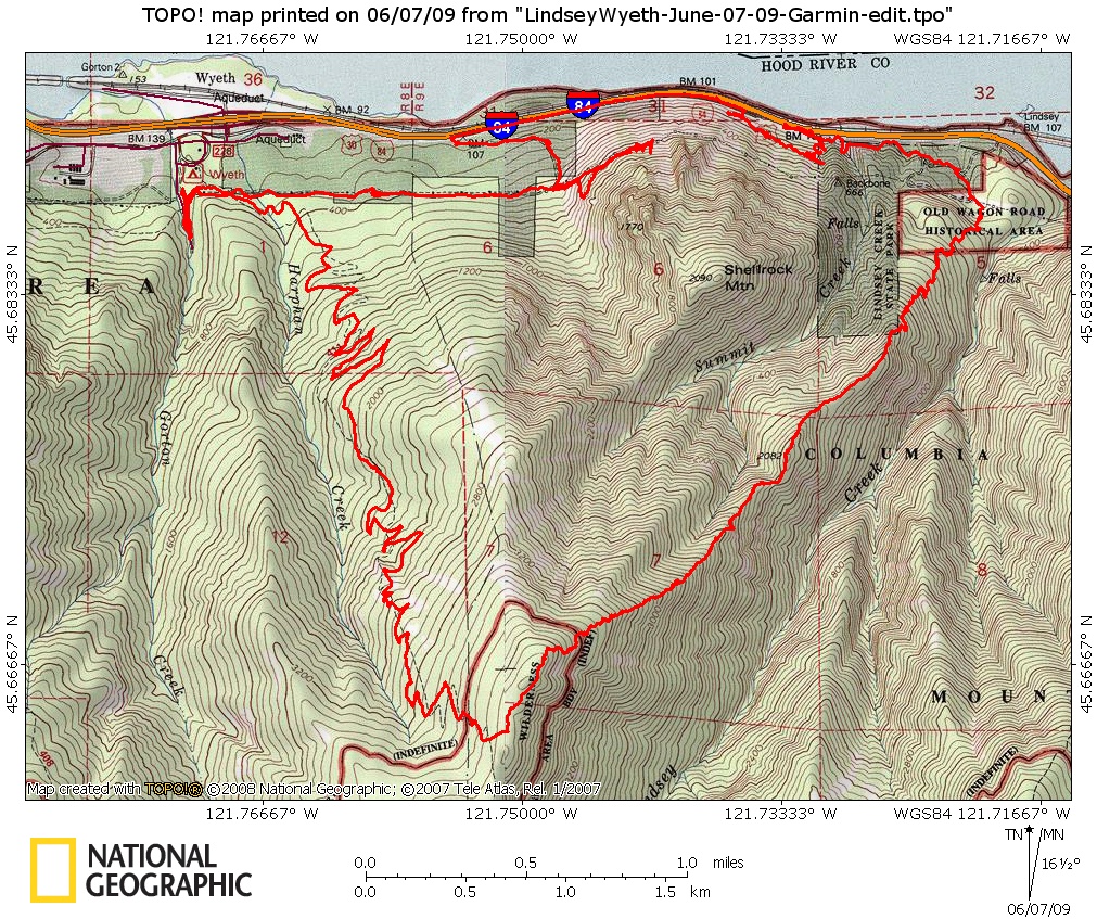
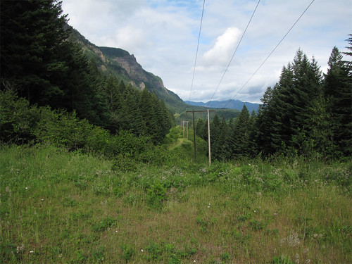
I followed the road to the point where Shellrock Mtn starts, I was expecting a bushwhack at this point but the road ended very nicely right at start of the power line trail. You can see the trail in the center heading up towards the steel towers of the power line.

Image

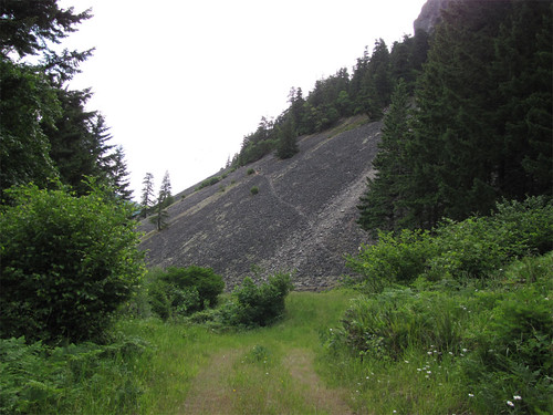
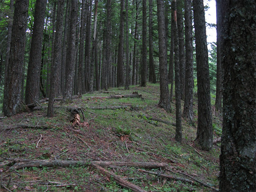
For me, the trail appears to be in fairly good shape as seen here:

Image

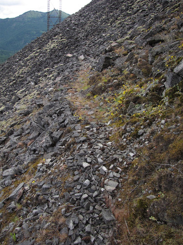
It was easy to follow and I had no problem with loose rock, seems fairly solid.

Unfortunately occupants of the steel towers in this section did not share my enthusiasm for this trail and pretty much wanted me gone. Osprey I believe, nesting, protective, and very upset.

Image

Image

Image

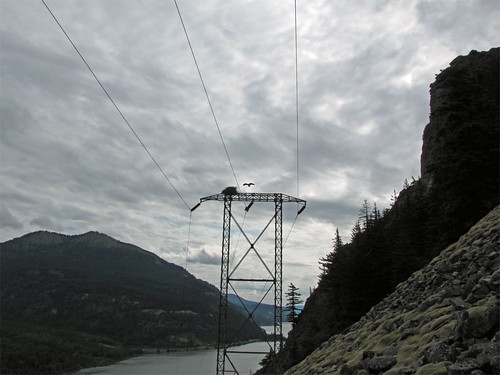
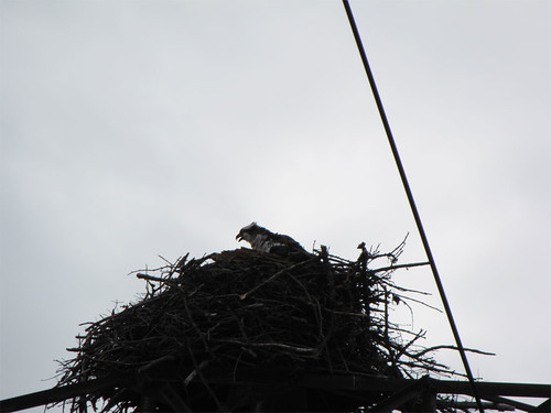
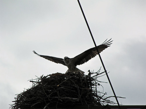
At this point, I bagged the power line trail, if the osprey are going to set up housekeeping on the towers then I'm not going to bother them. I suppose it is a seasonal thing and they will eventually be gone but people should stay away while they are nesting.

I backtracked back down the trail and took the access road to the freeway, on the way I ran across a big mound of chicken wire and parts of a busted up stoneware crock. Who knows what the chicken wire was for - likely the whole thing was an illegal dump.

Image

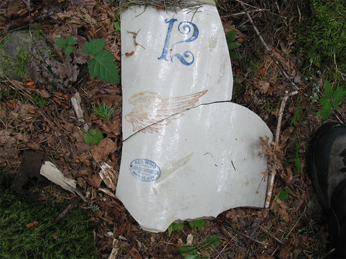
Neat but worthless. I googled the maker and turned up an example that matched the fragments I saw - 12 gallon stoneware crock and if in good shape, worth $125 according to the page.

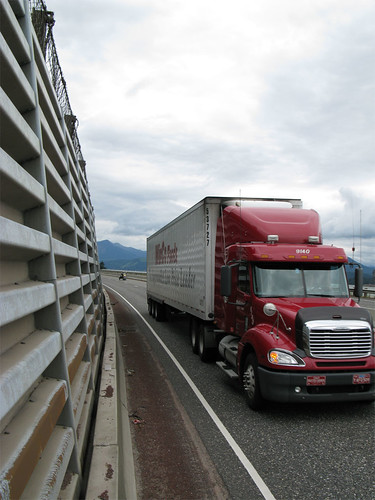
I followed the freeway around Shellrock, pretty unforgiving place to be as there is not a lot of room.

Image

Just beyond the retaining wall I spotted a piece of what I think might be the retaining wall of the old highway, nicely cut stones all arranged.

Image

I looked up from there and saw the road bed for the wagon road so there might be the 400 extension.

Image

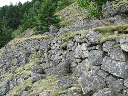
I'm sure there is an access road or path on the top of the section of the new freeway retaining wall I followed around Shellrock, combine that with the wagon road and you are almost there.

I followed the wagon road to the point where the trail up Shellrock begins and went down to the freeway, this time rather than follow the freeway I went on top of the retaining wall - looks like others have done this as there is a trail up a gully (see map below) that puts you on the retaining wall path.

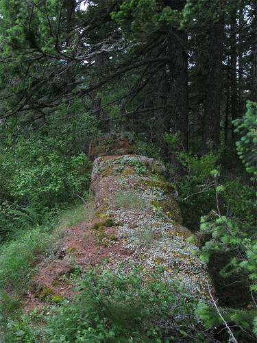
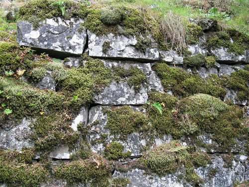
The freeway retaining wall ends at the old highway which I followed to the start of Lindsey ridge, underneath the moss is asphalt, here is a nicely banked corner.

Image

Slowly being reclaimed.

Image

Beyond here, connection with the Defiance Trail is easy as there is a road on the East side of Lindsey Creek and a short access trail connecting to Defiance trail and the trail to the Starvation trailhead. I reported on this a while back but haven't located the TR yet for a link.

I headed up the hill noting that Don Nelson's map, provided in Tom's thread mentioned above is very useful in identifying a road that goes partway up Lindsey Ridge eliminating for the most part a steep bushwhack at the start to get onto the ridge proper.

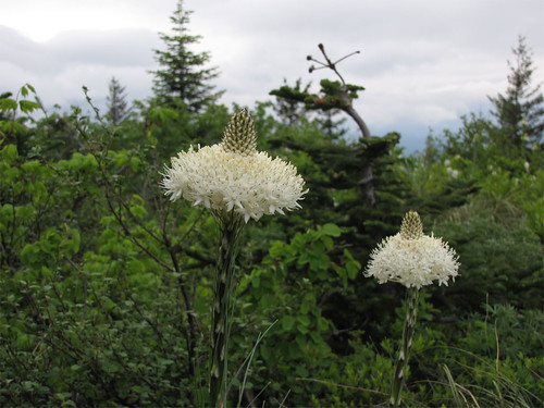
I have a bunch more pictures on the trip up Lindsey Ridge and down Wyeth so maybe I'll update this report later. Bear grass has started to bloom.

Image

~13-14 miles and ~4800 vertical feet cumulative. Geez, someone straighten out Wyeth trail, most of the mileage has to be in those god-awful switchbacks on Wyeth. I much prefer the straight up and down of Lindsey Ridge.

Image
The future's uncertain and the end is always near.

User avatar
chameleon
Posts: 1795
Joined: May 28th, 2008, 10:03 pm
Location: Oregon
Contact:

Re: Extend the 400? + Lindsey Ridge to Wyeth Loop, June 7, 2009

Post by chameleon » June 8th, 2009, 7:42 am

Awesome report! I've been meaning to follow Lindsay ridge up the whole way to descend the stream down. I half suspected the road to follow the ridge proper all the way up, since it switchbacks up and up from the wagon road area (I've followed it for a mile and a half or so). Did you come across any elements of a road once you were following the ridge itself?

And I hear you on the Wyeth trail. That has to be one of the most poorly designed trails I've seen, ridiculously long switchbacks to go an incredibly short distance. I almost prefer just following Harphan creek straight up to taking that trail now. Again, nice report. I look forward to your photos and description of Lindsay ridge!

-Zach

mandrake
Posts: 389
Joined: May 28th, 2008, 10:03 pm
Location: Portland, OR

Re: Extend the 400? + Lindsey Ridge to Wyeth Loop, June 7, 2009

Post by mandrake » June 8th, 2009, 8:23 am

Wow, the freeway hiking there looks pretty dangerous... FYI - you don't have to hike down in the traffic. Previously in coming from Wyeth, I'd skirt Shellrock by descending the mossy talus field at the edge of the forest. You descend to the highway, but one can hike on the south side of the divider all the way over to where you can scramble up to the old wagon road remnants. You'll be out of sight from the cars going by for about 95% of the route; it's easy and probably safer.

User avatar
Guy
Posts: 3333
Joined: May 10th, 2009, 4:42 pm
Location: The Foothills of Mt Hood
Contact:

Re: Extend the 400? + Lindsey Ridge to Wyeth Loop, June 7, 2009

Post by Guy » June 8th, 2009, 7:04 pm

This was a great report, Thanks. I was contemplating that Shellrock trail from the top of Dog Mountain on Sunday morning. It also looked to me that as well as the power line trail, on the north eastern side of the mountain some faint switchbacks (about 4) going up the mountain could be seen. Anyone else notice these? though I could be seeing things!!
hiking log & photos.
Ad monte summa aut mors

pablo
Posts: 1451
Joined: May 28th, 2008, 10:03 pm

Re: Extend the 400? + Lindsey Ridge to Wyeth Loop, June 7, 2009

Post by pablo » June 8th, 2009, 8:47 pm

Last year I did a couple trip reports on Lindsey ridge but they are currently unavailable as they were on the old .com site. The one I really liked doing was ascending on Lindsey Ridge and then descending on the ridge connecting to Shellrock Mtn - vision quest pits with huge views on that one.

Chameleon sez:
Did you come across any elements of a road once you were following the ridge itself?
Don Nelson's map is accurate on the road going up the hill, stops there and little human activity from there on. The forest on the ridge is young, clearly reproduction after a very thorough fire as there are very few standing snags and a fairly clear forest floor for most of the way up the ridge. Towards the top there is a little easy-to-avoid brush and a couple of steep spots, no scrambling required. I would grade Lindsey Ridge as a slightly tougher version of Rudolph Spur.

Here some stuff from the ridge - much of it is as clear as seen here only steeper:

Image

Image

Rock walkway

Image

Big views are sparse along the ridge but at the top is a meadow with views to Defiance, Hood, Silver Star, St.Helens, Adams. The following is from an opening about 1/2 way up.

Image
The future's uncertain and the end is always near.

User avatar
chameleon
Posts: 1795
Joined: May 28th, 2008, 10:03 pm
Location: Oregon
Contact:

Re: Extend the 400? + Lindsey Ridge to Wyeth Loop, June 7, 2009

Post by chameleon » June 8th, 2009, 9:02 pm

Wow, that ridge looks like a joy! I'm definately going to try to get up there soon. Thanks for the pics.
-Zach

User avatar
Splintercat
Posts: 8333
Joined: May 28th, 2008, 10:03 pm
Location: Portland
Contact:

Re: Extend the 400? + Lindsey Ridge to Wyeth Loop, June 7, 2009

Post by Splintercat » June 10th, 2009, 10:22 pm

Thanks, Paul - nice report! Good looking trail, too.

I ran into similar osprey on the Viento Bluffs last year, but went right underneath them, since I'd seen two nests right above busy trail sections a week or two before, on the Starvation Loop. My sense is that they're all squawk and no bite. Plus, there's a nest on a power pole on Marine Drive in the middle of an industrial district... so my assumption is that they're pretty tolerant of humans passing by.

You could always pack a raw salmon to toss in their direction as you pass the nest...

-Tom ;)

Post Reply