The Goat Rocks:
Screen Shot 2015-11-20 at 8.55.39 PM by fluttershyismagic, on Flickr
Screen Shot 2015-11-20 at 8.58.39 PM by fluttershyismagic, on Flickr
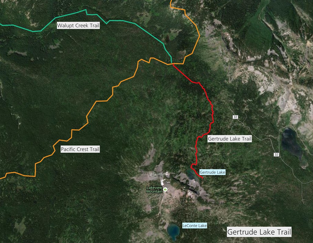
Gertrude Lake Trail
http://gpsfly.org/g/5137
Gertrude Lake Trail, another "lost" trail in the Goat Rocks Wilderness. (Completely within the GPNF.)
Gertrude Lake Trail by fluttershyismagic, on Flickr
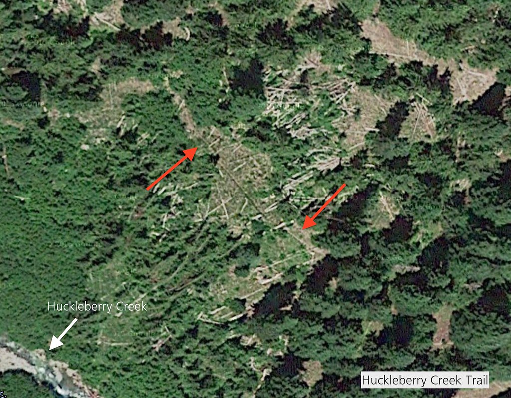
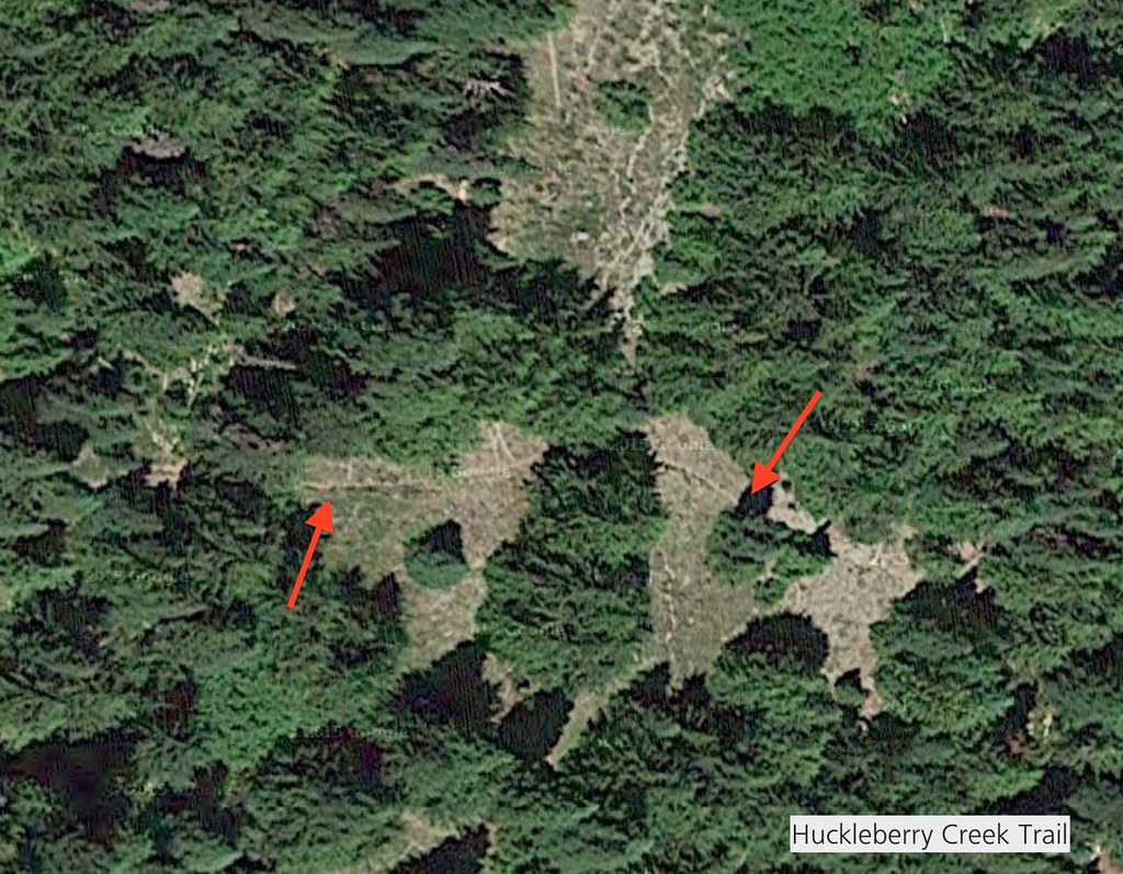
Huckleberry Creek Trail
http://gpsfly.org/g/5138
Huckleberry Creek Trail to the Klickitat River. This abandoned trail traverses Yakima Reservation lands; hiking this trail is not legal. But it is an interesting find, I think. (Track not tested.)
Screen Shot 2015-11-20 at 8.39.35 PM by fluttershyismagic, on Flickr
Screen Shot 2015-11-20 at 8.41.24 PM by fluttershyismagic, on Flickr
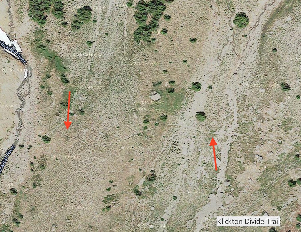
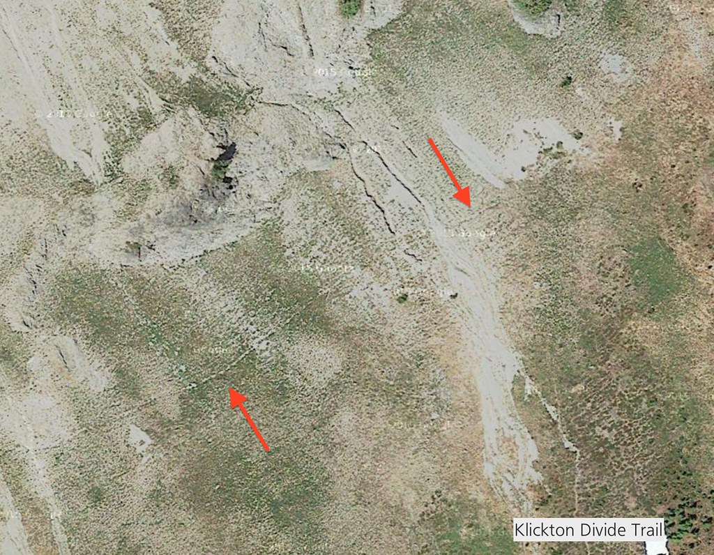
Klickton Divide Trail
http://gpsfly.org/g/5141
Klickton Divide Trail. This is one of the more suspicious lost trails. It may be that the trail is so old that it is deteriorating very badly; or, it is nothing more than pieced-together goat trails. (not a tested track. This trail traverses Yakima Reservation lands; hiking this trail is not legal.) There was a thread about this trail on Oregon Hikers a while back.
Screen Shot 2015-11-20 at 8.37.44 PM by fluttershyismagic, on Flickr
Screen Shot 2015-11-20 at 8.38.12 PM by fluttershyismagic, on Flickr
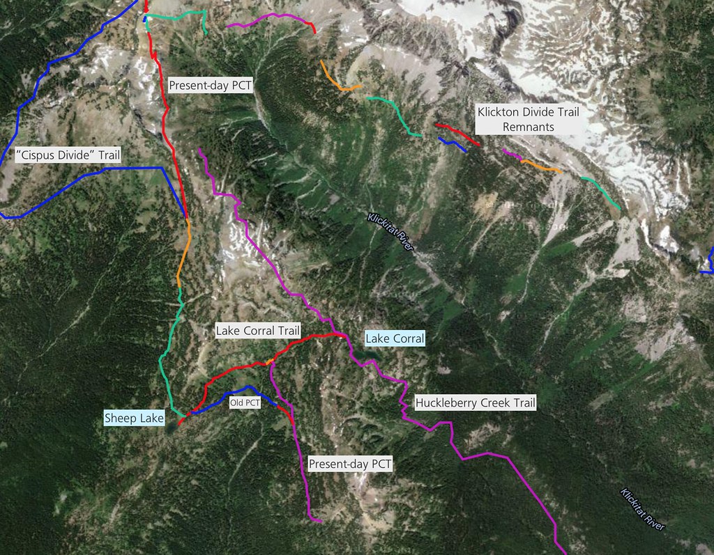
Lake Corral Trail
http://gpsfly.org/g/5142
Lake Corral Trails System. The trail to lake Corral is still pretty visible on the ground. You can see it in Google Maps Satellite view quite clearly.
**Lake Corral is located in Yakima Reservation lands, so camping wouldn't be permitted (enter at your own risk, as it technically isn't permitted to enter the Klickitat Basin unless on the PCT). This isn't a tested GPS track.
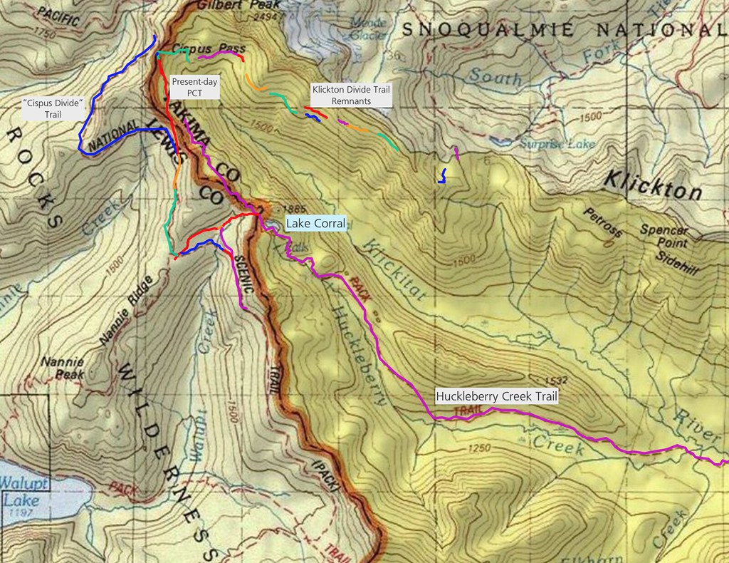
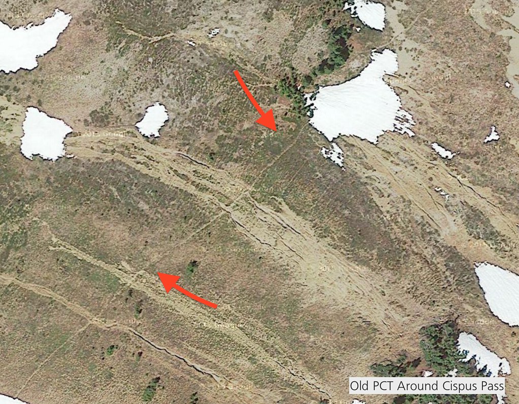
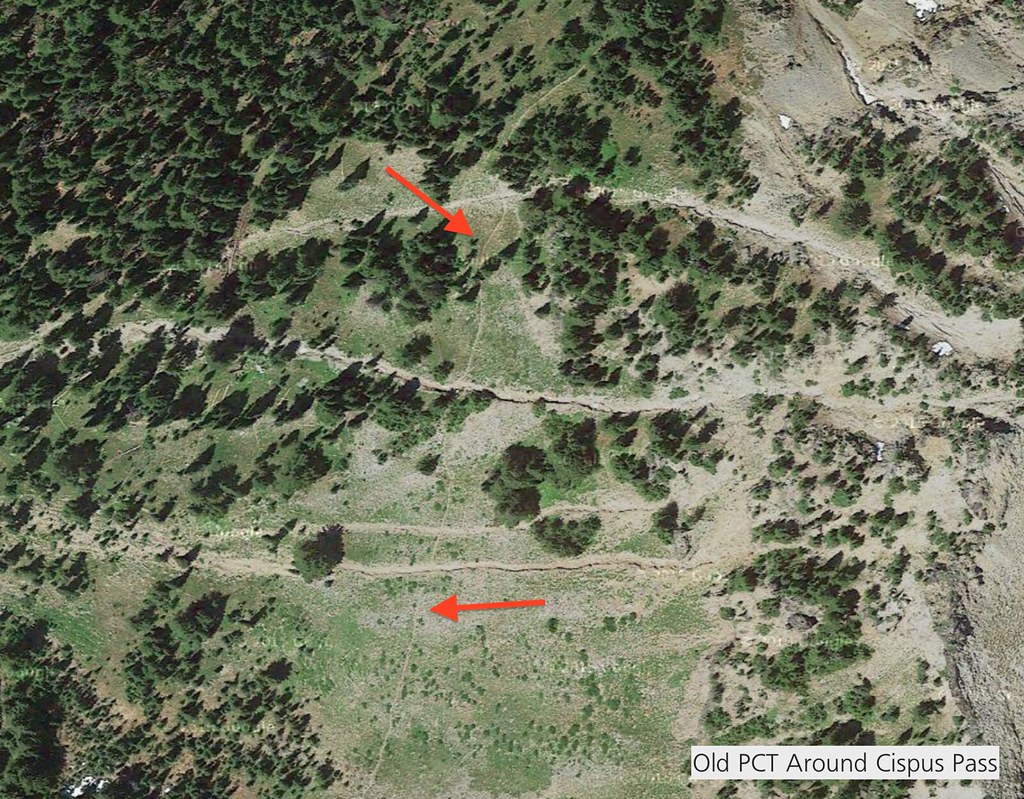
"Cispus Divide" /Old Pacific Crest Trail
http://gpsfly.org/g/5143
Old PCT Route around Cispus Basin, rather than going over it. The tread is very visible on Google Maps Satellite view, and, it shows up on old USGS topo maps as the old PCT. If it is still traversable, it might make a good loop hike.
**Warning: This isn't a tested GPS track! There may be multiple washouts, and, by the looks of it, it probably does.
Screen Shot 2015-11-20 at 8.34.08 PM by fluttershyismagic, on Flickr
Screen Shot 2015-11-20 at 8.34.56 PM by fluttershyismagic, on Flickr
http://gpsfly.org/g/5144
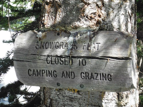
Abandoned Snowgrass Flats Trails -Goat Rocks
**Warning: This isn't a tested GPS track! Hiking on these trails may also be prohibited and bad for the fragile meadows. Many social trails in Snowgrass Flats were closed (especially for camping) because of meadow damage and overuse. But still, it might make for a good shortcut when hiking from Cispus Basin to Goat Lake; it would save a bit of unnecessary elevation gain.