Three Lynx Falls 12/24, Upper Falls 2/1

Re: Three Lynx Falls 12/24
We finally got up to the falls today. It was a little wetter out than it was in town but didn't let that dampen our spirits.  Melinda and I were both really impressed with it. Really neat find Brian...thanks.
-
BrianEdwards

- Posts: 2405
- Joined: February 2nd, 2010, 1:32 am
- Location: Oregon City, OR
- Contact:
Re: Three Lynx Falls 12/24
Cool, Tim.
Now someone needs to document the upper falls. I'm gonna try to tomorrow
Now someone needs to document the upper falls. I'm gonna try to tomorrow
Clackamas River Waterfall Project - 95 Documented, 18 to go.
-
Splintercat

- Posts: 8333
- Joined: May 28th, 2008, 10:03 pm
- Location: Portland
- Contact:
Re: Three Lynx Falls 12/24
Hey Brian - check this out:
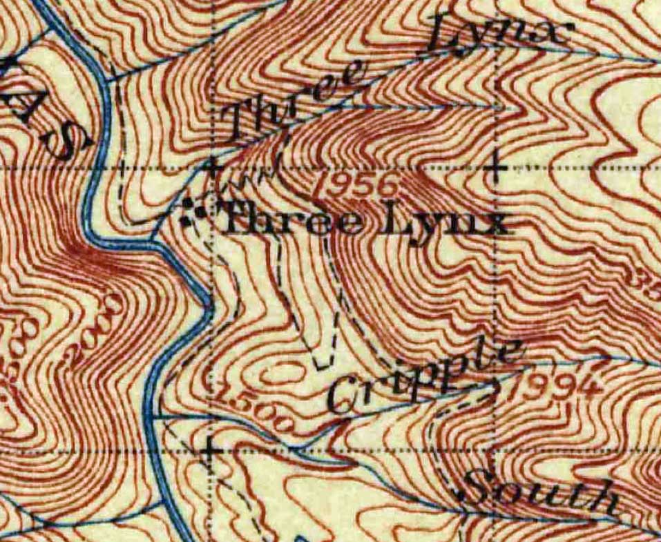
Note the loop trail network between Three Lynx and Cripple Creeks..! If an semblance of this were left, it would sure make for a handy route to the upper falls..! This is from the USGS 1916 historical topo.
Good luck -- looking forward to hearing more about this one!
Tom
Note the loop trail network between Three Lynx and Cripple Creeks..! If an semblance of this were left, it would sure make for a handy route to the upper falls..! This is from the USGS 1916 historical topo.
Good luck -- looking forward to hearing more about this one!
Tom
-
BrianEdwards
- Posts: 2405
- Joined: February 2nd, 2010, 1:32 am
- Location: Oregon City, OR
- Contact:
Re: Three Lynx Falls 12/24
Nice find, Tom! Tomorrow when I'm on that ridge, I will keep an eye out for a trail.
Clackamas River Waterfall Project - 95 Documented, 18 to go.
Re: Three Lynx Falls 12/24
Good luck with the upper falls. I can't wait to see it.
-
BrianEdwards
- Posts: 2405
- Joined: February 2nd, 2010, 1:32 am
- Location: Oregon City, OR
- Contact:
Re: Three Lynx Falls 12/24
Thanks Aaron
Clackamas River Waterfall Project - 95 Documented, 18 to go.
Re: Three Lynx Falls 12/24
My wife and I were the couple that RobfromRedland saw while visiting the lower three Lynxs falls. After we left them we drove a short distance up Pipeline road. There was a car parked at about the elevation of the upper falls. The people in the car appeared to be heading "side hill" toward the upper falls. After looking at a topo, it sure looked like an easier route to the upper falls and there is no crossing private property. Just a thought, as the area does not seem to have as much undergrowth as one would encounter bushwacking from the bottom
Randy
Randy
-
BrianEdwards
- Posts: 2405
- Joined: February 2nd, 2010, 1:32 am
- Location: Oregon City, OR
- Contact:
Re: Three Lynx Falls 12/24
You spurred my interest, Randy. I've been looking at maps tonight to try and find the best route.
Looking at the satellite image below, the purple pin is the closest point that Pipeline Road gets to the upper falls, The red pin is close to the school. You've been on the road to the dam. The dam is the two little white specks just below the lower falls.
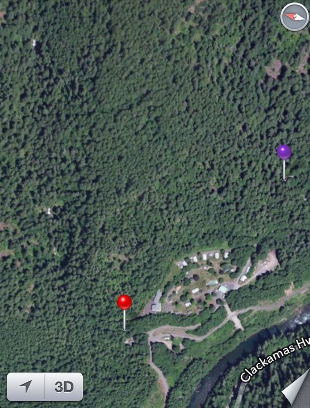
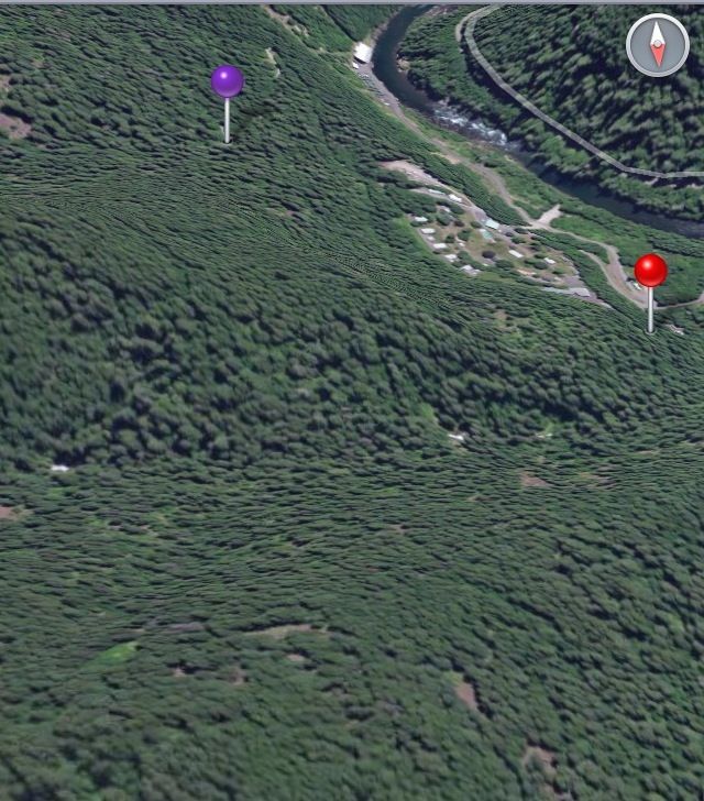
Looks like the shortest distance from a road to the upper falls is from the dam, on up the ridge. I think once you get up out of the spray zone of the lower waterfall, the brush will subside just like the rest of the area. From pipeline road, there appears to be a ridge separating the creek and the road. Here's a 3D view
I wonder if what u guys saw was the Cripple Creek trail..? It takes off westerly side hill before turning east towards Cripple.
Either way, I appreciate ya chiming in. I wonder if the switchback on Pipeline road that I've labeled with a purple pin has any kind of tread or game trail heading west from it. I'd have to assume with the town being established for so long, that there's bound to be some history/stuff on that hill/ridge right above town. Tom's map shows a potential trail.
So much to investigate...
Looking at the satellite image below, the purple pin is the closest point that Pipeline Road gets to the upper falls, The red pin is close to the school. You've been on the road to the dam. The dam is the two little white specks just below the lower falls.
Looks like the shortest distance from a road to the upper falls is from the dam, on up the ridge. I think once you get up out of the spray zone of the lower waterfall, the brush will subside just like the rest of the area. From pipeline road, there appears to be a ridge separating the creek and the road. Here's a 3D view
I wonder if what u guys saw was the Cripple Creek trail..? It takes off westerly side hill before turning east towards Cripple.
Either way, I appreciate ya chiming in. I wonder if the switchback on Pipeline road that I've labeled with a purple pin has any kind of tread or game trail heading west from it. I'd have to assume with the town being established for so long, that there's bound to be some history/stuff on that hill/ridge right above town. Tom's map shows a potential trail.
So much to investigate...
Clackamas River Waterfall Project - 95 Documented, 18 to go.
-
BrianEdwards
- Posts: 2405
- Joined: February 2nd, 2010, 1:32 am
- Location: Oregon City, OR
- Contact:
Re: Three Lynx Falls 12/24, Upper Falls 2/1
As promised, I had some waterfalls to check out up the Clackamas River today.
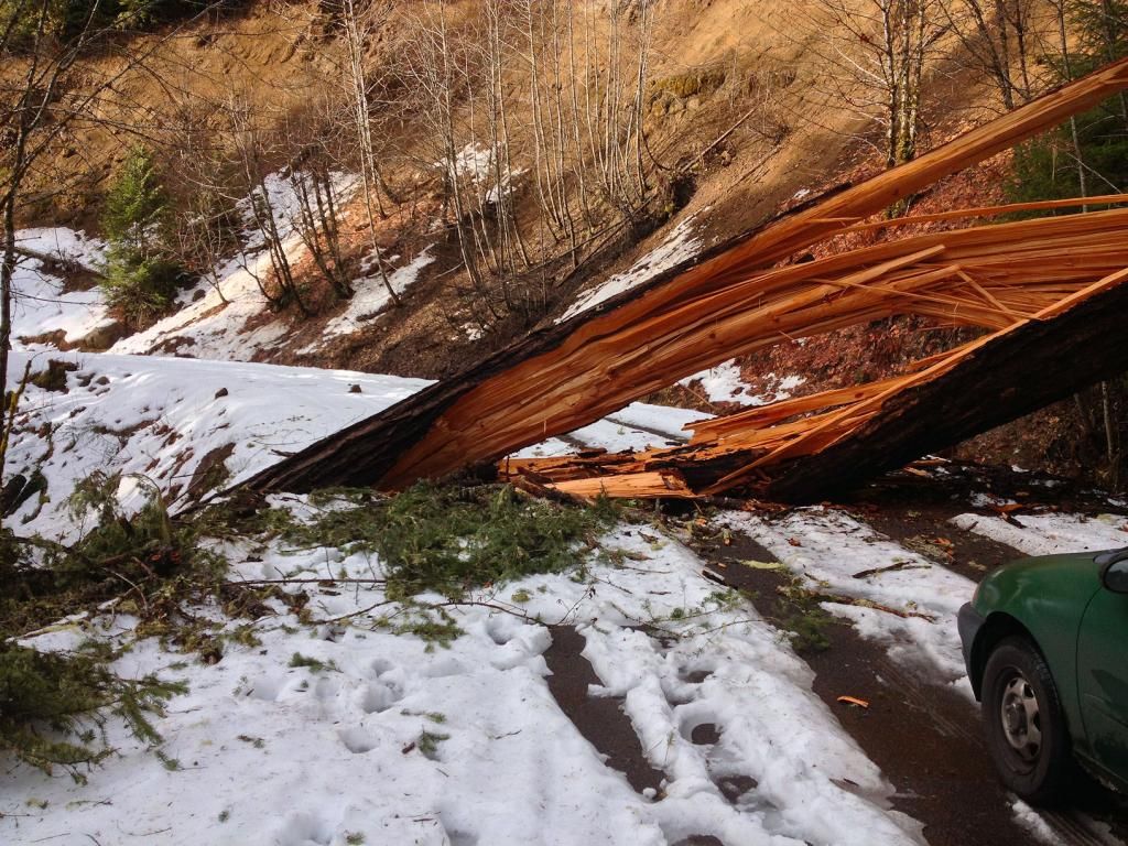
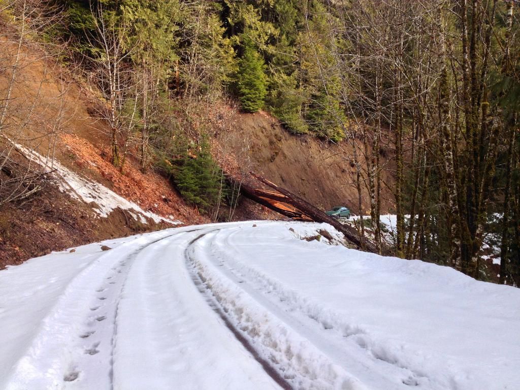
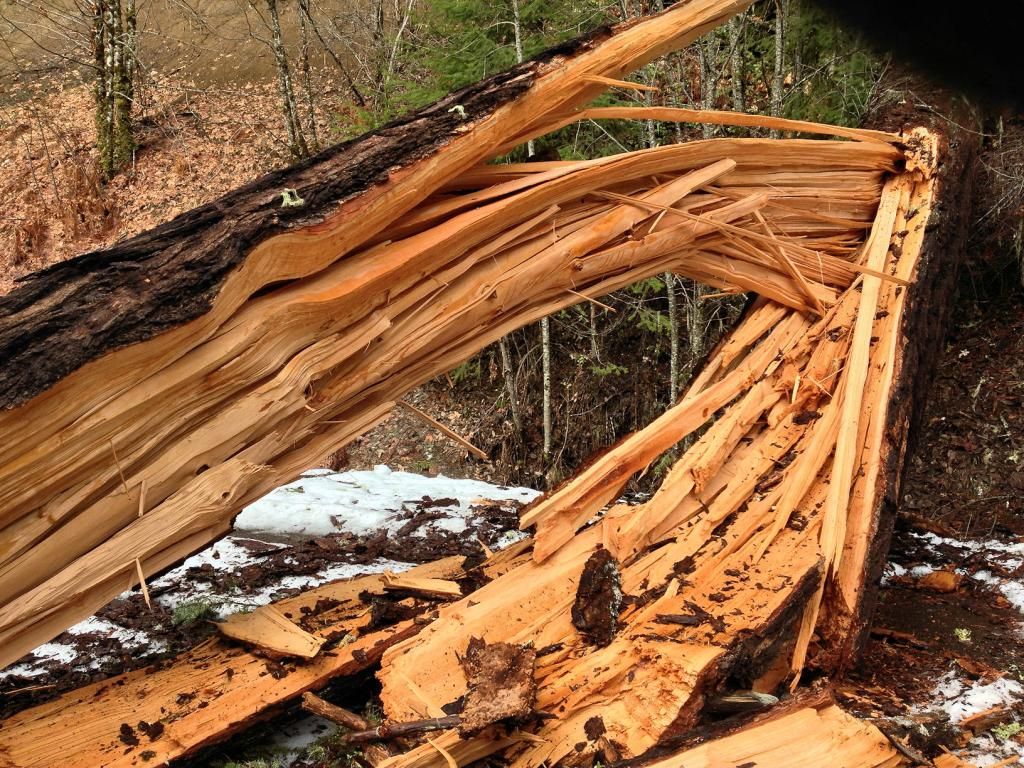
The plan was to start on Sandstone Creek and hit two falls on the eastern branch that I missed last time I was there. All was going well til I found this:
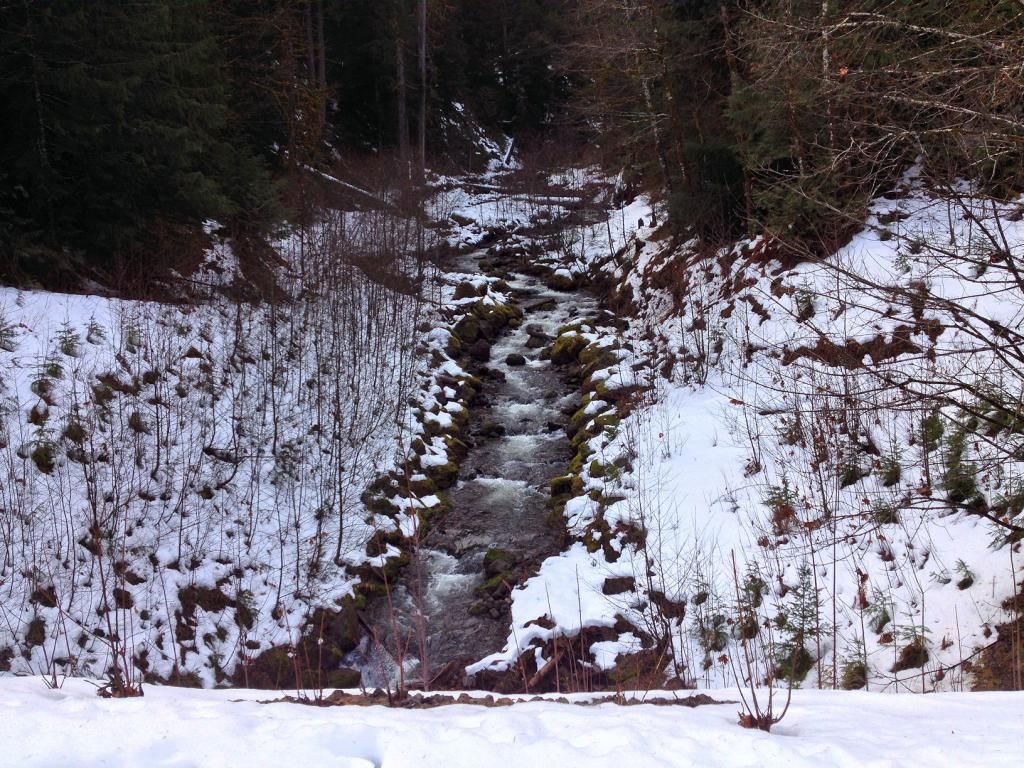
Sandstone Creek was just around the corner, so I struck out on foot up the road. I soon was at the creek crossing.
looking upstream from the road
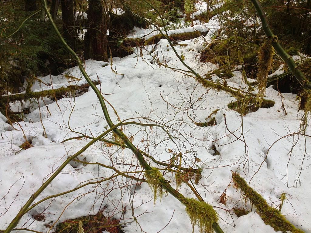
I took the same route up the creek as I did last time, but 15 minutes into the 'schwack, it was becoming obvious that the snow was getting too deep for travel. Having snow on a trail is one thing. But when it comes to bushwacking, it doesn't take much snow to make things very difficult. After stepping into several holes between logs that were covered in snow and sinking to my waist, I decided to bail. I had a long way to go, and more elevation to gain.
Walking back to the car
Tree
Next up was upper Three Lynx Creek. On my way there, I'm 99% positive I passed NWTrailApe brushing out the connector trail to the 715 from hwy 224. Was that you Will that I seen with a blue car and an orange vest on?
I parked at the school and headed up the scenic road towards lower Three Lynx Falls. I'm beginning to wonder if any of the town residence are wondering what all this new attention is in there town. I decided that if I did make it to the upper falls, that I most likely wont be returning there anytime soon. Being that these waterfalls are part of their drinking water source, I'd have to think that they'd like folks to stay out of the creek drainage.
Regardless, I neared the dam and big falls, and headed up the ridge. The thickest brush in the whole area is right above the dam in the spray zone of the big falls. Once I got up 80+ feet, the brush thinned considerably.
I came across a grade of some sort.
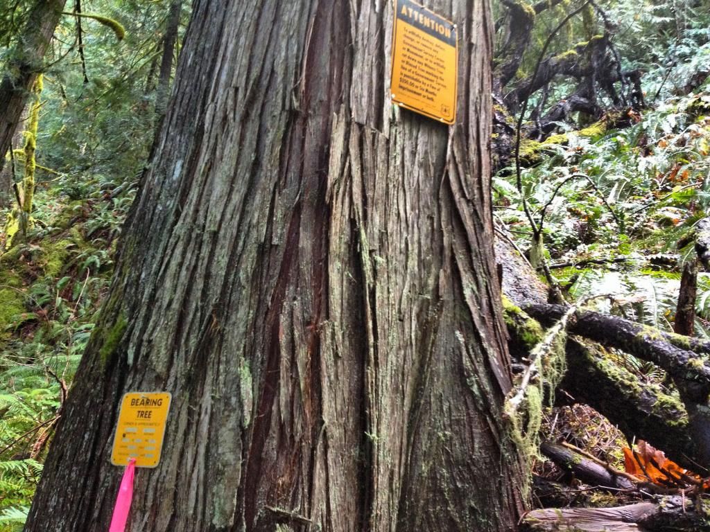
I stumbled onto two geologic corner/surveys by the big falls
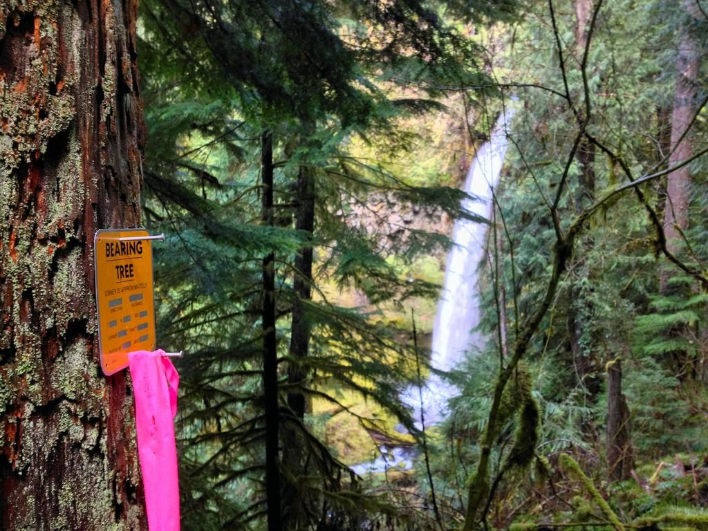
closer
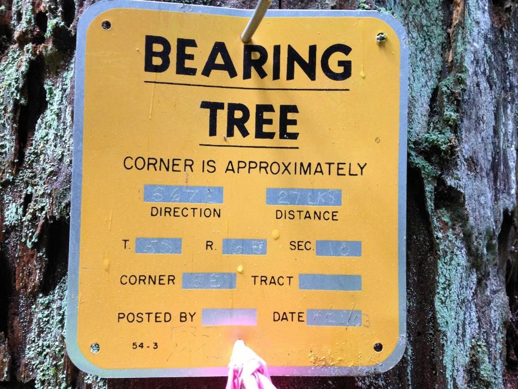
Uphill there was another one:
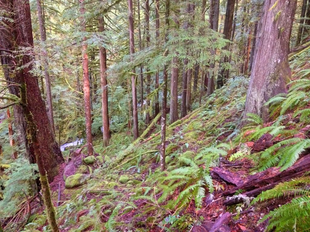
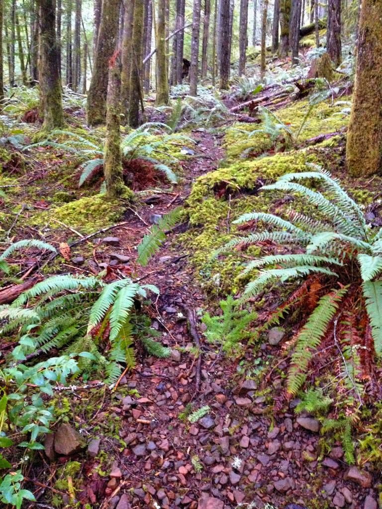
Getting above the amphitheater of the big falls was alot of effort. Its atleast 200' of elevation to get above the cliff on the east side. When I was finally able to move upstream, I was higher above the lower falls then they are tall. But because of the gain in elevation, I was able to head straight towards the upper falls on the ridge.
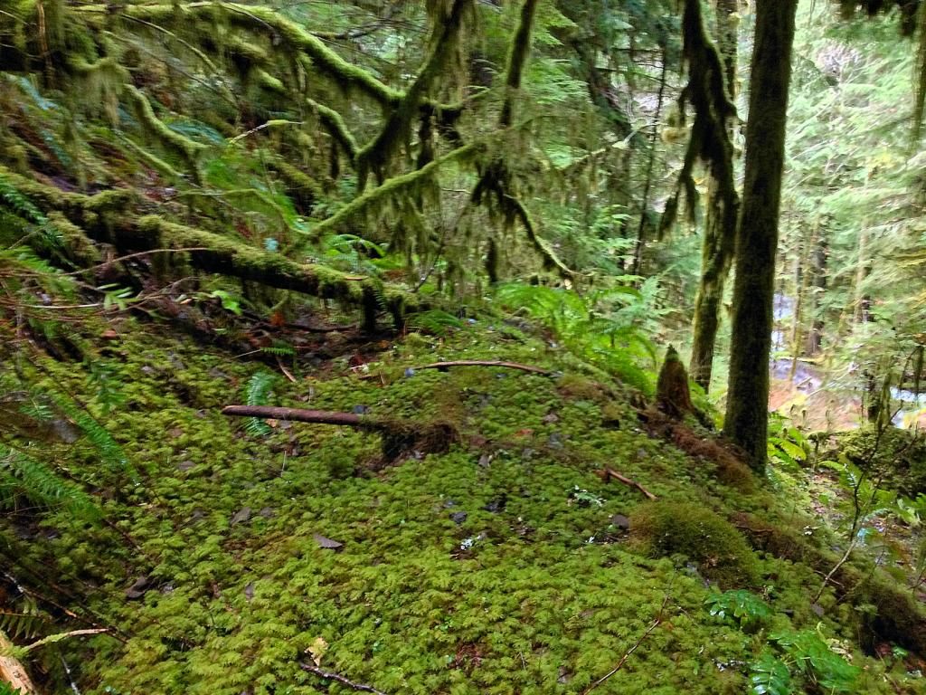
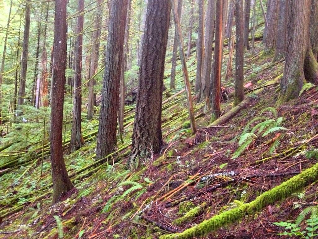
The forest in this drainage has never been logged. Its as good as any I've ever hiked in up the Clackamas.
More
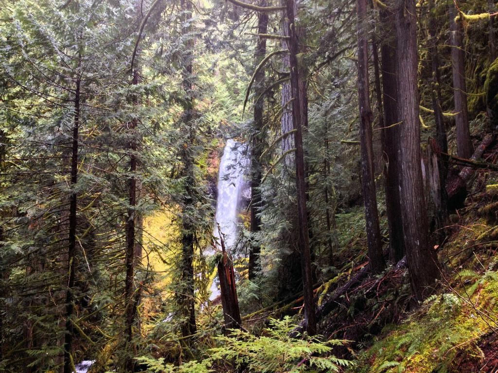
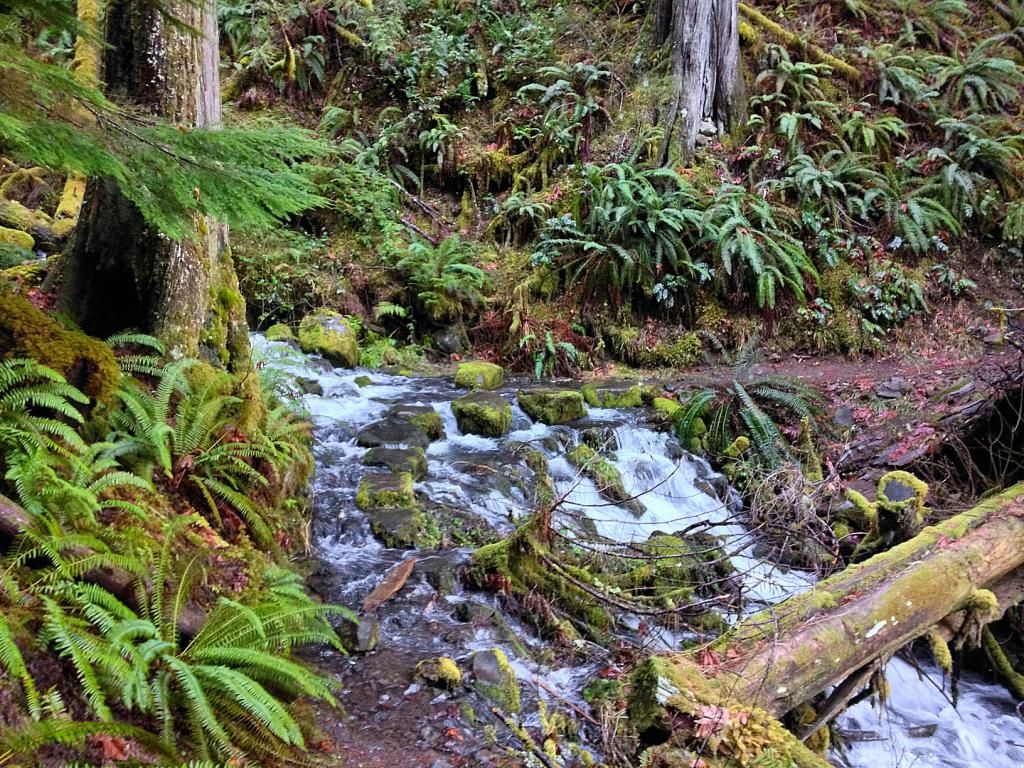
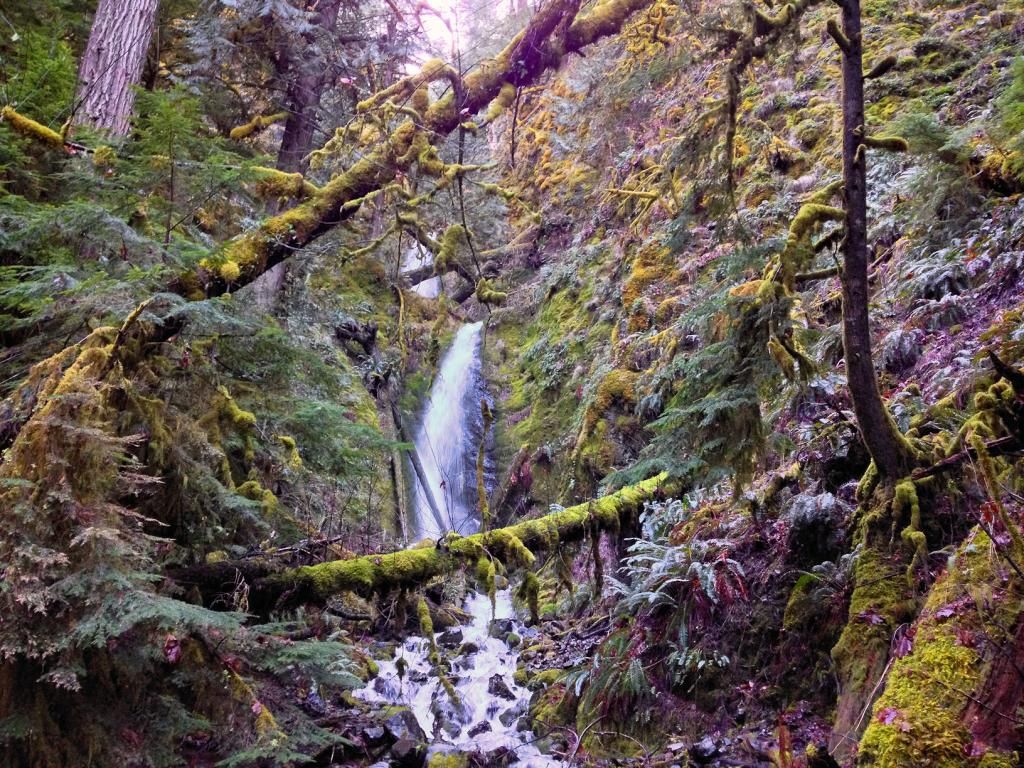
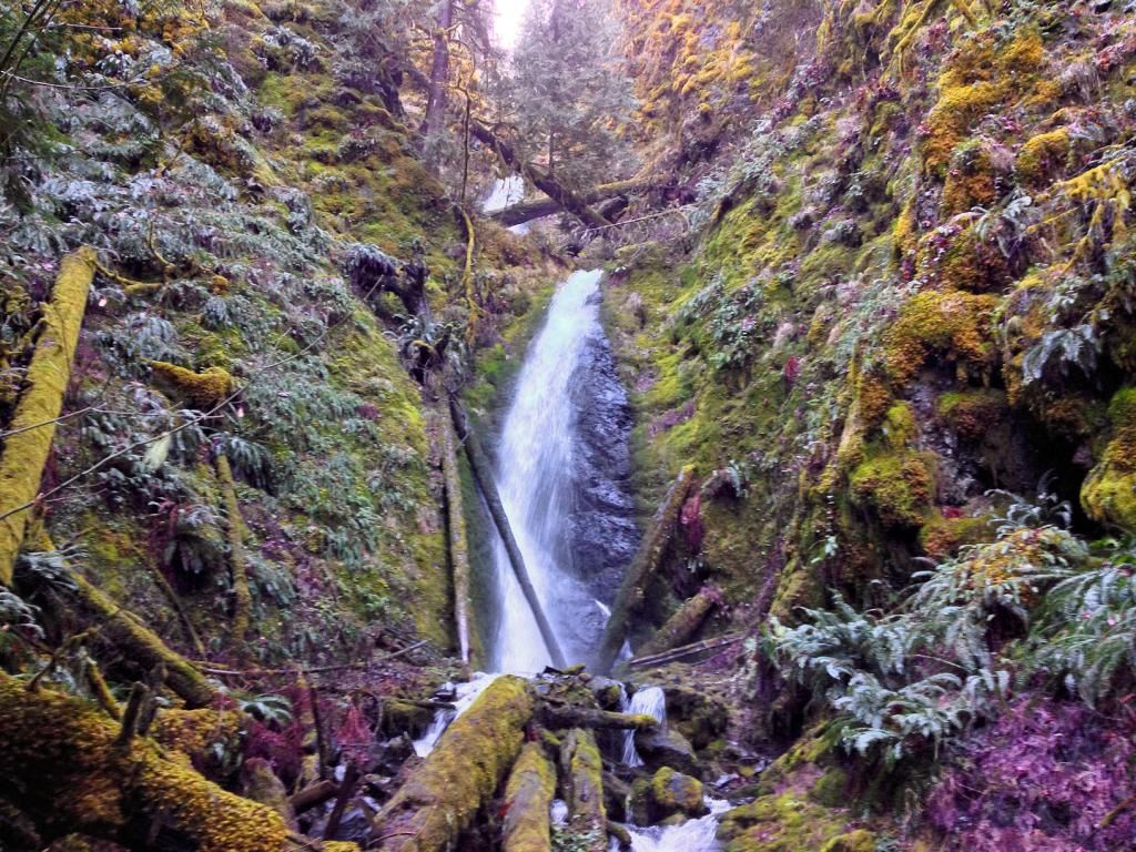
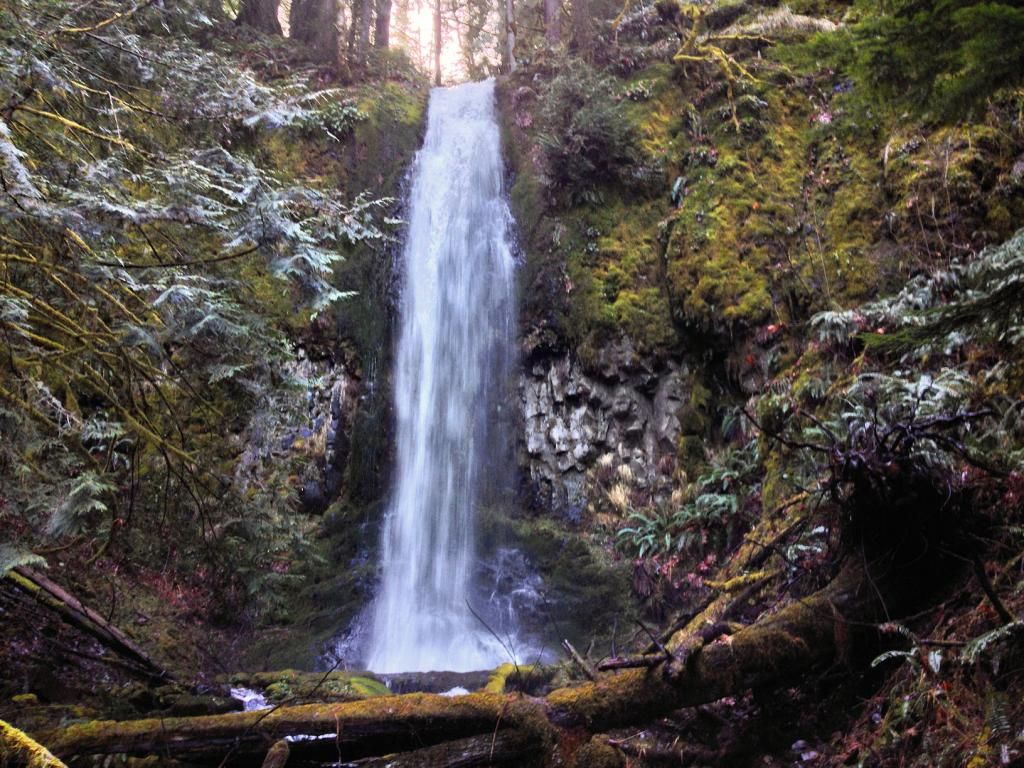
After another 15 or so minutes of trudging up the creek, I spied falling water, sweet!
Here's my first good view
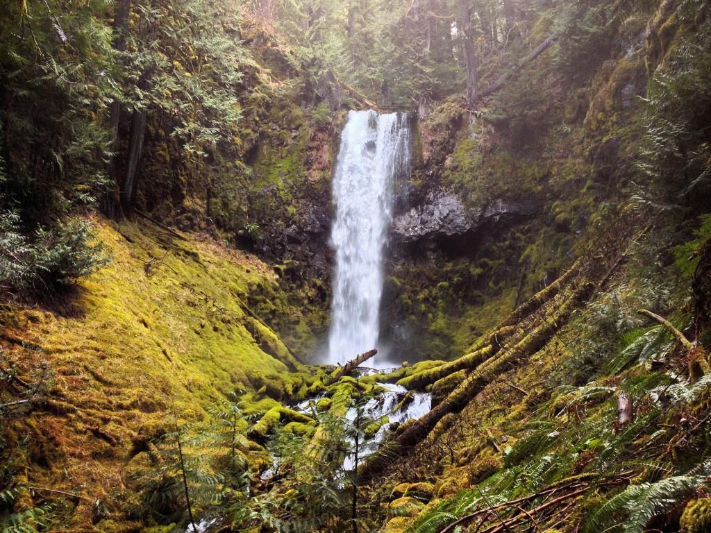
Down by the water I got a nice view. I'd guess it in the 60' range. The creek was very high today with all the melting snow up the hill. I stayed atleast 20' away, as to not disturb anything by the creek
Another
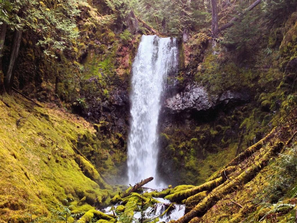
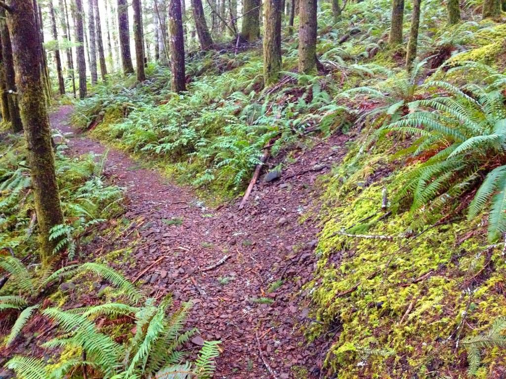
Nice waterfall. Just sux a little that it's on the creek that it's on. Soon I headed down. I decided to stay on the ridge all the way to the school and try to locate any sign of Splintercat's trail.
Alot of the ridge was a breeze to walk on:
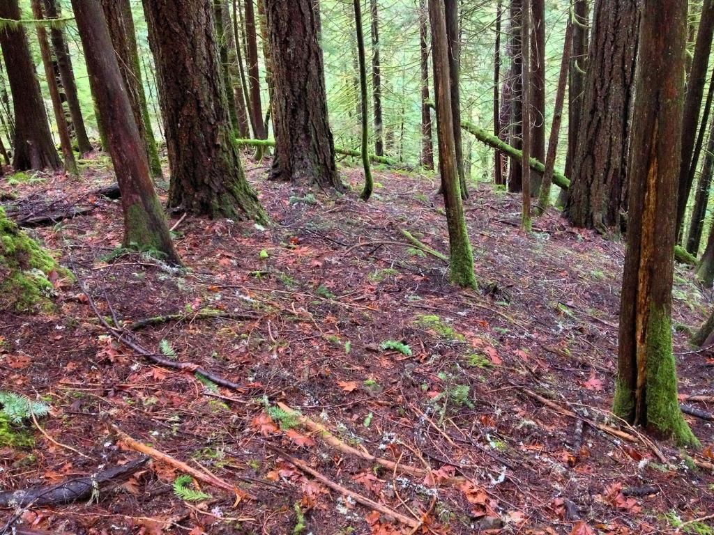
I weaved back and fourth, looking for tread or blazes, or flagging. But alas, I never seen anything convincing.
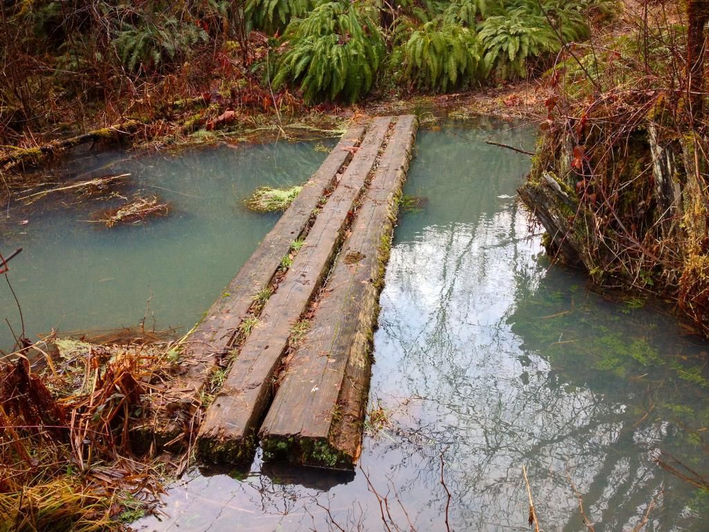
Once back at the car, I headed to the Narrows on the Clackamas River. The log stretched across the river I've used a as a bridge before. That was the plan today.
The trail was in nice shape, but under the second powerline clearing, the trail is completely submerged underwater for a long ways. Someday this should be re-routed 100 feet inland to higher ground.
Mr Shaw's floating dock was floating nicely, and held me just fine.
Raging Pup Creek
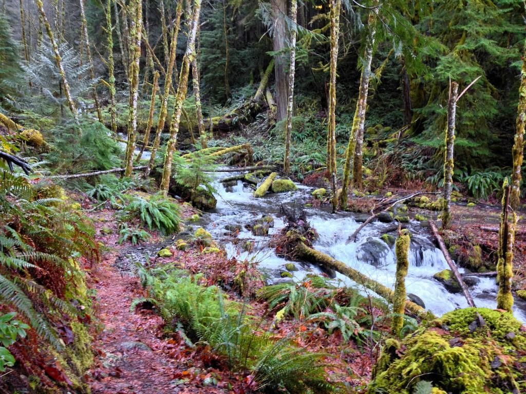
Steppingstone Creek
I headed further down the trail to get to the double falls, then I'd work my way back.
Upon reaching the double falls, there was a use trail that led right to the base
closer
Now I headed to Steppingstone Creek. About 500 ft west of the steppingstones, I found Tom's trail. Its the trail taking off to the right.
Trail
I took it to its end. From the end of the user trail, it became obvious real quick that the rest of the way to the falls was gonna be sketchy. Without blasting into the rock wall and sawing through several huge logs, I can't imagine being able to extend the trail to the falls. Plus, its quite a bit of elevation gain up to it. If anything, clear a log or two from double falls, which is much taller then Steppingstone creek and closer to the Fish Creek Trailhead for another waterfall spur.
Eventually I made it to Steppingstone Falls. Around 50 feet in height.
Getting up to these falls was one of the more difficult short bushwacks I've had to do up in the Clackamas. Atleast you can see half of it from the trail.
From here, I headed back to the Narrows, crossed the log in the now 50 degree sun, and headed for home.
Thanks for Looking
The plan was to start on Sandstone Creek and hit two falls on the eastern branch that I missed last time I was there. All was going well til I found this:
Sandstone Creek was just around the corner, so I struck out on foot up the road. I soon was at the creek crossing.
looking upstream from the road
I took the same route up the creek as I did last time, but 15 minutes into the 'schwack, it was becoming obvious that the snow was getting too deep for travel. Having snow on a trail is one thing. But when it comes to bushwacking, it doesn't take much snow to make things very difficult. After stepping into several holes between logs that were covered in snow and sinking to my waist, I decided to bail. I had a long way to go, and more elevation to gain.
Walking back to the car
Tree
Next up was upper Three Lynx Creek. On my way there, I'm 99% positive I passed NWTrailApe brushing out the connector trail to the 715 from hwy 224. Was that you Will that I seen with a blue car and an orange vest on?
I parked at the school and headed up the scenic road towards lower Three Lynx Falls. I'm beginning to wonder if any of the town residence are wondering what all this new attention is in there town. I decided that if I did make it to the upper falls, that I most likely wont be returning there anytime soon. Being that these waterfalls are part of their drinking water source, I'd have to think that they'd like folks to stay out of the creek drainage.
Regardless, I neared the dam and big falls, and headed up the ridge. The thickest brush in the whole area is right above the dam in the spray zone of the big falls. Once I got up 80+ feet, the brush thinned considerably.
I came across a grade of some sort.
I stumbled onto two geologic corner/surveys by the big falls
closer
Uphill there was another one:
Getting above the amphitheater of the big falls was alot of effort. Its atleast 200' of elevation to get above the cliff on the east side. When I was finally able to move upstream, I was higher above the lower falls then they are tall. But because of the gain in elevation, I was able to head straight towards the upper falls on the ridge.
The forest in this drainage has never been logged. Its as good as any I've ever hiked in up the Clackamas.
More
After another 15 or so minutes of trudging up the creek, I spied falling water, sweet!
Here's my first good view
Down by the water I got a nice view. I'd guess it in the 60' range. The creek was very high today with all the melting snow up the hill. I stayed atleast 20' away, as to not disturb anything by the creek
Another
Nice waterfall. Just sux a little that it's on the creek that it's on. Soon I headed down. I decided to stay on the ridge all the way to the school and try to locate any sign of Splintercat's trail.
Alot of the ridge was a breeze to walk on:
I weaved back and fourth, looking for tread or blazes, or flagging. But alas, I never seen anything convincing.
Once back at the car, I headed to the Narrows on the Clackamas River. The log stretched across the river I've used a as a bridge before. That was the plan today.
The trail was in nice shape, but under the second powerline clearing, the trail is completely submerged underwater for a long ways. Someday this should be re-routed 100 feet inland to higher ground.
Mr Shaw's floating dock was floating nicely, and held me just fine.
Raging Pup Creek
Steppingstone Creek
I headed further down the trail to get to the double falls, then I'd work my way back.
Upon reaching the double falls, there was a use trail that led right to the base
closer
Now I headed to Steppingstone Creek. About 500 ft west of the steppingstones, I found Tom's trail. Its the trail taking off to the right.
Trail
I took it to its end. From the end of the user trail, it became obvious real quick that the rest of the way to the falls was gonna be sketchy. Without blasting into the rock wall and sawing through several huge logs, I can't imagine being able to extend the trail to the falls. Plus, its quite a bit of elevation gain up to it. If anything, clear a log or two from double falls, which is much taller then Steppingstone creek and closer to the Fish Creek Trailhead for another waterfall spur.
Eventually I made it to Steppingstone Falls. Around 50 feet in height.
Getting up to these falls was one of the more difficult short bushwacks I've had to do up in the Clackamas. Atleast you can see half of it from the trail.
From here, I headed back to the Narrows, crossed the log in the now 50 degree sun, and headed for home.
Thanks for Looking
Last edited by BrianEdwards on February 4th, 2013, 3:24 pm, edited 2 times in total.
Clackamas River Waterfall Project - 95 Documented, 18 to go.
-
forestkeeper
- Posts: 1291
- Joined: July 23rd, 2011, 8:31 pm
- Location: Canby, Oregon
- Contact: