Mt Defiance Explorations - June 3, 2012
Posted: June 4th, 2012, 9:20 pm
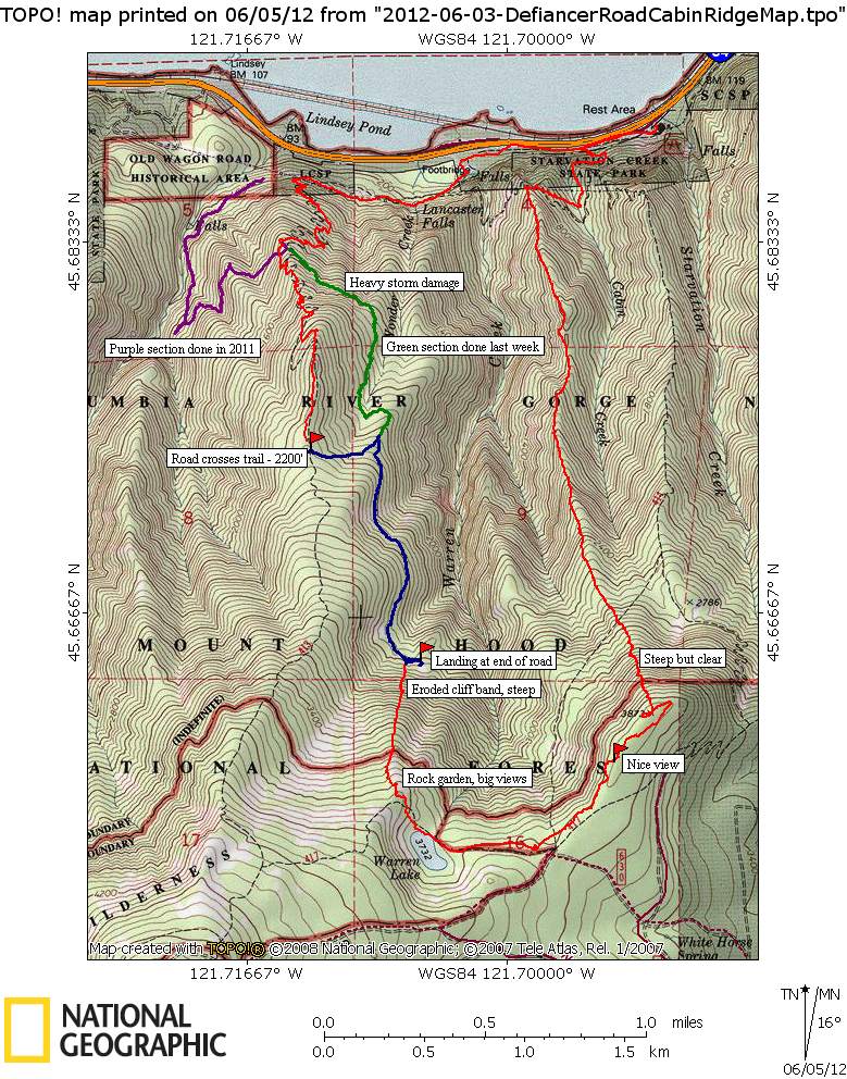
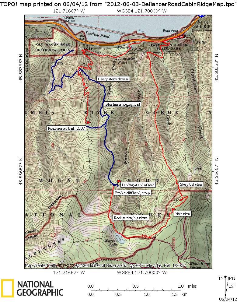
A couple of goals for this and a previous outing, one to finish out the route up Cabin Creek Ridge to Warren Lake, the other was to follow the logging road that crosses Defiance Trail at 1300'. On the logging road I knew it ended in a clearing due north of Warren Lake based on the DOGAMI LIDAR viewer so the plan was to drop down the little ridge west of Warren Lake to catch the road for the return to Defiance Trail. The previous week I explored the logging road going east but did not get to the end - that part of the road is in the blast zone and covered with the same stuff that clogged up Defiance Trail. I did follow a branch of the road up to where it crosses Defiance Trail again at the 2200' level - that was a bit of a surprise but at least I know now how they got the logs out of that upper piece.
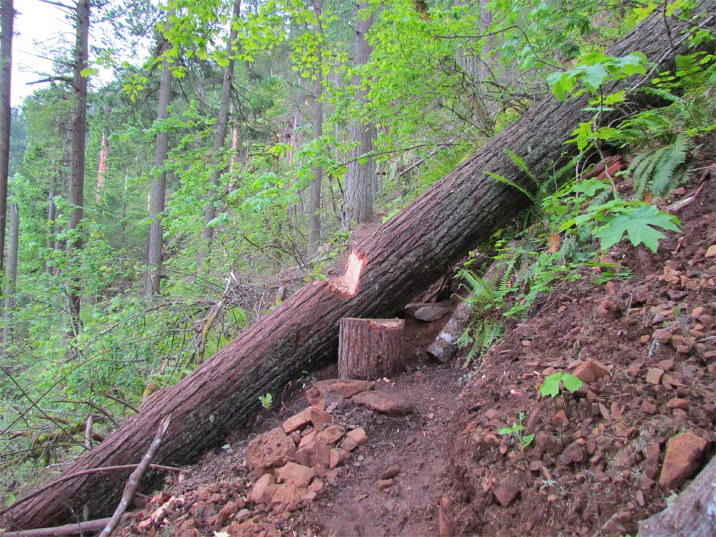
So Sunday I finished my exploration of Cabin Creek Ridge by continuing on up the hill to the plateau above Warren Lake. Very nice off-trail route the entire distance. I looked for the elusive trail found on the USGS TOPO as I made my way up the hill but saw nothing but deceptively nice game trail. I'm very skeptical and would need something like a 3' bench, blazed trees, and maybe a sign or 2 to convince me there was ever any trail through here.
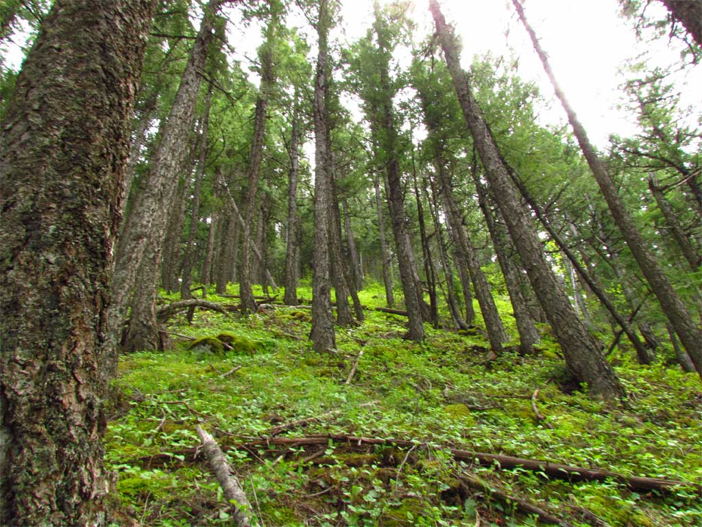
Cabin Creek Ridge is a wonderful place:
Off to Dog:
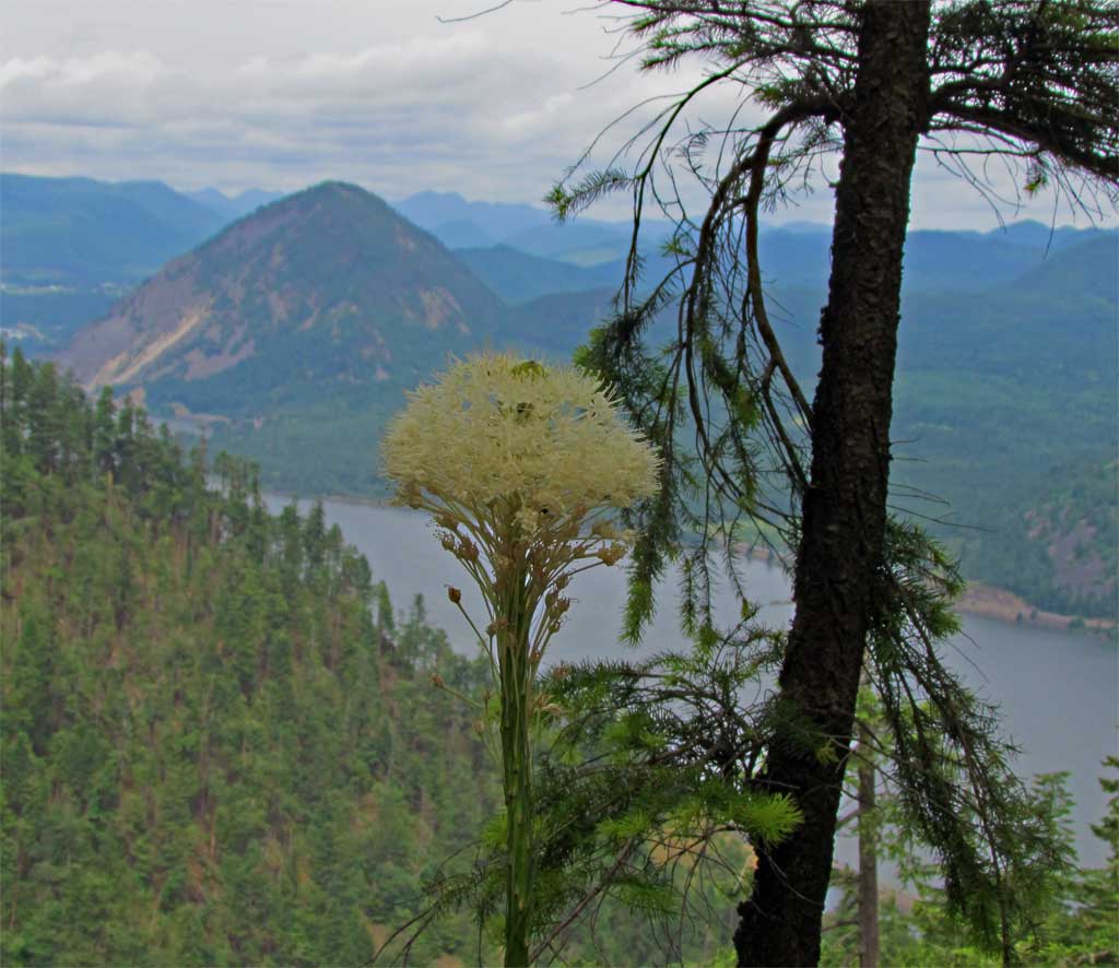
Saw my first beargrass bloom of the season:
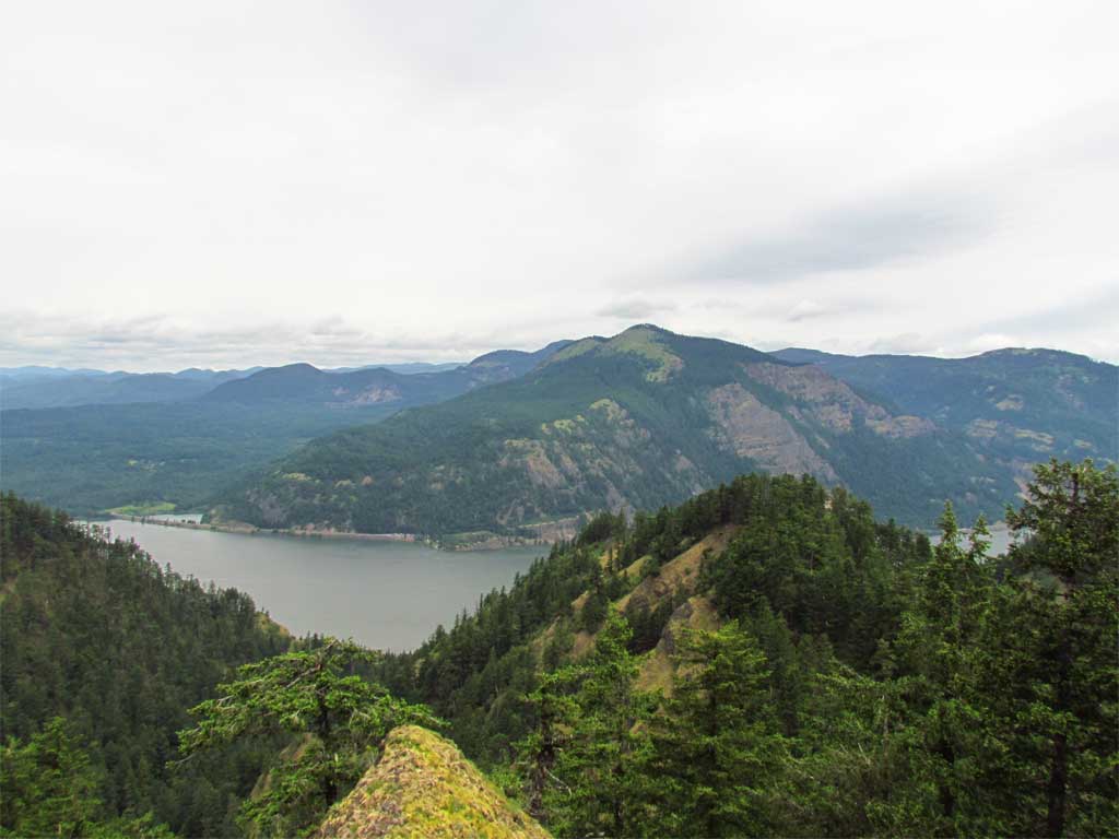
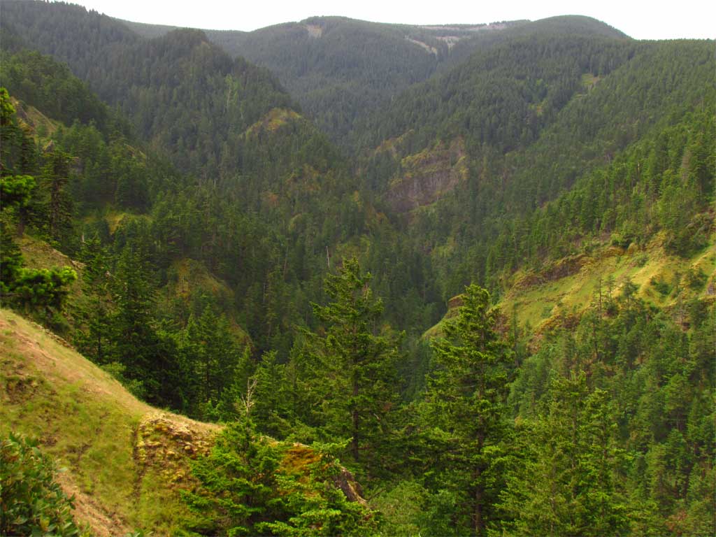
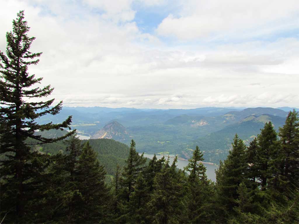
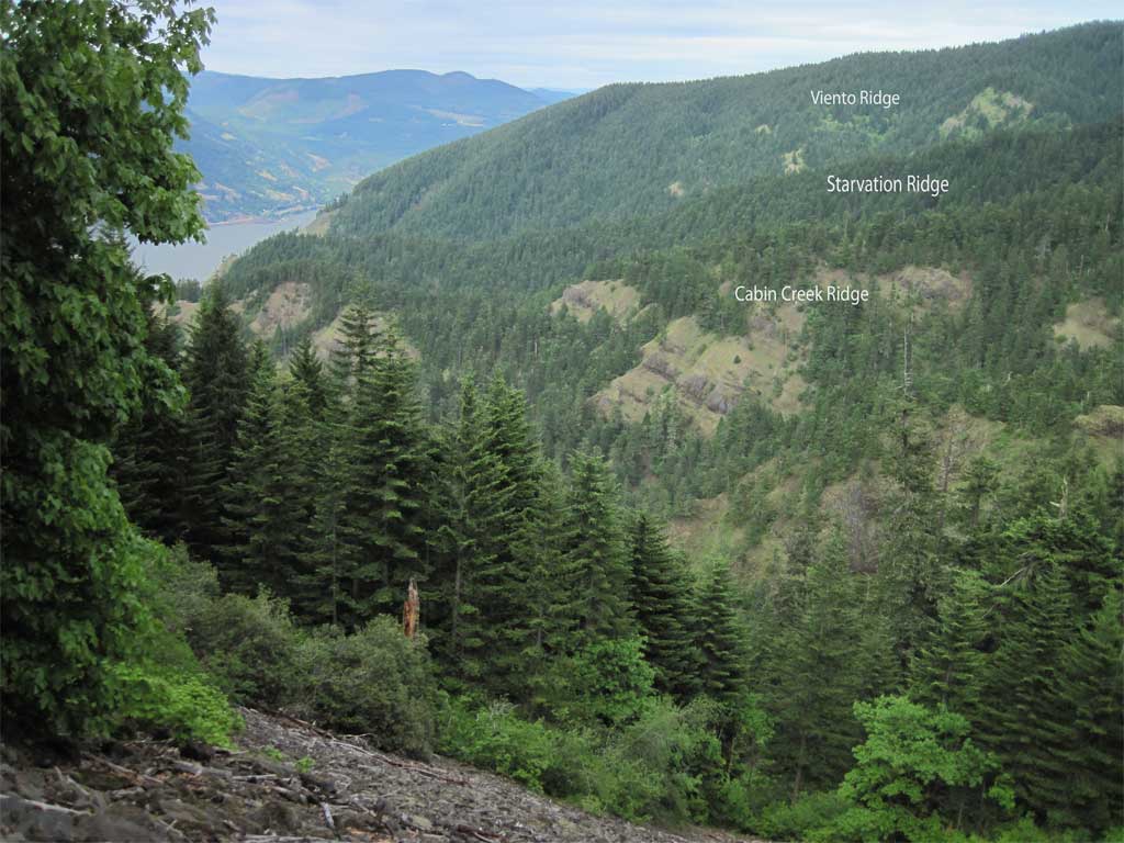
Warren Creek Canyon is very beautiful:
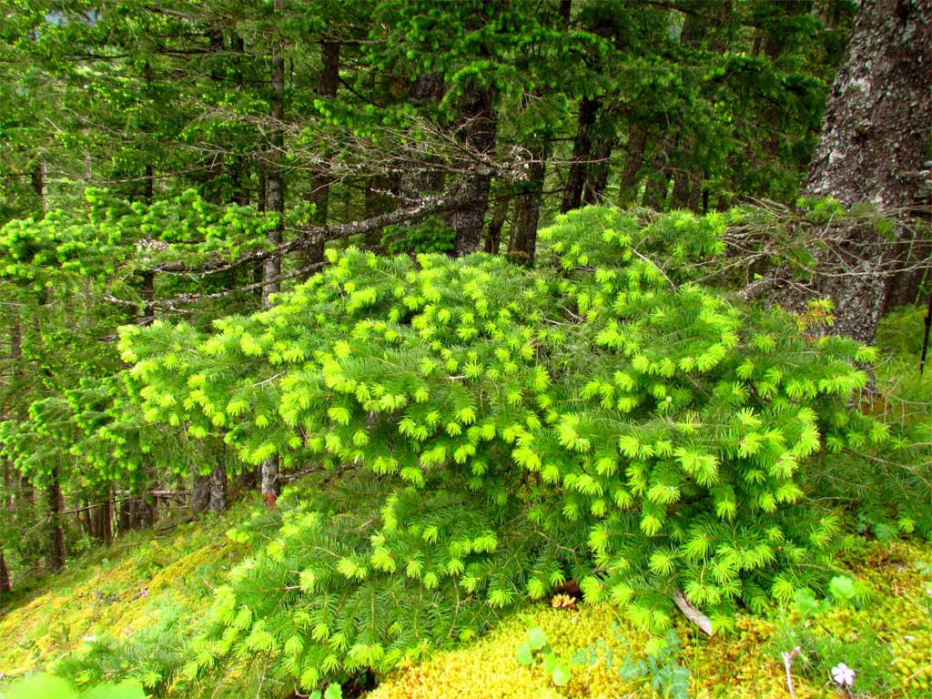
For me, I find the spring growth on Doug Fir to be as pretty as any flower.
The approach to the plateau above Warren Lake is steep but very clear and full of game trail to follow.
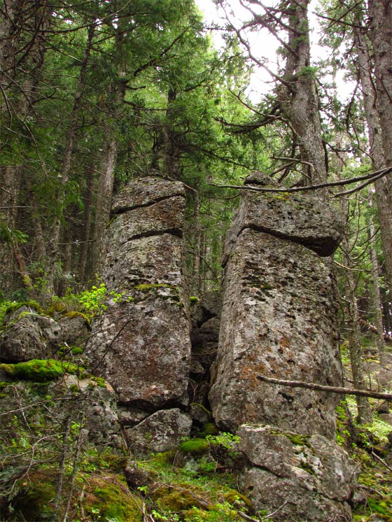
Lots of interesting rock outcrops:
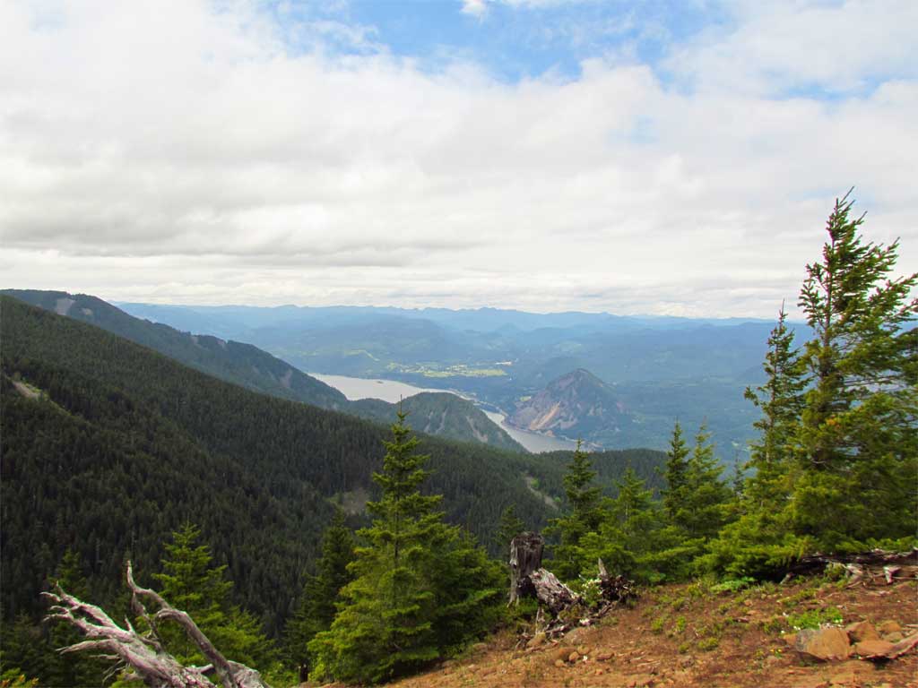
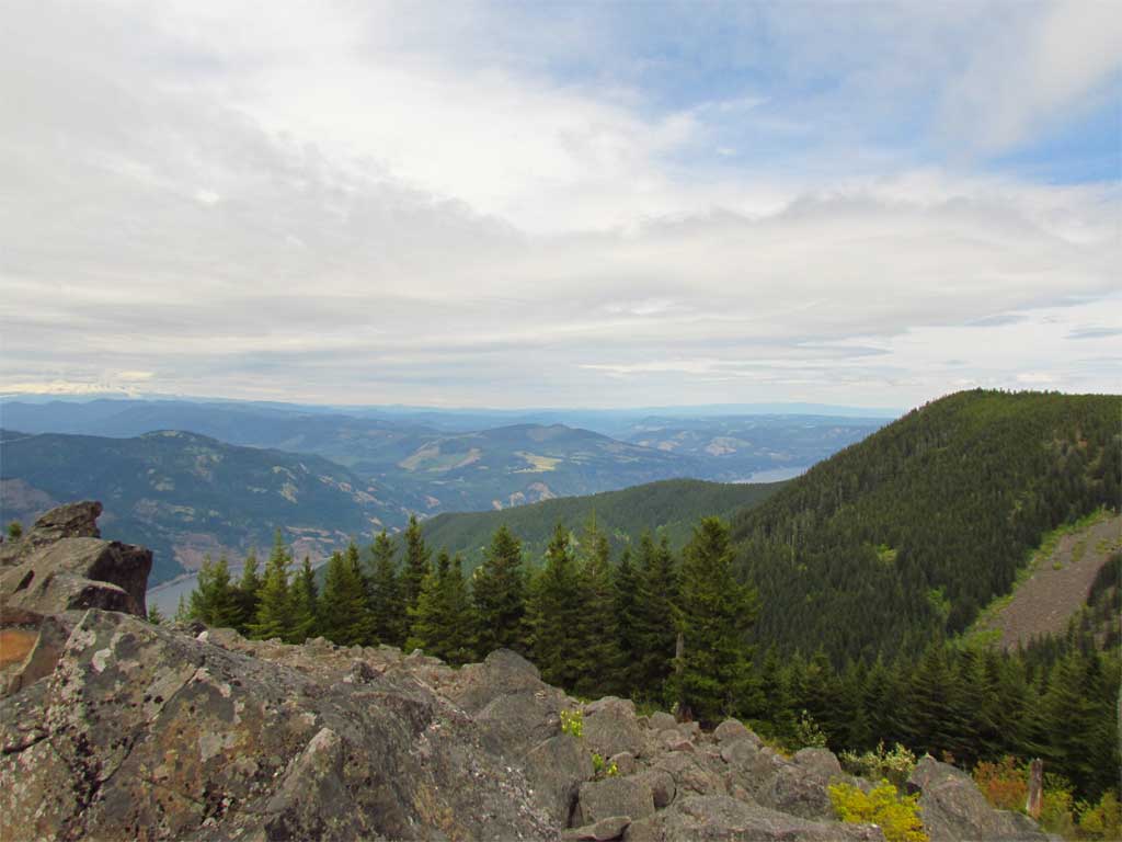
A couple of openings afforded views from little meadows found along the way:
I followed the edge of the plateau on my way to intersect the Mitchell Pt trail - ran into a nice opening that I don't think gets many visitors but is worth the detour:
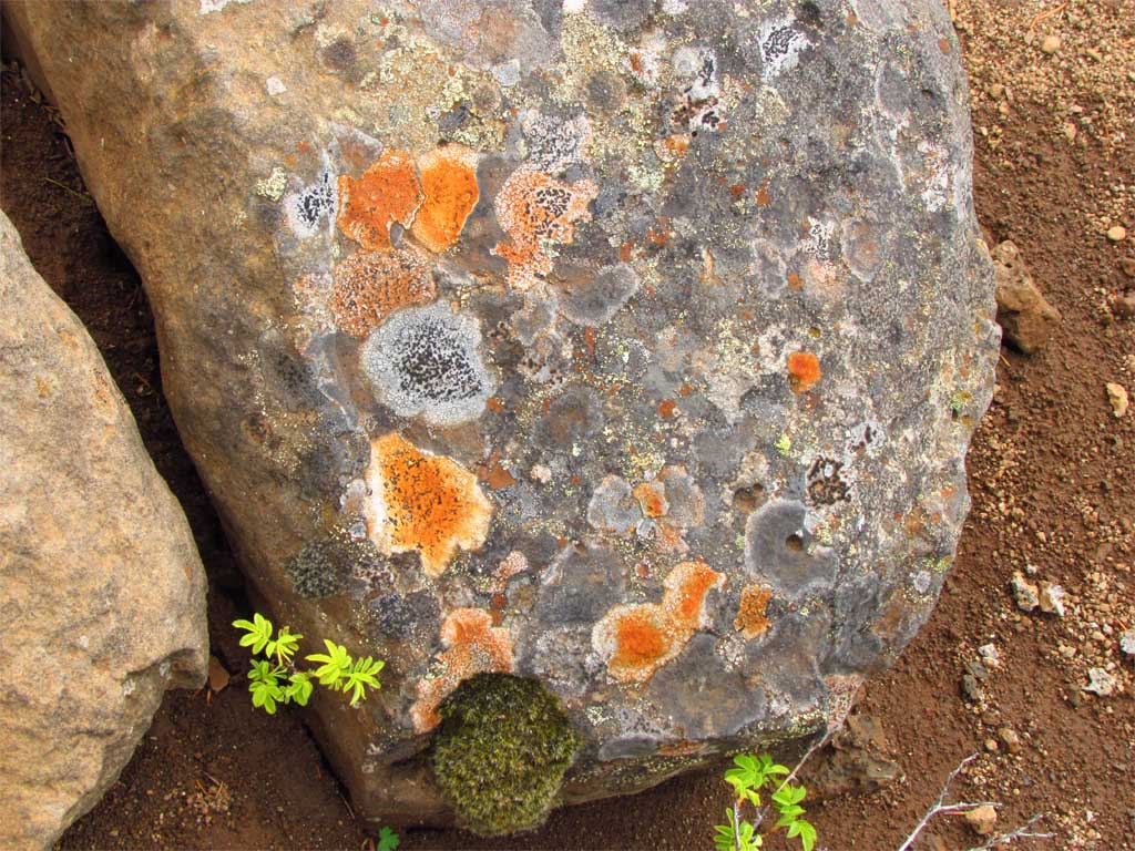
Bright orange lichen caught my eye:
I made it to Warren Lake, a couple of hikers, no campers. I went west from Warren Lake to start the descent to the logging road and followed a bit of trail to a wonderful rock garden that I did not know was there. From the rock cairns and path this is a known spot - huge boulders and great views.
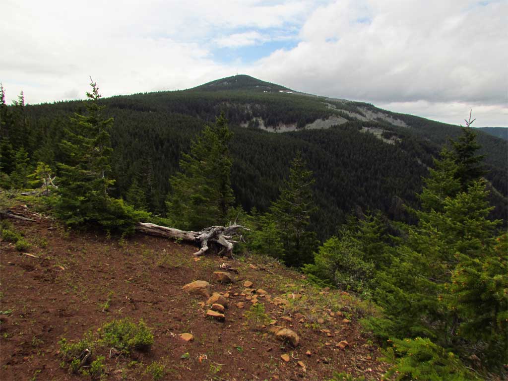
From there I continued north down the ridge which was fairly clear of brush with the only obstacle a decaying and very steep cliff band about halfway down to the the target road and landing. As I got closer to the landing area, stumps started popping up which was comforting and I made the road in good shape. The road is overgrown but easy traveling. I followed the road, stopping at an opening along the road to take a photo at the ridge I'd just ascended.
8.8 miles, 4200' cumulative elevation gain in 7.75 hours. Great day, I'll likely never return to the abandoned logging road but Cabin Creek Ridge to the plateau is a gem.
So Sunday I finished my exploration of Cabin Creek Ridge by continuing on up the hill to the plateau above Warren Lake. Very nice off-trail route the entire distance. I looked for the elusive trail found on the USGS TOPO as I made my way up the hill but saw nothing but deceptively nice game trail. I'm very skeptical and would need something like a 3' bench, blazed trees, and maybe a sign or 2 to convince me there was ever any trail through here.
Cabin Creek Ridge is a wonderful place:
Off to Dog:
Saw my first beargrass bloom of the season:
Warren Creek Canyon is very beautiful:
For me, I find the spring growth on Doug Fir to be as pretty as any flower.
The approach to the plateau above Warren Lake is steep but very clear and full of game trail to follow.
Lots of interesting rock outcrops:
A couple of openings afforded views from little meadows found along the way:
I followed the edge of the plateau on my way to intersect the Mitchell Pt trail - ran into a nice opening that I don't think gets many visitors but is worth the detour:
Bright orange lichen caught my eye:
I made it to Warren Lake, a couple of hikers, no campers. I went west from Warren Lake to start the descent to the logging road and followed a bit of trail to a wonderful rock garden that I did not know was there. From the rock cairns and path this is a known spot - huge boulders and great views.
From there I continued north down the ridge which was fairly clear of brush with the only obstacle a decaying and very steep cliff band about halfway down to the the target road and landing. As I got closer to the landing area, stumps started popping up which was comforting and I made the road in good shape. The road is overgrown but easy traveling. I followed the road, stopping at an opening along the road to take a photo at the ridge I'd just ascended.
8.8 miles, 4200' cumulative elevation gain in 7.75 hours. Great day, I'll likely never return to the abandoned logging road but Cabin Creek Ridge to the plateau is a gem.