McNeil Falls

Discussions and Trip Reports for off-trail adventures and rediscovering lost trails
Post Reply
User avatar
Splintercat
Posts: 8334
Joined: May 28th, 2008, 10:03 pm
Location: Portland
Contact:

McNeil Falls

Post by Splintercat » October 8th, 2008, 8:00 pm

This is a carry-over from a trip report on McNeil point, and subsequent discussion of the upper reaches of the Muddy Fork. This first set of images is rather old (2003), and McNeil Falls has changed a bit since then, but it shows the general location of this drop on the upper reaches of the Muddy Fork:

Image

...and here's the conceptual traverse that I had been thinking about, in hopes of getting a close-up photo of the falls from the lower canyon rim, then bushwhacking down to the Timberline Trail:

Image

...and here's a topo version of the bushwhack (note that some of the route drops behind a ridge in the photo view, above):

Image

I suppose that it goes without saying that the bushwhack would be in the downhill direction..!

-Tom :D

User avatar
bush_marmot
Posts: 86
Joined: June 17th, 2008, 10:24 pm

Re: McNeil Falls

Post by bush_marmot » October 8th, 2008, 10:26 pm

Tom,
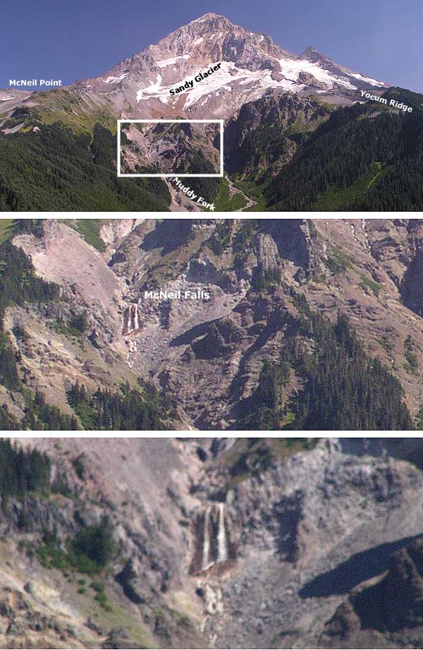
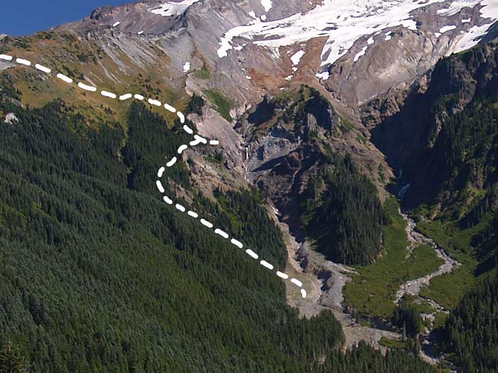
A very cool idea! If I read your map and photos correctly (and from your previous description), your viewpoint should be somewhere slightly above (and to the left of) that small pyramidal rock wedge in the center of this photo (taken from the Timberline Trail on the way to McNeil Point), maybe just above that finger of trees at the top of that ‘mini-buttress’.
McNeil_Falls_Viewpoint_Area.jpg
I’ve been over near there (a few hundred feet above) several times, but have never tried that descent through the trees (route marked on your photo) or out onto the buttressy area (was heading for Yocum Ridge or the Sandy Glacier instead). You could probably get a bunch of different views of the falls (hidden behind the ridge in this photo) at different elevations through there, up and down along the ridge edge. You can walk down (from higher up) practically to the top of the falls, depending on snow cover; the view of the falls itself from there, though, is limited. There’s a lot of unstable rock around here - especially on the creek side of the slope - and some ‘highly mobile’ slopes made up of large rocks and soft dirt (note the fresh rockfall on the snowfield in photo). But you should be able to get some good pictures of McNeil Falls (nice name) from several viewpoints in there.


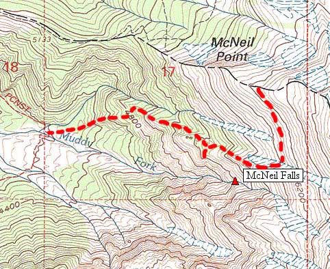
Also - it’s not necessary to ascend above McNeil Point to get over to those spurs and swales and falls (and rockslides).
There’s a good traverse route that cuts off the McNeil Point ‘shortcut’ (steep side) trail, about halfway up, which follows game tracks out to that area.
Below_Sandy_Glacier.jpg
It sounds interesting... but it might be snowing there this weekend!
Peter
:D

User avatar
Splintercat
Posts: 8334
Joined: May 28th, 2008, 10:03 pm
Location: Portland
Contact:

Re: McNeil Falls

Post by Splintercat » October 9th, 2008, 11:35 am

Thanks, Peter - I love that last photo! Now I have to get down there..! The info on the game trail is helpful, too, since that could also be an exit possibility if going all the way down to the TT isn't safe or practical.

I'm still intrigued by your comment that you had crossed all the way over to Yocum Ridge from the McNeil side - wow! That looks sketchy to me, with a choice between dodging crevasses or walking on really unstable glacial debris across the lower margin. Plus, I've seen a couple of big holes open up in the ice near the terminus in past years, so that's spooky, too..! :shock:

-Tom

Post Reply