That is a great visualization. What did you use to produce it?
Girl Scout Basin
Re: Girl Scout Basin
Re: Girl Scout Basin
Thanks for the Lidar. That is really an eye opener. I would never have guessed that it looked like that under all that vegetation. The Gorge never fails to impress.

Re: Girl Scout Basin
Kinda off-topic, but here's a slide I noticed east of Skamania Mountain (west of Hamilton Mountain). It's super obvious at its head, to the left, but you'll also notice you can see it slumping to the creek to the right. On the ground today, it wasn't all that dramatic. Grown over.
- Attachments
-

Re: Girl Scout Basin
I think it's an anticline? Or a syncline?
Somebody with more geology knowledge than me will have to step in. But I have read that there is a slope below ground and layerings of the sediment that make it extremely slide-prone on that layer boundary, kind of like snow layers that lead to avalanches.
I don't know if a Cascadia Subduction quake, which would be centered over a hundred miles away, is the key trigger for another slide. But slides there will be. Whether there could be one big enough to dam the Columbia again briefly - that would be rare, but I guess it is possible. Maybe we will need a kayak or canoe to get to the May wildflower bloom - on Dog Island.
-
Don Nelsen

- Posts: 4380
- Joined: May 28th, 2008, 10:03 pm
- Location: Vancouver, WA
Re: Girl Scout Basin
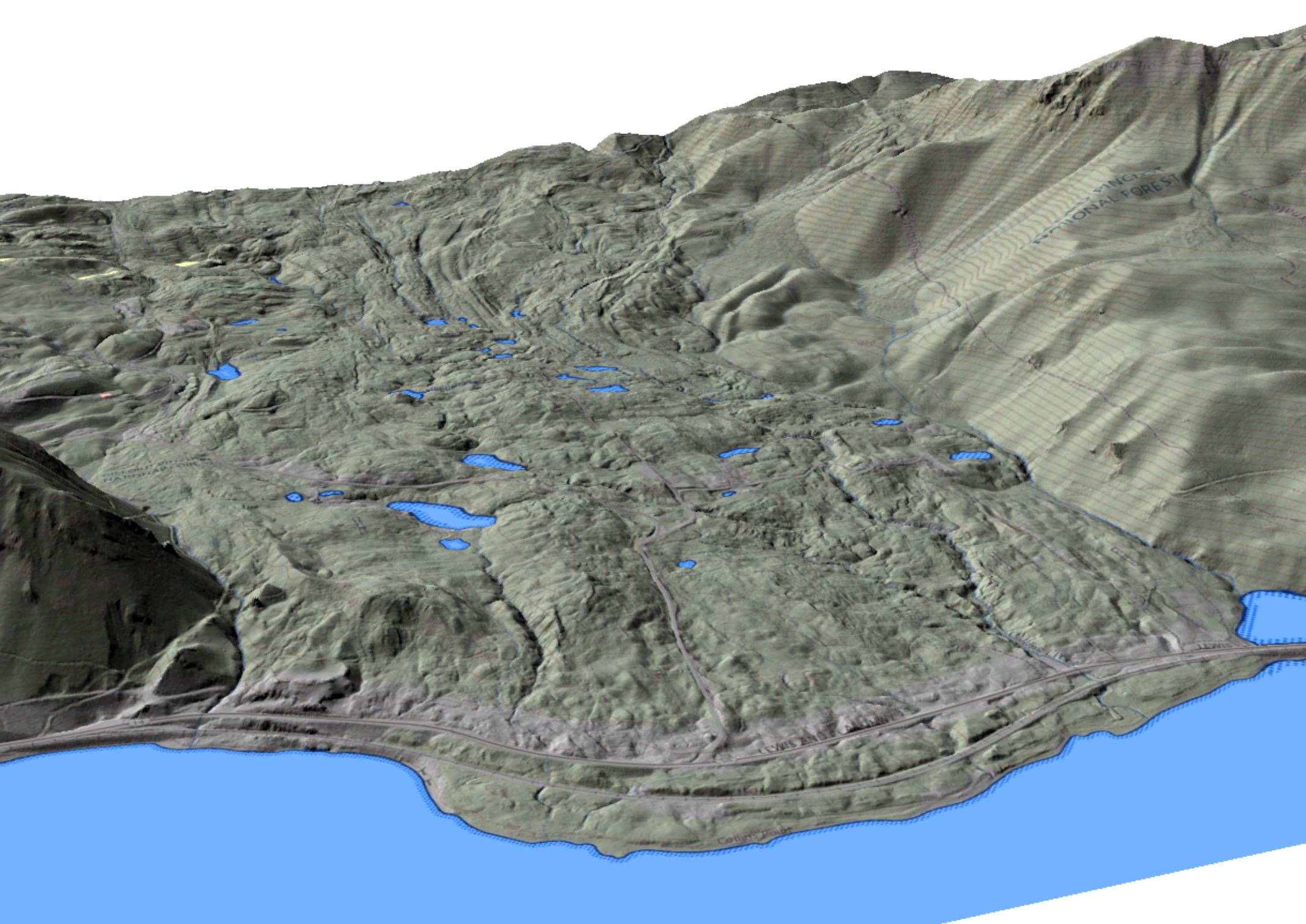
The timing has to be right for those slides to move. Only Collins Point is still considered active, though by only a few inches/year if at all. What geologists noted about the Collins Point slide was that after a few very dry years, basically the first half of the last century, especially the twenties and thirties, it barely moved at all. After a few very wet years in the late 40's and early fifties it took off, causing Bonneville Power lots of trouble with their transmission lines across the slide. So, rainfall is a major factor, lubricating the interface between the bedrock and the overlay. Possibly the big earthquake in April of 1949 helped it along. There was another, on Valentines Day, 1946, too. (The '49 quake was the biggest the pacific NW had ever seen up to that point, BTW.)
The substrate on the Washington side dips about 6 degrees towards the south, so that's the basic problem. The substrate dips south on the Oregon side too, but that's away from the river, so things are held in place much better.
(edited for clarity and typos.)
dn
The substrate on the Washington side dips about 6 degrees towards the south, so that's the basic problem. The substrate dips south on the Oregon side too, but that's away from the river, so things are held in place much better.
(edited for clarity and typos.)
dn
"Everything works in the planning stage" - Kelly
"If you don't do it this year, you will be one year older when you do" - Warren Miller
"If you don't do it this year, you will be one year older when you do" - Warren Miller
Re: Girl Scout Basin
That may be true, depending on what we call "active". But I'm watching the Greenleaf area. Related reading:Don Nelsen wrote: ↑September 23rd, 2021, 2:28 pmThe timing has to be right for those slides to move. Only Collins Point is still considered active, though by only a few inches/year if at all.
viewtopic.php?t=28707