Portland Hikers ArchiveReturn to Portland Hikers Archive University of Oregon Library Map Collection Redux - May 1, 2008 Posted by pablo (2008-05-06)
|
In my search for lost trails I once again visited the UofO map room to fill in some of the blanks from my previous visit. I imaged the time history of Columbia Gorge Trails, Pacific Crest Trail, and the wilderness areas Columbia (now Hatfield), Mt Hood, and Badger Creek. The 1972 and 1979 Mt Hood Nat'l Forest maps were added to the NF collection. Since they are within easy range, I grabbed some Willamette and Gifford Pinchot National Forest maps. Photos were done with a Canon 650IS 12.1 MP camera and are better than the last batch which were done with a 6MP camera. Size matters.
Not all are online, here's the ones that are:
Oregon National Forest 1915: Interestingly enough, at one time Tanner Butte was included in the Bull Run Watershed area and access restricted. Unfortunately, UofO has only the north half of this map.
Columbia Gorge Park 1916: There is an interesting bit of text on creating a trail up Moffett Creek here.
Willamette National Forest 1964: A ridge top trail west of Opal Creek, the #3358, is on my list from this one.
Gifford Pinchot National Forest - 1963: There is a trail coming off from Snow Lake to Heart Lake, likely obscured by ash, down the ridge that will make a nice loop with the Lakes Trail. I was surprised to see the peak of St Helens was private ground prior to the eruption. One of those checkerboarded railroad things I imagine.
Mt Hood National Forest 1972: Looks like by 1972 the current trail inventory was set, the trails along the Roaring River are gone as are the South Fork, Mack Hall Creek and Hambone trails.
--Paul
| Re: University of Oregon Library Map Collection Redux - May 1, 2008 Posted by Splintercat (2008-05-06)
| Thanks, Paul - these are addictive!
Right above that very interesting comment about Moffett Creek was mention of a trail "behind Elowah Falls". Until a couple of years ago, I wouldn't have thought of that, but then watched a couple of hikers head behind the falls as I was setting up for a photograph!
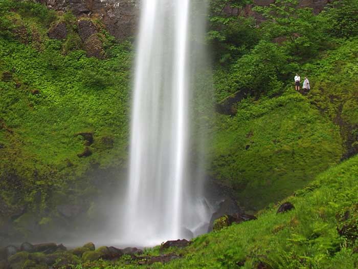
Of all the times I'd looked at this waterfall, it never dawned one me that there was room to walk behind it..! But I can imagine why the trail was never built, as the spray from the falls is overwhelming in winter and spring.
Tom | Re: University of Oregon Library Map Collection Redux - May 1, 2008 Posted by chameleon (2008-05-06)
| Holy smokes, for the "nature lover who is prepared for a rough tramp." (in regard to Moffett creek) lol That's a tad of an understatement. But I guess this is from back in the day when most of the country was not obese, sitting on the sofa watching Lost and American Idol. :) That is very interesting though and suggests that some folks have known about the wonders up Moffett for a long time! Cool. Thanks for the very fun post Paul! Hey, are you up for a Moffett creek trip one of these days?
-Zach | Re: University of Oregon Library Map Collection Redux - May 1, 2008 Posted by mattisnotfrench (2008-05-07)
|  pablo: pablo:
Wow! I know that the old Stony Creek trail goes up that way for awhile, but I never realized that it continued all the way to the saddle near Phantom Bridge. Crazy. What's really fascinating is to see where there were trails before, and they were all over the place-yet the two most popular trails in that area now, the Opal Creek Trail and the Little North Fork Trail, weren't yet constructed.
The other thing that interested me was a trail to Breitenbush Lake in the Firecamp Lakes area. I'll bet that has a great view of Mt. Jefferson.
Thanks for the photos!
| Re: University of Oregon Library Map Collection Redux - May 1, 2008 Posted by Don Nelsen (2008-05-07)
| Hi Paul,
Thank you very much for your work in posting and publicizing these great old maps. I've been having a great time going over them finding much I didn't know about. If the snow ever melts, I'll have lots more to explore.
Some the the old place names are interesting too: For instance, who knew that Angels Rest and Devils Rest were known as "Fort Rock" and "Eagle Aerie", Rock of Ages Ridge was "Vaculoma Cliffs" and Cougar Rock (just east of Multnomah Falls) was "Winema Pinnacles"?
Don | Re: University of Oregon Library Map Collection Redux - May 1, 2008 Posted by greglief (2008-05-07)
| Thanks!
|
Return to Portland Hikers Archive
Disclaimer:
Information found on PortlandHikers.org and PortlandHikersFieldGuide.org is
provided by website visitors and volunteers and should be considered anecdotal. All trails
and directions and subject to current conditions. Trails and roads can be rerouted due to
natural events and the website is not able to provide current information for every hike.
Please verify against two other sources before planning a trip. Outdoor activities present
inherent risks. Portlandhikers.org, nor any of its members, accept liability for injuries
relating to information found on this website.
|
Powered by phpBB © 2008 phpBB Group
|
|
© 2008 PortlandHikers.org - No content shall be copied or downloaded without permission
|
|
 |
