Portland Hikers ArchiveReturn to Portland Hikers Archive Waterfalls of Duncan Creek Posted by jaimito (2008-04-07)
| The usual suspects (Myself, Don, Lindsay and Andy) got together on a soggy sunday to document some waterfalls on Duncan Creek in the Gifford Pinchot National Forest. The trek started out immediately next to the creek on a fairly good trail that lasted for about 3/4 of a mile and then became a full on bushwack. The forest mainly consisted of second growth, and the remnants of the Yacolt burn were evident everywhere as there were huge rotting cedar snags everywhere. We joked because the whole area was like one big compost pile, the ground was spongy and the stumps were falling apart - and every tree we tried to grab onto or that we bumped into seemed to fall down.
The day was wet, cold, soggy, scary and a bit funny at times. All in all a good time, so here are some of the photos of another hidden gem in the gorge (Washington side that is).
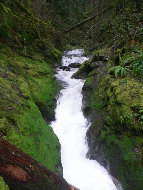
First falls was hard to photograph because basically it was a few small cascades that came to a "Y"junction with the major part of the creek ripping through a little slot. Here are a few shots of this first area. First photo is looking up through the slot to the 2 small upper cascades.
here are the 2 small upper cascades�
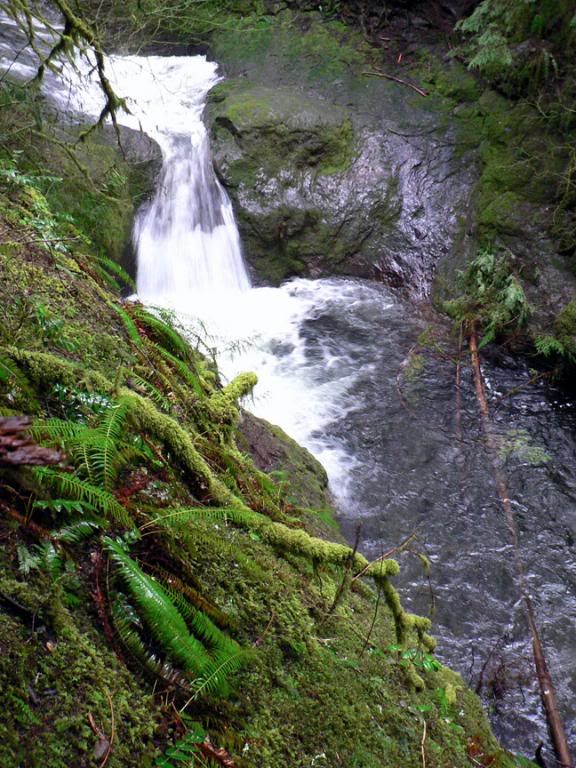
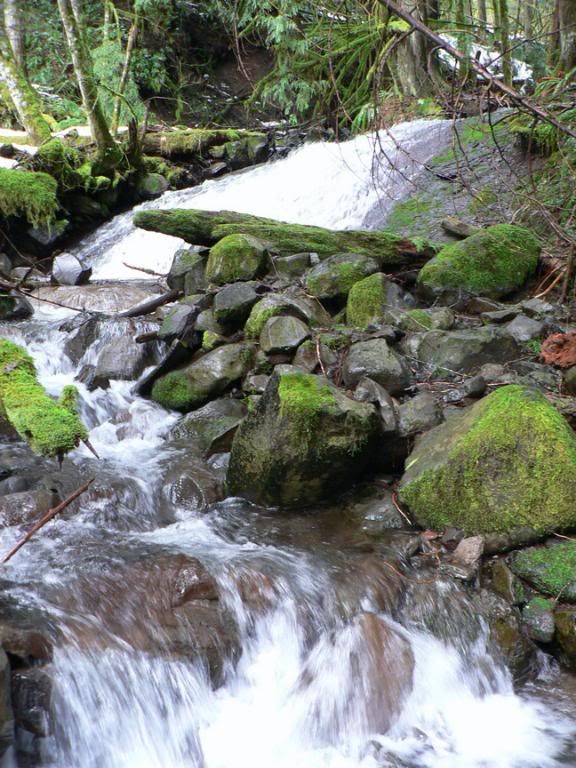
Just up around the corner from these little cascades was the first true falls on Duncan Creek. We estimated this falls to be atleast 15 to 20ft.
Traversing along side the creek another falls comes into site, this one is a nice little punchbowl, again in the 15 to 20 ft. range, hard to tell because the only real view is from above.
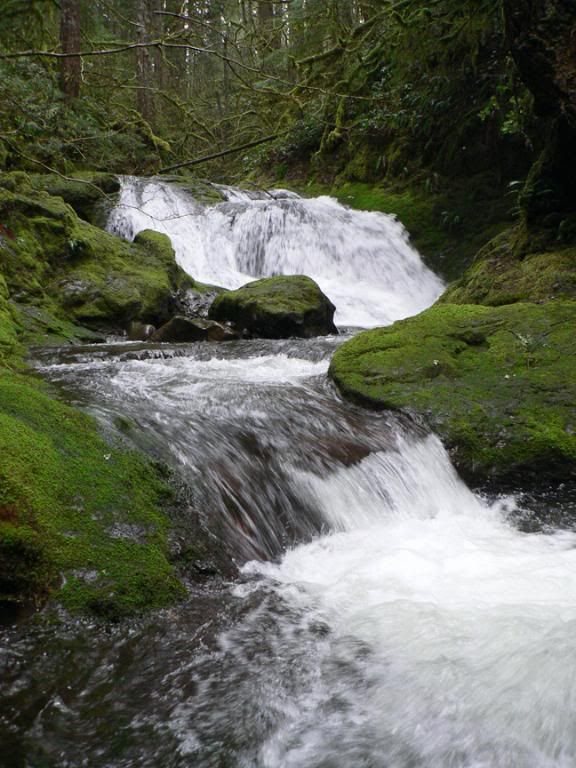
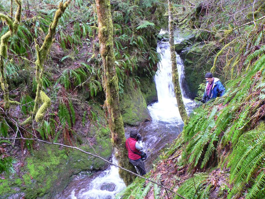
After the punchbowl you come up to another falls, this one I had to sit out on a log crossing the creek to get a shot.
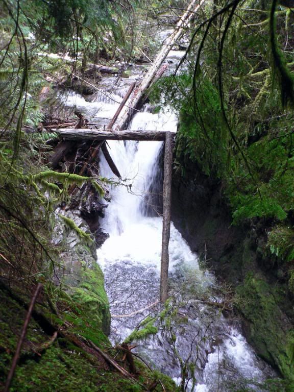
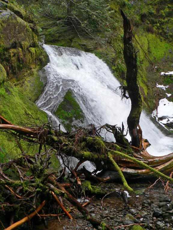
The fourth Falls on the trek� this one would be very cool if the trees weren't in the way, if you look there is a nice little stream that runs off on the left.
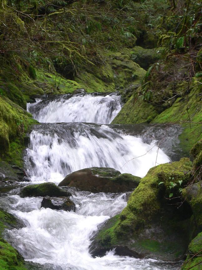
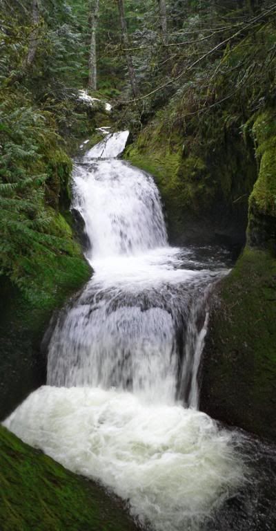
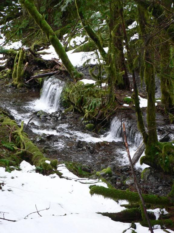
The fifth Falls on the creek was a nice series of 3 cascades with lower part ending in a nice bowl. The middle part was probably again abot 15' + with the upper and lower parts probably coming in somewhere around 6 feet.
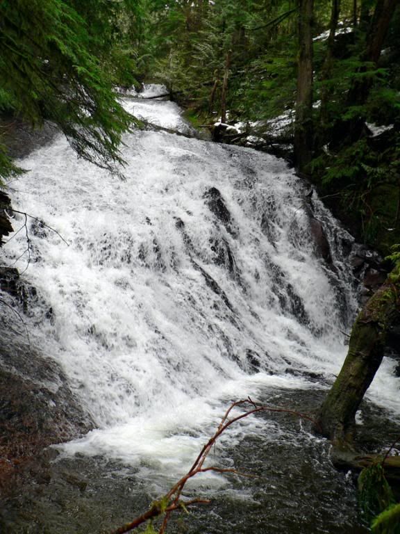
Finally we reached the upper falls on Duncan Creek which was just one big slide, hard to guess really how big, but very cool.
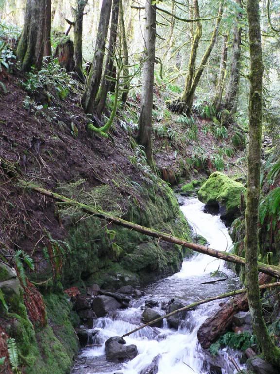
We then set out and crossed over to the other side of the creek to explore a bit and see what was there. Our first view of the creek brought us right to a nice little slide, not very big but very photogenic.
This part of the creek is rarely visited as far as we could tell. There were some very beautiful views of the creek below as we made our way down.
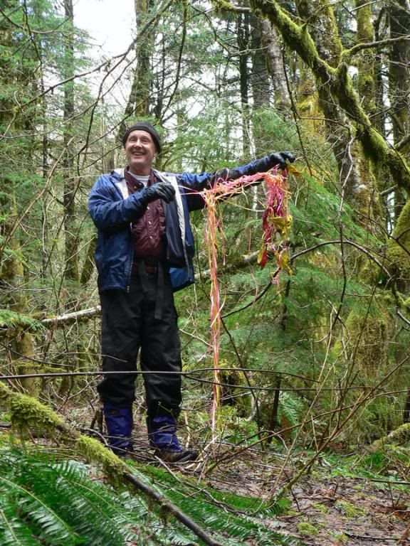
Don found some ancient artifacts.
As we were coming to the end of our trek we thought we weren't going to see any more falls and then Don spotted a nice little punchbowl tucked away beneath the cliff. Andy and Don getting a better look.
For all you trail Madden types out there , I will post a route / falls comparison later. All in all a great day of exploring in a very lush part of the gorge with more waterfalls, what more could you ask for.
| Re: Waterfalls of Duncan Creek Posted by Don Nelsen (2008-04-07)
| Hey Jamie, great report, and, as usual, your pictures make mine look amaturish. Here's a pic of you sitting on that log to get one of the your falls photos - I couldn't believe you did that - it had to be 25 feet to the water below!

Also, truth be known, we had plenty of posthole time up there: Here's Jamie enjoying it to the fullest.

Here's that last little falls on the west fork of the creek. I don't think you posted this one:

| Re: Waterfalls of Duncan Creek Posted by pablo (2008-04-07)
| Great bunch of falls ya got there - being a 'trail Madden' type, I'm looking forward to the map. I TOPO'ed Duncan Creek so I see the general location. Lots of private ground lower down. I wonder if that Woodward Creek to the east has similar stuff?
Thx,
--Paul
|
Return to Portland Hikers Archive
Disclaimer:
Information found on PortlandHikers.org and PortlandHikersFieldGuide.org is
provided by website visitors and volunteers and should be considered anecdotal. All trails
and directions and subject to current conditions. Trails and roads can be rerouted due to
natural events and the website is not able to provide current information for every hike.
Please verify against two other sources before planning a trip. Outdoor activities present
inherent risks. Portlandhikers.org, nor any of its members, accept liability for injuries
relating to information found on this website.
|
Powered by phpBB © 2008 phpBB Group
|
|
© 2008 PortlandHikers.org - No content shall be copied or downloaded without permission
|
|
 |


