Portland Hikers ArchiveReturn to Portland Hikers Archive Shellrock Mountain - November 25, 2007 Posted by pablo (2007-11-25)
|
The Shellrock Mtn off I-84...
Another scouting mission for a longer hike I've planned for 2008. I needed to know if the ridge south beyond the summit of Shellrock Mtn lent itself to a loop hike with either Wyeth or Mt Defiance. Looks like I'm good to go although icy conditions prevented me from going back as far as I wanted.
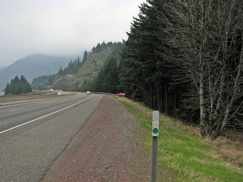
I thought locating a place to park and finding the trailhead would be difficult as I read a couple of articles giving conflicting mile marker information about where to park. Turned out to be very easy. If I may be so bold, here's the definitive set of directions. Go east on I-84 going around Shellrock Mtn until the retaining wall ends at which time you need to prepare to pull onto the fairly broad shoulder. The best place to park is at the west end of the guardrail that starts up about a 1/4 mile beyond the end of the retaining wall. There'll be a sign proclaiming this property to be owned by Oregon DOT, so I guess it belongs to us. Go over the guardrail and follow it east for three hundred feet or so - look off to the right for the trail heading up the hill. I'm not sure what the poison oak status is but I expect there is some.
Looking east from near the end of the retaining wall, park at the start of the guardrail where the little red truck is.
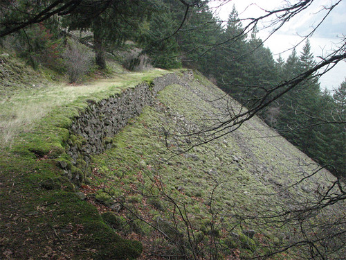
Shellrock Mtn has enough interesting parts to make it an attractive destination of which the 19th century wagon road is most notable. Has distinctive geology as seen here.
The trail to the viewless summit can be broken into 3 parts. The lower part is up a talus slope much like the Elevator Shaft only the trail is in better condition, better graded, and would be suitable for most hikers. The second part beyond the talus is a bit harder to follow but nicely graded and would be suitable for those with an eye for the trail. The third part to the summit is for adventure hikers comfortable with making their own way through light brush and a trail that is sometimes there and sometimes not. This top part has some easily avoided exposure but is a very steep hike up a narrow ridge.
First part with the wagon road section, just up from the freeway.
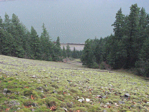
Top of the talus slope. The switchbacks on this first part take full advantage of the width of the slope to make for a nice grade.
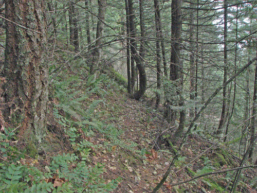
A section of the trail beyond the talus slope, the trail runs down the center of the photo. There is some blowdown to negotiate.
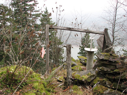
The second segment ends at what might have been a weather station on a rock outcropping with a view. On a better day probably pretty nice, not much to see on this day. No doubt had to be above 3000' feet to get any sunshine this day in this part of the gorge. There are 'DANGER' signs, cabling and some mild exposure at this abandoned station.
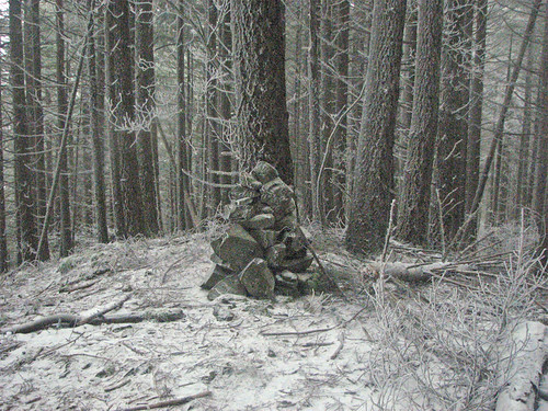
From the abandoned weather station the trail goes rustic with some widely spaced ribbons to mark the way. The ground was frozen and had a dusting of snow making it quite slick. There are some cliffs along this part but easy to avoid. Quite steep until near the summit. Got the rock cairn. I went a bit south beyond the summit to scout the connector to the ridge south.
I backtracked out and once on the wagon road I followed it east to it's terminus at a rock slide and then west until I saw no more existing segments. The section used by the trail looks to be in the best shape of the 4-5 segments I saw.
BTW, I'll make an attempt to turn this report into a Field Guide entry.
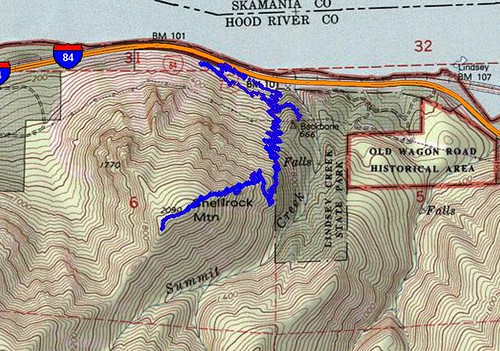
< 4 miles total, ~2000' vertical.
Track map
 | Re: Shellrock Mountain - November 25, 2007 Posted by pdxgene (2007-11-25)
| | If you hiked this today (as opposed to just having the chance to post it today) it's kind of amazing that if measured in a straight line , we probably didn't hike that many miles apart (maybe a guess of 15 or 20) today. But it looks like two completely different worlds.. There wasn't a cloud in the sky near Mt Hood... |
Return to Portland Hikers Archive
Disclaimer:
Information found on PortlandHikers.org and PortlandHikersFieldGuide.org is
provided by website visitors and volunteers and should be considered anecdotal. All trails
and directions and subject to current conditions. Trails and roads can be rerouted due to
natural events and the website is not able to provide current information for every hike.
Please verify against two other sources before planning a trip. Outdoor activities present
inherent risks. Portlandhikers.org, nor any of its members, accept liability for injuries
relating to information found on this website.
|
Powered by phpBB © 2008 phpBB Group
|
|
© 2008 PortlandHikers.org - No content shall be copied or downloaded without permission
|
|
 |
